SB 599: Atmospheric rivers: research: forecasting methods: experimental tools.
- Session Year: 2025-2026
- House: Senate
- Latest Version Date: 2026-09-27
Current Status:
Passed
(2026-09-27: Chaptered by Secretary of State. Chapter 650, Statutes of 2026.)
Introduced
In Committee
Awaiting First Chamber Vote
Passed First Chamber
In Committee
Awaiting Second Chamber Vote
Passed Second Chamber
Enacted
Existing law establishes the Atmospheric Rivers Research and Forecast Improvement Program: Enabling Climate Adaptation Through Forecast-Informed Reservoir Operations and Hazard Resiliency (AR/FIRO) Program in the Department of Water Resources. Existing law requires the department to operate reservoirs in a manner that improves flood protection, and to reoperate flood control and water storage facilities to capture water generated by atmospheric rivers. Existing law requires the department to research, develop, and implement new observations, prediction models, novel forecasting methods, and tailored decision support systems to improve predictions of atmospheric rivers and their impacts on water supply, flooding, post-wildfire debris flows, and environmental conditions.
This bill would, for novel forecasting methods researched, developed, and implemented by the department, require the department to include the use of experimental tools that produce seasonal and subseasonal atmospheric river forecasts, as defined.
Existing law establishes the Atmospheric Rivers Research and Forecast Improvement Program: Enabling Climate Adaptation Through Forecast-Informed Reservoir Operations and Hazard Resiliency (AR/FIRO) Program in the Department of Water Resources. Existing law requires the department to operate reservoirs in a manner that improves flood protection, and to reoperate flood control and water storage facilities to capture water generated by atmospheric rivers. Existing law requires the department to research, develop, and implement new observations, prediction models, novel forecasting methods, and tailored decision support systems to improve predictions of atmospheric rivers and their impacts on water supply, flooding, post-wildfire debris flows, and environmental conditions.
This bill would, for novel forecasting methods researched, developed, and implemented by the department, require the department to include the use of experimental tools that produce seasonal and subseasonal atmospheric river forecasts, as defined.
Existing law establishes the Atmospheric Rivers Research and Forecast Improvement Program: Enabling Climate Adaptation Through Forecast-Informed Reservoir Operations and Hazard Resiliency (AR/FIRO) Program in the Department of Water Resources. Existing law requires the department to operate reservoirs in a manner that improves flood protection, and to reoperate flood control and water storage facilities to capture water generated by atmospheric rivers. Existing law requires the department to research, develop, and implement new observations, prediction models, novel forecasting methods, and tailored decision support systems to improve predictions of atmospheric rivers and their impacts on water supply, flooding, post-wildfire debris flows, and environmental conditions.
This bill would, for novel forecasting methods researched, developed, and implemented by the department, require the department to include the use of experimental tools that produce seasonal and subseasonal atmospheric river forecasts, as defined.
Existing law establishes the Atmospheric Rivers Research and Forecast Improvement Program: Enabling Climate Adaptation Through Forecast-Informed Reservoir Operations and Hazard Resiliency (AR/FIRO) Program in the Department of Water Resources. Existing law requires the department to operate reservoirs in a manner that improves flood protection, and to reoperate flood control and water storage facilities to capture water generated by atmospheric rivers. Existing law requires the department to research, develop, and implement new observations, prediction models, novel forecasting methods, and tailored decision support systems to improve predictions of atmospheric rivers and their impacts on water supply, flooding, post-wildfire debris flows, and environmental conditions.
This bill would, for novel forecasting methods researched, developed, and implemented by the department, require the department to include the use of experimental tools that produce seasonal and subseasonal atmospheric river forecasts, as defined.
Existing law declares that all water within the state is the property of the people of the state, but the right to the use of the water may be acquired by appropriation in the manner provided by law. Existing law requires the appropriation to be for some useful or beneficial purpose. Existing law provides that the diversion of floodflows for groundwater recharge, commenced before January 1, 2029, does not require an appropriative water right if certain conditions are met, including that the diversion does not use new permanent infrastructure or permanent construction.This bill would make a nonsubstantive change to this provision.Existing law declares that all water within the state is the property of the people of the state, but the right to the use of the water may be acquired by appropriation in the manner provided by law. Existing law requires the appropriation to be for some useful or beneficial purpose. Existing law provides that the diversion of floodflows for groundwater recharge, commenced before January 1, 2029, does not require an appropriative water right if certain conditions are met, including that the diversion does not use new permanent infrastructure or permanent construction.
This bill would make a nonsubstantive change to this provision.
The Legislature finds and declares all of the following:
(a)Atmospheric rivers are long narrow bands of concentrated moisture in the atmosphere that often originate over tropical oceans and bring sustained, heavy precipitation, especially to the west coast of North America.
(b)Atmospheric rivers have been identified as major drivers of floods and precipitation, responsible for up to one-half of the annual precipitation in California and 94 percent of all flood damages, totaling around $620 million annually.
(c)Climate change is resulting in more intense and more frequent atmospheric rivers.
(d)In southern California, around Prado Dam, atmospheric rivers have caused the 10 largest events on record. Additionally, precipitation in the Yuba-Feather watershed is strongly tied to atmospheric river activity.
(e)Winter storms from late-December 2022 to mid-January 2023 caused massive flood damage in 40 of Californias 58 counties, resulting in 20 deaths and significant devastation to homes, roads, infrastructure, agriculture, businesses, and the economy. AccuWeather estimates that the storms have likely caused over $30 billion in damages and economic losses, including job and wage losses, crop losses, evacuation costs, airline delays, lost business, and supply chain interruptions.
(f)One in five Californians live in flood-prone areas, and all 58 counties have a history of severe flood damage. Homes and buildings worth approximately $900 billion are at risk of flooding.
(g)Flooding is the most widespread natural hazard in California, and is more pervasive than wildfires or earthquakes.
(h)Low-income communities of color are disproportionately at risk due to limited financial capacity for flood control upgrades and recovery.
(i)Over 250 aging dams and outdated flood infrastructure increase the likelihood of catastrophic flooding.
(j)California spends $1.8 billion annually on flood control operations and maintenance, and $1 billion annually on new investments.
(k)Since 2006, more than $4.5 billion in state funding has become available for new flood infrastructure from bonds and recent budget surpluses. However, investment needs cost estimates range from $50 billion to $115 billion, or approximately $2 billion to $4.5 billion annually for 25 years.
(l)Atmospheric River Reconnaissance (AR Recon), a Research and Operations Partnership within the National Oceanic and Atmospheric Administrations (NOAA) National Centers for Environmental Prediction and led by the Center for Western Weather and Water Extremes, leverages NOAA and United States Air Force investments in aircraft-based observations to improve predictions for various weather conditions, including atmospheric rivers and their intensity. AR Recon is now the leading effort within the National Winter Season Operations Plan for airborne weather reconnaissance.
(m)The AR Recon Partnership has provided improved forecasting skill for the Department of Water Resources (DWR) and California water agencies. With the use of AR Recon, statewide, five-day atmospheric river forecasts in water year 2020 were better than four-day forecasts in 2017.
(n)Although DWR has already invested in extended forecasts, such as subseasonal (two to six weeks) and seasonal (one to six months) forecasts, it is critical that the Legislature specifically recognize the use of these experimental tools as a key part of the solution to improving predictions about atmospheric river patterns and their impact on the state.
(o)Better atmospheric river forecast accuracy and lead time enhances the states resiliency to flood and drought.
(p)According to the Public Policy Institute of California, a major flood event, like the flood in 186162, could displace 1,500,000 people and cause over $1 trillion in damages and business losses.
(q)With minimal investment in the use of tools that help predict seasonal and subseasonal atmospheric river forecasts, California can save billions of dollars in flood damages through advanced warning, effective local planning, and effective emergency management.
(r)With effective seasonal and subseasonal atmospheric river forecasting, California can maximize its efforts to recharge more groundwater and boost our water supply for communities across the state, and protect communities from catastrophic flooding.
SEC. 2.Section 347 of the Water Code is amended to read:347.(a)The Atmospheric Rivers Research and Forecast Improvement Program: Enabling Climate Adaptation Through Forecast-Informed Reservoir Operations and Hazard Resiliency (AR/FIRO) Program is hereby established in the Department of Water Resources.
(b)(1)The department shall research, develop, and implement new observations, prediction models, novel forecasting methods, including the use of experimental tools that produce seasonal and subseasonal atmospheric river forecasts, and tailored decision support systems to improve predictions of atmospheric rivers and their impacts on water supply, flooding, post-wildfire debris flows, and environmental conditions.
(2)The department shall use all relevant information produced pursuant to paragraph (1) to operate reservoirs in a manner that improves flood protection in the state and to reoperate flood control and water storage facilities to capture water generated by atmospheric rivers and other storms. The goals of integrating forecast-informed reservoir operations into department operations shall be to increase water supply, hydropower availability, and water supply reliability. The department may use research generated by this program to refine climate projections of extreme weather and water events and changes in Sierra snow.
(3)Information produced pursuant to paragraph (1) shall be available to relevant federal, state, and local agencies.
(c)For purposes of this section, both of the following definitions apply:
(1)Seasonal forecast means a forecast that covers a period of approximately one to six months into the future.
(2)Subseasonal forecast means a forecast that covers a period of approximately two to six weeks into the future.
The Legislature finds and declares all of the following:
(a)Atmospheric rivers are long narrow bands of concentrated moisture in the atmosphere that often originate over tropical oceans and bring sustained, heavy precipitation, especially to the west coast of North America.
(b)Atmospheric rivers have been identified as major drivers of floods and precipitation, responsible for up to one-half of the annual precipitation in California and 94 percent of all flood damages, totaling around $620 million annually.
(c)Climate change is resulting in more intense and more frequent atmospheric rivers.
(d)In southern California, around Prado Dam, atmospheric rivers have caused the 10 largest events on record. Additionally, precipitation in the Yuba-Feather watershed is strongly tied to atmospheric river activity.
(e)Winter storms from late-December 2022 to mid-January 2023 caused massive flood damage in 40 of Californias 58 counties, resulting in 20 deaths and significant devastation to homes, roads, infrastructure, agriculture, businesses, and the economy. AccuWeather estimates that the storms have likely caused over $30 billion in damages and economic losses, including job and wage losses, crop losses, evacuation costs, airline delays, lost business, and supply chain interruptions.
(f)One in five Californians live in flood-prone areas, and all 58 counties have a history of severe flood damage. Homes and buildings worth approximately $900 billion are at risk of flooding.
(g)Flooding is the most widespread natural hazard in California, and is more pervasive than wildfires or earthquakes.
(h)Low-income communities of color are disproportionately at risk due to limited financial capacity for flood control upgrades and recovery.
(i)Over 250 aging dams and outdated flood infrastructure increase the likelihood of catastrophic flooding.
(j)California spends $1.8 billion annually on flood control operations and maintenance, and $1 billion annually on new investments.
(k)Since 2006, more than $4.5 billion in state funding has become available for new flood infrastructure from bonds and recent budget surpluses. However, investment needs cost estimates range from $50 billion to $115 billion, or approximately $2 billion to $4.5 billion annually for 25 years.
(l)Atmospheric River Reconnaissance (AR Recon), a Research and Operations Partnership within the National Oceanic and Atmospheric Administrations (NOAA) National Centers for Environmental Prediction and led by the Center for Western Weather and Water Extremes, leverages NOAA and United States Air Force investments in aircraft-based observations to improve predictions for various weather conditions, including atmospheric rivers and their intensity. AR Recon is now the leading effort within the National Winter Season Operations Plan for airborne weather reconnaissance.
(m)The AR Recon Partnership has provided improved forecasting skill for the Department of Water Resources (DWR) and California water agencies. With the use of AR Recon, statewide, five-day atmospheric river forecasts in water year 2020 were better than four-day forecasts in 2017.
(n)Although DWR has already invested in extended forecasts, such as subseasonal (two to six weeks) and seasonal (one to six months) forecasts, it is critical that the Legislature specifically recognize the use of these experimental tools as a key part of the solution to improving predictions about atmospheric river patterns and their impact on the state.
(o)Better atmospheric river forecast accuracy and lead time enhances the states resiliency to flood and drought.
(p)According to the Public Policy Institute of California, a major flood event, like the flood in 186162, could displace 1,500,000 people and cause over $1 trillion in damages and business losses.
(q)With minimal investment in the use of tools that help predict seasonal and subseasonal atmospheric river forecasts, California can save billions of dollars in flood damages through advanced warning, effective local planning, and effective emergency management.
(r)With effective seasonal and subseasonal atmospheric river forecasting, California can maximize its efforts to recharge more groundwater and boost our water supply for communities across the state, and protect communities from catastrophic flooding.
SEC. 2.Section 347 of the Water Code is amended to read:347.(a)The Atmospheric Rivers Research and Forecast Improvement Program: Enabling Climate Adaptation Through Forecast-Informed Reservoir Operations and Hazard Resiliency (AR/FIRO) Program is hereby established in the Department of Water Resources.
(b)(1)The department shall research, develop, and implement new observations, prediction models, novel forecasting methods, including the use of experimental tools that produce seasonal and subseasonal atmospheric river forecasts, and tailored decision support systems to improve predictions of atmospheric rivers and their impacts on water supply, flooding, post-wildfire debris flows, and environmental conditions.
(2)The department shall use all relevant information produced pursuant to paragraph (1) to operate reservoirs in a manner that improves flood protection in the state and to reoperate flood control and water storage facilities to capture water generated by atmospheric rivers and other storms. The goals of integrating forecast-informed reservoir operations into department operations shall be to increase water supply, hydropower availability, and water supply reliability. The department may use research generated by this program to refine climate projections of extreme weather and water events and changes in Sierra snow.
(3)Information produced pursuant to paragraph (1) shall be available to relevant federal, state, and local agencies.
(c)For purposes of this section, both of the following definitions apply:
(1)Seasonal forecast means a forecast that covers a period of approximately one to six months into the future.
(2)Subseasonal forecast means a forecast that covers a period of approximately two to six weeks into the future.
The Legislature finds and declares all of the following:
(a)Atmospheric rivers are long narrow bands of concentrated moisture that form over the Pacific Ocean. in the atmosphere that often originate over tropical oceans and bring sustained, heavy precipitation, especially to the west coast of North America.
(b)Atmospheric rivers have been identified as major drivers of floods and precipitation, responsible for up to one-half of the annual precipitation in California and 94 percent of all flood damages, totaling around $620 million annually.
(c)Climate change is resulting in more intense and more frequent atmospheric rivers.
(d)In southern California, around Prado Dam, atmospheric rivers have caused the 10 largest events on record. Additionally, precipitation in the Yuba-Feather watershed is strongly tied to atmospheric river activity.
(e)Winter storms from late-December 2022 to mid-January 2023 caused massive flood damage in 40 of Californias 58 counties, resulting in 20 deaths and significant devastation to homes, roads, infrastructure, agriculture, businesses, and the economy, and economy. AccuWeather estimates that the storms have likely caused over $30 billion in damages. damages and economic losses, including job and wage losses, crop losses, evacuation costs, airline delays, lost business, and supply chain interruptions.
(f)One in five Californians live in flood-prone areas, and all 58 counties have a history of severe flood damage. Homes and buildings worth approximately $900 billion are at risk of flooding.
(g)Flooding is the most widespread natural hazard in California, and is more pervasive than wildfires or earthquakes.
(h)Low-income communities of color are disproportionately at risk due to limited financial capacity for flood control upgrades and recovery.
(i)Over 250 aging dams and outdated flood infrastructure increase the likelihood of catastrophic flooding.
(j)California spends $1.8 billion annually on flood control operations and maintenance, and $1 billion annually on new investments, but investment needs range from $2 to $4.5 billion, inclusive, annually for the next 25 years. investments.
(k)Since 2006, only more than $4.5 billion in state funding has been allocated to become available for new flood infrastructure. infrastructure from bonds and recent budget surpluses. However, investment needs cost estimates range from $50 billion to $115 billion, or approximately $2 billion to $4.5 billion annually for 25 years.
(l)Atmospheric River Reconnaissance (AR Recon), a Research and Operations Partnership (RAOP) with NOAA within the National Oceanic and Atmospheric Administrations (NOAA) National Center Centers for Environmental Prediction (NCEP), Prediction and led by the Center for Western Weather and Water Extremes, leverages National Oceanic and Atmospheric Administration NOAA and United States Air Force investments in aircraft-based observations. It observations to improve predictions for various weather conditions, including atmospheric rivers and their intensity. AR Recon is now the leading effort within the National Winter Season Operations Plan for airborne weather reconnaissance.
(m)The AR Recon Partnership has provided improved forecasting skill. Statewide, skill for the Department of Water Resources (DWR) and California water agencies. With the use of AR Recon, statewide, five-day atmospheric river forecasts in water year 2020 were better than four-day forecasts in 2017.
(n)The Department of Water Resources is Although DWR has already invested in extended forecasts, such as subseasonal (two to six weeks) and seasonal (one to six months) forecasts. forecasts, it is critical that the Legislature specifically recognize the use of these experimental tools as a key part of the solution to improving predictions about atmospheric river patterns and their impact on the state.
(o)Better atmospheric river forecast accuracy and lead time enhances the states resiliency to flood and drought.
(p)According to the Public Policy Institute of California, a major flood event, like the flood in 186162, could displace 1,500,000 people and cause over $1 trillion in damages and business losses.
(q)With minimal investment in the use of tools that help predict seasonal and subseasonal atmospheric river forecasts, California can save billions of dollars in flood damages through advanced warning, effective local planning, and effective emergency management.
(q)(r)With effective seasonal and subseasonal atmospheric river forecasting, California can maximize its efforts to recharge more groundwater and boost our water supply for communities across the state, and protect communities from catastrophic flooding.
SEC. 2.Section 347 of the Water Code is amended to read:347.(a)The Atmospheric Rivers Research and Forecast Improvement Program: Enabling Climate Adaptation Through Forecast-Informed Reservoir Operations and Hazard Resiliency (AR/FIRO) Program is hereby established in the Department of Water Resources.
(b)(1)The department shall research, develop, and implement new observations, prediction models, novel forecasting methods, including the use of experimental tools that produce seasonal and subseasonal atmospheric river forecasts, and tailored decision support systems to improve predictions of atmospheric rivers and their impacts on water supply, flooding, post-wildfire debris flows, and environmental conditions.
(2)The department shall utilize use all relevant information produced pursuant to paragraph (1) to operate reservoirs in a manner that improves flood protection in the state and to reoperate flood control and water storage facilities to capture water generated by atmospheric rivers and other storms. The goals of integrating forecast-informed reservoir operations into department operations shall be to increase water supply, hydropower availability, and water supply reliability. The department may use research generated by this program to refine climate projections of extreme weather and water events and changes in Sierra snow.
(3)Information produced pursuant to paragraph (1) shall be available to relevant federal, state, and local agencies.
(c)For purposes of this section, both of the following definitions apply:
(1)Seasonal forecast means a forecast that covers a period of approximately one to six months into the future.
(2)Subseasonal forecast means a forecast that covers a period of approximately two to six weeks into the future.
The Legislature finds and declares all of the following:
(a)Atmospheric rivers are long narrow bands of concentrated moisture that form over the Pacific Ocean.
(b)Atmospheric rivers have been identified as major drivers of floods and precipitation, responsible for up to one-half of the annual precipitation in California and 94 percent of all flood damages, totaling around $620 million annually.
(c)Climate change is resulting in more intense and more frequent atmospheric rivers.
(d)In southern California, around Prado Dam, atmospheric rivers have caused the 10 largest events on record. Additionally, precipitation in the Yuba-Feather watershed is strongly tied to atmospheric river activity.
(e)Winter storms from late-December 2022 to mid-January 2023 caused massive flood damage in 40 of Californias 58 counties, resulting in 20 deaths and significant devastation to homes, roads, infrastructure, agriculture, businesses, the economy, and caused over $30 billion in damages.
(f)One in five Californians live in flood-prone areas, and all 58 counties have a history of severe flood damage. Homes and buildings worth approximately $900 billion are at risk of flooding.
(g)Flooding is the most widespread natural hazard in California, and is more pervasive than wildfires or earthquakes.
(h)Low-income communities of color are disproportionately at risk due to limited financial capacity for flood control upgrades and recovery.
(i)Over 250 aging dams and outdated flood infrastructure increase the likelihood of catastrophic flooding.
(j)California spends $1.8 billion annually on flood control operations and maintenance, and $1 billion annually on new investments, but investment needs range from $2 to $4.5 billion, inclusive, annually for the next 25 years.
(k)Since 2006, only $4.5 billion has been allocated to new flood infrastructure.
(l)Atmospheric River Reconnaissance (AR Recon), a Research and Operations Partnership (RAOP) with NOAA National Center for Environmental Prediction (NCEP), led by the Center for Western Weather and Water Extremes, leverages National Oceanic and Atmospheric Administration and United States Air Force investments in aircraft-based observations. It is now the leading effort within the National Winter Season Operations Plan for airborne weather reconnaissance.
(m)The AR Recon Partnership has improved forecasting skill. Statewide, five-day atmospheric river forecasts in water year 2020 were better than four-day forecasts in 2017.
(n)The Department of Water Resources is invested in extended forecasts, such as subseasonal (two to six weeks) and seasonal (one to six months) forecasts.
(o)Better atmospheric river forecast accuracy and lead time enhances the states resiliency to flood and drought.
(p)According to the Public Policy Institute of California, a major flood event, like the flood in 186162, could displace 1,500,000 people and cause over $1 trillion in damages and business losses.
(q)With effective atmospheric river forecasting, California can maximize its efforts to recharge more groundwater and boost our water supply for communities across the state, and protect communities from catastrophic flooding.
SEC. 2.Section 347 of the Water Code is amended to read:347.(a)The Atmospheric Rivers Research and Forecast Improvement Program: Enabling Climate Adaptation Through Forecast-Informed Reservoir Operations and Hazard Resiliency (AR/FIRO) Program is hereby established in the Department of Water Resources.
(b)(1)The department shall research, develop, and implement new observations, prediction models, novel forecasting methods, including the use of experimental tools that produce seasonal and subseasonal atmospheric river forecasts, and tailored decision support systems to improve predictions of atmospheric rivers and their impacts on water supply, flooding, post-wildfire debris flows, and environmental conditions.
(2)The department shall utilize all relevant information produced pursuant to paragraph (1) to operate reservoirs in a manner that improves flood protection in the state and to reoperate flood control and water storage facilities to capture water generated by atmospheric rivers and other storms. The goals of integrating forecast-informed reservoir operations into department operations shall be to increase water supply, hydropower availability, and water supply reliability. The department may use research generated by this program to refine climate projections of extreme weather and water events and changes in Sierra snow.
(3)Information produced pursuant to paragraph (1) shall be available to relevant federal, state, and local agencies.
(c)For purposes of this section, both of the following definitions apply:
(1)Seasonal forecast means a forecast that covers a period of approximately one to six months into the future.
(2)Subseasonal forecast means a forecast that covers a period of approximately two to six weeks into the future.
SECTION 1.Section 1242.1 of the Water Code is amended to read:1242.1.The diversion of floodflows for groundwater recharge shall not require an appropriative water right if all of the following conditions are met:(a)(1)A local or regional agency that has adopted a local plan of flood control pursuant to Section 8201 or has considered flood risk as part of its most recently adopted general plan has given notice via its internet website, electronic distribution list, emergency notification service, or another means of public notice, that flows downstream of the point of diversion are at imminent risk of flooding and inundation of land, roads, or structures.(2)As used in this section, floodflow means any of the following:(A)Where a waterbody is subject to a defined flood stage, flows in excess of flood stage where actions are necessary to avoid threats to human health and safety.(B)(i)Except as provided in clause (ii), where a waterbody is not subject to a defined flood stage, surface water escaped from or is likely to imminently escape from a channel or waterbody causing or threatening to cause inundation of residential or commercial structures, or roads needed for emergency response. Likely imminent escape from a channel or waterbody shall be demonstrated by measured flows in excess of the maximum design capacity of a flood control project, where such a project is present and the maximum design capacity is readily available information.(ii)This subparagraph does not apply to flows that inundate wetlands, working lands, or floodplains, events that constitute a design flood, groundwater seepage, or waters confined to a designated floodway.(C)Where flows would inundate ordinarily dry areas in the bed of a terminal lake to a depth that floods dairies and other ongoing agricultural activities, or areas with substantial residential, commercial, or industrial development.(3)As used in this subdivision, imminent means a high degree of confidence that a condition will begin in the immediate future.(b)The diversions cease when the flood conditions described in the public notice provided pursuant to subdivision (a) have abated to the point there is no longer a risk of flooding and inundation of land, roads, or structures downstream of the point of diversion.(c)Any water diverted is not diverted to, and will not be applied to, any of the following:(1)Any barns, ponds, or lands where manure or waste from an animal facility that generates waste from the feeding and housing of animals for more than 45 days per year in a confined area that is not vegetated are applied.(2)Any agricultural field that has been identified as an outlier with respect to nitrogen application by any of the following:(A)The board.(B)The appropriate regional board.(C)An agricultural coalition charged with implementation of the Irrigated Lands Regulatory Program.(3)Any area that could cause damage to critical levees, infrastructure, wastewater and drinking water systems, drinking water wells or drinking water supplies, or exacerbate the threat of flood and other health and safety concerns.(4)Any area that has not been in active irrigated agricultural cultivation within the past three years, including grazing lands, annual grasslands, and natural habitats. This limitation does not apply to facilities already constructed for the purpose of groundwater recharge or managed wetlands.(d)With respect to diversions from water tributaries to the Sacramento-San Joaquin Delta (Delta), water rights holders are not making releases of stored water or reoperating facilities to provide flow for the purposes of meeting water quality control plan or endangered species requirements in the Delta at the time of the diversion.(e)The diversion of floodflows for groundwater recharge uses the following as part of the diversion:(1)Either existing diversion infrastructure or temporary pumps.(2)Existing groundwater recharge locations, where available.(3)No new permanent construction or permanent infrastructure.(4)For diversions directly from rivers or streams, protective screens on temporary pump intakes to minimize the impacts of diversion to fish and other aquatic life. Such screens shall be constructed of any rigid material, perforated, woven, or slotted, that provides water passage while physically excluding fish. The screen face shall be parallel to the flow and adjacent to the waters edge. The upstream and downstream transitions to the screen structure shall be designed and constructed to minimize eddies upstream of, in front of, and downstream of the screen, while minimizing entrainment to the degree feasible. Prior to implementing this paragraph, the Department of Fish and Wildlife shall conduct at least one public workshop to review recommended design parameters and ranges of scenarios for deployment and use of protective screens. These recommendations and any other guidelines provided by the Department of Fish and Wildlife on the implementation of this paragraph shall not be subject to the Administrative Procedure Act (Chapter 3.5 (commencing with Section 11340) of Part 1 of Division 3 of Title 2 of the Government Code).(f)The person or entity making the diversion for groundwater recharge does not claim any water right based on that diversion and recharge.(g)(1)The person or entity making the diversion for groundwater recharge files all of the following with the board and with any applicable groundwater sustainability agency, as defined in Section 10721, for the basin:(A)A notice that provides the information specified in Subparagraphs (A) through (C), inclusive, of paragraph (2), 48 hours before whenever feasible, and in no event later than 48 hours after initially commencing diversion of floodflows for groundwater recharge.(B)A preliminary report no later than 14 days after initially commencing diversion of floodflows for groundwater recharge.(C)A final report no later than 15 days after diversions cease.(2)The preliminary and final reports shall do all of the following:(A)Identify the person or entity making the diversion for groundwater recharge.(B)Provide the Global Positioning System (GPS) coordinates for the point of diversion, a map identifying the approximate area inundated by the floodflows, and the corresponding assessor parcel numbers.(C)Identify the time when diversions of floodflows to groundwater recharge commenced, and, for final reports, when diversions ceased.(D)Provide an estimate, as of the reports date, of the amount of floodflows diverted for groundwater recharge.(h)This section shall only apply to diversions commenced before January 1, 2029.The diversion of floodflows for groundwater recharge shall not require an appropriative water right if all of the following conditions are met:
(a)(1)A local or regional agency that has adopted a local plan of flood control pursuant to Section 8201 or has considered flood risk as part of its most recently adopted general plan has given notice via its internet website, electronic distribution list, emergency notification service, or another means of public notice, that flows downstream of the point of diversion are at imminent risk of flooding and inundation of land, roads, or structures.
(2)As used in this section, floodflow means any of the following:
(A)Where a waterbody is subject to a defined flood stage, flows in excess of flood stage where actions are necessary to avoid threats to human health and safety.
(B)(i)Except as provided in clause (ii), where a waterbody is not subject to a defined flood stage, surface water escaped from or is likely to imminently escape from a channel or waterbody causing or threatening to cause inundation of residential or commercial structures, or roads needed for emergency response. Likely imminent escape from a channel or waterbody shall be demonstrated by measured flows in excess of the maximum design capacity of a flood control project, where such a project is present and the maximum design capacity is readily available information.
(ii)This subparagraph does not apply to flows that inundate wetlands, working lands, or floodplains, events that constitute a design flood, groundwater seepage, or waters confined to a designated floodway.
(C)Where flows would inundate ordinarily dry areas in the bed of a terminal lake to a depth that floods dairies and other ongoing agricultural activities, or areas with substantial residential, commercial, or industrial development.
(3)As used in this subdivision, imminent means a high degree of confidence that a condition will begin in the immediate future.
(b)The diversions cease when the flood conditions described in the public notice provided pursuant to subdivision (a) have abated to the point there is no longer a risk of flooding and inundation of land, roads, or structures downstream of the point of diversion.
(c)Any water diverted is not diverted to, and will not be applied to, any of the following:
(1)Any barns, ponds, or lands where manure or waste from an animal facility that generates waste from the feeding and housing of animals for more than 45 days per year in a confined area that is not vegetated are applied.
(2)Any agricultural field that has been identified as an outlier with respect to nitrogen application by any of the following:
(A)The board.
(B)The appropriate regional board.
(C)An agricultural coalition charged with implementation of the Irrigated Lands Regulatory Program.
(3)Any area that could cause damage to critical levees, infrastructure, wastewater and drinking water systems, drinking water wells or drinking water supplies, or exacerbate the threat of flood and other health and safety concerns.
(4)Any area that has not been in active irrigated agricultural cultivation within the past three years, including grazing lands, annual grasslands, and natural habitats. This limitation does not apply to facilities already constructed for the purpose of groundwater recharge or managed wetlands.
(d)With respect to diversions from water tributaries to the Sacramento-San Joaquin Delta (Delta), water rights holders are not making releases of stored water or reoperating facilities to provide flow for the purposes of meeting water quality control plan or endangered species requirements in the Delta at the time of the diversion.
(e)The diversion of floodflows for groundwater recharge uses the following as part of the diversion:
(1)Either existing diversion infrastructure or temporary pumps.
(2)Existing groundwater recharge locations, where available.
(3)No new permanent infrastructure construction or permanent construction. infrastructure.
(4)For diversions directly from rivers or streams, protective screens on temporary pump intakes to minimize the impacts of diversion to fish and other aquatic life. Such screens shall be constructed of any rigid material, perforated, woven, or slotted, that provides water passage while physically excluding fish. The screen face shall be parallel to the flow and adjacent to the waters edge. The upstream and downstream transitions to the screen structure shall be designed and constructed to minimize eddies upstream of, in front of, and downstream of the screen, while minimizing entrainment to the degree feasible. Prior to implementing this paragraph, the Department of Fish and Wildlife shall conduct at least one public workshop to review recommended design parameters and ranges of scenarios for deployment and use of protective screens. These recommendations and any other guidelines provided by the Department of Fish and Wildlife on the implementation of this paragraph shall not be subject to the Administrative Procedure Act (Chapter 3.5 (commencing with Section 11340) of Part 1 of Division 3 of Title 2 of the Government Code).
(f)The person or entity making the diversion for groundwater recharge does not claim any water right based on that diversion and recharge.
(g)(1)The person or entity making the diversion for groundwater recharge files all of the following with the board and with any applicable groundwater sustainability agency, as defined in Section 10721, for the basin:
(A)A notice that provides the information specified in Subparagraphs (A) through (C), inclusive, of paragraph (2), 48 hours before whenever feasible, and in no event later than 48 hours after initially commencing diversion of floodflows for groundwater recharge.
(B)A preliminary report no later than 14 days after initially commencing diversion of floodflows for groundwater recharge.
(C)A final report no later than 15 days after diversions cease.
(2)The preliminary and final reports shall do all of the following:
(A)Identify the person or entity making the diversion for groundwater recharge.
(B)Provide the Global Positioning System (GPS) coordinates for the point of diversion, a map identifying the approximate area inundated by the floodflows, and the corresponding assessor parcel numbers.
(C)Identify the time when diversions of floodflows to groundwater recharge commenced, and, for final reports, when diversions ceased.
(D)Provide an estimate, as of the reports date, of the amount of floodflows diverted for groundwater recharge.
(h)This section shall only apply to diversions commenced before January 1, 2029.
|
Date
|
Status
|
|---|---|
| Sep 27, 2026 | Chaptered by Secretary of State. Chapter 650, Statutes of 2026. |
| Sep 27, 2026 | Approved by the Governor. |
| Aug 27, 2026 | Enrolled and presented to the Governor at 4:30 p.m. |
| Aug 19, 2026 | In Senate. Ordered to engrossing and enrolling. |
| Aug 19, 2026 | (Corrected August 21). |
| Aug 19, 2026 | Read third time. Passed. (Ayes 78. Noes 0. Page 6261.) Ordered to the Senate. |
| Aug 19, 2026 | Read third time. Passed. Ordered to the Senate. |
| Aug 4, 2026 | Ordered to third reading. |
| Aug 4, 2026 | From inactive file. |
| Aug 3, 2026 | Notice of intention to remove from inactive file given by Assembly Member Aguiar-Curry. |
| Sep 10, 2025 | Ordered to inactive file on request of Assembly Member Aguiar-Curry. |
| Sep 2, 2025 | Read second time. Ordered to third reading. |
| Aug 29, 2025 | From committee: Do pass. (Ayes 15. Noes 0.) (August 29). |
| Jul 16, 2025 | July 16 set for first hearing. Placed on APPR. suspense file. |
| Jul 1, 2025 | From committee: Do pass and re-refer to Com. on APPR. with recommendation: To consent calendar. (Ayes 12. Noes 0.) (July 1). Re-referred to Com. on APPR. |
| Jun 5, 2025 | Referred to Com. on W. P., & W. |
| May 29, 2025 | In Assembly. Read first time. Held at Desk. |
| May 29, 2025 | Read third time. Passed. (Ayes 38. Noes 0. Page 1328.) Ordered to the Assembly. |
| May 27, 2025 | Ordered to special consent calendar. |
| May 23, 2025 | Read second time. Ordered to third reading. |
| May 23, 2025 | From committee: Do pass. (Ayes 6. Noes 0. Page 1206.) (May 23). |
| May 16, 2025 | Set for hearing May 23. |
| May 5, 2025 | May 5 hearing: Placed on APPR. suspense file. |
| Apr 29, 2025 | Set for hearing May 5. |
| Apr 24, 2025 | Read second time and amended. Re-referred to Com. on APPR. |
| Apr 23, 2025 | From committee: Do pass as amended and re-refer to Com. on APPR. with recommendation: To consent calendar. (Ayes 6. Noes 0. Page 839.) (April 22). |
| Apr 4, 2025 | Set for hearing April 22. |
| Apr 2, 2025 | Re-referred to Com. on N.R. & W. |
| Mar 24, 2025 | From committee with author's amendments. Read second time and amended. Re-referred to Com. on RLS. |
| Mar 5, 2025 | Referred to Com. on RLS. |
| Feb 21, 2025 | From printer. May be acted upon on or after March 23. |
| Feb 20, 2025 | Introduced. Read first time. To Com. on RLS. for assignment. To print. |
|
Date
|
Description
|
Location
|
Votes
|
|
|---|---|---|---|---|
| Aug 19, 2026 | SB 599 Caballero Senate Third Reading By Ward | Assembly Floor |
Passed |
|
| Aug 29, 2025 | Do pass. | Assembly Standing Committee on Appropriations |
Passed |
|
| Jul 1, 2025 | Do pass and be re-referred to the Committee on [Appropriations] with recommendation: To Consent Calendar | Assembly Standing Committee on Water, Parks, and Wildlife |
Passed |
|
| May 29, 2025 | Special Consent SB599 Caballero | Senate Floor |
Passed |
|
| May 23, 2025 | Do pass | Senate Standing Committee on Appropriations |
Passed |
|
| May 5, 2025 | Placed on suspense file | Senate Standing Committee on Appropriations |
Passed |
|
| Apr 22, 2025 | Do pass as amended, but first amend, and re-refer to the Committee on [Appropriations] with the recommendation: To Consent Calendar | Senate Standing Committee on Natural Resources and Water |
Passed |
This list shows positions taken on this bill by organizations on the date displayed, which is linked to the original source.
Positions by individuals are not included.
|
Organization
|
Position
|
Date
|
|---|---|---|
| Association of California Water Agencies (ACWA) | ** Support | |
| California Farm Bureau Federation | ** Support | |
| California Groundwater Coalition | ** Support | |
| California State Association Of Counties | ** Support | |
| County of Fresno | ** Support | |
| County of Monterey | ** Support | |
| East Bay Municipal Utility District | ** Support | |
| Irvine Ranch Water District | ** Support | |
| Kings River Conservation District | ** Support | |
| Kings River Water Association | ** Support | |
| Modesto Irrigation District | ** Support | |
| Orange County Water District | ** Support | |
| Santa Clara Valley Water District | ** Support | |
| Sonoma County Water Agency | ** Support | |
| Turlock Irrigation District | ** Support | |
| Upper San Gabriel Valley Municipal Water District | ** Support | |
| Valley Ag Water Coalition | ** Support | |
| Western Growers Association | ** Support |
SENATE THIRD READING
STR Bill Id:SB 599
Author:(Caballero)
As Amended Ver:April 24, 2025
Majority vote
SUMMARY
Requires the Department of Water Resources (DWR) to research, develop, and implement experimental tools that produce seasonal and subseasonal atmospheric river (AR) forecasts under the Atmospheric Rivers Research and Forecast Improvement Program (Atmospheric Rivers Program).
Major Provisions
- Requires DWR to research, develop, and implement experimental tools that produce seasonal and subseasonal AR forecasts under the Atmospheric Rivers Program.
- Defines "seasonal forecast" as a forecast that covers approximately one to six months into the future for the purposes of this bill.
- Defines "subseasonal forecast" as a forecast that covers approximately two to six weeks into the future for purposes of this bill.
COMMENTS
ARs are long narrow bands of atmospheric water vapor pushed along by strong winds. They transport large amounts of water vapor from the tropics to higher latitudes and strike coastlines globally from California to Europe to Antarctica. They can transport moisture equivalent to more than 25 times the amount of liquid water flowing through the mouth of the Mississippi River.
ARs and their intense precipitation can be both beneficial and hazardous, presenting a special challenge to California's water managers and flood control planners. According to the Scripps Institution of Oceanography (Scripps) at the University of California, San Diego and the National Oceanic and Atmospheric Administration (NOAA), a small number of ARs supply on average between 40% to 50% of California’s precipitation and snowpack annually. A single AR event can provide up to 30% of annual precipitation in Southern California. Problems occur when AR events last for more than a day or when several occur back-to-back such as occurred in January 2023; several ARs in sequence can cause hazards like flooding, mudslides, or ash flows in areas of recent wildfires. NOAA and Scripps research has shown ARs are implicated in most of the extreme precipitation and flooding events in California. Nearly 80% of levee breaches in the Central Valley have been associated with AR events.
A recent study by researchers at the Center for Western Weather and Water Extremes (CW3E) housed at Scripps examined the February 2017 AR event that contributed to the Oroville crisis and found that "California's reliance on precipitation from (ARs) is expected to increase as our climate warms." Similarly, research published in August 2022 ("ARkFuture") shows how climate change is leading to more extreme AR events. ARkFuture models a 30-day "megastorm" event in which "ARs are the primary storm mode" causing extremely high precipitation and associated runoff that is two to four times higher than historical averages (Huang and Swain, 2022). Such an event would result in a "megaflood." Better modeling and forecasting could help to mitigate the risks associated with such an event.
Forecast-Informed Reservoir Operations (FIRO) is a reservoir operations strategy that, in effect, allows reservoirs to be managed in "real-time" so that operators can keep water in the reservoir if the weather forecast shows no imminent precipitation in a reservoir's watershed or, alternatively, release water from the reservoir to free up space for additional flow (thereby maintaining flood protection) when the forecast indicates an AR is headed towards a reservoir's watershed. Enhanced forecasting capability is essential to implementing FIRO. Sonoma Water Agency has piloted and implemented FIRO at Lake Mendocino since 2019 and has been able to increase water stored in that reservoir by nearly 20% while maintaining flood protection. This additional water was immensely helpful in 2021 when the Russian River basin experienced extreme drought conditions.
According to the Author
"[ARs] are a recently recognized phenomenon that bring narrow bands of water vapor that can transport large quantities of water from tropical regions to California where it falls as rainfall. These ARs have grown in intensity and frequency where they create the potential for flooding, coastal damage and intense winds. [This bill] builds upon [DWR's] current research operations to advance extended range AR forecasts, to provide emergency operations ample lead-time for effective decision-making. With more accurate data and longer-range certainty, we can better prepare and protect our communities from catastrophic flood and other severe weather events, improve our water management and storage capabilities, and reduce financial devastation caused by flooding."
Arguments in Support
The Association of California Water Agencies (ACWA) supports this bill and asserts that it will improve weather forecasting to inform decision-making about flood prevention and water management. Further, ACWA maintains that this bill will "increase DWR's AR forecast capacity which would provide emergency operations with ample lead-time for effective decision-making and allow DWR and water managers across the state to better understand atmospheric rivers and their impacts, more effectively manage water resources, and prepare for natural disasters. These investments will save significant funding over time as the state is better able to manage this limited resource and plan for and avert potential disasters."
Arguments in Opposition
None on file.
FISCAL COMMENTS
According to the Assembly Appropriations Committee, this bill has the following fiscal impact:
DWR will likely incur significant ongoing costs to update and expand its work on ARs to include experimental tools that produce seasonal and sub-seasonal forecasts.
For its part, DWR estimates ongoing annual General Fund costs of approximately $5.5 million to implement the bill. DWR's AR/ FIRO Program has a $4 million annual operating budget. Improving the department’s ability to forecast AR events beyond the current four-to-10 day period to sub-seasonal (two-to-six weeks) and seasonal (one-to-six months) periods will require new and expanded research, study, and testing of novel forecasting tools and modeling.
VOTES
SENATE FLOOR: 38-0-2
YES: Allen, Alvarado-Gil, Archuleta, Arreguín, Ashby, Becker, Blakespear, Cabaldon, Caballero, Cervantes, Choi, Cortese, Dahle, Durazo, Gonzalez, Grayson, Grove, Hurtado, Jones, Laird, McGuire, McNerney, Menjivar, Niello, Ochoa Bogh, Padilla, Pérez, Richardson, Rubio, Seyarto, Smallwood-Cuevas, Stern, Strickland, Umberg, Valladares, Wahab, Weber Pierson, Wiener
ABS, ABST OR NV: Limón, Reyes
ASM WATER, PARKS, AND WILDLIFE: 12-0-1
YES: Papan, Jeff Gonzalez, Alvarez, Ávila Farías, Bains, Bennett, Boerner, Caloza, Hart, Celeste Rodriguez, Rogers, Tangipa
ABS, ABST OR NV: Macedo
ASM APPROPRIATIONS: 15-0-0
YES: Wicks, Sanchez, Arambula, Calderon, Caloza, Dixon, Elhawary, Fong, Mark González, Ahrens, Pacheco, Pellerin, Solache, Ta, Tangipa
UPDATED
VERSION: April 24, 2025
CONSULTANT: Pablo Garza / W., P., & W. / (916) 319-2096 FN: 0001390
Date of Hearing: July 16, 2025
ASSEMBLY COMMITTEE ON APPROPRIATIONS
Buffy Wicks, Chair
SBPCA Bill Id:SB 599
Author:(Caballero) – As Amended Ver:April 24, 2025
Policy Committee: | Water, Parks and Wildlife | Vote: | 12 - 0 |
|
| ||
|
|
Urgency: No State Mandated Local Program: No Reimbursable: No
SUMMARY:
This bill requires the Department of Water Resources (DWR) to research, develop, and implement experimental tools that produce seasonal and sub-seasonal atmospheric river (AR) forecasts, as defined, under the Atmospheric Rivers Research and Forecast Improvement Program: Enabling Climate Adaptation Through Forecast-Informed Reservoir Operations and Hazard Resiliency (AR/ FIRO) Program.
FISCAL EFFECT:
DWR will likely incur significant ongoing costs to update and expand its work on ARs to include experimental tools that produce seasonal and sub-seasonal forecasts.
For its part, DWR estimates ongoing annual General Fund costs of approximately $5.5 million to implement the bill. DWR’s AR/ FIRO Program has a $4 million annual operating budget. Improving the department’s ability to forecast AR events beyond the current four-to-10 day period to sub-seasonal (two-to-six weeks) and seasonal (one-to-six months) periods will require new and expanded research, study, and testing of novel forecasting tools and modeling.
COMMENTS:
1) Purpose. According to the author:
[This bill] builds upon [DWR’s] current research operations to advance extended range AR forecasts, to provide emergency operations ample lead-time for effective decision-making. With more accurate data and longer-range certainty, we can better prepare and protect our communities from catastrophic flood and other severe weather events, improve our water management and storage capabilities, and reduce financial devastation caused by flooding.
2) Background. ARs. ARs are long narrow bands of atmospheric water vapor pushed along by strong winds. They transport large amounts of water vapor from the tropics to higher latitudes and strike coastlines globally from California to Europe to Antarctica. They can transport moisture equivalent to more than 25 times the amount of liquid water flowing through the mouth of the Mississippi River.
ARs and their intense precipitation can be both beneficial and hazardous, presenting a special challenge to California’s water managers and flood control planners. According to the Scripps Institution of Oceanography (Scripps) at the University of California, San Diego and the National Oceanic and Atmospheric Administration (NOAA), a small number of ARs supply on average between 40% to 50% of California’s precipitation and snowpack annually. Problems occur when AR events last for more than one day or when several occur back-to-back such as those that occurred in January 2023; several ARs in sequence can cause hazards like flooding, mudslides, or ash flows in areas of recent wildfires. NOAA and Scripps research has shown ARs are implicated in most of the extreme precipitation and flooding events in California. Nearly 80% of levee breaches in the Central Valley have been associated with AR events.
FIRO. FIRO is a reservoir operations strategy that, in effect, allows reservoirs to be managed in “real-time” so that operators can keep water in the reservoir if the weather forecast shows no imminent precipitation in a reservoir’s watershed or, alternatively, release water from the reservoir to free up space for additional flow (thereby maintaining flood protection) when the forecast indicates an AR is headed towards a reservoir’s watershed. Enhanced forecasting capability is essential to implementing FIRO. Sonoma Water Agency has piloted and implemented FIRO at Lake Mendocino since 2019 and has increased water stored in that reservoir by nearly 20% while maintaining flood protection. This additional water was immensely helpful in 2021 when the Russian River basin experienced extreme drought conditions.
Among others in support of the bill, the Association of California Water Agencies writes:
SB 599 would increase DWR’s AR forecast capacity which would provide emergency operations with ample lead-time for effective decision-making and allow DWR and water managers across the state to better understand atmospheric rivers and their impacts, more effectively manage water resources, and prepare for natural disasters. These investments will save significant funding over time as the State is better able to manage this limited resource and plan for and avert potential disasters.
Analysis Prepared by: Nikita Koraddi / APPR. / (916) 319-2081
Date of Hearing: July 1, 2025
ASSEMBLY COMMITTEE ON WATER, PARKS, AND WILDLIFE
Diane Papan, Chair
SBPCA Bill Id:SB 599
Author:(Caballero) – As Amended Ver:April 24, 2025
SENATE VOTE: 38-0
SUBJECT: Atmospheric rivers: research: forecasting methods: experimental tools
SUMMARY: Requires the Department of Water Resources (DWR) to research, develop, and implement experimental tools that produce seasonal and subseasonal atmospheric river (AR) forecasts under the Atmospheric Rivers Research and Forecast Improvement Program (Atmospheric Rivers Program). Specifically, this bill:
- Requires DWR to research, develop, and implement experimental tools that produce seasonal and subseasonal AR forecasts under the Atmospheric Rivers Program.
- Defines “seasonal forecast” as a forecast that covers approximately one to six months into the future for the purposes of this bill.
- Defines “subseasonal forecast” as a forecast that covers approximately two to six weeks into the future for purposes of this bill.
- Makes legislative findings and declarations regarding the positive and negative impacts of ARs and the need for this bill.
EXISTING LAW: Establishes the Atmospheric Rivers Program within DWR and requires DWR, upon appropriation of special funds, to research climate forecasting and the impacts climate change has on ARs. Further, requires DWR to take all actions within its authority to re-operate reservoirs to capture water generated by ARs (Water Code § 347).
FISCAL EFFECT: Unknown. This bill is keyed fiscal.
COMMENTS:
- Purpose of this bill. According to the author, ARs “are a recently recognized phenomenon that bring narrow bands of water vapor that can transport large quantities of water from tropical regions to California where it falls as rainfall. These ARs have grown in intensity and frequency where they create the potential for flooding, coastal damage and intense winds. [This bill] builds upon [DWR’s] current research operations to advance extended range AR forecasts, to provide emergency operations ample lead-time for effective decision-making. With more accurate data and longer-range certainty, we can better prepare and protect our communities from catastrophic flood and other severe weather events, improve our water management and storage capabilities, and reduce financial devastation caused by flooding.”
- Background. ARs are long narrow bands of atmospheric water vapor pushed along by strong winds. They transport large amounts of water vapor from the tropics to higher latitudes and strike coastlines globally from California to Europe to Antarctica. They can transport moisture equivalent to more than 25 times the amount of liquid water flowing through the mouth of the Mississippi River.
ARs and their intense precipitation can be both beneficial and hazardous, presenting a special challenge to California’s water managers and flood control planners. According to the Scripps Institution of Oceanography (Scripps) at the University of California, San Diego and the National Oceanic and Atmospheric Administration (NOAA), a small number of ARs supply on average between 40% to 50% of California’s precipitation and snowpack annually. A single AR event can provide up to 30% of annual precipitation in Southern California. Problems occur when AR events last for more than a day or when several occur back-to-back such as occurred in January 2023; several ARs in sequence can cause hazards like flooding, mudslides, or ash flows in areas of recent wildfires. NOAA and Scripps research has shown ARs are implicated in most of the extreme precipitation and flooding events in California. Nearly 80% of levee breaches in the Central Valley have been associated with AR events.
A recent study by researchers at the Center for Western Weather and Water Extremes (CW3E) housed at Scripps examined the February 2017 AR event that contributed to the Oroville crisis and found that “California’s reliance on precipitation from (ARs) is expected to increase as our climate warms.” Similarly, research published in August 2022 (“ARkFuture”) shows how climate change is leading to more extreme AR events. ARkFuture models a 30-day “megastorm” event in which “ARs are the primary storm mode” causing extremely high precipitation and associated runoff that is two to four times higher than historical averages.[1] Such an event would result in a “megaflood.” Better modeling and forecasting could help to mitigate the risks associated with such an event.
Forecast-Informed Reservoir Operations (FIRO). FIRO is a reservoir operations strategy that, in effect, allows reservoirs to be managed in “real-time” so that operators can keep water in the reservoir if the weather forecast shows no imminent precipitation in a reservoir’s watershed or, alternatively, release water from the reservoir to free up space for additional flow (thereby maintaining flood protection) when the forecast indicates an AR is headed towards a reservoir’s watershed. Enhanced forecasting capability is essential to implementing FIRO. Sonoma Water Agency has piloted and implemented FIRO at Lake Mendocino since 2019 and has been able to increase water stored in that reservoir by nearly 20% while maintaining flood protection. This additional water was immensely helpful in 2021 when the Russian River basin experienced extreme drought conditions.
DWR Atmospheric Rivers Program funding. The Legislature has made previous appropriations to support this research, including $3 million in the 2016-17 Budget, $9.25 million in the 2019-20 Budget, $10 million in the 2021-22 Budget, and $16.75 million in the 2022-23 Budget. The 2024-25 Budget reduced funding by $6.8 million. Previously appropriated funding has allowed DWR to leverage resources and participation from federal and local agencies to deepen the understanding of ARs and implement FIRO at Lake Mendocino. DWR and water agencies are also seeking to implement FIRO in the Feather-Yuba River basin and the Santa Ana River basin. - Arguments in support. The Association of California Water Agencies (ACWA) supports this bill and asserts that it will improve weather forecasting to inform decision-making about flood prevention and water management. Further, ACWA maintains that this bill will “increase DWR’s AR forecast capacity which would provide emergency operations with ample lead-time for effective decision-making and allow DWR and water managers across the state to better understand atmospheric rivers and their impacts, more effectively manage water resources, and prepare for natural disasters. These investments will save significant funding over time as the state is better able to manage this limited resource and plan for and avert potential disasters.”
- Related legislation. AB 30 (Ward), Chapter 134, Statutes of 2023, reconfigures the existing Atmospheric Rivers Program at DWR.
REGISTERED SUPPORT / OPPOSITION:
Support
Association of California Water Agencies
California Groundwater Coalition
County of Fresno
County of Monterey
East Bay Municipal Utility District
Valley Ag Water Coalition
Opposition
None on file
Analysis Prepared by: Pablo Garza / W., P., & W. / (916) 319-2096
Xingying Huang and Daniel Swain, “Climate change is increasing the risk of a California megaflood,” Science Advances, 8 (2022): eabq0995, https://www.science.org/doi/10.1126/sciadv.abq0995. ↑
SENATE RULES COMMITTEE Office of Senate Floor Analyses (916) 651-1520 Fax: (916) 327-4478 | SB 599 |
THIRD READING
Bill No: SB 599
Author: Caballero (D)
Amended: 4/24/25
Vote: 21
SENATE NATURAL RES. & WATER COMMITTEE: 6-0, 4/22/25
AYES: Limón, Seyarto, Allen, Grove, Laird, Stern
NO VOTE RECORDED: Hurtado
SENATE APPROPRIATIONS COMMITTEE: 6-0, 5/23/25
AYES: Caballero, Seyarto, Cabaldon, Grayson, Richardson, Wahab
NO VOTE RECORDED: Dahle
SUBJECT: Atmospheric rivers: research: forecasting methods: experimental tools
SOURCE: Author
DIGEST:
This bill requires the Department of Water Resources (DWR), when researching, developing, and implementing novel forecasting methods pursuant to a certain atmospheric rivers research program, to also include the use of experimental tools that produce seasonal and subseasonal atmospheric river forecasts.
ANALYSIS:
Existing law establishes DWR with board jurisdiction over water management including dam safety, drought response and mitigation, water education, flood preparedness, and water supply and storage. (Water Code (Wat. C.) §120 et seq.)
This bill:
- Defines, for novel forecasting methods researched, developed, and implemented by DWR, requires DWR to include the use of experimental tools that produce seasonal and subseasonal atmospheric river forecasts.
- Defines “seasonal forecast” as a forecast that covers a period of approximately one to six months into the future.
- Defines “subseasonal forecast” as a forecast that covers a period approximately two to six weeks into the future.
- Makes various findings and declarations about atmospheric rivers, flooding in the state, and benefits of atmospheric river forecasting.
Background
- An (atmospheric) river runs through it. Atmospheric rivers (ARs) are regions in the atmosphere that stretch as long as thousands of miles and transport relatively elevated concentrations of water. Although many ARs are weak systems that provide a fresh source of water and snow, some of the larger, more powerful ARs can create extreme rainfall and floods capable of causing severe damage to life and property. ARs are approximately 250 – 375 miles wide on average and account for, on average, about 30-50% of annual precipitation in the western states (See https://psl.noaa.gov/arportal/about/; last accessed 4/4/2025).
While ARs are the source of most of California’s water supply, they can also cause most of the state’s flood damage. According to the DWR, about 80% of levee breaches in California’s Central Valley are associated with ARs (See https://water.ca.gov/News/Blog/2019/Feb-19/New-Scale-for-Atmospheric-Rivers-Impact; last accessed 4/4/2025).
California experienced 12 significant ARs between late December 2022 and late March 2023. Additionally, the number of intense ARs is likely to increase as a result of climate change.
- Forecast-informed reservoir operations (FIRO). FIRO is a flexible water management approach that uses forecasts to help water managers selectively retain or release water from reservoirs. FIRO uses data from watershed monitoring and improved water forecasting to help reservoir managers release water in advance of heavy storms, or to store extra water when the forecast is dry. FIRO helps managers know when and where ARs will occur and how much precipitation they will bring. Managers may opt to keep water in the reservoir if the weather forecast shows no imminent precipitation in the reservoir’s watershed or, alternatively, release water from the reservoir to free up space for additional flow if the forecast indicates an AR is headed towards the watershed. This flexibility helps water managers increase their resilience to droughts and floods.
According to a publication by the Center for Western Weather and Water Extremes at the Scripps Institution of Oceanography at UC San Diego (hereafter, CW3E), Better Forecasting of Atmospheric Rivers Mitigates Impact of 2021 Drought, implementing FIRO throughout California could provide more than 150 billion gallons of water annually. CW3E has developed a forecasting model which is able to predict where ARs will make landfall and how much precipitation the ARs will bring up to seven days before the event. According to CW3E’s fact sheet, Atmospheric Rivers Research Powers Forecast Informed Reservoir Operations, the use of FIRO allowed Lake Mendocino to store an additional 20% more water in water year 2020. Additionally, within California, widespread FIRO could save 500,000 acre-feet of water per year.
- AR Research and FIRO. Knowing when and where ARs will hit, and how much precipitation they will bring, is key to FIRO. According to the CW3E fact sheet, AR Research has improved forecasts by: (1) implementing the AR Reconnaissance (AR Recon) Program; (2) developing a regional weather model, West-WRF, tailored to predicting ARs and extreme precipitation in California; (3) applying forecast skill performance metrics focused on California and FIRO to drive forecast model improvements,; and (4) producing near real-time information supporting California water decisions, including tailored forecast products, models, and observations:
- AR Reconnaissance. The AR Recon Program is a targeted field program that was initiated in 2016 to better understand and reduce forecast errors of landfalling ARs by gathering data about the conditions in and around ARs. Led by CW3E, the program utilizes NOAA and U.S. Air Force investments in aircraft-based observations. According to CW3E, the AR Recon Program is now the leading effort within the National Winter Season Operations Plan for airborne weather reconnaissance. Working in coordination with NOAA’s Office of Marine and Aviation Operations and the U.S. Air Force Reserve 53rd Weather Reconnaissance Squadron, the program conducts data-collecting flights within ARs. It uses dropsondes, which are instruments that collect information related to an AR’s strength, direction, and speed as the instruments drop through the air. The program also uses surface buoys that measure surface pressure and airborne radio occultation, which gathers temperature and moisture data from the sides of an aircraft. On land, weather balloons are released every 3 hours during ARs to capture the evolution of the storm post landfall. Data is collected from the dropsondes flights, surface buoys, and weather balloons and sent to a global database where the data are input into weather prediction models (For additional information, see https://cw3e.ucsd.edu/dec2022-jan2023_arstorymap/).
- Subseasonal and seasonal forecasts. A subseasonal forecast is a forecast that covers a period of approximately 2 to 6 weeks into the future. A seasonal forecast is a forecast that covers a period approximately 1 to 6 months into the future. The AR Recon Program has helped provide both types of forecasts and both forecasts can help indicate the life cycle of an AR event.
- Recent FIRO assessment. A recent report, Final Viability Assessment for Yuba-Feather Forecast Informed Reservoir Operations, evaluated whether FIRO could be implemented at Lake Oroville and New Bullards Bar Reservoir to reduce downstream flood risk without negatively impacting water supplies. The largest FIRO assessment to date, and using “historical forecasts, reservoir storage, and river flow data, scientists found that FIRO, combined with a planned second spillway at New Bullards Bar, could provide additional flood storage capacity at the Yuba-Feather system and reduce downstream peak flows during prolonged storms … .” (https://water.ca.gov/News/News-Releases/2025/Mar-25/Report-Shows-Forecast-Informed-Reservoir-Operations-Can-Increase-Region-Resilience; last accessed 4/14/2025).
According to DWR’s website, “FIRO is being implemented successfully at Lake Mendocino in the Russian River watershed in Northern California and will soon be integrated into operations at Prado Dam in the Santa Ana River watershed in Southern California. As the largest and most complex FIRO assessment to date, and the first with the primary goal of reducing flood risk, the Yuba-Feather FIRO Program continues establishing FIRO’s benefit in California as an important part of a comprehensive water management and resilience strategy.”
FISCAL EFFECT: Appropriation: No Fiscal Com.: Yes Local: No
According to the Senate Appropriations Committee, “Ongoing costs of about $5.5 million annually (General Fund) for DWR to expand and update its work on atmospheric rivers (AR) to include experimental tools that produce seasonal (one to six months in the future) and sub-seasonal (two to six weeks into the future) AR forecasts.”
SUPPORT: (Verified 5/23/25)
Association of California Water Agencies
California Farm Bureau Federation
California Groundwater Coalition
California State Association of Counties
County of Fresno
County of Monterey
East Bay Municipal Utility District
Irvine Ranch Water District
Kings River Conservation District
Kings River Water Association
Modesto Irrigation District
Orange County Water District
Santa Clara Valley Water District
Sonoma County Water Agency
Turlock Irrigation District
Upper San Gabriel Valley Municipal Water District
Valley Ag Water Coalition
Western Growers Association
OPPOSITION: (Verified 5/23/25)
None received
ARGUMENTS IN SUPPORT: According to the author, “[a]tmospheric Rivers (AR) are a recently recognized phenomenon that bring narrow bands of water vapor that can transport large quantities of water from tropical regions to California where it falls as rainfall. These ARs have grown in intensity and frequency where they create the potential for flooding, coastal damage and intense winds.”
“SB 599 builds upon the Department of Water Resources’ (DWR) current research operations to advance extended range AR forecasts, to provide emergency operations ample lead-time for effective decision-making. With more accurate data and longer-range certainty, we can better prepare and protect our communities from catastrophic flood and other severe weather events, improve our water
management and storage capabilities and reduce financial devastation caused by flooding.”
Prepared by: Genevieve Wong / N.R. & W. / (916) 651-4116
5/26/25 13:22:30
**** END ****
SENATE COMMITTEE ON APPROPRIATIONS
Senator Anna Caballero, Chair
2025 - 2026 Regular Session
SB 599 (Caballero) - Atmospheric rivers: research: forecasting methods: experimental tools
Version: April 24, 2025 | Policy Vote: N.R. & W. 6 - 0 |
Urgency: No | Mandate: No |
Hearing Date: May 5, 2025 | Consultant: Ashley Ames |
Bill Summary:
This bill would require the Department of Water Resources (DWR), when researching, developing, and implementing novel forecasting methods pursuant to a certain atmospheric rivers research program, to also include the use of experimental tools that produce seasonal and subseasonal atmospheric river forecasts.
Fiscal Impact:
- Ongoing costs of about $5.5 million annually (General Fund) for DWR to expand and update its work on atmospheric rivers (AR) to include experimental tools that produce seasonal (one to six months in the future) and sub-seasonal (two to six weeks into the future) AR forecasts.
Background:
ARs are regions in the atmosphere that stretch as long as thousands of miles and transport relatively elevated concentrations of water. Although many ARs are weak systems that provide a fresh source of water and snow, some of the larger, more powerful ARs can create extreme rainfall and floods capable of causing severe damage to life and property. On average, ARs are approximately 250 – 375 miles wide and account for about 30-50% of annual precipitation in the western states. ARs contribute significantly to California’s water supply, but can also cause flood damage. According to the DWR, about 80 percent of levee breaches in California’s Central Valley are associated with ARs.
California experienced 12 significant ARs between late December 2022 and late March 2023. Additionally, the number of intense ARs is likely to increase as a result of climate change.
Forecast-informed reservoir operations (FIRO). FIRO is a flexible water management approach that uses forecasts to help water managers selectively retain or release water from reservoirs. FIRO uses data from watershed monitoring and improved water forecasting to help reservoir managers release water in advance of heavy storms, or to store extra water when the forecast is dry. FIRO helps managers know when and where ARs will occur and how much precipitation they will bring. Managers may opt to keep water in the reservoir if the weather forecast shows no imminent precipitation in the reservoir’s watershed or, alternatively, release water from the reservoir to free up space for additional flow if the forecast indicates an AR is headed towards the watershed. This flexibility helps water managers increase their resilience to droughts and floods.
AR Reconnaissance. The AR Recon Program is a targeted field program that was initiated in 2016 to better understand and reduce forecast errors of landfalling ARs by gathering data about the conditions in and around ARs. Led by CW3E, the program utilizes NOAA and U.S. Air Force investments in aircraft-based observations. According to CW3E, the AR Recon Program is now the leading effort within the National Winter Season Operations Plan for airborne weather reconnaissance. Working in coordination with NOAA’s Office of Marine and Aviation Operations and the U.S. Air Force Reserve 53rd Weather Reconnaissance Squadron, the program conducts data-collecting flights within ARs. It uses dropsondes, which are instruments that collect information related to an AR’s strength, direction, and speed as the instruments drop through the air. The program also uses surface buoys that measure surface pressure and airborne radio occultation, which gathers temperature and moisture data from the sides of an aircraft. On land, weather balloons are released every 3 hours during ARs to capture the evolution of the storm post landfall. Data is collected from the dropsondes flights, surface buoys, and weather balloons and sent to a global database where the data are input into weather prediction models.
Subseasonal and seasonal forecasts. A subseasonal forecast is a forecast that covers a period of approximately 2 to 6 weeks into the future. A seasonal forecast is a forecast that covers a period approximately 1 to 6 months into the future. The AR Recon Program has helped provide both types of forecasts and both forecasts can help indicate the life cycle of an AR event.
Recent FIRO assessment. A recent report, Final Viability Assessment for Yuba-Feather Forecast Informed Reservoir Operations, evaluated whether FIRO could be implemented at Lake Oroville and New Bullards Bar Reservoir to reduce downstream flood risk without negatively impacting water supplies. The largest FIRO assessment to date, and using “historical forecasts, reservoir storage, and river flow data, scientists found that FIRO, combined with a planned second spillway at New Bullards Bar, could provide additional flood storage capacity at the Yuba-Feather system and reduce downstream peak flows during prolonged storms … .”
According to DWR’s website, “FIRO is being implemented successfully at Lake Mendocino in the Russian River watershed in Northern California and will soon be integrated into operations at Prado Dam in the Santa Ana River watershed in Southern California. As the largest and most complex FIRO assessment to date, and the first with the primary goal of reducing flood risk, the Yuba-Feather FIRO Program continues establishing FIRO’s benefit in California as an important part of a comprehensive water management and resilience strategy.”
Proposed Law:
This bill would require DWR, when researching, developing, and implementing novel forecasting methods pursuant to a certain atmospheric rivers research program, to also include the use of experimental tools that produce seasonal and subseasonal atmospheric river forecasts. Specifically, it would:
- For novel forecasting methods researched, developed, and implemented by DWR, require DWR to include the use of experimental tools that produce seasonal and subseasonal atmospheric river forecasts.
- Define “seasonal forecast” as a forecast that covers a period of approximately one to six months into the future.
- Define “subseasonal forecast” as a forecast that covers a period approximately two to six weeks into the future.
- Make various findings and declarations about atmospheric rivers, flooding in the state, and benefits of atmospheric river forecasting, including that, “Since 2006, more than $4.5 billion in state funding has become available for new flood from bonds and recent budget surpluses. However, investment needs cost estimates range from $50 billion to $115 billion, or approximately $2 billion to $4.5 billion annually for 25 years.”
Related Legislation:
AB 30 (Ward, Chapter 134, Statutes of 2023) renames and reconfigures the Atmospheric Rivers: Research, Mitigation, and Climate Forecasting Program as the Atmospheric Rivers Research and Forecast Improvement Program: Enabling Climate Adaptation Through Forecast-Informed Reservoir Operations and Hazard Resiliency (AF/FIRO) Program.
SB 277 (Rodriguez, 2023) would have codified the State-Federal Flood Operations Center in DWR and would require DWR and the Office of Emergency Services to report on forecasting and data that would improve flood response. This bill was held on the Suspense File in this committee.
AB 2078 (Flora, 2022) would have renamed and reconfigured the Atmospheric Rivers: Research, Mitigation, and Climate Forecasting Program as the Atmospheric Rivers Research and Forecast Improvement Program: Enabling Climate Adaptation Through Forecast-Informed Reservoir Operations and Hazard Resiliency (AF/FIRO) Program. This bill was held on the Suspense File in the Assembly Appropriations Committee.
AB 557 (Wood, 2019) would have appropriated $9,250,000 from the General Fund to DWR in the 2019-20 fiscal year to operate the Atmospheric Rivers: Research, Mitigation, and Climate Forecasting Program. This bill was held on the Suspense File in the Assembly Appropriations Committee.
Staff Comments:
To assist DWR in implementation of this bill, the author has requested that the 2025-26 Budget include $5.5 million General Fund for the development of extended range AR forecasting.
-- END --
SENATE COMMITTEE ON NATURAL RESOURCES AND WATER
Senator Monique Limón, Chair
2025 - 2026 Regular
Bill No: SB 599 Hearing Date: April 22, 2025
Author: | |||
Version: | Amended | ||
Urgency: | Fiscal: | ||
Consultant: | |||
Subject: Atmospheric rivers: research: forecasting methods: experimental tools
SUMMARY
This bill would requires the Department of Water Resources (DWR), when researching, developing, and implementing novel forecasting methods pursuant to a certain atmospheric rivers research program, to also include the use of experimental tools that produce seasonal and subseasonal atmospheric river forecasts.
BACKGROUND AND EXISTING LAW
An (atmospheric) river runs through it. Atmospheric rivers (ARs) are regions in the atmosphere that stretch as long as thousands of miles and transport relatively elevated concentrations of water. Although many ARs are weak systems that provide a fresh source of water and snow, some of the larger, more powerful ARs can create extreme rainfall and floods capable of causing severe damage to life and property. ARs are approximately 250 – 375 miles wide on average and account for, on average, about 30-50% of annual precipitation in the western states.[1]
While ARs are the source of most of California’s water supply, they can also cause most of the state’s flood damage. According to the DWR, about 80 percent of levee breaches in California’s Central Valley are associated with ARs.[2]
California experienced 12 significant ARs between late December 2022 and late March 2023. Additionally, the number of intense ARs is likely to increase as a result of climate change.
Forecast-informed reservoir operations (FIRO). FIRO is a flexible water management approach that uses forecasts to help water managers selectively retain or release water from reservoirs. FIRO uses data from watershed monitoring and improved water forecasting to help reservoir managers release water in advance of heavy storms, or to store extra water when the forecast is dry. FIRO helps managers know when and where ARs will occur and how much precipitation they will bring. Managers may opt to keep water in the reservoir if the weather forecast shows no imminent precipitation in the reservoir’s watershed or, alternatively, release water from the reservoir to free up space for additional flow if the forecast indicates an AR is headed towards the watershed. This flexibility helps water managers increase their resilience to droughts and floods.
According to a publication by the Center for Western Weather and Water Extremes at the Scripps Institution of Oceanography at UC San Diego (hereafter, CW3E), Better Forecasting of Atmospheric Rivers Mitigates Impact of 2021 Drought, implementing FIRO throughout California could provide more than 150 billion gallons of water annually. CW3E has developed a forecasting model which is able to predict where ARs will make landfall and how much precipitation the ARs will bring up to seven days before the event. According to CW3E’s fact sheet, Atmospheric Rivers Research Powers Forecast Informed Reservoir Operations, the use of FIRO allowed Lake Mendocino to store an additional 20 percent more water in water year 2020. Additionally, within California, widespread FIRO could save 500,000 acre-feet of water per year.
AR Research and FIRO. Knowing when and where ARs will hit, and how much precipitation they will bring, is key to FIRO. According to the CW3E fact sheet, AR Research has improved forecasts by: (1) implementing the AR Reconnaissance (AR Recon) Program; (2) developing a regional weather model, West-WRF, tailored to predicting ARs and extreme precipitation in California; (3) applying forecast skill performance metrics focused on California and FIRO to drive forecast model improvements,; and (4) producing near real-time information supporting California water decisions, including tailored forecast products, models, and observations.
AR Reconnaissance. The AR Recon Program is a targeted field program that was initiated in 2016 to better understand and reduce forecast errors of landfalling ARs by gathering data about the conditions in and around ARs. Led by CW3E, the program utilizes NOAA and U.S. Air Force investments in aircraft-based observations. According to CW3E, the AR Recon Program is now the leading effort within the National Winter Season Operations Plan for airborne weather reconnaissance. Working in coordination with NOAA’s Office of Marine and Aviation Operations and the U.S. Air Force Reserve 53rd Weather Reconnaissance Squadron, the program conducts data-collecting flights within ARs. It uses dropsondes, which are instruments that collect information related to an AR’s strength, direction, and speed as the instruments drop through the air. The program also uses surface buoys that measure surface pressure and airborne radio occultation, which gathers temperature and moisture data from the sides of an aircraft. On land, weather balloons are released every 3 hours during ARs to capture the evolution of the storm post landfall. Data is collected from the dropsondes flights, surface buoys, and weather balloons and sent to a global database where the data are input into weather prediction models.[3]
Subseasonal and seasonal forecasts. A subseasonal forecast is a forecast that covers a period of approximately 2 to 6 weeks into the future. A seasonal forecast is a forecast that covers a period approximately 1 to 6 months into the future. The AR Recon Program has helped provide both types of forecasts and both forecasts can help indicate the life cycle of an AR event.
Recent FIRO assessment. A recent report, Final Viability Assessment for Yuba-Feather Forecast Informed Reservoir Operations, evaluated whether FIRO could be implemented at Lake Oroville and New Bullards Bar Reservoir to reduce downstream flood risk without negatively impacting water supplies. The largest FIRO assessment to date, and using “historical forecasts, reservoir storage, and river flow data, scientists found that FIRO, combined with a planned second spillway at New Bullards Bar, could provide additional flood storage capacity at the Yuba-Feather system and reduce downstream peak flows during prolonged storms … .”[4]
According to DWR’s website, “FIRO is being implemented successfully at Lake Mendocino in the Russian River watershed in Northern California and will soon be integrated into operations at Prado Dam in the Santa Ana River watershed in Southern California. As the largest and most complex FIRO assessment to date, and the first with the primary goal of reducing flood risk, the Yuba-Feather FIRO Program continues establishing FIRO’s benefit in California as an important part of a comprehensive water management and resilience strategy.”
PROPOSED LAW
This bill would:
- For novel forecasting methods researched, developed, and implemented by DWR, require DWR to include the use of experimental tools that produce seasonal and subseasonal atmospheric river forecasts.
- Define “seasonal forecast” as a forecast that covers a period of approximately one to six months into the future.
- Define “subseasonal forecast” as a forecast that covers a period approximately two to six weeks into the future.
- Make various findings and declarations about atmospheric rivers, flooding in the state, and benefits of atmospheric river forecasting.
ARGUMENTS IN SUPPORT
According to the author, “[a]tmospheric Rivers (AR) are a recently recognized phenomenon that bring narrow bands of water vapor that can transport large quantities of water from tropical regions to California where it falls as rainfall. These ARs have grown in intensity and frequency where they create the potential for flooding, coastal damage and intense winds.”
“SB 599 builds upon the Department of Water Resources’ (DWR) current research operations to advance extended range AR forecasts, to provide emergency operations ample lead-time for effective decision-making. With more accurate data and longer-range certainty, we can better prepare and protect our communities from catastrophic flood and other severe weather events, improve our water management and storage capabilities and reduce financial devastation caused by flooding.”
Sonoma Water, in support, writes “[t]he AR/FIRO program has already demonstrated success in improving reservoir operations by integrating modern forecasting techniques with reservoir management strategies. SB 599 will build upon this success by enabling DWR to add more forecasting tools to the AR/FIRO toolbox that look at longer lead times. Having better prediction of how many ARs will hit California in an upcoming winter will allow us to know ahead of time if we will experience flooding or drought in the months ahead. In turn, we can then work with our communities to respond to these changing conditions.”
ARGUMENTS IN OPPOSITION
None Received
COMMENTS
Need for bill. Under the existing AR/FIRO Program, DWR currently has the authority to use “experimental tools that produce seasonal and subseasonal atmospheric river forecasts” as those tools could fall within the category of “novel forecasting methods.” However this bill highlights their use by specifically requiring DWR to use these tools to help improve atmospheric river predictions and their impacts on water supply, flooding, post-wildfire debris flows, and environmental conditions. According to information provided by the author’s office, highlighting the use of these tools that provide seasonal and subseasonal forecasts “will (1) extend AR forecasts to provide temperature and precipitation predictions to support hydrologic forecast and water management operations, (2) couple new advances made possible with machine learning and modeling to improve subseasonal and seasonal AR forecasts and validation, (3) provide communications and training for decision-makers and water managers to ensure operational integration of subseasonal or seasonal AR forecast skill, and (4) allow advanced planning to manage and capture excess rainfall during an AR event to prevent flooding.” The usage of more accurate data and long-range certainty will help DWR better prepare for, and avoid, flooding and other severe weather events and improve water management and storage capabilities.
Tying it all together. This bill, by specifically directing DWR to use experimental tools that produce seasonal and subseasonal AR forecasts, would specifically authorize DWR to further collaborate with CW3E and utilize data from CW3E’s AR Recon Program to implement FIRO. Boosting DWR’s implementation of FIRO will help DWR better anticipate AR impacts and aid in the management of reservoirs.
Budget request. To assist DWR in implementation of this bill, the author has requested that the 2025-26 Budget include $5.5 million General Fund for the development of extended range AR forecasting.
Amendments to findings and declarations. Findings and declarations can be an important tool to help demonstrate Legislative intent and provide historical context. Author and committee staff worked together to reorganize and strengthen some of the findings and declarations of this bill. The committee may wish to amend the bill to include these changes. See Amendment 1.
Recent related legislation
AB 30 (Ward, Chapter 134, Statutes of 2023) renames and reconfigures the Atmospheric Rivers: Research, Mitigation, and Climate Forecasting Program as the Atmospheric Rivers Research and Forecast Improvement Program: Enabling Climate Adaptation Through Forecast-Informed Reservoir Operations and Hazard Resiliency (AF/FIRO) Program.
SB 277 (Rodriguez, 2023) would have codified the State-Federal Flood Operations Center in DWR and would require DWR and the Office of Emergency Services to report on forecasting and data that would improve flood response. This bill was held in the Senate Appropriations Committee on the suspense file.
AB 2078 (Flora, 2022) would have renamed and reconfigured the Atmospheric Rivers: Research, Mitigation, and Climate Forecasting Program as the Atmospheric Rivers Research and Forecast Improvement Program: Enabling Climate Adaptation Through Forecast-Informed Reservoir Operations and Hazard Resiliency (AF/FIRO) Program. This bill was held in the Assembly Appropriations Committee on the suspense file.
AB 557 (Wood, 2019) would have appropriated $9,250,000 from the General Fund to DWR in the 2019-20 fiscal year to operate the Atmospheric Rivers: Research, Mitigation, and Climate Forecasting Program. This bill was held in the Assembly Appropriations Committee on the suspense file.
SUGGESTED AMENDMENTS
AMENDMENT 1
Amend Section 1 of the bill as follows:
(a) Atmospheric rivers are long narrow bands of concentrated moisture in the atmosphere that form over the Pacific Ocean often originate over tropical oceans and bring sustained, heavy precipitation, especially to the west coast of North America.
.
.
.
(e) Winter storms from late-December 2022 to mid-January 2023 caused massive flood damage in 40 of California’s 58 counties, resulting in 20 deaths and significant devastation to homes, roads, infrastructure, agriculture, businesses, the economy, and . AcccuWeater estimates the storms likely caused over $30 billion in damages and economic losses, including job and wage losses, crop loss, evacuation costs, airline delays, lost business, and supply-chain interruptions.
.
.
.
(j). California spends $1.8 billion annually on flood control operations and maintenance, and $1 billion annually on new investments, but investment needs range from $2 to $4.5 billion, inclusive, annually for the next 25 years.
(k) Since 2006, only more than $4.5 billion in state funding has been allocated to become available for new flood infrastructure from bonds and recent budget surpluses. However, investment needs range from $50 to $115 billion or, put another way, $2 billion to $4.5 billion annually for the next 25 years.
(l) Atmospheric River Reconnaissance (AR Recon), a Research and Operations Partnership with the National Oceanic and Atmospheric Administration’s (NOAA) National Center for Environmental Prediction (NCEP) and led by the Center for Western Weather and Water Extremes, leverages National Oceanic and Atmospheric Administration NOAA and United States Air Force investments in aircraft-based observations to improve predictions for various weather conditions, including atmospheric rivers and their intensity. AR Recon It is now the leading effort within the National Winter Season Operations Plan for airborne weather reconnaissance.
(m) The AR Recon Partnership has provided improved forecasting skill for the Department of Water Resources (DWR) and California water agencies. With the use of AR Recon, statewide Statewide, five-day atmospheric river forecasts in water year 2020 were better than four-day forecasts in 2017.
(n) The Department of Water Resources is Although DWR has already invested in extended forecasts, such as subseasonable (two to six weeks) and seasonal (one to six months) forecasts, it is critical that the Legislature specifically recognize the use of these experimental tools as a key part of the solution to improving predictions about atmospheric river patterns and their impact on our state.
.
.
.
(q) With minimal investments in the use of tools that help predict seasonal and subseasonal atmospheric river forecasts, California can save billions of dollars in flood damages through advanced warning, effective local planning, and effective emergency management.
(q) (r) With effective seasonal and subseasonal atmospheric river forecasting, California can maximize its efforts to recharge more groundwater and boost our water supply for communities across the state, and protect communities from catastrophic flooding.
SUPPORT
Association of California Water Agencies (ACWA)
California Farm Bureau Federation
California Groundwater Coalition
County of Monterey
East Bay Municipal Utility District
Modesto Irrigation District
Sonoma County Water Agency
Turlock Irrigation District
Upper San Gabriel Valley Municipal Water District
Valley Ag Water Coalition
OPPOSITION
None Received
-- END --
See https://psl.noaa.gov/arportal/about/; last accessed 4/4/2025 ↑
See https://water.ca.gov/News/Blog/2019/Feb-19/New-Scale-for-Atmospheric-Rivers-Impact; last accessed 4/4/2025 ↑
For additional information, see https://cw3e.ucsd.edu/dec2022-jan2023_arstorymap/ ↑
https://water.ca.gov/News/News-Releases/2025/Mar-25/Report-Shows-Forecast-Informed-Reservoir-Operations-Can-Increase-Region-Resilience; last accessed 4/14/2025. ↑
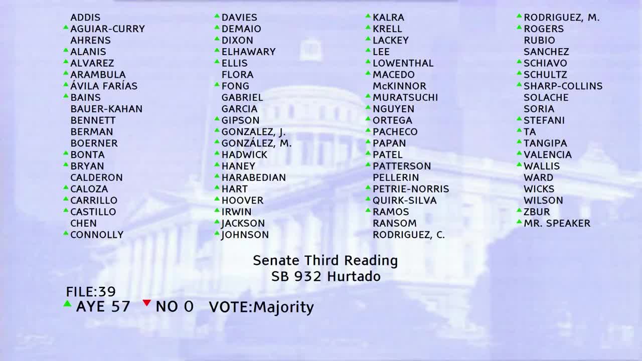
Bill Author

Bill Co-Author(s):