AB 2015: Department of Transportation: third-party navigation applications: study and report.
- Session Year: 2025-2026
- House: Assembly
- Latest Version Date: 2026-09-14
Current Status:
Passed
(2026-09-15: Chaptered by Secretary of State - Chapter 207, Statutes of 2026.)
Introduced
In Committee
Awaiting First Chamber Vote
Passed First Chamber
In Committee
Awaiting Second Chamber Vote
Passed Second Chamber
Enacted
Existing law establishes the Department of Transportation and vests it with full possession and control of the state highway system.
This bill would require the department, in consultation with the Transportation Agency and relevant regional and local authorities, to conduct a pilot study in a region or area of the state, as determined by the department, on the impact of third-party navigation applications on the state highway system and local street and road networks. The bill would require the pilot study to analyze how third-party navigation applications affect congestion displacement, local infrastructure, safety metrics, and emergency response, as provided. The bill would require the department, on or before January 1, 2029, to submit the study, and a report of related policy recommendations for regulatory or legislative action to improve the alignment between third-party navigation applications and state and local traffic management goals, to the relevant fiscal and policy committees of the Legislature. The bill would repeal these provisions on January 1, 2033.
Existing law establishes the Department of Transportation and vests it with full possession and control of the state highway system.
This bill would require the department, in consultation with the Transportation Agency and relevant regional and local authorities, to conduct a pilot study in a region or area of the state, as determined by the department, on the impact of third-party navigation applications on the state highway system and local street and road networks. The bill would require the pilot study to analyze how third-party navigation applications affect congestion displacement, local infrastructure, safety metrics, and emergency response, as provided. The bill would require the department, on or before January 1, 2029, to submit the study, and a report of related policy recommendations for regulatory or legislative action to improve the alignment between third-party navigation applications and state and local traffic management goals, to the relevant fiscal and policy committees of the Legislature. The bill would repeal these provisions on January 1, 2033.
Existing law establishes the Department of Transportation and vests it with full possession and control of the state highway system.
This bill would require the department, in consultation with the Transportation Agency and relevant regional and local authorities, to conduct a comprehensive pilot study in a region or area of the state, as determined by the department, on the impact of third-party navigation applications on the state highway system and local street and road networks. The bill would require the pilot study to analyze how third-party navigation applications affect congestion displacement, local infrastructure, safety metrics, and emergency response, as provided. The bill would require the department, on or before January 1, 2028, 2029, to submit the study, and a report of related policy recommendations for regulatory or legislative action to improve the alignment between third-party navigation applications and state and local traffic management goals, to the relevant fiscal and policy committees of the Legislature. The bill would repeal these provisions on January 1, 2032. 2033.
Existing law establishes the Department of Transportation and vests it with full possession and control of the state highway system.
This bill would require the department, in consultation with the Transportation Agency and local authorities, to conduct a comprehensive study on the impact of third-party navigation applications on the state highway system and local street and road networks. The bill would require the study to analyze how third-party navigation applications affect congestion displacement, local infrastructure, safety metrics, and emergency response, as provided. The bill would require the department, on or before January 1, 2028, to submit the study, and a report of related policy recommendations for regulatory or legislative action to improve the alignment between third-party navigation applications and state and local traffic management goals, to the relevant fiscal and policy committees of the Legislature. The bill would repeal these provisions on January 1, 2032.
Existing law authorizes local authorities, for those highways under their jurisdiction, to adopt rules and regulations by ordinance or resolution on various matters, including prohibiting the use of particular highways by certain vehicles and prohibiting entry to, or exit from, or both, from any street by means of islands, curbs, traffic barriers, or other roadway design features to implement the circulation element of an adopted general plan, as specified. Existing law also authorizes a local authority to adopt an ordinance to implement a slow streets program, which may include closures to vehicular traffic or through vehicular traffic of neighborhood local streets with connections to citywide bicycle networks, destinations that are within walking distance, or green space.This bill would additionally authorize local authorities to adopt rules and regulations by ordinance or resolution to prohibit any person, business, or other entity having ownership or control of a navigation program from providing directions to a driver that would include any of the streets in a slow streets program, and would require the local authority to notify the person, business, or other entity having ownership or control of a navigation program of the streets in a slow streets program.Existing law authorizes local authorities, for those highways under their jurisdiction, to adopt rules and regulations by ordinance or resolution on various matters, including prohibiting the use of particular highways by certain vehicles and prohibiting entry to, or exit from, or both, from any street by means of islands, curbs, traffic barriers, or other roadway design features to implement the circulation element of an adopted general plan, as specified. Existing law also authorizes a local authority to adopt an ordinance to implement a slow streets program, which may include closures to vehicular traffic or through vehicular traffic of neighborhood local streets with connections to citywide bicycle networks, destinations that are within walking distance, or green space.
This bill would additionally authorize local authorities to adopt rules and regulations by ordinance or resolution to prohibit any person, business, or other entity having ownership or control of a navigation program from providing directions to a driver that would include any of the streets in a slow streets program, and would require the local authority to notify the person, business, or other entity having ownership or control of a navigation program of the streets in a slow streets program.
Existing law generally prohibits a person from driving a vehicle upon a highway at a speed greater than 65 miles per hour. Existing law prohibits a person driving a vehicle upon a 2-lane, undivided highway at a speed greater than 55 miles per hour unless a higher speed has been posted by the Department of Transportation.This bill would make technical, nonsubstantive changes to those provisions.Existing law generally prohibits a person from driving a vehicle upon a highway at a speed greater than 65 miles per hour. Existing law prohibits a person driving a vehicle upon a 2-lane, undivided highway at a speed greater than 55 miles per hour unless a higher speed has been posted by the Department of Transportation.
This bill would make technical, nonsubstantive changes to those provisions.
(a)The department, in consultation with the Transportation Agency and relevant regional and local authorities, shall conduct a pilot study in a region or area of the state, as determined by the department, on the impact of third-party navigation applications on the state highway system and local street and road networks. The pilot study shall specifically analyze all of the following:
(1)Congestion displacement, analyzed by determining the extent to which third-party navigation applications shift congestion from state highways to local streets and the resulting changes in vehicle miles traveled.
(2)Local infrastructure impact, analyzed by determining the physical toll of increased traffic volumes associated with third-party navigation applications on local road pavement conditions, and related effects on maintenance costs.
(3)Safety metrics, analyzed by evaluating traffic safety on local roads affected by traffic diversion associated with third-party navigation applications, including changes in collision rates, near-miss incidents, and impacts on existing slow streets or pedestrian heavy zones.
(4)Emergency response, analyzed by determining the effect of traffic diversion associated with third-party navigation applications on the response times of police, fire, and emergency medical services.
(b)On or before January 1, 2029, the department shall submit to the relevant fiscal and policy committees of the Legislature the study required pursuant to subdivision (a) and a report, based on the findings of the study, that includes policy recommendations for regulatory or legislative action to improve the alignment between third-party navigation applications and state and local traffic management goals. Recommendations in the report may include any of the following:
(1)Data-sharing requirements between third-party navigation applications and local jurisdictions.
(2)Frameworks for third-party navigation applications to respect local traffic ordinances, such as weight limits or local access only designations.
(3)Technological standards to prioritize safety and emissions reductions over marginal time savings.
(c)(1)The study and report to be submitted pursuant to subdivision (b) shall be submitted in compliance with Section 9795 of the Government Code.
(2)Pursuant to Section 10231.5 of the Government Code, this section is repealed on January 1, 2033.
(a)The department, in consultation with the Transportation Agency and relevant regional and local authorities, shall conduct a pilot study in a region or area of the state, as determined by the department, on the impact of third-party navigation applications on the state highway system and local street and road networks. The pilot study shall specifically analyze all of the following:
(1)Congestion displacement, analyzed by determining the extent to which third-party navigation applications shift congestion from state highways to local streets and the resulting changes in vehicle miles traveled.
(2)Local infrastructure impact, analyzed by determining the physical toll of increased traffic volumes associated with third-party navigation applications on local road pavement conditions, and related effects on maintenance costs.
(3)Safety metrics, analyzed by evaluating traffic safety on local roads affected by traffic diversion associated with third-party navigation applications, including changes in collision rates, near-miss incidents, and impacts on existing slow streets or pedestrian heavy zones.
(4)Emergency response, analyzed by determining the effect of traffic diversion associated with third-party navigation applications on the response times of police, fire, and emergency medical services.
(b)On or before January 1, 2029, the department shall submit to the relevant fiscal and policy committees of the Legislature the study required pursuant to subdivision (a) and a report, based on the findings of the study, that includes policy recommendations for regulatory or legislative action to improve the alignment between third-party navigation applications and state and local traffic management goals. Recommendations in the report may include any of the following:
(1)Data-sharing requirements between third-party navigation applications and local jurisdictions.
(2)Frameworks for third-party navigation applications to respect local traffic ordinances, such as weight limits or local access only designations.
(3)Technological standards to prioritize safety and emissions reductions over marginal time savings.
(c)(1)The study and report to be submitted pursuant to subdivision (b) shall be submitted in compliance with Section 9795 of the Government Code.
(2)Pursuant to Section 10231.5 of the Government Code, this section is repealed on January 1, 2033.
(a)The department, in consultation with the Transportation Agency and relevant regional and local authorities, shall conduct a comprehensive pilot study in a region or area of the state, as determined by the department, on the impact of third-party navigation applications on the state highway system and local street and road networks. The pilot study shall specifically analyze all of the following:
(1)Congestion displacement, analyzed by determining the extent to which third-party navigation applications shift congestion from state highways to local streets and the resulting changes in vehicle miles traveled.
(2)Local infrastructure impact, analyzed by determining the physical toll of increased traffic volumes associated with third-party navigation applications on local road pavement conditions, and related effects on maintenance costs.
(3)Safety metrics, analyzed by evaluating traffic safety on local roads affected by traffic diversion associated with third-party navigation applications, including changes in collision rates, near-miss incidents, and impacts on existing slow streets or pedestrian heavy zones.
(4)Emergency response, analyzed by determining the effect of traffic diversion associated with third-party navigation applications on the response times of police, fire, and emergency medical services.
(b)On or before January 1, 2028, 2029, the department shall submit to the relevant fiscal and policy committees of the Legislature the study required pursuant to subdivision (a) and a report, based on the findings of the study, that includes policy recommendations for regulatory or legislative action to improve the alignment between third-party navigation applications and state and local traffic management goals. Recommendations in the report may include any of the following:
(1)Data-sharing requirements between third-party navigation applications and local jurisdictions.
(2)Frameworks for third-party navigation applications to respect local traffic ordinances, such as weight limits or local access only designations.
(3)Technological standards to prioritize safety and emissions reductions over marginal time savings.
(c)(1)The study and report to be submitted pursuant to subdivision (b) shall be submitted in compliance with Section 9795 of the Government Code.
(2)Pursuant to Section 10231.5 of the Government Code, this section is repealed on January 1, 2032. 2033.
(a)The department, in consultation with the Transportation Agency and local authorities, shall conduct a comprehensive study on the impact of third-party navigation applications on the state highway system and local street and road networks. The study shall specifically analyze all of the following:
(1)Congestion displacement, analyzed by determining the extent to which third-party navigation applications shift congestion from state highways to local streets and the resulting changes in vehicle miles traveled.
(2)Local infrastructure impact, analyzed by determining the physical toll of increased traffic volumes associated with third-party navigation applications on local road pavement conditions, and related effects on maintenance costs.
(3)Safety metrics, analyzed by evaluating traffic safety on local roads affected by traffic diversion associated with third-party navigation applications, including changes in collision rates, near-miss incidents, and impacts on existing slow streets or pedestrian heavy zones.
(4)Emergency response, analyzed by determining the effect of traffic diversion associated with third-party navigation applications on the response times of police, fire, and emergency medical services.
(b)On or before January 1, 2028, the department shall submit to the relevant fiscal and policy committees of the Legislature the study required pursuant to subdivision (a) and a report, based on the findings of the study, that includes policy recommendations for regulatory or legislative action to improve the alignment between third-party navigation applications and state and local traffic management goals. Recommendations in the report may include any of the following:
(1)Data-sharing requirements between third-party navigation applications and local jurisdictions.
(2)Frameworks for third-party navigation applications to respect local traffic ordinances, such as weight limits or local access only designations.
(3)Technological standards to prioritize safety and emissions reductions over marginal time savings.
(c)(1)The study and report to be submitted pursuant to subdivision (b) shall be submitted in compliance with Section 9795 of the Government Code.
(2)Pursuant to Section 10231.5 of the Government Code, this section is repealed on January 1, 2032.
SECTION 1.Section 21101 of the Vehicle Code is amended to read:21101.Local authorities, for those highways under their jurisdiction, may adopt rules and regulations by ordinance or resolution, except as provided in subdivision (f), on the following matters:(a)Closing any highway to vehicular traffic when, in the opinion of the legislative body having jurisdiction, the highway is either of the following:(1)No longer needed for vehicular traffic.(2)The closure is in the interests of public safety and all of the following conditions and requirements are met:(A)The street proposed for closure is located in a county with a population of 6,000,000 or more.(B)The street has an unsafe volume of traffic and a significant incidence of crime.(C)The affected local authority conducts a public hearing on the proposed street closure.(D)Notice of the hearing is provided to residents and owners of property adjacent to the street proposed for closure.(E)The local authority makes a finding that closure of the street likely would result in a reduced rate of crime.(b)Designating any highway as a through highway and requiring that all vehicles observe official traffic control devices before entering or crossing the highway or designating any intersection as a stop intersection and requiring all vehicles to stop at one or more entrances to the intersection.(c)Prohibiting the use of particular highways by certain vehicles, except as otherwise provided by the Public Utilities Commission pursuant to Article 2 (commencing with Section 1031) of Chapter 5 of Part 1 of Division 1 of the Public Utilities Code.(d)Closing particular streets during regular school hours for the purpose of conducting automobile driver training programs in the secondary schools and colleges of this state.(e)Temporarily closing a portion of any street for celebrations, parades, local special events, and other purposes when, in the opinion of local authorities having jurisdiction or a public officer or employee that the local authority designates by resolution, the closing is necessary for the safety and protection of persons who are to use that portion of the street during the temporary closing.(f)(1)Implementing a slow streets program. For purposes of this section, a slow streets program may include closures to vehicular traffic or through vehicular traffic of neighborhood local streets with connections to citywide bicycle networks, destinations, such as a business district, that are within walking distance, or green space. A local authority may implement a slow streets program by adopting an ordinance that provides for the closing of streets to vehicular traffic or limiting access and speed on a street using roadway design features, including, but not limited to, islands, curbs, or traffic barriers. A local authority may implement a slow streets program if it meets all of the following requirements:(A)Conducts an outreach and engagement process that includes notification to residents and owners of property abutting any street being considered for inclusion in the slow streets program.(B)Determines that the closure or traffic restriction leaves a sufficient portion of the streets in the surrounding area for other public uses, including vehicular, pedestrian, and bicycle traffic.(C)Provides advance notice of the closure or traffic restriction to residents and owners of property abutting the street.(D)Clearly designates the street closure or traffic restriction with signage in compliance with the California Manual on Uniform Traffic Control Devices.(E)Determines that the closure or traffic restriction is necessary for the safety and protection of persons who are to use that portion of the street during the closure or traffic restriction.(F)Maintains a publically available internet website with information about its slow streets program, a list of streets that are included in the program or are being evaluated for inclusion in the program, and instructions for participating in the public engagement process.(2)Prohibiting any person, business, or other entity having ownership or control of a navigation program from providing directions to a driver that would include any of the streets in a slow streets program implemented pursuant to this subdivision. The local authority shall notify any person, business, or other entity having ownership or control of a navigation program of the streets in a slow streets program.(g)Prohibiting entry to, or exit from, or both, from any street by means of islands, curbs, traffic barriers, or other roadway design features to implement the circulation element of a general plan adopted pursuant to Article 6 (commencing with Section 65350) of Chapter 3 of Division 1 of Title 7 of the Government Code. The rules and regulations authorized by this subdivision shall be consistent with the responsibility of local government to provide for the health and safety of its citizens.Local authorities, for those highways under their jurisdiction, may adopt rules and regulations by ordinance or resolution, except as provided in subdivision (f), on the following matters:
(a)Closing any highway to vehicular traffic when, in the opinion of the legislative body having jurisdiction, the highway is either of the following:
(1)No longer needed for vehicular traffic.
(2)The closure is in the interests of public safety and all of the following conditions and requirements are met:
(A)The street proposed for closure is located in a county with a population of 6,000,000 or more.
(B)The street has an unsafe volume of traffic and a significant incidence of crime.
(C)The affected local authority conducts a public hearing on the proposed street closure.
(D)Notice of the hearing is provided to residents and owners of property adjacent to the street proposed for closure.
(E)The local authority makes a finding that closure of the street likely would result in a reduced rate of crime.
(b)Designating any highway as a through highway and requiring that all vehicles observe official traffic control devices before entering or crossing the highway or designating any intersection as a stop intersection and requiring all vehicles to stop at one or more entrances to the intersection.
(c)Prohibiting the use of particular highways by certain vehicles, except as otherwise provided by the Public Utilities Commission pursuant to Article 2 (commencing with Section 1031) of Chapter 5 of Part 1 of Division 1 of the Public Utilities Code.
(d)Closing particular streets during regular school hours for the purpose of conducting automobile driver training programs in the secondary schools and colleges of this state.
(e)Temporarily closing a portion of any street for celebrations, parades, local special events, and other purposes when, in the opinion of local authorities having jurisdiction or a public officer or employee that the local authority designates by resolution, the closing is necessary for the safety and protection of persons who are to use that portion of the street during the temporary closing.
(f)(1)Implementing a slow streets program. For purposes of this section, a slow streets program may include closures to vehicular traffic or through vehicular traffic of neighborhood local streets with connections to citywide bicycle networks, destinations, such as a business district, that are within walking distance, or green space. A local authority may implement a slow streets program by adopting an ordinance that provides for the closing of streets to vehicular traffic or limiting access and speed on a street using roadway design features, including, but not limited to, islands, curbs, or traffic barriers. A local authority may implement a slow streets program if it meets all of the following requirements:
(1)(A)Conducts an outreach and engagement process that includes notification to residents and owners of property abutting any street being considered for inclusion in the slow streets program.
(2)(B)Determines that the closure or traffic restriction leaves a sufficient portion of the streets in the surrounding area for other public uses, including vehicular, pedestrian, and bicycle traffic.
(3)(C)Provides advance notice of the closure or traffic restriction to residents and owners of property abutting the street.
(4)(D)Clearly designates the street closure or traffic restriction with signage in compliance with the California Manual on Uniform Traffic Control Devices.
(5)(E)Determines that the closure or traffic restriction is necessary for the safety and protection of persons who are to use that portion of the street during the closure or traffic restriction.
(6)(F)Maintains a publically available internet website with information about its slow streets program, a list of streets that are included in the program or are being evaluated for inclusion in the program, and instructions for participating in the public engagement process.
(2)Prohibiting any person, business, or other entity having ownership or control of a navigation program from providing directions to a driver that would include any of the streets in a slow streets program implemented pursuant to this subdivision. The local authority shall notify any person, business, or other entity having ownership or control of a navigation program of the streets in a slow streets program.
(g)Prohibiting entry to, or exit from, or both, from any street by means of islands, curbs, traffic barriers, or other roadway design features to implement the circulation element of a general plan adopted pursuant to Article 6 (commencing with Section 65350) of Chapter 3 of Division 1 of Title 7 of the Government Code. The rules and regulations authorized by this subdivision shall be consistent with the responsibility of local government to provide for the health and safety of its citizens.
SECTION 1.Section 22349 of the Vehicle Code is amended to read:22349.(a)Except as provided in Section 22356, a person shall not drive a vehicle upon a highway at a speed greater than 65 miles per hour.(b)Notwithstanding any other law, a person shall not drive a vehicle upon a two-lane, undivided highway at a speed greater than 55 miles per hour unless that highway, or portion thereof, has been posted for a higher speed by the Department of Transportation or appropriate local agency upon the basis of an engineering and traffic survey. For purposes of this subdivision, the following apply:(1)A two-lane, undivided highway is a highway with not more than one through lane of travel in each direction.(2)A passing lane shall not be considered when determining the number of through lanes.(c)It is the intent of the Legislature that there be reasonable signage on affected two-lane, undivided highways described in subdivision (b) in continuing the 55 miles-per-hour speed limit, including placing signs at county boundaries to the extent possible, and at other appropriate locations.(a)Except as provided in Section 22356, no person may a person shall not drive a vehicle upon a highway at a speed greater than 65 miles per hour.
(b)Notwithstanding any other provision of law, no person may law, a person shall not drive a vehicle upon a two-lane, undivided highway at a speed greater than 55 miles per hour unless that highway, or portion thereof, has been posted for a higher speed by the Department of Transportation or appropriate local agency upon the basis of an engineering and traffic survey. For purposes of this subdivision, the following apply:
(1)A two-lane, undivided highway is a highway with not more than one through lane of travel in each direction.
(2)Passing lanes may A passing lane shall not be considered when determining the number of through lanes.
(c)It is the intent of the Legislature that there be reasonable signing signage on affected two-lane, undivided highways described in subdivision (b) in continuing the 55 miles-per-hour speed limit, including placing signs at county boundaries to the extent possible, and at other appropriate locations.
|
Date
|
Status
|
|---|---|
| Sep 15, 2026 | Chaptered by Secretary of State - Chapter 207, Statutes of 2026. |
| Sep 15, 2026 | Approved by the Governor. |
| Sep 14, 2026 | Chaptered by Secretary of State - Chapter 207, Statutes of 2026. |
| Sep 14, 2026 | Approved by the Governor. |
| Sep 8, 2026 | Enrolled and presented to the Governor at 3:30 p.m. |
| Aug 28, 2026 | Senate amendments concurred in. To Engrossing and Enrolling. (Ayes 61. Noes 12. Page 6813.). |
| Aug 28, 2026 | Senate amendments concurred in. To Engrossing and Enrolling. (Ayes 61. Noes 12.). |
| Aug 27, 2026 | In Assembly. Concurrence in Senate amendments pending. |
| Aug 27, 2026 | Read third time. Passed. Ordered to the Assembly. (Ayes 30. Noes 10. Page 6001.). |
| Aug 27, 2026 | Read third time. Passed. Ordered to the Assembly. (Ayes 30. Noes 10.). |
| Aug 17, 2026 | Read second time. Ordered to third reading. |
| Aug 13, 2026 | Read second time and amended. Ordered returned to second reading. |
| Aug 13, 2026 | From committee: Amend, and do pass as amended. (Ayes 5. Noes 2.) (August 13). |
| Aug 3, 2026 | In committee: Referred to APPR. suspense file. |
| Jun 24, 2026 | From committee: Do pass and re-refer to Com. on APPR. (Ayes 9. Noes 3.) (June 23). Re-referred to Com. on APPR. |
| Jun 10, 2026 | Referred to Com. on TRANS. |
| Jun 1, 2026 | In Senate. Read first time. To Com. on RLS. for assignment. |
| May 28, 2026 | Read third time. Passed. Ordered to the Senate. (Ayes 61. Noes 15. Page 5524.) |
| May 28, 2026 | Read third time. Passed. Ordered to the Senate. (Ayes 61. Noes 15.) |
| May 18, 2026 | Read second time. Ordered to third reading. |
| May 14, 2026 | Joint Rule 62(a), file notice suspended. (Page 5030.) |
| May 14, 2026 | From committee: Do pass. (Ayes 12. Noes 3.) (May 14). |
| May 14, 2026 | Joint Rule 62(a), file notice suspended. |
| May 13, 2026 | In committee: Set, first hearing. Referred to APPR. suspense file. |
| Apr 21, 2026 | From committee: Do pass and re-refer to Com. on APPR. (Ayes 13. Noes 1.) (April 20). Re-referred to Com. on APPR. |
| Apr 15, 2026 | Re-referred to Com. on TRANS. |
| Apr 14, 2026 | From committee chair, with author's amendments: Amend, and re-refer to Com. on TRANS. Read second time and amended. |
| Apr 8, 2026 | In committee: Hearing postponed by committee. |
| Mar 23, 2026 | Re-referred to Com. on TRANS. |
| Mar 19, 2026 | From committee chair, with author's amendments: Amend, and re-refer to Com. on TRANS. Read second time and amended. |
| Mar 19, 2026 | Referred to Coms. on TRANS. and L. GOV. |
| Feb 18, 2026 | From printer. May be heard in committee March 20. |
| Feb 17, 2026 | Read first time. To print. |
|
Date
|
Description
|
Location
|
Votes
|
|
|---|---|---|---|---|
| Aug 28, 2026 | AB 2015 Wicks Concurrence in Senate Amendments | Assembly Floor |
Passed |
|
| Aug 27, 2026 | Assembly 3rd Reading AB2015 Wicks By Arreguín | Senate Floor |
Passed |
|
| Aug 13, 2026 | Do pass as amended | Senate Standing Committee on Appropriations |
Passed |
|
| Aug 3, 2026 | Placed on suspense file | Senate Standing Committee on Appropriations |
Passed |
|
| Jun 23, 2026 | Do pass, but first be re-referred to the Committee on [Appropriations] | Senate Standing Committee on Transportation |
Passed |
|
| May 28, 2026 | AB 2015 Wicks Assembly Third Reading | Assembly Floor |
Passed |
|
| May 14, 2026 | Do pass. | Assembly Standing Committee on Appropriations |
Passed |
|
| Apr 20, 2026 | Do pass and be re-referred to the Committee on [Appropriations] | Assembly Standing Committee on Transportation |
Passed |
This list shows positions taken on this bill by organizations on the date displayed, which is linked to the original source.
Positions by individuals are not included.
|
Organization
|
Position
|
Date
|
|---|---|---|
| Alameda County Transportation Commission | ** Support | |
| California State Association Of Counties | ** Support | |
| Circulate Planning & Policy | ** Support | |
| City of South Pasadena | ** Support | |
| Streets for All | ** Support |
CONCURRENCE IN SENATE AMENDMENTS
CSA1 Bill Id:AB 2015
Author:(Wicks)
As Amended Ver:August 13, 2026
Majority vote
SUMMARY
Requires the Department of Transportation (Caltrans), in consultation with the California Transportation Agency (CalSTA) and local authorities, to conduct a pilot study and make recommendations on the impact of third-party navigation applications on the state highway system and local street and road networks by January 1, 2029.
Senate Amendments
- Reduce the scope of the study to be in a region or area of the state, as determined by Caltrans, instead of a comprehensive study.
- Provides an additional year for Caltrans to submit the study to the Legislature.
COMMENTS
Global Position System (GPS) became available for civilian use with limited accuracy in 1983.
The first handheld commercial GPS unit, the Magellan Nav 1000, was released in 1989. By 1991 Mazda became the first car company to factory install an in-car navigation system. By the mid-1990s, navigation websites like Mapquest became available, providing static print out directions for drivers to navigate from one location to another. In February of 2005, Google Maps was launched as a new solution to help drivers navigate.
In 2008, the Israeli startup Waze revolutionized navigation by utilizing crowdsourced data. Unlike traditional GPS devices, Waze incorporated real-time, user-submitted travel data to optimize routing based on live traffic patterns. Google acquired Waze in 2013 for approximately $1 billion. This community-driven data model became the industry standard, enabling navigation apps to dynamically divert traffic to avoid congestion.
According to the 2025 Annual Urban Mobility Scorecard, Americans lost an average of 63 hours sitting in traffic in 2024, the highest level ever measured. That's the equivalent of nearly eight full workdays lost to traffic and marks a 16% increase in national congestion costs over the last five years, now totaling $269 billion annually.
According to Mitigating Traffic Congestion: The Role of Intelligent Transportation Systems, a 2020 report by the London School of Economics, providing drivers with sensible route advice through navigation apps is a successful traffic management tool with the potential to reduce traffic externalities such as congestion, air pollution, and crashes. The report finds that the use of navigation systems alone is associated with a significant decrease in unnecessary travel time and congestion costs, resulting in annual national savings of approximately 175 million hours in travel time and $4.72 billion in travel costs. Furthermore, the study suggests that the congestion-mitigating effect of these systems is enhanced as commuters increasingly utilize online traffic services and navigation applications. These findings highlight that real-time information provided by navigation tools is a highly cost-effective intervention compared to traditional physical infrastructure investments, which can sometimes paradoxically exacerbate congestion.
According to Impact of Navigation Apps on Congestion and Spread Dynamics on a Transportation Network¸ a study conducted by UC Berkeley Institute of Transportation Studies, "Our findings reveal that traffic system performance improves when 30–60% of users follow dynamic routing. The Susceptible–infected–recovered (SIR) model supports these findings, highlighting the most efficient congestion propagation-to-dissipation ratio when 40% of users adopt dynamic routing, as indicated by the lowest basic reproductive number. This research provides valuable insights into the intricate relationship between navigation apps and traffic congestion, with implications for transportation planning and management."
According to the Author
"AB 2015 empowers local governments that have lawfully enacted slow streets programs to require navigation applications — including Google Maps, Apple Maps, and Waze — to exclude designated slow streets from their routing algorithms. The legislation closes a critical gap in existing law: communities can legally constrain traffic on streets, yet remain powerless as navigation platforms undermine that decision by directing a continuous stream of drivers onto those same roads.
The proliferation of real-time navigation applications has fundamentally changed how drivers move through cities. These apps continuously analyze traffic data and route drivers toward the fastest path — regardless of whether that path runs through a quiet residential block, past a school, or down a street that a community has worked for years to make safer.
AB 2015 is a pro-community, pro-safety measure rooted in the principle that locally elected governments, not algorithms, should determine how the streets of California's neighborhoods are used."
Arguments in Support
Streets for All, the sponsor of the bill, argues "While navigation applications are widely used to improve travel efficiency, their routing decisions can have unintended consequences on local communities and the broader transportation system. Drivers are often directed onto neighborhood streets or alternative routes that may not be designed to accommodate increased traffic volumes, leading to safety concerns, infrastructure strain, and conflicts with local traffic management strategies.
AB 2015 addresses this issue by creating a structured process to better understand the systemwide effects of navigation technologies. By analyzing congestion displacement, safety impacts, and coordination with emergency services, the study will provide critical data to inform future policy decisions and ensure that navigation tools operate in alignment with state and local transportation goals."
Arguments in Opposition
None on file.
FISCAL COMMENTS
According to Senate Appropriations Committee:
- Caltrans estimates one-time costs of approximately $3.9 million (State Highway Account) to complete the pilot study and report to the Legislature by January 1, 2029, including $2.5 million for a consultant contract and approximately $693,000 annually for two years for 4.0 PY (limited term) to oversee the consultant contract, coordinate with state and local partners, manage procurement and public outreach, develop supporting data capabilities, review technical work products, and prepare the final report. The consultant would develop specialized methodologies, analytical tools, and evaluation framework necessary to assess the impacts of traffic diversion caused by third-party navigation apps.
- The California Transportation Agency (CalSTA) indicates that any costs to consult with Caltrans for the study and report would be minor and absorbable. (State Highway Account)
VOTES:
ASM TRANSPORTATION: 13-1-2
YES: Wilson, Davies, Aguiar-Curry, Ahrens, Carrillo, Harabedian, Hart, Hoover, Jackson, Papan, Ransom, Rogers, Sharp-Collins
NO: Macedo
ABS, ABST OR NV: Ávila Farías, Lackey
ASM APPROPRIATIONS: 12-3-0
YES: Wicks, Hoover, Aguiar-Curry, Calderon, Caloza, Fong, Mark González, Krell, Pacheco, Pellerin, Sharp-Collins, Solache
NO: Dixon, Ta, Tangipa
ASSEMBLY FLOOR: 61-15-4
YES: Addis, Aguiar-Curry, Ahrens, Alvarez, Arambula, Ávila Farías, Bains, Bauer-Kahan, Bennett, Berman, Boerner, Bonta, Bryan, Calderon, Caloza, Carrillo, Chen, Connolly, Davies, Elhawary, Fong, Gabriel, Garcia, Gipson, Mark González, Haney, Harabedian, Hart, Hoover, Irwin, Jackson, Kalra, Krell, Lee, Lowenthal, McKinnor, Muratsuchi, Nguyen, Ortega, Pacheco, Papan, Patel, Pellerin, Petrie-Norris, Ramos, Ransom, Michelle Rodriguez, Rogers, Blanca Rubio, Schiavo, Schultz, Sharp-Collins, Solache, Soria, Stefani, Valencia, Ward, Wicks, Wilson, Zbur, Rivas
NO: Alanis, Castillo, DeMaio, Dixon, Ellis, Gallagher, Jeff Gonzalez, Hadwick, Johnson, Macedo, Patterson, Sanchez, Ta, Tangipa, Wallis
ABS, ABST OR NV: Flora, Lackey, Quirk-Silva, Celeste Rodriguez
UPDATED
VERSION: August 13, 2026
CONSULTANT: David Sforza / TRANS. / (916) 319-2093 FN: 0003738
SENATE RULES COMMITTEE Office of Senate Floor Analyses (916) 651-4171 | AB 2015 |
THIRD READING
Bill No: AB 2015
Author: Wicks (D)
Amended: 8/13/26 in Senate
Vote: 21
SENATE TRANSPORTATION COMMITTEE: 9-3, 6/23/26
AYES: Cortese, Archuleta, Arreguín, Blakespear, Gonzalez, Grayson, Menjivar, Richardson, Wiener
NOES: Strickland, Dahle, Seyarto
NO VOTE RECORDED: Valladares
SENATE APPROPRIATIONS COMMITTEE: 5-2, 8/13/26
AYES: Cervantes, Cabaldon, Grayson, Richardson, Wahab
NOES: Seyarto, Dahle
ASSEMBLY FLOOR: 61-15, 5/28/26 - See last page for vote
SUBJECT: Department of Transportation: third-party navigation applications: study and report
SOURCE: Streets for All
DIGEST:
This bill requires the California Department of Transportation (Caltrans) to conduct a pilot study and make recommendations on the impact of third-party navigation applications on roads in a particular region of the state.
ANALYSIS:
Existing law:
- Authorizes local jurisdictions to implement slow streets programs, by closing a portion or the entirety of a local street to through traffic. To implement a slow streets program, the jurisdictions must, among other things: (Vehicle Code (VEH) §21101)
- Conduct outreach and engagement with local residents and property owners.
- Determine that the restrictions leave a sufficient portion of surrounding streets for other uses.
- Determine that the closure is necessary for the safety of persons who use the street.
This bill:
- Requires Caltrans, in consultation with the California State Transportation Agency (CalSTA), and regional and local authorities, to conduct a pilot study, in a region of the state determined by Caltrans, on the impact of third-party navigation applications on the state highway system and local street and road networks. This study must analyze:
- The extent to which third-party navigation applications shift congestion from state highways to local streets;
- The impact on local infrastructure;
- Changes in traffic safety on local roads; and,
- The effect on response times of emergency responders.
- Requires Caltrans to submit a report based on the study to the relevant fiscal and policy committees of the Legislature by January 1, 2029. This report must contain policy recommendations, as part of which the following may be considered:
- Requiring data sharing between third-party navigation applications and local jurisdictions;
- Establishing frameworks for third-party navigation applications to respect local traffic ordinances; and,
- Establishing technological standards to prioritize safety and emissions reductions over marginal time savings.
Comments
- Purpose of the bill. According to the author, “Third-party navigation apps like Google Maps, Apple Maps, and Waze have fundamentally altered how drivers move through California’s cities and towns. By continuously optimizing for the fastest route, these algorithms regularly divert traffic off state highways and onto streets and roads — often without regard for weight limits, access restrictions, school zones, or other conditions that local governments have established to protect their communities. AB 2015 requires Caltrans to conduct a study on the impact of third-party navigation apps on the state highway system and local street and road networks. Sending drivers down the fastest path — regardless of whether that path runs through a quiet residential block, past a school, or down a street that a community has worked for years to make safer – is a decision that deserves to be scrutinized, so California has the data and policy framework to align navigation technology with the transportation planning decisions of state and local governments.”
- Third-party navigation applications. Third-party navigation apps have proliferated since the introduction of Waze in 2008, which utilized crowdsourced data, incorporating real-time, user-submitted travel information to optimize routing based on live traffic patterns. Since then, navigation apps have increasingly harnessed the ability to dynamically divert traffic to avoid congestion. This ability has become increasingly important, as according to the 2025 Annual Urban Mobility Scorecard, Americans lost an average of 63 hours sitting in traffic in 2024, equivalent to nearly eight full workdays. The same study found a 16% increase in national congestion costs over the previous five years, bringing the total cost up to $269 billion annually.
Navigation apps though have been shown to make a measurable difference in congestion. According to a 2020 report by the London School of Economics, titled Mitigating Traffic Congestion: The Role of Intelligent Transportation Systems, providing drivers with route advice through navigation apps is a successful traffic management tool with the potential to reduce traffic externalities such as congestion, air pollution, and crashes. The report found that the use of navigation systems by individual drivers is associated with a significant decrease in unnecessary travel time and congestion costs, resulting in annual national savings of approximately 175 million hours in travel time and $4.72 billion in travel costs. Furthermore, the study suggests that the congestion-mitigating effect of these systems is enhanced as commuters collectively increasingly utilize online traffic services and navigation applications. This finding is supported by a study from the UC Berkeley Institute of Transportation Studies, titled Impact of Navigation Apps on Congestion and Spread Dynamics on a Transportation Network, which found that traffic congestion can improve if even just 30-60% of users follow so‑called dynamic routing. These findings together highlight that real-time information provided by navigation apps is a highly cost-effective intervention for relieving congestion, especially compared to traditional physical infrastructure investments. - Slow streets programs. While navigation apps can help address traffic congestion at a macro level, local jurisdictions often have their own concerns with traffic and traffic safety. Increasingly, many jurisdictions have started adopting slow streets programs. These programs, also sometimes called safe streets programs, are generally focused on providing safe places for people to walk, cycle, skate, or otherwise get outside and exercise without having to worry about vehicular traffic at high speeds. Generally, these streets have specific exemptions for local access, deliveries, and emergency vehicles.
Slow streets are typically enforced through the installation of traffic diverters, narrowing streets, creating turn restrictions, or implementing other traffic calming measures. Signage, such as “Local Traffic Only” signs or other such signs redirecting the flow of traffic, is also used at main vehicle entry points to reduce vehicle congestion. Local jurisdictions have also at times identified stewards to take care of and monitor barricades.
According to state law, local authorities must adopt such a program by ordinance and are required to define the program and facilitate public engagement. Specifically, the locality must determine the closure or restriction is necessary for the safety and protection of the people who are to use that portion of the street, determine that the closure or restriction leaves a sufficient portion of streets in the surrounding area for other public uses, such as vehicular traffic, and clearly designates the streets with state-approved signage. Furthermore, the locality must conduct an outreach and engagement process that at a minimum, includes notification to the residents and owners of property abutting any street being considered for inclusion in the program; provide advance notice of any closure or traffic restriction to residents and owners of abutting streets; maintain a public website with information about the program, including a list of streets that are in the program or being considered and instructions for participating in the public engagement process. - Navigation apps move congestion to local roads. While third-party navigation apps have been shown to ease traffic congestion on busy commuter routes, in practice this is accomplished by diverting traffic to local streets and roads. This has created a host of issues for local jurisdictions, particularly when traffic is diverted into regions with slow streets programs.
Many of these issues arise because these local streets and roads were usually not designed to optimize or even accommodate high levels of traffic flow. These streets may be narrow, have steep hills, or have tight or blind turns, all of which can create hazards for drivers unfamiliar with the area. Furthermore, these roads were often not built to withstand the increased traffic volumes or use by heavier vehicles that navigation apps often bring.
Finally, many local jurisdictions are simply facing increased traffic congestion, in some cases to extreme levels. For example, in the small town of Leonia, New Jersey, navigation apps were increasingly routing commuters through the town to avoid backups ahead of the George Washington Bridge into New York City. As a result, businesses and private residences were being blocked as traffic piled up on local streets, with local residents reporting having to wait up to 15 minutes to pull out of their driveways.
Altogether, these issues have caused many jurisdictions to try and undertake their own solutions to prevent navigation apps from rerouting traffic through their local streets and roads. The town of Leonia changed local laws to prevent through traffic on all side streets during rush hour. Other communities have told their residents to go into applications like Google Maps and report local routes as incorrect routing options.
In California, many local jurisdictions are somewhat limited in the responses they can take. This is because state law generally restricts the ability of local jurisdictions to lower speed limits or close local roads. In most cases, local jurisdictions cannot lower local speed limits without performing a traffic study that demonstrates a clear safety need. Similarly, local jurisdictions are heavily restricted in their ability to close or limit access to local roads, with the slow streets program being one of the only primary exceptions. - Balancing the benefits of navigation apps with local concerns. AB 2015 seeks to take a first step towards balancing the concerns of local jurisdictions with the wider benefits of navigation apps on regional traffic patterns. It does so by requiring Caltrans to carry out a pilot study investigating how third-party navigation apps impact local jurisdictions. Specifically, the study must look at how congestion is displaced to local streets and roads and how that displacement impacts local infrastructure, traffic safety, and emergency response abilities. Caltrans is then tasked with producing a set of policy recommendations centered on producing new standards or frameworks to allow greater coordination between navigation apps and local jurisdictions, and to place guardrails on the ability of navigation apps to reroute traffic through local streets and roads.
Moving forward, the Legislature may want to consider the tradeoffs between overall traffic and pollution mitigation created by navigation apps, and the acute stresses that traffic displacement can cause for local jurisdictions.
FISCAL EFFECT: Appropriation: No Fiscal Com.: Yes Local: No
According to the Senate Appropriations Committee:
- Caltrans estimates one-time costs of approximately $3.9 million (State Highway Account) to complete the pilot study and report to the Legislature by January 1, 2029, including $2.5 million for a consultant contract and approximately $693,000 annually for two years for 4.0 PY (limited term) to oversee the consultant contract, coordinate with state and local partners, manage procurement and public outreach, develop supporting data capabilities, review technical work products, and prepare the final report. The consultant would develop specialized methodologies, analytical tools, and evaluation framework necessary to assess the impacts of traffic diversion caused by third-party navigation apps.
- The California Transportation Agency (CalSTA) indicates that any costs to consult with Caltrans for the study and report would be minor and absorbable. (State Highway Account)
SUPPORT: (Verified 8/13/26)
Streets for All (source)
Alameda County Transportation Commission
California State Association of Counties
Circulate Planning & Policy
City of South Pasadena
OPPOSITION: (Verified 8/13/26)
None received
ASSEMBLY FLOOR: 61-15, 5/28/26
AYES: Addis, Aguiar-Curry, Ahrens, Alvarez, Arambula, Ávila Farías, Bains, Bauer-Kahan, Bennett, Berman, Boerner, Bonta, Bryan, Calderon, Caloza, Carrillo, Chen, Connolly, Davies, Elhawary, Fong, Gabriel, Garcia, Gipson, Mark González, Haney, Harabedian, Hart, Hoover, Irwin, Jackson, Kalra, Krell, Lee, Lowenthal, McKinnor, Muratsuchi, Nguyen, Ortega, Pacheco, Papan, Patel, Pellerin, Petrie-Norris, Ramos, Ransom, Michelle Rodriguez, Rogers, Blanca Rubio, Schiavo, Schultz, Sharp-Collins, Solache, Soria, Stefani, Valencia, Ward, Wicks, Wilson, Zbur, Rivas
NOES: Alanis, Castillo, DeMaio, Dixon, Ellis, Gallagher, Jeff Gonzalez, Hadwick, Johnson, Macedo, Patterson, Sanchez, Ta, Tangipa, Wallis
NO VOTE RECORDED: Flora, Lackey, Quirk-Silva, Celeste Rodriguez
Prepared by: Samuel Myers / TRANS. / (916) 651-4121
8/17/26 10:47:35
SENATE COMMITTEE ON
Senator Sabrina Cervantes, Chair
2025 - 2026 Regular Session
AB 2015 (Wicks) - Department of Transportation: third-party navigation applications: study and report
Version: | Policy Vote: |
Urgency: | Mandate: |
Hearing Date: | Consultant: |
Bill Summary:
AB 2015 would require the Department of Transportation (Caltrans) to conduct a comprehensive study on the impact of third-party navigation applications (apps) on the state highway system and local streets and roads, and report recommendations to the Legislature by January 1, 2028.
*********** ANALYSIS ADDENDUM – SUSPENSE FILE ***********
The following information is revised to reflect amendments
adopted by the committee on August 13, 2026
Fiscal Impact:
- Caltrans estimates one-time costs of approximately $3.9 million (State Highway Account) to complete the pilot study and report to the Legislature by January 1, 2029, including $2.5 million for a consultant contract and approximately $693,000 annually for two years for 4.0 PY (limited term) to oversee the consultant contract, coordinate with state and local partners, manage procurement and public outreach, develop supporting data capabilities, review technical work products, and prepare the final report. The consultant would develop specialized methodologies, analytical tools, and evaluation framework necessary to assess the impacts of traffic diversion caused by third-party navigation apps.
- The California Transportation Agency (CalSTA) indicates that any costs to consult with Caltrans for the study and report would be minor and absorbable. (State Highway Account)
Author Amendments:
- Require Caltrans to consult with regional authorities, in addition to CalSTA and local authorities, when conducting the study.
- Limit the study to a pilot in a region or area of the state, as determined by Caltrans, rather than requiring a comprehensive study.
- Delay the deadline for Caltrans to submit a report to the Legislature to January 1, 2029.
-- END --
SENATE COMMITTEE ON
Senator Sabrina Cervantes, Chair
2025 - 2026 Regular Session
AB 2015 (Wicks) - Department of Transportation: third-party navigation applications: study and report
Version: | Policy Vote: |
Urgency: | Mandate: |
Hearing Date: | Consultant: |
Bill Summary:
AB 2015 would require the Department of Transportation (Caltrans) to conduct a comprehensive study on the impact of third-party navigation applications (apps) on the state highway system and local streets and roads, and report recommendations to the Legislature by January 1, 2028.
Fiscal Impact:
- Caltrans estimates one-time costs of approximately $6.1 million (State Highway Account) to complete the study and report to the Legislature by January 1, 2028, including $3.5 million for a consultant contract and approximately $2.6 million for 11.0 PY of one-year limited term positions to support study oversight, coordination, technical review, and report development. Caltrans indicates that the magnitude of these costs is partially driven by the accelerated timeframes specified in the bill. See Staff Comments.
- The California Transportation Agency (CalSTA) indicates that any costs to consult with Caltrans for the study and report would be minor and absorbable. (State Highway Account)
Background:
Existing law establishes Caltrans and vests the department with full possession and control of the state highway system. While cities and counties generally have the authority to control construct, improve, and maintain local streets and roads, state law provides some limitations when it comes to public road access. For example, local agencies can adopt rules and regulations prohibiting entry or exit from any street, but only if it is necessary to implement the circulation element of its General Plan. Existing law also authorizes local agencies to adopt an ordinance to implement a “slow streets” program, which may include closures to vehicular traffic or through vehicular traffic of neighborhood local streets with connections to citywide bicycle networks, destinations that are within walking distance, or green space. Slow streets are typically enforced through the installation of traffic diverters, narrowing streets, creating turn restrictions, or implementing other traffic calming measures. However, local agencies cannot place gates or other devices which deny access to certain members of the public, while allowing others unrestricted access. If a local agency does erect traffic control devices, it must comply with standards and specifications set by Caltrans.
Since the advent of factory-equipped GPS navigation systems in vehicles beginning in the early 1990s, the use of real-time navigation tools while driving has become commonplace. With the launch of Waze in 2008, the use of community-driven data, in which users submit real-time travel information that can be used to optimize routing based on travel patterns, has become the industry standard. As a result of this change over the last decade, navigation apps have increasingly harnessed the ability to dynamically divert traffic to avoid congestion. As noted in the policy analysis of this bill, several studies have concluded that providing drivers with route advice through navigation apps is a successful traffic management tool with the potential to reduce traffic externalities such as congestion, air pollution, and crashes. However, while third-party navigation apps have been shown to ease traffic congestion on busy commuter routes, in practice this is accomplished by diverting traffic onto local streets and roads. This congestion displacement oftentimes results in negative outcomes for local jurisdictions, including pavement damage and increased maintenance costs, traffic congestion on neighborhood streets, and safety concerns for vulnerable road users.
Proposed Law:
AB 2015 would require Caltrans, in consultation with CalSTA and local authorities, to conduct a comprehensive study on the impact of third-party navigation apps on the state highway system and local streets and roads that specifically analyzes all of the following:
- Congestion displacement, by determining the extent to which third-party navigation apps shift congestion from state highways to local streets and roads, and the resulting changes to vehicle miles traveled (VMT)
- Local infrastructure impact, by determining the physical toll of increased traffic volume on pavement conditions and local maintenance costs that are associated with navigation apps.
- Safety metrics, by evaluating traffic safety on local roads affected by traffic diversion associated with navigation apps, including changes in collision rates, near-miss incidents, and impacts on existing “slow streets” or pedestrian heavy zones.
- Emergency response, by determining the impact of traffic diversion associated with navigation apps on police, fire, and emergency medical services response times.
The bill would require Caltrans to submit the study and a report to the Legislature by January 1, 2028 that includes policy recommendations to improve alignment between navigation apps and state and local traffic management goals, which may include the following:
- Data-sharing requirements between navigation apps and local jurisdictions.
- Frameworks for navigation apps to respect local traffic ordinances, such as weight limits or local access only designations.
- Technological standards to prioritize safety and emissions reductions over marginal time savings.
Related Legislation:
AB 773 (Nazarian), Chap. 773/2021, authorized a local authority to adopt an ordinance to implement a slow streets program, which may include closures to vehicular traffic or through vehicular traffic of neighborhood local streets with connections to citywide bicycle networks, destinations that are within walking distance, or green space.
Staff Comments:
This bill would require Caltrans to conduct a labor-intensive analysis-driven study regarding the impacts that third-party navigation apps have on the entirety of the state highway system and local streets and roads, and to submit study findings and policy recommendations to the Legislature by January 1, 2028. While the bill’s operative date is January 1, 2027, it is most likely that Caltrans would submit a budget change proposal through the 2027-28 budget process to receive resources by July 1, 2027. This would only provide Caltrans with six months to contract with a consultant, hire temporary staff, oversee and review the work, and submit findings and recommendations to the Legislature.
According to Caltrans, the costs noted above reflect the scope and complexity of the required statewide study, the compressed six-month timeline for completing both the study and final report, the need for specialized consultant expertise, and limited in-house capacity. The department anticipates needing approximately 11 limited-term positions to oversee the consultant, coordinate with state and local partners, manage procurement and public outreach, develop supporting data capabilities, review technical work products, and prepare the final report, while the consultant would develop the technical methodologies, analytical tools, and evaluation framework needed to assess the impacts of third-party navigation app traffic diversion on safety, congestion, emergency response, and local transportation networks. Caltrans notes that the compressed six-month implementation timeline significantly increases the department's resource needs, particularly for limited-term staff needed to manage multiple workstreams at the same time.
Recommended Amendments:
The Committee may wish to amend the bill to extend the study and report due date to mitigate costs to Caltrans.
-- END --
SENATE COMMITTEE ON TRANSPORTATION
Senator Dave Cortese, Chair
2025 - 2026 Regular
Bill No: Hearing Date: 6/23/2026
Author: | Wicks | ||
Version: | 4/14/2026 Amended | ||
Urgency: | No | Fiscal: | Yes |
Consultant: | Samuel Myers | ||
SUBJECT:
DIGEST: This bill requires the California Department of Transportation (Caltrans) to conduct a comprehensive study and make recommendations on the impact of third-party navigation applications on roads across the state.
ANALYSIS:
Existing law:
- Establishes prima facie speed limits for all state roads and outlines conditions for when, and how much, those speed limits may be lowered by Caltrans or local jurisdictions. (VEH Division 11, Chapter 7, Article 1)
- Authorizes local jurisdictions to implement slow streets programs, by closing a portion or the entirety of a local street to through traffic. To implement a slow streets program, the jurisdictions must, among other things: (VEH 21101)
- Conduct outreach and engagement with local residents and property owners.
- Determine that the restrictions leave a sufficient portion of surrounding streets for other uses.
- Determine that the closure is necessary for the safety of persons who use the street.
- Conduct outreach and engagement with local residents and property owners.
This bill:
- Requires Caltrans, in consultation with the California State Transportation Agency (CalSTA), and local authorities, to conduct a comprehensive study on the impact of third-party navigation applications on the state highway system and local street and road networks. This study must analyze:
- The extent to which third-party navigation applications shift congestion from state highways to local streets;
- The impact on local infrastructure;
- Changes in traffic safety on local roads; and,
- The effect on response times of emergency responders.
- The extent to which third-party navigation applications shift congestion from state highways to local streets;
- Requires Caltrans to submit a report based on the study to the relevant fiscal and policy committees of the Legislature by January 1, 2028. This report must contain policy recommendations, as part of which the following may be considered:
- Requiring data sharing between third-party navigation applications and local jurisdictions;
- Establishing frameworks for third-party navigation applications to respect local traffic ordinances; and,
- Establishing technological standards to prioritize safety and emissions reductions over marginal time savings.
- Requiring data sharing between third-party navigation applications and local jurisdictions;
COMMENTS:
- Purpose of the bill. According to the author, “Third-party navigation apps like Google Maps, Apple Maps, and Waze have fundamentally altered how drivers move through California’s cities and towns. By continuously optimizing for the fastest route, these algorithms regularly divert traffic off state highways and onto streets and roads — often without regard for weight limits, access restrictions, school zones, or other conditions that local governments have established to protect their communities. AB 2015 requires Caltrans to conduct a study on the impact of third-party navigation apps on the state highway system and local street and road networks. Sending drivers down the fastest path — regardless of whether that path runs through a quiet residential block, past a school, or down a street that a community has worked for years to make safer – is a decision that deserves to be scrutinized, so California has the data and policy framework to align navigation technology with the transportation planning decisions of state and local governments.”
- Third-party navigation applications. The origin of third-party navigation apps goes back to 1983 and the opening of the Global Positioning System (GPS) for civilian use. The first handheld GPS unit became available in 1989 and the first vehicle to come equipped with in-car GPS navigation hit the market in 1991. However, the use of third-party navigations applications was not widespread until the early 2000s, with the advent of navigation websites such as Mapquest and Google Maps.
The real revolution in third-party navigation apps, however, was in 2008, with the launch of Waze. Unlike traditional GPS devices, Waze utilized crowdsourced data, incorporating real-time, user-submitted travel information to optimize routing based on live traffic patterns. Five years later, in 2013, Google acquired Waze for approximately $1 billion. Since then, this community-driven data model has become the industry standard for navigation apps.
As a result of this change in the industry, over the past decade navigation apps have increasingly harnessed the ability to dynamically divert traffic to avoid congestion. This ability has become increasingly important, as according to the 2025 Annual Urban Mobility Scorecard, Americans lost an average of 63 hours sitting in traffic in 2024, equivalent to nearly eight full workdays. The same study found a 16% increase in national congestion costs over the previous five years, bringing the total cost up to $269 billion annually.
Navigation apps though have been shown to make a measurable difference in congestion. According to a 2020 report by the London School of Economics, titled Mitigating Traffic Congestion: The Role of Intelligent Transportation Systems, providing drivers with route advice through navigation apps is a successful traffic management tool with the potential to reduce traffic externalities such as congestion, air pollution, and crashes. The report found that the use of navigation systems by individual drivers is associated with a significant decrease in unnecessary travel time and congestion costs, resulting in annual national savings of approximately 175 million hours in travel time and $4.72 billion in travel costs. Furthermore, the study suggests that the congestion-mitigating effect of these systems is enhanced as commuters collectively increasingly utilize online traffic services and navigation applications. This finding is supported by a study from the UC Berkeley Institute of Transportation Studies, titled Impact of Navigation Apps on Congestion and Spread Dynamics on a Transportation Network, which found that traffic congestion can improve if even just 30-60% of users follow so‑called dynamic routing. These findings together highlight that real-time information provided by navigation apps is a highly cost-effective intervention for relieving congestion, especially compared to traditional physical infrastructure investments.
Furthermore, navigation apps are increasingly rolling out features aimed at helping drivers select more fuel efficient, and thus environmentally friendly routes. For example, Google Maps allows the user to select whether they are driving a gas, diesel, hybrid, or electric vehicle. The program then takes this information, along with local and real-time information such as average fuel/energy consumption, topographic features, road types, and traffic patterns to suggest the most energy efficient route. Thus, in addition to addressing traffic congestion, navigation apps may be able to aid in limiting vehicle emissions as well. - Slow streets programs. While navigation apps can help address traffic congestion at a macro level, local jurisdictions often have their own concerns with traffic and traffic safety. Increasingly, many jurisdictions have started adopting slow streets programs. These programs, also sometimes called safe streets programs, are generally focused on providing safe places for people to walk, cycle, skate, or otherwise get outside and exercise without having to worry about vehicular traffic at high speeds. Generally, these streets have specific exemptions for local access, deliveries, and emergency vehicles.
Slow streets are typically enforced through the installation of traffic diverters, narrowing streets, creating turn restrictions, or implementing other traffic calming measures. Signage, such as “Local Traffic Only” signs or other such signs redirecting the flow of traffic, is also used at main vehicle entry points to reduce vehicle congestion. Local jurisdictions have also at times identified stewards to take care of and monitor barricades.
These programs came to prominence in California during the COVID-19 pandemic. Following the implementation of lockdown measures in 2020, many cities across the state, including Los Angeles, Sacramento, Oakland, and San Francisco, moved to implement temporary Slow Streets programs to help facilitate alternative mobility and outdoor activity. Each city developed a unique program with common elements including a focus on neighborhood local streets and establishing network connections for increased mobility.
The implementation of slow streets was made permanent in 2021 with the passage of AB 733 (Nazarian, Chapter 587, Statutes of 2021). AB 733 authorized local authorities to implement a permanent Slow Streets program by providing for the closure or restriction of vehicular traffic on neighborhood local streets. Local authorities must adopt the program by ordinance and are required to define the program and facilitate public engagement. Specifically, the locality must determine the closure or restriction is necessary for the safety and protection of the people who are to use that portion of the street, determine that the closure or restriction leaves a sufficient portion of streets in the surrounding area for other public uses, such as vehicular traffic, and clearly designates the streets with state-approved signage.
Furthermore, the locality must conduct an outreach and engagement process that at a minimum, includes notification to the residents and owners of property abutting any street being considered for inclusion in the program; provide advance notice of any closure or traffic restriction to residents and owners of abutting streets; maintain a public website with information about the program, including a list of streets that are in the program or being considered and instructions for participating in the public engagement process. - Navigation apps move congestion to local roads. While third-party navigation apps have been shown to ease traffic congestion on busy commuter routes, in practice this is accomplished by diverting traffic to local streets and roads. This has created a host of issues for local jurisdictions, particularly when traffic is diverted into regions with slow streets programs.
Many of these issues arise because these local streets and roads were usually not designed to optimize or even accommodate high levels of traffic flow. These streets may be narrow, have steep hills, or have tight or blind turns, all of which can create hazards for drivers unfamiliar with the area. Furthermore, these roads were often not built to withstand the increased traffic volumes or use by heavier vehicles that navigation apps often bring. This is problematic because both use frequency and vehicle weight are key factors that drive pavement degradation. Vehicle weight is particularly important, as the relationship between weight and damage is not linear. In fact, simply doubling the weight of a vehicle can increase damage to the road by 16 times. Thus, infrastructure damage on these roads increases substantially as more vehicles are rerouted onto them.
Finally, many local jurisdictions are simply facing increased traffic congestion, in some cases to extreme levels. For example, in the small town of Leonia, New Jersey, navigation apps were increasingly routing commuters through the town to avoid back ups ahead of the George Washington Bridge into New York City. As a result, businesses and private residences were being blocked as traffic piled up on local streets, with local residents reporting having to wait up to 15 minutes to pull out of their driveways[1].
Altogether, these issues have caused many jurisdictions to try and undertake their own solutions to prevent navigation apps from rerouting traffic through their local streets and roads. The town of Leonia changed local laws to prevent through traffic on all side streets during rush hour. Other communities have told their residents to go into applications like Google Maps and report local routes as incorrect routing options[2]. Forum sites such as Reddit and Nextdoor are also full of local residents suggesting methods to try and trick the apps into routing vehicles away from their streets or providing ways to create ad hoc traffic calming measures.
In California, many local jurisdictions are somewhat limited in the responses they can take. This is because state law generally restricts the ability of local jurisdictions to lower speed limits or close local roads. In most cases, local jurisdictions cannot lower local speed limits without performing a traffic study that demonstrates a clear safety need. Similarly, local jurisdictions are heavily restricted in their ability to close or limit access to local roads, with the slow streets program being one of the only primary exceptions. - Balancing the benefits of navigation apps with local concerns. AB 2015 seeks to take a first step towards balancing the concerns of local jurisdictions with the wider benefits of navigation apps on regional traffic patterns. It does so by requiring Caltrans to carry out a study investigating how third-party navigation apps impact local jurisdictions. Specifically, the study must look at how congestion is displaced to local streets and roads and how that displacement impacts local infrastructure, traffic safety, and emergency response abilities. Caltrans is then tasked with producing a set of policy recommendations centered on producing new standards or frameworks to allow greater coordination between navigation apps and local jurisdictions, and to place guardrails on the ability of navigation apps to reroute traffic through local streets and roads.
Moving forward, the Legislature may want to consider the tradeoffs between overall traffic and pollution mitigation created by navigation apps, and the acute stresses that traffic displacement can cause for local jurisdictions.
Related/previous Legislation:
AB 43 (Friedman, Chapter 690, Statutes of 2021) – Provided greater flexibility to Caltrans and local jurisdictions in setting speed limits.
AB 773 (Nazarian, Chapter 587, Statutes of 2021) – Authorized local jurisdictions to implement a slow streets program, as defined, as long as certain conditions are met.
FISCAL EFFECT: Appropriation: Fiscal Com.: Local:
POSITIONS: (Communicated to the committee before noon on Wednesday,
June 17, 2026.)
SUPPORT:
Streets for All (Sponsor)
Circulate Planning & Policy
City of South Pasadena
OPPOSITION:
None received
-- END --
ASSEMBLY THIRD READING
ATR Bill Id:AB 2015
Author:(Wicks)
As Amended Ver:April 14, 2026
Majority vote
SUMMARY
Requires the Department of Transportation (Caltrans), in consultation with the California Transportation Agency (CalSTA) and local authorities, to conduct a comprehensive study and make recommendations on the impact of third-party navigation applications on the state highway system and local street and road networks by January 1, 2028.
Major Provisions
- Requires the study to analyze the impact of third-party navigation applications on congestion displacement, local infrastructure impact, safety metrics and emergency response, as specified.
- On or before January 1, 2028, requires Caltrans to submit a report to the relevant fiscal and policy committees of the Legislature the study required and a report, based on the findings of the study, that includes policy recommendations for regulatory or legislative action to improve the alignment between third party navigation applications and state and local traffic management goals.
- The recommendations may include the following:
- Data-sharing requirements between third-part navigation applications and local jurisdictions.
- Frameworks for third-party navigation applications to respect local traffic ordinances, such as weight limits or local access only designations.
- Technological standards to prioritize safety and emissions reductions over marginal time savings.
COMMENTS
Global Position System (GPS) became available for civilian use with limited accuracy in 1983.
The first handheld commercial GPS unit, the Magellan Nav 1000, was released in 1989. By 1991 Mazda became the first car company to factory install an in-car navigation system. By the mid-1990s, navigation websites like Mapquest became available, providing static print out directions for drivers to navigate from one location to another. In February of 2005, Google Maps was launched as a new solution to help drivers navigate.
In 2008, the Israeli startup Waze revolutionized navigation by utilizing crowdsourced data. Unlike traditional GPS devices, Waze incorporated real-time, user-submitted travel data to optimize routing based on live traffic patterns. Google acquired Waze in 2013 for approximately $1 billion. This community-driven data model became the industry standard, enabling navigation apps to dynamically divert traffic to avoid congestion.
According to the 2025 Annual Urban Mobility Scorecard, Americans lost an average of 63 hours sitting in traffic in 2024, the highest level ever measured. That’s the equivalent of nearly eight full workdays lost to traffic and marks a 16% increase in national congestion costs over the last five years, now totaling $269 billion annually.
According to Mitigating Traffic Congestion: The Role of Intelligent Transportation Systems, a 2020 report by the London School of Economics, providing drivers with sensible route advice through navigation apps is a successful traffic management tool with the potential to reduce traffic externalities such as congestion, air pollution, and crashes. The report finds that the use of navigation systems alone is associated with a significant decrease in unnecessary travel time and congestion costs, resulting in annual national savings of approximately 175 million hours in travel time and $4.72 billion in travel costs. Furthermore, the study suggests that the congestion-mitigating effect of these systems is enhanced as commuters increasingly utilize online traffic services and navigation applications. These findings highlight that real-time information provided by navigation tools is a highly cost-effective intervention compared to traditional physical infrastructure investments, which can sometimes paradoxically exacerbate congestion.
According to Impact of Navigation Apps on Congestion and Spread Dynamics on a Transportation Network¸ a study conducted by UC Berkeley Institute of Transportation Studies, ″Our findings reveal that traffic system performance improves when 30–60% of users follow dynamic routing. The Susceptible–infected–recovered (SIR) model supports these findings, highlighting the most efficient congestion propagation-to-dissipation ratio when 40% of users adopt dynamic routing, as indicated by the lowest basic reproductive number. This research provides valuable insights into the intricate relationship between navigation apps and traffic congestion, with implications for transportation planning and management.″
According to the Author
″AB 2015 empowers local governments that have lawfully enacted slow streets programs to require navigation applications — including Google Maps, Apple Maps, and Waze — to exclude designated slow streets from their routing algorithms. The legislation closes a critical gap in existing law: communities can legally constrain traffic on streets, yet remain powerless as navigation platforms undermine that decision by directing a continuous stream of drivers onto those same roads.The proliferation of real-time navigation applications has fundamentally changed how drivers move through cities. These apps continuously analyze traffic data and route drivers toward the fastest path — regardless of whether that path runs through a quiet residential block, past a school, or down a street that a community has worked for years to make safer. AB 2015 is a pro-community, pro-safety measure rooted in the principle that locally elected governments, not algorithms, should determine how the streets of California’s neighborhoods are used.:
Arguments in Support
Streets for All, the sponsor of the bill, argues ″While navigation applications are widely used to improve travel efficiency, their routing decisions can have unintended consequences on local communities and the broader transportation system. Drivers are often directed onto neighborhood streets or alternative routes that may not be designed to accommodate increased traffic volumes, leading to safety concerns, infrastructure strain, and conflicts with local traffic management strategies.
AB 2015 addresses this issue by creating a structured process to better understand the systemwide effects of navigation technologies. By analyzing congestion displacement, safety impacts, and coordination with emergency services, the study will provide critical data to inform future policy decisions and ensure that navigation tools operate in alignment with state and local transportation goals.″
Arguments in Opposition
None on file.
FISCAL COMMENTS
According to Assembly Appropriations Committee:
This bill creates significant new analytical work of Caltrans and, to a much lesser extent, CalSTA and local authorities. Caltrans is not able to provide a cost estimate; however, it describes the costs to comply with the bill as ″significant,″ because of what Caltrans describes as the bill’s ″comprehensive nature″ and ″limited timeline for delivery.″ Caltrans further asserts it does not have in-house staffing or resources needed to perform this work and would likely need to contract with a specialized vendor in transportation and public engagement. (State Highway Account.)
VOTES
ASM TRANSPORTATION: 13-1-2
YES: Wilson, Davies, Aguiar-Curry, Ahrens, Carrillo, Harabedian, Hart, Hoover, Jackson, Papan, Ransom, Rogers, Sharp-Collins
NO: Macedo
ABS, ABST OR NV: Ávila Farías, Lackey
ASM APPROPRIATIONS: 12-3-0
YES: Wicks, Hoover, Aguiar-Curry, Calderon, Caloza, Fong, Mark González, Krell, Pacheco, Pellerin, Sharp-Collins, Solache
NO: Dixon, Ta, Tangipa
UPDATED
VERSION: April 14, 2026
CONSULTANT: David Sforza / TRANS. / (916) 319-2093 FN: 0002669
Date of Hearing: May 13, 2026
ASSEMBLY COMMITTEE ON APPROPRIATIONS
Buffy Wicks, Chair
ABPCA Bill Id:AB 2015
Author:(Wicks) – As Amended Ver:April 14, 2026
Policy Committee: | Transportation | Vote: | 13 - 1 |
|
| ||
|
|
Urgency: No State Mandated Local Program: No Reimbursable: No
SUMMARY:
This bill requires the Department of Transportation (Caltrans), in consultation with the California State Transportation Agency (CalSTA) and local authorities, to conduct a comprehensive study on the impact of third-party navigation applications on the state highway system and local street and road networks.
The bill requires the study to specifically analyze:
- Congestion displacement, analyzed by determining the extent to which third-party navigation applications shift congestion from state highways to local streets and the resulting changes in vehicle miles traveled.
- Local infrastructure impact, analyzed by determining the physical toll of increased traffic volumes associated with third-party navigation applications on local road pavement conditions, and related effects on maintenance costs.
- Safety metrics, analyzed by evaluating traffic safety on local roads affected by traffic diversion associated with third-party navigation applications, including changes in collision rates, near-miss incidents, and impacts on existing “slow streets” or pedestrian heavy zones.
- Emergency response, analyzed by determining the effect of traffic diversion associated with third-party navigation applications on the response times of police, fire, and emergency medical services.
The bill also requires Caltrans, by January 1, 2028, to submit the study to the relevant fiscal and policy committees of the Legislature and a report, based on the findings of the study, that includes policy recommendations for regulatory or legislative action to improve the alignment between third-party navigation applications and state and local traffic management goals.
FISCAL EFFECT:
This bill creates significant new analytical work of Caltrans and, to a much lesser extent, CalSTA and local authorities. Caltrans is not able to provide a cost estimate; however, it describes the costs to comply with the bill as “significant,” because of what Caltrans describes as the bill’s “comprehensive nature” and “limited timeline for delivery.” Caltrans further asserts it does not have in-house staffing or resources needed to perform this work and would likely need to contract with a specialized vendor in transportation and public engagement. (State Highway Account.)
COMMENTS:
Navigation apps are ubiquitous. Very often, such apps rely on crowd-sourced information fed in to the app by users, which the app uses to recommend less-congested routes back to those same users. Many times, the less-congested routes recommended by the apps are side streets that traverse residential and commercial districts. This phenomenon is sometimes known as “congestion displacement.” Bill proponent, Streets for All, contends congestion displacement “can have unintended consequences on local communities and the broader transportation system” by directing drivers to streets and routes “that may not be designed to accommodate increased traffic volumes, leading to safety concerns, infrastructure strain, and conflicts with local traffic management strategies.” The author intends this bill to lead to a better understanding of the effect of such apps on safety and related issues.
Analysis Prepared by: Jay Dickenson / APPR. / (916) 319-2081
Date of Hearing: April 20, 2026
ASSEMBLY COMMITTEE ON TRANSPORTATION
Lori D. Wilson, Chair
ABPCA Bill Id:AB 2015 (
Author:Wicks) – As Amended Ver:April 14, 2026
SUBJECT: Department of Transportation: third-party navigation applications: study and report
SUMMARY: Requires the Department of Transportation (Caltrans), in consultation with the California Transportation Agency (CalSTA) and local authorities, to conduct a comprehensive study and make recommendations on the impact of third-party navigation applications on the state highway system and local street and road networks by January 1, 2028. Specifically, this bill:
- Requires the study to analyze the impact of third-party navigation applications on congestion displacement, local infrastructure impact, safety metrics and emergency response, as specified.
- On or before January 1, 2028, requires Caltrans to submit a report to the relevant fiscal and policy committees of the Legislature the study required and a report, based on the findings of the study, that includes policy recommendations for regulatory or legislative action to improve the alignment between third party navigation applications and state and local traffic management goals.
- The recommendations may include the following:
- Data-sharing requirements between third-part navigation applications and local jurisdictions.
- Frameworks for third-party navigation applications to respect local traffic ordinances, such as weight limits or local access only designations.
- Technological standards to prioritize safety and emissions reductions over marginal time savings.
EXISTING LAW:
- Establishes Caltrans under the control of an executive officer known as the director of Transportation (Government Code Section 14001 and 14002).
- Establishes CalSTA, which consists of the Department of the California Highway Patrol, The California Transportation Commission, the Department of Motor Vehicles, Caltrans and the Board of Pilot Commissioners) (GOV 13975).
FISCAL EFFECT: Unknown
COMMENTS: Global Position System (GPS) became available for civilian use with limited accuracy in 1983.
The first handheld commercial GPS unit, the Magellan Nav 1000, was released in 1989. By 1991 Mazda became the first car company to factory install an in-car navigation system. By the mid-1990s, navigation websites like Mapquest became available, providing static print out directions for drivers to navigate from one location to another. In February of 2005, Google Maps was launched as a new solution to help drivers navigate.
In 2008, the Israeli startup Waze revolutionized navigation by utilizing crowdsourced data. Unlike traditional GPS devices, Waze incorporated real-time, user-submitted travel data to optimize routing based on live traffic patterns. Google acquired Waze in 2013 for approximately $1 billion. This community-driven data model became the industry standard, enabling navigation apps to dynamically divert traffic to avoid congestion.
According to the 2025 Annual Urban Mobility Scorecard, Americans lost an average of 63 hours sitting in traffic in 2024, the highest level ever measured. That’s the equivalent of nearly eight full workdays lost to traffic and marks a 16% increase in national congestion costs over the last five years, now totaling $269 billion annually.
According to Mitigating Traffic Congestion: The Role of Intelligent Transportation Systems, a 2020 report by the London School of Economics, providing drivers with sensible route advice through navigation apps is a successful traffic management tool with the potential to reduce traffic externalities such as congestion, air pollution, and crashes. The report finds that the use of navigation systems alone is associated with a significant decrease in unnecessary travel time and congestion costs, resulting in annual national savings of approximately 175 million hours in travel time and $4.72 billion in travel costs. Furthermore, the study suggests that the congestion-mitigating effect of these systems is enhanced as commuters increasingly utilize online traffic services and navigation applications. These findings highlight that real-time information provided by navigation tools is a highly cost-effective intervention compared to traditional physical infrastructure investments, which can sometimes paradoxically exacerbate congestion.
According to Impact of Navigation Apps on Congestion and Spread Dynamics on a Transportation Network¸ a study conducted by UC Berkeley Institute of Transportation Studies, “Our findings reveal that traffic system performance improves when 30–60% of users follow dynamic routing. The Susceptible–infected–recovered (SIR) model supports these findings, highlighting the most efficient congestion propagation-to-dissipation ratio when 40% of users adopt dynamic routing, as indicated by the lowest basic reproductive number. This research provides valuable insights into the intricate relationship between navigation apps and traffic congestion, with implications for transportation planning and management.”
REGISTERED SUPPORT / OPPOSITION:
Support
None on file
Opposition
None on file
Analysis Prepared by: David Sforza / TRANS. / (916) 319-2093
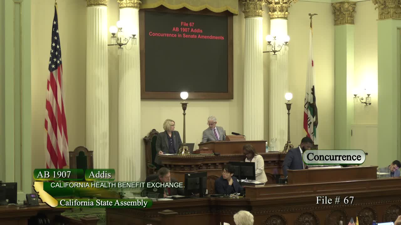
Bill Author

Bill Co-Author(s):