SB 1423: Regional planning: standardized spatial planning datasets.
- Session Year: 2025-2026
- House: Senate
- Latest Version Date: 2026-09-30
Current Status:
Passed
(2026-09-30: Chaptered by Secretary of State. Chapter 1039, Statutes of 2026.)
Introduced
In Committee
Awaiting First Chamber Vote
Passed First Chamber
In Committee
Awaiting Second Chamber Vote
Passed Second Chamber
Enacted
Existing law establishes the Office of Land Use and Climate Innovation in the Governors office for the purpose of serving the Governor and the Governors cabinet as staff for long-range planning and research and constituting the comprehensive state planning agency.
This bill would require the office, on or before July 1, 2028, to compile, standardize, maintain, and make publicly available through a consolidated online platform a core set of statewide standardized spatial planning datasets, as defined. The bill would require the datasets to include specified categories of information, including hazardous data, natural resource sensitivity data, and agricultural value data, as provided. The bill would also require the office, on or before January 1, 2029, to develop and provide guidance for agencies to inform how to use and integrate the datasets in regional planning processes and products. The bill would require the office to update those datasets as new or revised data becomes available from the originating state or federal agencies.
This bill would permit state, regional, and local governments to consider use of the standardized spatial planning datasets published by the office in the development and production of land use and infrastructure plans, as specified. The bill would require the office to provide technical assistance, upon request, for use of the data from these provisions. The bill would specify that it does not create new regulatory requirements, regulate land use or zoning, establish land use designations, or preempt the local land use authority of cities and counties.
Existing law establishes the Office of Land Use and Climate Innovation in the Governors office for the purpose of serving the Governor and the Governors cabinet as staff for long-range planning and research and constituting the comprehensive state planning agency.
This bill would require the office, on or before July 1, 2028, to compile, standardize, maintain, and make publicly available through a consolidated online platform a core set of statewide standardized spatial planning datasets, as defined. The bill would require the datasets to include specified categories of information, including hazardous data, natural resource sensitivity data, and agricultural value data, as provided. The bill would also require the office, on or before January 1, 2029, to develop and provide guidance for agencies to inform how to use and integrate the datasets in regional planning processes and products. The bill would require the office to update those datasets as new or revised data becomes available from the originating state or federal agencies.
This bill would permit state, regional, and local governments to consider use of the standardized spatial planning datasets published by the office in the development and production of land use and infrastructure plans, as specified. The bill would require the office to provide technical assistance, upon request, for use of the data from these provisions. The bill would specify that it does not create new regulatory requirements, regulate land use or zoning, establish land use designations, or preempt the local land use authority of cities and counties.
Existing law establishes the Office of Land Use and Climate Innovation in the Governors office for the purpose of serving the Governor and the Governors cabinet as staff for long-range planning and research and constituting the comprehensive state planning agency.
This bill would require the office, on or before July 1, 2027, 2028, to compile, standardize, maintain, and make publicly available through a consolidated online platform a core set of statewide standardized spatial planning datasets, as defined. The bill would require the datasets to include specified categories of information, including hazardous risk data, natural resource sensitivity data, and agricultural value data, as provided. The bill would also require the office, on or before January 1, 2028, 2029, to develop and provide guidance for agencies to inform how to use and integrate the datasets in regional planning processes and products. The bill would require the office to update those datasets at least every 3 years, as provided. as new or revised data becomes available from the originating state or federal agencies.
This bill would permit state, regional, and local governments to consider use of the standardized spatial planning datasets published by the office in the development and production of land use and infrastructure plans, as specified. The bill would require the office to provide technical assistance, upon request, for use of the data from these provisions. The bill would specify that it does not create new regulatory requirements, regulate land use or zoning, establish land use designations, or preempt the local land use authority of cities and counties.
Existing law establishes the Office of Land Use and Climate Innovation in the Governors office for the purpose of serving the Governor and the Governors cabinet as staff for long-range planning and research and constituting the comprehensive state planning agency.
This bill would require the office, on or before July 1, 2027, to compile, standardize, maintain, and make publicly available through a centralized consolidated online platform a core set of statewide standardized spatial planning datasets, as defined. The bill would require the datasets to include specified categories of information, including hazardous risk data, natural resource sensitivity data, and agricultural value data, as provided. The bill would also require the office, on or before January 1, 2028, to develop and publish provide guidance for regional planning agencies, as defined, on methods and best practices for incorporating and documenting use of the datasets in regional planning processes. agencies to inform how to use and integrate the datasets in regional planning processes and products. The bill would require the office to update those datasets at least every 3 years, as provided.
This bill would require a regional planning agency that adopts or substantially amends a regional planning document on or after January 1, 2028, to incorporate and use the datasets published by the office when developing specified land use strategies and plans, except as provided. The bill would also require a regional planning agency to take other actions as part of the adoption or amendment of those regional planning documents, including mapping and disclosing how the datasets were used in the development of the planning document, and would require a regional planning agency to apply a planning prioritization approach, as specified. This bill would permit state, regional, and local governments to consider use of the standardized spatial planning datasets published by the office in the development and production of land use and infrastructure plans, as specified. The bill would require the office to provide technical assistance to a regional planning agency, assistance, upon request, to support compliance with these provisions. for use of the data from these provisions. The bill would specify that it does not create new regulatory requirements, regulate land use or zoning, establish land use designations, or preempt the local land use authority of cities and counties. By imposing new duties on local agencies, the bill would impose a state-mandated local program.
The California Constitution requires the state to reimburse local agencies and school districts for certain costs mandated by the state. Statutory provisions establish procedures for making that reimbursement.This bill would provide that, if the Commission on State Mandates determines that the bill contains costs mandated by the state, reimbursement for those costs shall be made pursuant to the statutory provisions noted above.Existing law establishes the Office of Land Use and Climate Innovation in the Governors office for the purpose of serving the Governor and the Governors cabinet as staff for long-range planning and research and constituting the comprehensive state planning agency.
This bill would require the office, on or before July 1, 2027, to compile, standardize, maintain, and make publicly available through a centralized online platform a core set of statewide standardized spatial planning datasets, as defined. The bill would require the datasets to include specified categories of information, including hazardous risk data, natural resource sensitivity data, and agricultural value data, as provided. The bill would also require the office, on or before January 1, 2028, to develop and publish guidance for regional planning agencies, as defined, on methods and best practices for incorporating and documenting use of the datasets in regional planning processes. The bill would require the office to update those datasets at least every 3 years, as provided.
This bill would require a regional planning agency that adopts or substantially amends a regional planning document on or after January 1, 2028, to incorporate and use the datasets published by the office when developing specified land use strategies and plans, except as provided. The bill would also require a regional planning agency to take other actions as part of the adoption or amendment of those regional planning documents, including mapping and disclosing how the datasets were used in the development of the planning document, and would require a regional planning agency to apply a planning prioritization approach, as specified. The bill would require the office to provide technical assistance to a regional planning agency, upon request, to support compliance with these provisions. By imposing new duties on local agencies, the bill would impose a state-mandated local program.
The California Constitution requires the state to reimburse local agencies and school districts for certain costs mandated by the state. Statutory provisions establish procedures for making that reimbursement.
This bill would provide that, if the Commission on State Mandates determines that the bill contains costs mandated by the state, reimbursement for those costs shall be made pursuant to the statutory provisions noted above.
Existing law establishes the Active Transportation Program in the Department of Transportation for the purpose of encouraging increased use of active modes of transportation, such as biking and walking. Existing law requires the California Transportation Commission to develop guidelines and project selection criteria for the program and requires the guidelines to address, among other things, application timelines and application rating and ranking criteria.This bill would require the commission, on or before January 1, 2028, to conduct a study, and submit a report to the Legislature, on opportunities to improve equity, accessibility, cost-effectiveness, and the ease of application for prospective applicants for the Active Transportation Program, as specified. The bill would repeal these provisions on January 1, 2032.Existing law establishes the Active Transportation Program in the Department of Transportation for the purpose of encouraging increased use of active modes of transportation, such as biking and walking. Existing law requires the California Transportation Commission to develop guidelines with regard to and project selection that include, among other criteria, the benefit to disadvantaged communities and the potential for increasing and improving connectivity and mobility of nonmotorized users. Existing law criteria for the program and requires the guidelines adopted by the commission for the program to address, among other things, application timelines and application rating and ranking criteria.
This bill would rename the Active Transportation Program as the Safe Streets Program. The bill would require the guidelines with regard to project selection to also include as criteria the benefit to transit-oriented development zones, as defined. The bill would require the guidelines to establish an application process under which an applicant submits an initial application that would not require detailed engineering drawings and, if that application is deemed to be in conformance with the guidelines and project selection criteria, the applicant would be requested to submit a final and more comprehensive application for review.This bill would require the commission, on or before January 1, 2028, to conduct a study, and submit a report to the Legislature, on opportunities to improve equity, accessibility, cost-effectiveness, and the ease of application for prospective applicants for the Active Transportation Program, as specified. The bill would repeal these provisions on January 1, 2032.
Existing law generally provides for programming and allocation of available state and federal transportation funds for transportation capital improvement projects through the state transportation improvement program process administered by the California Transportation Commission. Existing law requires 25% of available funds to be programmed and expended on interregional improvement projects nominated by the Department of Transportation through the adoption of an interregional transportation improvement program, and 75% of available funds to be programmed and expended on regional improvement projects nominated by transportation planning agencies through the adoption of a regional transportation improvement program.
This bill would require at least 50% of funds programmed in the interregional transportation improvement program, and 50% of funds programmed in a regional transportation improvement program, to be programmed for safe streets projects, as specified. The bill would require those funds to be prioritized for safe streets projects located in areas of transit-oriented development zones, as defined, that lack adequate pedestrian safety and mobility access.
Existing law establishes the Active Transportation Program in the Department of Transportation for the purpose of encouraging increased use of active modes of transportation, such as biking and walking. Existing law requires the California Transportation Commission to develop guidelines with regard to project selection that include, among other criteria, the benefit to disadvantaged communities and the potential for increasing and improving connectivity and mobility of nonmotorized users. Existing law requires the guidelines adopted by the commission for the program to address, among other things, application timelines and application rating and ranking criteria.
This bill would rename the Active Transportation Program as the Safe Streets Program. The bill would require the guidelines with regard to project selection to also include as criteria the benefit to transit-oriented development zones, as defined. The bill would require the guidelines to establish an application process under which an applicant submits an initial application that would not require detailed engineering drawings and, if that application is deemed to be in conformance with the guidelines and project selection criteria, the applicant would be requested to submit a final and more comprehensive application for review.
Existing law, contingent upon an appropriation, requires the Office of Emergency Services to enter into a joint powers agreement with the Department of Forestry and Fire Protection to develop and administer a comprehensive wildfire mitigation program to, among other things, encourage cost-effective structure hardening and retrofitting to create fire-resistant homes, businesses, and public buildings. Existing law requires the State Fire Marshal and the Department of Forestry and Fire Protection to identify activities that are eligible for financial assistance under the program and requires the joint powers authority to develop criteria and a scoring methodology to prioritize financial assistance provided through the program based on specific factors, as provided. Existing law requires the joint powers authority, no later than July 1, 2028, to submit a report to the Legislature regarding the implementation of the wildfire mitigation financial assistance program, as provided.This bill would instead require the joint powers authority to submit the report to the Legislature regarding the implementation of the wildfire mitigation financial assistance program no later than January 1, 2028.Existing law, contingent upon an appropriation, requires the Office of Emergency Services to enter into a joint powers agreement with the Department of Forestry and Fire Protection to develop and administer a comprehensive wildfire mitigation program to, among other things, encourage cost-effective structure hardening and retrofitting to create fire-resistant homes, businesses, and public buildings. Existing law requires the State Fire Marshal and the Department of Forestry and Fire Protection to identify activities that are eligible for financial assistance under the program and requires the joint powers authority to develop criteria and a scoring methodology to prioritize financial assistance provided through the program based on specific factors, as provided. Existing law requires the joint powers authority, no later than July 1, 2028, to submit a report to the Legislature regarding the implementation of the wildfire mitigation financial assistance program, as provided.
This bill would instead require the joint powers authority to submit the report to the Legislature regarding the implementation of the wildfire mitigation financial assistance program no later than January 1, 2028.
The Legislature finds and declares all of the following:
(a)Climate change is intensifying wildfire, flood, drought, and sea level rise risks across California. Sound land use planning that accounts for these risks is essential to protect the lives, property, and fiscal health of Californians.
(b)California has invested substantially in publicly available spatial data and planning tools to support land use decision making. The Governors Office of Land Use and Climate Innovation, in coordination with state agencies, maintains datasets and mapping tools that provide critical information on hazards, environmental resources, infrastructure, and land use conditions.
(c)Standardizing statewide spatial planning data will make planning decisions and their outcomes more consistent with the states planning priorities, such as those specified in Section 65041.1 of the Government Code, promote transparency and consistency across plans and documents, reduce costs, promote efficiencies, and support more resilient and equitable communities.
(d)Standardized spatial planning datasets are intended as tools to inform and guide future planning decisions and to support voluntary data-informed planning across state, regional, and local agencies.
SEC. 2.Section 65040.18 is added to the Government Code, to read:65040.18.(a)For purposes of this section, the following terms have the following meanings:
(1)Consolidated online platform means a publicly accessible online portal maintained or designated by the office that provides access to standardized spatial planning datasets as a decision support tool.
(2)Standardized spatial planning dataset means geospatial data layers that have been compiled, standardized, and published by the office pursuant to this section.
(b)On or before July 1, 2028, the office shall compile, standardize, maintain, and make publicly available through a consolidated online platform a core set of statewide standardized spatial planning datasets.
(c)The standardized spatial planning datasets shall include the following categories of information:
(1)Hazard data, including, but not limited to, all of the following:
(A)State and local responsibility area high and very high fire hazard severity zones as determined by the Department of Forestry and Fire Protection.
(B)One-hundred-year and 500-year flood plains as designated by relevant state and federal agencies.
(C)Coastal and inland areas subject to sea level rise inundation as identified by the Ocean Protection Council.
(2)Natural resource sensitivity data, including, but not limited to, all of the following:
(A)Wetlands and riparian areas as mapped by relevant state and federal agencies.
(B)Biological resource areas that contain, support, or are necessary to sustain important biological or ecological resources, including species biodiversity, significant habitats and wildlife corridors as determined by the Department of Fish and Wildlife and the Natural Resources Agency.
(C)Legally protected lands and lands under a conservation easement.
(3)Agricultural value data, including, but not limited to, both of the following:
(A)Prime and unique farmlands and farmland of statewide and local importance as classified by the Department of Conservation.
(B)Lands subject to Williamson Act contracts pursuant to Chapter 7 (commencing with Section 51200) of Part 1 of Division 1 of Title 5.
(d)On or before January 1, 2029, the office shall develop and provide guidance for agencies to inform them on how to use and integrate standardized spatial planning datasets in regional planning processes and products.
(e)The office shall update the standardized spatial planning datasets as new or revised data becomes available from the originating state or federal source agencies.
SEC. 3.Article 15 (commencing with Section 65770) is added to Chapter 3 of Division 1 of Title 7 of the Government Code, to read:15.Regional Use of Standardized Spatial Planning Documents65770.(a)State, regional, and local governments may consider use of the standardized spatial planning datasets published by the Office of Land Use and Climate Innovation pursuant to Section 65040.18 in the development and production of land use and infrastructure plans, including, but not limited to:
(1)General plans pursuant to Section 65300.
(2)Regional transportation plans and sustainable communities strategies prepared pursuant to Section 65080.
(3)Regional housing needs allocations processes pursuant to Section 65584.
(4)Climate action plans.
(b)In addition to subdivision (a), nothing in this section or in Section 65040.18 shall restrict agencies from using more precise or current data that are available at the regional or local level, including data developed through natural community conservation plans or other regional conservation initiatives, to inform and refine planning processes or decisions.
(c)Nothing in this section or in Section 65040.18 creates new regulatory requirements, regulates land use or zoning, establishes land use designations, or preempts the local land use authority of cities and counties.
(d)The Office of Land Use and Climate Innovation shall provide technical assistance for use of data pursuant to this section upon request.
The Legislature finds and declares all of the following:
(a)Climate change is intensifying wildfire, flood, drought, and sea level rise risks across California. Sound land use planning that accounts for these risks is essential to protect the lives, property, and fiscal health of Californians.
(b)California has invested substantially in publicly available spatial data and planning tools to support land use decision making. The Governors Office of Land Use and Climate Innovation, in coordination with state agencies, maintains datasets and mapping tools that provide critical information on hazards, environmental resources, infrastructure, and land use conditions.
(c)Standardizing statewide spatial planning data will make planning decisions and their outcomes more consistent with the states planning priorities, such as those specified in Section 65041.1 of the Government Code, promote transparency and consistency across plans and documents, reduce costs, promote efficiencies, and support more resilient and equitable communities.
(d)Standardized spatial planning datasets are intended as tools to inform and guide future planning decisions and to support voluntary data-informed planning across state, regional, and local agencies.
SEC. 2.Section 65040.18 is added to the Government Code, to read:65040.18.(a)For purposes of this section, the following terms have the following meanings:
(1)Consolidated online platform means a publicly accessible online portal maintained or designated by the office that provides access to standardized spatial planning datasets as a decision support tool.
(2)Standardized spatial planning dataset means geospatial data layers that have been compiled, standardized, and published by the office pursuant to this section.
(b)On or before July 1, 2028, the office shall compile, standardize, maintain, and make publicly available through a consolidated online platform a core set of statewide standardized spatial planning datasets.
(c)The standardized spatial planning datasets shall include the following categories of information:
(1)Hazard data, including, but not limited to, all of the following:
(A)State and local responsibility area high and very high fire hazard severity zones as determined by the Department of Forestry and Fire Protection.
(B)One-hundred-year and 500-year flood plains as designated by relevant state and federal agencies.
(C)Coastal and inland areas subject to sea level rise inundation as identified by the Ocean Protection Council.
(2)Natural resource sensitivity data, including, but not limited to, all of the following:
(A)Wetlands and riparian areas as mapped by relevant state and federal agencies.
(B)Biological resource areas that contain, support, or are necessary to sustain important biological or ecological resources, including species biodiversity, significant habitats and wildlife corridors as determined by the Department of Fish and Wildlife and the Natural Resources Agency.
(C)Legally protected lands and lands under a conservation easement.
(3)Agricultural value data, including, but not limited to, both of the following:
(A)Prime and unique farmlands and farmland of statewide and local importance as classified by the Department of Conservation.
(B)Lands subject to Williamson Act contracts pursuant to Chapter 7 (commencing with Section 51200) of Part 1 of Division 1 of Title 5.
(d)On or before January 1, 2029, the office shall develop and provide guidance for agencies to inform them on how to use and integrate standardized spatial planning datasets in regional planning processes and products.
(e)The office shall update the standardized spatial planning datasets as new or revised data becomes available from the originating state or federal source agencies.
SEC. 3.Article 15 (commencing with Section 65770) is added to Chapter 3 of Division 1 of Title 7 of the Government Code, to read:15.Regional Use of Standardized Spatial Planning Documents65770.(a)State, regional, and local governments may consider use of the standardized spatial planning datasets published by the Office of Land Use and Climate Innovation pursuant to Section 65040.18 in the development and production of land use and infrastructure plans, including, but not limited to:
(1)General plans pursuant to Section 65300.
(2)Regional transportation plans and sustainable communities strategies prepared pursuant to Section 65080.
(3)Regional housing needs allocations processes pursuant to Section 65584.
(4)Climate action plans.
(b)In addition to subdivision (a), nothing in this section or in Section 65040.18 shall restrict agencies from using more precise or current data that are available at the regional or local level, including data developed through natural community conservation plans or other regional conservation initiatives, to inform and refine planning processes or decisions.
(c)Nothing in this section or in Section 65040.18 creates new regulatory requirements, regulates land use or zoning, establishes land use designations, or preempts the local land use authority of cities and counties.
(d)The Office of Land Use and Climate Innovation shall provide technical assistance for use of data pursuant to this section upon request.
The Legislature finds and declares all of the following:
(a)Climate change is intensifying wildfire, flood, drought, and sea level rise risks across California. Sound land use planning that accounts for these risks is essential to protect the lives, property, and fiscal health of Californians.
(b)California has invested substantially in publicly available spatial data and planning tools to support land use decision making. The Governors Office of Land Use and Climate Innovation, in coordination with state agencies, maintains datasets and mapping tools that provide critical information on hazards, environmental resources, infrastructure, and land use conditions.
(c)Standardizing statewide spatial planning data will make planning decisions and their outcomes more consistent with the states planning priorities, such as those specified in Section 65041.1 of the Government Code, promote transparency and consistency across plans and documents, reduce costs, promote efficiencies, and support more resilient and equitable communities.
(d)Standardized spatial planning datasets are intended as tools to inform and guide future planning decisions and to support voluntary data-informed planning across state, regional, and local agencies.
SEC. 2.Section 65040.18 is added to the Government Code, to read:65040.18.(a)For purposes of this section, the following terms have the following meanings:
(1)Consolidated online platform means a publicly accessible online portal maintained or designated by the office that provides access to standardized spatial planning datasets as a decision support tool.
(2)Standardized spatial planning dataset means geospatial data layers that have been compiled, standardized, and published by the office pursuant to this section.
(b)On or before July 1, 2027, 2028, the office shall compile, standardize, maintain, and make publicly available through a consolidated online platform a core set of statewide standardized spatial planning datasets.
(c)The standardized spatial planning datasets shall include the following categories of information:
(1)Hazard risk data, including, but not limited to, all of the following:
(A)State and local responsibility area high and very high fire hazard severity zones as determined by the Department of Forestry and Fire Protection.
(B)One-hundred-year and 500-year flood plains as designated by relevant state and federal agencies.
(C)Coastal and inland areas subject to sea level rise inundation risk as identified by the Ocean Protection Council.
(2)Natural resource sensitivity data, including, but not limited to, all of the following:
(A)Wetlands and riparian areas as mapped by relevant state and federal agencies.
(B)Biological resource areas that contain, support, or are necessary to sustain important biological or ecological resources, including species biodiversity, significant habitats and wildlife corridors as determined by the Department of Fish and Wildlife and the Natural Resources Agency.
(C)Legally protected lands and lands under a conservation easement.
(3)Agricultural value data, including, but not limited to, both of the following:
(A)Prime and unique farmlands and farmland of statewide and local importance as classified by the Department of Conservation.
(B)Lands subject to Williamson Act contracts pursuant to Chapter 7 (commencing with Section 51200) of Part 1 of Division 1 of Title 5.
(d)On or before January 1, 2028, 2029, the office shall develop and provide guidance for agencies to inform them on how to use and integrate standardized spatial planning datasets in regional planning processes and products.
(e)The office shall update the standardized spatial planning datasets as new or revised data becomes available from the originating state or federal source agencies, but no less frequently than every three years. agencies.
SEC. 3.Article 15 (commencing with Section 65770) is added to Chapter 3 of Division 1 of Title 7 of the Government Code, to read:15.Regional Use of Standardized Spatial Planning Documents65770.(a)State, regional, and local governments may consider use of the standardized spatial planning datasets published by the Office of Land Use and Climate Innovation pursuant to Section 65040.18 in the development and production of land use and infrastructure plans, including, but not limited to:
(1)General plans pursuant to Section 65300.
(2)Regional transportation plans and sustainable communities strategies prepared pursuant to Section 65080.
(3)Regional housing needs allocations processes pursuant to Section 65584.
(4)Climate action plans.
(b)In addition to subdivision (a), nothing in this section or in Section 65040.18 shall restrict agencies from using more precise or current data that are available at the regional or local level, including data developed through natural community conservation plans or other regional conservation initiatives, to inform and refine planning processes or decisions.
(c)Nothing in this section or in Section 65040.18 creates new regulatory requirements, regulates land use or zoning, establishes land use designations, or preempts the local land use authority of cities and counties.
(d)The Office of Land Use and Climate Innovation shall provide technical assistance for use of data pursuant to this section upon request.
The Legislature finds and declares all of the following:
(a)Climate change is intensifying wildfire, flood, drought, and sea level rise risks across California. Sound land use planning that accounts for these risks is essential to protect the lives, property, and fiscal health of Californians.
(b)California has invested substantially in publicly available spatial data and planning tools to support land use decision making. The Governors Office of Land Use and Climate Innovation, in coordination with state agencies, maintains datasets and mapping tools that provide critical information on hazards, environmental resources, infrastructure, and land use conditions.
(c)Standardizing and requiring the use of statewide spatial planning data will improve planning outcomes, make planning decisions and their outcomes more consistent with the states planning priorities, such as those specified in Section 65041.1 of the Government Code, promote transparency and consistency across regional planning agencies, plans and documents, reduce costs, promote efficiencies, and support more resilient and equitable communities.
(d)Standardized spatial planning datasets are intended as tools to inform and guide future planning decisions. decisions and to support voluntary data-informed planning across state, regional, and local agencies.
SEC. 2.Section 65040.18 is added to the Government Code, to read:65040.18.(a)For purposes of this section section, the following terms have the following meanings:
(1)Centralized online platform Consolidated online platform means a publicly accessible online portal maintained or designated by the office that provides access to standardized spatial planning datasets. datasets as a decision support tool.
(2)Regional planning agency means a council of governments, metropolitan planning organization, or county authorized under state law to develop regional land use strategies, transportation plans, or infrastructure plans.(3)(2)Standardized spatial planning dataset means a geospatial data layer layers that has have been compiled, standardized, and published by the office pursuant to this section.
(b)On or before July 1, 2027, the office shall compile, standardize, maintain, and make publicly available through a centralized consolidated online platform a core set of statewide standardized spatial planning datasets.
(c)The standardized spatial planning datasets shall include the following categories of information:
(1)Hazard risk data, including, but not limited to, all of the following:
(A)State and local responsibility area high and very high fire hazard severity zones as determined by the Department of Forestry and Fire Protection.
(B)One hundred-year One-hundred-year and 500-year flood plains as designated by relevant state and federal agencies.
(C)Coastal and inland areas subject to sea level rise inundation risk as identified by the Ocean Protection Council.
(2)Natural resource sensitivity data, including, but not limited to, all of the following:
(A)Wetlands and riparian areas as mapped by relevant state and federal agencies.
(B)Biological resource areas that contain, support, or are necessary to sustain important biological or ecological resources, including species biodiversity, significant habitats and wildlife corridors as determined by the Department of Fish and Wildlife and the Natural Resources Agency.
(C)Legally protected lands and lands under a conservation easement.
(3)Agricultural value data, including, but not limited to, both of the following:
(A)Prime and unique farmlands and farmland of statewide and local importance as classified by the Department of Conservation.
(B)Lands subject to Williamson Act contracts pursuant to Chapter 7 (commencing with Section 51200) of Part 1 of Division 1 of Title 5.
(d)On or before January 1, 2028, the office shall develop and publish provide guidance for regional planning agencies on methods and best practices for incorporating and documenting use of the agencies to inform them on how to use and integrate standardized spatial planning datasets in regional planning processes. processes and products.
(e)The office shall update the standardized spatial planning datasets as new or revised data becomes available from the originating state or federal source agencies, but no less frequently than every three years.
SEC. 3.Article 15 (commencing with Section 65770) is added to Chapter 3 of Division 1 of Title 7 of the Government Code, to read:15.Regional Use of Standardized Spatial Planning Documents65770.For purposes of this section, regional planning agency means a council of governments, metropolitan planning organization, or county authorized under state law to develop regional land use strategies, transportation plans, or infrastructure plans.65771.65770.(a)A regional planning agency that adopts or substantially amends a regional planning document on or after January 1, 2028, shall incorporate and use State, regional, and local governments may consider use of the standardized spatial planning datasets published by the Office of Land Use and Climate Innovation pursuant to Section 65040.18 when developing any of the following, as applicable: in the development and production of land use and infrastructure plans, including, but not limited to:
(1)Regional land use strategies.
(1)General plans pursuant to Section 65300.
(2)Regional transportation plans and sustainable communities strategies prepared pursuant to Section 65080.
(3)Regional infrastructure plans.
(4)Any other applicable regional planning documents as determined by the Office of Land Use and Climate Innovation in consultation with regional planning agencies.(b)A regional planning agency shall, as part of the adoption or amendment of any regional planning document subject to subdivision (a), do all of the following:(1)Map and disclose how the standardized spatial planning datasets were used in the development of the planning document.(2)Identify areas of elevated hazard risk, natural resource sensitivity, or land use conflict based on the standardized spatial planning datasets.(3)Document how the identified areas of elevated risk, sensitivity, or conflict were considered in determining planning priorities and outcomes.(c)A regional planning agency shall apply a planning prioritization approach that does all of the following:(1)Prioritizes the avoidance of directing growth or significant new infrastructure into areas identified in the standardized spatial planning datasets as posing high hazard risk, significant natural resource sensitivity, or significant agricultural value, where feasible.(2)Encourages minimization of growth in areas identified by paragraph (1) where avoidance is determined not to be feasible.(3)Encourages and supports mitigation strategies.(3)Regional housing needs allocations processes pursuant to Section 65584.
(4)Climate action plans.
(d)(b)In addition to subdivision (a), a regional planning agency is encouraged to use other more precise, current, or stringent nothing in this section or in Section 65040.18 shall restrict agencies from using more precise or current data that are available at the regional or local level, including data developed through natural community conservation plans or other regional conservation initiatives, to inform and refine land use screening and planning planning processes or decisions.
(c)Nothing in this section or in Section 65040.18 creates new regulatory requirements, regulates land use or zoning, establishes land use designations, or preempts the local land use authority of cities and counties.
(e)(d)The Office of Land Use and Climate and Innovation shall provide technical assistance to a regional planning agency, upon request, to support compliance with this section. for use of data pursuant to this section upon request.
65772.This article does not apply to the adoption or amendment of a regional planning document for a community with a density greater than 1 unit per acre or as otherwise determined by the Office of Land Use and Climate and Innovation.SEC. 4.If the Commission on State Mandates determines that this act contains costs mandated by the state, reimbursement to local agencies and school districts for those costs shall be made pursuant to Part 7 (commencing with Section 17500) of Division 4 of Title 2 of the Government Code.The Legislature finds and declares all of the following:
(a)Climate change is intensifying wildfire, flood, drought, and sea level rise risks across California. Sound land use planning that accounts for these risks is essential to protect the lives, property, and fiscal health of Californians.
(b)California has invested substantially in publicly available spatial data and planning tools to support land use decision making. The Governors Office of Land Use and Climate Innovation, in coordination with state agencies, maintains datasets and mapping tools that provide critical information on hazards, environmental resources, infrastructure, and land use conditions.
(c)Standardizing and requiring the use of statewide spatial planning data will improve planning outcomes, promote transparency and consistency across regional planning agencies, and support more resilient and equitable communities.
(d)Standardized spatial planning datasets are intended as tools to inform and guide future planning decisions.
SEC. 2.Section 65040.18 is added to the Government Code, to read:65040.18.(a)For purposes of this section the following terms have the following meanings:
(1)Centralized online platform means a publicly accessible online portal maintained or designated by the office that provides access to standardized spatial planning datasets.
(2)Regional planning agency means a council of governments, metropolitan planning organization, or county authorized under state law to develop regional land use strategies, transportation plans, or infrastructure plans.
(3)Standardized spatial planning dataset means a geospatial data layer that has been compiled, standardized, and published by the office pursuant to this section.
(b)On or before July 1, 2027, the office shall compile, standardize, maintain, and make publicly available through a centralized online platform a core set of statewide standardized spatial planning datasets.
(c)The standardized spatial planning datasets shall include the following categories of information:
(1)Hazard risk data, including, but not limited to, all of the following:
(A)State and local responsibility area high and very high fire hazard severity zones as determined by the Department of Forestry and Fire Protection.
(B)One hundred-year and 500-year flood plains as designated by relevant state and federal agencies.
(C)Coastal and inland areas subject to sea level rise inundation risk as identified by the Ocean Protection Council.
(2)Natural resource sensitivity data, including, but not limited to, all of the following:
(A)Wetlands and riparian areas as mapped by relevant state and federal agencies.
(B)Biological resource areas that contain, support, or are necessary to sustain important biological or ecological resources, including species biodiversity, significant habitats and wildlife corridors as determined by the Department of Fish and Wildlife and the Natural Resources Agency.
(C)Legally protected lands and lands under a conservation easement.
(3)Agricultural value data, including, but not limited to, both of the following:
(A)Prime and unique farmlands and farmland of statewide importance as classified by the Department of Conservation.
(B)Lands subject to Williamson Act contracts pursuant to Chapter 7 (commencing with Section 51200) of Part 1 of Division 1 of Title 5.
(d)On or before January 1, 2028, the office shall develop and publish guidance for regional planning agencies on methods and best practices for incorporating and documenting use of the standardized spatial planning datasets in regional planning processes.
(e)The office shall update the standardized spatial planning datasets as new or revised data becomes available from the originating state or federal source agencies, but no less frequently than every three years.
SEC. 3.Article 15 (commencing with Section 65770) is added to Chapter 3 of Division 1 of Title 7 of the Government Code, to read:15.Regional Use of Standardized Spatial Planning Documents65770.For purposes of this section, regional planning agency means a council of governments, metropolitan planning organization, or county authorized under state law to develop regional land use strategies, transportation plans, or infrastructure plans.
65771.(a)A regional planning agency that adopts or substantially amends a regional planning document on or after January 1, 2028, shall incorporate and use the standardized spatial planning datasets published by the Office of Land Use and Climate Innovation pursuant to Section 65040.18 when developing any of the following, as applicable:
(1)Regional land use strategies.
(2)Regional transportation plans and sustainable communities strategies prepared pursuant to Section 65080.
(3)Regional infrastructure plans.
(4)Any other applicable regional planning documents as determined by the Office of Land Use and Climate Innovation in consultation with regional planning agencies.
(b)A regional planning agency shall, as part of the adoption or amendment of any regional planning document subject to subdivision (a), do all of the following:
(1)Map and disclose how the standardized spatial planning datasets were used in the development of the planning document.
(2)Identify areas of elevated hazard risk, natural resource sensitivity, or land use conflict based on the standardized spatial planning datasets.
(3)Document how the identified areas of elevated risk, sensitivity, or conflict were considered in determining planning priorities and outcomes.
(c)A regional planning agency shall apply a planning prioritization approach that does all of the following:
(1)Prioritizes the avoidance of directing growth or significant new infrastructure into areas identified in the standardized spatial planning datasets as posing high hazard risk, significant natural resource sensitivity, or significant agricultural value, where feasible.
(2)Encourages minimization of growth in areas identified by paragraph (1) where avoidance is determined not to be feasible.
(3)Encourages and supports mitigation strategies.
(d)In addition to subdivision (a), a regional planning agency is encouraged to use other more precise, current, or stringent data that are available at the regional or local level, including data developed through natural community conservation plans or other regional conservation initiatives, to inform and refine land use screening and planning decisions.
(e)The Office of Land Use and Climate and Innovation shall provide technical assistance to a regional planning agency, upon request, to support compliance with this section.
65772.This article does not apply to the adoption or amendment of a regional planning document for a community with a density greater than 1 unit per acre or as otherwise determined by the Office of Land Use and Climate and Innovation.
SEC. 4.If the Commission on State Mandates determines that this act contains costs mandated by the state, reimbursement to local agencies and school districts for those costs shall be made pursuant to Part 7 (commencing with Section 17500) of Division 4 of Title 2 of the Government Code.
SECTION 1.Section 2386 is added to the Streets and Highways Code, immediately following Section 2385, to read:2386.(a)The commission shall, on or before January 1, 2028, conduct a study, and submit a report to the Legislature, on opportunities to improve equity, accessibility, cost-effectiveness, and the ease of application for prospective applicants for the Active Transportation Program.(b)The study described in subdivision (a) shall consider, at minimum, methods for reducing applicant and administrative burden, including both of the following:(1)A two-phase application process.(2)A preapplication screening process.(c)(1)A report to be submitted pursuant to this section shall be submitted in compliance with Section 9795 of the Government Code.(2)Pursuant to Section 10231.5 of the Government Code, this section is repealed on January 1, 2032.(a)The commission shall, on or before January 1, 2028, conduct a study, and submit a report to the Legislature, on opportunities to improve equity, accessibility, cost-effectiveness, and the ease of application for prospective applicants for the Active Transportation Program.
(b)The study described in subdivision (a) shall consider, at minimum, methods for reducing applicant and administrative burden, including both of the following:
(1)A two-phase application process.
(2)A preapplication screening process.
(c)(1)A report to be submitted pursuant to this section shall be submitted in compliance with Section 9795 of the Government Code.
(2)Pursuant to Section 10231.5 of the Government Code, this section is repealed on January 1, 2032.
All matter omitted in this version of the bill appears in the bill as amended in the Senate, March 25, 2026. (JR11)The Legislature finds and declares all of the following:
(a)Increasing active transportation is essential to reducing vehicle miles traveled and meeting greenhouse gas reduction targets.
(b)Active transportation infrastructure, including protected bike lanes and safe crossings, significantly improves safety for children, seniors, and persons with disabilities, who are disproportionately impacted by traffic violence.
(c)Projects such as first- and last-mile connections and trails deliver high-return benefits to local economies and transit ridership at a fraction of the cost of traditional roadway expansion.
(d)Access to safe outdoor spaces for walking and rolling contributes to improved physical and mental health outcomes for all Californians.
(e)Under current practice, active transportation projects compete poorly in regional transportation improvement programs, and smaller counties often lack the fiscal capacity to advance nonautomobile projects.
(f)To achieve equity and safety, the state must distinguish between genuine active transportation investments and roadway widenings that offer only incidental pedestrian improvements.
SEC. 2.Section 14526 of the Government Code is amended to read:14526.(a)Not later than October 15 of each odd-numbered year, based on the guidelines established pursuant to Section 14530.1, and after consulting with the transportation planning agencies, county transportation commissions, and transportation authorities, the department shall submit to the commission the draft five-year interregional transportation improvement program consisting of all of the following:
(1)Projects to improve state highways, pursuant to subdivision (b) of Section 164 of the Streets and Highways Code.
(2)Projects to improve the intercity passenger rail system.
(3)Projects to improve interregional movement of people, vehicles, and goods.
(b)Projects included in the interregional transportation improvement program shall be consistent with the state interregional transportation strategic plan prepared pursuant to Section 14524.4.
(c)Projects may not be included in the draft interregional transportation improvement program without a project study report or major investment study.
(d)Major projects shall include current costs updated as of November 1 of the year of submittal and escalated to the appropriate year, and shall be consistent with, and provide the information required in, subdivision (b) of Section 14529.
(e)Projects included in the draft interregional transportation improvement program shall be consistent with the adopted regional transportation plan.
(f)(1)At least 50 percent of the funds programmed in the interregional transportation improvement program shall be programmed for safe streets projects. The funds programmed pursuant to this subdivision shall be prioritized in the interregional transportation improvement program for safe streets projects located in areas of transit-oriented development zones that lack adequate pedestrian safety and mobility access.
(2)For purposes of this subdivision, the following definitions apply:
(A)Safe streets project means a project that meets all of the goals set forth in paragraphs (1) to (3), inclusive, of subdivision (b) of Section 2380 of the Streets and Highways Code. Safe streets projects include sidewalk and curb ramp networks, protected bicycle facilities, safe crossings, traffic calming measures, and Safe Routes to School projects. A project consisting of roadway widening or capacity expansion shall not be classified as a safe streets project solely because it includes incidental bicycle lanes or sidewalks.
(B)Transit-oriented development zone has the same meaning as defined in Section 65912.156.
(f)(g)On or before November 15 of each odd-numbered year, the commission shall hold at least one hearing in northern California and one hearing in southern California to attempt to reconcile any objections by any member of the public or other stakeholder to the draft interregional transportation improvement program.
(g)(h)The department shall consider the input received at the hearings conducted pursuant to subdivision (f) (g) and shall develop a final interregional transportation improvement program. The final interregional transportation improvement program shall include a summary of the major comments received at the hearings and responses to those comments, and shall be submitted to the commission for approval not later than December 15 of each odd-numbered year.
(h)(i)The commission shall, when approving the final interregional transportation improvement program pursuant to subdivision (g), (h), evaluate the extent to which the program is consistent with funding priorities established in Section 167 of the Streets and Highways Code.
SEC. 3.Section 14527 of the Government Code is amended to read:14527.(a)After consulting with the department, the regional transportation planning agencies and county transportation commissions shall adopt and submit to the commission and the department, not later than December 15, 2001, and December 15 of each odd-numbered year thereafter, a five-year regional transportation improvement program in conformance with Section 65082. In counties where a county transportation commission has been created pursuant to Chapter 2 (commencing with Section 130050) of Division 12 of the Public Utilities Code, that commission shall adopt and submit the county transportation improvement program, in conformance with Sections 130303 and 130304 of that code, to the multicounty-designated transportation planning agency. Other information, including a program for expenditure of local or federal funds, may be submitted for information purposes with the program, but only at the discretion of the transportation planning agencies or the county transportation commissions. As used in this section, county transportation commission includes a transportation authority created pursuant to Chapter 2 (commencing with Section 130050) of Division 12 of the Public Utilities Code.
(b)(1)The regional transportation improvement program shall include all projects to be funded with the county share under paragraph (2) of subdivision (a) of Section 164 of the Streets and Highways Code. The regional programs shall be limited to projects to be funded in whole or in part with the county share that shall include all projects to receive allocations by the commission during the following five fiscal years. For each project, the total expenditure for each project component and the total amount of commission allocation and the year of allocation shall be stated. The total cost of projects to be funded with the county share shall not exceed the amount specified in the fund estimate made by the commission pursuant to Section 14525.
(2)(A)At least 50 percent of the funds described paragraph (1) shall be programmed in the regional transportation improvement program for safe streets projects. The funds programmed pursuant to this paragraph shall be prioritized in the regional transportation improvement program for safe streets projects located in areas of transit-oriented development zones that lack adequate pedestrian safety and mobility access.
(B)Subparagraph (A) does not apply to any portion of a county share reserved before January 1, 2027, for a future programming year pursuant to Section 188.8 of the Streets and Highways Code.
(C)For purposes of this paragraph, the following definitions apply:
(i)Safe streets project means a project that meets all of the goals set forth in paragraphs (1) to (3), inclusive, of subdivision (b) of Section 2380 of the Streets and Highways Code. Safe streets projects include sidewalk and curb ramp networks, protected bicycle facilities, safe crossings, traffic calming measures, and Safe Routes to School projects. A project consisting of roadway widening or capacity expansion shall not be classified as a safe streets project solely because it includes incidental bicycle lanes or sidewalks.
(ii)Transit-oriented development zone has the same meaning as defined in Section 65912.156.
(c)The regional transportation planning agencies and county transportation commissions may recommend projects to improve state highways with the interregional share pursuant to subdivision (b) of Section 164 of the Streets and Highways Code. The recommendations shall be separate and distinct from the regional transportation improvement program. A project recommended for funding pursuant to this subdivision shall constitute a usable segment and shall not be a condition for inclusion of other projects in the regional transportation improvement program.
(d)The department may nominate or recommend the inclusion of projects in the regional transportation improvement program to improve state highways with the county share pursuant to paragraph (2) of subdivision (a) and subdivision (e) of Section 164 of the Streets and Highways Code. A regional transportation planning agency and a county transportation commission shall have sole authority for determining whether any of the project nominations or recommendations are accepted and included in the regional transportation improvement program adopted and submitted pursuant to this section. This authority provided to a regional transportation planning agency or to a county transportation commission extends only to a project located within its jurisdiction.
(e)Major projects shall include current costs updated as of November 1 of the year of submittal and escalated to the appropriate year, and shall be consistent with, and provide the information required in, subdivision (b) of Section 14529.
(f)The regional transportation improvement program may not change the project delivery milestone date of any project as shown in the prior adopted state transportation improvement program without the consent of the department or other agency responsible for the projects delivery.
(g)Projects may not be included in the regional transportation improvement program without a complete project study report or, for a project that is not on a state highway, a project study report equivalent or major investment study.
(h)(1)Each transportation planning agency and county transportation commission may request and receive an amount not to exceed 5 percent of its county share for the purposes of project planning, programming, and monitoring.
(2)Notwithstanding any other law, but to the extent consistent with applicable federal law or regulation, the department may make an advance payment up to three hundred thousand dollars ($300,000) per year to transportation planning agencies and county transportation commissions for programming, planning, and monitoring under paragraph (1) where the total allocation under that paragraph is equal to or less than three hundred thousand dollars ($300,000). Funds advanced shall be programmed in the State Transportation Improvement Program and allocated by the California Transportation Commission prior to payment.
SEC. 4.The heading of Chapter 8 (commencing with Section 2380) of Division 3 of the Streets and Highways Code is amended to read:8.Active Transportation Safe Streets ProgramSEC. 5.Section 2380 of the Streets and Highways Code is amended to read:2380.(a)There is hereby established the Active Transportation Safe Streets Program in the department for the purpose of encouraging increased use of active modes of transportation, such as biking and walking. It Any reference in any law or regulation to the Active Transportation Program shall be deemed to refer to the Safe Streets Program.
(b)It is the intent of the Legislature that the program achieve all of the following goals:
(a)(1)Increase the proportion of trips accomplished by biking and walking.
(b)(2)Increase safety and mobility for nonmotorized users.
(c)(3)Advance the active transportation efforts of regional agencies to achieve greenhouse gas reduction goals as established pursuant to Senate Bill 375 (Chapter 728, 728 of the Statutes of 2008) and Senate Bill 391 (Chapter 585, 585 of the Statutes of 2009).
(d)(4)Enhance public health, including reduction of childhood obesity through the use of programs including, but not limited to, projects eligible for Safe Routes to School Program funding.
(e)(5)Ensure that disadvantaged communities fully share in the benefits of the program.
(f)(6)Provide a broad spectrum of projects to benefit many types of active transportation users.
SEC. 6.Section 2381 of the Streets and Highways Code is amended to read:2381.(a)The Active Transportation Safe Streets Program shall be funded by state and federal funds from appropriations in the annual Budget Act. Funds for the program shall be appropriated to the department, for allocation by the commission. The amount to be appropriated shall include 100 percent of the federal Transportation Alternative Program funds described in Section 133(h) of Title 23 of the United States Code, except for any federal funds for recreational trails projects described in Section 133(h)(5) of Title 23 of the United States Code appropriated to the Department of Parks and Recreation; twenty-one million dollars ($21,000,000) of federal Highway Safety Improvement funds or other federal funds; and State Highway Account funds. Future funding may be augmented if state or federal funds increase, or if other funding sources are identified. Funds appropriated for the Active Transportation Safe Streets Program shall be distributed as follows:
(1)Forty percent to metropolitan planning organizations in urban areas with populations greater than 200,000, in proportion to their relative share of population. Funds allocated under this paragraph shall be obligated for eligible projects selected through a competitive process by the metropolitan planning organizations in consultation with the department and the commission and in accordance with guidelines established pursuant to this chapter.
(2)Ten percent to small urban and rural regions with populations of 200,000 or less, with projects competitively awarded by the commission to projects in those regions.
(3)Fifty percent to projects competitively awarded by the commission on a statewide basis.
(b)For the purpose of paragraph (1) of subdivision (a), the following shall apply in the region served by the multicounty designated transportation planning agency described in Section 130004 of the Public Utilities Code:
(1)The multicounty designated transportation planning agency shall consult with the county transportation commissions created pursuant to Sections 130050, 130050.1, and 132800 of the Public Utilities Code, the commission, and the department in the development of competitive selection criteria to be adopted by the multicounty designated transportation planning agency, which should include consideration of geographic equity, consistent with program objectives.
(2)The multicounty designated transportation planning agency shall place priority on projects that are consistent with plans adopted by local and regional governments within the county where the project is located.
(3)The multicounty designated transportation planning agency shall obtain concurrence from the county transportation commissions, adopt the projects selected in a comprehensive program of projects, and make funds available to selected project recipients.
(c)The Legislature finds and declares that the program described in this chapter constitutes a highway purpose under Article XIX of the California Constitution and justifies the expenditure of highway funds therefor, and all expenditures of Article XIX funds under this program shall be consistent with Article XIX.
SEC. 7.Section 2382 of the Streets and Highways Code is amended to read:2382.(a)The California Transportation Commission shall develop guidelines and project selection criteria for the Active Transportation Safe Streets Program in consultation with the Active Transportation Safe Streets Program Workgroup, which shall be formed for purposes of providing guidance on matters including, but not limited to, development of and subsequent revisions to program guidelines, schedules and procedures, project selection criteria, performance measures, and program evaluation. The workgroup shall include, but not be limited to, representatives of government agencies and active transportation stakeholder organizations with expertise in pedestrian and bicycle issues, including Safe Routes to School programs.
(b)(1)The guidelines shall be the complete and full statement of the policies and criteria that the commission intends to use in selecting projects to be included in the program. The guidelines shall address subjects that include, but are not limited to, project eligibility, application timelines, application rating and ranking criteria, project monitoring, reporting, and transparency, and project performance measurement.
(2)The guidelines shall establish an application process under which an applicant submits an initial application that shall not require detailed engineering drawings and, if that application is deemed to be in conformance with the guidelines and project selection criteria, the applicant shall be requested to submit a final and more comprehensive application for review.
(c)The guidelines shall include a process to ensure that no less than 25 percent of overall program funds benefit disadvantaged communities during each program cycle. The guidelines shall establish a program definition for disadvantaged communities that may include, but need not be limited to, the definition in Section 39711 of the Health and Safety Code and the definition of low-income schools in paragraph (7) of subdivision (b) of former Section 2333.5, as that section read on January 1, 2013. A project eligible under this subdivision shall clearly demonstrate a benefit to a disadvantaged community or be directly located in a disadvantaged community.
(d)The guidelines shall allow streamlining of project delivery by authorizing an implementing agency to seek commission approval of a letter of no prejudice that will allow the agency to expend its own funds for a project programmed in a future year of the adopted program of projects, in advance of allocation of funds to the project by the commission, and to be reimbursed at a later time for eligible expenditures.
(e)The California Transportation Commission shall adopt the guidelines and selection criteria for, and define the types of projects eligible to be funded through, the program following at least two public hearings. Projects funded in this program shall be limited to active transportation projects. The guidelines shall ensure that eligible projects meet one or more of the goals set forth in Section 2380 and may give increased weight to projects meeting multiple goals.
(f)In developing the guidelines with regard to project eligibility, the commission shall include, but need not be limited to, the following project types:
(1)Development of new bikeways and walkways, or improvements to existing bikeways and walkways, that improve mobility, access, or safety for nonmotorized users. On and after January 1, 2026, the guidelines with regard to project eligibility shall not include the development of Class III bikeways, as described in Section 890.4, or the marking in Figure 9C-9 of the 2014 California Manual on Uniform Traffic Control Devices, Revision 8, unless any of the following apply:
(A)The Class III bikeway or marking is on a highway with a design speed limit of 25 miles per hour or less.
(B)The project will implement improvements to reduce the design speed limit to 25 miles per hour or less.
(C)The project applicant demonstrates that the use of the Class III bikeway or marking is appropriate for the local community context and advances a lower stress environment or a low-stress network.
(2)Secure bicycle parking at employment centers, park and ride lots, rail and transit stations, and ferry docks and landings.
(3)Bicycle-carrying facilities on public transit, including rail and ferries.
(4)Installation of traffic control devices to improve the safety of pedestrians and bicyclists.
(5)Elimination of hazardous conditions on existing bikeways and walkways.
(6)Maintenance of bikeways and walkways.
(7)Recreational trails and trailheads, park projects that facilitate trail linkages or connectivity to nonmotorized corridors, and conversion of abandoned railroad corridors to trails.
(8)Safe Routes to School projects that improve the safety of children walking and bicycling to school, in accordance with Section 1404 of Public Law 109-59.
(9)Safe routes to transit projects, which will encourage transit by improving biking and walking routes to mass transportation facilities and schoolbus stops.
(10)Educational programs to increase biking and walking, and other noninfrastructure investments that demonstrate effectiveness in increasing active transportation.
(g)In developing the guidelines with regard to project selection, the commission shall include, but need not be limited to, the following criteria:
(1)Demonstrated needs of the applicant.
(2)Potential for reducing pedestrian and bicyclist injuries and fatalities.
(3)Potential for encouraging increased walking and bicycling, especially among students.
(4)Identification of safety hazards for pedestrians and bicyclists.
(5)Identification of walking and bicycling routes to and from schools, transit facilities, and community centers.
(6)Identification of the local public participation process that culminated in the project proposal, which may include noticed public meetings and consultation with local stakeholders.
(7)Benefit to disadvantaged communities. In developing guidelines relative to this paragraph, the commission shall consider, but need not be limited to, the definition of disadvantaged communities as applied pursuant to subdivision (c).
(8)Benefit to transit-oriented development zones, as defined in Section 65912.156 of the Government Code.
(8)(9)Cost-effectiveness, defined as maximizing the impact of the funds provided.
(9)(10)The adoption by a city or county applicant of a bicycle transportation plan, pursuant to Section 891.2, a pedestrian plan, a safe routes to school plan, or an overall active transportation plan.
(10)(11)Use of the California Conservation Corps or a qualified community conservation corps, as defined in Section 14507.5 of the Public Resources Code, as partners to undertake or construct applicable projects in accordance with Section 1524 of Public Law 112-141.
(11)(12)Other factors, such as potential for reducing congestion, improving air quality, reducing greenhouse gas emissions, and increasing and improving connectivity and mobility of nonmotorized users. On and after January 1, 2026, increasing or improving connectivity of nonmotorized users shall not include the addition of a bikeway connecting to a Class III bikeway, as described in Section 890.4, or the marking in Figure 9C-9 of the 2014 California Manual on Uniform Traffic Control Devices, Revision 8, unless the bikeway or marking is on a highway with a design speed limit of 25 miles per hour or less or the project will implement improvements to reduce the design speed limit to 25 miles per hour or less.
(h)For the use of federal Transportation Alternative Program funds, or other federal funds, commission guidelines shall meet all applicable federal requirements.
(i)For the use of federal Highway Safety Improvement Program funds for active transportation projects specific to reducing fatalities and serious injuries, the criteria for the selection of projects shall be based on a data-driven process that is aligned with the states Strategic Highway Safety Plan.
(j)The guidelines may include incentives intended to maximize the potential for attracting funds other than program funds for eligible projects.
(k)In reviewing and selecting projects funded by federal funds in the Recreational Trails Program, the commission shall collaborate with the Department of Parks and Recreation to evaluate proposed projects, and to ensure federal requirements are met.
(l)To ensure that regional agencies charged with allocating funds to projects pursuant to paragraph (1) of subdivision (a) of Section 2381 have sufficient discretion to develop regional guidelines, the commission may adopt separate guidelines for the state and for the regional agencies relative to subdivision (g).
SECTION 1.Section 8654.10 of the Government Code is amended to read:8654.10.(a)The operation of this article is contingent upon an appropriation by the Legislature in the annual Budget Act or another statute for purposes of this article.(b)No later than January 1, 2028, the joint powers authority shall submit a report to the Legislature, in compliance with Section 9795, regarding the implementation of the wildfire mitigation financial assistance program administered pursuant to this article. The report shall include, but is not limited to, all of the following:(1)An evaluation of the cost-effectiveness of the wildfire mitigation program compared to other structure hardening, defensible space, vegetation management, and fuel reduction incentive programs.(2)An evaluation of the overall wildfire risk reduction achieved statewide through awards of financial assistance under the wildfire mitigation program.(3)Detailed information about the quantity, monetary value, geographic distribution, and categories of awards of financial assistance made under the wildfire mitigation program.(4)Detailed information about the sources and amounts of funds appropriated or granted to the wildfire mitigation program.(5)Detailed information about barriers encountered to completing work awarded financial assistance under the wildfire mitigation program, including state, regional, or local permitting requirements.(6)Any other information the Office of Emergency Services determines is necessary or convenient to evaluate the financial assistance awarded under the program.(c)This article shall remain in effect only until July 1, 2029, and as of that date is repealed.(a)The operation of this article is contingent upon an appropriation by the Legislature in the annual Budget Act or another statute for purposes of this article.
(b)No later than July January 1, 2028, the joint powers authority shall submit a report to the Legislature, in compliance with Section 9795, regarding the implementation of the wildfire mitigation financial assistance program administered pursuant to this article. The report shall include, but is not limited to, all of the following:
(1)An evaluation of the cost-effectiveness of the wildfire mitigation program compared to other structure hardening, defensible space, vegetation management, and fuel reduction incentive programs.
(2)An evaluation of the overall wildfire risk reduction achieved statewide through awards of financial assistance under the wildfire mitigation program.
(3)Detailed information about the quantity, monetary value, geographic distribution, and categories of awards of financial assistance made under the wildfire mitigation program.
(4)Detailed information about the sources and amounts of funds appropriated or granted to the wildfire mitigation program.
(5)Detailed information about barriers encountered to completing work awarded financial assistance under the wildfire mitigation program, including state, regional, or local permitting requirements.
(6)Any other information the Office of Emergency Services determines is necessary or convenient to evaluate the financial assistance awarded under the program.
(c)This article shall remain in effect only until July 1, 2029, and as of that date is repealed.
|
Date
|
Status
|
|---|---|
| Sep 30, 2026 | Chaptered by Secretary of State. Chapter 1039, Statutes of 2026. |
| Sep 30, 2026 | Approved by the Governor. |
| Sep 8, 2026 | Enrolled and presented to the Governor at 4 p.m. |
| Aug 30, 2026 | Assembly amendments concurred in. (Ayes 29. Noes 10. Page 6149.) Ordered to engrossing and enrolling. |
| Aug 30, 2026 | Assembly amendments concurred in. (Ayes 28. Noes 10.) Ordered to engrossing and enrolling. |
| Aug 28, 2026 | From committee: That the Assembly amendments be concurred in. (Ayes 5. Noes 2. Page 6104.) |
| Aug 28, 2026 | From committee: Be re-referred to Com. on L. GOV. pursuant to Senate Rule 29.10(d). (Ayes 5. Noes 0. Page 6094.) Re-referred to Com. on L. GOV. |
| Aug 28, 2026 | From committee: That the Assembly amendments be concurred in. (Ayes 5. Noes 2.) |
| Aug 28, 2026 | From committee: Be re-referred to Com. on L. GOV. pursuant to Senate Rule 29.10(d). (Ayes 5. Noes 0.) Re-referred to Com. on L. GOV. |
| Aug 28, 2026 | Re-referred to Com. on RLS. pursuant to Senate Rule 29.10(d). |
| Aug 28, 2026 | In Senate. Concurrence in Assembly amendments pending. |
| Aug 27, 2026 | Read third time. Passed. (Ayes 52. Noes 19. Page 6743.) Ordered to the Senate. |
| Aug 27, 2026 | Read third time. Passed. Ordered to the Senate. |
| Aug 17, 2026 | Read second time. Ordered to third reading. |
| Aug 13, 2026 | Read second time and amended. Ordered to second reading. |
| Aug 13, 2026 | From committee: Do pass as amended. (Ayes 11. Noes 3.) (August 13). |
| Aug 13, 2026 | Assembly Rule 63 suspended. |
| Aug 5, 2026 | August 5 set for first hearing. Placed on suspense file. |
| Jul 2, 2026 | From committee: Do pass and re-refer to Com. on APPR. (Ayes 8. Noes 1.) (July 1). Re-referred to Com. on APPR. |
| Jun 22, 2026 | From committee with author's amendments. Read second time and amended. Re-referred to Com. on L. GOV. |
| Jun 15, 2026 | Re-referred to Com. on L. GOV. pursuant to Assembly Rule 96. |
| Jun 10, 2026 | From committee with author's amendments. Read second time and amended. Re-referred to Com. on TRANS. |
| Jun 4, 2026 | Referred to Com. on TRANS. |
| May 27, 2026 | In Assembly. Read first time. Held at Desk. |
| May 27, 2026 | Read third time. Passed. (Ayes 29. Noes 9. Page 4495.) Ordered to the Assembly. |
| May 27, 2026 | Read third time. Passed. (Ayes 29. Noes 9.) Ordered to the Assembly. |
| May 14, 2026 | From committee: Do pass. (Ayes 5. Noes 0. Page 4276.) (May 14). |
| May 14, 2026 | Read second time. Ordered to third reading. |
| May 14, 2026 | From committee: Do pass. (Ayes 5. Noes 0.) (May 14). |
| May 12, 2026 | Set for hearing May 14. |
| May 11, 2026 | May 11 hearing: Placed on APPR. suspense file. |
| May 4, 2026 | Set for hearing May 11. |
| Apr 23, 2026 | Read second time and amended. Re-referred to Com. on APPR. |
| Apr 22, 2026 | From committee: Do pass as amended and re-refer to Com. on APPR. (Ayes 8. Noes 1. Page 3986.) (April 21). |
| Apr 22, 2026 | From committee: Do pass as amended and re-refer to Com. on APPR. (Ayes 8. Noes 1.) (April 21). |
| Apr 10, 2026 | Set for hearing April 21. |
| Apr 8, 2026 | Re-referred to Com. on TRANS. |
| Mar 26, 2026 | Re-referred to Com. on RLS. |
| Mar 26, 2026 | Withdrawn from committee. |
| Mar 25, 2026 | From committee with author's amendments. Read second time and amended. Re-referred to Com. on E.M. |
| Mar 4, 2026 | Referred to Coms. on E.M. and N.R. & W. |
| Feb 23, 2026 | Read first time. |
| Feb 23, 2026 | From printer. May be acted upon on or after March 23. |
| Feb 20, 2026 | Introduced. To Com. on RLS. for assignment. To print. |
|
Date
|
Description
|
Location
|
Votes
|
|
|---|---|---|---|---|
| Aug 30, 2026 | Unfinished Business SB1423 Stern Concurrence | Senate Floor |
Passed |
|
| Aug 28, 2026 | That the Assembly amendments be concurred in | Senate Standing Committee on Local Government |
Passed |
|
| Aug 27, 2026 | SB 1423 Stern Senate Third Reading By Rogers | Assembly Floor |
Passed |
|
| Aug 13, 2026 | Do pass as amended. | Assembly Standing Committee on Appropriations |
Passed |
|
| Jul 1, 2026 | Do pass and be re-referred to the Committee on [Appropriations] | Assembly Standing Committee on Local Government |
Passed |
|
| May 27, 2026 | Senate 3rd Reading SB1423 Stern | Senate Floor |
Passed |
|
| May 14, 2026 | Do pass | Senate Standing Committee on Appropriations |
Passed |
|
| May 11, 2026 | Placed on suspense file | Senate Standing Committee on Appropriations |
Passed |
|
| Apr 21, 2026 | Do pass as amended, but first amend, and re-refer to the Committee on [Appropriations] | Senate Standing Committee on Transportation |
Passed |
This list shows positions taken on this bill by organizations on the date displayed, which is linked to the original source.
Positions by individuals are not included.
|
Organization
|
Position
|
Date
|
|---|---|---|
| Associated General Contractors Of California | ** Against | |
| ATP Technical Advisory Workgroup | ** Against | |
| Brentwood Alliance of Canyons & Hillsides | ** Support | |
| California Alliance for Jobs | ** Against | |
| California Apartment Association | ** Against | |
| California Asphalt Pavement Association | ** Against | |
| California Association Of Councils Of Governments | ** Against | |
| California Building Industry Association | ** Against | |
| CALIFORNIA CONSTRUCTION & INDUSTRIAL MATERIALS ASSOCIATION | ** Against | |
| California Native Plant Society | ** Support | |
| California State Council Of Laborers | ** Against | |
| california wildlife foundation | ** Support | |
| Canyon Back Alliance | ** Support | |
| Center For Biological Diversity | ** Support | |
| Coachella Valley Association of Governments | ** Against | |
| Coastal Corridor Alliance | ** Support | |
| Council of Infill Builders | ** Support | |
| Endangered Habitats League | ** Support | |
| Environmental Center of San Diego | ** Support | |
| Friends of Harbors, Beaches and Parks | ** Support | |
| Friends of Los Penasquitos Canyon Preserve | ** Support | |
| Hills for Everyone | ** Support | |
| International Union of Operating Engineers | ** Against | |
| Los Angeles Waterkeeper | ** Support | |
| Los Cerritos Wetlands Land Trust | ** Support | |
| Merced County Association Of Governments | ** Against | |
| Nature Conservancy | ** Support | |
| Nevada County Transportation Commission | ** Against | |
| Palomar Audubon Society | ** Support | |
| Planning And Conservation League | ** Support | |
| Planning and Conservation League (Sponsor) | ** Support | |
| Pomona Valley Bird Alliance | ** Support | |
| Professional Engineers in California Government (PECG) | ** Against | |
| Rebuild Socal Partnership | ** Against | |
| Riverside County Transportation Commission (RCTC) | ** Against | |
| Rural Canyons Conservation Fund | ** Support | |
| San Bernardino Valley Audubon Society | ** Support | |
| San Diego Bird Alliance | ** Support | |
| Self-Help Counties Coalition | ** Against | |
| Southern California Contractors Association | ** Against | |
| State Alliance for Firesafe Road Regulations | ** Support | |
| State Alliance for Firesafe Road Regulations (SAFRR) | ** Support | |
| Stewards of the Arroyo Seco | ** Support | |
| Streets for All | ** Support | |
| The Escondido Creek Conservancy | ** Support | |
| Transportation California | ** Against | |
| Tubb Canyon Desert Conservancy | ** Support | |
| Tulare County Association of Governments | ** Against | |
| Wildlife Conservation Network | ** Support |
SENATE RULES COMMITTEE Office of Senate Floor Analyses (916) 651-4171 | SB 1423 |
UNFINISHED BUSINESS
Bill No: SB 1423
Author: Stern (D)
Amended: 8/13/26
Vote: 21
SENATE LOCAL GOVERNMENT COMMITTEE: 5-2, 8/28/26
ASSEMBLY FLOOR: 52-19, 8/27/26 - See last page for vote
SUBJECT: Regional planning: standardized spatial planning datasets
SOURCE: Planning and Conservation League
DIGEST:
This bill requires the Governor’s Office of Land Use and Climate Innovation (LCI) to create a consolidated online platform to make publicly available statewide standardized spatial planning datasets for use in local planning.
Assembly Amendments
struck the contents of the bill and inserted the current provisions.
ANALYSIS:
Existing law:
- Establishes LCI as the state’s comprehensive planning agency.
- Requires LCI to publish various documents that provide technical advice to cities and counties, including the General Plan Guidelines.
This bill:
- Requires LCI, on or before July 1, 2028, to compile, standardize, maintain, and make publicly available through a consolidated online platform a core set of statewide standardized spatial planning datasets. These datasets must include:
- Fire hazard severity zones (FHSZs), as specified;
- 100-year and 500-year flood plains;
- Coastal and inland areas subject to sea level rise inundation;
- Wetlands and riparian areas;
- Biological resource areas that contain, support, or are necessary to sustain important biological or ecological resources, as specified;
- Legally protected lands and lands under a conservation easement;
- Prime and unique farmlands and farmland of statewide and local importance; and
- Lands subject to Williamson Act contracts.
- Requires LCI to update the datasets as new or revised data becomes available from the originating state or federal source agencies.
- Requires LCI, on or before January 1, 2029, to develop and provide guidance for agencies to inform them on how to use and integrate these datasets in regional planning processes and products. It must also provide technical assistance for the use of the data.
- Provides that state, regional, and local governments may consider use of the datasets in the development and production of land use and infrastructure plans.
- States that this bill does not:
- Prevent agencies from using more precise or current data;
- Create new regulatory requirements;
- Regulate land use or zoning;
- Establish land use designations; or
- Preempt the local land use authority of cities or counties.
Background
LCI’s Site Check tool. Among the tools that LCI has produced is its “Site Check” mapping tool. Site Check is a freely available interactive tool that allows the public to layer maps of various types of natural hazard zones, sensitive environmental sites, and other land use information to identify parcels that may be suitable for development. It is intended to help users “quickly find parcels where housing projects may qualify for streamlining and exemptions under the California Environmental Quality Act (CEQA). Developers and public agencies considering how CEQA may apply to a housing project can turn to Site Check as a ‘first step’ in their evaluations.” Among other layers, Site Check allows users to visualize the boundaries of:
- Urban areas;
- Zoning designations;
- Transit stops and vehicle miles traveled data;
- Special habitat areas;
- Prime farmlands or farmlands of statewide importance;
- Wetlands and riparian areas;
- Earthquake and fault zones;
- State Conservancy Boundaries;
- 100-year flood plains; and
- Fire Hazard Severity Zones (FHSZ).
Planning requirements. The Legislature has required cities and counties to take on dozens of additional planning responsibilities in recent years, including to adopt plans to mitigate flooding, fire hazards, habitat loss, climate hazards, environmental justice issues, extreme heat, traffic deaths, and impacts from warehouses, among others. Legislation has also reduced local discretion and eliminated project-specific environmental review pertaining to some kinds of housing projects, necessitating more upfront planning to ensure new development’s impacts are adequately addressed.
The Planning and Conservation League wants LCI to develop additional planning tools for local governments.
Comments
Purpose of the bill. According to the author, “Senate Bill 1423 equips California’s local and regional planning agencies with standardized spatial datasets. By providing comprehensive, statewide mapping tools, this legislation ensures that planners can make informed, equitable decisions regarding climate resilience, land use, and ecosystem protection. For too long, our planning agencies have relied on outdated or fragmented geographic information. SB 1423 changes this by establishing a centralized, state-supported repository of spatial data. This ensures that every community, regardless of resources, has access to the high-quality environmental, infrastructural, and demographic mapping needed to drive smart, sustainable development.”
Spot the difference. LCI’s Site Check tool maps various hazards and other land use datasets. SB 1423 requires LCI to develop a new tool that uses many of the same datasets. Specifically, SB 1423 overlaps with Site Check by including similar, although not always identical, requirements to display FHSZs, flood plains, special habitat areas, farmland, and wetlands and riparian areas. SB 1423’s proposed tool includes certain coastal inundation zones, conservation easements, the 500-year flood plain, and other biological resources, but does not include other relevant information for planning such as infill areas that are included in Site Check. Additionally, the bill directs LCI to use datasets that are already available from state or federal agencies. Because similar information is already available, including in a publicly accessible map through Site Check, it is unclear whether the tool developed under SB 1423 will prove useful to planners.
FISCAL EFFECT: Appropriation: No Fiscal Com.: Yes Local: No
According to the Assembly Appropriations Committee:
- LCI estimates General Fund (GF) costs of $282,000 annually for the first two years, including $187,000 annually for two years for one limited-term research data specialist position to manage and organize existing and any needed datasets for implementation, and approximately $75,000 annually for two years for contracts for data federation and data management.
- Additionally, LCI estimates ongoing GF costs of approximately $222,000 annually, including $20,000 annually starting in year one for software licensing, and $202,000 annually starting in year two for one permanent research data specialist position to provide technical assistance and support to users.
SUPPORT: (Verified 8/28/26)
Planning and Conservation League (Sponsor)
Brentwood Alliance of Canyons & Hillsides
California Native Plant Society
California Wildlife Foundation
Canyon Back Alliance
Center for Biological Diversity
Coastal Corridor Alliance
Council of Infill Builders
Endangered Habitats League
Environmental Center of San Diego
Friends of Harbors, Beaches and Parks
Friends of Los Penasquitos Canyon Preserve
Hills for Everyone
Los Angeles Waterkeeper
Los Cerritos Wetlands Land Trust
Nature Conservancy; the
Palomar Audubon Society
Pomona Valley Bird Alliance
Rural Canyons Conservation Fund
San Bernardino Valley Audubon Society
San Diego Bird Alliance
State Alliance for Firesafe Road Regulations
Stewards of the Arroyo Seco
The Escondido Creek Conservancy
Tubb Canyon Desert Conservancy
Wildlife Conservation Network
OPPOSITION: (Verified 8/28/26)
California Apartment Association
California Building Industry Association
ASSEMBLY FLOOR: 52-19, 8/27/26
AYES: Addis, Aguiar-Curry, Ahrens, Alvarez, Arambula, Ávila Farías, Bauer-Kahan, Bennett, Berman, Boerner, Bonta, Bryan, Calderon, Caloza, Carrillo, Connolly, Elhawary, Fong, Gabriel, Garcia, Gipson, Mark González, Haney, Harabedian, Hart, Irwin, Kalra, Krell, Lee, Lowenthal, Muratsuchi, Ortega, Papan, Patel, Pellerin, Petrie-Norris, Quirk-Silva, Ramos, Ransom, Celeste Rodriguez, Rogers, Blanca Rubio, Schiavo, Schultz, Sharp-Collins, Soria, Stefani, Ward, Wicks, Wilson, Zbur, Rivas
NOES: Alanis, Castillo, Chen, Davies, DeMaio, Dixon, Ellis, Flora, Jeff Gonzalez, Hadwick, Hoover, Johnson, Lackey, Macedo, Patterson, Sanchez, Ta, Tangipa, Wallis
NO VOTE RECORDED: Bains, Jackson, McKinnor, Nguyen, Pacheco, Michelle Rodriguez, Solache, Valencia
Prepared by: Anton Favorini-Csorba / L. GOV. / (916) 651-4119
8/30/26 13:53:44
**** END ****
SENATE COMMITTEE ON LOCAL GOVERNMENT
Senator María Elena Durazo, Chair
2025 - 2026 Regular
Pursuant to Rule 29.10(d)
Bill No: | SB 1423 | Hearing Date: | 8/28/26 |
Author: | Stern | Fiscal: | Yes |
Version: | 8/13/26 | Consultant: | Favorini-Csorba |
Regional planning: standardized spatial planning datasets
Requires the Governor’s Office of Land Use and Climate Innovation to create a consolidated online platform to make publicly available statewide standardized spatial planning datasets for use in local planning.
Background
The California Constitution allows cities and counties to “make and enforce within its limits, all local, police, sanitary and other ordinances and regulations not in conflict with general laws.” It is from this fundamental power (commonly called the police power) that cities and counties derive their authority to regulate behavior to preserve the health, safety, and welfare of the public—including land use authority.
Planning and Zoning Law. State law provides additional powers and duties for cities and counties regarding land use. The Planning and Zoning Law requires every county and city to adopt a general plan that sets out planned uses for all of the area covered by the plan. A general plan must include specified mandatory “elements,” including a housing element that establishes the locations and densities of housing, among other requirements. Cities’ and counties’ major land use decisions—including most zoning ordinances and other aspects of development permitting—must be consistent with their general plans. The Planning and Zoning Law also establishes a planning agency in each city and county, which may be a separate planning commission, administrative body, or the legislative body of the city or county itself. Cities and counties must provide a path to appeal a decision to the planning commission and/or the city council or county board of supervisors.
Local governments use their police power to enact zoning ordinances that shape development, such as setting maximum heights and densities for housing units, minimum numbers of required parking spaces, setbacks to preserve privacy, lot coverage ratios to increase open space, and others. These ordinances can also include conditions on development to address aesthetics, community impacts, or other particular site-specific considerations.
Land use planning technical advice. The California Governor’s Office of Land Use and Climate Innovation (LCI) serves as the state’s comprehensive planning agency. To help local officials comply with statutory requirements and implement best practices in land use planning, LCI publishes a variety of documents that provide technical advice to cities and counties: chief among them are the General Plan Guidelines. LCI’s General Plan Guidelines recommend the information that local planners should collect, suggest goals, policies, and objectives that local general plans could adopt, and list numerous examples of feasible implementation measures to carry out those local goals. LCI must regularly review and revise these guidelines, which were last comprehensively updated in 2017. LCI also develops a wide range of other technical advisory documents on land use planning topics including compatibility with military installations, fire hazard planning, climate adaptation, and environmental justice.
LCI’s Site Check tool. Among the tools that LCI has produced is its “Site Check” mapping tool. Site Check is a freely available interactive tool that allows the public to layer maps of various types of natural hazard zones, sensitive environmental sites, and other land use information to identify parcels that may be suitable for development. It is intended to help users “quickly find parcels where housing projects may qualify for streamlining and exemptions under the California Environmental Quality Act (CEQA). Developers and public agencies considering how CEQA may apply to a housing project can turn to Site Check as a ‘first step’ in their evaluations.” Among other layers, Site Check allows users to visualize the boundaries of:
- Urban areas;
- Zoning designations;
- Transit stops and vehicle miles traveled data;
- Special habitat areas;
- Prime farmlands or farmlands of statewide importance;
- Wetlands and riparian areas;
- Earthquake and fault zones;
- State Conservancy Boundaries;
- 100-year flood plains; and
- Fire Hazard Severity Zones (FHSZ).
Planning requirements. The Legislature has required cities and counties to take on dozens of additional planning responsibilities in recent years, including to adopt plans to mitigate flooding, fire hazards, habitat loss, climate hazards, environmental justice issues, extreme heat, traffic deaths, and impacts from warehouses, among others. Legislation has also reduced local discretion and eliminated project-specific environmental review pertaining to some kinds of housing projects, necessitating more upfront planning to ensure new development’s impacts are adequately addressed.
The Planning and Conservation League wants LCI to develop additional planning tools for local governments.
Proposed Law
Senate Bill 1423 requires LCI, on or before July 1, 2028, to compile, standardize, maintain, and make publicly available through a consolidated online platform a core set of statewide standardized spatial planning datasets. These datasets must include:
- FHSZs, as specified;
- 100-year and 500-year flood plains;
- Coastal and inland areas subject to sea level rise inundation;
- Wetlands and riparian areas;
- Biological resource areas that contain, support, or are necessary to sustain important biological or ecological resources, as specified;
- Legally protected lands and lands under a conservation easement;
- Prime and unique farmlands and farmland of statewide and local importance; and
- Lands subject to Williamson Act contracts.
LCI must update the datasets as new or revised data becomes available from the originating state or federal source agencies.
On or before January 1, 2029, LCI must develop and provide guidance for agencies to inform them on how to use and integrate these datasets in regional planning processes and products. It must also provide technical assistance for the use of the data.
SB 1423 also provides that state, regional, and local governments may consider use of the datasets in the development and production of land use and infrastructure plans, and states that the bill does not:
- Prevent agencies from using more precise or current data;
- Create new regulatory requirements;
- Regulate land use or zoning;
- Establish land use designations; or
- Preempt the local land use authority of cities or counties.
Comments
1. Purpose of the bill. According to the author, “Senate Bill 1423 equips California’s local and regional planning agencies with standardized spatial datasets. By providing comprehensive, statewide mapping tools, this legislation ensures that planners can make informed, equitable decisions regarding climate resilience, land use, and ecosystem protection. For too long, our planning agencies have relied on outdated or fragmented geographic information. SB 1423 changes this by establishing a centralized, state-supported repository of spatial data. This ensures that every community, regardless of resources, has access to the high-quality environmental, infrastructural, and demographic mapping needed to drive smart, sustainable development.”
2. Spot the difference. LCI’s Site Check tool maps various hazards and other land use datasets. SB 1423 requires LCI to develop a new tool that uses many of the same datasets. Specifically, SB 1423 overlaps with Site Check by including similar, although not always identical, requirements to display FHSZs, flood plains, special habitat areas, farmland, and wetlands and riparian areas. SB 1423’s proposed tool includes certain coastal inundation zones, conservation easements, the 500-year flood plain, and other biological resources, but does not include other relevant information for planning such as infill areas that are included in Site Check. Additionally, the bill directs LCI to use datasets that are already available from state or federal agencies. Because similar information is already available, including in a publicly accessible map through Site Check, it is unclear whether the tool developed under SB 1423 will prove useful to planners.
3. Gut and amend. As approved by the Senate, SB 1423 required the California Transportation Commission to conduct a study, and submit a report to the Legislature, on opportunities to improve the Active Transportation Program. On June 10th, 2026, the author amended the bill to remove those contents and insert the current provisions. Because this topic was never heard in the Senate, the Senate Rules Committee referred the amended bill under Senate Rule 29.10(d) to the Senate Committee on Local Government for a hearing on the Assembly’s amendments. At its hearing, the Committee has four choices:
- Send the bill back to the Senate Floor, recommending concurrence;
- Send the bill back to the Senate Floor, recommending nonconcurrence;
- Send the bill back to the Senate Floor, without recommendation; or
- Hold the bill.
Assembly Actions
Assembly Local Government Committee: 8-1
Assembly Appropriations Committee: 11-3
Assembly Floor: 52-19
Support and Opposition
(8/27/26)
Support: Planning and Conservation League (Sponsor)
Brentwood Alliance of Canyons & Hillsides
California Native Plant Society
California Wildlife Foundation
Canyon Back Alliance
Center for Biological Diversity
Coastal Corridor Alliance
Council of Infill Builders
Endangered Habitats League
Environmental Center of San Diego
Friends of Harbors, Beaches and Parks
Friends of Los Penasquitos Canyon Preserve
Hills for Everyone
Los Angeles Waterkeeper
Los Cerritos Wetlands Land Trust
Nature Conservancy; the
Palomar Audubon Society
Pomona Valley Bird Alliance
Rural Canyons Conservation Fund
San Bernardino Valley Audubon Society
San Diego Bird Alliance
State Alliance for Firesafe Road Regulations (SAFRR)
Stewards of the Arroyo Seco
The Escondido Creek Conservancy
Tubb Canyon Desert Conservancy
Wildlife Conservation Network
Opposition: California Apartment Association
California Building Industry Association
-- END --
SENATE THIRD READING
STR Bill Id:SB 1423
Author:(Stern)
As Amended Ver:August 13, 2026
Majority vote
SUMMARY
Requires the Governor′s Office of Land Use and Climate Innovation (LCI) to create a consolidated online platform to make publicly available a core set of statewide standardized spatial planning datasets for consideration by state, regional, and local governments in land use and infrastructure plans.
Major Provisions
- Finds and declares the following:
- Climate change is intensifying wildfire, flood, drought, and sea level rise risks across California. Sound land use planning that accounts for these risks is essential to protect the lives, property, and fiscal health of Californians.
- California has invested substantially in publicly available spatial data and planning tools to support land use decision making. LCI, in coordination with state agencies, maintains datasets and mapping tools that provide critical information on hazards, environmental resources, infrastructure, and land use conditions.
- Standardizing statewide spatial planning data will make planning decisions and their outcomes more consistent with the state′s planning priorities, as specified, promote transparency and consistency across plans and documents, reduce costs, promote efficiencies, and support more resilient and equitable communities.
- Standardized spatial planning datasets are intended as tools to inform and guide future planning decisions and to support voluntary data-informed planning across state, regional, and local agencies.
- Defines the following terms:
- ″Consolidated online platform″ means a publicly accessible online portal maintained or designated by the office that provides access to standardized spatial planning datasets as a decision support tool.
- ″Standardized spatial planning dataset″ means geospatial data layers that have been compiled, standardized, and published by the office pursuant to this bill.
- Requires, on or before July 1, 2028, LCI to compile, standardize, maintain, and make publicly available through a consolidated online platform a core set of statewide standardized spatial planning datasets.
- Requires the standardized spatial planning dataset to include the following categories of information:
- Hazard data, including, but not limited to, all of the following:
- State and local responsibility area high and very high fire hazard severity zones as determined by the Department of Forestry and Fire Protection.
- One-hundred-year and 500-year flood plains as designated by relevant state and federal agencies.
- Coastal and inland areas subject to sea level rise inundation as identified by the Ocean Protection Council.
- Natural resource sensitivity data, including, but not limited to, all of the following:
- Wetlands and riparian areas as mapped by relevant state and federal agencies.
- Biological resource areas that contain, support, or are necessary to sustain important biological or ecological resources, including species biodiversity, significant habitats and wildlife corridors as determined by the Department of Fish and Wildlife and the Natural Resources Agency.
- Legally protected lands and lands under a conservation easement.
- Agricultural value data, including, but not limited to, both of the following:
- Prime and unique farmlands and farmland of statewide and local importance as classified by the Department of Conservation.
- Lands subject to Williamson Act contracts pursuant to Chapter 7 (commencing with Section 51200) of Part 1 of Division 1 of Title 5.
- Hazard data, including, but not limited to, all of the following:
- Requires, on or before January 1, 2029, LCI to develop and provide guidance for agencies to inform them on how to use and integrate standardized spatial planning datasets in regional planning processes and products.
- Requires LCI to update the standardized spatial planning datasets as new or revised data becomes available from the originating state or federal source agencies.
- Allows state, regional, and local governments to consider use of the standardized planning datasets published by LCI in the development and production of land use and infrastructure plans, including, but not limited to:
- General plans, as specified.
- Regional transportation plans and sustainable communities strategies, as specified.
- Regional housing need allocation processes, as specified.
- Climate action plans.
- Provides that nothing in the bill shall restrict agencies from using more precise or current data that are available at the regional or local level, including data developed through natural community conservation plans or other regional conservation initiatives, to inform and refine planning processes or decisions.
- Provides that nothing in the bill creates new regulatory requirements, regulates land use or zoning, establishes land use designations, or preempts the local land use authority of cities and counties.
- Requires LCI to provide technical assistance for use of data, pursuant to this bill, upon request.
COMMENTS
- Planning and Zoning Law. State law provides additional powers and duties for cities and counties regarding land use. The Planning and Zoning Law require every county and city to adopt a general plan that sets out planned uses for all of the area covered by the plan. A general plan must include specified mandatory ″elements,″ including a housing element that establishes the locations and densities of housing, and a land use element that describes the general categories of uses (such as multifamily residential, single family residential, retail commercial, and open space) that are allowed in specific portions of a jurisdiction. Cities and counties′ major land use decisions—including zoning ordinances and other aspects of development permitting—must be consistent with their general plans. General plans also include policies, standards, and mitigation measures that developments must comply with, to protect against flood hazards, fire hazards, and climate change, and to further environmental justice, among other state goals. Local governments use their police power to enact zoning ordinances that establish the types of land uses that are allowed or authorized in an area. Zoning ordinances also contain provisions to physically shape development and impose other requirements, such as setting maximum heights and densities for housing units, minimum numbers of required parking spaces, setbacks, and lot coverage ratios. These ordinances can also include conditions on development to address aesthetics, community impacts, or other particular site-specific considerations.
- The Governor′s Office of Land Use & Climate Innovation. The California Governor′s Office of Land Use and Climate Innovation (LCI) serves as the state′s comprehensive planning agency. LCI plays a critical role in shaping long-range land use policies, administering state planning grants, developing and maintaining the General Plan Guidelines (GPG), collecting General Plan Annual Progress Reports (APRs) from local jurisdictions, and providing technical assistance to cities and counties preparing general plans.
The GPG serve as an essential ″how to″ resource for local governments drafting or updating their general plans. It details statutory requirements for both mandatory and optional elements, offers LCI-recommended policy language, and provides links to examples from existing general plans. Additionally, the GPG provides guidance for community engagement and outreach. The most recent edition, released in 2017, focused on four key policy themes: climate change, economics, healthy communities, and equitable opportunities. The 2017 GPG also introduced a General Plan Mapping Tool, allowing jurisdictions to integrate local, regional, and statewide data into their planning efforts at no cost. In 2020, LCI released further guidance on incorporating the Environmental Justice element into general plans [SB 1000 (Leyva), Chapter 587, Statutes of 2016].
Each year, by April 1, all jurisdictions must submit separate General Plan and Housing Element APRs to LCI and the Department of Housing and Community Development (HCD). The General Plan APR provides an overview of the jurisdiction′s progress in implementing its general plan over the previous year. LCI uses these reports to update the Directory of California Planning.
- General Plan Database Mapping Tool. LCI, in partnership with the University of California, Davis, began collecting land use element data beginning late 2021 and finished compiling this data in late 2022.[1] LCI combined data from 532 individual jurisdictions (of California′s 539 jurisdictions) to create one statewide dataset. An effort was made to contact each jurisdiction in the state and request general plan data in whatever form available. In the event that general plan maps were not available in a GIS format, those maps were converted from PDF or image maps using geo-referencing techniques and then transposing map information to parcel geometries sourced from county assessor data.
According to the Author
″Senate Bill 1423 equips California′s local and regional planning agencies with standardized spatial datasets. By providing comprehensive, statewide mapping tools, this legislation ensures that planners can make informed, equitable decisions regarding climate resilience, land use, and ecosystem protection. For too long, our planning agencies have relied on outdated or fragmented geographic information. SB 1423 changes this by establishing a centralized, state-supported repository of spatial data. This ensures that every community, regardless of resources, has access to the high-quality environmental, infrastructural, and demographic mapping needed to drive smart, sustainable development.″
Arguments in Support
The Planning and Conservation League, the sponsor of the bill, writes in support, ″California has made significant investments in high-quality data on wildfire hazard, flood risk, sea level rise, natural resources, and agricultural lands. However, these datasets are often fragmented across agencies, difficult to access, and not easily used together in planning processes. As a result, public agencies frequently rely on inconsistent or incomplete information when making decisions about growth, infrastructure, and long-term investment.
″SB 1423 addresses this gap by directing the Office of Land Use and Climate Innovation to compile, standardize, and maintain a core set of statewide datasets and make them publicly available through a consolidated, accessible platform. This approach will improve coordination across planning efforts and ensure that agencies have access to a shared, reliable foundation of information.
″Importantly, SB 1423 is not regulatory. It does not impose new mandates, alter land use authority, or require specific planning outcomes. Instead, it provides a voluntary, flexible decision-support tool, allowing state, regional, and local governments to consider and use these datasets—while preserving the ability to rely on more precise or locally developed data.
″By making existing data more accessible and interoperable, SB 1423 will:
- Promote greater consistency and transparency across plans and planning processes
- Reduce duplicative data development and associated costs
- Support more efficient and informed decision-making
- Help align investments with California′s climate resilience, conservation, and infrastructure goals
″At a time when California faces increasing risks from wildfire, flooding, and other climate impacts, it is essential that planning decisions are based on the best available information. SB 1423 provides the tools to do so—without adding regulatory burden.″
Arguments in Opposition
The California Apartment Association and the California Building Industry Association writes in opposition,
- ″1)Duplication of Funded Data Infrastructure: The spatial planning datasets SB 1423 seeks to elevate are already published and maintained by their source agencies on California′s centralized open data portal (gis.data.ca.gov). Directing the [LCI] to re-host and re-curate this existing data essentially recreates infrastructure the state already pays to operate.
- Misplaced Technical Assistance and Staffing Burdens: The bill mandates LCI to provide technical assistance for datasets it neither created nor maintains. This builds a new, redundant support function at LCI on top of the subject-matter expertise that already resides at the originating agencies (such as CAL FIRE, DWR, and CDFW). This mandate is a predictable driver of ongoing, duplicative staffing costs.
- Redundant Standardization: … Environmental scientists, geographers, and IT professionals have already established rigorous standards for QA/QC, metadata, and analytical uses, as detailed in the California Open Data Publishing Handbook. Recreating this framework is unnecessary and fiscally inefficient.
- Heightened Litigation Risk and Implementation Friction: The agencies that produce the datasets referenced in SB 1423 explicitly state in their metadata that the data is not suitable for parcel-level, site-specific regulatory planning. Enshrining these expressly disclaimed, broadstroke datasets into statute invites disputes over how they are applied. This creates foreseeable litigation risk and friction for local agencies who erroneously rely on them for the wrong purpose.
- Conflating Hazard with Risk: Fundamentally, SB 1423 fails to recognize that safe development routinely occurs in mapped hazard areas through modern building codes and mitigation. The bill′s mandated datasets credit none of these mitigations. For instance, the bill pushes the use of 500-year floodplains, which sweep in all of Downtown Sacramento and many neighboring areas. Excluding these already-developed, transit-rich areas from housing opportunities directly contradicts California′s own planning priorities for urban infill.″
FISCAL COMMENTS
According to the Assembly Appropriations Committee,
″LCI estimates General Fund (GF) costs of $282,000 annually for the first two years, including $187,000 annually for two years for one limited-term research data specialist position to manage and organize existing and any needed datasets for implementation, and approximately $75,000 annually for two years for contracts for data federation and data management.
″Additionally, LCI estimates ongoing GF costs of approximately $222,000 annually, including $20,000 annually starting in year one for software licensing, and $202,000 annually starting in year two for one permanent research data specialist position to provide technical assistance and support to users.″
VOTES
SENATE FLOOR: 29-9-2
YES: Allen, Archuleta, Arreguín, Ashby, Becker, Blakespear, Cabaldon, Caballero, Cervantes, Cortese, Durazo, Gonzalez, Grayson, Hurtado, Laird, Limón, McGuire, McNerney, Menjivar, Padilla, Reyes, Richardson, Rubio, Smallwood-Cuevas, Stern, Umberg, Wahab, Weber Pierson, Wiener
NO: Alvarado-Gil, Choi, Grove, Jones, Niello, Ochoa Bogh, Seyarto, Strickland, Valladares
ABS, ABST OR NV: Dahle, Pérez
ASM LOCAL GOVERNMENT: 8-1-1
YES: Carrillo, Pacheco, Ramos, Ransom, Blanca Rubio, Stefani, Ward, Wilson
NO: Johnson
ABS, ABST OR NV: Ta
ASM APPROPRIATIONS: 11-3-1
YES: Wicks, Arambula, Calderon, Caloza, Fong, Mark González, Krell, Pacheco, Pellerin, Sharp-Collins, Solache
NO: Hoover, Dixon, Tangipa
ABS, ABST OR NV: Ta
UPDATED
VERSION: August 13, 2026
CONSULTANT: Linda Rios / L. GOV. / (916) 319-3958 FN: 0003469
Aniket Banginwar, Dexter Antonio, Mirthala Lopez, Lindsay Poirier, Sujoy Ghosh, Makena Dettmann, & Catherine Brinkley. (2023, January 6). General Plan Database Mapping Tool (v3.0). Zenodo. ↑
Date of Hearing: August 5, 2026
ASSEMBLY COMMITTEE ON APPROPRIATIONS
Buffy Wicks, Chair
SBPCA Bill Id:SB 1423
Author:(Stern) – As Amended Ver:June 22, 2026
Policy Committee: | Local Government | Vote: | 8 - 1 |
|
| ||
|
|
Urgency: No State Mandated Local Program: No Reimbursable: No
SUMMARY:
This bill requires the Governor’s Office of Land Use and Climate Innovation (LCI) to create a consolidated online platform to make publicly available a core set of statewide standardized spatial planning datasets for consideration by state, regional, and local governments in land use and infrastructure plans.
Specifically, this bill:
- Requires, by July 1, 2027, LCI to compile, standardize, maintain, and make publicly available through a consolidated online platform (portal) a core set of statewide standardized spatial planning datasets, which must include hazard risk data, natural resource sensitivity data, and agricultural value data, as specified, and to update the datasets no less than every three years.
- Requires, by January 1, 2028, LCI to develop and provide guidance for agencies on using and integrating standardized spatial planning datasets in regional planning processes and products.
- Authorizes, but does not require, state, regional, and local governments to consider use of the standardized planning datasets in the development and production of land use and infrastructure plans, including general plans, regional transportation plans and sustainable communities strategies, regional housing needs allocations, and climate action plans.
- Requires LCI to provide technical assistance, upon request, for use of the data.
- Provides that nothing in this bill restricts an agency from using more precise or current data available at the regional or local level or creates new regulatory requirements, regulates land use or zoning, establishes land use designations, or preempts the local land use authority of cities and counties.
FISCAL EFFECT:
LCI estimates General Fund (GF) costs of $282,000 annually for the first two years, including $187,000 annually for two years for one limited-term research data specialist position to manage and organize existing and any needed datasets for implementation, and approximately $75,000 annually for two years for contracts for data federation and data management.
Additionally, LCI estimates ongoing GF costs of approximately $222,000 annually, including $20,000 annually starting in year one for software licensing, and $202,000 annually starting in year two for one permanent research data specialist position to provide technical assistance and support to users.
COMMENTS:
- Purpose. According to the author:
For too long, our planning agencies have relied on outdated or fragmented geographic information. [This bill] changes this by establishing a centralized, state-supported repository of spatial data. This ensures that every community, regardless of resources, has access to the high-quality environmental, infrastructural, and demographic mapping needed to drive smart, sustainable development.
- Background. The Planning and Zoning Law requires every county and city to adopt a general plan that must include specified elements, including a housing element that establishes the location and density of housing, and a land use element that describes the general categories of uses allowed in specific portions of a jurisdiction. Cities and counties’ major land use decisions, including zoning ordinances and other aspects of development permitting, must be consistent with their general plans. General plans also include policies, standards, and mitigation measures that developments must comply with to protect against flood hazards, fire hazards, and climate change, and to further environmental justice, among other state goals.
LCI, in the Governor’s office, provides long-range planning and research and serves as the state’s comprehensive planning agency. LCI assists in shaping long-range land use policies, administering state planning grants, developing and maintaining local general plan guidelines, collecting general plan annual progress reports from local jurisdictions, and providing technical assistance to cities and counties preparing general plans.
This bill requires LCI to develop and make publicly available a core set of statewide standardized spatial planning datasets to support voluntary data-informed planning across state, regional, and local agencies.
- Support and Opposition. This bill is sponsored by the Planning and Conservation League and supported by numerous environmental and conservation groups, who collectively assert:
California has made significant investments in high-quality data on wildfire hazard, flood risk, sea level rise, natural resources, and agricultural lands. However, these datasets are often fragmented across agencies, difficult to access, and not easily used together in planning processes. As a result, public agencies frequently rely on inconsistent or incomplete information when making decisions about growth, infrastructure, and long-term investment.
This bill is opposed by the California Building Industry Association and the California Apartment Association who assert:
[This bill] urges state, regional, and local governments to use out-of-date, inaccurate, and imprecise data when adopting general plans, regional transportation plans, sustainable communities strategies, regional housing needs allocations, and climate action plans. As a result, these planning documents will be more likely to misinform the public and make the planning documents more susceptible to legal challenge. [This bill also] focuses on including hazard risk, but hazards and risks are very different things. In doing so, [this bill] does not recognize that development in any of the areas specified in the bill can occur with mitigation.
Analysis Prepared by: Jennifer Swenson / APPR. / (916) 319-2081
Date of Hearing: July 1, 2026
ASSEMBLY COMMITTEE ON LOCAL GOVERNMENT
Juan Carrillo, Chair
SBPCA Bill Id:SB 1423
Author:(Stern) – As Amended Ver:June 22, 2026
SENATE VOTE: 29-9
SUBJECT: Regional planning: standardized spatial planning datasets
SUMMARY: Requires the Governor’s Office of Land Use and Climate Innovation (LCI) to create a consolidated online platform to make publicly available a core set of statewide standardized spatial planning datasets that include specified categories of information for consideration in state, regional, and local land use and infrastructure plans. Specifically, this bill:
- Finds and declares the following:
- Climate change is intensifying wildfire, flood, drought, and sea level rise risks across California. Sound land use planning that accounts for these risks is essential to protect the lives, property, and fiscal health of Californians.
- California has invested substantially in publicly available spatial data and planning tools to support land use decision making. LCI, in coordination with state agencies, maintains datasets and mapping tools that provide critical information on hazards, environmental resources, infrastructure, and land use conditions.
- Standardizing statewide spatial planning data will make planning decisions and their outcomes more consistent with the state’s planning priorities, as specified, promote transparency and consistency across plans and documents, reduce costs, promote efficiencies, and support more resilient and equitable communities.
- Standardized spatial planning datasets are intended as tools to inform and guide future planning decisions and to support voluntary data-informed planning across state, regional, and local agencies.
- Defines the following terms:
- “Consolidated online platform” means a publicly accessible online portal maintained or designated by the office that provides access to standardized spatial planning datasets as a decision support tool.
- “Standardized spatial planning dataset” means geospatial data layers that have been compiled, standardized, and published by the office pursuant to this bill.
- Requires, on or before July 1, 2027, LCI to compile, standardize, maintain, and make publicly available through a consolidated online platform a core set of statewide standardized spatial planning datasets.
- Requires the standardized spatial planning dataset to include the following categories of information:
- Hazard risk data, including, but not limited to, all of the following:
- State and local responsibility area high and very high fire hazard severity zones as determined by the Department of Forestry and Fire Protection.
- One-hundred-year and 500-year flood plains as designated by relevant state and federal agencies.
- Coastal and inland areas subject to sea level rise inundation risk as identified by the Ocean Protection Council.
- Natural resource sensitivity data, including, but not limited to, all of the following:
- Wetlands and riparian areas as mapped by relevant state and federal agencies.
- Biological resource areas that contain, support, or are necessary to sustain important biological or ecological resources, including species biodiversity, significant habitats and wildlife corridors as determined by the Department of Fish and Wildlife and the Natural Resources Agency.
- Legally protected lands and lands under a conservation easement.
- Agricultural value data, including, but not limited to, both of the following:
- Prime and unique farmlands and farmland of statewide and local importance as classified by the Department of Conservation.
- Lands subject to Williamson Act contracts pursuant to Chapter 7 (commencing with Section 51200) of Part 1 of Division 1 of Title 5.
- Hazard risk data, including, but not limited to, all of the following:
- Requires, on or before January 1, 2028, LCI to develop and provide guidance for agencies to inform them on how to use and integrate standardized spatial planning datasets in regional planning processes and products.
- Requires LCI to update the standardized spatial planning datasets as new or revised data becomes available from the originating state or federal source agencies, but no less frequently than every three years.
- Allows state, regional, and local governments to consider use of the standardized planning datasets published by LCI in the development and production of land use and infrastructure plans, including, but not limited to:
- General plans, as specified.
- Regional transportation plans and sustainable communities strategies, as specified.
- Regional housing need allocation processes, as specified.
- Climate action plans.
- Provides that nothing in the bill shall restrict agencies from using more precise or current data that are available at the regional or local level, including data developed through natural community conservation plans or other regional conservation initiatives, to inform and refine planning processes or decisions.
- Provides that nothing in the bill creates new regulatory requirements, regulates land use or zoning, establishes land use designations, or preempts the local land use authority of cities and counties.
- Requires LCI to provide technical assistance for use of data, pursuant to this bill, upon request.
EXISTING LAW:
- Establishes the Governor’s Office of Land Use and Climate Innovation, or LCI, [Government Code (GOV) § 65025 et seq.], which among other provisions includes:
- Finds that decisions involving the future growth of the state, most of which are made and will continue to be made at the local level, should be guided by an effective planning process, including the local general plan, and should proceed within the framework of officially approved statewide goals and policies directed to land use, population growth and distribution, development, open space, resource preservation and utilization, air and water quality, and other related physical, social and economic development factors. (GOV § 65030.1)
- Finds that it is necessary to have one agency at the state level that is responsible for developing state land use policies, coordinating planning of all state agencies, and assisting and monitoring local and regional planning. Provides that the Legislature recognizes the Office of Land Use and Climate Innovation, in the office of the Governor, as the most appropriate state agency to carry out this statewide land use planning function. It is not the intent of the Legislature to vest in the office any direct operating or regulatory powers over land use, public works, or other state, regional, or local projects or programs. (GOV § 65035)
- Requires LCI, in developing a land use policy for the state, to cooperate with the Department of Transportation and other federal, state, regional, and local agencies in their development of a viable, feasible, and attainable long-range master plan for aviation that will provide a framework for discussions, a program of accomplishments, and a means to resolve the complex problems of air transportation in California. Such policy and plan shall be guided by the environmental goals and policies of the State Environmental Goals and Policy Report.
FISCAL EFFECT: This bill is keyed fiscal.
COMMENTS:
- Bill Summary. This bill requires LCI, on or before July 1, 2027, to compile, standardize, maintain, and make publicly available a core set of statewide standardized spatial planning datasets through a consolidated online platform. The bill requires the datasets to include specified categories of information, including hazardous risk data, natural resource sensitivity data, and agricultural value data, as provided. The bill also requires the office, on or before January 1, 2028, to develop and provide guidance for agencies to inform them how to use and integrate the datasets in regional planning processes and products. The bill requires the office to update those datasets at least every 3 years, as provided.
This bill permits, but does not require, any state, regional, and local agency to consider use of the standardized spatial planning datasets published by LCI in the development and production of land use and infrastructure plans. The bill requires LCI to provide technical assistance, upon request, for use of the data pursuant to this bill.
This bill also specifies that the bill does not create new regulatory requirements, regulate land use or zoning, establish land use designations, or preempt the local land use authority of cities and counties.
This bill is sponsored by the Planning and Conservation League.
- Author’s Statement. According to the author, “Senate Bill 1423 equips California’s local and regional planning agencies with standardized spatial datasets. By providing comprehensive, statewide mapping tools, this legislation ensures that planners can make informed, equitable decisions regarding climate resilience, land use, and ecosystem protection. For too long, our planning agencies have relied on outdated or fragmented geographic information. SB 1423 changes this by establishing a centralized, state-supported repository of spatial data. This ensures that every community, regardless of resources, has access to the high-quality environmental, infrastructural, and demographic mapping needed to drive smart, sustainable development.”
- Planning and Zoning Law. State law provides additional powers and duties for cities and counties regarding land use. The Planning and Zoning Law require every county and city to adopt a general plan that sets out planned uses for all of the area covered by the plan. A general plan must include specified mandatory “elements,” including a housing element that establishes the locations and densities of housing, and a land use element that describes the general categories of uses (such as multifamily residential, single family residential, retail commercial, and open space) that are allowed in specific portions of a jurisdiction. Cities and counties’ major land use decisions—including zoning ordinances and other aspects of development permitting—must be consistent with their general plans. General plans also include policies, standards, and mitigation measures that developments must comply with, to protect against flood hazards, fire hazards, and climate change, and to further environmental justice, among other state goals.
Local governments use their police power to enact zoning ordinances that establish the types of land uses that are allowed or authorized in an area. Zoning ordinances also contain provisions to physically shape development and impose other requirements, such as setting maximum heights and densities for housing units, minimum numbers of required parking spaces, setbacks, and lot coverage ratios. These ordinances can also include conditions on development to address aesthetics, community impacts, or other particular site-specific considerations. - The Governor’s Office of Land Use & Climate Innovation. The California Governor’s Office of Land Use and Climate Innovation (LCI) serves as the state’s comprehensive planning agency. LCI plays a critical role in shaping long-range land use policies, administering state planning grants, developing and maintaining the General Plan Guidelines (GPG), collecting General Plan Annual Progress Reports (APRs) from local jurisdictions, and providing technical assistance to cities and counties preparing general plans.
The GPG serve as an essential “how to” resource for local governments drafting or updating their general plans. It details statutory requirements for both mandatory and optional elements, offers LCI-recommended policy language, and provides links to examples from existing general plans. Additionally, the GPG provides guidance for community engagement and outreach. The most recent edition, released in 2017, focused on four key policy themes: climate change, economics, healthy communities, and equitable opportunities. The 2017 GPG also introduced a General Plan Mapping Tool, allowing jurisdictions to integrate local, regional, and statewide data into their planning efforts at no cost. In 2020, LCI released further guidance on incorporating the Environmental Justice element into general plans [SB 1000 (Leyva), Chapter 587, Statutes of 2016].
Each year, by April 1, all jurisdictions must submit separate General Plan and Housing Element APRs to LCI and the Department of Housing and Community Development (HCD). The General Plan APR provides an overview of the jurisdiction’s progress in implementing its general plan over the previous year. LCI uses these reports to update the Directory of California Planning.
- General Plan Database Mapping Tool. LCI, in partnership with the University of California, Davis, began collecting land use element data beginning late 2021 and finished compiling this data in late 2022.[1] LCI combined data from 532 individual jurisdictions (of California’s 539 jurisdictions) to create one statewide dataset. An effort was made to contact each jurisdiction in the state and request general plan data in whatever form available. In the event that general plan maps were not available in a GIS format, those maps were converted from PDF or image maps using geo-referencing techniques and then transposing map information to parcel geometries sourced from county assessor data.
- Related Legislation. AB 1599 (Ahrens) requires the California Department of Transportation (Caltrans) to create the California Transit Stop Registry and requires transit operators to use a unique identifier that conforms with the registry when publishing any dataset with stop information. This bill is pending in the Senate Appropriations Committee.
AB 2728 (Soria) would have required the Department of Water Resources to make certain data on fish hatchery production, release, and escapement available on the statewide integrated water data platform by August 1, 2027. The bill was gutted and amended to address a different policy issue.
- Previous Legislation. AB 734 (Schultz) of 2025 would have required the California Energy Commission (CEC) to make biological resources data it receives during the permitting processes for energy and renewable energy projects available to the public unless disclosure of the data would put species at risk. AB 734 was vetoed by the Governor.
SB 364 (Bryan, 2023) would have, among other things, required Caltrans to develop a database of street furniture and integrate said data into GTFS data across the state. This bill was held in the Senate Transportation Committee.
- Arguments in Support. The Planning and Conservation League, the sponsor of the bill, writes in support, “California has made significant investments in high-quality data on wildfire hazard, flood risk, sea level rise, natural resources, and agricultural lands. However, these datasets are often fragmented across agencies, difficult to access, and not easily used together in planning processes. As a result, public agencies frequently rely on inconsistent or incomplete information when making decisions about growth, infrastructure, and long-term investment.
“SB 1423 addresses this gap by directing the Office of Land Use and Climate Innovation to compile, standardize, and maintain a core set of statewide datasets and make them publicly available through a consolidated, accessible platform. This approach will improve coordination across planning efforts and ensure that agencies have access to a shared, reliable foundation of information.
“Importantly, SB 1423 is not regulatory. It does not impose new mandates, alter land use authority, or require specific planning outcomes. Instead, it provides a voluntary, flexible decision-support tool, allowing state, regional, and local governments to consider and use these datasets—while preserving the ability to rely on more precise or locally developed data.
“By making existing data more accessible and interoperable, SB 1423 will:
- Promote greater consistency and transparency across plans and planning processes
- Reduce duplicative data development and associated costs
- Support more efficient and informed decision-making
- Help align investments with California’s climate resilience, conservation, and infrastructure goals
“At a time when California faces increasing risks from wildfire, flooding, and other climate impacts, it is essential that planning decisions are based on the best available information. SB 1423 provides the tools to do so—without adding regulatory burden.”
- Arguments in Opposition. The California Building Industry Association and the California Apartment Association write in opposition to the bill, “SB 1423 urges state, regional, and local governments to use out-of-date, inaccurate, and imprecise data when adopting general plans, regional transportation plans, sustainable communities strategies, regional housing needs allocations, and climate action plans. As a result, these planning documents will be more likely to misinform the public and make the planning documents more susceptible to legal challenge.
“While SB 1423 purports to make these decisions consistent with the state’s planning priorities specified in Government Code section 65041.1, it will actually undermine that outcome. SB 1423 focuses on including hazard risk [sic], but hazards and risks are very different things. In doing so, SB 1423 does not recognize that development in any of the areas specified in the bill can occur with mitigation.
“Among the data sets to be considered are 500-year floodplains. Downtown Sacramento –including the Capitol – and many neighboring developed and developing areas are in a 500-year floodplain. The state’s planning priorities call for promoting infill development and using land efficiently, building adjacent to existing developed areas. In spite of meeting these planning priorities, these areas will be excluded.
“Moreover, other categories in the bill are also contrary to some of the state’s planning priorities. Some agricultural land is in areas appropriately planned for growth. Similarly, for some natural resource areas, riparian areas, biological resource areas, and high and very high fire hazard severity zones, the same conflict arises. Master-planned communities may be built in fire hazard zones to protect existing communities and comply with all the latest science-based fire mitigation measures that have been proven to withstand fires without any structural damage or death. Master-planned communities in these fire hazard zones also reduce the fuel load for wildfires and their associated greenhouse gas emissions and air quality impacts. Yet these values are not recognized.”
REGISTERED SUPPORT / OPPOSITION:
Support
Planning and Conservation League - SPONSOR
California Wildlife Foundation
Center for Biological Diversity
Coastal Corridor Alliance
Endangered Habitats League
Environmental Center of San Diego
Friends of Harbors, Beaches and Parks
Friends of Los Penasquitos Canyon Preserve
Hills for Everyone
Los Angeles Waterkeeper
Nature Conservancy; the
Palomar Audubon Society
Pomona Valley Bird Alliance
Rural Canyons Conservation Fund
San Bernardino Valley Audubon Society
Stewards of the Arroyo Seco
The Escondido Creek Conservancy
Tubb Canyon Desert Conservancy
Wildlife Conservation Network
Opposition
California Apartment Association
California Building Industry Association
Analysis Prepared by: Linda Rios / L. GOV. / (916) 319-3958
Aniket Banginwar, Dexter Antonio, Mirthala Lopez, Lindsay Poirier, Sujoy Ghosh, Makena Dettmann, & Catherine Brinkley. (2023, January 6). General Plan Database Mapping Tool (v3.0). Zenodo. ↑
SENATE RULES COMMITTEE Office of Senate Floor Analyses (916) 651-4171 | SB 1423 |
THIRD READING
Bill No: SB 1423
Author: Stern (D)
Amended: 4/23/26
Vote: 21
SENATE TRANSPORTATION COMMITTEE: 8-1, 4/21/26
AYES: Cortese, Archuleta, Arreguín, Blakespear, Gonzalez, Grayson, Richardson, Wiener
NOES: Strickland
NO VOTE RECORDED: Dahle, Menjivar, Seyarto, Valladares
SENATE APPROPRIATIONS COMMITTEE: 5-2, 5/14/26
AYES: Cervantes, Cabaldon, Grayson, Richardson, Wahab
NOES: Seyarto, Dahle
SUBJECT: Active Transportation Program: report
SOURCE: Streets for All
DIGEST:
This bill requires the California Transportation Commission (CTC) to conduct a study on ways to improve the application process for the Active Transportation Program (ATP).
ANALYSIS:
Existing law establishes ATP within Caltrans for the purpose of encouraging increased use of active modes of transportation, such as biking and walking. (Streets and Highways Code Section 2380)
This bill:
- Requires CTC to conduct a study on opportunities to improve the equity, accessibility, cost-effectiveness, and ease of application for applicants to the ATP program.
- Requires the study to, at a minimum, consider methods for reducing applicant and administrative burden, including:
- A two-phase application process, and,
- A preapplication screening process.
- Requires a report on the study to be submitted to the Legislature by January 1, 2028.
Comments
- Purpose of the bill. According to the author, “Many of our communities face barriers in trying to access funding for walking and biking paths that are essential to public safety, especially in dense urban areas. This legislation is a step toward breaking down those barriers, by examining how we can make Active Transportation Projects more equitable, accessible, and less burdensome for local applicants. This isn’t just about building better paths; it’s about ensuring that funding for cleaner, safer, and more connected neighborhoods finally reaches the communities that need it most.”
- The Active Transportation Program. In 2013, SB 99 (Committee on Budget and Fiscal Review, Chapter 359, Statutes of 2013) created ATP. The intent of the program was to consolidate existing federal and state transportation programs, including the Transportation Alternatives Program (TAP), Bicycle Transportation Account (BTA), and State Safe Routes to School (SRTS), into a single program with a focus to make California a national leader in active transportation. The program is funded through a combination of federal and state funds, including $100 million annually from SB 1 (Beall, Chapter 5, Statutes of 2017), otherwise known as the Road Repair and Accountability Act. SB 1 increased several taxes and fees to raise roughly $5.2 billion annually to be used towards various transportation programs across California.
Overall, ATP is designed to increase the use of active modes of transportation. Specifically, its goals are to increase the proportion of trips accomplished by biking and walking; increase safety and mobility for non-motorized users; advance the active transportation efforts of regional agencies to achieve greenhouse gas (GHG) reduction goals; enhance public health; ensure that disadvantaged communities fully share in the benefits of the program; and provide a broad spectrum of projects to benefit many types of active transportation users.
ATP funding is allocated per year, but divided into four year cycles. Each cycle includes the current year and the three upcoming years. Effectively, each cycle includes the last two years of the previous cycle as well as the two years beyond that. For instance, the current cycle, Cycle 7, covers fiscal years 2026 through 2029. In the initial cycles, funding remained relatively constant, increasing from roughly $350 million in available funding in Cycle 1 to roughly $480 million in available funding in Cycle 5. Initially, Cycle 6 was given a surplus of funding, with an initial fund estimate of roughly $1.7 billion. This came amidst overall budget surpluses experienced in the immediate post-pandemic boom. However, as the budget constrained in future years, that number was revised downward. As a result, the Cycle 7 funding, which was initially estimated at roughly $550 million, was revised downward to only about $160 million, severely limiting capacity. For Cycle 8 it is projected that funding will return to more typical levels, with an initial fund estimate of around $620 million according to CTC.
However, regardless of the funding state, ATP has always been severely oversubscribed. Over the first six cycles the program received approximately 3,200 applications, but were only able to fund roughly 1,200 projects. In general, requests were roughly three times higher than available funding. This rate jumped in Cycle 7 with the overall funding reduction.
Despite these challenges, the program has been successful at achieving its goals. As stated above, over 1,200 projects have been selected, benefiting both urban and rural areas. More than 400 of the funded projects are Safe Routes to Schools projects and programs that encourage a healthy and active lifestyle throughout students' lives. In addition, every cycle has seen more than 85% of funds going towards projects that will benefit disadvantaged communities throughout the state. - SB 1423 requires studying ways to improve the ATP application process. This bill requires CTC to study ways to improve the ATP application process, specifically by finding ways to reduce applicant burden. Namely, the goal of the study would be to identify ways to address complaints that smaller, less resourced project sponsors may have difficulty meeting the extensive application requirements.
In particular, this bill requires CTC to study the effects of creating a two-tiered application process for the program. Supporters of this bill have argued that under such a two-tiered process, applicants would be able to submit an initial application that does not require detailed engineering guidelines. The purpose of this application would be to determine conformance with overall program guidelines, before a more detailed application is required. Under these rules, these sponsors could be saved from having to carry out this more extensive work if they are rejected in the initial application round.
However, it is unclear how effective such a change would be in practice. As discussed above, ATP is heavily oversubscribed. This means that decisions about which projects to fund often come down to very slight differences between applications. For instance, all applications are currently scored on a 100 point scale to determine which ones should be awarded. However, given the oversubscription rate, all projects that receive funding generally receive a score of 90 or above. Thus, many qualified applicants would still make it through an initial application round, only to have their projects ultimately rejected. It is therefore unknown if this change would significantly reduce ease of access to project sponsors, making the study proposed by this bill a necessary first step for evaluating this, and other, application streamlining proposals, before attempting to implement them.
FISCAL EFFECT: Appropriation: No Fiscal Com.: Yes Local: No
According to the Senate Appropriations Committee:
- CTC anticipates one-time costs in the low hundreds of thousands of dollars in 2027-28 for staff workload to engage stakeholders and explore options for revising the ATP application process, and submit a report to the Legislature. To the extent the study and report ultimately recommends implementation of a two-stage application process and/or preapplication screening, CTC would incur significant costs related to program administration.
- CTC indicates that the timeframes in the bill would be challenging to implement. Existing ATP program staff will be fully occupied with the programming and allocation actions associated with Cycle 8 of the program in early 2027, and any additional resources that may be provided through the budget process would not be available until July 1, 2027, leaving only 6 months to conduct the study and submit the report to the Legislature. CTC further notes that the topic of a two-stage application process has been discussed through previous stakeholder workshops held review ATP guidelines and make updates before submitting a call for projects. The stakeholder consensus has consistently been opposed to the idea. The concept was also examined and rejected by CTC’s ATP Technical Advisory Workgroup, which provides guidance on these manners. Implementing a two-step process would likely impose a significant cost burden on CTC without clear demonstrated benefits. It would require significant additional resources to address compressed timelines for guidelines workshops, site visits, and additional time for a second evaluation process within the current two-year programming calendar.
SUPPORT: (Verified 5/14/2026)
Streets for All (Source)
OPPOSITION: (Verified 5/14/2026)
None received
Prepared by: Samuel Myers / TRANS. / (916) 651-4121
5/16/26 11:27:21
**** END ****
SENATE COMMITTEE ON
Senator Sabrina Cervantes, Chair
2025 - 2026 Regular Session
SB 1423 (Stern) - Active Transportation Program: report
Version: | Policy Vote: |
Urgency: | Mandate: |
Hearing Date: | Consultant: |
Bill Summary:
SB 1423 would require the California Transportation Commission (CTC) to conduct a specified study that considers methods for reducing applicant and administrative burdens related to the Active Transportation Program (ATP) and submit a report to the Legislature by January 1, 2028.
Fiscal Impact:
- The CTC anticipates one-time costs in the low hundreds of thousands of dollars in 2027-28 for staff workload to engage stakeholders and explore options for revising the ATP application process, and submit a report to the Legislature. To the extent the study and report ultimately recommends implementation of a two-stage application process and/or preapplication screening, the CTC would incur significant costs related to program administration. See Staff Comments. (State Highway Account, Public Transportation Account)
Background:
Existing law establishes the Active Transportation Program within Caltrans for the purpose of encouraging increased use of active modes of transportation, such as biking and walking. The ATP consolidates the following federal and state transportation programs into a single program: the Transportation Alternatives Program; Bicycle Transportation Account; and State Safe Routes to School. Existing law requires the CTC to develop guidelines and project selection criteria in consultation with the ATP Workgroup, which is formed to provide guidance on revisions to guidelines, schedules and procedures, project selection criteria, performance measures, and program evaluation.
The CTC adopts guidelines for each four-year cycle of funding and allocates the moneys to cities, counties, and regional agencies responsible for the development or operation of bikeways and roadways where bicycle travel is permitted, using minimum safety design criteria developed by Caltrans, as specified. According to the 2027 ATP Fund Estimate adopted by the CTC in March of 2026, a total of approximately $1.16 billion in state and federal funds will be available for ATP projects over the four-year funding period, including $297 million in the 2027-28 fiscal year.
Proposed Law:
SB 1423 would require the CTC to conduct a study and submit a report to the Legislature by January 1, 2028 on opportunities to improve equity, accessibility, cost-effectiveness, and ease of application for prospective applicants for the ATP. The study must consider, at minimum, methods for reducing applicant and administrative burden, including both a two-phase application process and a preapplication screening process. These provisions would be repealed on January 1, 2032.
Staff Comments:
The CTC indicates that the timeframes in the bill would be challenging to implement. Existing ATP program staff will be fully occupied with the programming and allocation actions associated with Cycle 8 of the program in early 2027, and any additional resources that may be provided through the budget process would not be available until July 1, 2027, leaving only 6 months to conduct the study and submit the report to the Legislature. The CTC further notes that the topic of a two-stage application process has been discussed through previous stakeholder workshops held review ATP guidelines and make updates before submitting a call for projects. The stakeholder consensus has consistently been opposed to the idea. The concept was also examined and rejected by the CTC’s ATP Technical Advisory Workgroup, which provides guidance on these manners. Implementing a two-step process would likely impose a significant cost burden on the CTC without clear demonstrated benefits. It would require significant additional resources to address compressed timelines for guidelines workshops, site visits, and additional time for a second evaluation process within the current two-year programming calendar.
-- END --
SENATE COMMITTEE ON TRANSPORTATION
Senator Dave Cortese, Chair
2025 - 2026 Regular
Bill No: Hearing Date: 4/21/2026
Author: | Stern | ||
Version: | 3/25/2026 Amended | ||
Urgency: | No | Fiscal: | Yes |
Consultant: | Samuel Myers | ||
SUBJECT:
DIGEST: This bill would require 50% of all funds programmed to the Interregional Transportation Improvement Program (ITIP) and the Regional Transportation Improvement Program (RTIP) be programmed specifically for safe streets projects, and renames the Active Transportation Program the Safe Streets Program.
ANALYSIS:
Existing law:
- Creates regional transportation planning agencies (RTPA)s and in designated areas throughout the state and requires them to prepare and adopt a regional transportation plan (RTP) directed at achieving a coordinated and balanced regional transportation system. (GOV 14527; SHC 65082)
- Requires RTPAs and county transportation commissions to develop a short-term list of specific transportation projects through a public input process and based on the region’s reasonably expected revenues. This project list is called RTIP, which includes the highest priority transportation projects needed to implement the region’s long-term transportation and land use vision. (GOV 14527)
- Requires the California Department of Transportation (Caltrans) to prepare and the California Transportation Commission (CTC) to approve an Interregional Transportation Strategic Plan (ITSP) directed at achieving a high functioning and balanced interregional transportation system. (GOV 14524.4)
- Requires, every two years, Caltrans to submit the ITIP and the regional
transportation entities to submit their RTIPs to CTC for inclusion in a statewide
plan called the State Transportation Improvement Plan (STIP). Requires CTC to develop the STIP, a five-year program of future state transportation funding allocations for state highway, intercity rail, and regional highway and transit improvements. (GOV 14524; SHC 163)
- Mandates that 75% of funds allocated to the STIP be allocated to RTIPs that implement local RTPs, as submitted by transportation planning agencies. (SHC 164)
- Mandates that 25% of funds allocated to STIP be allocated to the Interregional Transportation Improvement Plan (ITIP) that implements the ITSP, as submitted by Caltrans. (SHC 164).
- Requires CTC to compute, based on a formula of population and lane miles, the share of STIP funding CTC should allocate to each county over the course of the five-year Fund Estimate for STIP projects. (SHC 164).
- Establishes the Active Transportation Program (ATP) within Caltrans for the purpose of encouraging increased use of active modes of transportation, such as biking and walking. (SHC 2380)
- Enacts the Road Repair and Accountability Act of 2017, SB 1 (Beall, Chapter 5, Statutes of 2017), which provides roughly $5.2 billion annually to fund the state’s highways, local streets and roads, public transportation, and active transportation programs. (SHC 2030)
- Requires, to the extent beneficial, cost effective, and practicable, Caltrans, cities and counties receiving funds under SB 1 to incorporate complete street elements into projects, including, but not limited to, elements that improve the quality of bicycle and pedestrian facilities and that improve safety for all users of transportation facilities. (SHC 2030(f))
- Defines “transit-oriented development zone” as the area within one-half mile of a transit-oriented development stop. (GOV 65912.156(m))
- Defines “transit-oriented development stop” as a transit stop or station located in an urban transit county, that either (GOV 65912.156(p)):
- Is identified in a region’s transportation improvement program, and is served by light rail, heavy rail, high or very-high frequency commuter rail, or bus service; or,
- Is a preferred alternative stop identified in an adopted environmental review or local implementation document, regardless of its status in a region’s transportation improvement program.
- Is identified in a region’s transportation improvement program, and is served by light rail, heavy rail, high or very-high frequency commuter rail, or bus service; or,
- Defines an “urban transit county” as a county with more than 15 passenger rails stations. (GOV 65912.156(q))
This bill:
- Makes a number of findings and declarations regarding the benefits of active transportation and the need to improve access to active transportation projects.
- Defines a “safe streets project” as a project that:
- Increases the proportion of trips accomplished by biking and walking, increases safety and mobility for nonmotorized users, and advances the active transportation efforts of regional agencies; and,
- Includes sidewalk and curb ramp networks, protected bicycle facilities, safe crossings, traffic calming measures, and Safe Routes to School projects.
- Increases the proportion of trips accomplished by biking and walking, increases safety and mobility for nonmotorized users, and advances the active transportation efforts of regional agencies; and,
- States that a project consisting of roadway widening or capacity expansion shall not be classified as a safe streets project solely because it includes incidental bicycle lanes or sidewalks.
- Establishes that 50% of the funds programmed for ITIP shall be programmed for safe streets projects, and that these funds must prioritize projects located in transit-oriented development zones.
- Establishes that 50% of the funds programmed for RTIP shall be programmed for safe streets projects, and that these funds must prioritize projects located in transit-oriented development zones.
- Renames the Active Transportation Program as the Safe Streets Program.
- Directs CTC, in administering the Safe Streets Program, to establish a process by which applicants may submit an initial application that does not require detailed engineering drawings.
COMMENTS:
- Purpose of the bill. According to the author, “California is facing a preventable roadway safety crisis, with pedestrian fatalities at near 40-year highs and traffic violence leading as the most common cause of death for children in our state. Despite this, our current transportation funding system does not sufficiently address this, commonly prioritizing highway widening over street safety. SB 1423 will tackle this by focusing our transportation dollars on what works: safer streets for all who use them. By dedicating 50% of STIP funds to projects that reduce crashes, prioritizing those investments near transit-oriented developments where more people will live, and streamlining access to funding for local governments, this bill will facilitate safer streets and address our roadway safety crisis.”
- California’s transportation network. California’s transportation network consists of streets, highways, railways, bicycle routes, and pedestrian pathways. This network provides people and businesses the ability to access destinations and move goods and services throughout the state. Construction, operations, and maintenance responsibilities are shared amongst state, regional, tribal and local governments. Funding for these activities comes from federal, state, and local taxes, fees and assessments, and private and tribal investments. This collaborative effort results in an integrated transportation network that provides mobility for 40 million people, while helping California sustain its position as the world’s fourth largest economy. Currently, roughly $35 billion (federal, state, and local funds combined) is spent annually in California on building and maintaining the transportation network. Additionally, the federal Infrastructure Investment and Jobs Act was expected to provide California with approximately $40 billion over five years.
On the state level, a wide array of funding programs have been implemented by multiple state agencies. Funding to support these programs come from a wide variety of sources including federal grants, fuel taxes, bond funding, and general fund revenues. Most recently, a major source of funding for these programs comes from SB 1 (Beall, Chapter 5, Statutes of 2017), otherwise known as the Road Repair and Accountability Act. SB 1 increased several taxes and fees to raise roughly $5.2 billion annually to be used towards deferred maintenance on the state highways and local streets and roads, and to improve the state's trade corridors, transit, and active transportation facilities. - State Transportation Improvement Program. STIP is a five-year plan for the allocation and expenditure of funds for state highway improvements, intercity rail, regional highway and transit improvements, and active transportation improvements. STIP is updated every two years and formally adopted by CTC. Each new STIP includes project carried forward from the previous STIP, plus new projects and reserves.
Funding for STIP comes from a variety of sources, including the state excise tax of gasoline. The 2026 STIP has a total funding capacity of roughly $2.7 billion. This includes $1.6 billion carried over from the 2024 STIP and $1.1 billion in new capacity. This funding is split roughly evenly across the five-year window, giving approximately $500 billion to $580 billion annually. STIP funding has been relatively stable over the past few cycles in the $2 billion range.
STIP funding is divided into two buckets. 25% of the funding is dedicated to funding interregional projects, and the remaining 75% is dedicated to funding regional projects. The interregional portion, called ITIP, is allocated by Caltrans and meant to fund projects that cross metropolitan boundaries and link the state’s transportation systems together. ITIP has further funding allocations, including mandating a 40% – 60% split between the north and south regions of the state, the so-called north – south split, as well as requiring that at least 15% of ITIP funds are spent on intercity passenger rail.
All projects programmed in ITIP must also conform with ITSP. This plan, first developed by Caltrans in 2015, and updated every five years thereafter, is a statewide plan that guides investment throughout California’s 11 strategic interregional corridors. Specifically, these interregional projects are intended to improve the interregional transportation system between various regions prioritizing the movement of people and goods. Its primary purpose is to inform how ITIP funds should be spent.
The regional portion of STIP funding is referred to as RTIP. RTIP is comprised of multiple different projects proposed by regional agencies across the state. Much like ITIP, the program includes a list of recommended capital outlays for transportation improvements, including new facilities, rehabilitation, and operational improvements in each agency’s respective region.
After the allocation of 75% for RTIP and 25% for ITIP, the STIP must also follow the 40% – 60% north-south split. Finally, CTC then computes, based on a formula of population and lane miles, the share of STIP funding to allocate to each county over the course of the five-year Fund Estimate for STIP projects. The regional agencies then program projects based on their shares.
These requests are informed by each agency’s RTPs. These plans are developed by Metropolitan Planning Organizations (MPOs) and RTPAs every four, and identify a 20-year vision for transportation priorities and investments. RTPs are generally developed in cooperation with the Federal Highway Administration, Federal Transit Administration, Caltrans, and other stakeholders, including system users. The purpose of the RTP is to establish regional goals, identify present and future needs, deficiencies, and constraints, analyze potential solutions, estimate available funding, and propose investments, ultimately informing RTIP programming.
Additionally, all MPOs are required to develop Sustainable Communities Strategies (SCS), or long-range plans which align transportation, housing, and land use decisions toward achieving Greenhouse Gas (GHG) emissions reduction targets set by the California Air Resources Board (CARB). The RTP/SCSs are used to inform RTIP project selection.
- The Active Transportation Program. In 2013, SB 99 (Committee on Budget and Fiscal Review, Chapter 359, Statutes of 2013) created ATP. The intent of the program was to consolidate existing federal and state transportation programs, including the Transportation Alternatives Program (TAP), Bicycle Transportation Account (BTA), and State Safe Routes to School (SRTS), into a single program with a focus to make California a national leader in active transportation. The program is funded through a combination of federal and state funds, including $100 million annually from SB 1.
Overall, the program is designed to increase the use of active modes of transportation. Specifically, its goals are to increase the proportion of trips accomplished by biking and walking; increase safety and mobility for non-motorized users; advance the active transportation efforts of regional agencies to achieve GHG reduction goals; enhance public health; ensure that disadvantaged communities fully share in the benefits of the program; and provide a broad spectrum of projects to benefit many types of active transportation users.
ATP funding is allocated per year, but divided into four year cycles. Each cycle includes the current year and the three upcoming years. Effectively, each cycle includes the last two years of the previous cycle as well as the two years beyond that. For instance, the current cycle, Cycle 7, covers fiscal years 2026 through 2029. In the initial cycles, funding remained relatively constant, increasing from roughly $350 million in available funding in Cycle 1 to roughly $480 million in available funding in Cycle 5. Initially, Cycle 6 was given a surplus of funding, with an initial fund estimate of roughly $1.7 billion. This came amidst overall budget surpluses experienced in the immediate post-pandemic boom. However, as the budget constrained in future years, that number was revised downward. As a result, the Cycle 7 funding, which was initially estimated at roughly $550 million, was revised downward to only about $160 million, severely limiting capacity. For Cycle 8 it is projected that funding will return to more typical levels, with an initial fund estimate of around $620 million according to CTC.
However, regardless of the funding state, ATP has always been severely oversubscribed. Over the first six cycles the program received approximately 3,200 applications, but were only able to fund roughly 1,200 projects. In general, requests were roughly three times higher than available funding. This rate jumped in Cycle 7 with the overall funding reduction.
Despite these challenges, the program has been successful at achieving its goals. As stated above, over 1,200 projects have been selected, benefiting both urban and rural areas. More than 400 of the funded projects are Safe Routes to Schools projects and programs that encourage a healthy and active lifestyle throughout students' lives. In addition, every cycle has seen more than 85% of funds going towards projects that will benefit disadvantaged communities throughout the state. - SB 1423 makes major changes to transportation funding programs. SB 1423 makes major changes to STIP and ATP, two of the state’s key transportation funding programs. Specifically, SB 1423 requires that 50% of STIP funding, including 50% of ITIP and RTIP funds, be used to support safe streets projects. These are defined as projects that include traffic calming and a variety of projects that would generally fall under the umbrella of active transportation. Streets for All, writing as the sponsor, argues this is needed as “California is currently facing a roadway safety crisis. Pedestrian fatalities are near 40-year highs, and traffic violence is the leading cause of death for children in the state. Many communities lack basic infrastructure for safe walking, biking, and accessing transit.”
In addition to these STIP changes, SB 1423 would also rename the ATP to the Safe Streets Program and create a new two-tiered application process for the program. This change aims to address complaints that smaller, less resourced project sponsors may have difficulty meeting the extensive application requirements. Writing as the bill sponsor, Streets for All states “SB 1423… introduces a streamlined, two-step application process, allowing jurisdictions to submit an initial conceptual proposal before investing in costly technical designs”, and that “existing funding programs are oversubscribed and overly complex, requiring cities to spend significant resources on applications with no guarantee of success.” - STIP funds already support active transportation. SB 1423 would require 50% of all STIP funding to support certain types of active transportation projects. However, such projects are already well supported by STIP. STIP guidelines currently allow for bicycle and pedestrian projects to be programmed within STIP. Specifically, RTIP guidelines state that “regions should consider incorporating complete streets elements in all highway projects proposed for funding in the STIP”. Furthermore, ITIP guidelines state that Caltrans may propose active transportation projects and provides multiple example of active transportation projects that fit within ITIP, including first and last mile connections to the intercity rail system, bicycle highways that cross multiple regions, and projects that support a multi-use trails that cross multiple regions.
Indeed, the most recent list of funded STIP projects reveal a large number of these active transportation projects. These include projects around inter-regional trails, highway underpasses, bicycle and pedestrian connectivity projects, complete streets projects, trail intersection improvements, trail gap closures, and pedestrian tunnels. In fact, according to CTC, roughly 30% of all STIP funds are currently spent on active transportation projects. Thus, SB 1423 would effectively mandate a practice already being carried out, but in so doing remove discretion from Caltrans and regional transportation agencies about how to best serve their own regions. - Rail and transit are important for active transportation. Beyond active transportation projects themselves, two other types of projects are generally important to supporting broader access to active transportation options. These projects are those involving rail, particularly intercity rail, and mass transit more generally. These types of services serve to connect trails, bike paths, and pedestrian walkways, thus supporting the use of active transportation in both commuting and traveling further distances. Indeed, this is a major component of Caltrans’ ITIP strategy, and a key reason for their increasing focus on using ITIP funds to support intercity rail. Many ITIP projects are in fact focused on projects that, at least indirectly, help connect these types of active transportation options. As a result, over the past two ITIP cycles, roughly 85% of funding has gone to active transportation, rail, mass transit, or sustainable transit projects, with the vast majority going to support intercity rail.
SB 1423, by mandating ITIP funds be spent on active transportation exclusively, would cut off this important revenue stream for rail and transit projects. This would be particularly devastating for intercity rail. As a result, these services may face disruptions, which would in turn harm overall progress towards mode shifting and encouraging higher use of active transportation options. - Reduced flexibility in STIP programming. SB 1423 requires that 50% of all STIP funding, including 50% of ITIP and 50% of RTIP, be spent on safe streets projects, as defined. This definition lists specific types of projects that qualify, however this list is not comprehensive. Certain types of projects that would generally be considered active transportation, such as multi-use trails or non-separated bike lanes, would thus not count towards the 50% mandate. This issue further extends to the bill the renaming the Active Transportation Program as the Safe Streets Program. Non-urban projects in particular, like trails and interregional bikeways, may then be excluded from this program more broadly, as they would not qualify as “safe streets” projects.
Furthermore, the definition prioritizes funding in transit-oriented development zones, which by definition only includes specific urban transit counties. As defined by last years, SB 79 (Wiener, Chapter 512, Statutes of 2025), these counties are understood to be limited to the counties of Alameda, Los Angeles, Orange, Sacramento, San Diego, San Francisco, San Mateo, and Santa Clara. Thus, this requirement could potentially exclude large amounts of STIP funding from rural areas, particularly in ITIP.
On RTIP side, the 50% requirement may negatively impact smaller counties where road capacity remains their most pressing transportation issue. In many rural areas the demand for road capacity and road maintenance greatly outstrips needs for other types of transportation projects. Thus, the 50% requirement may force these counties to spend limited resources on unneeded projects at the expense of pressing issues. In fact, a coalition of stakeholders, writing in opposition note that “Communities across the state must be able to respond to their own most pressing priorities, including highway improvements, freight movement, congestion relief, passenger rail, safety, and multimodal connectivity. A broad statewide programming mandate would make it harder for regional and state partners to balance those needs and deliver the projects that are most critical to their communities.”
An additional issue for rural counties in particular has to do with the small amounts of STIP funds these counties generally receive. As a result, these counties often bank their funds, saving large percentages of STIP funds every year for multiple years to then invest in one, larger project. The 50% requirement would thus severely impact this banking process. Indeed, writing in opposition, the California Association of Councils of Governments (CALCOG) write “Because these allocations are already modest, rural agencies frequently forgo programming in one cycle and carry funds forward to the next in order to accumulate enough to deliver a single project. As a result, a 50% active transportation set aside makes this problem significantly worse. It doubles the amount of time agencies must save before they can fund a non-active transportation project, further delaying safety improvements and critical maintenance.”
Finally, because STIP operates in multi-year cycles, each new STIP must first account for all carryover projects from the previous cycle before any new funding can be programmed. Thus, once the 50% mandate is enacted, it is possible that the previous cycle’s carryover projects may not meet this threshold. Thus, these ongoing projects may have their funding cut off mid-stream. As stated above, this is most likely to affect smaller counties with already limited funding. - Two-tiered ATP application. In addition to changing the name of ATP, SB 1423 also directs CTC to develop a new two-tier application process for the program. Under this process, applicants would be able to submit an initial application that does not require detailed engineering guidelines. The purpose of this application would be to determine conformance with overall program guidelines, before a more detailed application is required. Under these rules, these sponsors could be saved from having to carry out this more extensive work if they are rejected in the initial application round.
However, it is unclear how effective such a change would be in practice. As discussed above, ATP is heavily oversubscribed. This means that decisions about which projects to fund often comes down to very slight differences between applications. For instance, all applications are currently scored on a 100 point scale to determine which ones should be awarded. However, given the oversubscription rate, all projects that receive funding generally receive a score of 90 or above. Thus, many qualified applicants would still make it through an initial application round, only to have their projects ultimately rejected. It is therefore unlikely that this change would significantly reduce ease of access to project sponsors, while it would certainly increase administrative burden for CTC. - Committee amendments. Given the potential overall impacts to STIP funding, and the possibility for unintended negative consequences to ATP funding, the committee has proposed, and the author has agreed to accept, amendments to better address the author’s underlying concerns. These amendments will strike all of the above provisions of the bill and instead require CTC to produce a study evaluating alternative application processes for ATP. The study will assess opportunities to improve equity, accessibility, cost-effectiveness, and ease of application for prospective applicants in the ATP. Specifically, it will evaluate a two-phase application process and pre-application screening for ATP. A report on the study will be due to the Legislature by January 1, 2028.
Related/PREVIOUS Legislation:
SB 79 (Wiener, Chapter 512, Statutes of 2025) – Required a housing development project within a specified radius of existing or currently proposed major transit-oriented development (TOD) stop, as defined, be an allowable use on a site zoned for residential, mixed, or commercial development, if the housing development meets certain requirements. This bill also allows a transit agency to adopt TOD zoning standards for district owned land located in a TOD zone.
SB 960 (Wiener, Chapter 630, Statutes of 2024) – Required, among other provisions, that to the extent feasible that facilities for pedestrians and bicyclists be provided and improved on all State Highway Operation and Protection Program (SHOPP) projects.
SB 922 (Wiener, Chapter 987, Statutes of 2022) – Expanded the California Environmental Quality Act (CEQA) exemptions for specified transit, bicycle, and pedestrian projects, and extends these exemptions from 2023 to 2030.
AB 7 (Friedman, 2022) – Would have required Caltrans and CTC to incorporate specified goals regarding statewide rail, zero emission vehicles, public health, and environmental impact into funding guidelines, and would have required the California Transportation Plan to include an analysis of progress towards achieving principles in various climate and infrastructure plans. This bill was held on the Senate Floor.
AB 1147 (Friedman, 2021) – Would have required the Governor’s Office of Planning and Research to develop a guidance document to provide best practices for establishing “15-minute communities,” and would have required Caltrans to develop a bicycle highway pilot program. This bill was vetoed by Governor Newsom.
SB 127 (Wiener, 2019) – Would have changed state policies for the management of the state highway system, including requiring Caltrans to incorporate complete street elements into projects in specified areas. This bill was vetoed by Governor Newsom.
SB 1 (Beall, Chapter 5, Statutes of 2017) – Increased several taxes and fees to raise the equivalent of roughly $52.4 billion over ten years in new transportation revenues and makes adjustments for inflation every year; directed the funding to be used towards deferred maintenance on the state highways and local streets and roads, and to improve the state's trade corridors, transit, and active transportation facilities.
SB 99 (Committee on Budget and Fiscal Review, Chapter 359, Statutes of 2013) – Created the Active Transportation Program to consolidate existing federal and state transportation programs.
FISCAL EFFECT: Appropriation: Fiscal Com.: Local:
POSITIONS: (Communicated to the committee before noon on Wednesday,
April 15, 2026.)
SUPPORT:
Streets for All (Sponsor)
OPPOSITION:
Associated General Contractors of California
California Alliance for Jobs
California Asphalt Pavement Association
California Association of Councils of Governments
California Construction & Industrial Materials Association
California State Council of Laborers
Coachella Valley Association of Governments
International Union of Operating Engineers
Merced County Association of Governments
Nevada County Transportation Commission
Professional Engineers in California Government (PECG)
Rebuild Socal Partnership
Riverside County Transportation Commission (RCTC)
Self-help Counties Coalition
Southern California Contractors Association
Transportation California
Tulare County Association of Governments
-- END --
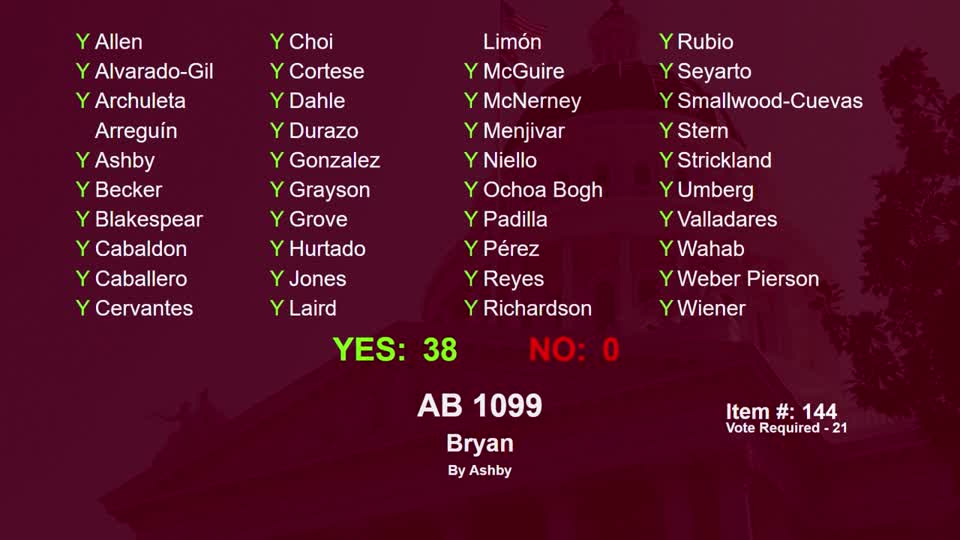
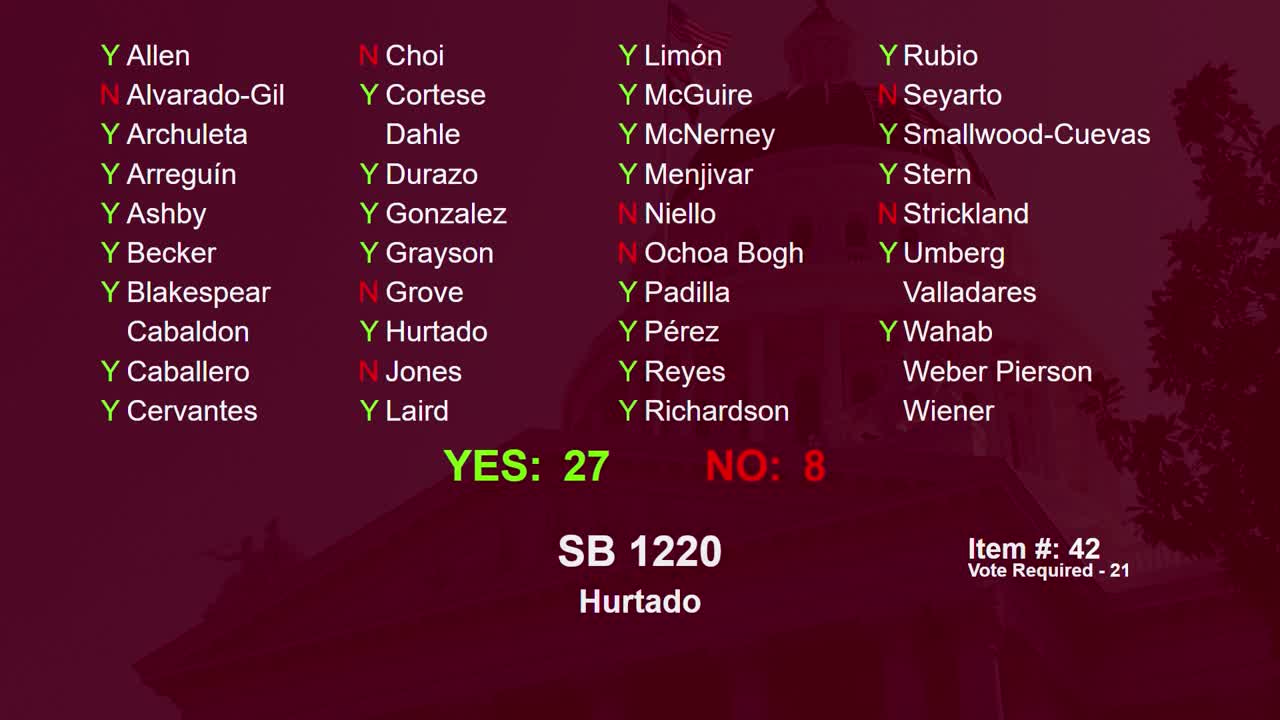
Bill Author

Bill Co-Author(s):