AB 2189: Rim of the Valley Trail Corridor: boundary revisions.
- Session Year: 2015-2016
- House: Assembly
- Latest Version Date: 2016-09-09
Existing law establishes the Santa Monica Mountains Conservancy in the Natural Resources Agency and prescribes the functions and duties of the conservancy with regard to the preservation, protection, and management of specified lands in the Santa Monica Mountains Zone, as defined. For purposes of providing a recreational trail corridor, the zone includes trails and accessways generally following the Rim of the Valley Trail, as specified. Existing law authorizes the conservancy to revise the boundaries of the Rim of the Valley Trail Corridor in the vicinity of the City of Santa Clarita if it determines, based on relevant scientific information and land use planning studies and after holding at least one public hearing, that a boundary revision is necessary, and to prepare and file a revised map showing the revised boundaries, as prescribed.
This bill would, pursuant to the same process and conditions, also authorize the conservancy to revise the boundaries of the Rim of the Valley Trail Corridor in the vicinity of the City of Moorpark, and to prepare and file a revised map, as prescribed.
Existing law establishes the Santa Monica Mountains Conservancy in the Natural Resources Agency and prescribes the functions and duties of the conservancy with regard to the preservation, protection, and management of specified lands in the Santa Monica Mountains Zone, as defined. For purposes of providing a recreational trail corridor, the zone includes trails and accessways generally following the Rim of the Valley Trail, as specified. Existing law authorizes the conservancy to revise the boundaries of the Rim of the Valley Trail Corridor in the vicinity of the City of Santa Clarita if it determines, based on relevant scientific information and land use planning studies and after holding at least one public hearing, that a boundary revision is necessary, and to prepare and file a revised map showing the revised boundaries, as prescribed.
This bill would, pursuant to the same process and conditions, also authorize the conservancy to revise the boundaries of the Rim of the Valley Trail Corridor in the vicinity of the City of Moorpark, and to prepare and file a revised map, as prescribed.
Existing law establishes the Santa Monica Mountains Conservancy in the Natural Resources Agency and prescribes the functions and duties of the conservancy with regard to the preservation, protection, and management of specified lands in the Santa Monica Mountains Zone, as defined. For purposes of providing a recreational trail corridor, the zone includes trails and accessways generally following the Rim of the Valley Trail, as specified. Existing law authorizes the conservancy to revise the boundaries of the Rim of the Valley Trail corridor Corridor in the vicinity of the City of Santa Clarita if it determines, based on relevant scientific information and land use planning studies and after holding at least one public hearing, that a boundary revision is necessary, and to prepare and file a revised map showing the revised boundaries, as prescribed.
This bill would, pursuant to the same process and conditions, also authorize the conservancy to revise the boundaries of the Rim of the Valley Trail corridor Corridor in the vicinity of the City of Moorpark, and to prepare and file a revised map, as prescribed.
Existing law establishes the Santa Monica Mountains Conservancy in the Natural Resources Agency and prescribes the functions and duties of the conservancy with regard to the preservation, protection, and management of specified lands in the Santa Monica Mountains Zone, as defined. For purposes of providing a recreational trail corridor, the zone includes trails and accessways generally following the Rim of the Valley Trail, as specified. Existing law authorizes the conservancy to revise the boundaries of the Rim of the Valley Trail corridor in the vicinity of the City of Santa Clarita if it determines, based on relevant scientific information and land use planning studies and after holding at least one public hearing, that a boundary revision is necessary, and to prepare and file a revised map showing the revised boundaries, as prescribed.
This bill would, pursuant to the same process and conditions, also authorize the conservancy to revise the boundaries of the Rim of the Valley Trail corridor in the vicinity of the City of Moorpark, and to prepare and file a revised map, as prescribed.
The Legislature finds and declares both of the following:
(a)The boundary of the Rim of the Valley Trail Corridor within the Santa Monica Mountains Zone should be determined exclusively upon the best scientific and resource-based information regarding trail, recreational, and environmental resources in the area.
(b)Landowners, local government entities, members of the public, and other affected parties should be afforded maximum participation in the process by which the Rim of the Valley Trail Corridor is delineated.
SEC. 2.Section 33204.8 is added to the Public Resources Code, to read:33204.8.(a)(1)Notwithstanding the requirements in Section 33105.5, if the conservancy determines, based on relevant scientific information and land use planning studies, and after holding at least one public hearing in the area that would be affected by a revision of the boundaries of the Rim of the Valley Trail Corridor, that a boundary revision within and in the vicinity of the City of Moorpark, as described in paragraph (2), is necessary, the executive director shall prepare and file with the Secretary of State, the Assembly Committee on Natural Resources, and the Senate Committee on Natural Resources and Water a revised map showing the changes in the boundaries of the Rim of the Valley Trail Corridor.
(2)The conservancy shall determine potential boundary revisions of the Rim of the Valley Trail Corridor for the area within the city limits of the City of Moorpark; the area of the north of the city limits and south of Broadway Road between Happy Camp Canyon Regional Park and Grimes Canyon Road; and the area west of the city limits of the City of Moorpark, south of Los Angeles Avenue, north of the Arroyo Simi, and east of the Gabbert Canyon Drainage Channel.
(3)A revised map prepared pursuant to paragraph (1) shall be supported by relevant scientific information, and shall be in accordance with the purposes and objectives of Section 33204.3.
(b)Notwithstanding Section 33201, this section does not affect the jurisdiction of the State Coastal Conservancy.
The Legislature finds and declares both of the following:
(a)The boundary of the Rim of the Valley Trail Corridor within the Santa Monica Mountains Zone should be determined exclusively upon the best scientific and resource-based information regarding trail, recreational, and environmental resources in the area.
(b)Landowners, local government entities, members of the public, and other affected parties should be afforded maximum participation in the process by which the Rim of the Valley Trail Corridor is delineated.
SEC. 2.Section 33204.8 is added to the Public Resources Code, to read:33204.8.(a)(1)Notwithstanding the requirements in Section 33105.5, if the conservancy determines, based on relevant scientific information and land use planning studies, and after holding at least one public hearing in the area that would be affected by a revision of the boundaries of the Rim of the Valley Trail Corridor, that a boundary revision within and in the vicinity of the City of Moorpark, as described in paragraph (2), is necessary, the executive director shall prepare and file with the Secretary of State, the Assembly Committee on Natural Resources, and the Senate Committee on Natural Resources and Water a revised map showing the changes in the boundaries of the Rim of the Valley Trail Corridor.
(2)The conservancy shall determine potential boundary revisions of the Rim of the Valley Trail Corridor for the area within the city limits of the City of Moorpark; the area of the north of the city limits and south of Broadway Road between Happy Camp Canyon Regional Park and Grimes Canyon Road; and the area west of the city limits of the City of Moorpark, south of Los Angeles Avenue, north of the Arroyo Simi, and east of the Gabbert Canyon Drainage Channel.
(3)A revised map prepared pursuant to paragraph (1) shall be supported by relevant scientific information, and shall be in accordance with the purposes and objectives of Section 33204.3.
(b)Notwithstanding Section 33201, this section does not affect the jurisdiction of the State Coastal Conservancy.
The Legislature finds and declares both of the following:
(a)The boundary of the Rim of the Valley Trail Corridor within the Santa Monica Mountains Zone should be determined exclusively upon the best scientific and resource-based information regarding trail, recreational, and environmental resources in the area.
(b)Landowners, local government entities, members of the public, and other affected parties should be afforded maximum participation in the process by which the Rim of the Valley Trail Corridor is delineated.
SECTION 1.SEC. 2.Section 33204.8 is added to the Public Resources Code, to read:33204.8.(a)The Legislature finds and declares both of the following:
(1)The boundary of the Rim of the Valley Trail Corridor should be determined exclusively upon the best scientific and resource-based information regarding trail, recreational, and environmental resources in the area.
(2)Landowners, local government entities, members of the public, and other affected parties should be afforded maximum participation in the process by which the Rim of the Valley Corridor Trail is delineated.
(b)
33204.8.(a)(1)Notwithstanding the requirements in Section 33105.5, if the conservancy determines, based on relevant scientific information and land use planning studies, and after holding at least one public hearing in the area that would be affected by a revision of the boundaries of the Rim of the Valley Trail Corridor, that a boundary revision within and in the vicinity of the City of Moorpark, as described in paragraph (2), is necessary, the executive director shall prepare and file with the Secretary of State, the Assembly Committee on Natural Resources, and the Senate Committee on Natural Resources and Water, Water a revised map showing the changes in the boundaries of the Rim of the Valley Trail Corridor.
(2)The conservancy shall determine potential boundary revisions of the Rim of the Valley Trail Corridor for the area within the city limits of the City of Moorpark; the area of the north of the city limits and south of Broadway Road between Happy Camp Canyon Regional Park and Grimes Canyon Road; and the area west of the city limits of the City of Moorpark, south of Los Angeles Avenue, north of the Arroyo Simi, and east of the Gabbert Canyon Drainage Channel.
(3)A revised map prepared pursuant to paragraph (1) shall be supported by relevant scientific information, and shall be in accordance with the purposes and objectives of Section 33204.3.
(c)
(b)Notwithstanding Section 33201, this section does not affect the jurisdiction of the State Coastal Conservancy.
(a)The Legislature finds and declares both of the following:
(1)The boundary of the Rim of the Valley Trail Corridor should be determined exclusively upon the best scientific and resource-based information regarding trail, recreational, and environmental resources in the area.
(2)Landowners, local government entities, members of the public, and other affected parties should be afforded maximum participation in the process by which the Rim of the Valley Corridor Trail is delineated.
(b)(1)Notwithstanding the requirements in Section 33105.5, if the conservancy determines, based on relevant scientific information and land use planning studies, and after holding at least one public hearing in the area that would be affected by a revision of the boundaries of the Rim of the Valley Trail Corridor, that a boundary revision within and in the vicinity of the City of Moorpark, as described in paragraph (2), is necessary, the executive director shall prepare and file with the Secretary of State, the Assembly Committee on Natural Resources, and the Senate Committee on Natural Resources and Water, a revised map showing the changes in the boundaries of the Rim of the Valley Trail Corridor.
(2)The conservancy shall determine potential boundary revisions of the Rim of the Valley Trail Corridor for the area within the city limits of the City of Moorpark; the area of the north of the city limits and south of Broadway Road between Happy Camp Canyon Regional Park and Grimes Canyon Road; and the area west of the city limits of the City of Moorpark, south of Los Angeles Avenue, north of the Arroyo Simi, and east of Gabbert Canyon Drainage Channel.
(3)A revised map prepared pursuant to paragraph (1) shall be supported by relevant scientific information, and shall be in accordance with the purposes and objectives of Section 33204.3.
(c)Notwithstanding Section 33201, this section does not affect the jurisdiction of the State Coastal Conservancy.
|
Date
|
Status
|
|---|---|
| Jun 2, 2016 | In Senate. Read first time. To Com. on RLS. for assignment. |
| Sep 9, 2016 | Chaptered by Secretary of State - Chapter 263, Statutes of 2016. |
| Sep 9, 2016 | Approved by the Governor. |
| Aug 23, 2016 | Enrolled and presented to the Governor at 2 p.m. |
| Aug 17, 2016 | Read third time. Passed. Ordered to the Assembly. (Ayes 36. Noes 0.). |
| Aug 17, 2016 | Read third time. Passed. Ordered to the Assembly. (Ayes 36. Noes 0. Page 5063.). |
| Aug 17, 2016 | Read third time. Passed. Ordered to the Assembly. |
| Aug 17, 2016 | In Assembly. Ordered to Engrossing and Enrolling. |
| Aug 15, 2016 | Read second time. Ordered to third reading. |
| Aug 11, 2016 | From committee: Do pass. (Ayes 7. Noes 0.) (August 11). |
| Aug 1, 2016 | In committee: Referred to APPR. suspense file. |
| Jun 29, 2016 | From committee: Do pass and re-refer to Com. on APPR. (Ayes 8. Noes 0.) (June 28). Re-referred to Com. on APPR. |
| Jun 9, 2016 | Referred to Com. on N.R. & W. |
| Feb 18, 2016 | Read first time. To print. |
| Jun 1, 2016 | Read third time. Passed. Ordered to the Senate. (Ayes 72. Noes 5.) |
| Jun 1, 2016 | Read third time. Passed. Ordered to the Senate. (Ayes 72. Noes 5. Page 5118.) |
| Jun 1, 2016 | Read third time. Passed. Ordered to the Senate. |
| May 31, 2016 | Read second time. Ordered to third reading. |
| May 27, 2016 | From committee: Do pass. (Ayes 19. Noes 1.) (May 27). |
| Apr 13, 2016 | In committee: Set, first hearing. Referred to suspense file. |
| Apr 5, 2016 | From committee: Do pass and re-refer to Com. on APPR. (Ayes 9. Noes 0.) (April 4). Re-referred to Com. on APPR. |
| Mar 29, 2016 | Re-referred to Com. on NAT. RES. |
| Mar 28, 2016 | From committee chair, with author's amendments: Amend, and re-refer to Com. on NAT. RES. Read second time and amended. |
| Mar 3, 2016 | Referred to Com. on NAT. RES. |
| Feb 19, 2016 | From printer. May be heard in committee March 20. |
|
Date
|
Description
|
Location
|
Votes
|
|
|---|---|---|---|---|
| Aug 17, 2016 | Assembly 3rd Reading AB2189 Irwin By Pavley | Senate Floor |
Passed |
|
| Aug 11, 2016 | Do pass | Senate Standing Committee on Appropriations |
Passed |
|
| Aug 1, 2016 | Placed on suspense file | Senate Standing Committee on Appropriations |
Passed |
|
| Jun 28, 2016 | Do pass, but first be re-referred to the Committee on [Appropriations] | Senate Standing Committee on Natural Resources and Water |
Passed |
|
| Jun 1, 2016 | AB 2189 IRWIN Assembly Third Reading | Assembly Floor |
Passed |
|
| May 27, 2016 | Do pass. | Assembly Standing Committee on Appropriations |
Passed |
|
| Apr 4, 2016 | Do pass and be re-referred to the Committee on [Appropriations] | Assembly Standing Committee on Natural Resources |
Passed |
This list shows positions taken on this bill by organizations on the date displayed, which is linked to the original source.
Positions by individuals are not included.
|
Organization
|
Position
|
Date
|
|---|---|---|
| Autobahn California | * Support | Apr 4, 2016 |
| City of Moorpark | ** Support | Aug 17, 2016 |
| Mountains Recreation And Conservation Authority | ** Support | Aug 17, 2016 |
| Mountains Recreation Conservation Authority | ** Support | Aug 17, 2016 |
| Santa Monica Mountains Conservancy | ** Support | Aug 17, 2016 |
| Sierra Club California | * Support | Jun 20, 2018 |
Office of Senate Floor Analyses (916) 651-1520 Fax: (916) 327-4478 | AB |
THIRD READING
Bill No: AB 2189
:
SENATE NATURAL RES. & WATER COMMITTEE: 8-0, 6/28/16
AYES: Pavley, Stone, Allen, Hertzberg, Hueso, Jackson, Monning, Vidak
NO VOTE RECORDED: Wolk
SENATE APPROPRIATIONS COMMITTEE: 7-0, 8/11/16
AYES: Lara, Bates, Beall, Hill, McGuire, Mendoza, Nielsen
ASSEMBLY FLOOR: 72-5, 6/1/16 - See last page for vote
DIGEST: This bill expands the geographic scope within which the Santa Monica Mountains Conservancy may revise the boundaries of the Rim of the Valley Trail Corridor in the City of Moorpark.
Existing law:
- Establishes the Santa Monica Mountains Conservancy (conservancy) in the Natural Resources Agency.
- Prescribes the functions and duties of the conservancy with regard to the preservation, protection and management of specified lands in the Santa Monica Mountains Zone (zone).
- Defines the zone to include trails and accessways generally following the Rim of the Valley trail, as specified.
- Authorizes the conservancy to revise the boundaries of the Rim of the Valley Trail Corridor in the vicinity of the City of Santa Clarita if it determines, based on relevant scientific information and land use planning studies and after holding a least on public hearing, that a boundary revision is necessary.
- The conservancy shall also prepare and file a revised map showing the revised boundaries.
This bill expands the geographic scope within which the Santa Monica Mountains Conservancy may revise the boundaries of the Rim of the Valley Trail Corridor in the City of Moorpark. Specifically, this bill:
- Authorizes the conservancy to expand the boundaries of the Rim of the Valley Trail Corridor in the vicinity, as specified, of the City of Moorpark.
- Any revision must be based upon relevant scientific and land use planning studies and after holding at least one public hearing in the affected area leading to the determination that a boundary revision is necessary.
- The executive director of the conservancy prepares and files a revised map showing the changes in the Rim of the Valley Trail Corridor’s boundaries with the Secretary of State and legislative committees. The revised map must be in accordance with the purposes and objections of the coordinated trail development plan and recreational access program for the trail corridor.
- Makes relevant and appropriate legislative findings.
- Does not affect the jurisdiction of the State Coastal Conservancy.
Background
The conservancy was established in 1980 and has helped to preserve of 73,000 acres of parkland in both wilderness and urban settings. The conservancy has also improved more than 114 public recreational facilities. According to the conservancy, its mission is to “strategically buy back, preserve, protect, restore and enhance pieces of Southern California to form an interlinking system of urban, rural and river parks, open space, trails and wildlife habitats through direction action, alliances and partnerships.”
The boundaries of the zone have been modified since the establishment of the conservancy, including with respect to the Rim of the Valley Trail Corridor.
Currently the southern portion of the City of Moorpark is within the conservancy’s corridor and the City of Moorpark has held a seat on the conservancy’s advisory committee since 1992.
Comments
Those most directly affected by this proposal support the bill. The City of Moorpark is the bill’s sponsor, and the conservancy supports the bill.
Related/Prior Legislation
AB 110 (Smyth, Chapter 407, Statutes of 2009) expanded the geographic area within which the conservancy may revise the boundaries of the Rim of the Valley Trail Corridor to includes areas in the vicinity of the City of Santa Clarita, including Elsmere Canyon and its watershed.
FISCAL EFFECT: Appropriation: Fiscal Com.: Local:
According to the Senate Appropriations Committee:
- Minor costs to the conservancy for additional administrative costs.
- Unknown, significant, cost pressures to acquire open space and create recreational and educational opportunities in the Moorpark area (various funds).
City of Moorpark (source)
Mountains Recreation and Conservation Authority
Santa Monica Mountains Conservancy
OPPOSITION: (Verified 8/11/16)
None received
ARGUMENTS IN SUPPORT: According to the author, “[a]n expansion of the Santa Monica Mountains Conservancy boundaries to include areas in and around the City of Moorpark would greatly strengthen the partnership between the two entities and aid both in accomplishing their common goals and objectives. The Conservancy and City [of Moorpark] could then combine both financial and technical resources to preserve open space, establish greenbelts, and create new recreational and educational opportunities for both residents and visitors in the Moorpark area.”
The conservancy, the Mountains Recreation and Conservation Authority and the City of Moorpark in their letters of support echo the author’s comments.
ASSEMBLY FLOOR: 72-5, 6/1/16
AYES: Achadjian, Alejo, Travis Allen, Arambula, Atkins, Baker, Bloom, Bonilla, Bonta, Brough, Brown, Burke, Calderon, Campos, Chang, Chau, Chávez, Chiu, Chu, Cooley, Cooper, Dababneh, Daly, Dodd, Eggman, Frazier, Cristina Garcia, Eduardo Garcia, Gatto, Gipson, Gomez, Gonzalez, Gordon, Gray, Hadley, Harper, Roger Hernández, Holden, Irwin, Jones, Jones-Sawyer, Kim, Levine, Linder, Lopez, Low, Maienschein, Mayes, McCarty, Medina, Melendez, Mullin, Nazarian, Obernolte, O'Donnell, Olsen, Quirk, Ridley-Thomas, Rodriguez, Salas, Santiago, Steinorth, Mark Stone, Thurmond, Ting, Wagner, Waldron, Weber, Wilk, Williams, Wood, Rendon
NOES: Beth Gaines, Gallagher, Grove, Lackey, Mathis
NO VOTE RECORDED: Bigelow, Dahle, Patterson
8/15/16 20:22:14
**** END ****
SENATE COMMITTEE ON APPROPRIATIONS
Senator Ricardo Lara, Chair
2015 - 2016 Regular Session
AB 2189 (Irwin) - Rim of the Valley Trail Corridor: boundary revisions
Version: March 28, 2016 | Policy Vote: N.R. & W. 8 - 0 |
Urgency: No | Mandate: No |
Hearing Date: August 1, 2016 | Consultant: Narisha Bonakdar |
This bill meets the criteria for referral to the Suspense File.
Bill Summary:
AB 2189 expands the geographic scope within which the Santa Monica Mountains Conservancy (Conservancy) may revise the boundaries of the Rim of the Valley Trail Corridor (Corridor).
Fiscal Impact:
- Minor costs to the Conservancy for additional administrative costs.
- Unknown, significant, cost pressures to acquire open space and create recreational and educational opportunities in the Moorpark area (various funds). (See staff comments)
Background:
- The Conservancy was established by the Legislature in 1980 to strategically preserve and protect portions of Southern California to form an interlinking system of parks, open space, trails, and wildlife habitats through direct action, alliances, and partnerships. To achieve this goal, the Conservancy may lease, rent, sell, transfer, or exchange lands for park purposes; award grants or interest free loans to state and local agencies to purchase or restore parks, recreation, conservation, or buffer-zone areas to ensure that the character and intensity of development on these lands is generally compatible with and does not adversely impact the environment.
Since its creation, the Conservancy has helped preserve over 73,000 acres of parkland in both wilderness and urban settings, and has improved more than 114 public recreational facilities throughout Southern California.
Currently, the southern portion of Moorpark is within the Conservancy's Corridor and Moorpark holds a seat on the Conservancy's Advisory Committee.
Proposed Law:
This bill:
- Expands the geographic scope within which the Conservancy may revise the boundaries of the Corridor to include areas in the vicinity of the City of Moorpark, as specified.
- Requires the determination on whether to revise the boundaries to be based on relevant scientific information.
- Requires any revised map prepared by the Conservancy to be in accordance with the purposes and objectives of the coordinated trail development plan and recreational access program for the Corridor.
Related Legislation:
AB 2534 (Nazarian, 2016) would allow the Conservancy to establish a working group for regional access and economic sustainability along the Los Angeles River in its San Fernando Valley reach. This bill is being considered in the Senate Appropriations Committee.
Staff Comments:
- According to the author, an expansion of the Conservancy boundaries to include areas in and around the City of Moorpark will greatly strengthen the partnership between the city and Conservancy, and aid both in accomplishing their common goals and objectives.
This bill expands the jurisdiction eligible to receive grant funding and other program benefits. This expansion will likely result in the redirection of resources from one jurisdiction to another, or cost pressures to maintain the same level of service for all jurisdictions previously or potentially served.
In Fiscal Year 2015-16, $17.5 million was spent on local assistance grants. The enacted Budget for Fiscal Year 2016-17 indicates a $4.3 million allocation for local assistance grants. The City of Moorpark would be eligible to apply for this grant funding.
-- END --
SENATE COMMITTEE ON NATURAL RESOURCES AND WATER
Senator Fran Pavley, Chair
2015 - 2016 Regular
Bill No: AB Hearing Date: June 28, 2016
Author: | Irwin | ||
Version: | March 28, 2016 | ||
Urgency: | No | Fiscal: | Yes |
Consultant: | Katharine Moore | ||
Subject: Rim of the Valley Trail Corridor: boundary revisions
BACKGROUND AND EXISTING LAW
- The Santa Monica Mountains Conservancy (conservancy) was established in the Natural Resources Agency in 1980 (see Public Resources Code §§33000 et seq.). In the years since, the conservancy has helped to preserve over 73,000 acres of parkland in both wilderness and urban setting, and has improved more than 114 public recreational facilities throughout Southern California.
- According to the conservancy, its mission is to “strategically buy back, preserve, protect, restore and enhance pieces of Southern California to form an interlinking system of urban, rural and river parks, open space, trails and wildlife habitats through direction action, alliances and partnerships.”
- Existing law prescribes the functions and duties of the conservancy with regard to the preservation, protection, and management of specified lands in the Santa Monica Mountains Zone (zone), as defined.
- The boundaries of the zone have changed over time. In 1983, the boundaries of the zone were altered to include hiking and equestrian trail connections and accessways following the Rim of the Valley trail corridor (trail corridor). The boundaries were expanded again in 1989 to include the Santa Clarita Woodlands located in the Santa Susana Mountains. Other minor boundary adjustments are also authorized. Certain boundaries may be revised by the conservancy if it determines a boundary revision is necessary based upon relevant scientific information and land use planning studies and after holding at least one public hearing, as specified.
- Currently the southern portion of the City of Moorpark is within the conservancy’s corridor and the City of Moorpark has held a seat on the conservancy’s advisory committee since 1992.
PROPOSED LAW
This bill would:
- Authorize the conservancy to expand the boundaries of the Rim of the Valley trail corridor in the vicinity, as specified, of the City of Moorpark.
- Any revision must be based upon relevant scientific and land use planning studies and after holding at least one public hearing in the affected area leading to the determination that a boundary revision is necessary.
- The executive director of the conservancy prepares and files a revised map showing the changes in the Rim of the Valley trail corridor’s boundaries with the Secretary of State and legislative committees. The revised map must be in accordance with the purposes and objections of the coordinated trail development plan and recreational access program for the trail corridor.
- Make relevant and appropriate legislative findings, and
- Not affect the jurisdiction of the State Coastal Conservancy.
ARGUMENTS IN SUPPORT
According to the author, “[a]n expansion of the Santa Monica Mountains Conservancy boundaries to include areas in and around the City of Moorpark would greatly strengthen the partnership between the two entities and aid both in accomplishing their common goals and objectives. The Conservancy and City [of Moorpark] could then combine both financial and technical resources to preserve open space, establish greenbelts, and create new recreational and educational opportunities for both residents and visitors in the Moorpark area.”
The conservancy, the Mountains Recreation and Conservation Authority and the City of Moorpark in their letters of support echo the author’s comments.
ARGUMENTS IN OPPOSITION
None received
COMMENTS
Those most directly affected by this proposal support the bill. The City of Moorpark is the bill’s sponsor, and the conservancy supports the bill.
Recent related bills
AB 2534 (Nazarian, 2016) would allow the conservancy to establish a working group for regional access and economic sustainability along the Los Angeles River in its San Fernando Valley reach, as specified (before the Senate Natural Resources and Water Committee)
AB 110 (Smyth, c. 407, Statutes of 2009) expanded the geographic area within which the conservancy may revise the boundaries of the Rim of the Valley trail corridor to includes areas in the vicinity of the City of Santa Clarita, including Elsmere Canyon and its watershed.
SUPPORT
City of Moorpark (sponsor)
Mountains Recreation Conservation Authority
Santa Monica Mountains Conservancy
OPPOSITION
None Received
-- END --
ASSEMBLY THIRD READING
ATR Bill Id:AB 2189
Author:(Irwin)
As Amended Ver:
Majority vote
Committee | Votes | Ayes | Noes |
Natural Resources | 9-0 | Williams, Jones, Cristina Garcia, Gomez, Hadley, Harper, McCarty, Mark Stone, Wood | |
Appropriations | 19-1 | Gonzalez, Bigelow, Bloom, Bonilla, Bonta, Calderon, Chang, Daly, Eggman, Eduardo Garcia, Roger Hernández, Holden, Jones, Obernolte, Quirk, Santiago, Wagner, Weber, Wood | Gallagher |
SUMMARY: Expands the geographic scope within which the Santa Monica Mountains Conservancy (Conservancy) may revise the boundaries of the Rim of the Valley Trail Corridor. Specifically, this bill:
- Expands the geographic scope within which the Conservancy may revise the boundaries of the Corridor to include areas in the vicinity of the City of Moorpark.
- Requires the determination on whether to revise the boundaries to be based on relevant scientific information.
- Requires any revised map prepared by the Conservancy to be in accordance with the purposes and objectives of the coordinated trail development plan and recreational access program for the Corridor.
EXISTING LAW:
- Creates the Conservancy to protect the natural resources of, and promote recreational opportunities in, the Santa Monica Mountains. The Conservancy is authorized to acquire land from willing sellers, and to provide grants to local governments and non-profit organizations for planning, acquisition, improvement, and operation of wildlife habitat and recreation resources within the Santa Monica Mountains Zone (Zone).
- Expanded the boundaries of the Zone twice: first in 1983, to include hiking and equestrian trail connections and accessways following the Rim of the Valley Trail; and again in 1989, to include the Santa Clarita Woodlands portion of the Santa Susana Mountains and other minor boundary adjustments.
- Required the Conservancy to prepare and adopt a coordinated trail development plan and recreational access program for the Corridor by 1990. In order to implement the plan, the executive director of the Conservancy was authorized to make minor boundary changes prior to July 31, 1990.
- Authorizes the Conservancy to revise the boundary of the Corridor near Placerita Canyon State Park east of State Route 14, including Whitney Canyon and its adjacent watersheds, if it determines, based on scientific information and land use planning studies and after holding a public hearing, that such a revision is necessary.
- Expands the geographic scope within which the Conservancy may revise the boundaries of the Corridor to include areas in the vicinity of the City of Santa Clarita, including Elsmere Canyon and its watershed.
FISCAL EFFECT: According to the Assembly Appropriations Committee:
- Potential administrative cost pressures resulting from the potential boundary expansion in the $100,000 to $200,000 range (Environmental License Plate Fund).
- Potential unknown acquisition or development cost pressures to preserve open space and create recreational and educational opportunities in the Moorpark area (various funds).
COMMENTS: The Conservancy was established by the Legislature in 1980. Since that time, it has helped preserve over 73,000 acres of parkland in both wilderness and urban settings, and has improved more than 114 public recreational facilities throughout Southern California. Currently, the southern portion of Moorpark is within the Conservancy's Corridor and Moorpark has held a seat on the Conservancy's Advisory Committee since 1992. The mission of the Conservancy is to strategically preserve and protect portions of Southern California to form an interlinking system of parks, open space, trails, and wildlife habitats through direct action, alliances, and partnerships. The author states:
An expansion of the Santa Monica Mountains Conservancy boundaries to include areas in and around the City of Moorpark would greatly strengthen the partnership between the two entities and aid both in accomplishing their common goals and objectives. The Conservancy and City could then combine both financial and technical resources to preserve open space, establish greenbelts, and create new recreational and educational opportunities for both residents and visitors in the Moorpark area.
This bill would permit the Conservancy to revise its borders based on scientific information, which can include land use planning studies and information to evaluate the conservation and habitat value of the land. The Conservancy conducted a similar process in the vicinity of the City of Santa Clarita, which resulted in Elsmere Canyon being added to the Conservancy.
Analysis Prepared by: Michael Jarred / NAT. RES. / (916) 319-2092 FN: 0003111
Date of Hearing: April 13, 2016
ASSEMBLY COMMITTEE ON APPROPRIATIONS
Lorena Gonzalez, Chair
ABPCA Bill Id:AB 2189
Author:(Irwin) – As Amended Ver:March 28, 2016
Policy Committee: | Natural Resources | Vote: | 9 - 0 |
|
| ||
|
|
Urgency: No State Mandated Local Program: No Reimbursable: No
SUMMARY:
This bill expands the geographic scope within which the Santa Monica Mountains Conservancy (Conservancy) may revise the boundaries of the Rim of the Valley Trail Corridor (Corridor). Specifically, this bill:
- Expands the geographic scope within which the Conservancy may revise the boundaries of the Corridor to include areas in the vicinity of the City of Moorpark, as specified.
- Requires the determination on whether to revise the boundaries to be based on relevant scientific information.
- Requires any revised map prepared by the Conservancy to be in accordance with the purposes and objectives of the coordinated trail development plan and recreational access program for the Rim of the Valley Trail Corridor.
FISCAL EFFECT:
- Potential administrative cost pressures resulting from the potential boundary expansion in the $100,000 to $200,000 range (Environmental License Plate Fund).
- Potential unknown acquisition or development cost pressures to preserve open space and create recreational and educational opportunities in the Moorpark area (various funds).
COMMENTS:
- Purpose. According to the author, an expansion of the Conservancy boundaries to include areas in and around the City of Moorpark will greatly strengthen the partnership between the city and Conservancy aid both in accomplishing their common goals and objectives.
- Background. The Conservancy was established by the Legislature in 1980. The mission of the Conservancy is to strategically preserve and protect portions of Southern California to form an interlinking system of parks, open space, trails, and wildlife habitats through direct action, alliances, and partnerships.
Since its creation, the Conservancy has helped preserve over 73,000 acres of parkland in both wilderness and urban settings, and has improved more than 114 public recreational facilities throughout Southern California.
Currently, the southern portion of Moorpark is within the Conservancy's Corridor and Moorpark holds a seat on the Conservancy's Advisory Committee.
Analysis Prepared by: Jennifer Galehouse / APPR. / (916) 319-2081
Date of Hearing: April 4, 2016
ASSEMBLY COMMITTEE ON NATURAL RESOURCES
Das Williams, Chair
ABPCA Bill Id:AB 2189 (
Author:Irwin) – As Amended Ver:March 28, 2016
SUBJECT: Rim of the Valley Trail corridor: boundary revisions
SUMMARY: Expands the geographic scope within which the Santa Monica Mountains Conservancy (Conservancy) may revise the boundaries of the Rim of the Valley Trail Corridor.
EXISTING LAW:
- Creates the Conservancy to protect the natural resources of, and promote recreational opportunities in, the Santa Monica Mountains. The Conservancy is authorized to acquire land from willing sellers, and to provide grants to local governments and non-profit organizations for planning, acquisition, improvement, and operation of wildlife habitat and recreation resources within the Santa Monica Mountains Zone (Zone).
- Expanded the boundaries of the Zone twice: first in 1983, to include hiking and equestrian trail connections and accessways following the Rim of the Valley Trail; and again in 1989, to include the Santa Clarita Woodlands portion of the Santa Susana Mountains and other minor boundary adjustments.
- Required the Conservancy to prepare and adopt a coordinated trail development plan and recreational access program for the Corridor by 1990. In order to implement the plan, the executive director of the Conservancy was authorized to make minor boundary changes prior to July 31, 1990.
- Authorizes the Conservancy to revise the boundary of the Corridor near Placerita Canyon State Park east of State Route 14, including Whitney Canyon and its adjacent watersheds, if it determines, based on scientific information and land use planning studies and after holding a public hearing, that such a revision is necessary.
- Expands the geographic scope within which the Conservancy may revise the boundaries of the Corridor to include areas in the vicinity of the City of Santa Clarita, including Elsmere Canyon and its watershed.
THIS BILL:
- Expands the geographic scope within which the Conservancy may revise the boundaries of the Corridor to include areas in the vicinity of the City of Moorpark.
- Requires the determination on whether to revise the boundaries to be based on relevant scientific information.
- Describes the area in the vicinity of Moorpark.
- Requires any revised map prepared by the Conservancy to be in accordance with the purposes and objectives of the coordinated trail development plan and recreational access program for the Corridor.
FISCAL EFFECT: Unknown
COMMENTS:
- Background: The Conservancy was established by the Legislature in 1980. Since that time, it has helped preserve over 73,000 acres of parkland in both wilderness and urban settings, and has improved more than 114 public recreational facilities throughout Southern California. Currently, the southern portion of Moorpark is within the Conservancy's Corridor and Moorpark has held a seat on the Conservancy's Advisory Committee since 1992. The mission of the Conservancy is to strategically preserve and protect portions of Southern California to form an interlinking system of parks, open space, trails, and wildlife habitats through direct action, alliances, and partnerships. The author states:
An expansion of the Santa Monica Mountains Conservancy boundaries to include areas in and around the City of Moorpark would greatly strengthen the partnership between the two entities and aid both in accomplishing their common goals and objectives. The Conservancy and City could then combine both financial and technical resources to preserve open space, establish greenbelts, and create new recreational and educational opportunities for both residents and visitors in the Moorpark area.
This bill would permit the Conservancy to revise its borders based on scientific information, which can include land use planning studies and information to evaluate the conservation and habitat value of the land. The Conservancy conducted a similar process in the vicinity of the City of Santa Clarita, which resulted in Elsmere Canyon being added to the Conservancy.
- Prior Legislation.
AB 110 (Smyth), Chapter 407, Statutes of 2009, expanded the geographic scope within which the Conservancy may revise the boundaries of the Corridor to include areas in the vicinity of the City of Santa Clarita, including Elsmere Canyon and its watershed.
REGISTERED SUPPORT / OPPOSITION:
Support
City of Moorpark
Mountains Recreation and Conservation Authority
Opposition
None on file
Analysis Prepared by: Michael Jarred / NAT. RES. / (916) 319-2092
Discussed in Hearing
 3MIN
Senate Standing Committee on Environmental Quality
 2MIN
Senate Floor
 51SEC
Assembly Floor
 1MIN
Assembly Standing Committee on Appropriations
 2MIN
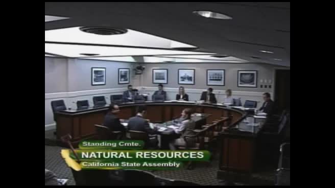
Assembly Standing Committee on Natural Resources
Bill Author

Bill Co-Author(s):