AB 2651: Greenway easements.
- Session Year: 2015-2016
- House: Assembly
- Latest Version Date: 2016-09-22
(1)The Greenway Development and Sustainment Act applies certain creation and transfer provisions similar to those of conservation easements to greenway easements. The act defines various terms for purposes of the act, including greenway, to mean certain types of travel corridors that, among other requirements, incorporate an array of amenities for users of the corridor and nearby communities, and greenway easement, to mean a limitation in a deed, will, or other instrument for the purpose of developing greenways adjacent to urban waterways. The act provides that a recorded greenway easement constitutes an enforceable restriction for purposes of certain property tax provisions.
This bill would instead require a greenway to incorporate an array of amenities only within an urbanized area, as defined. The bill would include easements created for the purpose of preserving greenways adjacent to urban waterways as greenway easements. The bill would require greenway easements created for the purpose of developing greenways to be consistent with restoration efforts undertaken at the adjacent urban waterways at the time of the creation of the easement.
The Greenway Development and Sustainment Act requires that a greenway reflect specified design standards applicable for each affected local agency as documented in the local agencys applicable planning document.
This bill would require that these design standards be consistent with plans and facilities for controlling the floodwater of rivers and their tributaries, as applicable.
Because this bill, by revising these terms for purposes of the act and by expanding the definition of a greenway easement, would change the manner in which county assessors assess property for property taxation purposes, this bill would impose a state-mandated local program.
(2)The Planning and Zoning Law requires each city, county, and city and county to prepare and adopt a general plan that contains certain mandatory elements, including a land use element and an open-space element. Existing law includes greenways, as defined in the Greenway Development and Sustainment Act, in the definition of open-space land for the purposes of the open-space element.
This bill would instead specify that greenways be included in the land use element of a general plan.
By revising the contents of the mandatory elements of a general plan, this bill would impose a state-mandated local program.
(3)This bill would incorporate additional changes to Section 65302 of the Government Code proposed by SB 974 and SB 1000 that would become effective only if this bill and either or both of those bills are chaptered and become operative on or before January 1, 2017, and this bill is chaptered last.
(4)The California Constitution requires the state to reimburse local agencies and school districts for certain costs mandated by the state. Statutory provisions establish procedures for making that reimbursement.
This bill would provide that with regard to certain mandates no reimbursement is required by this act for a specified reason.
With regard to any other mandates, this bill would provide that, if the Commission on State Mandates determines that the bill contains costs so mandated by the state, reimbursement for those costs shall be made pursuant to the statutory provisions noted above.
(5)This bill would declare that it is to take effect immediately as an urgency statute.
(1)The Greenway Development and Sustainment Act applies certain creation and transfer provisions similar to those of conservation easements to greenway easements. The act defines various terms for purposes of the act, including greenway, to mean certain types of travel corridors that, among other requirements, incorporate an array of amenities for users of the corridor and nearby communities, and greenway easement, to mean a limitation in a deed, will, or other instrument for the purpose of developing greenways adjacent to urban waterways. The act provides that a recorded greenway easement constitutes an enforceable restriction for purposes of certain property tax provisions.
This bill would instead require a greenway to incorporate an array of amenities only within an urbanized area, as defined. The bill would include easements created for the purpose of preserving greenways adjacent to urban waterways as greenway easements. The bill would require greenway easements created for the purpose of developing greenways to be consistent with restoration efforts undertaken at the adjacent urban waterways at the time of the creation of the easement.
The Greenway Development and Sustainment Act requires that a greenway reflect specified design standards applicable for each affected local agency as documented in the local agencys applicable planning document.
This bill would require that these design standards be consistent with plans and facilities for controlling the floodwater of rivers and their tributaries, as applicable.
Because this bill, by revising these terms for purposes of the act and by expanding the definition of a greenway easement, would change the manner in which county assessors assess property for property taxation purposes, this bill would impose a state-mandated local program.
(2)The Planning and Zoning Law requires each city, county, and city and county to prepare and adopt a general plan that contains certain mandatory elements, including a land use element and an open-space element. Existing law includes greenways, as defined in the Greenway Development and Sustainment Act, in the definition of open-space land for the purposes of the open-space element.
This bill would instead specify that greenways be included in the land use element of a general plan.
By revising the contents of the mandatory elements of a general plan, this bill would impose a state-mandated local program.
(3)This bill would incorporate additional changes to Section 65302 of the Government Code proposed by SB 974 and SB 1000 that would become effective only if this bill and either or both of those bills are chaptered and become operative on or before January 1, 2017, and this bill is chaptered last.
(4)The California Constitution requires the state to reimburse local agencies and school districts for certain costs mandated by the state. Statutory provisions establish procedures for making that reimbursement.
This bill would provide that with regard to certain mandates no reimbursement is required by this act for a specified reason.
With regard to any other mandates, this bill would provide that, if the Commission on State Mandates determines that the bill contains costs so mandated by the state, reimbursement for those costs shall be made pursuant to the statutory provisions noted above.
(5)This bill would declare that it is to take effect immediately as an urgency statute.
(1)The Greenway Development and Sustainment Act applies certain creation and transfer provisions similar to those of conservation easements to greenway easements. The act defines various terms for purposes of the act, including greenway, to mean certain types of travel corridors that, among other requirements, incorporate an array of amenities for users of the corridor and nearby communities, and greenway easement, to mean a limitation in a deed, will, or other instrument for the purpose of developing greenways adjacent to urban waterways. The act provides that a recorded greenway easement constitutes an enforceable restriction for purposes of certain property tax provisions.
This bill would instead require a greenway to incorporate an array of amenities only within an urbanized area, as defined. The bill would include easements created for the purpose of preserving greenways adjacent to urban waterways as greenway easements. The bill would require greenway easements created for the purpose of developing greenways to be consistent with restoration efforts undertaken at the adjacent urban waterways at the time of the creation of the easement.
The Greenway Development and Sustainment Act requires that a greenway reflect specified design standards applicable for each affected local agency as documented in the local agencys applicable planning document.
This bill would require that these design standards be consistent with plans and facilities for controlling the floodwater of rivers and their tributaries, as applicable.
Because this bill, by revising these terms for purposes of the act and by expanding the definition of a greenway easement, would change the manner in which county assessors assess property for property taxation purposes, this bill would impose a state-mandated local program.
(2)The Planning and Zoning Law requires each city, county, and city and county to prepare and adopt a general plan that contains certain mandatory elements, including a land use element and an open-space element. Existing law includes greenways, as defined in the Greenway Development and Sustainment Act, in the definition of open-space land for the purposes of the open-space element.
This bill would instead specify that greenways be included in the land use element of a general plan.
By revising the contents of the mandatory elements of a general plan, this bill would impose a state-mandated local program.
(3)This bill would incorporate additional changes to Section 65302 of the Government Code proposed by SB 974 and SB 1000 that would become effective only if this bill and either or both of those bills are chaptered and become operative on or before January 1, 2017, and this bill is chaptered last.
(3)
(4)The California Constitution requires the state to reimburse local agencies and school districts for certain costs mandated by the state. Statutory provisions establish procedures for making that reimbursement.
This bill would provide that with regard to certain mandates no reimbursement is required by this act for a specified reason.
With regard to any other mandates, this bill would provide that, if the Commission on State Mandates determines that the bill contains costs so mandated by the state, reimbursement for those costs shall be made pursuant to the statutory provisions noted above.
(4)
(5)This bill would declare that it is to take effect immediately as an urgency statute.
The
(1)The Greenway Development and Sustainment Act applies certain creation and transfer provisions similar to those of conversation conservation easements to greenway easements. The act defines various terms for purposes of the act, including greenway, to mean certain types of travel corridors that, among other requirements, incorporate an array of amenities for users of the corridor and nearby communities, and greenway easement, to mean a limitation in a deed, will, or other instrument for the purpose of developing greenways adjacent to urban waterways. The act provides that a recorded greenway easement constitutes an enforceable restriction for purposes of certain property tax provisions.
This bill would instead require a greenway to incorporate an array of amenities only within an urbanized area, as defined. The bill would include easements created for the purpose of preserving greenways adjacent to urban waterways as greenway easements. The bill would require greenway easements created for the purpose of developing greenways to be consistent with restoration efforts undertaken at the adjacent urban waterways at the time of the creation of the easement.
Because this bill, by revising these terms for purposes of the act and by expanding the definition of a greenway easement, would change the manner in which county assessors assess property for property taxation purposes, this bill would impose a state-mandated local program.
(2)The Planning and Zoning Law requires each city, county, and city and county to prepare and adopt a general plan that contains certain mandatory elements, including a land use element and an open-space element. Existing law includes greenways, as defined in the Greenway Development and Sustainment Act, in the definition of open-space land for the purposes of the open-space element.
This bill would instead specify that greenways be included in the land use element of a general plan.
By revising the contents of the mandatory elements of a general plan, this bill would impose a state-mandated local program.
(3)The California Constitution requires the state to reimburse local agencies and school districts for certain costs mandated by the state. Statutory provisions establish procedures for making that reimbursement.
This bill would provide that with regard to certain mandates no reimbursement is required by this act for a specified reason.
With regard to any other mandates, this bill would provide that, if the Commission on State Mandates determines that the bill contains costs so mandated by the state, reimbursement for those costs shall be made pursuant to the statutory provisions noted above.
(4)This bill would declare that it is to take effect immediately as an urgency statute.
The Greenway Development and Sustainment Act applies certain creation and transfer provisions similar to those of conversation easements to greenway easements. The act defines various terms for purposes of the act, including greenway, to mean certain types of travel corridors that, among other requirements, incorporate an array of amenities for users of the corridor and nearby communities, and greenway easement, to mean a limitation in a deed, will, or other instrument for the purpose of developing greenways adjacent to urban waterways. The act provides that a recorded greenway easement constitutes an enforceable restriction for purposes of certain property tax provisions.
This bill would instead require a greenway to incorporate an array of amenities only within an urbanized area, as defined.
Existing law establishes various plans and programs intended to preserve, protect, and rehabilitate lands adjacent to rivers in the state.
This bill would require the Natural Resources Agency to establish and administer a grant program, known as the Urban Water and Transportation Environmental Revitalization Grant Program. The bill would require the program to provide grants for projects that develop greenways in areas that are adjacent to an urban creek in certain areas, and would require an entity that receives a grant under the program to provide a matching cost share. The bill would appropriate $500,000,000 from the General Fund to the agency for purposes of the program and would prohibit more than 5% of these moneys from being used for administrative costs of the program.
Existing law establishes various plans and programs intended to preserve, protect, and rehabilitate lands adjacent to rivers in the state.
This bill would require the Natural Resources Agency to establish and administer a grant program, known as the Urban Water and Transportation Environmental Revitalization Grant Program. The bill would require the program to provide grants for projects that develop greenways in areas that are adjacent to an urban creek in certain areas, and would require an entity that receives a grant under the program to provide a matching cost share. The bill would appropriate $500,000,000 from the General Fund to the agency for purposes of the program and would prohibit more than 5% of these moneys from being used for administrative costs of the program.
(1)The Greenway Development and Sustainment Act applies to greenway easements certain creation and transfer provisions similar to those of conversation easements. The act defines various terms for purposes of the act, including greenway, to mean certain types of travel corridors that, among other requirements, incorporate an array of amenities for users of the corridor and nearby communities, and greenway easement to mean a limitation in a deed, will, or other instrument for the purpose of developing greenways adjacent to urban waterways. The act provides that a recorded greenway easement constitutes an enforceable restriction for purposes of certain property tax provisions.
This bill would require a greenway to incorporate an array of amenities only within an urbanized area, as defined. The bill would include easements created for the purpose of preserving greenways adjacent to urban waterways as greenway easements. The bill would require greenway easements created for the purpose of developing greenways to be consistent with restoration efforts undertaken at the adjacent urban waterways at the time of the creation of the easement.
Because this bill, by revising these terms for purposes of the act and by expanding the definition of a greenway easement, would change the manner in which county assessors assess property for property taxation purposes, this bill would impose a state-mandated local program.
(2)The Planning and Zoning Law requires each city, county, and city and county to prepare and adopt a general plan that contains certain mandatory elements, including a land use element and an open-space element. Existing law includes greenways, as defined in the Greenway Development and Sustainment Act, in the definition of open-space land for the purposes of the open-space element.
This bill would instead specify that greenways be included in the land use element of a general plan.
By revising the contents of the mandatory elements of a general plan, this bill would impose a state-mandated local program.
(3)The California Constitution requires the state to reimburse local agencies and school districts for certain costs mandated by the state. Statutory provisions establish procedures for making that reimbursement.
This bill would provide that with regard to certain mandates no reimbursement is required by this act for a specified reason.
With regard to any other mandates, this bill would provide that, if the Commission on State Mandates determines that the bill contains costs so mandated by the state, reimbursement for those costs shall be made pursuant to the statutory provisions noted above.
(4)This bill would declare that it is to take effect immediately as an urgency statute.
(1)The Greenway Development and Sustainment Act applies to greenway easements certain creation and transfer provisions similar to those of conversation easements. The act defines various terms for purposes of the act, including greenway, to mean certain types of travel corridors that, among other requirements, incorporate an array of amenities for users of the corridor and nearby communities, and greenway easement to mean a limitation in a deed, will, or other instrument for the purpose of developing greenways adjacent to urban waterways. The act provides that a recorded greenway easement constitutes an enforceable restriction for purposes of certain property tax provisions.
This bill would require a greenway to incorporate an array of amenities only within an urbanized area, as defined. The bill would include easements created for the purpose of preserving greenways adjacent to urban waterways as greenway easements. The bill would require greenway easements created for the purpose of developing greenways to be consistent with restoration efforts undertaken at the adjacent urban waterways at the time of the creation of the easement.
Because this bill, by revising these terms for purposes of the act and by expanding the definition of a greenway easement, would change the manner in which county assessors assess property for property taxation purposes, this bill would impose a state-mandated local program.
(2)The Planning and Zoning Law requires each city, county, and city and county to prepare and adopt a general plan that contains certain mandatory elements, including a land use element and an open-space element. Existing law includes greenways, as defined in the Greenway Development and Sustainment Act, in the definition of open-space land for the purposes of the open-space element.
This bill would instead specify that greenways be included in the land use element of a general plan.
By revising the contents of the mandatory elements of a general plan, this bill would impose a state-mandated local program.
(3)The California Constitution requires the state to reimburse local agencies and school districts for certain costs mandated by the state. Statutory provisions establish procedures for making that reimbursement.
This bill would provide that with regard to certain mandates no reimbursement is required by this act for a specified reason.
With regard to any other mandates, this bill would provide that, if the Commission on State Mandates determines that the bill contains costs so mandated by the state, reimbursement for those costs shall be made pursuant to the statutory provisions noted above.
(4)This bill would declare that it is to take effect immediately as an urgency statute.
For purposes of this chapter, the following definitions apply:
(a)(1)Adjacent means within 400 yards from the property boundary of an existing urban waterway.
(2)This subdivision does not create a new authority to place or extend an easement on private property that is not part of a voluntary agreement.
(b)Greenway means a pedestrian and bicycle, nonmotorized vehicle transportation, and recreational travel corridor that meets the following requirements:
(1)Includes landscaping that improves rivers and streams, provides flood protection benefits, and incorporates the significance and value of natural, historical, and cultural resources, as documented in the local agencys applicable planning document, including, but not limited to, a master plan, a general plan, or a specific plan.
(2)Is separated and protected from shared roadways, is adjacent to an urban waterway, and incorporates both ease of access to nearby communities and an array of amenities within an urbanized area and services for the users of the corridor and nearby communities.
(3)Is located on public lands or private lands, or a combination of public and private lands, where public access to those lands for greenway purposes has been legally authorized by, or legally obtained from, the fee owner of the land and, if applicable, the operator of any facility or improvement located on the land, through leases, easements, or other agreements entered into by the fee owner and the operator of any affected facility or improvement on the land.
(4)Reflects design standards regarding appropriate widths, clearances, setbacks from obstructions, and centerlines protecting directional travel, and other considerations, as appropriate, that are applicable for each affected local agency, as documented in the local agencys applicable planning document, including, but not limited to, a master plan, general plan, or specific plan, and that are consistent with plans and facilities for controlling the floodwater of rivers and their tributaries, as applicable.
(5)May incorporate appropriate lighting, public amenities within an urbanized area, art, and other features that are consistent with a local agencys planning document, including, but not limited to, a general plan, master plan, or specific plan.
(c)Greenway easement means any limitation in a deed, will, or other instrument in the form of an easement, restriction, covenant, or condition that is or has been executed by or on behalf of the owner of the land subject to the easement and is binding upon successive owners of that land, for either of the following purposes:
(1)Developing greenways adjacent to urban waterways consistent with restoration efforts undertaken at those waterways at the time of the creation of the easement, if any.
(2)Preserving greenways adjacent to urban waterways.
(d)Local agency means a city, county, or city and county.
(e)Urbanized area has the same meaning as set forth in Section 21071 of the Public Resources Code.
(f)Urban waterway means a creek, stream, or river that crosses (1) developed residential, commercial, or industrial property or (2) open space where the land use is designated as residential, commercial, or industrial, as referenced in a local agencys planning document, including, but not limited to, a general plan, master plan, or specific general plan.
SEC. 2.Section 65302 of the Government Code is amended to read:65302.The general plan shall consist of a statement of development policies and shall include a diagram or diagrams and text setting forth objectives, principles, standards, and plan proposals. The plan shall include the following elements:
(a)A land use element that designates the proposed general distribution and general location and extent of the uses of the land for housing, business, industry, open space, including agriculture, natural resources, recreation, and enjoyment of scenic beauty, education, public buildings and grounds, solid and liquid waste disposal facilities, greenways, as defined in Section 816.52 of the Civil Code, and other categories of public and private uses of land. The location and designation of the extent of the uses of the land for public and private uses shall consider the identification of land and natural resources pursuant to paragraph (3) of subdivision (d). The land use element shall include a statement of the standards of population density and building intensity recommended for the various districts and other territory covered by the plan. The land use element shall identify and annually review those areas covered by the plan that are subject to flooding identified by flood plain mapping prepared by the Federal Emergency Management Agency (FEMA) or the Department of Water Resources. The land use element shall also do both of the following:
(1)Designate in a land use category that provides for timber production those parcels of real property zoned for timberland production pursuant to the California Timberland Productivity Act of 1982 (Chapter 6.7 (commencing with Section 51100) of Part 1 of Division 1 of Title 5).
(2)Consider the impact of new growth on military readiness activities carried out on military bases, installations, and operating and training areas, when proposing zoning ordinances or designating land uses covered by the general plan for land, or other territory adjacent to military facilities, or underlying designated military aviation routes and airspace.
(A)In determining the impact of new growth on military readiness activities, information provided by military facilities shall be considered. Cities and counties shall address military impacts based on information from the military and other sources.
(B)The following definitions govern this paragraph:
(i)Military readiness activities mean all of the following:
(I)Training, support, and operations that prepare the men and women of the military for combat.
(II)Operation, maintenance, and security of any military installation.
(III)Testing of military equipment, vehicles, weapons, and sensors for proper operation or suitability for combat use.
(ii)Military installation means a base, camp, post, station, yard, center, homeport facility for any ship, or other activity under the jurisdiction of the United States Department of Defense as defined in paragraph (1) of subsection (g) of Section 2687 of Title 10 of the United States Code.
(b)(1)A circulation element consisting of the general location and extent of existing and proposed major thoroughfares, transportation routes, terminals, any military airports and ports, and other local public utilities and facilities, all correlated with the land use element of the plan.
(2)(A)Commencing January 1, 2011, upon any substantive revision of the circulation element, the legislative body shall modify the circulation element to plan for a balanced, multimodal transportation network that meets the needs of all users of streets, roads, and highways for safe and convenient travel in a manner that is suitable to the rural, suburban, or urban context of the general plan.
(B)For purposes of this paragraph, users of streets, roads, and highways mean bicyclists, children, persons with disabilities, motorists, movers of commercial goods, pedestrians, users of public transportation, and seniors.
(c)A housing element as provided in Article 10.6 (commencing with Section 65580).
(d)(1)A conservation element for the conservation, development, and utilization of natural resources including water and its hydraulic force, forests, soils, rivers and other waters, harbors, fisheries, wildlife, minerals, and other natural resources. The conservation element shall consider the effect of development within the jurisdiction, as described in the land use element, on natural resources located on public lands, including military installations. That portion of the conservation element including waters shall be developed in coordination with any countywide water agency and with all district and city agencies, including flood management, water conservation, or groundwater agencies that have developed, served, controlled, managed, or conserved water of any type for any purpose in the county or city for which the plan is prepared. Coordination shall include the discussion and evaluation of any water supply and demand information described in Section 65352.5, if that information has been submitted by the water agency to the city or county.
(2)The conservation element may also cover all of the following:
(A)The reclamation of land and waters.
(B)Prevention and control of the pollution of streams and other waters.
(C)Regulation of the use of land in stream channels and other areas required for the accomplishment of the conservation plan.
(D)Prevention, control, and correction of the erosion of soils, beaches, and shores.
(E)Protection of watersheds.
(F)The location, quantity, and quality of the rock, sand, and gravel resources.
(3)Upon the next revision of the housing element on or after January 1, 2009, the conservation element shall identify rivers, creeks, streams, flood corridors, riparian habitats, and land that may accommodate floodwater for purposes of groundwater recharge and stormwater management.
(e)An open-space element as provided in Article 10.5 (commencing with Section 65560).
(f)(1)A noise element that shall identify and appraise noise problems in the community. The noise element shall analyze and quantify, to the extent practicable, as determined by the legislative body, current and projected noise levels for all of the following sources:
(A)Highways and freeways.
(B)Primary arterials and major local streets.
(C)Passenger and freight online railroad operations and ground rapid transit systems.
(D)Commercial, general aviation, heliport, helistop, and military airport operations, aircraft overflights, jet engine test stands, and all other ground facilities and maintenance functions related to airport operation.
(E)Local industrial plants, including, but not limited to, railroad classification yards.
(F)Other ground stationary noise sources, including, but not limited to, military installations, identified by local agencies as contributing to the community noise environment.
(2)Noise contours shall be shown for all of these sources and stated in terms of community noise equivalent level (CNEL) or day-night average sound level (Ldn). The noise contours shall be prepared on the basis of noise monitoring or following generally accepted noise modeling techniques for the various sources identified in paragraphs (1) to (6), inclusive.
(3)The noise contours shall be used as a guide for establishing a pattern of land uses in the land use element that minimizes the exposure of community residents to excessive noise.
(4)The noise element shall include implementation measures and possible solutions that address existing and foreseeable noise problems, if any. The adopted noise element shall serve as a guideline for compliance with the states noise insulation standards.
(g)(1)A safety element for the protection of the community from any unreasonable risks associated with the effects of seismically induced surface rupture, ground shaking, ground failure, tsunami, seiche, and dam failure; slope instability leading to mudslides and landslides; subsidence; liquefaction; and other seismic hazards identified pursuant to Chapter 7.8 (commencing with Section 2690) of Division 2 of the Public Resources Code, and other geologic hazards known to the legislative body; flooding; and wildland and urban fires. The safety element shall include mapping of known seismic and other geologic hazards. It shall also address evacuation routes, military installations, peakload water supply requirements, and minimum road widths and clearances around structures, as those items relate to identified fire and geologic hazards.
(2)The safety element, upon the next revision of the housing element on or after January 1, 2009, shall also do the following:
(A)Identify information regarding flood hazards, including, but not limited to, the following:
(i)Flood hazard zones. As used in this subdivision, flood hazard zone means an area subject to flooding that is delineated as either a special hazard area or an area of moderate or minimal hazard on an official flood insurance rate map issued by the Federal Emergency Management Agency (FEMA). The identification of a flood hazard zone does not imply that areas outside the flood hazard zones or uses permitted within flood hazard zones will be free from flooding or flood damage.
(ii)National Flood Insurance Program maps published by FEMA.
(iii)Information about flood hazards that is available from the United States Army Corps of Engineers.
(iv)Designated floodway maps that are available from the Central Valley Flood Protection Board.
(v)Dam failure inundation maps prepared pursuant to Section 8589.5 that are available from the Office of Emergency Services.
(vi)Awareness Floodplain Mapping Program maps and 200-year flood plain maps that are or may be available from, or accepted by, the Department of Water Resources.
(vii)Maps of levee protection zones.
(viii)Areas subject to inundation in the event of the failure of project or nonproject levees or floodwalls.
(ix)Historical data on flooding, including locally prepared maps of areas that are subject to flooding, areas that are vulnerable to flooding after wildfires, and sites that have been repeatedly damaged by flooding.
(x)Existing and planned development in flood hazard zones, including structures, roads, utilities, and essential public facilities.
(xi)Local, state, and federal agencies with responsibility for flood protection, including special districts and local offices of emergency services.
(B)Establish a set of comprehensive goals, policies, and objectives based on the information identified pursuant to subparagraph (A), for the protection of the community from the unreasonable risks of flooding, including, but not limited to:
(i)Avoiding or minimizing the risks of flooding to new development.
(ii)Evaluating whether new development should be located in flood hazard zones, and identifying construction methods or other methods to minimize damage if new development is located in flood hazard zones.
(iii)Maintaining the structural and operational integrity of essential public facilities during flooding.
(iv)Locating, when feasible, new essential public facilities outside of flood hazard zones, including hospitals and health care facilities, emergency shelters, fire stations, emergency command centers, and emergency communications facilities or identifying construction methods or other methods to minimize damage if these facilities are located in flood hazard zones.
(v)Establishing cooperative working relationships among public agencies with responsibility for flood protection.
(C)Establish a set of feasible implementation measures designed to carry out the goals, policies, and objectives established pursuant to subparagraph (B).
(3)Upon the next revision of the housing element on or after January 1, 2014, the safety element shall be reviewed and updated as necessary to address the risk of fire for land classified as state responsibility areas, as defined in Section 4102 of the Public Resources Code, and land classified as very high fire hazard severity zones, as defined in Section 51177. This review shall consider the advice included in the Office of Planning and Researchs most recent publication of Fire Hazard Planning, General Plan Technical Advice Series and shall also include all of the following:
(A)Information regarding fire hazards, including, but not limited to, all of the following:
(i)Fire hazard severity zone maps available from the Department of Forestry and Fire Protection.
(ii)Any historical data on wildfires available from local agencies or a reference to where the data can be found.
(iii)Information about wildfire hazard areas that may be available from the United States Geological Survey.
(iv)General location and distribution of existing and planned uses of land in very high fire hazard severity zones and in state responsibility areas, including structures, roads, utilities, and essential public facilities. The location and distribution of planned uses of land shall not require defensible space compliance measures required by state law or local ordinance to occur on publicly owned lands or open-space designations of homeowner associations.
(v)Local, state, and federal agencies with responsibility for fire protection, including special districts and local offices of emergency services.
(B)A set of goals, policies, and objectives based on the information identified pursuant to subparagraph (A) for the protection of the community from the unreasonable risk of wildfire.
(C)A set of feasible implementation measures designed to carry out the goals, policies, and objectives based on the information identified pursuant to subparagraph (B) including, but not limited to, all of the following:
(i)Avoiding or minimizing the wildfire hazards associated with new uses of land.
(ii)Locating, when feasible, new essential public facilities outside of high fire risk areas, including, but not limited to, hospitals and health care facilities, emergency shelters, emergency command centers, and emergency communications facilities, or identifying construction methods or other methods to minimize damage if these facilities are located in a state responsibility area or very high fire hazard severity zone.
(iii)Designing adequate infrastructure if a new development is located in a state responsibility area or in a very high fire hazard severity zone, including safe access for emergency response vehicles, visible street signs, and water supplies for structural fire suppression.
(iv)Working cooperatively with public agencies with responsibility for fire protection.
(D)If a city or county has adopted a fire safety plan or document separate from the general plan, an attachment of, or reference to, a city or countys adopted fire safety plan or document that fulfills commensurate goals and objectives and contains information required pursuant to this paragraph.
(4)Upon the next revision of a local hazard mitigation plan, adopted in accordance with the federal Disaster Mitigation Act of 2000 (Public Law 106-390), on or after January 1, 2017, or, if a local jurisdiction has not adopted a local hazard mitigation plan, beginning on or before January 1, 2022, the safety element shall be reviewed and updated as necessary to address climate adaptation and resiliency strategies applicable to the city or county. This review shall consider advice provided in the Office of Planning and Researchs General Plan Guidelines and shall include all of the following:
(A)(i)A vulnerability assessment that identifies the risks that climate change poses to the local jurisdiction and the geographic areas at risk from climate change impacts, including, but not limited to, an assessment of how climate change may affect the risks addressed pursuant to paragraphs (2) and (3).
(ii)Information that may be available from federal, state, regional, and local agencies that will assist in developing the vulnerability assessment and the adaptation policies and strategies required pursuant to subparagraph (B), including, but not limited to, all of the following:
(I)Information from the Internet-based Cal-Adapt tool.
(II)Information from the most recent version of the California Adaptation Planning Guide.
(III)Information from local agencies on the types of assets, resources, and populations that will be sensitive to various climate change exposures.
(IV)Information from local agencies on their current ability to deal with the impacts of climate change.
(V)Historical data on natural events and hazards, including locally prepared maps of areas subject to previous risk, areas that are vulnerable, and sites that have been repeatedly damaged.
(VI)Existing and planned development in identified at-risk areas, including structures, roads, utilities, and essential public facilities.
(VII)Federal, state, regional, and local agencies with responsibility for the protection of public health and safety and the environment, including special districts and local offices of emergency services.
(B)A set of adaptation and resilience goals, policies, and objectives based on the information specified in subparagraph (A) for the protection of the community.
(C)A set of feasible implementation measures designed to carry out the goals, policies, and objectives identified pursuant to subparagraph (B) including, but not limited to, all of the following:
(i)Feasible methods to avoid or minimize climate change impacts associated with new uses of land.
(ii)The location, when feasible, of new essential public facilities outside of at-risk areas, including, but not limited to, hospitals and health care facilities, emergency shelters, emergency command centers, and emergency communications facilities, or identifying construction methods or other methods to minimize damage if these facilities are located in at-risk areas.
(iii)The designation of adequate and feasible infrastructure located in an at-risk area.
(iv)Guidelines for working cooperatively with relevant local, regional, state, and federal agencies.
(v)The identification of natural infrastructure that may be used in adaptation projects, where feasible. Where feasible, the plan shall use existing natural features and ecosystem processes, or the restoration of natural features and ecosystem processes, when developing alternatives for consideration. For the purposes of this clause, natural infrastructure means the preservation or restoration of ecological systems, or utilization of engineered systems that use ecological processes, to increase resiliency to climate change, manage other environmental hazards, or both. This may include, but is not limited to, floodplain and wetlands restoration or preservation, combining levees with restored natural systems to reduce flood risk, and urban tree planting to mitigate high heat days.
(D)(i)If a city or county has adopted the local hazard mitigation plan, or other climate adaptation plan or document that fulfills commensurate goals and objectives and contains the information required pursuant to this paragraph, separate from the general plan, an attachment of, or reference to, the local hazard mitigation plan or other climate adaptation plan or document.
(ii)Cities or counties that have an adopted hazard mitigation plan, or other climate adaptation plan or document that substantially complies with this section, or have substantially equivalent provisions to this subdivision in their general plans, may use that information in the safety element to comply with this subdivision, and shall summarize and incorporate by reference into the safety element the other general plan provisions, climate adaptation plan or document, specifically showing how each requirement of this subdivision has been met.
(5)After the initial revision of the safety element pursuant to paragraphs (2), (3), and (4) upon each revision of the housing element, the planning agency shall review and, if necessary, revise the safety element to identify new information that was not available during the previous revision of the safety element.
(6)Cities and counties that have flood plain management ordinances that have been approved by FEMA that substantially comply with this section, or have substantially equivalent provisions to this subdivision in their general plans, may use that information in the safety element to comply with this subdivision, and shall summarize and incorporate by reference into the safety element the other general plan provisions or the flood plain ordinance, specifically showing how each requirement of this subdivision has been met.
(7)Prior to the periodic review of its general plan and prior to preparing or revising its safety element, each city and county shall consult the California Geological Survey of the Department of Conservation, the Central Valley Flood Protection Board, if the city or county is located within the boundaries of the Sacramento and San Joaquin Drainage District, as set forth in Section 8501 of the Water Code, and the Office of Emergency Services for the purpose of including information known by and available to the department, the agency, and the board required by this subdivision.
(8)To the extent that a countys safety element is sufficiently detailed and contains appropriate policies and programs for adoption by a city, a city may adopt that portion of the countys safety element that pertains to the citys planning area in satisfaction of the requirement imposed by this subdivision.
SEC. 2.1.Section 65302 of the Government Code is amended to read:65302.The general plan shall consist of a statement of development policies and shall include a diagram or diagrams and text setting forth objectives, principles, standards, and plan proposals. The plan shall include the following elements:
(a)A land use element that designates the proposed general distribution and general location and extent of the uses of the land for housing, business, industry, open space, including agriculture, natural resources, recreation, and enjoyment of scenic beauty, education, public buildings and grounds, solid and liquid waste disposal facilities, greenways, as defined in Section 816.52 of the Civil Code, and other categories of public and private uses of land. The location and designation of the extent of the uses of the land for public and private uses shall consider the identification of land and natural resources pursuant to paragraph (3) of subdivision (d). The land use element shall include a statement of the standards of population density and building intensity recommended for the various districts and other territory covered by the plan. The land use element shall identify and annually review those areas covered by the plan that are subject to flooding identified by flood plain mapping prepared by the Federal Emergency Management Agency (FEMA) or the Department of Water Resources. The land use element shall also do both of the following:
(1)Designate in a land use category that provides for timber production those parcels of real property zoned for timberland production pursuant to the California Timberland Productivity Act of 1982 (Chapter 6.7 (commencing with Section 51100) of Part 1 of Division 1 of Title 5).
(2)Consider the impact of new growth on military readiness activities carried out on military bases, installations, and operating and training areas, when proposing zoning ordinances or designating land uses covered by the general plan for land, or other territory adjacent to military facilities, or underlying designated military aviation routes and airspace.
(A)In determining the impact of new growth on military readiness activities, information provided by military facilities shall be considered. Cities and counties shall address military impacts based on information from the military and other sources.
(B)The following definitions govern this paragraph:
(i)Military readiness activities mean all of the following:
(I)Training, support, and operations that prepare the men and women of the military for combat.
(II)Operation, maintenance, and security of any military installation.
(III)Testing of military equipment, vehicles, weapons, and sensors for proper operation or suitability for combat use.
(ii)Military installation means a base, camp, post, station, yard, center, homeport facility for any ship, or other activity under the jurisdiction of the United States Department of Defense as defined in paragraph (1) of subsection (g) of Section 2687 of Title 10 of the United States Code.
(b)(1)A circulation element consisting of the general location and extent of existing and proposed major thoroughfares, transportation routes, terminals, any military airports and ports, and other local public utilities and facilities, all correlated with the land use element of the plan.
(2)(A)Commencing January 1, 2011, upon any substantive revision of the circulation element, the legislative body shall modify the circulation element to plan for a balanced, multimodal transportation network that meets the needs of all users of streets, roads, and highways for safe and convenient travel in a manner that is suitable to the rural, suburban, or urban context of the general plan.
(B)For purposes of this paragraph, users of streets, roads, and highways mean bicyclists, children, persons with disabilities, motorists, movers of commercial goods, pedestrians, users of public transportation, and seniors.
(c)A housing element as provided in Article 10.6 (commencing with Section 65580).
(d)(1)A conservation element for the conservation, development, and utilization of natural resources including water and its hydraulic force, forests, soils, rivers and other waters, harbors, fisheries, wildlife, minerals, and other natural resources. The conservation element shall consider the effect of development within the jurisdiction, as described in the land use element, on natural resources located on public lands, including military installations. That portion of the conservation element including waters shall be developed in coordination with any countywide water agency and with all district and city agencies, including flood management, water conservation, or groundwater agencies that have developed, served, controlled, managed, or conserved water of any type for any purpose in the county or city for which the plan is prepared. Coordination shall include the discussion and evaluation of any water supply and demand information described in Section 65352.5, if that information has been submitted by the water agency to the city or county.
(2)The conservation element may also cover all of the following:
(A)The reclamation of land and waters.
(B)Prevention and control of the pollution of streams and other waters.
(C)Regulation of the use of land in stream channels and other areas required for the accomplishment of the conservation plan.
(D)Prevention, control, and correction of the erosion of soils, beaches, and shores.
(E)Protection of watersheds.
(F)The location, quantity, and quality of the rock, sand, and gravel resources.
(3)Upon the next revision of the housing element on or after January 1, 2009, the conservation element shall identify rivers, creeks, streams, flood corridors, riparian habitats, and land that may accommodate floodwater for purposes of groundwater recharge and stormwater management.
(e)An open-space element as provided in Article 10.5 (commencing with Section 65560).
(f)(1)A noise element that shall identify and appraise noise problems in the community. The noise element shall analyze and quantify, to the extent practicable, as determined by the legislative body, current and projected noise levels for all of the following sources:
(A)Highways and freeways.
(B)Primary arterials and major local streets.
(C)Passenger and freight online railroad operations and ground rapid transit systems.
(D)Commercial, general aviation, heliport, helistop, and military airport operations, aircraft overflights, jet engine test stands, and all other ground facilities and maintenance functions related to airport operation.
(E)Local industrial plants, including, but not limited to, railroad classification yards.
(F)Other ground stationary noise sources, including, but not limited to, military installations, identified by local agencies as contributing to the community noise environment.
(2)Noise contours shall be shown for all of these sources and stated in terms of community noise equivalent level (CNEL) or day-night average sound level (Ldn). The noise contours shall be prepared on the basis of noise monitoring or following generally accepted noise modeling techniques for the various sources identified in paragraphs (1) to (6), inclusive.
(3)The noise contours shall be used as a guide for establishing a pattern of land uses in the land use element that minimizes the exposure of community residents to excessive noise.
(4)The noise element shall include implementation measures and possible solutions that address existing and foreseeable noise problems, if any. The adopted noise element shall serve as a guideline for compliance with the states noise insulation standards.
(g)(1)A safety element for the protection of the community from any unreasonable risks associated with the effects of seismically induced surface rupture, ground shaking, ground failure, tsunami, seiche, and dam failure; slope instability leading to mudslides and landslides; subsidence; liquefaction; and other seismic hazards identified pursuant to Chapter 7.8 (commencing with Section 2690) of Division 2 of the Public Resources Code, and other geologic hazards known to the legislative body; flooding; and wildland and urban fires. The safety element shall include mapping of known seismic and other geologic hazards. It shall also address evacuation routes, military installations, peakload water supply requirements, and minimum road widths and clearances around structures, as those items relate to identified fire and geologic hazards.
(2)The safety element, upon the next revision of the housing element on or after January 1, 2009, shall also do the following:
(A)Identify information regarding flood hazards, including, but not limited to, the following:
(i)Flood hazard zones. As used in this subdivision, flood hazard zone means an area subject to flooding that is delineated as either a special hazard area or an area of moderate or minimal hazard on an official flood insurance rate map issued by the Federal Emergency Management Agency (FEMA). The identification of a flood hazard zone does not imply that areas outside the flood hazard zones or uses permitted within flood hazard zones will be free from flooding or flood damage.
(ii)National Flood Insurance Program maps published by FEMA.
(iii)Information about flood hazards that is available from the United States Army Corps of Engineers.
(iv)Designated floodway maps that are available from the Central Valley Flood Protection Board.
(v)Dam failure inundation maps prepared pursuant to Section 8589.5 that are available from the Office of Emergency Services.
(vi)Awareness Floodplain Mapping Program maps and 200-year flood plain maps that are or may be available from, or accepted by, the Department of Water Resources.
(vii)Maps of levee protection zones.
(viii)Areas subject to inundation in the event of the failure of project or nonproject levees or floodwalls.
(ix)Historical data on flooding, including locally prepared maps of areas that are subject to flooding, areas that are vulnerable to flooding after wildfires, and sites that have been repeatedly damaged by flooding.
(x)Existing and planned development in flood hazard zones, including structures, roads, utilities, and essential public facilities.
(xi)Local, state, and federal agencies with responsibility for flood protection, including special districts and local offices of emergency services.
(B)Establish a set of comprehensive goals, policies, and objectives based on the information identified pursuant to subparagraph (A), for the protection of the community from the unreasonable risks of flooding, including, but not limited to:
(i)Avoiding or minimizing the risks of flooding to new development.
(ii)Evaluating whether new development should be located in flood hazard zones, and identifying construction methods or other methods to minimize damage if new development is located in flood hazard zones.
(iii)Maintaining the structural and operational integrity of essential public facilities during flooding.
(iv)Locating, when feasible, new essential public facilities outside of flood hazard zones, including hospitals and health care facilities, emergency shelters, fire stations, emergency command centers, and emergency communications facilities or identifying construction methods or other methods to minimize damage if these facilities are located in flood hazard zones.
(v)Establishing cooperative working relationships among public agencies with responsibility for flood protection.
(C)Establish a set of feasible implementation measures designed to carry out the goals, policies, and objectives established pursuant to subparagraph (B).
(3)Upon the next revision of the housing element on or after January 1, 2014, the safety element shall be reviewed and updated as necessary to address the risk of fire for land classified as state responsibility areas, as defined in Section 4102 of the Public Resources Code, and land classified as very high fire hazard severity zones, as defined in Section 51177. This review shall consider the advice included in the Office of Planning and Researchs most recent publication of Fire Hazard Planning, General Plan Technical Advice Series and shall also include all of the following:
(A)Information regarding fire hazards, including, but not limited to, all of the following:
(i)Fire hazard severity zone maps available from the Department of Forestry and Fire Protection.
(ii) Any historical data on wildfires available from local agencies or a reference to where the data can be found.
(iii)Information about wildfire hazard areas that may be available from the United States Geological Survey.
(iv)General location and distribution of existing and planned uses of land in very high fire hazard severity zones and in state responsibility areas, including structures, roads, utilities, and essential public facilities. The location and distribution of planned uses of land shall not require defensible space compliance measures required by state law or local ordinance to occur on publicly owned lands or open-space designations of homeowner associations.
(v)Local, state, and federal agencies with responsibility for fire protection, including special districts and local offices of emergency services.
(B)A set of goals, policies, and objectives based on the information identified pursuant to subparagraph (A) for the protection of the community from the unreasonable risk of wildfire.
(C)A set of feasible implementation measures designed to carry out the goals, policies, and objectives based on the information identified pursuant to subparagraph (B) including, but not limited to, all of the following:
(i)Avoiding or minimizing the wildfire hazards associated with new uses of land.
(ii)Locating, when feasible, new essential public facilities outside of high fire risk areas, including, but not limited to, hospitals and health care facilities, emergency shelters, emergency command centers, and emergency communications facilities, or identifying construction methods or other methods to minimize damage if these facilities are located in a state responsibility area or very high fire hazard severity zone.
(iii)Designing adequate infrastructure if a new development is located in a state responsibility area or in a very high fire hazard severity zone, including safe access for emergency response vehicles, visible street signs, and water supplies for structural fire suppression.
(iv)Working cooperatively with public agencies with responsibility for fire protection.
(D)If a city or county has adopted a fire safety plan or document separate from the general plan, an attachment of, or reference to, a city or countys adopted fire safety plan or document that fulfills commensurate goals and objectives and contains information required pursuant to this paragraph.
(4)Upon the next revision of a local hazard mitigation plan, adopted in accordance with the federal Disaster Mitigation Act of 2000 (Public Law 106-390), on or after January 1, 2017, or, if a local jurisdiction has not adopted a local hazard mitigation plan, beginning on or before January 1, 2022, the safety element shall be reviewed and updated as necessary to address climate adaptation and resiliency strategies applicable to the city or county. This review shall consider advice provided in the Office of Planning and Researchs General Plan Guidelines and shall include all of the following:
(A)(i)A vulnerability assessment that identifies the risks that climate change poses to the local jurisdiction and the geographic areas at risk from climate change impacts, including, but not limited to, an assessment of how climate change may affect the risks addressed pursuant to paragraphs (2) and (3).
(ii)Information that may be available from federal, state, regional, and local agencies that will assist in developing the vulnerability assessment and the adaptation policies and strategies required pursuant to subparagraph (B), including, but not limited to, all of the following:
(I)Information from the Internet-based Cal-Adapt tool.
(II)Information from the most recent version of the California Adaptation Planning Guide.
(III)Information from local agencies on the types of assets, resources, and populations that will be sensitive to various climate change exposures.
(IV)Information from local agencies on their current ability to deal with the impacts of climate change.
(V)Historical data on natural events and hazards, including locally prepared maps of areas subject to previous risk, areas that are vulnerable, and sites that have been repeatedly damaged.
(VI)Existing and planned development in identified at-risk areas, including structures, roads, utilities, and essential public facilities.
(VII)Federal, state, regional, and local agencies with responsibility for the protection of public health and safety and the environment, including special districts and local offices of emergency services.
(B)A set of adaptation and resilience goals, policies, and objectives based on the information specified in subparagraph (A) for the protection of the community.
(C)A set of feasible implementation measures designed to carry out the goals, policies, and objectives identified pursuant to subparagraph (B) including, but not limited to, all of the following:
(i)Feasible methods to avoid or minimize climate change impacts associated with new uses of land.
(ii)The location, when feasible, of new essential public facilities outside of at-risk areas, including, but not limited to, hospitals and health care facilities, emergency shelters, emergency command centers, and emergency communications facilities, or identifying construction methods or other methods to minimize damage if these facilities are located in at-risk areas.
(iii)The designation of adequate and feasible infrastructure located in an at-risk area.
(iv)Guidelines for working cooperatively with relevant local, regional, state, and federal agencies.
(v)The identification of natural infrastructure that may be used in adaptation projects, where feasible. Where feasible, the plan shall use existing natural features and ecosystem processes, or the restoration of natural features and ecosystem processes, when developing alternatives for consideration. For the purposes of this clause, natural infrastructure means the preservation or restoration of ecological systems, or utilization of engineered systems that use ecological processes, to increase resiliency to climate change, manage other environmental hazards, or both. This may include, but is not limited to, floodplain and wetlands restoration or preservation, combining levees with restored natural systems to reduce flood risk, and urban tree planting to mitigate high heat days.
(D)(i)If a city or county has adopted the local hazard mitigation plan, or other climate adaptation plan or document that fulfills commensurate goals and objectives and contains the information required pursuant to this paragraph, separate from the general plan, an attachment of, or reference to, the local hazard mitigation plan or other climate adaptation plan or document.
(ii)Cities or counties that have an adopted hazard mitigation plan, or other climate adaptation plan or document that substantially complies with this section, or have substantially equivalent provisions to this subdivision in their general plans, may use that information in the safety element to comply with this subdivision, and shall summarize and incorporate by reference into the safety element the other general plan provisions, climate adaptation plan or document, specifically showing how each requirement of this subdivision has been met.
(5)After the initial revision of the safety element pursuant to paragraphs (2) and (3) upon each revision of the housing element, the planning agency shall review and, if necessary, revise the safety element to identify new information relating to flood and fire hazards that was not available during the previous revision of the safety element.
(6)Cities and counties that have flood plain management ordinances that have been approved by FEMA that substantially comply with this section, or have substantially equivalent provisions to this subdivision in their general plans, may use that information in the safety element to comply with this subdivision, and shall summarize and incorporate by reference into the safety element the other general plan provisions or the flood plain ordinance, specifically showing how each requirement of this subdivision has been met.
(7)Prior to the periodic review of its general plan and prior to preparing or revising its safety element, each city and county shall consult the California Geological Survey of the Department of Conservation, the Central Valley Flood Protection Board, if the city or county is located within the boundaries of the Sacramento and San Joaquin Drainage District, as set forth in Section 8501 of the Water Code, and the Office of Emergency Services for the purpose of including information known by and available to the department, the agency, and the board required by this subdivision.
(8)To the extent that a countys safety element is sufficiently detailed and contains appropriate policies and programs for adoption by a city, a city may adopt that portion of the countys safety element that pertains to the citys planning area in satisfaction of the requirement imposed by this subdivision.
SEC. 2.2.Section 65302 of the Government Code is amended to read:65302.The general plan shall consist of a statement of development policies and shall include a diagram or diagrams and text setting forth objectives, principles, standards, and plan proposals. The plan shall include the following elements:
(a)A land use element that designates the proposed general distribution and general location and extent of the uses of the land for housing, business, industry, open space, including agriculture, natural resources, recreation, and enjoyment of scenic beauty, education, public buildings and grounds, solid and liquid waste disposal facilities, greenways, as defined in Section 816.52 of the Civil Code, and other categories of public and private uses of land. The location and designation of the extent of the uses of the land for public and private uses shall consider the identification of land and natural resources pursuant to paragraph (3) of subdivision (d). The land use element shall include a statement of the standards of population density and building intensity recommended for the various districts and other territory covered by the plan. The land use element shall identify and annually review those areas covered by the plan that are subject to flooding identified by flood plain mapping prepared by the Federal Emergency Management Agency (FEMA) or the Department of Water Resources. The land use element shall also do both of the following:
(1)Designate in a land use category that provides for timber production those parcels of real property zoned for timberland production pursuant to the California Timberland Productivity Act of 1982 (Chapter 6.7 (commencing with Section 51100) of Part 1 of Division 1 of Title 5).
(2)Consider the impact of new growth on military readiness activities carried out on military bases, installations, and operating and training areas, when proposing zoning ordinances or designating land uses covered by the general plan for land, or other territory adjacent to military facilities, or underlying designated military aviation routes and airspace.
(A)In determining the impact of new growth on military readiness activities, information provided by military facilities shall be considered. Cities and counties shall address military impacts based on information from the military and other sources.
(B)The following definitions govern this paragraph:
(i)Military readiness activities mean all of the following:
(I)Training, support, and operations that prepare the men and women of the military for combat.
(II)Operation, maintenance, and security of any military installation.
(III)Testing of military equipment, vehicles, weapons, and sensors for proper operation or suitability for combat use.
(ii)Military installation means a base, camp, post, station, yard, center, homeport facility for any ship, or other activity under the jurisdiction of the United States Department of Defense as defined in paragraph (1) of subsection (g) of Section 2687 of Title 10 of the United States Code.
(b)(1)A circulation element consisting of the general location and extent of existing and proposed major thoroughfares, transportation routes, terminals, any military airports and ports, and other local public utilities and facilities, all correlated with the land use element of the plan.
(2)(A)Commencing January 1, 2011, upon any substantive revision of the circulation element, the legislative body shall modify the circulation element to plan for a balanced, multimodal transportation network that meets the needs of all users of streets, roads, and highways for safe and convenient travel in a manner that is suitable to the rural, suburban, or urban context of the general plan.
(B)For purposes of this paragraph, users of streets, roads, and highways mean bicyclists, children, persons with disabilities, motorists, movers of commercial goods, pedestrians, users of public transportation, and seniors.
(c)A housing element as provided in Article 10.6 (commencing with Section 65580).
(d)(1)A conservation element for the conservation, development, and utilization of natural resources including water and its hydraulic force, forests, soils, rivers and other waters, harbors, fisheries, wildlife, minerals, and other natural resources. The conservation element shall consider the effect of development within the jurisdiction, as described in the land use element, on natural resources located on public lands, including military installations. That portion of the conservation element including waters shall be developed in coordination with any countywide water agency and with all district and city agencies, including flood management, water conservation, or groundwater agencies that have developed, served, controlled, managed, or conserved water of any type for any purpose in the county or city for which the plan is prepared. Coordination shall include the discussion and evaluation of any water supply and demand information described in Section 65352.5, if that information has been submitted by the water agency to the city or county.
(2)The conservation element may also cover all of the following:
(A)The reclamation of land and waters.
(B)Prevention and control of the pollution of streams and other waters.
(C)Regulation of the use of land in stream channels and other areas required for the accomplishment of the conservation plan.
(D)Prevention, control, and correction of the erosion of soils, beaches, and shores.
(E)Protection of watersheds.
(F)The location, quantity, and quality of the rock, sand, and gravel resources.
(3)Upon the next revision of the housing element on or after January 1, 2009, the conservation element shall identify rivers, creeks, streams, flood corridors, riparian habitats, and land that may accommodate floodwater for purposes of groundwater recharge and stormwater management.
(e)An open-space element as provided in Article 10.5 (commencing with Section 65560).
(f)(1)A noise element that shall identify and appraise noise problems in the community. The noise element shall analyze and quantify, to the extent practicable, as determined by the legislative body, current and projected noise levels for all of the following sources:
(A)Highways and freeways.
(B)Primary arterials and major local streets.
(C)Passenger and freight online railroad operations and ground rapid transit systems.
(D)Commercial, general aviation, heliport, helistop, and military airport operations, aircraft overflights, jet engine test stands, and all other ground facilities and maintenance functions related to airport operation.
(E)Local industrial plants, including, but not limited to, railroad classification yards.
(F)Other ground stationary noise sources, including, but not limited to, military installations, identified by local agencies as contributing to the community noise environment.
(2)Noise contours shall be shown for all of these sources and stated in terms of community noise equivalent level (CNEL) or day-night average sound level (Ldn). The noise contours shall be prepared on the basis of noise monitoring or following generally accepted noise modeling techniques for the various sources identified in paragraphs (1) to (6), inclusive.
(3)The noise contours shall be used as a guide for establishing a pattern of land uses in the land use element that minimizes the exposure of community residents to excessive noise.
(4)The noise element shall include implementation measures and possible solutions that address existing and foreseeable noise problems, if any. The adopted noise element shall serve as a guideline for compliance with the states noise insulation standards.
(g)(1)A safety element for the protection of the community from any unreasonable risks associated with the effects of seismically induced surface rupture, ground shaking, ground failure, tsunami, seiche, and dam failure; slope instability leading to mudslides and landslides; subsidence; liquefaction; and other seismic hazards identified pursuant to Chapter 7.8 (commencing with Section 2690) of Division 2 of the Public Resources Code, and other geologic hazards known to the legislative body; flooding; and wildland and urban fires. The safety element shall include mapping of known seismic and other geologic hazards. It shall also address evacuation routes, military installations, peakload water supply requirements, and minimum road widths and clearances around structures, as those items relate to identified fire and geologic hazards.
(2)The safety element, upon the next revision of the housing element on or after January 1, 2009, shall also do the following:
(A)Identify information regarding flood hazards, including, but not limited to, the following:
(i)Flood hazard zones. As used in this subdivision, flood hazard zone means an area subject to flooding that is delineated as either a special hazard area or an area of moderate or minimal hazard on an official flood insurance rate map issued by the Federal Emergency Management Agency (FEMA). The identification of a flood hazard zone does not imply that areas outside the flood hazard zones or uses permitted within flood hazard zones will be free from flooding or flood damage.
(ii)National Flood Insurance Program maps published by FEMA.
(iii)Information about flood hazards that is available from the United States Army Corps of Engineers.
(iv)Designated floodway maps that are available from the Central Valley Flood Protection Board.
(v)Dam failure inundation maps prepared pursuant to Section 8589.5 that are available from the Office of Emergency Services.
(vi)Awareness Floodplain Mapping Program maps and 200-year flood plain maps that are or may be available from, or accepted by, the Department of Water Resources.
(vii)Maps of levee protection zones.
(viii)Areas subject to inundation in the event of the failure of project or nonproject levees or floodwalls.
(ix)Historical data on flooding, including locally prepared maps of areas that are subject to flooding, areas that are vulnerable to flooding after wildfires, and sites that have been repeatedly damaged by flooding.
(x)Existing and planned development in flood hazard zones, including structures, roads, utilities, and essential public facilities.
(xi)Local, state, and federal agencies with responsibility for flood protection, including special districts and local offices of emergency services.
(B)Establish a set of comprehensive goals, policies, and objectives based on the information identified pursuant to subparagraph (A), for the protection of the community from the unreasonable risks of flooding, including, but not limited to:
(i)Avoiding or minimizing the risks of flooding to new development.
(ii)Evaluating whether new development should be located in flood hazard zones, and identifying construction methods or other methods to minimize damage if new development is located in flood hazard zones.
(iii)Maintaining the structural and operational integrity of essential public facilities during flooding.
(iv)Locating, when feasible, new essential public facilities outside of flood hazard zones, including hospitals and health care facilities, emergency shelters, fire stations, emergency command centers, and emergency communications facilities or identifying construction methods or other methods to minimize damage if these facilities are located in flood hazard zones.
(v)Establishing cooperative working relationships among public agencies with responsibility for flood protection.
(C)Establish a set of feasible implementation measures designed to carry out the goals, policies, and objectives established pursuant to subparagraph (B).
(3)Upon the next revision of the housing element on or after January 1, 2014, the safety element shall be reviewed and updated as necessary to address the risk of fire for land classified as state responsibility areas, as defined in Section 4102 of the Public Resources Code, and land classified as very high fire hazard severity zones, as defined in Section 51177. This review shall consider the advice included in the Office of Planning and Researchs most recent publication of Fire Hazard Planning, General Plan Technical Advice Series and shall also include all of the following:
(A)Information regarding fire hazards, including, but not limited to, all of the following:
(i)Fire hazard severity zone maps available from the Department of Forestry and Fire Protection.
(ii) Any historical data on wildfires available from local agencies or a reference to where the data can be found.
(iii)Information about wildfire hazard areas that may be available from the United States Geological Survey.
(iv)General location and distribution of existing and planned uses of land in very high fire hazard severity zones and in state responsibility areas, including structures, roads, utilities, and essential public facilities. The location and distribution of planned uses of land shall not require defensible space compliance measures required by state law or local ordinance to occur on publicly owned lands or open space designations of homeowner associations.
(v)Local, state, and federal agencies with responsibility for fire protection, including special districts and local offices of emergency services.
(B)A set of goals, policies, and objectives based on the information identified pursuant to subparagraph (A) for the protection of the community from the unreasonable risk of wildfire.
(C)A set of feasible implementation measures designed to carry out the goals, policies, and objectives based on the information identified pursuant to subparagraph (B) including, but not limited to, all of the following:
(i)Avoiding or minimizing the wildfire hazards associated with new uses of land.
(ii)Locating, when feasible, new essential public facilities outside of high fire risk areas, including, but not limited to, hospitals and health care facilities, emergency shelters, emergency command centers, and emergency communications facilities, or identifying construction methods or other methods to minimize damage if these facilities are located in a state responsibility area or very high fire hazard severity zone.
(iii)Designing adequate infrastructure if a new development is located in a state responsibility area or in a very high fire hazard severity zone, including safe access for emergency response vehicles, visible street signs, and water supplies for structural fire suppression.
(iv)Working cooperatively with public agencies with responsibility for fire protection.
(D)If a city or county has adopted a fire safety plan or document separate from the general plan, an attachment of, or reference to, a city or countys adopted fire safety plan or document that fulfills commensurate goals and objectives and contains information required pursuant to this paragraph.
(4)Upon the next revision of a local hazard mitigation plan, adopted in accordance with the federal Disaster Mitigation Act of 2000 (Public Law 106-390), on or after January 1, 2017, or, if a local jurisdiction has not adopted a local hazard mitigation plan, beginning on or before January 1, 2022, the safety element shall be reviewed and updated as necessary to address climate adaptation and resiliency strategies applicable to the city or county. This review shall consider advice provided in the Office of Planning and Researchs General Plan Guidelines and shall include all of the following:
(A)(i)A vulnerability assessment that identifies the risks that climate change poses to the local jurisdiction and the geographic areas at risk from climate change impacts, including, but not limited to, an assessment of how climate change may affect the risks addressed pursuant to paragraphs (2) and (3).
(ii)Information that may be available from federal, state, regional, and local agencies that will assist in developing the vulnerability assessment and the adaptation policies and strategies required pursuant to subparagraph (B), including, but not limited to, all of the following:
(I)Information from the Internet-based Cal-Adapt tool.
(II)Information from the most recent version of the California Adaptation Planning Guide.
(III)Information from local agencies on the types of assets, resources, and populations that will be sensitive to various climate change exposures.
(IV)Information from local agencies on their current ability to deal with the impacts of climate change.
(V)Historical data on natural events and hazards, including locally prepared maps of areas subject to previous risk, areas that are vulnerable, and sites that have been repeatedly damaged.
(VI)Existing and planned development in identified at-risk areas, including structures, roads, utilities, and essential public facilities.
(VII)Federal, state, regional, and local agencies with responsibility for the protection of public health and safety and the environment, including special districts and local offices of emergency services.
(B)A set of adaptation and resilience goals, policies, and objectives based on the information specified in subparagraph (A) for the protection of the community.
(C)A set of feasible implementation measures designed to carry out the goals, policies, and objectives identified pursuant to subparagraph (B) including, but not limited to, all of the following:
(i)Feasible methods to avoid or minimize climate change impacts associated with new uses of land.
(ii)The location, when feasible, of new essential public facilities outside of at-risk areas, including, but not limited to, hospitals and health care facilities, emergency shelters, emergency command centers, and emergency communications facilities, or identifying construction methods or other methods to minimize damage if these facilities are located in at-risk areas.
(iii)The designation of adequate and feasible infrastructure located in an at-risk area.
(iv)Guidelines for working cooperatively with relevant local, regional, state, and federal agencies.
(v)The identification of natural infrastructure that may be used in adaptation projects, where feasible. Where feasible, the plan shall use existing natural features and ecosystem processes, or the restoration of natural features and ecosystem processes, when developing alternatives for consideration. For the purposes of this clause, natural infrastructure means the preservation or restoration of ecological systems, or utilization of engineered systems that use ecological processes, to increase resiliency to climate change, manage other environmental hazards, or both. This may include, but is not limited to, floodplain and wetlands restoration or preservation, combining levees with restored natural systems to reduce flood risk, and urban tree planting to mitigate high heat days.
(D)(i)If a city or county has adopted the local hazard mitigation plan, or other climate adaptation plan or document that fulfills commensurate goals and objectives and contains the information required pursuant to this paragraph, separate from the general plan, an attachment of, or reference to, the local hazard mitigation plan or other climate adaptation plan or document.
(ii)Cities or counties that have an adopted hazard mitigation plan, or other climate adaptation plan or document that substantially complies with this section, or have substantially equivalent provisions to this subdivision in their general plans, may use that information in the safety element to comply with this subdivision, and shall summarize and incorporate by reference into the safety element the other general plan provisions, climate adaptation plan or document, specifically showing how each requirement of this subdivision has been met.
(5)After the initial revision of the safety element pursuant to paragraphs (2) and (3) upon each revision of the housing element, the planning agency shall review and, if necessary, revise the safety element to identify new information relating to flood and fire hazards that was not available during the previous revision of the safety element.
(6)Cities and counties that have flood plain management ordinances that have been approved by FEMA that substantially comply with this section, or have substantially equivalent provisions to this subdivision in their general plans, may use that information in the safety element to comply with this subdivision, and shall summarize and incorporate by reference into the safety element the other general plan provisions or the flood plain ordinance, specifically showing how each requirement of this subdivision has been met.
(7)Prior to the periodic review of its general plan and prior to preparing or revising its safety element, each city and county shall consult the California Geological Survey of the Department of Conservation, the Central Valley Flood Protection Board, if the city or county is located within the boundaries of the Sacramento and San Joaquin Drainage District, as set forth in Section 8501 of the Water Code, and the Office of Emergency Services for the purpose of including information known by and available to the department, the agency, and the board required by this subdivision.
(8)To the extent that a countys safety element is sufficiently detailed and contains appropriate policies and programs for adoption by a city, a city may adopt that portion of the countys safety element that pertains to the citys planning area in satisfaction of the requirement imposed by this subdivision.
(h)(1)An environmental justice element, or related goals, policies, and objectives integrated in other elements, that identifies disadvantaged communities within the area covered by the general plan of the city, county, or city and county, if the city, county, or city and county has a disadvantaged community. The environmental justice element, or related environmental justice goals, policies, and objectives integrated in other elements, shall do all of the following:
(A)Identify objectives and policies to reduce the unique or compounded health risks in disadvantaged communities by means that include, but are not limited to, the reduction of pollution exposure, including the improvement of air quality, and the promotion of public facilities, food access, safe and sanitary homes, and physical activity.
(B)Identify objectives and policies to promote civil engagement in the public decisionmaking process.
(C)Identify objectives and policies that prioritize improvements and programs that address the needs of disadvantaged communities.
(2)A city, county, or city and county subject to this subdivision shall adopt or review the environmental justice element, or the environmental justice goals, policies, and objectives in other elements, upon the adoption or next revision of two or more elements concurrently on or after January 1, 2018.
(3)By adding this subdivision, the Legislature does not intend to require a city, county, or city and county to take any action otherwise prohibited by the United States Constitution or the California Constitution.
(4)For purposes of this subdivision, the following terms shall apply:
(A)Disadvantaged communities means an area identified by the California Environmental Protection Agency pursuant to Section 39711 of the Health and Safety Code or an area that is a low-income area that is disproportionately affected by environmental pollution and other hazards that can lead to negative health effects, exposure, or environmental degradation.
(B)Public facilities includes public improvements, public services, and community amenities, as defined in subdivision (d) of Section 66000.
(C)Low-income area means an area with household incomes at or below 80 percent of the statewide median income or with household incomes at or below the threshold designated as low income by the Department of Housing and Community Developments list of state income limits adopted pursuant to Section 50093.
SEC. 2.3.Section 65302 of the Government Code is amended to read:65302.The general plan shall consist of a statement of development policies and shall include a diagram or diagrams and text setting forth objectives, principles, standards, and plan proposals. The plan shall include the following elements:
(a)A land use element that designates the proposed general distribution and general location and extent of the uses of the land for housing, business, industry, open space, including agriculture, natural resources, recreation, and enjoyment of scenic beauty, education, public buildings and grounds, solid and liquid waste disposal facilities, greenways, as defined in Section 816.52 of the Civil Code, and other categories of public and private uses of land. The location and designation of the extent of the uses of the land for public and private uses shall consider the identification of land and natural resources pursuant to paragraph (3) of subdivision (d). The land use element shall include a statement of the standards of population density and building intensity recommended for the various districts and other territory covered by the plan. The land use element shall identify and annually review those areas covered by the plan that are subject to flooding identified by flood plain mapping prepared by the Federal Emergency Management Agency (FEMA) or the Department of Water Resources. The land use element shall also do both of the following:
(1)Designate in a land use category that provides for timber production those parcels of real property zoned for timberland production pursuant to the California Timberland Productivity Act of 1982 (Chapter 6.7 (commencing with Section 51100) of Part 1 of Division 1 of Title 5).
(2)Consider the impact of new growth on military readiness activities carried out on military bases, installations, and operating and training areas, when proposing zoning ordinances or designating land uses covered by the general plan for land, or other territory adjacent to military facilities, or underlying designated military aviation routes and airspace.
(A)In determining the impact of new growth on military readiness activities, information provided by military facilities shall be considered. Cities and counties shall address military impacts based on information from the military and other sources.
(B)The following definitions govern this paragraph:
(i)Military readiness activities mean all of the following:
(I)Training, support, and operations that prepare the men and women of the military for combat.
(II)Operation, maintenance, and security of any military installation.
(III)Testing of military equipment, vehicles, weapons, and sensors for proper operation or suitability for combat use.
(ii)Military installation means a base, camp, post, station, yard, center, homeport facility for any ship, or other activity under the jurisdiction of the United States Department of Defense as defined in paragraph (1) of subsection (g) of Section 2687 of Title 10 of the United States Code.
(b)(1)A circulation element consisting of the general location and extent of existing and proposed major thoroughfares, transportation routes, terminals, any military airports and ports, and other local public utilities and facilities, all correlated with the land use element of the plan.
(2)(A)Commencing January 1, 2011, upon any substantive revision of the circulation element, the legislative body shall modify the circulation element to plan for a balanced, multimodal transportation network that meets the needs of all users of streets, roads, and highways for safe and convenient travel in a manner that is suitable to the rural, suburban, or urban context of the general plan.
(B)For purposes of this paragraph, users of streets, roads, and highways mean bicyclists, children, persons with disabilities, motorists, movers of commercial goods, pedestrians, users of public transportation, and seniors.
(c)A housing element as provided in Article 10.6 (commencing with Section 65580).
(d)(1)A conservation element for the conservation, development, and utilization of natural resources including water and its hydraulic force, forests, soils, rivers and other waters, harbors, fisheries, wildlife, minerals, and other natural resources. The conservation element shall consider the effect of development within the jurisdiction, as described in the land use element, on natural resources located on public lands, including military installations. That portion of the conservation element including waters shall be developed in coordination with any countywide water agency and with all district and city agencies, including flood management, water conservation, or groundwater agencies that have developed, served, controlled, managed, or conserved water of any type for any purpose in the county or city for which the plan is prepared. Coordination shall include the discussion and evaluation of any water supply and demand information described in Section 65352.5, if that information has been submitted by the water agency to the city or county.
(2)The conservation element may also cover all of the following:
(A)The reclamation of land and waters.
(B)Prevention and control of the pollution of streams and other waters.
(C)Regulation of the use of land in stream channels and other areas required for the accomplishment of the conservation plan.
(D)Prevention, control, and correction of the erosion of soils, beaches, and shores.
(E)Protection of watersheds.
(F)The location, quantity, and quality of the rock, sand, and gravel resources.
(3)Upon the next revision of the housing element on or after January 1, 2009, the conservation element shall identify rivers, creeks, streams, flood corridors, riparian habitats, and land that may accommodate floodwater for purposes of groundwater recharge and stormwater management.
(e)An open-space element as provided in Article 10.5 (commencing with Section 65560).
(f)(1)A noise element that shall identify and appraise noise problems in the community. The noise element shall analyze and quantify, to the extent practicable, as determined by the legislative body, current and projected noise levels for all of the following sources:
(A)Highways and freeways.
(B)Primary arterials and major local streets.
(C)Passenger and freight online railroad operations and ground rapid transit systems.
(D)Commercial, general aviation, heliport, helistop, and military airport operations, aircraft overflights, jet engine test stands, and all other ground facilities and maintenance functions related to airport operation.
(E)Local industrial plants, including, but not limited to, railroad classification yards.
(F)Other ground stationary noise sources, including, but not limited to, military installations, identified by local agencies as contributing to the community noise environment.
(2)Noise contours shall be shown for all of these sources and stated in terms of community noise equivalent level (CNEL) or day-night average sound level (Ldn). The noise contours shall be prepared on the basis of noise monitoring or following generally accepted noise modeling techniques for the various sources identified in paragraphs (1) to (6), inclusive.
(3)The noise contours shall be used as a guide for establishing a pattern of land uses in the land use element that minimizes the exposure of community residents to excessive noise.
(4)The noise element shall include implementation measures and possible solutions that address existing and foreseeable noise problems, if any. The adopted noise element shall serve as a guideline for compliance with the states noise insulation standards.
(g)(1)A safety element for the protection of the community from any unreasonable risks associated with the effects of seismically induced surface rupture, ground shaking, ground failure, tsunami, seiche, and dam failure; slope instability leading to mudslides and landslides; subsidence; liquefaction; and other seismic hazards identified pursuant to Chapter 7.8 (commencing with Section 2690) of Division 2 of the Public Resources Code, and other geologic hazards known to the legislative body; flooding; and wildland and urban fires. The safety element shall include mapping of known seismic and other geologic hazards. It shall also address evacuation routes, military installations, peakload water supply requirements, and minimum road widths and clearances around structures, as those items relate to identified fire and geologic hazards.
(2)The safety element, upon the next revision of the housing element on or after January 1, 2009, shall also do the following:
(A)Identify information regarding flood hazards, including, but not limited to, the following:
(i)Flood hazard zones. As used in this subdivision, flood hazard zone means an area subject to flooding that is delineated as either a special hazard area or an area of moderate or minimal hazard on an official flood insurance rate map issued by the Federal Emergency Management Agency (FEMA). The identification of a flood hazard zone does not imply that areas outside the flood hazard zones or uses permitted within flood hazard zones will be free from flooding or flood damage.
(ii)National Flood Insurance Program maps published by FEMA.
(iii)Information about flood hazards that is available from the United States Army Corps of Engineers.
(iv)Designated floodway maps that are available from the Central Valley Flood Protection Board.
(v)Dam failure inundation maps prepared pursuant to Section 8589.5 that are available from the Office of Emergency Services.
(vi)Awareness Floodplain Mapping Program maps and 200-year flood plain maps that are or may be available from, or accepted by, the Department of Water Resources.
(vii)Maps of levee protection zones.
(viii)Areas subject to inundation in the event of the failure of project or nonproject levees or floodwalls.
(ix)Historical data on flooding, including locally prepared maps of areas that are subject to flooding, areas that are vulnerable to flooding after wildfires, and sites that have been repeatedly damaged by flooding.
(x)Existing and planned development in flood hazard zones, including structures, roads, utilities, and essential public facilities.
(xi)Local, state, and federal agencies with responsibility for flood protection, including special districts and local offices of emergency services.
(B)Establish a set of comprehensive goals, policies, and objectives based on the information identified pursuant to subparagraph (A), for the protection of the community from the unreasonable risks of flooding, including, but not limited to:
(i)Avoiding or minimizing the risks of flooding to new development.
(ii)Evaluating whether new development should be located in flood hazard zones, and identifying construction methods or other methods to minimize damage if new development is located in flood hazard zones.
(iii)Maintaining the structural and operational integrity of essential public facilities during flooding.
(iv)Locating, when feasible, new essential public facilities outside of flood hazard zones, including hospitals and health care facilities, emergency shelters, fire stations, emergency command centers, and emergency communications facilities or identifying construction methods or other methods to minimize damage if these facilities are located in flood hazard zones.
(v)Establishing cooperative working relationships among public agencies with responsibility for flood protection.
(C)Establish a set of feasible implementation measures designed to carry out the goals, policies, and objectives established pursuant to subparagraph (B).
(3)Upon the next revision of the housing element on or after January 1, 2014, the safety element shall be reviewed and updated as necessary to address the risk of fire for land classified as state responsibility areas, as defined in Section 4102 of the Public Resources Code, and land classified as very high fire hazard severity zones, as defined in Section 51177. This review shall consider the advice included in the Office of Planning and Researchs most recent publication of Fire Hazard Planning, General Plan Technical Advice Series and shall also include all of the following:
(A)Information regarding fire hazards, including, but not limited to, all of the following:
(i)Fire hazard severity zone maps available from the Department of Forestry and Fire Protection.
(ii) Any historical data on wildfires available from local agencies or a reference to where the data can be found.
(iii)Information about wildfire hazard areas that may be available from the United States Geological Survey.
(iv)General location and distribution of existing and planned uses of land in very high fire hazard severity zones and in state responsibility areas, including structures, roads, utilities, and essential public facilities. The location and distribution of planned uses of land shall not require defensible space compliance measures required by state law or local ordinance to occur on publicly owned lands or open-space designations of homeowner associations.
(v)Local, state, and federal agencies with responsibility for fire protection, including special districts and local offices of emergency services.
(B)A set of goals, policies, and objectives based on the information identified pursuant to subparagraph (A) for the protection of the community from the unreasonable risk of wildfire.
(C)A set of feasible implementation measures designed to carry out the goals, policies, and objectives based on the information identified pursuant to subparagraph (B) including, but not limited to, all of the following:
(i)Avoiding or minimizing the wildfire hazards associated with new uses of land.
(ii)Locating, when feasible, new essential public facilities outside of high fire risk areas, including, but not limited to, hospitals and health care facilities, emergency shelters, emergency command centers, and emergency communications facilities, or identifying construction methods or other methods to minimize damage if these facilities are located in a state responsibility area or very high fire hazard severity zone.
(iii)Designing adequate infrastructure if a new development is located in a state responsibility area or in a very high fire hazard severity zone, including safe access for emergency response vehicles, visible street signs, and water supplies for structural fire suppression.
(iv)Working cooperatively with public agencies with responsibility for fire protection.
(D)If a city or county has adopted a fire safety plan or document separate from the general plan, an attachment of, or reference to, a city or countys adopted fire safety plan or document that fulfills commensurate goals and objectives and contains information required pursuant to this paragraph.
(4)Upon the next revision of a local hazard mitigation plan, adopted in accordance with the federal Disaster Mitigation Act of 2000 (Public Law 106-390), on or after January 1, 2017, or, if a local jurisdiction has not adopted a local hazard mitigation plan, beginning on or before January 1, 2022, the safety element shall be reviewed and updated as necessary to address climate adaptation and resiliency strategies applicable to the city or county. This review shall consider advice provided in the Office of Planning and Researchs General Plan Guidelines and shall include all of the following:
(A)(i)A vulnerability assessment that identifies the risks that climate change poses to the local jurisdiction and the geographic areas at risk from climate change impacts, including, but not limited to, an assessment of how climate change may affect the risks addressed pursuant to paragraphs (2) and (3).
(ii)Information that may be available from federal, state, regional, and local agencies that will assist in developing the vulnerability assessment and the adaptation policies and strategies required pursuant to subparagraph (B), including, but not limited to, all of the following:
(I)Information from the Internet-based Cal-Adapt tool.
(II)Information from the most recent version of the California Adaptation Planning Guide.
(III)Information from local agencies on the types of assets, resources, and populations that will be sensitive to various climate change exposures.
(IV)Information from local agencies on their current ability to deal with the impacts of climate change.
(V)Historical data on natural events and hazards, including locally prepared maps of areas subject to previous risk, areas that are vulnerable, and sites that have been repeatedly damaged.
(VI)Existing and planned development in identified at-risk areas, including structures, roads, utilities, and essential public facilities.
(VII)Federal, state, regional, and local agencies with responsibility for the protection of public health and safety and the environment, including special districts and local offices of emergency services.
(B)A set of adaptation and resilience goals, policies, and objectives based on the information specified in subparagraph (A) for the protection of the community.
(C)A set of feasible implementation measures designed to carry out the goals, policies, and objectives identified pursuant to subparagraph (B) including, but not limited to, all of the following:
(i)Feasible methods to avoid or minimize climate change impacts associated with new uses of land.
(ii)The location, when feasible, of new essential public facilities outside of at-risk areas, including, but not limited to, hospitals and health care facilities, emergency shelters, emergency command centers, and emergency communications facilities, or identifying construction methods or other methods to minimize damage if these facilities are located in at-risk areas.
(iii)The designation of adequate and feasible infrastructure located in an at-risk area.
(iv)Guidelines for working cooperatively with relevant local, regional, state, and federal agencies.
(v)The identification of natural infrastructure that may be used in adaptation projects, where feasible. Where feasible, the plan shall use existing natural features and ecosystem processes, or the restoration of natural features and ecosystem processes, when developing alternatives for consideration. For the purposes of this clause, natural infrastructure means the preservation or restoration of ecological systems, or utilization of engineered systems that use ecological processes, to increase resiliency to climate change, manage other environmental hazards, or both. This may include, but is not limited to, floodplain and wetlands restoration or preservation, combining levees with restored natural systems to reduce flood risk, and urban tree planting to mitigate high heat days.
(D)(i)If a city or county has adopted the local hazard mitigation plan, or other climate adaptation plan or document that fulfills commensurate goals and objectives and contains the information required pursuant to this paragraph, separate from the general plan, an attachment of, or reference to, the local hazard mitigation plan or other climate adaptation plan or document.
(ii)Cities or counties that have an adopted hazard mitigation plan, or other climate adaptation plan or document that substantially complies with this section, or have substantially equivalent provisions to this subdivision in their general plans, may use that information in the safety element to comply with this subdivision, and shall summarize and incorporate by reference into the safety element the other general plan provisions, climate adaptation plan or document, specifically showing how each requirement of this subdivision has been met.
(5)After the initial revision of the safety element pursuant to paragraphs (2) and (3) upon each revision of the housing element, the planning agency shall review and, if necessary, revise the safety element to identify new information relating to flood and fire hazards that was not available during the previous revision of the safety element.
(6)Cities and counties that have flood plain management ordinances that have been approved by FEMA that substantially comply with this section, or have substantially equivalent provisions to this subdivision in their general plans, may use that information in the safety element to comply with this subdivision, and shall summarize and incorporate by reference into the safety element the other general plan provisions or the flood plain ordinance, specifically showing how each requirement of this subdivision has been met.
(7)Prior to the periodic review of its general plan and prior to preparing or revising its safety element, each city and county shall consult the California Geological Survey of the Department of Conservation, the Central Valley Flood Protection Board, if the city or county is located within the boundaries of the Sacramento and San Joaquin Drainage District, as set forth in Section 8501 of the Water Code, and the Office of Emergency Services for the purpose of including information known by and available to the department, the agency, and the board required by this subdivision.
(8)To the extent that a countys safety element is sufficiently detailed and contains appropriate policies and programs for adoption by a city, a city may adopt that portion of the countys safety element that pertains to the citys planning area in satisfaction of the requirement imposed by this subdivision.
(h)(1)An environmental justice element, or related goals, policies, and objectives integrated in other elements, that identifies disadvantaged communities within the area covered by the general plan of the city, county, or city and county, if the city, county, or city and county has a disadvantaged community. The environmental justice element, or related environmental justice goals, policies, and objectives integrated in other elements, shall do all of the following:
(A)Identify objectives and policies to reduce the unique or compounded health risks in disadvantaged communities by means that include, but are not limited to, the reduction of pollution exposure, including the improvement of air quality, and the promotion of public facilities, food access, safe and sanitary homes, and physical activity.
(B)Identify objectives and policies to promote civil engagement in the public decisionmaking process.
(C)Identify objectives and policies that prioritize improvements and programs that address the needs of disadvantaged communities.
(2)A city, county, or city and county subject to this subdivision shall adopt or review the environmental justice element, or the environmental justice goals, policies, and objectives in other elements, upon the adoption or next revision of two or more elements concurrently on or after January 1, 2018.
(3)By adding this subdivision, the Legislature does not intend to require a city, county, or city and county to take any action otherwise prohibited by the United States Constitution or the California Constitution.
(4)For purposes of this subdivision, the following terms shall apply:
(A)Disadvantaged communities means an area identified by the California Environmental Protection Agency pursuant to Section 39711 of the Health and Safety Code or an area that is a low-income area that is disproportionately affected by environmental pollution and other hazards that can lead to negative health effects, exposure, or environmental degradation.
(B)Public facilities includes public improvements, public services, and community amenities, as defined in subdivision (d) of Section 66000.
(C)Low-income area means an area with household incomes at or below 80 percent of the statewide median income or with household incomes at or below the threshold designated as low income by the Department of Housing and Community Developments list of state income limits adopted pursuant to Section 50093.
SEC. 3.Section 65560 of the Government Code is amended to read:65560.(a)Local open-space plan is the open-space element of a county or city general plan adopted by the board or council, either as the local open-space plan or as the interim local open-space plan adopted pursuant to Section 65563.
(b)Open-space land is any parcel or area of land or water that is essentially unimproved and devoted to an open-space use as defined in this section, and that is designated on a local, regional, or state open-space plan as any of the following:
(1)Open space for the preservation of natural resources, including, but not limited to, areas required for the preservation of plant and animal life, including habitat for fish and wildlife species; areas required for ecologic and other scientific study purposes; rivers, streams, bays, and estuaries; and coastal beaches, lakeshores, banks of rivers and streams, and watershed lands.
(2)Open space used for the managed production of resources, including, but not limited to, forest lands, rangeland, agricultural lands, and areas of economic importance for the production of food or fiber; areas required for recharge of groundwater basins; bays, estuaries, marshes, rivers, and streams that are important for the management of commercial fisheries; and areas containing major mineral deposits, including those in short supply.
(3)Open space for outdoor recreation, including, but not limited to, areas of outstanding scenic, historic, and cultural value; areas particularly suited for park and recreation purposes, including access to lakeshores, beaches, and rivers and streams; and areas that serve as links between major recreation and open-space reservations, including utility easements, banks of rivers and streams, trails, and scenic highway corridors.
(4)Open space for public health and safety, including, but not limited to, areas that require special management or regulation because of hazardous or special conditions such as earthquake fault zones, unstable soil areas, flood plains, watersheds, areas presenting high fire risks, areas required for the protection of water quality and water reservoirs, and areas required for the protection and enhancement of air quality.
(5)Open space in support of the mission of military installations that comprises areas adjacent to military installations, military training routes, and underlying restricted airspace that can provide additional buffer zones to military activities and complement the resource values of the military lands.
(6)Open space for the protection of places, features, and objects described in Sections 5097.9 and 5097.993 of the Public Resources Code.
SEC. 4.(a)Section 2.1 of this bill incorporates amendments to Section 65302 of the Government Code proposed by both this bill and Senate Bill 974. It shall only become operative if (1) both bills are enacted and become effective on or before January 1, 2017, (2) each bill amends Section 65302 of the Government Code, and (3) Senate Bill 1000 is not enacted or as enacted does not amend that section, and (4) this bill is enacted after Senate Bill 974, in which case Sections 2, 2.2 and 2.3 of this bill shall not become operative.
(b)Section 2.2 of this bill incorporates amendments to Section 65302 of the Government Code proposed by both this bill and Senate Bill 1000. It shall only become operative if (1) both bills are enacted and become effective on or before January 1, 2017, (2) each bill amends Section 65302 of the Government Code, (3) Senate Bill 974 is not enacted or as enacted does not amend that section, and (4) this bill is enacted after Senate Bill 1000 in which case Sections 2, 2.1 and 2.3 of this bill shall not become operative.
(c)Section 2.3 of this bill incorporates amendments to Section 65302 of the Government Code proposed by this bill, Senate Bill 974, and Senate Bill 1000. It shall only become operative if (1) all three bills are enacted and become effective on or before January 1, 2017, (2) all three bills amend Section 65302 of the Government Code, and (3) this bill is enacted after Senate Bill 974 and Senate Bill 1000, in which case Sections 2, 2.1 and 2.2 of this bill shall not become operative.
SEC. 5.No reimbursement is required by this act pursuant to Section 6 of Article XIIIB of the California Constitution for certain costs because a local agency or school district has the authority to levy service charges, fees, or assessments sufficient to pay for the program or level of service mandated by this act, within the meaning of Section 17556 of the Government Code.
However, if the Commission on State Mandates determines that this act contains other costs mandated by the state, reimbursement to local agencies and school districts for those costs shall be made pursuant to Part 7 (commencing with Section 17500) of Division 4 of Title 2 of the Government Code.
SEC. 6.This act is an urgency statute necessary for the immediate preservation of the public peace, health, or safety within the meaning of Article IV of the Constitution and shall go into immediate effect. The facts constituting the necessity are:
In order to timely facilitate the orderly and efficient implementation of Chapter 639 of the Statutes of 2015, it is necessary that this act take effect immediately.
For purposes of this chapter, the following definitions apply:
(a)(1)Adjacent means within 400 yards from the property boundary of an existing urban waterway.
(2)This subdivision does not create a new authority to place or extend an easement on private property that is not part of a voluntary agreement.
(b)Greenway means a pedestrian and bicycle, nonmotorized vehicle transportation, and recreational travel corridor that meets the following requirements:
(1)Includes landscaping that improves rivers and streams, provides flood protection benefits, and incorporates the significance and value of natural, historical, and cultural resources, as documented in the local agencys applicable planning document, including, but not limited to, a master plan, a general plan, or a specific plan.
(2)Is separated and protected from shared roadways, is adjacent to an urban waterway, and incorporates both ease of access to nearby communities and an array of amenities within an urbanized area and services for the users of the corridor and nearby communities.
(3)Is located on public lands or private lands, or a combination of public and private lands, where public access to those lands for greenway purposes has been legally authorized by, or legally obtained from, the fee owner of the land and, if applicable, the operator of any facility or improvement located on the land, through leases, easements, or other agreements entered into by the fee owner and the operator of any affected facility or improvement on the land.
(4)Reflects design standards regarding appropriate widths, clearances, setbacks from obstructions, and centerlines protecting directional travel, and other considerations, as appropriate, that are applicable for each affected local agency, as documented in the local agencys applicable planning document, including, but not limited to, a master plan, general plan, or specific plan, and that are consistent with plans and facilities for controlling the floodwater of rivers and their tributaries, as applicable.
(5)May incorporate appropriate lighting, public amenities within an urbanized area, art, and other features that are consistent with a local agencys planning document, including, but not limited to, a general plan, master plan, or specific plan.
(c)Greenway easement means any limitation in a deed, will, or other instrument in the form of an easement, restriction, covenant, or condition that is or has been executed by or on behalf of the owner of the land subject to the easement and is binding upon successive owners of that land, for either of the following purposes:
(1)Developing greenways adjacent to urban waterways consistent with restoration efforts undertaken at those waterways at the time of the creation of the easement, if any.
(2)Preserving greenways adjacent to urban waterways.
(d)Local agency means a city, county, or city and county.
(e)Urbanized area has the same meaning as set forth in Section 21071 of the Public Resources Code.
(f)Urban waterway means a creek, stream, or river that crosses (1) developed residential, commercial, or industrial property or (2) open space where the land use is designated as residential, commercial, or industrial, as referenced in a local agencys planning document, including, but not limited to, a general plan, master plan, or specific general plan.
SEC. 2.Section 65302 of the Government Code is amended to read:65302.The general plan shall consist of a statement of development policies and shall include a diagram or diagrams and text setting forth objectives, principles, standards, and plan proposals. The plan shall include the following elements:
(a)A land use element that designates the proposed general distribution and general location and extent of the uses of the land for housing, business, industry, open space, including agriculture, natural resources, recreation, and enjoyment of scenic beauty, education, public buildings and grounds, solid and liquid waste disposal facilities, greenways, as defined in Section 816.52 of the Civil Code, and other categories of public and private uses of land. The location and designation of the extent of the uses of the land for public and private uses shall consider the identification of land and natural resources pursuant to paragraph (3) of subdivision (d). The land use element shall include a statement of the standards of population density and building intensity recommended for the various districts and other territory covered by the plan. The land use element shall identify and annually review those areas covered by the plan that are subject to flooding identified by flood plain mapping prepared by the Federal Emergency Management Agency (FEMA) or the Department of Water Resources. The land use element shall also do both of the following:
(1)Designate in a land use category that provides for timber production those parcels of real property zoned for timberland production pursuant to the California Timberland Productivity Act of 1982 (Chapter 6.7 (commencing with Section 51100) of Part 1 of Division 1 of Title 5).
(2)Consider the impact of new growth on military readiness activities carried out on military bases, installations, and operating and training areas, when proposing zoning ordinances or designating land uses covered by the general plan for land, or other territory adjacent to military facilities, or underlying designated military aviation routes and airspace.
(A)In determining the impact of new growth on military readiness activities, information provided by military facilities shall be considered. Cities and counties shall address military impacts based on information from the military and other sources.
(B)The following definitions govern this paragraph:
(i)Military readiness activities mean all of the following:
(I)Training, support, and operations that prepare the men and women of the military for combat.
(II)Operation, maintenance, and security of any military installation.
(III)Testing of military equipment, vehicles, weapons, and sensors for proper operation or suitability for combat use.
(ii)Military installation means a base, camp, post, station, yard, center, homeport facility for any ship, or other activity under the jurisdiction of the United States Department of Defense as defined in paragraph (1) of subsection (g) of Section 2687 of Title 10 of the United States Code.
(b)(1)A circulation element consisting of the general location and extent of existing and proposed major thoroughfares, transportation routes, terminals, any military airports and ports, and other local public utilities and facilities, all correlated with the land use element of the plan.
(2)(A)Commencing January 1, 2011, upon any substantive revision of the circulation element, the legislative body shall modify the circulation element to plan for a balanced, multimodal transportation network that meets the needs of all users of streets, roads, and highways for safe and convenient travel in a manner that is suitable to the rural, suburban, or urban context of the general plan.
(B)For purposes of this paragraph, users of streets, roads, and highways mean bicyclists, children, persons with disabilities, motorists, movers of commercial goods, pedestrians, users of public transportation, and seniors.
(c)A housing element as provided in Article 10.6 (commencing with Section 65580).
(d)(1)A conservation element for the conservation, development, and utilization of natural resources including water and its hydraulic force, forests, soils, rivers and other waters, harbors, fisheries, wildlife, minerals, and other natural resources. The conservation element shall consider the effect of development within the jurisdiction, as described in the land use element, on natural resources located on public lands, including military installations. That portion of the conservation element including waters shall be developed in coordination with any countywide water agency and with all district and city agencies, including flood management, water conservation, or groundwater agencies that have developed, served, controlled, managed, or conserved water of any type for any purpose in the county or city for which the plan is prepared. Coordination shall include the discussion and evaluation of any water supply and demand information described in Section 65352.5, if that information has been submitted by the water agency to the city or county.
(2)The conservation element may also cover all of the following:
(A)The reclamation of land and waters.
(B)Prevention and control of the pollution of streams and other waters.
(C)Regulation of the use of land in stream channels and other areas required for the accomplishment of the conservation plan.
(D)Prevention, control, and correction of the erosion of soils, beaches, and shores.
(E)Protection of watersheds.
(F)The location, quantity, and quality of the rock, sand, and gravel resources.
(3)Upon the next revision of the housing element on or after January 1, 2009, the conservation element shall identify rivers, creeks, streams, flood corridors, riparian habitats, and land that may accommodate floodwater for purposes of groundwater recharge and stormwater management.
(e)An open-space element as provided in Article 10.5 (commencing with Section 65560).
(f)(1)A noise element that shall identify and appraise noise problems in the community. The noise element shall analyze and quantify, to the extent practicable, as determined by the legislative body, current and projected noise levels for all of the following sources:
(A)Highways and freeways.
(B)Primary arterials and major local streets.
(C)Passenger and freight online railroad operations and ground rapid transit systems.
(D)Commercial, general aviation, heliport, helistop, and military airport operations, aircraft overflights, jet engine test stands, and all other ground facilities and maintenance functions related to airport operation.
(E)Local industrial plants, including, but not limited to, railroad classification yards.
(F)Other ground stationary noise sources, including, but not limited to, military installations, identified by local agencies as contributing to the community noise environment.
(2)Noise contours shall be shown for all of these sources and stated in terms of community noise equivalent level (CNEL) or day-night average sound level (Ldn). The noise contours shall be prepared on the basis of noise monitoring or following generally accepted noise modeling techniques for the various sources identified in paragraphs (1) to (6), inclusive.
(3)The noise contours shall be used as a guide for establishing a pattern of land uses in the land use element that minimizes the exposure of community residents to excessive noise.
(4)The noise element shall include implementation measures and possible solutions that address existing and foreseeable noise problems, if any. The adopted noise element shall serve as a guideline for compliance with the states noise insulation standards.
(g)(1)A safety element for the protection of the community from any unreasonable risks associated with the effects of seismically induced surface rupture, ground shaking, ground failure, tsunami, seiche, and dam failure; slope instability leading to mudslides and landslides; subsidence; liquefaction; and other seismic hazards identified pursuant to Chapter 7.8 (commencing with Section 2690) of Division 2 of the Public Resources Code, and other geologic hazards known to the legislative body; flooding; and wildland and urban fires. The safety element shall include mapping of known seismic and other geologic hazards. It shall also address evacuation routes, military installations, peakload water supply requirements, and minimum road widths and clearances around structures, as those items relate to identified fire and geologic hazards.
(2)The safety element, upon the next revision of the housing element on or after January 1, 2009, shall also do the following:
(A)Identify information regarding flood hazards, including, but not limited to, the following:
(i)Flood hazard zones. As used in this subdivision, flood hazard zone means an area subject to flooding that is delineated as either a special hazard area or an area of moderate or minimal hazard on an official flood insurance rate map issued by the Federal Emergency Management Agency (FEMA). The identification of a flood hazard zone does not imply that areas outside the flood hazard zones or uses permitted within flood hazard zones will be free from flooding or flood damage.
(ii)National Flood Insurance Program maps published by FEMA.
(iii)Information about flood hazards that is available from the United States Army Corps of Engineers.
(iv)Designated floodway maps that are available from the Central Valley Flood Protection Board.
(v)Dam failure inundation maps prepared pursuant to Section 8589.5 that are available from the Office of Emergency Services.
(vi)Awareness Floodplain Mapping Program maps and 200-year flood plain maps that are or may be available from, or accepted by, the Department of Water Resources.
(vii)Maps of levee protection zones.
(viii)Areas subject to inundation in the event of the failure of project or nonproject levees or floodwalls.
(ix)Historical data on flooding, including locally prepared maps of areas that are subject to flooding, areas that are vulnerable to flooding after wildfires, and sites that have been repeatedly damaged by flooding.
(x)Existing and planned development in flood hazard zones, including structures, roads, utilities, and essential public facilities.
(xi)Local, state, and federal agencies with responsibility for flood protection, including special districts and local offices of emergency services.
(B)Establish a set of comprehensive goals, policies, and objectives based on the information identified pursuant to subparagraph (A), for the protection of the community from the unreasonable risks of flooding, including, but not limited to:
(i)Avoiding or minimizing the risks of flooding to new development.
(ii)Evaluating whether new development should be located in flood hazard zones, and identifying construction methods or other methods to minimize damage if new development is located in flood hazard zones.
(iii)Maintaining the structural and operational integrity of essential public facilities during flooding.
(iv)Locating, when feasible, new essential public facilities outside of flood hazard zones, including hospitals and health care facilities, emergency shelters, fire stations, emergency command centers, and emergency communications facilities or identifying construction methods or other methods to minimize damage if these facilities are located in flood hazard zones.
(v)Establishing cooperative working relationships among public agencies with responsibility for flood protection.
(C)Establish a set of feasible implementation measures designed to carry out the goals, policies, and objectives established pursuant to subparagraph (B).
(3)Upon the next revision of the housing element on or after January 1, 2014, the safety element shall be reviewed and updated as necessary to address the risk of fire for land classified as state responsibility areas, as defined in Section 4102 of the Public Resources Code, and land classified as very high fire hazard severity zones, as defined in Section 51177. This review shall consider the advice included in the Office of Planning and Researchs most recent publication of Fire Hazard Planning, General Plan Technical Advice Series and shall also include all of the following:
(A)Information regarding fire hazards, including, but not limited to, all of the following:
(i)Fire hazard severity zone maps available from the Department of Forestry and Fire Protection.
(ii)Any historical data on wildfires available from local agencies or a reference to where the data can be found.
(iii)Information about wildfire hazard areas that may be available from the United States Geological Survey.
(iv)General location and distribution of existing and planned uses of land in very high fire hazard severity zones and in state responsibility areas, including structures, roads, utilities, and essential public facilities. The location and distribution of planned uses of land shall not require defensible space compliance measures required by state law or local ordinance to occur on publicly owned lands or open-space designations of homeowner associations.
(v)Local, state, and federal agencies with responsibility for fire protection, including special districts and local offices of emergency services.
(B)A set of goals, policies, and objectives based on the information identified pursuant to subparagraph (A) for the protection of the community from the unreasonable risk of wildfire.
(C)A set of feasible implementation measures designed to carry out the goals, policies, and objectives based on the information identified pursuant to subparagraph (B) including, but not limited to, all of the following:
(i)Avoiding or minimizing the wildfire hazards associated with new uses of land.
(ii)Locating, when feasible, new essential public facilities outside of high fire risk areas, including, but not limited to, hospitals and health care facilities, emergency shelters, emergency command centers, and emergency communications facilities, or identifying construction methods or other methods to minimize damage if these facilities are located in a state responsibility area or very high fire hazard severity zone.
(iii)Designing adequate infrastructure if a new development is located in a state responsibility area or in a very high fire hazard severity zone, including safe access for emergency response vehicles, visible street signs, and water supplies for structural fire suppression.
(iv)Working cooperatively with public agencies with responsibility for fire protection.
(D)If a city or county has adopted a fire safety plan or document separate from the general plan, an attachment of, or reference to, a city or countys adopted fire safety plan or document that fulfills commensurate goals and objectives and contains information required pursuant to this paragraph.
(4)Upon the next revision of a local hazard mitigation plan, adopted in accordance with the federal Disaster Mitigation Act of 2000 (Public Law 106-390), on or after January 1, 2017, or, if a local jurisdiction has not adopted a local hazard mitigation plan, beginning on or before January 1, 2022, the safety element shall be reviewed and updated as necessary to address climate adaptation and resiliency strategies applicable to the city or county. This review shall consider advice provided in the Office of Planning and Researchs General Plan Guidelines and shall include all of the following:
(A)(i)A vulnerability assessment that identifies the risks that climate change poses to the local jurisdiction and the geographic areas at risk from climate change impacts, including, but not limited to, an assessment of how climate change may affect the risks addressed pursuant to paragraphs (2) and (3).
(ii)Information that may be available from federal, state, regional, and local agencies that will assist in developing the vulnerability assessment and the adaptation policies and strategies required pursuant to subparagraph (B), including, but not limited to, all of the following:
(I)Information from the Internet-based Cal-Adapt tool.
(II)Information from the most recent version of the California Adaptation Planning Guide.
(III)Information from local agencies on the types of assets, resources, and populations that will be sensitive to various climate change exposures.
(IV)Information from local agencies on their current ability to deal with the impacts of climate change.
(V)Historical data on natural events and hazards, including locally prepared maps of areas subject to previous risk, areas that are vulnerable, and sites that have been repeatedly damaged.
(VI)Existing and planned development in identified at-risk areas, including structures, roads, utilities, and essential public facilities.
(VII)Federal, state, regional, and local agencies with responsibility for the protection of public health and safety and the environment, including special districts and local offices of emergency services.
(B)A set of adaptation and resilience goals, policies, and objectives based on the information specified in subparagraph (A) for the protection of the community.
(C)A set of feasible implementation measures designed to carry out the goals, policies, and objectives identified pursuant to subparagraph (B) including, but not limited to, all of the following:
(i)Feasible methods to avoid or minimize climate change impacts associated with new uses of land.
(ii)The location, when feasible, of new essential public facilities outside of at-risk areas, including, but not limited to, hospitals and health care facilities, emergency shelters, emergency command centers, and emergency communications facilities, or identifying construction methods or other methods to minimize damage if these facilities are located in at-risk areas.
(iii)The designation of adequate and feasible infrastructure located in an at-risk area.
(iv)Guidelines for working cooperatively with relevant local, regional, state, and federal agencies.
(v)The identification of natural infrastructure that may be used in adaptation projects, where feasible. Where feasible, the plan shall use existing natural features and ecosystem processes, or the restoration of natural features and ecosystem processes, when developing alternatives for consideration. For the purposes of this clause, natural infrastructure means the preservation or restoration of ecological systems, or utilization of engineered systems that use ecological processes, to increase resiliency to climate change, manage other environmental hazards, or both. This may include, but is not limited to, floodplain and wetlands restoration or preservation, combining levees with restored natural systems to reduce flood risk, and urban tree planting to mitigate high heat days.
(D)(i)If a city or county has adopted the local hazard mitigation plan, or other climate adaptation plan or document that fulfills commensurate goals and objectives and contains the information required pursuant to this paragraph, separate from the general plan, an attachment of, or reference to, the local hazard mitigation plan or other climate adaptation plan or document.
(ii)Cities or counties that have an adopted hazard mitigation plan, or other climate adaptation plan or document that substantially complies with this section, or have substantially equivalent provisions to this subdivision in their general plans, may use that information in the safety element to comply with this subdivision, and shall summarize and incorporate by reference into the safety element the other general plan provisions, climate adaptation plan or document, specifically showing how each requirement of this subdivision has been met.
(5)After the initial revision of the safety element pursuant to paragraphs (2), (3), and (4) upon each revision of the housing element, the planning agency shall review and, if necessary, revise the safety element to identify new information that was not available during the previous revision of the safety element.
(6)Cities and counties that have flood plain management ordinances that have been approved by FEMA that substantially comply with this section, or have substantially equivalent provisions to this subdivision in their general plans, may use that information in the safety element to comply with this subdivision, and shall summarize and incorporate by reference into the safety element the other general plan provisions or the flood plain ordinance, specifically showing how each requirement of this subdivision has been met.
(7)Prior to the periodic review of its general plan and prior to preparing or revising its safety element, each city and county shall consult the California Geological Survey of the Department of Conservation, the Central Valley Flood Protection Board, if the city or county is located within the boundaries of the Sacramento and San Joaquin Drainage District, as set forth in Section 8501 of the Water Code, and the Office of Emergency Services for the purpose of including information known by and available to the department, the agency, and the board required by this subdivision.
(8)To the extent that a countys safety element is sufficiently detailed and contains appropriate policies and programs for adoption by a city, a city may adopt that portion of the countys safety element that pertains to the citys planning area in satisfaction of the requirement imposed by this subdivision.
SEC. 2.1.Section 65302 of the Government Code is amended to read:65302.The general plan shall consist of a statement of development policies and shall include a diagram or diagrams and text setting forth objectives, principles, standards, and plan proposals. The plan shall include the following elements:
(a)A land use element that designates the proposed general distribution and general location and extent of the uses of the land for housing, business, industry, open space, including agriculture, natural resources, recreation, and enjoyment of scenic beauty, education, public buildings and grounds, solid and liquid waste disposal facilities, greenways, as defined in Section 816.52 of the Civil Code, and other categories of public and private uses of land. The location and designation of the extent of the uses of the land for public and private uses shall consider the identification of land and natural resources pursuant to paragraph (3) of subdivision (d). The land use element shall include a statement of the standards of population density and building intensity recommended for the various districts and other territory covered by the plan. The land use element shall identify and annually review those areas covered by the plan that are subject to flooding identified by flood plain mapping prepared by the Federal Emergency Management Agency (FEMA) or the Department of Water Resources. The land use element shall also do both of the following:
(1)Designate in a land use category that provides for timber production those parcels of real property zoned for timberland production pursuant to the California Timberland Productivity Act of 1982 (Chapter 6.7 (commencing with Section 51100) of Part 1 of Division 1 of Title 5).
(2)Consider the impact of new growth on military readiness activities carried out on military bases, installations, and operating and training areas, when proposing zoning ordinances or designating land uses covered by the general plan for land, or other territory adjacent to military facilities, or underlying designated military aviation routes and airspace.
(A)In determining the impact of new growth on military readiness activities, information provided by military facilities shall be considered. Cities and counties shall address military impacts based on information from the military and other sources.
(B)The following definitions govern this paragraph:
(i)Military readiness activities mean all of the following:
(I)Training, support, and operations that prepare the men and women of the military for combat.
(II)Operation, maintenance, and security of any military installation.
(III)Testing of military equipment, vehicles, weapons, and sensors for proper operation or suitability for combat use.
(ii)Military installation means a base, camp, post, station, yard, center, homeport facility for any ship, or other activity under the jurisdiction of the United States Department of Defense as defined in paragraph (1) of subsection (g) of Section 2687 of Title 10 of the United States Code.
(b)(1)A circulation element consisting of the general location and extent of existing and proposed major thoroughfares, transportation routes, terminals, any military airports and ports, and other local public utilities and facilities, all correlated with the land use element of the plan.
(2)(A)Commencing January 1, 2011, upon any substantive revision of the circulation element, the legislative body shall modify the circulation element to plan for a balanced, multimodal transportation network that meets the needs of all users of streets, roads, and highways for safe and convenient travel in a manner that is suitable to the rural, suburban, or urban context of the general plan.
(B)For purposes of this paragraph, users of streets, roads, and highways mean bicyclists, children, persons with disabilities, motorists, movers of commercial goods, pedestrians, users of public transportation, and seniors.
(c)A housing element as provided in Article 10.6 (commencing with Section 65580).
(d)(1)A conservation element for the conservation, development, and utilization of natural resources including water and its hydraulic force, forests, soils, rivers and other waters, harbors, fisheries, wildlife, minerals, and other natural resources. The conservation element shall consider the effect of development within the jurisdiction, as described in the land use element, on natural resources located on public lands, including military installations. That portion of the conservation element including waters shall be developed in coordination with any countywide water agency and with all district and city agencies, including flood management, water conservation, or groundwater agencies that have developed, served, controlled, managed, or conserved water of any type for any purpose in the county or city for which the plan is prepared. Coordination shall include the discussion and evaluation of any water supply and demand information described in Section 65352.5, if that information has been submitted by the water agency to the city or county.
(2)The conservation element may also cover all of the following:
(A)The reclamation of land and waters.
(B)Prevention and control of the pollution of streams and other waters.
(C)Regulation of the use of land in stream channels and other areas required for the accomplishment of the conservation plan.
(D)Prevention, control, and correction of the erosion of soils, beaches, and shores.
(E)Protection of watersheds.
(F)The location, quantity, and quality of the rock, sand, and gravel resources.
(3)Upon the next revision of the housing element on or after January 1, 2009, the conservation element shall identify rivers, creeks, streams, flood corridors, riparian habitats, and land that may accommodate floodwater for purposes of groundwater recharge and stormwater management.
(e)An open-space element as provided in Article 10.5 (commencing with Section 65560).
(f)(1)A noise element that shall identify and appraise noise problems in the community. The noise element shall analyze and quantify, to the extent practicable, as determined by the legislative body, current and projected noise levels for all of the following sources:
(A)Highways and freeways.
(B)Primary arterials and major local streets.
(C)Passenger and freight online railroad operations and ground rapid transit systems.
(D)Commercial, general aviation, heliport, helistop, and military airport operations, aircraft overflights, jet engine test stands, and all other ground facilities and maintenance functions related to airport operation.
(E)Local industrial plants, including, but not limited to, railroad classification yards.
(F)Other ground stationary noise sources, including, but not limited to, military installations, identified by local agencies as contributing to the community noise environment.
(2)Noise contours shall be shown for all of these sources and stated in terms of community noise equivalent level (CNEL) or day-night average sound level (Ldn). The noise contours shall be prepared on the basis of noise monitoring or following generally accepted noise modeling techniques for the various sources identified in paragraphs (1) to (6), inclusive.
(3)The noise contours shall be used as a guide for establishing a pattern of land uses in the land use element that minimizes the exposure of community residents to excessive noise.
(4)The noise element shall include implementation measures and possible solutions that address existing and foreseeable noise problems, if any. The adopted noise element shall serve as a guideline for compliance with the states noise insulation standards.
(g)(1)A safety element for the protection of the community from any unreasonable risks associated with the effects of seismically induced surface rupture, ground shaking, ground failure, tsunami, seiche, and dam failure; slope instability leading to mudslides and landslides; subsidence; liquefaction; and other seismic hazards identified pursuant to Chapter 7.8 (commencing with Section 2690) of Division 2 of the Public Resources Code, and other geologic hazards known to the legislative body; flooding; and wildland and urban fires. The safety element shall include mapping of known seismic and other geologic hazards. It shall also address evacuation routes, military installations, peakload water supply requirements, and minimum road widths and clearances around structures, as those items relate to identified fire and geologic hazards.
(2)The safety element, upon the next revision of the housing element on or after January 1, 2009, shall also do the following:
(A)Identify information regarding flood hazards, including, but not limited to, the following:
(i)Flood hazard zones. As used in this subdivision, flood hazard zone means an area subject to flooding that is delineated as either a special hazard area or an area of moderate or minimal hazard on an official flood insurance rate map issued by the Federal Emergency Management Agency (FEMA). The identification of a flood hazard zone does not imply that areas outside the flood hazard zones or uses permitted within flood hazard zones will be free from flooding or flood damage.
(ii)National Flood Insurance Program maps published by FEMA.
(iii)Information about flood hazards that is available from the United States Army Corps of Engineers.
(iv)Designated floodway maps that are available from the Central Valley Flood Protection Board.
(v)Dam failure inundation maps prepared pursuant to Section 8589.5 that are available from the Office of Emergency Services.
(vi)Awareness Floodplain Mapping Program maps and 200-year flood plain maps that are or may be available from, or accepted by, the Department of Water Resources.
(vii)Maps of levee protection zones.
(viii)Areas subject to inundation in the event of the failure of project or nonproject levees or floodwalls.
(ix)Historical data on flooding, including locally prepared maps of areas that are subject to flooding, areas that are vulnerable to flooding after wildfires, and sites that have been repeatedly damaged by flooding.
(x)Existing and planned development in flood hazard zones, including structures, roads, utilities, and essential public facilities.
(xi)Local, state, and federal agencies with responsibility for flood protection, including special districts and local offices of emergency services.
(B)Establish a set of comprehensive goals, policies, and objectives based on the information identified pursuant to subparagraph (A), for the protection of the community from the unreasonable risks of flooding, including, but not limited to:
(i)Avoiding or minimizing the risks of flooding to new development.
(ii)Evaluating whether new development should be located in flood hazard zones, and identifying construction methods or other methods to minimize damage if new development is located in flood hazard zones.
(iii)Maintaining the structural and operational integrity of essential public facilities during flooding.
(iv)Locating, when feasible, new essential public facilities outside of flood hazard zones, including hospitals and health care facilities, emergency shelters, fire stations, emergency command centers, and emergency communications facilities or identifying construction methods or other methods to minimize damage if these facilities are located in flood hazard zones.
(v)Establishing cooperative working relationships among public agencies with responsibility for flood protection.
(C)Establish a set of feasible implementation measures designed to carry out the goals, policies, and objectives established pursuant to subparagraph (B).
(3)Upon the next revision of the housing element on or after January 1, 2014, the safety element shall be reviewed and updated as necessary to address the risk of fire for land classified as state responsibility areas, as defined in Section 4102 of the Public Resources Code, and land classified as very high fire hazard severity zones, as defined in Section 51177. This review shall consider the advice included in the Office of Planning and Researchs most recent publication of Fire Hazard Planning, General Plan Technical Advice Series and shall also include all of the following:
(A)Information regarding fire hazards, including, but not limited to, all of the following:
(i)Fire hazard severity zone maps available from the Department of Forestry and Fire Protection.
(ii) Any historical data on wildfires available from local agencies or a reference to where the data can be found.
(iii)Information about wildfire hazard areas that may be available from the United States Geological Survey.
(iv)General location and distribution of existing and planned uses of land in very high fire hazard severity zones and in state responsibility areas, including structures, roads, utilities, and essential public facilities. The location and distribution of planned uses of land shall not require defensible space compliance measures required by state law or local ordinance to occur on publicly owned lands or open-space designations of homeowner associations.
(v)Local, state, and federal agencies with responsibility for fire protection, including special districts and local offices of emergency services.
(B)A set of goals, policies, and objectives based on the information identified pursuant to subparagraph (A) for the protection of the community from the unreasonable risk of wildfire.
(C)A set of feasible implementation measures designed to carry out the goals, policies, and objectives based on the information identified pursuant to subparagraph (B) including, but not limited to, all of the following:
(i)Avoiding or minimizing the wildfire hazards associated with new uses of land.
(ii)Locating, when feasible, new essential public facilities outside of high fire risk areas, including, but not limited to, hospitals and health care facilities, emergency shelters, emergency command centers, and emergency communications facilities, or identifying construction methods or other methods to minimize damage if these facilities are located in a state responsibility area or very high fire hazard severity zone.
(iii)Designing adequate infrastructure if a new development is located in a state responsibility area or in a very high fire hazard severity zone, including safe access for emergency response vehicles, visible street signs, and water supplies for structural fire suppression.
(iv)Working cooperatively with public agencies with responsibility for fire protection.
(D)If a city or county has adopted a fire safety plan or document separate from the general plan, an attachment of, or reference to, a city or countys adopted fire safety plan or document that fulfills commensurate goals and objectives and contains information required pursuant to this paragraph.
(4)Upon the next revision of a local hazard mitigation plan, adopted in accordance with the federal Disaster Mitigation Act of 2000 (Public Law 106-390), on or after January 1, 2017, or, if a local jurisdiction has not adopted a local hazard mitigation plan, beginning on or before January 1, 2022, the safety element shall be reviewed and updated as necessary to address climate adaptation and resiliency strategies applicable to the city or county. This review shall consider advice provided in the Office of Planning and Researchs General Plan Guidelines and shall include all of the following:
(A)(i)A vulnerability assessment that identifies the risks that climate change poses to the local jurisdiction and the geographic areas at risk from climate change impacts, including, but not limited to, an assessment of how climate change may affect the risks addressed pursuant to paragraphs (2) and (3).
(ii)Information that may be available from federal, state, regional, and local agencies that will assist in developing the vulnerability assessment and the adaptation policies and strategies required pursuant to subparagraph (B), including, but not limited to, all of the following:
(I)Information from the Internet-based Cal-Adapt tool.
(II)Information from the most recent version of the California Adaptation Planning Guide.
(III)Information from local agencies on the types of assets, resources, and populations that will be sensitive to various climate change exposures.
(IV)Information from local agencies on their current ability to deal with the impacts of climate change.
(V)Historical data on natural events and hazards, including locally prepared maps of areas subject to previous risk, areas that are vulnerable, and sites that have been repeatedly damaged.
(VI)Existing and planned development in identified at-risk areas, including structures, roads, utilities, and essential public facilities.
(VII)Federal, state, regional, and local agencies with responsibility for the protection of public health and safety and the environment, including special districts and local offices of emergency services.
(B)A set of adaptation and resilience goals, policies, and objectives based on the information specified in subparagraph (A) for the protection of the community.
(C)A set of feasible implementation measures designed to carry out the goals, policies, and objectives identified pursuant to subparagraph (B) including, but not limited to, all of the following:
(i)Feasible methods to avoid or minimize climate change impacts associated with new uses of land.
(ii)The location, when feasible, of new essential public facilities outside of at-risk areas, including, but not limited to, hospitals and health care facilities, emergency shelters, emergency command centers, and emergency communications facilities, or identifying construction methods or other methods to minimize damage if these facilities are located in at-risk areas.
(iii)The designation of adequate and feasible infrastructure located in an at-risk area.
(iv)Guidelines for working cooperatively with relevant local, regional, state, and federal agencies.
(v)The identification of natural infrastructure that may be used in adaptation projects, where feasible. Where feasible, the plan shall use existing natural features and ecosystem processes, or the restoration of natural features and ecosystem processes, when developing alternatives for consideration. For the purposes of this clause, natural infrastructure means the preservation or restoration of ecological systems, or utilization of engineered systems that use ecological processes, to increase resiliency to climate change, manage other environmental hazards, or both. This may include, but is not limited to, floodplain and wetlands restoration or preservation, combining levees with restored natural systems to reduce flood risk, and urban tree planting to mitigate high heat days.
(D)(i)If a city or county has adopted the local hazard mitigation plan, or other climate adaptation plan or document that fulfills commensurate goals and objectives and contains the information required pursuant to this paragraph, separate from the general plan, an attachment of, or reference to, the local hazard mitigation plan or other climate adaptation plan or document.
(ii)Cities or counties that have an adopted hazard mitigation plan, or other climate adaptation plan or document that substantially complies with this section, or have substantially equivalent provisions to this subdivision in their general plans, may use that information in the safety element to comply with this subdivision, and shall summarize and incorporate by reference into the safety element the other general plan provisions, climate adaptation plan or document, specifically showing how each requirement of this subdivision has been met.
(5)After the initial revision of the safety element pursuant to paragraphs (2) and (3) upon each revision of the housing element, the planning agency shall review and, if necessary, revise the safety element to identify new information relating to flood and fire hazards that was not available during the previous revision of the safety element.
(6)Cities and counties that have flood plain management ordinances that have been approved by FEMA that substantially comply with this section, or have substantially equivalent provisions to this subdivision in their general plans, may use that information in the safety element to comply with this subdivision, and shall summarize and incorporate by reference into the safety element the other general plan provisions or the flood plain ordinance, specifically showing how each requirement of this subdivision has been met.
(7)Prior to the periodic review of its general plan and prior to preparing or revising its safety element, each city and county shall consult the California Geological Survey of the Department of Conservation, the Central Valley Flood Protection Board, if the city or county is located within the boundaries of the Sacramento and San Joaquin Drainage District, as set forth in Section 8501 of the Water Code, and the Office of Emergency Services for the purpose of including information known by and available to the department, the agency, and the board required by this subdivision.
(8)To the extent that a countys safety element is sufficiently detailed and contains appropriate policies and programs for adoption by a city, a city may adopt that portion of the countys safety element that pertains to the citys planning area in satisfaction of the requirement imposed by this subdivision.
SEC. 2.2.Section 65302 of the Government Code is amended to read:65302.The general plan shall consist of a statement of development policies and shall include a diagram or diagrams and text setting forth objectives, principles, standards, and plan proposals. The plan shall include the following elements:
(a)A land use element that designates the proposed general distribution and general location and extent of the uses of the land for housing, business, industry, open space, including agriculture, natural resources, recreation, and enjoyment of scenic beauty, education, public buildings and grounds, solid and liquid waste disposal facilities, greenways, as defined in Section 816.52 of the Civil Code, and other categories of public and private uses of land. The location and designation of the extent of the uses of the land for public and private uses shall consider the identification of land and natural resources pursuant to paragraph (3) of subdivision (d). The land use element shall include a statement of the standards of population density and building intensity recommended for the various districts and other territory covered by the plan. The land use element shall identify and annually review those areas covered by the plan that are subject to flooding identified by flood plain mapping prepared by the Federal Emergency Management Agency (FEMA) or the Department of Water Resources. The land use element shall also do both of the following:
(1)Designate in a land use category that provides for timber production those parcels of real property zoned for timberland production pursuant to the California Timberland Productivity Act of 1982 (Chapter 6.7 (commencing with Section 51100) of Part 1 of Division 1 of Title 5).
(2)Consider the impact of new growth on military readiness activities carried out on military bases, installations, and operating and training areas, when proposing zoning ordinances or designating land uses covered by the general plan for land, or other territory adjacent to military facilities, or underlying designated military aviation routes and airspace.
(A)In determining the impact of new growth on military readiness activities, information provided by military facilities shall be considered. Cities and counties shall address military impacts based on information from the military and other sources.
(B)The following definitions govern this paragraph:
(i)Military readiness activities mean all of the following:
(I)Training, support, and operations that prepare the men and women of the military for combat.
(II)Operation, maintenance, and security of any military installation.
(III)Testing of military equipment, vehicles, weapons, and sensors for proper operation or suitability for combat use.
(ii)Military installation means a base, camp, post, station, yard, center, homeport facility for any ship, or other activity under the jurisdiction of the United States Department of Defense as defined in paragraph (1) of subsection (g) of Section 2687 of Title 10 of the United States Code.
(b)(1)A circulation element consisting of the general location and extent of existing and proposed major thoroughfares, transportation routes, terminals, any military airports and ports, and other local public utilities and facilities, all correlated with the land use element of the plan.
(2)(A)Commencing January 1, 2011, upon any substantive revision of the circulation element, the legislative body shall modify the circulation element to plan for a balanced, multimodal transportation network that meets the needs of all users of streets, roads, and highways for safe and convenient travel in a manner that is suitable to the rural, suburban, or urban context of the general plan.
(B)For purposes of this paragraph, users of streets, roads, and highways mean bicyclists, children, persons with disabilities, motorists, movers of commercial goods, pedestrians, users of public transportation, and seniors.
(c)A housing element as provided in Article 10.6 (commencing with Section 65580).
(d)(1)A conservation element for the conservation, development, and utilization of natural resources including water and its hydraulic force, forests, soils, rivers and other waters, harbors, fisheries, wildlife, minerals, and other natural resources. The conservation element shall consider the effect of development within the jurisdiction, as described in the land use element, on natural resources located on public lands, including military installations. That portion of the conservation element including waters shall be developed in coordination with any countywide water agency and with all district and city agencies, including flood management, water conservation, or groundwater agencies that have developed, served, controlled, managed, or conserved water of any type for any purpose in the county or city for which the plan is prepared. Coordination shall include the discussion and evaluation of any water supply and demand information described in Section 65352.5, if that information has been submitted by the water agency to the city or county.
(2)The conservation element may also cover all of the following:
(A)The reclamation of land and waters.
(B)Prevention and control of the pollution of streams and other waters.
(C)Regulation of the use of land in stream channels and other areas required for the accomplishment of the conservation plan.
(D)Prevention, control, and correction of the erosion of soils, beaches, and shores.
(E)Protection of watersheds.
(F)The location, quantity, and quality of the rock, sand, and gravel resources.
(3)Upon the next revision of the housing element on or after January 1, 2009, the conservation element shall identify rivers, creeks, streams, flood corridors, riparian habitats, and land that may accommodate floodwater for purposes of groundwater recharge and stormwater management.
(e)An open-space element as provided in Article 10.5 (commencing with Section 65560).
(f)(1)A noise element that shall identify and appraise noise problems in the community. The noise element shall analyze and quantify, to the extent practicable, as determined by the legislative body, current and projected noise levels for all of the following sources:
(A)Highways and freeways.
(B)Primary arterials and major local streets.
(C)Passenger and freight online railroad operations and ground rapid transit systems.
(D)Commercial, general aviation, heliport, helistop, and military airport operations, aircraft overflights, jet engine test stands, and all other ground facilities and maintenance functions related to airport operation.
(E)Local industrial plants, including, but not limited to, railroad classification yards.
(F)Other ground stationary noise sources, including, but not limited to, military installations, identified by local agencies as contributing to the community noise environment.
(2)Noise contours shall be shown for all of these sources and stated in terms of community noise equivalent level (CNEL) or day-night average sound level (Ldn). The noise contours shall be prepared on the basis of noise monitoring or following generally accepted noise modeling techniques for the various sources identified in paragraphs (1) to (6), inclusive.
(3)The noise contours shall be used as a guide for establishing a pattern of land uses in the land use element that minimizes the exposure of community residents to excessive noise.
(4)The noise element shall include implementation measures and possible solutions that address existing and foreseeable noise problems, if any. The adopted noise element shall serve as a guideline for compliance with the states noise insulation standards.
(g)(1)A safety element for the protection of the community from any unreasonable risks associated with the effects of seismically induced surface rupture, ground shaking, ground failure, tsunami, seiche, and dam failure; slope instability leading to mudslides and landslides; subsidence; liquefaction; and other seismic hazards identified pursuant to Chapter 7.8 (commencing with Section 2690) of Division 2 of the Public Resources Code, and other geologic hazards known to the legislative body; flooding; and wildland and urban fires. The safety element shall include mapping of known seismic and other geologic hazards. It shall also address evacuation routes, military installations, peakload water supply requirements, and minimum road widths and clearances around structures, as those items relate to identified fire and geologic hazards.
(2)The safety element, upon the next revision of the housing element on or after January 1, 2009, shall also do the following:
(A)Identify information regarding flood hazards, including, but not limited to, the following:
(i)Flood hazard zones. As used in this subdivision, flood hazard zone means an area subject to flooding that is delineated as either a special hazard area or an area of moderate or minimal hazard on an official flood insurance rate map issued by the Federal Emergency Management Agency (FEMA). The identification of a flood hazard zone does not imply that areas outside the flood hazard zones or uses permitted within flood hazard zones will be free from flooding or flood damage.
(ii)National Flood Insurance Program maps published by FEMA.
(iii)Information about flood hazards that is available from the United States Army Corps of Engineers.
(iv)Designated floodway maps that are available from the Central Valley Flood Protection Board.
(v)Dam failure inundation maps prepared pursuant to Section 8589.5 that are available from the Office of Emergency Services.
(vi)Awareness Floodplain Mapping Program maps and 200-year flood plain maps that are or may be available from, or accepted by, the Department of Water Resources.
(vii)Maps of levee protection zones.
(viii)Areas subject to inundation in the event of the failure of project or nonproject levees or floodwalls.
(ix)Historical data on flooding, including locally prepared maps of areas that are subject to flooding, areas that are vulnerable to flooding after wildfires, and sites that have been repeatedly damaged by flooding.
(x)Existing and planned development in flood hazard zones, including structures, roads, utilities, and essential public facilities.
(xi)Local, state, and federal agencies with responsibility for flood protection, including special districts and local offices of emergency services.
(B)Establish a set of comprehensive goals, policies, and objectives based on the information identified pursuant to subparagraph (A), for the protection of the community from the unreasonable risks of flooding, including, but not limited to:
(i)Avoiding or minimizing the risks of flooding to new development.
(ii)Evaluating whether new development should be located in flood hazard zones, and identifying construction methods or other methods to minimize damage if new development is located in flood hazard zones.
(iii)Maintaining the structural and operational integrity of essential public facilities during flooding.
(iv)Locating, when feasible, new essential public facilities outside of flood hazard zones, including hospitals and health care facilities, emergency shelters, fire stations, emergency command centers, and emergency communications facilities or identifying construction methods or other methods to minimize damage if these facilities are located in flood hazard zones.
(v)Establishing cooperative working relationships among public agencies with responsibility for flood protection.
(C)Establish a set of feasible implementation measures designed to carry out the goals, policies, and objectives established pursuant to subparagraph (B).
(3)Upon the next revision of the housing element on or after January 1, 2014, the safety element shall be reviewed and updated as necessary to address the risk of fire for land classified as state responsibility areas, as defined in Section 4102 of the Public Resources Code, and land classified as very high fire hazard severity zones, as defined in Section 51177. This review shall consider the advice included in the Office of Planning and Researchs most recent publication of Fire Hazard Planning, General Plan Technical Advice Series and shall also include all of the following:
(A)Information regarding fire hazards, including, but not limited to, all of the following:
(i)Fire hazard severity zone maps available from the Department of Forestry and Fire Protection.
(ii) Any historical data on wildfires available from local agencies or a reference to where the data can be found.
(iii)Information about wildfire hazard areas that may be available from the United States Geological Survey.
(iv)General location and distribution of existing and planned uses of land in very high fire hazard severity zones and in state responsibility areas, including structures, roads, utilities, and essential public facilities. The location and distribution of planned uses of land shall not require defensible space compliance measures required by state law or local ordinance to occur on publicly owned lands or open space designations of homeowner associations.
(v)Local, state, and federal agencies with responsibility for fire protection, including special districts and local offices of emergency services.
(B)A set of goals, policies, and objectives based on the information identified pursuant to subparagraph (A) for the protection of the community from the unreasonable risk of wildfire.
(C)A set of feasible implementation measures designed to carry out the goals, policies, and objectives based on the information identified pursuant to subparagraph (B) including, but not limited to, all of the following:
(i)Avoiding or minimizing the wildfire hazards associated with new uses of land.
(ii)Locating, when feasible, new essential public facilities outside of high fire risk areas, including, but not limited to, hospitals and health care facilities, emergency shelters, emergency command centers, and emergency communications facilities, or identifying construction methods or other methods to minimize damage if these facilities are located in a state responsibility area or very high fire hazard severity zone.
(iii)Designing adequate infrastructure if a new development is located in a state responsibility area or in a very high fire hazard severity zone, including safe access for emergency response vehicles, visible street signs, and water supplies for structural fire suppression.
(iv)Working cooperatively with public agencies with responsibility for fire protection.
(D)If a city or county has adopted a fire safety plan or document separate from the general plan, an attachment of, or reference to, a city or countys adopted fire safety plan or document that fulfills commensurate goals and objectives and contains information required pursuant to this paragraph.
(4)Upon the next revision of a local hazard mitigation plan, adopted in accordance with the federal Disaster Mitigation Act of 2000 (Public Law 106-390), on or after January 1, 2017, or, if a local jurisdiction has not adopted a local hazard mitigation plan, beginning on or before January 1, 2022, the safety element shall be reviewed and updated as necessary to address climate adaptation and resiliency strategies applicable to the city or county. This review shall consider advice provided in the Office of Planning and Researchs General Plan Guidelines and shall include all of the following:
(A)(i)A vulnerability assessment that identifies the risks that climate change poses to the local jurisdiction and the geographic areas at risk from climate change impacts, including, but not limited to, an assessment of how climate change may affect the risks addressed pursuant to paragraphs (2) and (3).
(ii)Information that may be available from federal, state, regional, and local agencies that will assist in developing the vulnerability assessment and the adaptation policies and strategies required pursuant to subparagraph (B), including, but not limited to, all of the following:
(I)Information from the Internet-based Cal-Adapt tool.
(II)Information from the most recent version of the California Adaptation Planning Guide.
(III)Information from local agencies on the types of assets, resources, and populations that will be sensitive to various climate change exposures.
(IV)Information from local agencies on their current ability to deal with the impacts of climate change.
(V)Historical data on natural events and hazards, including locally prepared maps of areas subject to previous risk, areas that are vulnerable, and sites that have been repeatedly damaged.
(VI)Existing and planned development in identified at-risk areas, including structures, roads, utilities, and essential public facilities.
(VII)Federal, state, regional, and local agencies with responsibility for the protection of public health and safety and the environment, including special districts and local offices of emergency services.
(B)A set of adaptation and resilience goals, policies, and objectives based on the information specified in subparagraph (A) for the protection of the community.
(C)A set of feasible implementation measures designed to carry out the goals, policies, and objectives identified pursuant to subparagraph (B) including, but not limited to, all of the following:
(i)Feasible methods to avoid or minimize climate change impacts associated with new uses of land.
(ii)The location, when feasible, of new essential public facilities outside of at-risk areas, including, but not limited to, hospitals and health care facilities, emergency shelters, emergency command centers, and emergency communications facilities, or identifying construction methods or other methods to minimize damage if these facilities are located in at-risk areas.
(iii)The designation of adequate and feasible infrastructure located in an at-risk area.
(iv)Guidelines for working cooperatively with relevant local, regional, state, and federal agencies.
(v)The identification of natural infrastructure that may be used in adaptation projects, where feasible. Where feasible, the plan shall use existing natural features and ecosystem processes, or the restoration of natural features and ecosystem processes, when developing alternatives for consideration. For the purposes of this clause, natural infrastructure means the preservation or restoration of ecological systems, or utilization of engineered systems that use ecological processes, to increase resiliency to climate change, manage other environmental hazards, or both. This may include, but is not limited to, floodplain and wetlands restoration or preservation, combining levees with restored natural systems to reduce flood risk, and urban tree planting to mitigate high heat days.
(D)(i)If a city or county has adopted the local hazard mitigation plan, or other climate adaptation plan or document that fulfills commensurate goals and objectives and contains the information required pursuant to this paragraph, separate from the general plan, an attachment of, or reference to, the local hazard mitigation plan or other climate adaptation plan or document.
(ii)Cities or counties that have an adopted hazard mitigation plan, or other climate adaptation plan or document that substantially complies with this section, or have substantially equivalent provisions to this subdivision in their general plans, may use that information in the safety element to comply with this subdivision, and shall summarize and incorporate by reference into the safety element the other general plan provisions, climate adaptation plan or document, specifically showing how each requirement of this subdivision has been met.
(5)After the initial revision of the safety element pursuant to paragraphs (2) and (3) upon each revision of the housing element, the planning agency shall review and, if necessary, revise the safety element to identify new information relating to flood and fire hazards that was not available during the previous revision of the safety element.
(6)Cities and counties that have flood plain management ordinances that have been approved by FEMA that substantially comply with this section, or have substantially equivalent provisions to this subdivision in their general plans, may use that information in the safety element to comply with this subdivision, and shall summarize and incorporate by reference into the safety element the other general plan provisions or the flood plain ordinance, specifically showing how each requirement of this subdivision has been met.
(7)Prior to the periodic review of its general plan and prior to preparing or revising its safety element, each city and county shall consult the California Geological Survey of the Department of Conservation, the Central Valley Flood Protection Board, if the city or county is located within the boundaries of the Sacramento and San Joaquin Drainage District, as set forth in Section 8501 of the Water Code, and the Office of Emergency Services for the purpose of including information known by and available to the department, the agency, and the board required by this subdivision.
(8)To the extent that a countys safety element is sufficiently detailed and contains appropriate policies and programs for adoption by a city, a city may adopt that portion of the countys safety element that pertains to the citys planning area in satisfaction of the requirement imposed by this subdivision.
(h)(1)An environmental justice element, or related goals, policies, and objectives integrated in other elements, that identifies disadvantaged communities within the area covered by the general plan of the city, county, or city and county, if the city, county, or city and county has a disadvantaged community. The environmental justice element, or related environmental justice goals, policies, and objectives integrated in other elements, shall do all of the following:
(A)Identify objectives and policies to reduce the unique or compounded health risks in disadvantaged communities by means that include, but are not limited to, the reduction of pollution exposure, including the improvement of air quality, and the promotion of public facilities, food access, safe and sanitary homes, and physical activity.
(B)Identify objectives and policies to promote civil engagement in the public decisionmaking process.
(C)Identify objectives and policies that prioritize improvements and programs that address the needs of disadvantaged communities.
(2)A city, county, or city and county subject to this subdivision shall adopt or review the environmental justice element, or the environmental justice goals, policies, and objectives in other elements, upon the adoption or next revision of two or more elements concurrently on or after January 1, 2018.
(3)By adding this subdivision, the Legislature does not intend to require a city, county, or city and county to take any action otherwise prohibited by the United States Constitution or the California Constitution.
(4)For purposes of this subdivision, the following terms shall apply:
(A)Disadvantaged communities means an area identified by the California Environmental Protection Agency pursuant to Section 39711 of the Health and Safety Code or an area that is a low-income area that is disproportionately affected by environmental pollution and other hazards that can lead to negative health effects, exposure, or environmental degradation.
(B)Public facilities includes public improvements, public services, and community amenities, as defined in subdivision (d) of Section 66000.
(C)Low-income area means an area with household incomes at or below 80 percent of the statewide median income or with household incomes at or below the threshold designated as low income by the Department of Housing and Community Developments list of state income limits adopted pursuant to Section 50093.
SEC. 2.3.Section 65302 of the Government Code is amended to read:65302.The general plan shall consist of a statement of development policies and shall include a diagram or diagrams and text setting forth objectives, principles, standards, and plan proposals. The plan shall include the following elements:
(a)A land use element that designates the proposed general distribution and general location and extent of the uses of the land for housing, business, industry, open space, including agriculture, natural resources, recreation, and enjoyment of scenic beauty, education, public buildings and grounds, solid and liquid waste disposal facilities, greenways, as defined in Section 816.52 of the Civil Code, and other categories of public and private uses of land. The location and designation of the extent of the uses of the land for public and private uses shall consider the identification of land and natural resources pursuant to paragraph (3) of subdivision (d). The land use element shall include a statement of the standards of population density and building intensity recommended for the various districts and other territory covered by the plan. The land use element shall identify and annually review those areas covered by the plan that are subject to flooding identified by flood plain mapping prepared by the Federal Emergency Management Agency (FEMA) or the Department of Water Resources. The land use element shall also do both of the following:
(1)Designate in a land use category that provides for timber production those parcels of real property zoned for timberland production pursuant to the California Timberland Productivity Act of 1982 (Chapter 6.7 (commencing with Section 51100) of Part 1 of Division 1 of Title 5).
(2)Consider the impact of new growth on military readiness activities carried out on military bases, installations, and operating and training areas, when proposing zoning ordinances or designating land uses covered by the general plan for land, or other territory adjacent to military facilities, or underlying designated military aviation routes and airspace.
(A)In determining the impact of new growth on military readiness activities, information provided by military facilities shall be considered. Cities and counties shall address military impacts based on information from the military and other sources.
(B)The following definitions govern this paragraph:
(i)Military readiness activities mean all of the following:
(I)Training, support, and operations that prepare the men and women of the military for combat.
(II)Operation, maintenance, and security of any military installation.
(III)Testing of military equipment, vehicles, weapons, and sensors for proper operation or suitability for combat use.
(ii)Military installation means a base, camp, post, station, yard, center, homeport facility for any ship, or other activity under the jurisdiction of the United States Department of Defense as defined in paragraph (1) of subsection (g) of Section 2687 of Title 10 of the United States Code.
(b)(1)A circulation element consisting of the general location and extent of existing and proposed major thoroughfares, transportation routes, terminals, any military airports and ports, and other local public utilities and facilities, all correlated with the land use element of the plan.
(2)(A)Commencing January 1, 2011, upon any substantive revision of the circulation element, the legislative body shall modify the circulation element to plan for a balanced, multimodal transportation network that meets the needs of all users of streets, roads, and highways for safe and convenient travel in a manner that is suitable to the rural, suburban, or urban context of the general plan.
(B)For purposes of this paragraph, users of streets, roads, and highways mean bicyclists, children, persons with disabilities, motorists, movers of commercial goods, pedestrians, users of public transportation, and seniors.
(c)A housing element as provided in Article 10.6 (commencing with Section 65580).
(d)(1)A conservation element for the conservation, development, and utilization of natural resources including water and its hydraulic force, forests, soils, rivers and other waters, harbors, fisheries, wildlife, minerals, and other natural resources. The conservation element shall consider the effect of development within the jurisdiction, as described in the land use element, on natural resources located on public lands, including military installations. That portion of the conservation element including waters shall be developed in coordination with any countywide water agency and with all district and city agencies, including flood management, water conservation, or groundwater agencies that have developed, served, controlled, managed, or conserved water of any type for any purpose in the county or city for which the plan is prepared. Coordination shall include the discussion and evaluation of any water supply and demand information described in Section 65352.5, if that information has been submitted by the water agency to the city or county.
(2)The conservation element may also cover all of the following:
(A)The reclamation of land and waters.
(B)Prevention and control of the pollution of streams and other waters.
(C)Regulation of the use of land in stream channels and other areas required for the accomplishment of the conservation plan.
(D)Prevention, control, and correction of the erosion of soils, beaches, and shores.
(E)Protection of watersheds.
(F)The location, quantity, and quality of the rock, sand, and gravel resources.
(3)Upon the next revision of the housing element on or after January 1, 2009, the conservation element shall identify rivers, creeks, streams, flood corridors, riparian habitats, and land that may accommodate floodwater for purposes of groundwater recharge and stormwater management.
(e)An open-space element as provided in Article 10.5 (commencing with Section 65560).
(f)(1)A noise element that shall identify and appraise noise problems in the community. The noise element shall analyze and quantify, to the extent practicable, as determined by the legislative body, current and projected noise levels for all of the following sources:
(A)Highways and freeways.
(B)Primary arterials and major local streets.
(C)Passenger and freight online railroad operations and ground rapid transit systems.
(D)Commercial, general aviation, heliport, helistop, and military airport operations, aircraft overflights, jet engine test stands, and all other ground facilities and maintenance functions related to airport operation.
(E)Local industrial plants, including, but not limited to, railroad classification yards.
(F)Other ground stationary noise sources, including, but not limited to, military installations, identified by local agencies as contributing to the community noise environment.
(2)Noise contours shall be shown for all of these sources and stated in terms of community noise equivalent level (CNEL) or day-night average sound level (Ldn). The noise contours shall be prepared on the basis of noise monitoring or following generally accepted noise modeling techniques for the various sources identified in paragraphs (1) to (6), inclusive.
(3)The noise contours shall be used as a guide for establishing a pattern of land uses in the land use element that minimizes the exposure of community residents to excessive noise.
(4)The noise element shall include implementation measures and possible solutions that address existing and foreseeable noise problems, if any. The adopted noise element shall serve as a guideline for compliance with the states noise insulation standards.
(g)(1)A safety element for the protection of the community from any unreasonable risks associated with the effects of seismically induced surface rupture, ground shaking, ground failure, tsunami, seiche, and dam failure; slope instability leading to mudslides and landslides; subsidence; liquefaction; and other seismic hazards identified pursuant to Chapter 7.8 (commencing with Section 2690) of Division 2 of the Public Resources Code, and other geologic hazards known to the legislative body; flooding; and wildland and urban fires. The safety element shall include mapping of known seismic and other geologic hazards. It shall also address evacuation routes, military installations, peakload water supply requirements, and minimum road widths and clearances around structures, as those items relate to identified fire and geologic hazards.
(2)The safety element, upon the next revision of the housing element on or after January 1, 2009, shall also do the following:
(A)Identify information regarding flood hazards, including, but not limited to, the following:
(i)Flood hazard zones. As used in this subdivision, flood hazard zone means an area subject to flooding that is delineated as either a special hazard area or an area of moderate or minimal hazard on an official flood insurance rate map issued by the Federal Emergency Management Agency (FEMA). The identification of a flood hazard zone does not imply that areas outside the flood hazard zones or uses permitted within flood hazard zones will be free from flooding or flood damage.
(ii)National Flood Insurance Program maps published by FEMA.
(iii)Information about flood hazards that is available from the United States Army Corps of Engineers.
(iv)Designated floodway maps that are available from the Central Valley Flood Protection Board.
(v)Dam failure inundation maps prepared pursuant to Section 8589.5 that are available from the Office of Emergency Services.
(vi)Awareness Floodplain Mapping Program maps and 200-year flood plain maps that are or may be available from, or accepted by, the Department of Water Resources.
(vii)Maps of levee protection zones.
(viii)Areas subject to inundation in the event of the failure of project or nonproject levees or floodwalls.
(ix)Historical data on flooding, including locally prepared maps of areas that are subject to flooding, areas that are vulnerable to flooding after wildfires, and sites that have been repeatedly damaged by flooding.
(x)Existing and planned development in flood hazard zones, including structures, roads, utilities, and essential public facilities.
(xi)Local, state, and federal agencies with responsibility for flood protection, including special districts and local offices of emergency services.
(B)Establish a set of comprehensive goals, policies, and objectives based on the information identified pursuant to subparagraph (A), for the protection of the community from the unreasonable risks of flooding, including, but not limited to:
(i)Avoiding or minimizing the risks of flooding to new development.
(ii)Evaluating whether new development should be located in flood hazard zones, and identifying construction methods or other methods to minimize damage if new development is located in flood hazard zones.
(iii)Maintaining the structural and operational integrity of essential public facilities during flooding.
(iv)Locating, when feasible, new essential public facilities outside of flood hazard zones, including hospitals and health care facilities, emergency shelters, fire stations, emergency command centers, and emergency communications facilities or identifying construction methods or other methods to minimize damage if these facilities are located in flood hazard zones.
(v)Establishing cooperative working relationships among public agencies with responsibility for flood protection.
(C)Establish a set of feasible implementation measures designed to carry out the goals, policies, and objectives established pursuant to subparagraph (B).
(3)Upon the next revision of the housing element on or after January 1, 2014, the safety element shall be reviewed and updated as necessary to address the risk of fire for land classified as state responsibility areas, as defined in Section 4102 of the Public Resources Code, and land classified as very high fire hazard severity zones, as defined in Section 51177. This review shall consider the advice included in the Office of Planning and Researchs most recent publication of Fire Hazard Planning, General Plan Technical Advice Series and shall also include all of the following:
(A)Information regarding fire hazards, including, but not limited to, all of the following:
(i)Fire hazard severity zone maps available from the Department of Forestry and Fire Protection.
(ii) Any historical data on wildfires available from local agencies or a reference to where the data can be found.
(iii)Information about wildfire hazard areas that may be available from the United States Geological Survey.
(iv)General location and distribution of existing and planned uses of land in very high fire hazard severity zones and in state responsibility areas, including structures, roads, utilities, and essential public facilities. The location and distribution of planned uses of land shall not require defensible space compliance measures required by state law or local ordinance to occur on publicly owned lands or open-space designations of homeowner associations.
(v)Local, state, and federal agencies with responsibility for fire protection, including special districts and local offices of emergency services.
(B)A set of goals, policies, and objectives based on the information identified pursuant to subparagraph (A) for the protection of the community from the unreasonable risk of wildfire.
(C)A set of feasible implementation measures designed to carry out the goals, policies, and objectives based on the information identified pursuant to subparagraph (B) including, but not limited to, all of the following:
(i)Avoiding or minimizing the wildfire hazards associated with new uses of land.
(ii)Locating, when feasible, new essential public facilities outside of high fire risk areas, including, but not limited to, hospitals and health care facilities, emergency shelters, emergency command centers, and emergency communications facilities, or identifying construction methods or other methods to minimize damage if these facilities are located in a state responsibility area or very high fire hazard severity zone.
(iii)Designing adequate infrastructure if a new development is located in a state responsibility area or in a very high fire hazard severity zone, including safe access for emergency response vehicles, visible street signs, and water supplies for structural fire suppression.
(iv)Working cooperatively with public agencies with responsibility for fire protection.
(D)If a city or county has adopted a fire safety plan or document separate from the general plan, an attachment of, or reference to, a city or countys adopted fire safety plan or document that fulfills commensurate goals and objectives and contains information required pursuant to this paragraph.
(4)Upon the next revision of a local hazard mitigation plan, adopted in accordance with the federal Disaster Mitigation Act of 2000 (Public Law 106-390), on or after January 1, 2017, or, if a local jurisdiction has not adopted a local hazard mitigation plan, beginning on or before January 1, 2022, the safety element shall be reviewed and updated as necessary to address climate adaptation and resiliency strategies applicable to the city or county. This review shall consider advice provided in the Office of Planning and Researchs General Plan Guidelines and shall include all of the following:
(A)(i)A vulnerability assessment that identifies the risks that climate change poses to the local jurisdiction and the geographic areas at risk from climate change impacts, including, but not limited to, an assessment of how climate change may affect the risks addressed pursuant to paragraphs (2) and (3).
(ii)Information that may be available from federal, state, regional, and local agencies that will assist in developing the vulnerability assessment and the adaptation policies and strategies required pursuant to subparagraph (B), including, but not limited to, all of the following:
(I)Information from the Internet-based Cal-Adapt tool.
(II)Information from the most recent version of the California Adaptation Planning Guide.
(III)Information from local agencies on the types of assets, resources, and populations that will be sensitive to various climate change exposures.
(IV)Information from local agencies on their current ability to deal with the impacts of climate change.
(V)Historical data on natural events and hazards, including locally prepared maps of areas subject to previous risk, areas that are vulnerable, and sites that have been repeatedly damaged.
(VI)Existing and planned development in identified at-risk areas, including structures, roads, utilities, and essential public facilities.
(VII)Federal, state, regional, and local agencies with responsibility for the protection of public health and safety and the environment, including special districts and local offices of emergency services.
(B)A set of adaptation and resilience goals, policies, and objectives based on the information specified in subparagraph (A) for the protection of the community.
(C)A set of feasible implementation measures designed to carry out the goals, policies, and objectives identified pursuant to subparagraph (B) including, but not limited to, all of the following:
(i)Feasible methods to avoid or minimize climate change impacts associated with new uses of land.
(ii)The location, when feasible, of new essential public facilities outside of at-risk areas, including, but not limited to, hospitals and health care facilities, emergency shelters, emergency command centers, and emergency communications facilities, or identifying construction methods or other methods to minimize damage if these facilities are located in at-risk areas.
(iii)The designation of adequate and feasible infrastructure located in an at-risk area.
(iv)Guidelines for working cooperatively with relevant local, regional, state, and federal agencies.
(v)The identification of natural infrastructure that may be used in adaptation projects, where feasible. Where feasible, the plan shall use existing natural features and ecosystem processes, or the restoration of natural features and ecosystem processes, when developing alternatives for consideration. For the purposes of this clause, natural infrastructure means the preservation or restoration of ecological systems, or utilization of engineered systems that use ecological processes, to increase resiliency to climate change, manage other environmental hazards, or both. This may include, but is not limited to, floodplain and wetlands restoration or preservation, combining levees with restored natural systems to reduce flood risk, and urban tree planting to mitigate high heat days.
(D)(i)If a city or county has adopted the local hazard mitigation plan, or other climate adaptation plan or document that fulfills commensurate goals and objectives and contains the information required pursuant to this paragraph, separate from the general plan, an attachment of, or reference to, the local hazard mitigation plan or other climate adaptation plan or document.
(ii)Cities or counties that have an adopted hazard mitigation plan, or other climate adaptation plan or document that substantially complies with this section, or have substantially equivalent provisions to this subdivision in their general plans, may use that information in the safety element to comply with this subdivision, and shall summarize and incorporate by reference into the safety element the other general plan provisions, climate adaptation plan or document, specifically showing how each requirement of this subdivision has been met.
(5)After the initial revision of the safety element pursuant to paragraphs (2) and (3) upon each revision of the housing element, the planning agency shall review and, if necessary, revise the safety element to identify new information relating to flood and fire hazards that was not available during the previous revision of the safety element.
(6)Cities and counties that have flood plain management ordinances that have been approved by FEMA that substantially comply with this section, or have substantially equivalent provisions to this subdivision in their general plans, may use that information in the safety element to comply with this subdivision, and shall summarize and incorporate by reference into the safety element the other general plan provisions or the flood plain ordinance, specifically showing how each requirement of this subdivision has been met.
(7)Prior to the periodic review of its general plan and prior to preparing or revising its safety element, each city and county shall consult the California Geological Survey of the Department of Conservation, the Central Valley Flood Protection Board, if the city or county is located within the boundaries of the Sacramento and San Joaquin Drainage District, as set forth in Section 8501 of the Water Code, and the Office of Emergency Services for the purpose of including information known by and available to the department, the agency, and the board required by this subdivision.
(8)To the extent that a countys safety element is sufficiently detailed and contains appropriate policies and programs for adoption by a city, a city may adopt that portion of the countys safety element that pertains to the citys planning area in satisfaction of the requirement imposed by this subdivision.
(h)(1)An environmental justice element, or related goals, policies, and objectives integrated in other elements, that identifies disadvantaged communities within the area covered by the general plan of the city, county, or city and county, if the city, county, or city and county has a disadvantaged community. The environmental justice element, or related environmental justice goals, policies, and objectives integrated in other elements, shall do all of the following:
(A)Identify objectives and policies to reduce the unique or compounded health risks in disadvantaged communities by means that include, but are not limited to, the reduction of pollution exposure, including the improvement of air quality, and the promotion of public facilities, food access, safe and sanitary homes, and physical activity.
(B)Identify objectives and policies to promote civil engagement in the public decisionmaking process.
(C)Identify objectives and policies that prioritize improvements and programs that address the needs of disadvantaged communities.
(2)A city, county, or city and county subject to this subdivision shall adopt or review the environmental justice element, or the environmental justice goals, policies, and objectives in other elements, upon the adoption or next revision of two or more elements concurrently on or after January 1, 2018.
(3)By adding this subdivision, the Legislature does not intend to require a city, county, or city and county to take any action otherwise prohibited by the United States Constitution or the California Constitution.
(4)For purposes of this subdivision, the following terms shall apply:
(A)Disadvantaged communities means an area identified by the California Environmental Protection Agency pursuant to Section 39711 of the Health and Safety Code or an area that is a low-income area that is disproportionately affected by environmental pollution and other hazards that can lead to negative health effects, exposure, or environmental degradation.
(B)Public facilities includes public improvements, public services, and community amenities, as defined in subdivision (d) of Section 66000.
(C)Low-income area means an area with household incomes at or below 80 percent of the statewide median income or with household incomes at or below the threshold designated as low income by the Department of Housing and Community Developments list of state income limits adopted pursuant to Section 50093.
SEC. 3.Section 65560 of the Government Code is amended to read:65560.(a)Local open-space plan is the open-space element of a county or city general plan adopted by the board or council, either as the local open-space plan or as the interim local open-space plan adopted pursuant to Section 65563.
(b)Open-space land is any parcel or area of land or water that is essentially unimproved and devoted to an open-space use as defined in this section, and that is designated on a local, regional, or state open-space plan as any of the following:
(1)Open space for the preservation of natural resources, including, but not limited to, areas required for the preservation of plant and animal life, including habitat for fish and wildlife species; areas required for ecologic and other scientific study purposes; rivers, streams, bays, and estuaries; and coastal beaches, lakeshores, banks of rivers and streams, and watershed lands.
(2)Open space used for the managed production of resources, including, but not limited to, forest lands, rangeland, agricultural lands, and areas of economic importance for the production of food or fiber; areas required for recharge of groundwater basins; bays, estuaries, marshes, rivers, and streams that are important for the management of commercial fisheries; and areas containing major mineral deposits, including those in short supply.
(3)Open space for outdoor recreation, including, but not limited to, areas of outstanding scenic, historic, and cultural value; areas particularly suited for park and recreation purposes, including access to lakeshores, beaches, and rivers and streams; and areas that serve as links between major recreation and open-space reservations, including utility easements, banks of rivers and streams, trails, and scenic highway corridors.
(4)Open space for public health and safety, including, but not limited to, areas that require special management or regulation because of hazardous or special conditions such as earthquake fault zones, unstable soil areas, flood plains, watersheds, areas presenting high fire risks, areas required for the protection of water quality and water reservoirs, and areas required for the protection and enhancement of air quality.
(5)Open space in support of the mission of military installations that comprises areas adjacent to military installations, military training routes, and underlying restricted airspace that can provide additional buffer zones to military activities and complement the resource values of the military lands.
(6)Open space for the protection of places, features, and objects described in Sections 5097.9 and 5097.993 of the Public Resources Code.
SEC. 4.(a)Section 2.1 of this bill incorporates amendments to Section 65302 of the Government Code proposed by both this bill and Senate Bill 974. It shall only become operative if (1) both bills are enacted and become effective on or before January 1, 2017, (2) each bill amends Section 65302 of the Government Code, and (3) Senate Bill 1000 is not enacted or as enacted does not amend that section, and (4) this bill is enacted after Senate Bill 974, in which case Sections 2, 2.2 and 2.3 of this bill shall not become operative.
(b)Section 2.2 of this bill incorporates amendments to Section 65302 of the Government Code proposed by both this bill and Senate Bill 1000. It shall only become operative if (1) both bills are enacted and become effective on or before January 1, 2017, (2) each bill amends Section 65302 of the Government Code, (3) Senate Bill 974 is not enacted or as enacted does not amend that section, and (4) this bill is enacted after Senate Bill 1000 in which case Sections 2, 2.1 and 2.3 of this bill shall not become operative.
(c)Section 2.3 of this bill incorporates amendments to Section 65302 of the Government Code proposed by this bill, Senate Bill 974, and Senate Bill 1000. It shall only become operative if (1) all three bills are enacted and become effective on or before January 1, 2017, (2) all three bills amend Section 65302 of the Government Code, and (3) this bill is enacted after Senate Bill 974 and Senate Bill 1000, in which case Sections 2, 2.1 and 2.2 of this bill shall not become operative.
SEC. 5.No reimbursement is required by this act pursuant to Section 6 of Article XIIIB of the California Constitution for certain costs because a local agency or school district has the authority to levy service charges, fees, or assessments sufficient to pay for the program or level of service mandated by this act, within the meaning of Section 17556 of the Government Code.
However, if the Commission on State Mandates determines that this act contains other costs mandated by the state, reimbursement to local agencies and school districts for those costs shall be made pursuant to Part 7 (commencing with Section 17500) of Division 4 of Title 2 of the Government Code.
SEC. 6.This act is an urgency statute necessary for the immediate preservation of the public peace, health, or safety within the meaning of Article IV of the Constitution and shall go into immediate effect. The facts constituting the necessity are:
In order to timely facilitate the orderly and efficient implementation of Chapter 639 of the Statutes of 2015, it is necessary that this act take effect immediately.
For purposes of this chapter, the following definitions apply:
(a)(1)Adjacent means within 400 yards from the property boundary of an existing urban waterway.
(2)This subdivision does not create a new authority to place or extend an easement on private property that is not part of a voluntary agreement.
(b)Greenway means a pedestrian and bicycle, nonmotorized vehicle transportation, and recreational travel corridor that meets the following requirements:
(1)Includes landscaping that improves rivers and streams, provides flood protection benefits, and incorporates the significance and value of natural, historical, and cultural resources, as documented in the local agencys applicable planning document, including, but not limited to, a master plan, a general plan, or a specific plan.
(2)Is separated and protected from shared roadways, is adjacent to an urban waterway, and incorporates both ease of access to nearby communities and an array of amenities within an urbanized area and services for the users of the corridor and nearby communities.
(3)Is located on public lands or private lands, or a combination of public and private lands, where public access to those lands for greenway purposes has been legally authorized by, or legally obtained from, the fee owner of the land and, if applicable, the operator of any facility or improvement located on the land, through leases, easements, or other agreements entered into by the fee owner and the operator of any affected facility or improvement on the land.
(4)Reflects design standards regarding appropriate widths, clearances, setbacks from obstructions, and centerlines protecting directional travel, and other considerations, as appropriate, that are applicable for each affected local agency, as documented in the local agencys applicable planning document, including, but not limited to, a master plan, general plan, or specific plan. plan, and that are consistent with plans and facilities for controlling the floodwater of rivers and their tributaries, as applicable.
(5)May incorporate appropriate lighting, public amenities within an urbanized area, art, and other features that are consistent with a local agencys planning document, including, but not limited to, a general plan, master plan, or specific plan.
(c)Greenway easement means any limitation in a deed, will, or other instrument in the form of an easement, restriction, covenant, or condition that is or has been executed by or on behalf of the owner of the land subject to the easement and is binding upon successive owners of that land, for either of the following purposes:
(1)Developing greenways adjacent to urban waterways consistent with restoration efforts undertaken at those waterways at the time of the creation of the easement, if any.
(2)Preserving greenways adjacent to urban waterways.
(d)Local agency means a city, county, or city and county.
(e)Urbanized area has the same meaning as set forth in Section 21071 of the Public Resources Code.
(f)Urban waterway means a creek, stream, or river that crosses (1) developed residential, commercial, or industrial property or (2) open space where the land use is designated as residential, commercial, or industrial, as referenced in a local agencys planning document, including, but not limited to, a general plan, master plan, or specific general plan.
SEC. 2.Section 65302 of the Government Code is amended to read:65302.The general plan shall consist of a statement of development policies and shall include a diagram or diagrams and text setting forth objectives, principles, standards, and plan proposals. The plan shall include the following elements:
(a)A land use element that designates the proposed general distribution and general location and extent of the uses of the land for housing, business, industry, open space, including agriculture, natural resources, recreation, and enjoyment of scenic beauty, education, public buildings and grounds, solid and liquid waste disposal facilities, greenways, as defined in Section 816.52 of the Civil Code, and other categories of public and private uses of land. The location and designation of the extent of the uses of the land for public and private uses shall consider the identification of land and natural resources pursuant to paragraph (3) of subdivision (d). The land use element shall include a statement of the standards of population density and building intensity recommended for the various districts and other territory covered by the plan. The land use element shall identify and annually review those areas covered by the plan that are subject to flooding identified by flood plain mapping prepared by the Federal Emergency Management Agency (FEMA) or the Department of Water Resources. The land use element shall also do both of the following:
(1)Designate in a land use category that provides for timber production those parcels of real property zoned for timberland production pursuant to the California Timberland Productivity Act of 1982 (Chapter 6.7 (commencing with Section 51100) of Part 1 of Division 1 of Title 5).
(2)Consider the impact of new growth on military readiness activities carried out on military bases, installations, and operating and training areas, when proposing zoning ordinances or designating land uses covered by the general plan for land, or other territory adjacent to military facilities, or underlying designated military aviation routes and airspace.
(A)In determining the impact of new growth on military readiness activities, information provided by military facilities shall be considered. Cities and counties shall address military impacts based on information from the military and other sources.
(B)The following definitions govern this paragraph:
(i)Military readiness activities mean all of the following:
(I)Training, support, and operations that prepare the men and women of the military for combat.
(II)Operation, maintenance, and security of any military installation.
(III)Testing of military equipment, vehicles, weapons, and sensors for proper operation or suitability for combat use.
(ii)Military installation means a base, camp, post, station, yard, center, homeport facility for any ship, or other activity under the jurisdiction of the United States Department of Defense as defined in paragraph (1) of subsection (g) of Section 2687 of Title 10 of the United States Code.
(b)(1)A circulation element consisting of the general location and extent of existing and proposed major thoroughfares, transportation routes, terminals, any military airports and ports, and other local public utilities and facilities, all correlated with the land use element of the plan.
(2)(A)Commencing January 1, 2011, upon any substantive revision of the circulation element, the legislative body shall modify the circulation element to plan for a balanced, multimodal transportation network that meets the needs of all users of streets, roads, and highways for safe and convenient travel in a manner that is suitable to the rural, suburban, or urban context of the general plan.
(B)For purposes of this paragraph, users of streets, roads, and highways mean bicyclists, children, persons with disabilities, motorists, movers of commercial goods, pedestrians, users of public transportation, and seniors.
(c)A housing element as provided in Article 10.6 (commencing with Section 65580).
(d)(1)A conservation element for the conservation, development, and utilization of natural resources including water and its hydraulic force, forests, soils, rivers and other waters, harbors, fisheries, wildlife, minerals, and other natural resources. The conservation element shall consider the effect of development within the jurisdiction, as described in the land use element, on natural resources located on public lands, including military installations. That portion of the conservation element including waters shall be developed in coordination with any countywide water agency and with all district and city agencies, including flood management, water conservation, or groundwater agencies that have developed, served, controlled, managed, or conserved water of any type for any purpose in the county or city for which the plan is prepared. Coordination shall include the discussion and evaluation of any water supply and demand information described in Section 65352.5, if that information has been submitted by the water agency to the city or county.
(2)The conservation element may also cover all of the following:
(A)The reclamation of land and waters.
(B)Prevention and control of the pollution of streams and other waters.
(C)Regulation of the use of land in stream channels and other areas required for the accomplishment of the conservation plan.
(D)Prevention, control, and correction of the erosion of soils, beaches, and shores.
(E)Protection of watersheds.
(F)The location, quantity, and quality of the rock, sand, and gravel resources.
(3)Upon the next revision of the housing element on or after January 1, 2009, the conservation element shall identify rivers, creeks, streams, flood corridors, riparian habitats, and land that may accommodate floodwater for purposes of groundwater recharge and stormwater management.
(e)An open-space element as provided in Article 10.5 (commencing with Section 65560).
(f)(1)A noise element that shall identify and appraise noise problems in the community. The noise element shall analyze and quantify, to the extent practicable, as determined by the legislative body, current and projected noise levels for all of the following sources:
(A)Highways and freeways.
(B)Primary arterials and major local streets.
(C)Passenger and freight online railroad operations and ground rapid transit systems.
(D)Commercial, general aviation, heliport, helistop, and military airport operations, aircraft overflights, jet engine test stands, and all other ground facilities and maintenance functions related to airport operation.
(E)Local industrial plants, including, but not limited to, railroad classification yards.
(F)Other ground stationary noise sources, including, but not limited to, military installations, identified by local agencies as contributing to the community noise environment.
(2)Noise contours shall be shown for all of these sources and stated in terms of community noise equivalent level (CNEL) or day-night average sound level (Ldn). The noise contours shall be prepared on the basis of noise monitoring or following generally accepted noise modeling techniques for the various sources identified in paragraphs (1) to (6), inclusive.
(3)The noise contours shall be used as a guide for establishing a pattern of land uses in the land use element that minimizes the exposure of community residents to excessive noise.
(4)The noise element shall include implementation measures and possible solutions that address existing and foreseeable noise problems, if any. The adopted noise element shall serve as a guideline for compliance with the states noise insulation standards.
(g)(1)A safety element for the protection of the community from any unreasonable risks associated with the effects of seismically induced surface rupture, ground shaking, ground failure, tsunami, seiche, and dam failure; slope instability leading to mudslides and landslides; subsidence; liquefaction; and other seismic hazards identified pursuant to Chapter 7.8 (commencing with Section 2690) of Division 2 of the Public Resources Code, and other geologic hazards known to the legislative body; flooding; and wildland and urban fires. The safety element shall include mapping of known seismic and other geologic hazards. It shall also address evacuation routes, military installations, peakload water supply requirements, and minimum road widths and clearances around structures, as those items relate to identified fire and geologic hazards.
(2)The safety element, upon the next revision of the housing element on or after January 1, 2009, shall also do the following:
(A)Identify information regarding flood hazards, including, but not limited to, the following:
(i)Flood hazard zones. As used in this subdivision, flood hazard zone means an area subject to flooding that is delineated as either a special hazard area or an area of moderate or minimal hazard on an official flood insurance rate map issued by the Federal Emergency Management Agency (FEMA). The identification of a flood hazard zone does not imply that areas outside the flood hazard zones or uses permitted within flood hazard zones will be free from flooding or flood damage.
(ii)National Flood Insurance Program maps published by FEMA.
(iii)Information about flood hazards that is available from the United States Army Corps of Engineers.
(iv)Designated floodway maps that are available from the Central Valley Flood Protection Board.
(v)Dam failure inundation maps prepared pursuant to Section 8589.5 that are available from the Office of Emergency Services.
(vi)Awareness Floodplain Mapping Program maps and 200-year flood plain maps that are or may be available from, or accepted by, the Department of Water Resources.
(vii)Maps of levee protection zones.
(viii)Areas subject to inundation in the event of the failure of project or nonproject levees or floodwalls.
(ix)Historical data on flooding, including locally prepared maps of areas that are subject to flooding, areas that are vulnerable to flooding after wildfires, and sites that have been repeatedly damaged by flooding.
(x)Existing and planned development in flood hazard zones, including structures, roads, utilities, and essential public facilities.
(xi)Local, state, and federal agencies with responsibility for flood protection, including special districts and local offices of emergency services.
(B)Establish a set of comprehensive goals, policies, and objectives based on the information identified pursuant to subparagraph (A), for the protection of the community from the unreasonable risks of flooding, including, but not limited to:
(i)Avoiding or minimizing the risks of flooding to new development.
(ii)Evaluating whether new development should be located in flood hazard zones, and identifying construction methods or other methods to minimize damage if new development is located in flood hazard zones.
(iii)Maintaining the structural and operational integrity of essential public facilities during flooding.
(iv)Locating, when feasible, new essential public facilities outside of flood hazard zones, including hospitals and health care facilities, emergency shelters, fire stations, emergency command centers, and emergency communications facilities or identifying construction methods or other methods to minimize damage if these facilities are located in flood hazard zones.
(v)Establishing cooperative working relationships among public agencies with responsibility for flood protection.
(C)Establish a set of feasible implementation measures designed to carry out the goals, policies, and objectives established pursuant to subparagraph (B).
(3)Upon the next revision of the housing element on or after January 1, 2014, the safety element shall be reviewed and updated as necessary to address the risk of fire for land classified as state responsibility areas, as defined in Section 4102 of the Public Resources Code, and land classified as very high fire hazard severity zones, as defined in Section 51177. This review shall consider the advice included in the Office of Planning and Researchs most recent publication of Fire Hazard Planning, General Plan Technical Advice Series and shall also include all of the following:
(A)Information regarding fire hazards, including, but not limited to, all of the following:
(i)Fire hazard severity zone maps available from the Department of Forestry and Fire Protection.
(ii)Any historical data on wildfires available from local agencies or a reference to where the data can be found.
(iii)Information about wildfire hazard areas that may be available from the United States Geological Survey.
(iv)General location and distribution of existing and planned uses of land in very high fire hazard severity zones and in state responsibility areas, including structures, roads, utilities, and essential public facilities. The location and distribution of planned uses of land shall not require defensible space compliance measures required by state law or local ordinance to occur on publicly owned lands or open space open-space designations of homeowner associations.
(v)Local, state, and federal agencies with responsibility for fire protection, including special districts and local offices of emergency services.
(B)A set of goals, policies, and objectives based on the information identified pursuant to subparagraph (A) for the protection of the community from the unreasonable risk of wildfire.
(C)A set of feasible implementation measures designed to carry out the goals, policies, and objectives based on the information identified pursuant to subparagraph (B) including, but not limited to, all of the following:
(i)Avoiding or minimizing the wildfire hazards associated with new uses of land.
(ii)Locating, when feasible, new essential public facilities outside of high fire risk areas, including, but not limited to, hospitals and health care facilities, emergency shelters, emergency command centers, and emergency communications facilities, or identifying construction methods or other methods to minimize damage if these facilities are located in a state responsibility area or very high fire hazard severity zone.
(iii)Designing adequate infrastructure if a new development is located in a state responsibility area or in a very high fire hazard severity zone, including safe access for emergency response vehicles, visible street signs, and water supplies for structural fire suppression.
(iv)Working cooperatively with public agencies with responsibility for fire protection.
(D)If a city or county has adopted a fire safety plan or document separate from the general plan, an attachment of, or reference to, a city or countys adopted fire safety plan or document that fulfills commensurate goals and objectives and contains information required pursuant to this paragraph.
(4)Upon the next revision of a local hazard mitigation plan, adopted in accordance with the federal Disaster Mitigation Act of 2000 (Public Law 106-390), on or after January 1, 2017, or, if a local jurisdiction has not adopted a local hazard mitigation plan, beginning on or before January 1, 2022, the safety element shall be reviewed and updated as necessary to address climate adaptation and resiliency strategies applicable to the city or county. This review shall consider advice provided in the Office of Planning and Researchs General Plan Guidelines and shall include all of the following:
(A)(i)A vulnerability assessment that identifies the risks that climate change poses to the local jurisdiction and the geographic areas at risk from climate change impacts, including, but not limited to, an assessment of how climate change may affect the risks addressed pursuant to paragraphs (2) and (3).
(ii)Information that may be available from federal, state, regional, and local agencies that will assist in developing the vulnerability assessment and the adaptation policies and strategies required pursuant to subparagraph (B), including, but not limited to, all of the following:
(I)Information from the Internet-based Cal-Adapt tool.
(II)Information from the most recent version of the California Adaptation Planning Guide.
(III)Information from local agencies on the types of assets, resources, and populations that will be sensitive to various climate change exposures.
(IV)Information from local agencies on their current ability to deal with the impacts of climate change.
(V)Historical data on natural events and hazards, including locally prepared maps of areas subject to previous risk, areas that are vulnerable, and sites that have been repeatedly damaged.
(VI)Existing and planned development in identified at-risk areas, including structures, roads, utilities, and essential public facilities.
(VII)Federal, state, regional, and local agencies with responsibility for the protection of public health and safety and the environment, including special districts and local offices of emergency services.
(B)A set of adaptation and resilience goals, policies, and objectives based on the information specified in subparagraph (A) for the protection of the community.
(C)A set of feasible implementation measures designed to carry out the goals, policies, and objectives identified pursuant to subparagraph (B) including, but not limited to, all of the following:
(i)Feasible methods to avoid or minimize climate change impacts associated with new uses of land.
(ii)The location, when feasible, of new essential public facilities outside of at-risk areas, including, but not limited to, hospitals and health care facilities, emergency shelters, emergency command centers, and emergency communications facilities, or identifying construction methods or other methods to minimize damage if these facilities are located in at-risk areas.
(iii)The designation of adequate and feasible infrastructure located in an at-risk area.
(iv)Guidelines for working cooperatively with relevant local, regional, state, and federal agencies.
(v)The identification of natural infrastructure that may be used in adaptation projects, where feasible. Where feasible, the plan shall use existing natural features and ecosystem processes, or the restoration of natural features and ecosystem processes, when developing alternatives for consideration. For the purposes of this clause, natural infrastructure means the preservation or restoration of ecological systems, or utilization of engineered systems that use ecological processes, to increase resiliency to climate change, manage other environmental hazards, or both. This may include, but is not limited to, floodplain and wetlands restoration or preservation, combining levees with restored natural systems to reduce flood risk, and urban tree planting to mitigate high heat days.
(D)(i)If a city or county has adopted the local hazard mitigation plan, or other climate adaptation plan or document that fulfills commensurate goals and objectives and contains the information required pursuant to this paragraph, separate from the general plan, an attachment of, or reference to, the local hazard mitigation plan or other climate adaptation plan or document.
(ii)Cities or counties that have an adopted hazard mitigation plan, or other climate adaptation plan or document that substantially complies with this section, or have substantially equivalent provisions to this subdivision in their general plans, may use that information in the safety element to comply with this subdivision, and shall summarize and incorporate by reference into the safety element the other general plan provisions, climate adaptation plan or document, specifically showing how each requirement of this subdivision has been met.
(5)After the initial revision of the safety element pursuant to paragraphs (2), (3), and (4) upon each revision of the housing element, the planning agency shall review and, if necessary, revise the safety element to identify new information that was not available during the previous revision of the safety element.
(6)Cities and counties that have flood plain management ordinances that have been approved by FEMA that substantially comply with this section, or have substantially equivalent provisions to this subdivision in their general plans, may use that information in the safety element to comply with this subdivision, and shall summarize and incorporate by reference into the safety element the other general plan provisions or the flood plain ordinance, specifically showing how each requirement of this subdivision has been met.
(7)Prior to the periodic review of its general plan and prior to preparing or revising its safety element, each city and county shall consult the California Geological Survey of the Department of Conservation, the Central Valley Flood Protection Board, if the city or county is located within the boundaries of the Sacramento and San Joaquin Drainage District, as set forth in Section 8501 of the Water Code, and the Office of Emergency Services for the purpose of including information known by and available to the department, the agency, and the board required by this subdivision.
(8)To the extent that a countys safety element is sufficiently detailed and contains appropriate policies and programs for adoption by a city, a city may adopt that portion of the countys safety element that pertains to the citys planning area in satisfaction of the requirement imposed by this subdivision.
SEC. 2.1.Section 65302 of the Government Code is amended to read:65302.The general plan shall consist of a statement of development policies and shall include a diagram or diagrams and text setting forth objectives, principles, standards, and plan proposals. The plan shall include the following elements:
(a)A land use element that designates the proposed general distribution and general location and extent of the uses of the land for housing, business, industry, open space, including agriculture, natural resources, recreation, and enjoyment of scenic beauty, education, public buildings and grounds, solid and liquid waste disposal facilities, greenways, as defined in Section 816.52 of the Civil Code, and other categories of public and private uses of land. The location and designation of the extent of the uses of the land for public and private uses shall consider the identification of land and natural resources pursuant to paragraph (3) of subdivision (d). The land use element shall include a statement of the standards of population density and building intensity recommended for the various districts and other territory covered by the plan. The land use element shall identify and annually review those areas covered by the plan that are subject to flooding identified by flood plain mapping prepared by the Federal Emergency Management Agency (FEMA) or the Department of Water Resources. The land use element shall also do both of the following:
(1)Designate in a land use category that provides for timber production those parcels of real property zoned for timberland production pursuant to the California Timberland Productivity Act of 1982 (Chapter 6.7 (commencing with Section 51100) of Part 1 of Division 1 of Title 5).
(2)Consider the impact of new growth on military readiness activities carried out on military bases, installations, and operating and training areas, when proposing zoning ordinances or designating land uses covered by the general plan for land, or other territory adjacent to military facilities, or underlying designated military aviation routes and airspace.
(A)In determining the impact of new growth on military readiness activities, information provided by military facilities shall be considered. Cities and counties shall address military impacts based on information from the military and other sources.
(B)The following definitions govern this paragraph:
(i)Military readiness activities mean all of the following:
(I)Training, support, and operations that prepare the men and women of the military for combat.
(II)Operation, maintenance, and security of any military installation.
(III)Testing of military equipment, vehicles, weapons, and sensors for proper operation or suitability for combat use.
(ii)Military installation means a base, camp, post, station, yard, center, homeport facility for any ship, or other activity under the jurisdiction of the United States Department of Defense as defined in paragraph (1) of subsection (g) of Section 2687 of Title 10 of the United States Code.
(b)(1)A circulation element consisting of the general location and extent of existing and proposed major thoroughfares, transportation routes, terminals, any military airports and ports, and other local public utilities and facilities, all correlated with the land use element of the plan.
(2)(A)Commencing January 1, 2011, upon any substantive revision of the circulation element, the legislative body shall modify the circulation element to plan for a balanced, multimodal transportation network that meets the needs of all users of streets, roads, and highways for safe and convenient travel in a manner that is suitable to the rural, suburban, or urban context of the general plan.
(B)For purposes of this paragraph, users of streets, roads, and highways mean bicyclists, children, persons with disabilities, motorists, movers of commercial goods, pedestrians, users of public transportation, and seniors.
(c)A housing element as provided in Article 10.6 (commencing with Section 65580).
(d)(1)A conservation element for the conservation, development, and utilization of natural resources including water and its hydraulic force, forests, soils, rivers and other waters, harbors, fisheries, wildlife, minerals, and other natural resources. The conservation element shall consider the effect of development within the jurisdiction, as described in the land use element, on natural resources located on public lands, including military installations. That portion of the conservation element including waters shall be developed in coordination with any countywide water agency and with all district and city agencies, including flood management, water conservation, or groundwater agencies that have developed, served, controlled, managed, or conserved water of any type for any purpose in the county or city for which the plan is prepared. Coordination shall include the discussion and evaluation of any water supply and demand information described in Section 65352.5, if that information has been submitted by the water agency to the city or county.
(2)The conservation element may also cover all of the following:
(A)The reclamation of land and waters.
(B)Prevention and control of the pollution of streams and other waters.
(C)Regulation of the use of land in stream channels and other areas required for the accomplishment of the conservation plan.
(D)Prevention, control, and correction of the erosion of soils, beaches, and shores.
(E)Protection of watersheds.
(F)The location, quantity quantity, and quality of the rock, sand, and gravel resources.
(3)Upon the next revision of the housing element on or after January 1, 2009, the conservation element shall identify rivers, creeks, streams, flood corridors, riparian habitats, and land that may accommodate floodwater for purposes of groundwater recharge and stormwater management.
(e)An open-space element as provided in Article 10.5 (commencing with Section 65560).
(f)(1)A noise element that shall identify and appraise noise problems in the community. The noise element shall analyze and quantify, to the extent practicable, as determined by the legislative body, current and projected noise levels for all of the following sources:
(A)Highways and freeways.
(B)Primary arterials and major local streets.
(C)Passenger and freight online railroad operations and ground rapid transit systems.
(D)Commercial, general aviation, heliport, helistop, and military airport operations, aircraft overflights, jet engine test stands, and all other ground facilities and maintenance functions related to airport operation.
(E)Local industrial plants, including, but not limited to, railroad classification yards.
(F)Other ground stationary noise sources, including, but not limited to, military installations, identified by local agencies as contributing to the community noise environment.
(2)Noise contours shall be shown for all of these sources and stated in terms of community noise equivalent level (CNEL) or day-night average sound level (Ldn). The noise contours shall be prepared on the basis of noise monitoring or following generally accepted noise modeling techniques for the various sources identified in paragraphs (1) to (6), inclusive.
(3)The noise contours shall be used as a guide for establishing a pattern of land uses in the land use element that minimizes the exposure of community residents to excessive noise.
(4)The noise element shall include implementation measures and possible solutions that address existing and foreseeable noise problems, if any. The adopted noise element shall serve as a guideline for compliance with the states noise insulation standards.
(g)(1)A safety element for the protection of the community from any unreasonable risks associated with the effects of seismically induced surface rupture, ground shaking, ground failure, tsunami, seiche, and dam failure; slope instability leading to mudslides and landslides; subsidence; liquefaction; and other seismic hazards identified pursuant to Chapter 7.8 (commencing with Section 2690) of Division 2 of the Public Resources Code, and other geologic hazards known to the legislative body; flooding; and wildland and urban fires. The safety element shall include mapping of known seismic and other geologic hazards. It shall also address evacuation routes, military installations, peakload water supply requirements, and minimum road widths and clearances around structures, as those items relate to identified fire and geologic hazards.
(2)The safety element, upon the next revision of the housing element on or after January 1, 2009, shall also do the following:
(A)Identify information regarding flood hazards, including, but not limited to, the following:
(i)Flood hazard zones. As used in this subdivision, flood hazard zone means an area subject to flooding that is delineated as either a special hazard area or an area of moderate or minimal hazard on an official flood insurance rate map issued by the Federal Emergency Management Agency (FEMA). The identification of a flood hazard zone does not imply that areas outside the flood hazard zones or uses permitted within flood hazard zones will be free from flooding or flood damage.
(ii)National Flood Insurance Program maps published by FEMA.
(iii)Information about flood hazards that is available from the United States Army Corps of Engineers.
(iv)Designated floodway maps that are available from the Central Valley Flood Protection Board.
(v)Dam failure inundation maps prepared pursuant to Section 8589.5 that are available from the Office of Emergency Services.
(vi)Awareness Floodplain Mapping Program maps and 200-year flood plain maps that are or may be available from, or accepted by, the Department of Water Resources.
(vii)Maps of levee protection zones.
(viii)Areas subject to inundation in the event of the failure of project or nonproject levees or floodwalls.
(ix)Historical data on flooding, including locally prepared maps of areas that are subject to flooding, areas that are vulnerable to flooding after wildfires, and sites that have been repeatedly damaged by flooding.
(x)Existing and planned development in flood hazard zones, including structures, roads, utilities, and essential public facilities.
(xi)Local, state, and federal agencies with responsibility for flood protection, including special districts and local offices of emergency services.
(B)Establish a set of comprehensive goals, policies, and objectives based on the information identified pursuant to subparagraph (A), for the protection of the community from the unreasonable risks of flooding, including, but not limited to:
(i)Avoiding or minimizing the risks of flooding to new development.
(ii)Evaluating whether new development should be located in flood hazard zones, and identifying construction methods or other methods to minimize damage if new development is located in flood hazard zones.
(iii)Maintaining the structural and operational integrity of essential public facilities during flooding.
(iv)Locating, when feasible, new essential public facilities outside of flood hazard zones, including hospitals and health care facilities, emergency shelters, fire stations, emergency command centers, and emergency communications facilities or identifying construction methods or other methods to minimize damage if these facilities are located in flood hazard zones.
(v)Establishing cooperative working relationships among public agencies with responsibility for flood protection.
(C)Establish a set of feasible implementation measures designed to carry out the goals, policies, and objectives established pursuant to subparagraph (B).
(3)Upon the next revision of the housing element on or after January 1, 2014, the safety element shall be reviewed and updated as necessary to address the risk of fire for land classified as state responsibility areas, as defined in Section 4102 of the Public Resources Code, and land classified as very high fire hazard severity zones, as defined in Section 51177. This review shall consider the advice included in the Office of Planning and Researchs most recent publication of Fire Hazard Planning, General Plan Technical Advice Series and shall also include all of the following:
(A)Information regarding fire hazards, including, but not limited to, all of the following:
(i)Fire hazard severity zone maps available from the Department of Forestry and Fire Protection.
(ii) Any historical data on wildfires available from local agencies or a reference to where the data can be found.
(iii)Information about wildfire hazard areas that may be available from the United States Geological Survey.
(iv)General location and distribution of existing and planned uses of land in very high fire hazard severity zones and in state responsibility areas, including structures, roads, utilities, and essential public facilities. The location and distribution of planned uses of land shall not require defensible space compliance measures required by state law or local ordinance to occur on publicly owned lands or open space open-space designations of homeowner associations.
(v)Local, state, and federal agencies with responsibility for fire protection, including special districts and local offices of emergency services.
(B)A set of goals, policies, and objectives based on the information identified pursuant to subparagraph (A) for the protection of the community from the unreasonable risk of wildfire.
(C)A set of feasible implementation measures designed to carry out the goals, policies, and objectives based on the information identified pursuant to subparagraph (B) including, but not limited to, all of the following:
(i)Avoiding or minimizing the wildfire hazards associated with new uses of land.
(ii)Locating, when feasible, new essential public facilities outside of high fire risk areas, including, but not limited to, hospitals and health care facilities, emergency shelters, emergency command centers, and emergency communications facilities, or identifying construction methods or other methods to minimize damage if these facilities are located in a state responsibility area or very high fire hazard severity zone.
(iii)Designing adequate infrastructure if a new development is located in a state responsibility area or in a very high fire hazard severity zone, including safe access for emergency response vehicles, visible street signs, and water supplies for structural fire suppression.
(iv)Working cooperatively with public agencies with responsibility for fire protection.
(D)If a city or county has adopted a fire safety plan or document separate from the general plan, an attachment of, or reference to, a city or countys adopted fire safety plan or document that fulfills commensurate goals and objectives and contains information required pursuant to this paragraph.
(4)Upon the next revision of a local hazard mitigation plan, adopted in accordance with the federal Disaster Mitigation Act of 2000 (Public Law 106-390), on or after January 1, 2017, or, if a local jurisdiction has not adopted a local hazard mitigation plan, beginning on or before January 1, 2022, the safety element shall be reviewed and updated as necessary to address climate adaptation and resiliency strategies applicable to the city or county. This review shall consider advice provided in the Office of Planning and Researchs General Plan Guidelines and shall include all of the following:
(A)(i)A vulnerability assessment that identifies the risks that climate change poses to the local jurisdiction and the geographic areas at risk from climate change impacts, including, but not limited to, an assessment of how climate change may affect the risks addressed pursuant to paragraphs (2) and (3).
(ii)Information that may be available from federal, state, regional, and local agencies that will assist in developing the vulnerability assessment and the adaptation policies and strategies required pursuant to subparagraph (B), including, but not limited to, all of the following:
(I)Information from the Internet-based Cal-Adapt tool.
(II)Information from the most recent version of the California Adaptation Planning Guide.
(III)Information from local agencies on the types of assets, resources, and populations that will be sensitive to various climate change exposures.
(IV)Information from local agencies on their current ability to deal with the impacts of climate change.
(V)Historical data on natural events and hazards, including locally prepared maps of areas subject to previous risk, areas that are vulnerable, and sites that have been repeatedly damaged.
(VI)Existing and planned development in identified at-risk areas, including structures, roads, utilities, and essential public facilities.
(VII)Federal, state, regional, and local agencies with responsibility for the protection of public health and safety and the environment, including special districts and local offices of emergency services.
(B)A set of adaptation and resilience goals, policies, and objectives based on the information specified in subparagraph (A) for the protection of the community.
(C)A set of feasible implementation measures designed to carry out the goals, policies, and objectives identified pursuant to subparagraph (B) including, but not limited to, all of the following:
(i)Feasible methods to avoid or minimize climate change impacts associated with new uses of land.
(ii)The location, when feasible, of new essential public facilities outside of at-risk areas, including, but not limited to, hospitals and health care facilities, emergency shelters, emergency command centers, and emergency communications facilities, or identifying construction methods or other methods to minimize damage if these facilities are located in at-risk areas.
(iii)The designation of adequate and feasible infrastructure located in an at-risk area.
(iv)Guidelines for working cooperatively with relevant local, regional, state, and federal agencies.
(v)The identification of natural infrastructure that may be used in adaptation projects, where feasible. Where feasible, the plan shall use existing natural features and ecosystem processes, or the restoration of natural features and ecosystem processes, when developing alternatives for consideration. For the purposes of this clause, natural infrastructure means the preservation or restoration of ecological systems, or utilization of engineered systems that use ecological processes, to increase resiliency to climate change, manage other environmental hazards, or both. This may include, but is not limited to, floodplain and wetlands restoration or preservation, combining levees with restored natural systems to reduce flood risk, and urban tree planting to mitigate high heat days.
(D)(i)If a city or county has adopted the local hazard mitigation plan, or other climate adaptation plan or document that fulfills commensurate goals and objectives and contains the information required pursuant to this paragraph, separate from the general plan, an attachment of, or reference to, the local hazard mitigation plan or other climate adaptation plan or document.
(ii)Cities or counties that have an adopted hazard mitigation plan, or other climate adaptation plan or document that substantially complies with this section, or have substantially equivalent provisions to this subdivision in their general plans, may use that information in the safety element to comply with this subdivision, and shall summarize and incorporate by reference into the safety element the other general plan provisions, climate adaptation plan or document, specifically showing how each requirement of this subdivision has been met.
(5)After the initial revision of the safety element pursuant to paragraphs (2), (3), and (4) (2) and (3) upon each revision of the housing element, the planning agency shall review and, if necessary, revise the safety element to identify new information relating to flood and fire hazards that was not available during the previous revision of the safety element.
(6)Cities and counties that have flood plain management ordinances that have been approved by FEMA that substantially comply with this section, or have substantially equivalent provisions to this subdivision in their general plans, may use that information in the safety element to comply with this subdivision, and shall summarize and incorporate by reference into the safety element the other general plan provisions or the flood plain ordinance, specifically showing how each requirement of this subdivision has been met.
(7)Prior to the periodic review of its general plan and prior to preparing or revising its safety element, each city and county shall consult the California Geological Survey of the Department of Conservation, the Central Valley Flood Protection Board, if the city or county is located within the boundaries of the Sacramento and San Joaquin Drainage District, as set forth in Section 8501 of the Water Code, and the Office of Emergency Services for the purpose of including information known by and available to the department, the agency, and the board required by this subdivision.
(8)To the extent that a countys safety element is sufficiently detailed and contains appropriate policies and programs for adoption by a city, a city may adopt that portion of the countys safety element that pertains to the citys planning area in satisfaction of the requirement imposed by this subdivision.
SEC. 2.2.Section 65302 of the Government Code is amended to read:65302.The general plan shall consist of a statement of development policies and shall include a diagram or diagrams and text setting forth objectives, principles, standards, and plan proposals. The plan shall include the following elements:
(a)A land use element that designates the proposed general distribution and general location and extent of the uses of the land for housing, business, industry, open space, including agriculture, natural resources, recreation, and enjoyment of scenic beauty, education, public buildings and grounds, solid and liquid waste disposal facilities, greenways, as defined in Section 816.52 of the Civil Code, and other categories of public and private uses of land. The location and designation of the extent of the uses of the land for public and private uses shall consider the identification of land and natural resources pursuant to paragraph (3) of subdivision (d). The land use element shall include a statement of the standards of population density and building intensity recommended for the various districts and other territory covered by the plan. The land use element shall identify and annually review those areas covered by the plan that are subject to flooding identified by flood plain mapping prepared by the Federal Emergency Management Agency (FEMA) or the Department of Water Resources. The land use element shall also do both of the following:
(1)Designate in a land use category that provides for timber production those parcels of real property zoned for timberland production pursuant to the California Timberland Productivity Act of 1982 (Chapter 6.7 (commencing with Section 51100) of Part 1 of Division 1 of Title 5).
(2)Consider the impact of new growth on military readiness activities carried out on military bases, installations, and operating and training areas, when proposing zoning ordinances or designating land uses covered by the general plan for land, or other territory adjacent to military facilities, or underlying designated military aviation routes and airspace.
(A)In determining the impact of new growth on military readiness activities, information provided by military facilities shall be considered. Cities and counties shall address military impacts based on information from the military and other sources.
(B)The following definitions govern this paragraph:
(i)Military readiness activities mean all of the following:
(I)Training, support, and operations that prepare the men and women of the military for combat.
(II)Operation, maintenance, and security of any military installation.
(III)Testing of military equipment, vehicles, weapons, and sensors for proper operation or suitability for combat use.
(ii)Military installation means a base, camp, post, station, yard, center, homeport facility for any ship, or other activity under the jurisdiction of the United States Department of Defense as defined in paragraph (1) of subsection (g) of Section 2687 of Title 10 of the United States Code.
(b)(1)A circulation element consisting of the general location and extent of existing and proposed major thoroughfares, transportation routes, terminals, any military airports and ports, and other local public utilities and facilities, all correlated with the land use element of the plan.
(2)(A)Commencing January 1, 2011, upon any substantive revision of the circulation element, the legislative body shall modify the circulation element to plan for a balanced, multimodal transportation network that meets the needs of all users of streets, roads, and highways for safe and convenient travel in a manner that is suitable to the rural, suburban, or urban context of the general plan.
(B)For purposes of this paragraph, users of streets, roads, and highways mean bicyclists, children, persons with disabilities, motorists, movers of commercial goods, pedestrians, users of public transportation, and seniors.
(c)A housing element as provided in Article 10.6 (commencing with Section 65580).
(d)(1)A conservation element for the conservation, development, and utilization of natural resources including water and its hydraulic force, forests, soils, rivers and other waters, harbors, fisheries, wildlife, minerals, and other natural resources. The conservation element shall consider the effect of development within the jurisdiction, as described in the land use element, on natural resources located on public lands, including military installations. That portion of the conservation element including waters shall be developed in coordination with any countywide water agency and with all district and city agencies, including flood management, water conservation, or groundwater agencies that have developed, served, controlled, managed, or conserved water of any type for any purpose in the county or city for which the plan is prepared. Coordination shall include the discussion and evaluation of any water supply and demand information described in Section 65352.5, if that information has been submitted by the water agency to the city or county.
(2)The conservation element may also cover all of the following:
(A)The reclamation of land and waters.
(B)Prevention and control of the pollution of streams and other waters.
(C)Regulation of the use of land in stream channels and other areas required for the accomplishment of the conservation plan.
(D)Prevention, control, and correction of the erosion of soils, beaches, and shores.
(E)Protection of watersheds.
(F)The location, quantity quantity, and quality of the rock, sand, and gravel resources.
(3)Upon the next revision of the housing element on or after January 1, 2009, the conservation element shall identify rivers, creeks, streams, flood corridors, riparian habitats, and land that may accommodate floodwater for purposes of groundwater recharge and stormwater management.
(e)An open-space element as provided in Article 10.5 (commencing with Section 65560).
(f)(1)A noise element that shall identify and appraise noise problems in the community. The noise element shall analyze and quantify, to the extent practicable, as determined by the legislative body, current and projected noise levels for all of the following sources:
(A)Highways and freeways.
(B)Primary arterials and major local streets.
(C)Passenger and freight online railroad operations and ground rapid transit systems.
(D)Commercial, general aviation, heliport, helistop, and military airport operations, aircraft overflights, jet engine test stands, and all other ground facilities and maintenance functions related to airport operation.
(E)Local industrial plants, including, but not limited to, railroad classification yards.
(F)Other ground stationary noise sources, including, but not limited to, military installations, identified by local agencies as contributing to the community noise environment.
(2)Noise contours shall be shown for all of these sources and stated in terms of community noise equivalent level (CNEL) or day-night average sound level (Ldn). The noise contours shall be prepared on the basis of noise monitoring or following generally accepted noise modeling techniques for the various sources identified in paragraphs (1) to (6), inclusive.
(3)The noise contours shall be used as a guide for establishing a pattern of land uses in the land use element that minimizes the exposure of community residents to excessive noise.
(4)The noise element shall include implementation measures and possible solutions that address existing and foreseeable noise problems, if any. The adopted noise element shall serve as a guideline for compliance with the states noise insulation standards.
(g)(1)A safety element for the protection of the community from any unreasonable risks associated with the effects of seismically induced surface rupture, ground shaking, ground failure, tsunami, seiche, and dam failure; slope instability leading to mudslides and landslides; subsidence; liquefaction; and other seismic hazards identified pursuant to Chapter 7.8 (commencing with Section 2690) of Division 2 of the Public Resources Code, and other geologic hazards known to the legislative body; flooding; and wildland and urban fires. The safety element shall include mapping of known seismic and other geologic hazards. It shall also address evacuation routes, military installations, peakload water supply requirements, and minimum road widths and clearances around structures, as those items relate to identified fire and geologic hazards.
(2)The safety element, upon the next revision of the housing element on or after January 1, 2009, shall also do the following:
(A)Identify information regarding flood hazards, including, but not limited to, the following:
(i)Flood hazard zones. As used in this subdivision, flood hazard zone means an area subject to flooding that is delineated as either a special hazard area or an area of moderate or minimal hazard on an official flood insurance rate map issued by the Federal Emergency Management Agency (FEMA). The identification of a flood hazard zone does not imply that areas outside the flood hazard zones or uses permitted within flood hazard zones will be free from flooding or flood damage.
(ii)National Flood Insurance Program maps published by FEMA.
(iii)Information about flood hazards that is available from the United States Army Corps of Engineers.
(iv)Designated floodway maps that are available from the Central Valley Flood Protection Board.
(v)Dam failure inundation maps prepared pursuant to Section 8589.5 that are available from the Office of Emergency Services.
(vi)Awareness Floodplain Mapping Program maps and 200-year flood plain maps that are or may be available from, or accepted by, the Department of Water Resources.
(vii)Maps of levee protection zones.
(viii)Areas subject to inundation in the event of the failure of project or nonproject levees or floodwalls.
(ix)Historical data on flooding, including locally prepared maps of areas that are subject to flooding, areas that are vulnerable to flooding after wildfires, and sites that have been repeatedly damaged by flooding.
(x)Existing and planned development in flood hazard zones, including structures, roads, utilities, and essential public facilities.
(xi)Local, state, and federal agencies with responsibility for flood protection, including special districts and local offices of emergency services.
(B)Establish a set of comprehensive goals, policies, and objectives based on the information identified pursuant to subparagraph (A), for the protection of the community from the unreasonable risks of flooding, including, but not limited to:
(i)Avoiding or minimizing the risks of flooding to new development.
(ii)Evaluating whether new development should be located in flood hazard zones, and identifying construction methods or other methods to minimize damage if new development is located in flood hazard zones.
(iii)Maintaining the structural and operational integrity of essential public facilities during flooding.
(iv)Locating, when feasible, new essential public facilities outside of flood hazard zones, including hospitals and health care facilities, emergency shelters, fire stations, emergency command centers, and emergency communications facilities or identifying construction methods or other methods to minimize damage if these facilities are located in flood hazard zones.
(v)Establishing cooperative working relationships among public agencies with responsibility for flood protection.
(C)Establish a set of feasible implementation measures designed to carry out the goals, policies, and objectives established pursuant to subparagraph (B).
(3)Upon the next revision of the housing element on or after January 1, 2014, the safety element shall be reviewed and updated as necessary to address the risk of fire for land classified as state responsibility areas, as defined in Section 4102 of the Public Resources Code, and land classified as very high fire hazard severity zones, as defined in Section 51177. This review shall consider the advice included in the Office of Planning and Researchs most recent publication of Fire Hazard Planning, General Plan Technical Advice Series and shall also include all of the following:
(A)Information regarding fire hazards, including, but not limited to, all of the following:
(i)Fire hazard severity zone maps available from the Department of Forestry and Fire Protection.
(ii) Any historical data on wildfires available from local agencies or a reference to where the data can be found.
(iii)Information about wildfire hazard areas that may be available from the United States Geological Survey.
(iv)General location and distribution of existing and planned uses of land in very high fire hazard severity zones and in state responsibility areas, including structures, roads, utilities, and essential public facilities. The location and distribution of planned uses of land shall not require defensible space compliance measures required by state law or local ordinance to occur on publicly owned lands or open space designations of homeowner associations.
(v)Local, state, and federal agencies with responsibility for fire protection, including special districts and local offices of emergency services.
(B)A set of goals, policies, and objectives based on the information identified pursuant to subparagraph (A) for the protection of the community from the unreasonable risk of wildfire.
(C)A set of feasible implementation measures designed to carry out the goals, policies, and objectives based on the information identified pursuant to subparagraph (B) including, but not limited to, all of the following:
(i)Avoiding or minimizing the wildfire hazards associated with new uses of land.
(ii)Locating, when feasible, new essential public facilities outside of high fire risk areas, including, but not limited to, hospitals and health care facilities, emergency shelters, emergency command centers, and emergency communications facilities, or identifying construction methods or other methods to minimize damage if these facilities are located in a state responsibility area or very high fire hazard severity zone.
(iii)Designing adequate infrastructure if a new development is located in a state responsibility area or in a very high fire hazard severity zone, including safe access for emergency response vehicles, visible street signs, and water supplies for structural fire suppression.
(iv)Working cooperatively with public agencies with responsibility for fire protection.
(D)If a city or county has adopted a fire safety plan or document separate from the general plan, an attachment of, or reference to, a city or countys adopted fire safety plan or document that fulfills commensurate goals and objectives and contains information required pursuant to this paragraph.
(4)Upon the next revision of a local hazard mitigation plan, adopted in accordance with the federal Disaster Mitigation Act of 2000 (Public Law 106-390), on or after January 1, 2017, or, if a local jurisdiction has not adopted a local hazard mitigation plan, beginning on or before January 1, 2022, the safety element shall be reviewed and updated as necessary to address climate adaptation and resiliency strategies applicable to the city or county. This review shall consider advice provided in the Office of Planning and Researchs General Plan Guidelines and shall include all of the following:
(A)(i)A vulnerability assessment that identifies the risks that climate change poses to the local jurisdiction and the geographic areas at risk from climate change impacts, including, but not limited to, an assessment of how climate change may affect the risks addressed pursuant to paragraphs (2) and (3).
(ii)Information that may be available from federal, state, regional, and local agencies that will assist in developing the vulnerability assessment and the adaptation policies and strategies required pursuant to subparagraph (B), including, but not limited to, all of the following:
(I)Information from the Internet-based Cal-Adapt tool.
(II)Information from the most recent version of the California Adaptation Planning Guide.
(III)Information from local agencies on the types of assets, resources, and populations that will be sensitive to various climate change exposures.
(IV)Information from local agencies on their current ability to deal with the impacts of climate change.
(V)Historical data on natural events and hazards, including locally prepared maps of areas subject to previous risk, areas that are vulnerable, and sites that have been repeatedly damaged.
(VI)Existing and planned development in identified at-risk areas, including structures, roads, utilities, and essential public facilities.
(VII)Federal, state, regional, and local agencies with responsibility for the protection of public health and safety and the environment, including special districts and local offices of emergency services.
(B)A set of adaptation and resilience goals, policies, and objectives based on the information specified in subparagraph (A) for the protection of the community.
(C)A set of feasible implementation measures designed to carry out the goals, policies, and objectives identified pursuant to subparagraph (B) including, but not limited to, all of the following:
(i)Feasible methods to avoid or minimize climate change impacts associated with new uses of land.
(ii)The location, when feasible, of new essential public facilities outside of at-risk areas, including, but not limited to, hospitals and health care facilities, emergency shelters, emergency command centers, and emergency communications facilities, or identifying construction methods or other methods to minimize damage if these facilities are located in at-risk areas.
(iii)The designation of adequate and feasible infrastructure located in an at-risk area.
(iv)Guidelines for working cooperatively with relevant local, regional, state, and federal agencies.
(v)The identification of natural infrastructure that may be used in adaptation projects, where feasible. Where feasible, the plan shall use existing natural features and ecosystem processes, or the restoration of natural features and ecosystem processes, when developing alternatives for consideration. For the purposes of this clause, natural infrastructure means the preservation or restoration of ecological systems, or utilization of engineered systems that use ecological processes, to increase resiliency to climate change, manage other environmental hazards, or both. This may include, but is not limited to, floodplain and wetlands restoration or preservation, combining levees with restored natural systems to reduce flood risk, and urban tree planting to mitigate high heat days.
(D)(i)If a city or county has adopted the local hazard mitigation plan, or other climate adaptation plan or document that fulfills commensurate goals and objectives and contains the information required pursuant to this paragraph, separate from the general plan, an attachment of, or reference to, the local hazard mitigation plan or other climate adaptation plan or document.
(ii)Cities or counties that have an adopted hazard mitigation plan, or other climate adaptation plan or document that substantially complies with this section, or have substantially equivalent provisions to this subdivision in their general plans, may use that information in the safety element to comply with this subdivision, and shall summarize and incorporate by reference into the safety element the other general plan provisions, climate adaptation plan or document, specifically showing how each requirement of this subdivision has been met.
(5)After the initial revision of the safety element pursuant to paragraphs (2), (3), and (4) (2) and (3) upon each revision of the housing element, the planning agency shall review and, if necessary, revise the safety element to identify new information relating to flood and fire hazards that was not available during the previous revision of the safety element.
(6)Cities and counties that have flood plain management ordinances that have been approved by FEMA that substantially comply with this section, or have substantially equivalent provisions to this subdivision in their general plans, may use that information in the safety element to comply with this subdivision, and shall summarize and incorporate by reference into the safety element the other general plan provisions or the flood plain ordinance, specifically showing how each requirement of this subdivision has been met.
(7)Prior to the periodic review of its general plan and prior to preparing or revising its safety element, each city and county shall consult the California Geological Survey of the Department of Conservation, the Central Valley Flood Protection Board, if the city or county is located within the boundaries of the Sacramento and San Joaquin Drainage District, as set forth in Section 8501 of the Water Code, and the Office of Emergency Services for the purpose of including information known by and available to the department, the agency, and the board required by this subdivision.
(8)To the extent that a countys safety element is sufficiently detailed and contains appropriate policies and programs for adoption by a city, a city may adopt that portion of the countys safety element that pertains to the citys planning area in satisfaction of the requirement imposed by this subdivision.
(h)(1)An environmental justice element, or related goals, policies, and objectives integrated in other elements, that identifies disadvantaged communities within the area covered by the general plan of the city, county, or city and county, if the city, county, or city and county has a disadvantaged community. The environmental justice element, or related environmental justice goals, policies, and objectives integrated in other elements, shall do all of the following:
(A)Identify objectives and policies to reduce the unique or compounded health risks in disadvantaged communities by means that include, but are not limited to, the reduction of pollution exposure, including the improvement of air quality, and the promotion of public facilities, food access, safe and sanitary homes, and physical activity.
(B)Identify objectives and policies to promote civil engagement in the public decisionmaking process.
(C)Identify objectives and policies that prioritize improvements and programs that address the needs of disadvantaged communities.
(2)A city, county, or city and county subject to this subdivision shall adopt or review the environmental justice element, or the environmental justice goals, policies, and objectives in other elements, upon the adoption or next revision of two or more elements concurrently on or after January 1, 2018.
(3)By adding this subdivision, the Legislature does not intend to require a city, county, or city and county to take any action otherwise prohibited by the United States Constitution or the California Constitution.
(4)For purposes of this subdivision, the following terms shall apply:
(A)Disadvantaged communities means an area identified by the California Environmental Protection Agency pursuant to Section 39711 of the Health and Safety Code or an area that is a low-income area that is disproportionately affected by environmental pollution and other hazards that can lead to negative health effects, exposure, or environmental degradation.
(B)Public facilities includes public improvements, public services, and community amenities, as defined in subdivision (d) of Section 66000.
(C)Low-income area means an area with household incomes at or below 80 percent of the statewide median income or with household incomes at or below the threshold designated as low income by the Department of Housing and Community Developments list of state income limits adopted pursuant to Section 50093.
SEC. 2.3.Section 65302 of the Government Code is amended to read:65302.The general plan shall consist of a statement of development policies and shall include a diagram or diagrams and text setting forth objectives, principles, standards, and plan proposals. The plan shall include the following elements:
(a)A land use element that designates the proposed general distribution and general location and extent of the uses of the land for housing, business, industry, open space, including agriculture, natural resources, recreation, and enjoyment of scenic beauty, education, public buildings and grounds, solid and liquid waste disposal facilities, greenways, as defined in Section 816.52 of the Civil Code, and other categories of public and private uses of land. The location and designation of the extent of the uses of the land for public and private uses shall consider the identification of land and natural resources pursuant to paragraph (3) of subdivision (d). The land use element shall include a statement of the standards of population density and building intensity recommended for the various districts and other territory covered by the plan. The land use element shall identify and annually review those areas covered by the plan that are subject to flooding identified by flood plain mapping prepared by the Federal Emergency Management Agency (FEMA) or the Department of Water Resources. The land use element shall also do both of the following:
(1)Designate in a land use category that provides for timber production those parcels of real property zoned for timberland production pursuant to the California Timberland Productivity Act of 1982 (Chapter 6.7 (commencing with Section 51100) of Part 1 of Division 1 of Title 5).
(2)Consider the impact of new growth on military readiness activities carried out on military bases, installations, and operating and training areas, when proposing zoning ordinances or designating land uses covered by the general plan for land, or other territory adjacent to military facilities, or underlying designated military aviation routes and airspace.
(A)In determining the impact of new growth on military readiness activities, information provided by military facilities shall be considered. Cities and counties shall address military impacts based on information from the military and other sources.
(B)The following definitions govern this paragraph:
(i)Military readiness activities mean all of the following:
(I)Training, support, and operations that prepare the men and women of the military for combat.
(II)Operation, maintenance, and security of any military installation.
(III)Testing of military equipment, vehicles, weapons, and sensors for proper operation or suitability for combat use.
(ii)Military installation means a base, camp, post, station, yard, center, homeport facility for any ship, or other activity under the jurisdiction of the United States Department of Defense as defined in paragraph (1) of subsection (g) of Section 2687 of Title 10 of the United States Code.
(b)(1)A circulation element consisting of the general location and extent of existing and proposed major thoroughfares, transportation routes, terminals, any military airports and ports, and other local public utilities and facilities, all correlated with the land use element of the plan.
(2)(A)Commencing January 1, 2011, upon any substantive revision of the circulation element, the legislative body shall modify the circulation element to plan for a balanced, multimodal transportation network that meets the needs of all users of streets, roads, and highways for safe and convenient travel in a manner that is suitable to the rural, suburban, or urban context of the general plan.
(B)For purposes of this paragraph, users of streets, roads, and highways mean bicyclists, children, persons with disabilities, motorists, movers of commercial goods, pedestrians, users of public transportation, and seniors.
(c)A housing element as provided in Article 10.6 (commencing with Section 65580).
(d)(1)A conservation element for the conservation, development, and utilization of natural resources including water and its hydraulic force, forests, soils, rivers and other waters, harbors, fisheries, wildlife, minerals, and other natural resources. The conservation element shall consider the effect of development within the jurisdiction, as described in the land use element, on natural resources located on public lands, including military installations. That portion of the conservation element including waters shall be developed in coordination with any countywide water agency and with all district and city agencies, including flood management, water conservation, or groundwater agencies that have developed, served, controlled, managed, or conserved water of any type for any purpose in the county or city for which the plan is prepared. Coordination shall include the discussion and evaluation of any water supply and demand information described in Section 65352.5, if that information has been submitted by the water agency to the city or county.
(2)The conservation element may also cover all of the following:
(A)The reclamation of land and waters.
(B)Prevention and control of the pollution of streams and other waters.
(C)Regulation of the use of land in stream channels and other areas required for the accomplishment of the conservation plan.
(D)Prevention, control, and correction of the erosion of soils, beaches, and shores.
(E)Protection of watersheds.
(F)The location, quantity quantity, and quality of the rock, sand, and gravel resources.
(3)Upon the next revision of the housing element on or after January 1, 2009, the conservation element shall identify rivers, creeks, streams, flood corridors, riparian habitats, and land that may accommodate floodwater for purposes of groundwater recharge and stormwater management.
(e)An open-space element as provided in Article 10.5 (commencing with Section 65560).
(f)(1)A noise element that shall identify and appraise noise problems in the community. The noise element shall analyze and quantify, to the extent practicable, as determined by the legislative body, current and projected noise levels for all of the following sources:
(A)Highways and freeways.
(B)Primary arterials and major local streets.
(C)Passenger and freight online railroad operations and ground rapid transit systems.
(D)Commercial, general aviation, heliport, helistop, and military airport operations, aircraft overflights, jet engine test stands, and all other ground facilities and maintenance functions related to airport operation.
(E)Local industrial plants, including, but not limited to, railroad classification yards.
(F)Other ground stationary noise sources, including, but not limited to, military installations, identified by local agencies as contributing to the community noise environment.
(2)Noise contours shall be shown for all of these sources and stated in terms of community noise equivalent level (CNEL) or day-night average sound level (Ldn). The noise contours shall be prepared on the basis of noise monitoring or following generally accepted noise modeling techniques for the various sources identified in paragraphs (1) to (6), inclusive.
(3)The noise contours shall be used as a guide for establishing a pattern of land uses in the land use element that minimizes the exposure of community residents to excessive noise.
(4)The noise element shall include implementation measures and possible solutions that address existing and foreseeable noise problems, if any. The adopted noise element shall serve as a guideline for compliance with the states noise insulation standards.
(g)(1)A safety element for the protection of the community from any unreasonable risks associated with the effects of seismically induced surface rupture, ground shaking, ground failure, tsunami, seiche, and dam failure; slope instability leading to mudslides and landslides; subsidence; liquefaction; and other seismic hazards identified pursuant to Chapter 7.8 (commencing with Section 2690) of Division 2 of the Public Resources Code, and other geologic hazards known to the legislative body; flooding; and wildland and urban fires. The safety element shall include mapping of known seismic and other geologic hazards. It shall also address evacuation routes, military installations, peakload water supply requirements, and minimum road widths and clearances around structures, as those items relate to identified fire and geologic hazards.
(2)The safety element, upon the next revision of the housing element on or after January 1, 2009, shall also do the following:
(A)Identify information regarding flood hazards, including, but not limited to, the following:
(i)Flood hazard zones. As used in this subdivision, flood hazard zone means an area subject to flooding that is delineated as either a special hazard area or an area of moderate or minimal hazard on an official flood insurance rate map issued by the Federal Emergency Management Agency (FEMA). The identification of a flood hazard zone does not imply that areas outside the flood hazard zones or uses permitted within flood hazard zones will be free from flooding or flood damage.
(ii)National Flood Insurance Program maps published by FEMA.
(iii)Information about flood hazards that is available from the United States Army Corps of Engineers.
(iv)Designated floodway maps that are available from the Central Valley Flood Protection Board.
(v)Dam failure inundation maps prepared pursuant to Section 8589.5 that are available from the Office of Emergency Services.
(vi)Awareness Floodplain Mapping Program maps and 200-year flood plain maps that are or may be available from, or accepted by, the Department of Water Resources.
(vii)Maps of levee protection zones.
(viii)Areas subject to inundation in the event of the failure of project or nonproject levees or floodwalls.
(ix)Historical data on flooding, including locally prepared maps of areas that are subject to flooding, areas that are vulnerable to flooding after wildfires, and sites that have been repeatedly damaged by flooding.
(x)Existing and planned development in flood hazard zones, including structures, roads, utilities, and essential public facilities.
(xi)Local, state, and federal agencies with responsibility for flood protection, including special districts and local offices of emergency services.
(B)Establish a set of comprehensive goals, policies, and objectives based on the information identified pursuant to subparagraph (A), for the protection of the community from the unreasonable risks of flooding, including, but not limited to:
(i)Avoiding or minimizing the risks of flooding to new development.
(ii)Evaluating whether new development should be located in flood hazard zones, and identifying construction methods or other methods to minimize damage if new development is located in flood hazard zones.
(iii)Maintaining the structural and operational integrity of essential public facilities during flooding.
(iv)Locating, when feasible, new essential public facilities outside of flood hazard zones, including hospitals and health care facilities, emergency shelters, fire stations, emergency command centers, and emergency communications facilities or identifying construction methods or other methods to minimize damage if these facilities are located in flood hazard zones.
(v)Establishing cooperative working relationships among public agencies with responsibility for flood protection.
(C)Establish a set of feasible implementation measures designed to carry out the goals, policies, and objectives established pursuant to subparagraph (B).
(3)Upon the next revision of the housing element on or after January 1, 2014, the safety element shall be reviewed and updated as necessary to address the risk of fire for land classified as state responsibility areas, as defined in Section 4102 of the Public Resources Code, and land classified as very high fire hazard severity zones, as defined in Section 51177. This review shall consider the advice included in the Office of Planning and Researchs most recent publication of Fire Hazard Planning, General Plan Technical Advice Series and shall also include all of the following:
(A)Information regarding fire hazards, including, but not limited to, all of the following:
(i)Fire hazard severity zone maps available from the Department of Forestry and Fire Protection.
(ii) Any historical data on wildfires available from local agencies or a reference to where the data can be found.
(iii)Information about wildfire hazard areas that may be available from the United States Geological Survey.
(iv)General location and distribution of existing and planned uses of land in very high fire hazard severity zones and in state responsibility areas, including structures, roads, utilities, and essential public facilities. The location and distribution of planned uses of land shall not require defensible space compliance measures required by state law or local ordinance to occur on publicly owned lands or open space open-space designations of homeowner associations.
(v)Local, state, and federal agencies with responsibility for fire protection, including special districts and local offices of emergency services.
(B)A set of goals, policies, and objectives based on the information identified pursuant to subparagraph (A) for the protection of the community from the unreasonable risk of wildfire.
(C)A set of feasible implementation measures designed to carry out the goals, policies, and objectives based on the information identified pursuant to subparagraph (B) including, but not limited to, all of the following:
(i)Avoiding or minimizing the wildfire hazards associated with new uses of land.
(ii)Locating, when feasible, new essential public facilities outside of high fire risk areas, including, but not limited to, hospitals and health care facilities, emergency shelters, emergency command centers, and emergency communications facilities, or identifying construction methods or other methods to minimize damage if these facilities are located in a state responsibility area or very high fire hazard severity zone.
(iii)Designing adequate infrastructure if a new development is located in a state responsibility area or in a very high fire hazard severity zone, including safe access for emergency response vehicles, visible street signs, and water supplies for structural fire suppression.
(iv)Working cooperatively with public agencies with responsibility for fire protection.
(D)If a city or county has adopted a fire safety plan or document separate from the general plan, an attachment of, or reference to, a city or countys adopted fire safety plan or document that fulfills commensurate goals and objectives and contains information required pursuant to this paragraph.
(4)Upon the next revision of a local hazard mitigation plan, adopted in accordance with the federal Disaster Mitigation Act of 2000 (Public Law 106-390), on or after January 1, 2017, or, if a local jurisdiction has not adopted a local hazard mitigation plan, beginning on or before January 1, 2022, the safety element shall be reviewed and updated as necessary to address climate adaptation and resiliency strategies applicable to the city or county. This review shall consider advice provided in the Office of Planning and Researchs General Plan Guidelines and shall include all of the following:
(A)(i)A vulnerability assessment that identifies the risks that climate change poses to the local jurisdiction and the geographic areas at risk from climate change impacts, including, but not limited to, an assessment of how climate change may affect the risks addressed pursuant to paragraphs (2) and (3).
(ii)Information that may be available from federal, state, regional, and local agencies that will assist in developing the vulnerability assessment and the adaptation policies and strategies required pursuant to subparagraph (B), including, but not limited to, all of the following:
(I)Information from the Internet-based Cal-Adapt tool.
(II)Information from the most recent version of the California Adaptation Planning Guide.
(III)Information from local agencies on the types of assets, resources, and populations that will be sensitive to various climate change exposures.
(IV)Information from local agencies on their current ability to deal with the impacts of climate change.
(V)Historical data on natural events and hazards, including locally prepared maps of areas subject to previous risk, areas that are vulnerable, and sites that have been repeatedly damaged.
(VI)Existing and planned development in identified at-risk areas, including structures, roads, utilities, and essential public facilities.
(VII)Federal, state, regional, and local agencies with responsibility for the protection of public health and safety and the environment, including special districts and local offices of emergency services.
(B)A set of adaptation and resilience goals, policies, and objectives based on the information specified in subparagraph (A) for the protection of the community.
(C)A set of feasible implementation measures designed to carry out the goals, policies, and objectives identified pursuant to subparagraph (B) including, but not limited to, all of the following:
(i)Feasible methods to avoid or minimize climate change impacts associated with new uses of land.
(ii)The location, when feasible, of new essential public facilities outside of at-risk areas, including, but not limited to, hospitals and health care facilities, emergency shelters, emergency command centers, and emergency communications facilities, or identifying construction methods or other methods to minimize damage if these facilities are located in at-risk areas.
(iii)The designation of adequate and feasible infrastructure located in an at-risk area.
(iv)Guidelines for working cooperatively with relevant local, regional, state, and federal agencies.
(v)The identification of natural infrastructure that may be used in adaptation projects, where feasible. Where feasible, the plan shall use existing natural features and ecosystem processes, or the restoration of natural features and ecosystem processes, when developing alternatives for consideration. For the purposes of this clause, natural infrastructure means the preservation or restoration of ecological systems, or utilization of engineered systems that use ecological processes, to increase resiliency to climate change, manage other environmental hazards, or both. This may include, but is not limited to, floodplain and wetlands restoration or preservation, combining levees with restored natural systems to reduce flood risk, and urban tree planting to mitigate high heat days.
(D)(i)If a city or county has adopted the local hazard mitigation plan, or other climate adaptation plan or document that fulfills commensurate goals and objectives and contains the information required pursuant to this paragraph, separate from the general plan, an attachment of, or reference to, the local hazard mitigation plan or other climate adaptation plan or document.
(ii)Cities or counties that have an adopted hazard mitigation plan, or other climate adaptation plan or document that substantially complies with this section, or have substantially equivalent provisions to this subdivision in their general plans, may use that information in the safety element to comply with this subdivision, and shall summarize and incorporate by reference into the safety element the other general plan provisions, climate adaptation plan or document, specifically showing how each requirement of this subdivision has been met.
(5)After the initial revision of the safety element pursuant to paragraphs (2), (3), and (4) (2) and (3) upon each revision of the housing element, the planning agency shall review and, if necessary, revise the safety element to identify new information relating to flood and fire hazards that was not available during the previous revision of the safety element.
(6)Cities and counties that have flood plain management ordinances that have been approved by FEMA that substantially comply with this section, or have substantially equivalent provisions to this subdivision in their general plans, may use that information in the safety element to comply with this subdivision, and shall summarize and incorporate by reference into the safety element the other general plan provisions or the flood plain ordinance, specifically showing how each requirement of this subdivision has been met.
(7)Prior to the periodic review of its general plan and prior to preparing or revising its safety element, each city and county shall consult the California Geological Survey of the Department of Conservation, the Central Valley Flood Protection Board, if the city or county is located within the boundaries of the Sacramento and San Joaquin Drainage District, as set forth in Section 8501 of the Water Code, and the Office of Emergency Services for the purpose of including information known by and available to the department, the agency, and the board required by this subdivision.
(8)To the extent that a countys safety element is sufficiently detailed and contains appropriate policies and programs for adoption by a city, a city may adopt that portion of the countys safety element that pertains to the citys planning area in satisfaction of the requirement imposed by this subdivision.
(h)(1)An environmental justice element, or related goals, policies, and objectives integrated in other elements, that identifies disadvantaged communities within the area covered by the general plan of the city, county, or city and county, if the city, county, or city and county has a disadvantaged community. The environmental justice element, or related environmental justice goals, policies, and objectives integrated in other elements, shall do all of the following:
(A)Identify objectives and policies to reduce the unique or compounded health risks in disadvantaged communities by means that include, but are not limited to, the reduction of pollution exposure, including the improvement of air quality, and the promotion of public facilities, food access, safe and sanitary homes, and physical activity.
(B)Identify objectives and policies to promote civil engagement in the public decisionmaking process.
(C)Identify objectives and policies that prioritize improvements and programs that address the needs of disadvantaged communities.
(2)A city, county, or city and county subject to this subdivision shall adopt or review the environmental justice element, or the environmental justice goals, policies, and objectives in other elements, upon the adoption or next revision of two or more elements concurrently on or after January 1, 2018.
(3)By adding this subdivision, the Legislature does not intend to require a city, county, or city and county to take any action otherwise prohibited by the United States Constitution or the California Constitution.
(4)For purposes of this subdivision, the following terms shall apply:
(A)Disadvantaged communities means an area identified by the California Environmental Protection Agency pursuant to Section 39711 of the Health and Safety Code or an area that is a low-income area that is disproportionately affected by environmental pollution and other hazards that can lead to negative health effects, exposure, or environmental degradation.
(B)Public facilities includes public improvements, public services, and community amenities, as defined in subdivision (d) of Section 66000.
(C)Low-income area means an area with household incomes at or below 80 percent of the statewide median income or with household incomes at or below the threshold designated as low income by the Department of Housing and Community Developments list of state income limits adopted pursuant to Section 50093.
SEC. 3.Section 65560 of the Government Code is amended to read:65560.(a)Local open-space plan is the open-space element of a county or city general plan adopted by the board or council, either as the local open-space plan or as the interim local open-space plan adopted pursuant to Section 65563.
(b)Open-space land is any parcel or area of land or water that is essentially unimproved and devoted to an open-space use as defined in this section, and that is designated on a local, regional, or state open-space plan as any of the following:
(1)Open space for the preservation of natural resources, including, but not limited to, areas required for the preservation of plant and animal life, including habitat for fish and wildlife species; areas required for ecologic and other scientific study purposes; rivers, streams, bays, and estuaries; and coastal beaches, lakeshores, banks of rivers and streams, and watershed lands.
(2)Open space used for the managed production of resources, including, but not limited to, forest lands, rangeland, agricultural lands, and areas of economic importance for the production of food or fiber; areas required for recharge of groundwater basins; bays, estuaries, marshes, rivers, and streams that are important for the management of commercial fisheries; and areas containing major mineral deposits, including those in short supply.
(3)Open space for outdoor recreation, including, but not limited to, areas of outstanding scenic, historic, and cultural value; areas particularly suited for park and recreation purposes, including access to lakeshores, beaches, and rivers and streams; and areas that serve as links between major recreation and open-space reservations, including utility easements, banks of rivers and streams, trails, and scenic highway corridors.
(4)Open space for public health and safety, including, but not limited to, areas that require special management or regulation because of hazardous or special conditions such as earthquake fault zones, unstable soil areas, flood plains, watersheds, areas presenting high fire risks, areas required for the protection of water quality and water reservoirs, and areas required for the protection and enhancement of air quality.
(5)Open space in support of the mission of military installations that comprises areas adjacent to military installations, military training routes, and underlying restricted airspace that can provide additional buffer zones to military activities and complement the resource values of the military lands.
(6)Open space for the protection of places, features, and objects described in Sections 5097.9 and 5097.993 of the Public Resources Code.
SEC. 4.(a)Section 2.1 of this bill incorporates amendments to Section 65302 of the Government Code proposed by both this bill and Senate Bill 974. It shall only become operative if (1) both bills are enacted and become effective on or before January 1, 2017, (2) each bill amends Section 65302 of the Government Code, and (3) Senate Bill 1000 is not enacted or as enacted does not amend that section, and (4) this bill is enacted after Senate Bill 974, in which case Sections 2, 2.2 and 2.3 of this bill shall not become operative.
(b)Section 2.2 of this bill incorporates amendments to Section 65302 of the Government Code proposed by both this bill and Senate Bill 1000. It shall only become operative if (1) both bills are enacted and become effective on or before January 1, 2017, (2) each bill amends Section 65302 of the Government Code, (3) Senate Bill 974 is not enacted or as enacted does not amend that section, and (4) this bill is enacted after Senate Bill 1000 in which case Sections 2, 2.1 and 2.3 of this bill shall not become operative.
(c)Section 2.3 of this bill incorporates amendments to Section 65302 of the Government Code proposed by this bill, Senate Bill 974, and Senate Bill 1000. It shall only become operative if (1) all three bills are enacted and become effective on or before January 1, 2017, (2) all three bills amend Section 65302 of the Government Code, and (3) this bill is enacted after Senate Bill 974 and Senate Bill 1000, in which case Sections 2, 2.1 and 2.2 of this bill shall not become operative.
SEC. 4.SEC. 5.No reimbursement is required by this act pursuant to Section 6 of Article XIIIB of the California Constitution for certain costs because a local agency or school district has the authority to levy service charges, fees, or assessments sufficient to pay for the program or level of service mandated by this act, within the meaning of Section 17556 of the Government Code.
However, if the Commission on State Mandates determines that this act contains other costs mandated by the state, reimbursement to local agencies and school districts for those costs shall be made pursuant to Part 7 (commencing with Section 17500) of Division 4 of Title 2 of the Government Code.
SEC. 5.SEC. 6.This act is an urgency statute necessary for the immediate preservation of the public peace, health, or safety within the meaning of Article IV of the Constitution and shall go into immediate effect. The facts constituting the necessity are:
In order to timely facilitate the orderly and efficient implementation of Chapter 639 of the Statutes of 2015, it is necessary that this act take effect immediately.
For purposes of this chapter, the following definitions apply:
(a)(1)Adjacent means within 400 yards from the property boundary of an existing urban waterway.
(2)This subdivision does not create a new authority to place or extend an easement on private property that is not part of a voluntary agreement.
(b)Greenway means a pedestrian and bicycle, nonmotorized vehicle transportation, and recreational travel corridor that meets the following requirements:
(1)Includes landscaping that improves rivers and streams, provides flood protection benefits, and incorporates the significance and value of natural, historical, and cultural resources, as documented in the local agencys applicable planning document, including, but not limited to, a master plan, a general plan, or a specific plan.
(2)Is separated and protected from shared roadways, is adjacent to an urban waterway, and incorporates both ease of access to nearby communities and an array of amenities within an urbanized area and services for the users of the corridor and nearby communities.
(3)Is located on public lands or private lands, or a combination of public and private lands, where public access to those lands for greenway purposes has been legally authorized by, or legally obtained from, the fee owner of the land and, if applicable, the operator of any facility or improvement located on the land, through leases, easements, or other agreements entered into by the fee owner and the operator of any affected facility or improvement on the land.
(4)Reflects design standards regarding appropriate widths, clearances, setbacks from obstructions, and centerlines protecting directional travel, and other considerations, as appropriate, that are applicable for each affected local agency, as documented in the local agencys applicable planning document, including, but not limited to, a master plan, general plan, or specific plan.
(5)May incorporate appropriate lighting, public amenities within an urbanized area, art, and other features that are consistent with a local agencys planning document, including, but not limited to, a general plan, master plan, or specific plan.
(c)Greenway easement means any limitation in a deed, will, or other instrument in the form of an easement, restriction, covenant, or condition that is or has been executed by or on behalf of the owner of the land subject to the easement and is binding upon successive owners of that land, for either of the purpose of developing following purposes:
(1)Developing greenways adjacent to urban waterways consistent with restoration efforts undertaken at those waterways at the time of the creation of the easement, if any.
(2)Preserving greenways adjacent to urban waterways.
(d)Local agency means a city, county, or city and county.
(e)Urbanized area has the same meaning as set forth in Section 21071 of the Public Resources Code.
(f)Urban waterway means a creek, stream, or river that crosses (1) developed residential, commercial, or industrial property or (2) open space where the land use is designated as residential, commercial, or industrial, as referenced in a local agencys planning document, including, but not limited to, a general plan, master plan, or specific general plan.
SEC. 2.Section 65302 of the Government Code is amended to read:65302.The general plan shall consist of a statement of development policies and shall include a diagram or diagrams and text setting forth objectives, principles, standards, and plan proposals. The plan shall include the following elements:
(a)A land use element that designates the proposed general distribution and general location and extent of the uses of the land for housing, business, industry, open space, including agriculture, natural resources, recreation, and enjoyment of scenic beauty, education, public buildings and grounds, solid and liquid waste disposal facilities, greenways, as defined in Section 816.52 of the Civil Code, and other categories of public and private uses of land. The location and designation of the extent of the uses of the land for public and private uses shall consider the identification of land and natural resources pursuant to paragraph (3) of subdivision (d). The land use element shall include a statement of the standards of population density and building intensity recommended for the various districts and other territory covered by the plan. The land use element shall identify and annually review those areas covered by the plan that are subject to flooding identified by flood plain mapping prepared by the Federal Emergency Management Agency (FEMA) or the Department of Water Resources. The land use element shall also do both of the following:
(1)Designate in a land use category that provides for timber production those parcels of real property zoned for timberland production pursuant to the California Timberland Productivity Act of 1982 (Chapter 6.7 (commencing with Section 51100) of Part 1 of Division 1 of Title 5).
(2)Consider the impact of new growth on military readiness activities carried out on military bases, installations, and operating and training areas, when proposing zoning ordinances or designating land uses covered by the general plan for land, or other territory adjacent to military facilities, or underlying designated military aviation routes and airspace.
(A)In determining the impact of new growth on military readiness activities, information provided by military facilities shall be considered. Cities and counties shall address military impacts based on information from the military and other sources.
(B)The following definitions govern this paragraph:
(i)Military readiness activities mean all of the following:
(I)Training, support, and operations that prepare the men and women of the military for combat.
(II)Operation, maintenance, and security of any military installation.
(III)Testing of military equipment, vehicles, weapons, and sensors for proper operation or suitability for combat use.
(ii)Military installation means a base, camp, post, station, yard, center, homeport facility for any ship, or other activity under the jurisdiction of the United States Department of Defense as defined in paragraph (1) of subsection (g) of Section 2687 of Title 10 of the United States Code.
(b)(1)A circulation element consisting of the general location and extent of existing and proposed major thoroughfares, transportation routes, terminals, any military airports and ports, and other local public utilities and facilities, all correlated with the land use element of the plan.
(2)(A)Commencing January 1, 2011, upon any substantive revision of the circulation element, the legislative body shall modify the circulation element to plan for a balanced, multimodal transportation network that meets the needs of all users of streets, roads, and highways for safe and convenient travel in a manner that is suitable to the rural, suburban, or urban context of the general plan.
(B)For purposes of this paragraph, users of streets, roads, and highways mean bicyclists, children, persons with disabilities, motorists, movers of commercial goods, pedestrians, users of public transportation, and seniors.
(c)A housing element as provided in Article 10.6 (commencing with Section 65580).
(d)(1)A conservation element for the conservation, development, and utilization of natural resources including water and its hydraulic force, forests, soils, rivers and other waters, harbors, fisheries, wildlife, minerals, and other natural resources. The conservation element shall consider the effect of development within the jurisdiction, as described in the land use element, on natural resources located on public lands, including military installations. That portion of the conservation element including waters shall be developed in coordination with any countywide water agency and with all district and city agencies, including flood management, water conservation, or groundwater agencies that have developed, served, controlled, managed, or conserved water of any type for any purpose in the county or city for which the plan is prepared. Coordination shall include the discussion and evaluation of any water supply and demand information described in Section 65352.5, if that information has been submitted by the water agency to the city or county.
(2)The conservation element may also cover all of the following:
(A)The reclamation of land and waters.
(B)Prevention and control of the pollution of streams and other waters.
(C)Regulation of the use of land in stream channels and other areas required for the accomplishment of the conservation plan.
(D)Prevention, control, and correction of the erosion of soils, beaches, and shores.
(E)Protection of watersheds.
(F)The location, quantity quantity, and quality of the rock, sand, and gravel resources.
(3)Upon the next revision of the housing element on or after January 1, 2009, the conservation element shall identify rivers, creeks, streams, flood corridors, riparian habitats, and land that may accommodate floodwater for purposes of groundwater recharge and stormwater management.
(e)An open-space element as provided in Article 10.5 (commencing with Section 65560).
(f)(1)A noise element that shall identify and appraise noise problems in the community. The noise element shall analyze and quantify, to the extent practicable, as determined by the legislative body, current and projected noise levels for all of the following sources:
(A)Highways and freeways.
(B)Primary arterials and major local streets.
(C)Passenger and freight online railroad operations and ground rapid transit systems.
(D)Commercial, general aviation, heliport, helistop, and military airport operations, aircraft overflights, jet engine test stands, and all other ground facilities and maintenance functions related to airport operation.
(E)Local industrial plants, including, but not limited to, railroad classification yards.
(F)Other ground stationary noise sources, including, but not limited to, military installations, identified by local agencies as contributing to the community noise environment.
(2)Noise contours shall be shown for all of these sources and stated in terms of community noise equivalent level (CNEL) or day-night average sound level (Ldn). The noise contours shall be prepared on the basis of noise monitoring or following generally accepted noise modeling techniques for the various sources identified in paragraphs (1) to (6), inclusive.
(3)The noise contours shall be used as a guide for establishing a pattern of land uses in the land use element that minimizes the exposure of community residents to excessive noise.
(4)The noise element shall include implementation measures and possible solutions that address existing and foreseeable noise problems, if any. The adopted noise element shall serve as a guideline for compliance with the states noise insulation standards.
(g)(1)A safety element for the protection of the community from any unreasonable risks associated with the effects of seismically induced surface rupture, ground shaking, ground failure, tsunami, seiche, and dam failure; slope instability leading to mudslides and landslides; subsidence; liquefaction; and other seismic hazards identified pursuant to Chapter 7.8 (commencing with Section 2690) of Division 2 of the Public Resources Code, and other geologic hazards known to the legislative body; flooding; and wildland and urban fires. The safety element shall include mapping of known seismic and other geologic hazards. It shall also address evacuation routes, military installations, peakload water supply requirements, and minimum road widths and clearances around structures, as those items relate to identified fire and geologic hazards.
(2)The safety element, upon the next revision of the housing element on or after January 1, 2009, shall also do the following:
(A)Identify information regarding flood hazards, including, but not limited to, the following:
(i)Flood hazard zones. As used in this subdivision, flood hazard zone means an area subject to flooding that is delineated as either a special hazard area or an area of moderate or minimal hazard on an official flood insurance rate map issued by the Federal Emergency Management Agency (FEMA). The identification of a flood hazard zone does not imply that areas outside the flood hazard zones or uses permitted within flood hazard zones will be free from flooding or flood damage.
(ii)National Flood Insurance Program maps published by FEMA.
(iii)Information about flood hazards that is available from the United States Army Corps of Engineers.
(iv)Designated floodway maps that are available from the Central Valley Flood Protection Board.
(v)Dam failure inundation maps prepared pursuant to Section 8589.5 that are available from the Office of Emergency Services.
(vi)Awareness Floodplain Mapping Program maps and 200-year flood plain maps that are or may be available from, or accepted by, the Department of Water Resources.
(vii)Maps of levee protection zones.
(viii)Areas subject to inundation in the event of the failure of project or nonproject levees or floodwalls.
(ix)Historical data on flooding, including locally prepared maps of areas that are subject to flooding, areas that are vulnerable to flooding after wildfires, and sites that have been repeatedly damaged by flooding.
(x)Existing and planned development in flood hazard zones, including structures, roads, utilities, and essential public facilities.
(xi)Local, state, and federal agencies with responsibility for flood protection, including special districts and local offices of emergency services.
(B)Establish a set of comprehensive goals, policies, and objectives based on the information identified pursuant to subparagraph (A), for the protection of the community from the unreasonable risks of flooding, including, but not limited to:
(i)Avoiding or minimizing the risks of flooding to new development.
(ii)Evaluating whether new development should be located in flood hazard zones, and identifying construction methods or other methods to minimize damage if new development is located in flood hazard zones.
(iii)Maintaining the structural and operational integrity of essential public facilities during flooding.
(iv)Locating, when feasible, new essential public facilities outside of flood hazard zones, including hospitals and health care facilities, emergency shelters, fire stations, emergency command centers, and emergency communications facilities or identifying construction methods or other methods to minimize damage if these facilities are located in flood hazard zones.
(v)Establishing cooperative working relationships among public agencies with responsibility for flood protection.
(C)Establish a set of feasible implementation measures designed to carry out the goals, policies, and objectives established pursuant to subparagraph (B).
(3)Upon the next revision of the housing element on or after January 1, 2014, the safety element shall be reviewed and updated as necessary to address the risk of fire for land classified as state responsibility areas, as defined in Section 4102 of the Public Resources Code, and land classified as very high fire hazard severity zones, as defined in Section 51177. This review shall consider the advice included in the Office of Planning and Researchs most recent publication of Fire Hazard Planning, General Plan Technical Advice Series and shall also include all of the following:
(A)Information regarding fire hazards, including, but not limited to, all of the following:
(i)Fire hazard severity zone maps available from the Department of Forestry and Fire Protection.
(ii)Any historical data on wildfires available from local agencies or a reference to where the data can be found.
(iii)Information about wildfire hazard areas that may be available from the United States Geological Survey.
(iv)General location and distribution of existing and planned uses of land in very high fire hazard severity zones and in state responsibility areas, including structures, roads, utilities, and essential public facilities. The location and distribution of planned uses of land shall not require defensible space compliance measures required by state law or local ordinance to occur on publicly owned lands or open space designations of homeowner associations.
(v)Local, state, and federal agencies with responsibility for fire protection, including special districts and local offices of emergency services.
(B)A set of goals, policies, and objectives based on the information identified pursuant to subparagraph (A) for the protection of the community from the unreasonable risk of wildfire.
(C)A set of feasible implementation measures designed to carry out the goals, policies, and objectives based on the information identified pursuant to subparagraph (B) including, but not limited to, all of the following:
(i)Avoiding or minimizing the wildfire hazards associated with new uses of land.
(ii)Locating, when feasible, new essential public facilities outside of high fire risk areas, including, but not limited to, hospitals and health care facilities, emergency shelters, emergency command centers, and emergency communications facilities, or identifying construction methods or other methods to minimize damage if these facilities are located in a state responsibility area or very high fire hazard severity zone.
(iii)Designing adequate infrastructure if a new development is located in a state responsibility area or in a very high fire hazard severity zone, including safe access for emergency response vehicles, visible street signs, and water supplies for structural fire suppression.
(iv)Working cooperatively with public agencies with responsibility for fire protection.
(D)If a city or county has adopted a fire safety plan or document separate from the general plan, an attachment of, or reference to, a city or countys adopted fire safety plan or document that fulfills commensurate goals and objectives and contains information required pursuant to this paragraph.
(4)Upon the next revision of a local hazard mitigation plan, adopted in accordance with the federal Disaster Mitigation Act of 2000 (Public Law 106-390), on or after January 1, 2017, or, if a local jurisdiction has not adopted a local hazard mitigation plan, beginning on or before January 1, 2022, the safety element shall be reviewed and updated as necessary to address climate adaptation and resiliency strategies applicable to the city or county. This review shall consider advice provided in the Office of Planning and Researchs General Plan Guidelines and shall include all of the following:
(A)(i)A vulnerability assessment that identifies the risks that climate change poses to the local jurisdiction and the geographic areas at risk from climate change impacts, including, but not limited to, an assessment of how climate change may affect the risks addressed pursuant to paragraphs (2) and (3).
(ii)Information that may be available from federal, state, regional, and local agencies that will assist in developing the vulnerability assessment and the adaptation policies and strategies required pursuant to subparagraph (B), including, but not limited to, all of the following:
(I)Information from the Internet-based Cal-Adapt tool.
(II)Information from the most recent version of the California Adaptation Planning Guide.
(III)Information from local agencies on the types of assets, resources, and populations that will be sensitive to various climate change exposures.
(IV)Information from local agencies on their current ability to deal with the impacts of climate change.
(V)Historical data on natural events and hazards, including locally prepared maps of areas subject to previous risk, areas that are vulnerable, and sites that have been repeatedly damaged.
(VI)Existing and planned development in identified at-risk areas, including structures, roads, utilities, and essential public facilities.
(VII)Federal, state, regional, and local agencies with responsibility for the protection of public health and safety and the environment, including special districts and local offices of emergency services.
(B)A set of adaptation and resilience goals, policies, and objectives based on the information specified in subparagraph (A) for the protection of the community.
(C)A set of feasible implementation measures designed to carry out the goals, policies, and objectives identified pursuant to subparagraph (B) including, but not limited to, all of the following:
(i)Feasible methods to avoid or minimize climate change impacts associated with new uses of land.
(ii)The location, when feasible, of new essential public facilities outside of at-risk areas, including, but not limited to, hospitals and health care facilities, emergency shelters, emergency command centers, and emergency communications facilities, or identifying construction methods or other methods to minimize damage if these facilities are located in at-risk areas.
(iii)The designation of adequate and feasible infrastructure located in an at-risk area.
(iv)Guidelines for working cooperatively with relevant local, regional, state, and federal agencies.
(v)The identification of natural infrastructure that may be used in adaptation projects, where feasible. Where feasible, the plan shall use existing natural features and ecosystem processes, or the restoration of natural features and ecosystem processes, when developing alternatives for consideration. For the purposes of this clause, natural infrastructure means the preservation or restoration of ecological systems, or utilization of engineered systems that use ecological processes, to increase resiliency to climate change, manage other environmental hazards, or both. This may include, but is not limited to, floodplain and wetlands restoration or preservation, combining levees with restored natural systems to reduce flood risk, and urban tree planting to mitigate high heat days.
(D)(i)If a city or county has adopted the local hazard mitigation plan, or other climate adaptation plan or document that fulfills commensurate goals and objectives and contains the information required pursuant to this paragraph, separate from the general plan, an attachment of, or reference to, the local hazard mitigation plan or other climate adaptation plan or document.
(ii)Cities or counties that have an adopted hazard mitigation plan, or other climate adaptation plan or document that substantially complies with this section, or have substantially equivalent provisions to this subdivision in their general plans, may use that information in the safety element to comply with this subdivision, and shall summarize and incorporate by reference into the safety element the other general plan provisions, climate adaptation plan or document, specifically showing how each requirement of this subdivision has been met.
(5)After the initial revision of the safety element pursuant to paragraphs (2), (3), and (4) upon each revision of the housing element, the planning agency shall review and, if necessary, revise the safety element to identify new information that was not available during the previous revision of the safety element.
(6)Cities and counties that have flood plain management ordinances that have been approved by FEMA that substantially comply with this section, or have substantially equivalent provisions to this subdivision in their general plans, may use that information in the safety element to comply with this subdivision, and shall summarize and incorporate by reference into the safety element the other general plan provisions or the flood plain ordinance, specifically showing how each requirement of this subdivision has been met.
(7)Prior to the periodic review of its general plan and prior to preparing or revising its safety element, each city and county shall consult the California Geological Survey of the Department of Conservation, the Central Valley Flood Protection Board, if the city or county is located within the boundaries of the Sacramento and San Joaquin Drainage District, as set forth in Section 8501 of the Water Code, and the Office of Emergency Services for the purpose of including information known by and available to the department, the agency, and the board required by this subdivision.
(8)To the extent that a countys safety element is sufficiently detailed and contains appropriate policies and programs for adoption by a city, a city may adopt that portion of the countys safety element that pertains to the citys planning area in satisfaction of the requirement imposed by this subdivision.
SEC. 3.Section 65560 of the Government Code is amended to read:65560.(a)Local open-space plan is the open-space element of a county or city general plan adopted by the board or council, either as the local open-space plan or as the interim local open-space plan adopted pursuant to Section 65563.
(b)Open-space land is any parcel or area of land or water that is essentially unimproved and devoted to an open-space use as defined in this section, and that is designated on a local, regional, or state open-space plan as any of the following:
(1)Open space for the preservation of natural resources resources, including, but not limited to, areas required for the preservation of plant and animal life, including habitat for fish and wildlife species; areas required for ecologic and other scientific study purposes; rivers, streams, bays, and estuaries; and coastal beaches, lakeshores, banks of rivers and streams, greenways, as defined in Section 816.52 of the Civil Code, and watershed lands.
(2)Open space used for the managed production of resources, including, but not limited to, forest lands, rangeland, agricultural lands, and areas of economic importance for the production of food or fiber; areas required for recharge of groundwater basins; bays, estuaries, marshes, rivers, and streams that are important for the management of commercial fisheries; and areas containing major mineral deposits, including those in short supply.
(3)Open space for outdoor recreation, including, but not limited to, areas of outstanding scenic, historic, and cultural value; areas particularly suited for park and recreation purposes, including access to lakeshores, beaches, and rivers and streams; and areas that serve as links between major recreation and open-space reservations, including utility easements, banks of rivers and streams, trails, greenways, and scenic highway corridors.
(4)Open space for public health and safety, including, but not limited to, areas that require special management or regulation because of hazardous or special conditions such as earthquake fault zones, unstable soil areas, flood plains, watersheds, areas presenting high fire risks, areas required for the protection of water quality and water reservoirs, and areas required for the protection and enhancement of air quality.
(5)Open space in support of the mission of military installations that comprises areas adjacent to military installations, military training routes, and underlying restricted airspace that can provide additional buffer zones to military activities and complement the resource values of the military lands.
(6)Open space for the protection of places, features, and objects described in Sections 5097.9 and 5097.993 of the Public Resources Code.
SEC. 4.No reimbursement is required by this act pursuant to Section 6 of Article XIIIB of the California Constitution for certain costs because a local agency or school district has the authority to levy service charges, fees, or assessments sufficient to pay for the program or level of service mandated by this act, within the meaning of Section 17556 of the Government Code.
However, if the Commission on State Mandates determines that this act contains other costs mandated by the state, reimbursement to local agencies and school districts for those costs shall be made pursuant to Part 7 (commencing with Section 17500) of Division 4 of Title 2 of the Government Code.
SEC. 5.This act is an urgency statute necessary for the immediate preservation of the public peace, health, or safety within the meaning of Article IV of the Constitution and shall go into immediate effect. The facts constituting the necessity are:
In order to timely facilitate the orderly and efficient implementation of Chapter 639 of the Statutes of 2015, it is necessary that this act take effect immediately.
For purposes of this chapter, the following definitions apply:
(a)(1)Adjacent means within 400 yards from the property boundary of an existing urban waterway.
(2)This subdivision does not create a new authority to place or extend an easement on private property that is not part of a voluntary agreement.
(b)Greenway means a pedestrian and bicycle, nonmotorized vehicle transportation, and recreational travel corridor that meets the following requirements:
(1)Includes landscaping that improves rivers and streams, provides flood protection benefits, and incorporates the significance and value of natural, historical, and cultural resources, as documented in the local agencys applicable planning document, including, but not limited to, a master plan, a general plan, or a specific plan.
(2)Is separated and protected from shared roadways, is adjacent to an urban waterway, and incorporates both ease of access to nearby communities and an array of amenities within an urbanized area and services for the users of the corridor and nearby communities.
(3)Is located on public lands or private lands, or a combination of public and private lands, where public access to those lands for greenway purposes has been legally authorized by, or legally obtained from, the fee owner of the land and, if applicable, the operator of any facility or improvement located on the land, through leases, easements, or other agreements entered into by the fee owner and the operator of any affected facility or improvement on the land.
(4)Reflects design standards regarding appropriate widths, clearances, setbacks from obstructions, and centerlines protecting directional travel, and other considerations, as appropriate, that are applicable for each affected local agency, as documented in the local agencys applicable planning document, including, but not limited to, a master plan, general plan, or specific plan.
(5)May incorporate appropriate lighting, public amenities, amenities within an urbanized area, art, and other features that are consistent with a local agencys planning document, including, but not limited to, a general plan, master plan, or specific plan.
(c)Greenway easement means any limitation in a deed, will, or other instrument in the form of an easement, restriction, covenant, or condition that is or has been executed by or on behalf of the owner of the land subject to the easement and is binding upon successive owners of that land, for the purpose of developing greenways adjacent to urban waterways.
(d)Local agency means a city, county, or city and county.
(e)Urbanized area has the same meaning as set forth in Section 21071 of the Public Resources Code.
(e)
(f)Urban waterway means a creek, stream, or river that crosses (1) developed residential, commercial, or industrial property or (2) open space where the land use is designated as residential, commercial, or industrial, as referenced in a local agencys planning document, including, but not limited to, a general plan, master plan, or specific general plan.
SECTION 1.Chapter 10.5 (commencing with Section 5845) is added to Division 5 of the Public Resources Code, to read:10.5.Urban Water and Transportation Environmental Revitalization Grant Program5845.(a)The Natural Resources Agency shall establish and administer a grant program, to be known as the Urban Water and Transportation Environmental Revitalization Grant Program. The program shall provide grants for projects that develop greenways, as defined in Section 816.52 of the Civil Code, in areas that are adjacent to an urban creek, as defined in subdivision (e) of Section 7048 of the Water Code, and its tributaries, and that are within the areas described in Division 22.8 (commencing with Section 32600) and Division 23 (commencing with Section 33000).
(b)An entity that receives a grant pursuant to this chapter shall be required to provide a matching cost share.
SEC. 2.The sum of five hundred million dollars ($500,000,000) is hereby appropriated from the General Fund to the Natural Resources Agency for purposes of Section 1 of this act. No more than 5 percent of these moneys shall be used for administrative costs of the grant program.
(a)The Natural Resources Agency shall establish and administer a grant program, to be known as the Urban Water and Transportation Environmental Revitalization Grant Program. The program shall provide grants for projects that develop greenways, as defined in Section 816.52 of the Civil Code, in areas that are adjacent to an urban creek, as defined in subdivision (e) of Section 7048 of the Water Code, and its tributaries, and that are within the areas described in Division 22.8 (commencing with Section 32600) and Division 23 (commencing with Section 33000).
(b)An entity that receives a grant pursuant to this chapter shall be required to provide a matching cost share.
SEC. 2.The sum of five hundred million dollars ($500,000,000) is hereby appropriated from the General Fund to the Natural Resources Agency for purposes of Section 1 of this act. No more than 5 percent of these moneys shall be used for administrative costs of the grant program.
SECTION 1.Section 816.52 of the Civil Code is amended to read:816.52.For purposes of this chapter, the following definitions apply:
(a)(1)Adjacent means within 400 yards from the property boundary of an existing urban waterway.
(2)This subdivision does not create a new authority to place or extend an easement on private property that is not part of a voluntary agreement.
(b)Greenway means a pedestrian and bicycle, nonmotorized vehicle transportation, and recreational travel corridor that meets the following requirements:
(1)Includes landscaping that improves rivers and streams, provides flood protection benefits, and incorporates the significance and value of natural, historical, and cultural resources, as documented in the local agencys applicable planning document, including, but not limited to, a master plan, a general plan, or a specific plan.
(2)Is separated and protected from shared roadways, is adjacent to an urban waterway, and incorporates both ease of access to nearby communities and an array of amenities within an urbanized area and services for the users of the corridor and nearby communities.
(3)Is located on public lands or private lands, or a combination of public and private lands, where public access to those lands for greenway purposes has been legally authorized by, or legally obtained from, the fee owner of the land and, if applicable, the operator of any facility or improvement located on the land, through leases, easements, or other agreements entered into by the fee owner and the operator of any affected facility or improvement on the land.
(4)Reflects design standards regarding appropriate widths, clearances, setbacks from obstructions, and centerlines protecting directional travel, and other considerations, as appropriate, that are applicable for each affected local agency, as documented in the local agencys applicable planning document, including, but not limited to, a master plan, general plan, or specific plan.
(5)May incorporate appropriate lighting, public amenities within an urbanized area, art, and other features that are consistent with a local agencys planning document, including, but not limited to, a general plan, master plan, or specific plan.
(c)Greenway easement means any limitation in a deed, will, or other instrument in the form of an easement, restriction, covenant, or condition that is or has been executed by or on behalf of the owner of the land subject to the easement and is binding upon successive owners of that land, for either of the following purposes:
(1)Developing greenways adjacent to urban waterways consistent with restoration efforts undertaken at those waterways at the time of the creation of the easement, if any.
(2)Preserving greenways adjacent to urban waterways.
(d)Local agency means a city, county, or city and county.
(e)Urbanized area has the same meaning as set forth in Section 21071 of the Public Resources Code.
(f)Urban waterway means a creek, stream, or river that crosses (1) developed residential, commercial, or industrial property or (2) open space where the land use is designated as residential, commercial, or industrial, as referenced in a local agencys planning document, including, but not limited to, a general plan, master plan, or specific general plan.
SEC. 2.Section 65302 of the Government Code is amended to read:65302.The general plan shall consist of a statement of development policies and shall include a diagram or diagrams and text setting forth objectives, principles, standards, and plan proposals. The plan shall include the following elements:
(a)A land use element that designates the proposed general distribution and general location and extent of the uses of the land for housing, business, industry, open space, including agriculture, natural resources, recreation, and enjoyment of scenic beauty, education, public buildings and grounds, solid and liquid waste disposal facilities, greenways, as defined in Section 816.52 of the Civil Code, and other categories of public and private uses of land. The location and designation of the extent of the uses of the land for public and private uses shall consider the identification of land and natural resources pursuant to paragraph (3) of subdivision (d). The land use element shall include a statement of the standards of population density and building intensity recommended for the various districts and other territory covered by the plan. The land use element shall identify and annually review those areas covered by the plan that are subject to flooding identified by flood plain mapping prepared by the Federal Emergency Management Agency (FEMA) or the Department of Water Resources. The land use element shall also do both of the following:
(1)Designate in a land use category that provides for timber production those parcels of real property zoned for timberland production pursuant to the California Timberland Productivity Act of 1982 (Chapter 6.7 (commencing with Section 51100) of Part 1 of Division 1 of Title 5).
(2)Consider the impact of new growth on military readiness activities carried out on military bases, installations, and operating and training areas, when proposing zoning ordinances or designating land uses covered by the general plan for land, or other territory adjacent to military facilities, or underlying designated military aviation routes and airspace.
(A)In determining the impact of new growth on military readiness activities, information provided by military facilities shall be considered. Cities and counties shall address military impacts based on information from the military and other sources.
(B)The following definitions govern this paragraph:
(i)Military readiness activities mean all of the following:
(I)Training, support, and operations that prepare the men and women of the military for combat.
(II)Operation, maintenance, and security of any military installation.
(III)Testing of military equipment, vehicles, weapons, and sensors for proper operation or suitability for combat use.
(ii)Military installation means a base, camp, post, station, yard, center, homeport facility for any ship, or other activity under the jurisdiction of the United States Department of Defense as defined in paragraph (1) of subsection (g) of Section 2687 of Title 10 of the United States Code.
(b)(1)A circulation element consisting of the general location and extent of existing and proposed major thoroughfares, transportation routes, terminals, any military airports and ports, and other local public utilities and facilities, all correlated with the land use element of the plan.
(2)(A)Commencing January 1, 2011, upon any substantive revision of the circulation element, the legislative body shall modify the circulation element to plan for a balanced, multimodal transportation network that meets the needs of all users of streets, roads, and highways for safe and convenient travel in a manner that is suitable to the rural, suburban, or urban context of the general plan.
(B)For purposes of this paragraph, users of streets, roads, and highways mean bicyclists, children, persons with disabilities, motorists, movers of commercial goods, pedestrians, users of public transportation, and seniors.
(c)A housing element as provided in Article 10.6 (commencing with Section 65580).
(d)(1)A conservation element for the conservation, development, and utilization of natural resources including water and its hydraulic force, forests, soils, rivers and other waters, harbors, fisheries, wildlife, minerals, and other natural resources. The conservation element shall consider the effect of development within the jurisdiction, as described in the land use element, on natural resources located on public lands, including military installations. That portion of the conservation element including waters shall be developed in coordination with any countywide water agency and with all district and city agencies, including flood management, water conservation, or groundwater agencies that have developed, served, controlled, managed, or conserved water of any type for any purpose in the county or city for which the plan is prepared. Coordination shall include the discussion and evaluation of any water supply and demand information described in Section 65352.5, if that information has been submitted by the water agency to the city or county.
(2)The conservation element may also cover all of the following:
(A)The reclamation of land and waters.
(B)Prevention and control of the pollution of streams and other waters.
(C)Regulation of the use of land in stream channels and other areas required for the accomplishment of the conservation plan.
(D)Prevention, control, and correction of the erosion of soils, beaches, and shores.
(E)Protection of watersheds.
(F)The location, quantity and quality of the rock, sand, and gravel resources.
(3)Upon the next revision of the housing element on or after January 1, 2009, the conservation element shall identify rivers, creeks, streams, flood corridors, riparian habitats, and land that may accommodate floodwater for purposes of groundwater recharge and stormwater management.
(e)An open-space element as provided in Article 10.5 (commencing with Section 65560).
(f)(1)A noise element that shall identify and appraise noise problems in the community. The noise element shall analyze and quantify, to the extent practicable, as determined by the legislative body, current and projected noise levels for all of the following sources:
(A)Highways and freeways.
(B)Primary arterials and major local streets.
(C)Passenger and freight online railroad operations and ground rapid transit systems.
(D)Commercial, general aviation, heliport, helistop, and military airport operations, aircraft overflights, jet engine test stands, and all other ground facilities and maintenance functions related to airport operation.
(E)Local industrial plants, including, but not limited to, railroad classification yards.
(F)Other ground stationary noise sources, including, but not limited to, military installations, identified by local agencies as contributing to the community noise environment.
(2)Noise contours shall be shown for all of these sources and stated in terms of community noise equivalent level (CNEL) or day-night average sound level (Ldn). The noise contours shall be prepared on the basis of noise monitoring or following generally accepted noise modeling techniques for the various sources identified in paragraphs (1) to (6), inclusive.
(3)The noise contours shall be used as a guide for establishing a pattern of land uses in the land use element that minimizes the exposure of community residents to excessive noise.
(4)The noise element shall include implementation measures and possible solutions that address existing and foreseeable noise problems, if any. The adopted noise element shall serve as a guideline for compliance with the states noise insulation standards.
(g)(1)A safety element for the protection of the community from any unreasonable risks associated with the effects of seismically induced surface rupture, ground shaking, ground failure, tsunami, seiche, and dam failure; slope instability leading to mudslides and landslides; subsidence; liquefaction; and other seismic hazards identified pursuant to Chapter 7.8 (commencing with Section 2690) of Division 2 of the Public Resources Code, and other geologic hazards known to the legislative body; flooding; and wildland and urban fires. The safety element shall include mapping of known seismic and other geologic hazards. It shall also address evacuation routes, military installations, peakload water supply requirements, and minimum road widths and clearances around structures, as those items relate to identified fire and geologic hazards.
(2)The safety element, upon the next revision of the housing element on or after January 1, 2009, shall also do the following:
(A)Identify information regarding flood hazards, including, but not limited to, the following:
(i)Flood hazard zones. As used in this subdivision, flood hazard zone means an area subject to flooding that is delineated as either a special hazard area or an area of moderate or minimal hazard on an official flood insurance rate map issued by the Federal Emergency Management Agency (FEMA). The identification of a flood hazard zone does not imply that areas outside the flood hazard zones or uses permitted within flood hazard zones will be free from flooding or flood damage.
(ii)National Flood Insurance Program maps published by FEMA.
(iii)Information about flood hazards that is available from the United States Army Corps of Engineers.
(iv)Designated floodway maps that are available from the Central Valley Flood Protection Board.
(v)Dam failure inundation maps prepared pursuant to Section 8589.5 that are available from the Office of Emergency Services.
(vi)Awareness Floodplain Mapping Program maps and 200-year flood plain maps that are or may be available from, or accepted by, the Department of Water Resources.
(vii)Maps of levee protection zones.
(viii)Areas subject to inundation in the event of the failure of project or nonproject levees or floodwalls.
(ix)Historical data on flooding, including locally prepared maps of areas that are subject to flooding, areas that are vulnerable to flooding after wildfires, and sites that have been repeatedly damaged by flooding.
(x)Existing and planned development in flood hazard zones, including structures, roads, utilities, and essential public facilities.
(xi)Local, state, and federal agencies with responsibility for flood protection, including special districts and local offices of emergency services.
(B)Establish a set of comprehensive goals, policies, and objectives based on the information identified pursuant to subparagraph (A), for the protection of the community from the unreasonable risks of flooding, including, but not limited to:
(i)Avoiding or minimizing the risks of flooding to new development.
(ii)Evaluating whether new development should be located in flood hazard zones, and identifying construction methods or other methods to minimize damage if new development is located in flood hazard zones.
(iii)Maintaining the structural and operational integrity of essential public facilities during flooding.
(iv)Locating, when feasible, new essential public facilities outside of flood hazard zones, including hospitals and health care facilities, emergency shelters, fire stations, emergency command centers, and emergency communications facilities or identifying construction methods or other methods to minimize damage if these facilities are located in flood hazard zones.
(v)Establishing cooperative working relationships among public agencies with responsibility for flood protection.
(C)Establish a set of feasible implementation measures designed to carry out the goals, policies, and objectives established pursuant to subparagraph (B).
(3)Upon the next revision of the housing element on or after January 1, 2014, the safety element shall be reviewed and updated as necessary to address the risk of fire for land classified as state responsibility areas, as defined in Section 4102 of the Public Resources Code, and land classified as very high fire hazard severity zones, as defined in Section 51177. This review shall consider the advice included in the Office of Planning and Researchs most recent publication of Fire Hazard Planning, General Plan Technical Advice Series and shall also include all of the following:
(A)Information regarding fire hazards, including, but not limited to, all of the following:
(i)Fire hazard severity zone maps available from the Department of Forestry and Fire Protection.
(ii)Any historical data on wildfires available from local agencies or a reference to where the data can be found.
(iii)Information about wildfire hazard areas that may be available from the United States Geological Survey.
(iv)General location and distribution of existing and planned uses of land in very high fire hazard severity zones and in state responsibility areas, including structures, roads, utilities, and essential public facilities. The location and distribution of planned uses of land shall not require defensible space compliance measures required by state law or local ordinance to occur on publicly owned lands or open space designations of homeowner associations.
(v)Local, state, and federal agencies with responsibility for fire protection, including special districts and local offices of emergency services.
(B)A set of goals, policies, and objectives based on the information identified pursuant to subparagraph (A) for the protection of the community from the unreasonable risk of wildfire.
(C)A set of feasible implementation measures designed to carry out the goals, policies, and objectives based on the information identified pursuant to subparagraph (B) including, but not limited to, all of the following:
(i)Avoiding or minimizing the wildfire hazards associated with new uses of land.
(ii)Locating, when feasible, new essential public facilities outside of high fire risk areas, including, but not limited to, hospitals and health care facilities, emergency shelters, emergency command centers, and emergency communications facilities, or identifying construction methods or other methods to minimize damage if these facilities are located in a state responsibility area or very high fire hazard severity zone.
(iii)Designing adequate infrastructure if a new development is located in a state responsibility area or in a very high fire hazard severity zone, including safe access for emergency response vehicles, visible street signs, and water supplies for structural fire suppression.
(iv)Working cooperatively with public agencies with responsibility for fire protection.
(D)If a city or county has adopted a fire safety plan or document separate from the general plan, an attachment of, or reference to, a city or countys adopted fire safety plan or document that fulfills commensurate goals and objectives and contains information required pursuant to this paragraph.
(4)Upon the next revision of a local hazard mitigation plan, adopted in accordance with the federal Disaster Mitigation Act of 2000 (Public Law 106-390), on or after January 1, 2017, or, if a local jurisdiction has not adopted a local hazard mitigation plan, beginning on or before January 1, 2022, the safety element shall be reviewed and updated as necessary to address climate adaptation and resiliency strategies applicable to the city or county. This review shall consider advice provided in the Office of Planning and Researchs General Plan Guidelines and shall include all of the following:
(A)(i)A vulnerability assessment that identifies the risks that climate change poses to the local jurisdiction and the geographic areas at risk from climate change impacts, including, but not limited to, an assessment of how climate change may affect the risks addressed pursuant to paragraphs (2) and (3).
(ii)Information that may be available from federal, state, regional, and local agencies that will assist in developing the vulnerability assessment and the adaptation policies and strategies required pursuant to subparagraph (B), including, but not limited to, all of the following:
(I)Information from the Internet-based Cal-Adapt tool.
(II)Information from the most recent version of the California Adaptation Planning Guide.
(III)Information from local agencies on the types of assets, resources, and populations that will be sensitive to various climate change exposures.
(IV)Information from local agencies on their current ability to deal with the impacts of climate change.
(V)Historical data on natural events and hazards, including locally prepared maps of areas subject to previous risk, areas that are vulnerable, and sites that have been repeatedly damaged.
(VI)Existing and planned development in identified at-risk areas, including structures, roads, utilities, and essential public facilities.
(VII)Federal, state, regional, and local agencies with responsibility for the protection of public health and safety and the environment, including special districts and local offices of emergency services.
(B)A set of adaptation and resilience goals, policies, and objectives based on the information specified in subparagraph (A) for the protection of the community.
(C)A set of feasible implementation measures designed to carry out the goals, policies, and objectives identified pursuant to subparagraph (B) including, but not limited to, all of the following:
(i)Feasible methods to avoid or minimize climate change impacts associated with new uses of land.
(ii)The location, when feasible, of new essential public facilities outside of at-risk areas, including, but not limited to, hospitals and health care facilities, emergency shelters, emergency command centers, and emergency communications facilities, or identifying construction methods or other methods to minimize damage if these facilities are located in at-risk areas.
(iii)The designation of adequate and feasible infrastructure located in an at-risk area.
(iv)Guidelines for working cooperatively with relevant local, regional, state, and federal agencies.
(v)The identification of natural infrastructure that may be used in adaptation projects, where feasible. Where feasible, the plan shall use existing natural features and ecosystem processes, or the restoration of natural features and ecosystem processes, when developing alternatives for consideration. For the purposes of this clause, natural infrastructure means the preservation or restoration of ecological systems, or utilization of engineered systems that use ecological processes, to increase resiliency to climate change, manage other environmental hazards, or both. This may include, but is not limited to, floodplain and wetlands restoration or preservation, combining levees with restored natural systems to reduce flood risk, and urban tree planting to mitigate high heat days.
(D)(i)If a city or county has adopted the local hazard mitigation plan, or other climate adaptation plan or document that fulfills commensurate goals and objectives and contains the information required pursuant to this paragraph, separate from the general plan, an attachment of, or reference to, the local hazard mitigation plan or other climate adaptation plan or document.
(ii)Cities or counties that have an adopted hazard mitigation plan, or other climate adaptation plan or document that substantially complies with this section, or have substantially equivalent provisions to this subdivision in their general plans, may use that information in the safety element to comply with this subdivision, and shall summarize and incorporate by reference into the safety element the other general plan provisions, climate adaptation plan or document, specifically showing how each requirement of this subdivision has been met.
(5)After the initial revision of the safety element pursuant to paragraphs (2), (3), and (4) upon each revision of the housing element, the planning agency shall review and, if necessary, revise the safety element to identify new information that was not available during the previous revision of the safety element.
(6)Cities and counties that have flood plain management ordinances that have been approved by FEMA that substantially comply with this section, or have substantially equivalent provisions to this subdivision in their general plans, may use that information in the safety element to comply with this subdivision, and shall summarize and incorporate by reference into the safety element the other general plan provisions or the flood plain ordinance, specifically showing how each requirement of this subdivision has been met.
(7)Prior to the periodic review of its general plan and prior to preparing or revising its safety element, each city and county shall consult the California Geological Survey of the Department of Conservation, the Central Valley Flood Protection Board, if the city or county is located within the boundaries of the Sacramento and San Joaquin Drainage District, as set forth in Section 8501 of the Water Code, and the Office of Emergency Services for the purpose of including information known by and available to the department, the agency, and the board required by this subdivision.
(8)To the extent that a countys safety element is sufficiently detailed and contains appropriate policies and programs for adoption by a city, a city may adopt that portion of the countys safety element that pertains to the citys planning area in satisfaction of the requirement imposed by this subdivision.
SEC. 3.Section 65560 of the Government Code is amended to read:65560.(a)Local open-space plan is the open-space element of a county or city general plan adopted by the board or council, either as the local open-space plan or as the interim local open-space plan adopted pursuant to Section 65563.
(b)Open-space land is any parcel or area of land or water that is essentially unimproved and devoted to an open-space use as defined in this section, and that is designated on a local, regional, or state open-space plan as any of the following:
(1)Open space for the preservation of natural resources including, but not limited to, areas required for the preservation of plant and animal life, including habitat for fish and wildlife species; areas required for ecologic and other scientific study purposes; rivers, streams, bays, and estuaries; and coastal beaches, lakeshores, banks of rivers and streams, and watershed lands.
(2)Open space used for the managed production of resources, including, but not limited to, forest lands, rangeland, agricultural lands, and areas of economic importance for the production of food or fiber; areas required for recharge of groundwater basins; bays, estuaries, marshes, rivers, and streams that are important for the management of commercial fisheries; and areas containing major mineral deposits, including those in short supply.
(3)Open space for outdoor recreation, including, but not limited to, areas of outstanding scenic, historic, and cultural value; areas particularly suited for park and recreation purposes, including access to lakeshores, beaches, and rivers and streams; and areas that serve as links between major recreation and open-space reservations, including utility easements, banks of rivers and streams, trails, and scenic highway corridors.
(4)Open space for public health and safety, including, but not limited to, areas that require special management or regulation because of hazardous or special conditions such as earthquake fault zones, unstable soil areas, flood plains, watersheds, areas presenting high fire risks, areas required for the protection of water quality and water reservoirs, and areas required for the protection and enhancement of air quality.
(5)Open space in support of the mission of military installations that comprises areas adjacent to military installations, military training routes, and underlying restricted airspace that can provide additional buffer zones to military activities and complement the resource values of the military lands.
(6)Open space for the protection of places, features, and objects described in Sections 5097.9 and 5097.993 of the Public Resources Code.
SEC. 4.No reimbursement is required by this act pursuant to Section 6 of Article XIIIB of the California Constitution for certain costs because a local agency or school district has the authority to levy service charges, fees, or assessments sufficient to pay for the program or level of service mandated by this act, within the meaning of Section 17556 of the Government Code.
However, if the Commission on State Mandates determines that this act contains other costs mandated by the state, reimbursement to local agencies and school districts for those costs shall be made pursuant to Part 7 (commencing with Section 17500) of Division 4 of Title 2 of the Government Code.
SEC. 5.This act is an urgency statute necessary for the immediate preservation of the public peace, health, or safety within the meaning of Article IV of the Constitution and shall go into immediate effect. The facts constituting the necessity are:
In order to timely facilitate the orderly and efficient implementation of Chapter 639 of the Statutes of 2015, it is necessary that this act take effect immediately.
For purposes of this chapter, the following definitions apply:
(a)(1)Adjacent means within 400 yards from the property boundary of an existing urban waterway.
(2)This subdivision does not create a new authority to place or extend an easement on private property that is not part of a voluntary agreement.
(b)Greenway means a pedestrian and bicycle, nonmotorized vehicle transportation, and recreational travel corridor that meets the following requirements:
(1)Includes landscaping that improves rivers and streams, provides flood protection benefits, and incorporates the significance and value of natural, historical, and cultural resources, as documented in the local agencys applicable planning document, including, but not limited to, a master plan, a general plan, or a specific plan.
(2)Is separated and protected from shared roadways, is adjacent to an urban waterway, and incorporates both ease of access to nearby communities and an array of amenities within an urbanized area and services for the users of the corridor and nearby communities.
(3)Is located on public lands or private lands, or a combination of public and private lands, where public access to those lands for greenway purposes has been legally authorized by, or legally obtained from, the fee owner of the land and, if applicable, the operator of any facility or improvement located on the land, through leases, easements, or other agreements entered into by the fee owner and the operator of any affected facility or improvement on the land.
(4)Reflects design standards regarding appropriate widths, clearances, setbacks from obstructions, and centerlines protecting directional travel, and other considerations, as appropriate, that are applicable for each affected local agency, as documented in the local agencys applicable planning document, including, but not limited to, a master plan, general plan, or specific plan.
(5)May incorporate appropriate lighting, public amenities, amenities within an urbanized area, art, and other features that are consistent with a local agencys planning document, including, but not limited to, a general plan, master plan, or specific plan.
(c)Greenway easement means any limitation in a deed, will, or other instrument in the form of an easement, restriction, covenant, or condition that is or has been executed by or on behalf of the owner of the land subject to the easement and is binding upon successive owners of that land, for either of the purpose of developing following purposes:
(1)Developing greenways adjacent to urban waterways consistent with restoration efforts undertaken at those waterways at the time of the creation of the easement, if any.
(2)Preserving greenways adjacent to urban waterways.
(d)Local agency means a city, county, or city and county.
(e)Urbanized area has the same meaning as set forth in Section 21071 of the Public Resources Code.
(e)
(f)Urban waterway means a creek, stream, or river that crosses (1) developed residential, commercial, or industrial property or (2) open space where the land use is designated as residential, commercial, or industrial, as referenced in a local agencys planning document, including, but not limited to, a general plan, master plan, or specific general plan.
SEC. 2.Section 65302 of the Government Code is amended to read:65302.The general plan shall consist of a statement of development policies and shall include a diagram or diagrams and text setting forth objectives, principles, standards, and plan proposals. The plan shall include the following elements:
(a)A land use element that designates the proposed general distribution and general location and extent of the uses of the land for housing, business, industry, open space, including agriculture, natural resources, recreation, and enjoyment of scenic beauty, education, public buildings and grounds, solid and liquid waste disposal facilities, greenways, as defined in Section 816.52 of the Civil Code, and other categories of public and private uses of land. The location and designation of the extent of the uses of the land for public and private uses shall consider the identification of land and natural resources pursuant to paragraph (3) of subdivision (d). The land use element shall include a statement of the standards of population density and building intensity recommended for the various districts and other territory covered by the plan. The land use element shall identify and annually review those areas covered by the plan that are subject to flooding identified by flood plain mapping prepared by the Federal Emergency Management Agency (FEMA) or the Department of Water Resources. The land use element shall also do both of the following:
(1)Designate in a land use category that provides for timber production those parcels of real property zoned for timberland production pursuant to the California Timberland Productivity Act of 1982 (Chapter 6.7 (commencing with Section 51100) of Part 1 of Division 1 of Title 5).
(2)Consider the impact of new growth on military readiness activities carried out on military bases, installations, and operating and training areas, when proposing zoning ordinances or designating land uses covered by the general plan for land, or other territory adjacent to military facilities, or underlying designated military aviation routes and airspace.
(A)In determining the impact of new growth on military readiness activities, information provided by military facilities shall be considered. Cities and counties shall address military impacts based on information from the military and other sources.
(B)The following definitions govern this paragraph:
(i)Military readiness activities mean all of the following:
(I)Training, support, and operations that prepare the men and women of the military for combat.
(II)Operation, maintenance, and security of any military installation.
(III)Testing of military equipment, vehicles, weapons, and sensors for proper operation or suitability for combat use.
(ii)Military installation means a base, camp, post, station, yard, center, homeport facility for any ship, or other activity under the jurisdiction of the United States Department of Defense as defined in paragraph (1) of subsection (g) of Section 2687 of Title 10 of the United States Code.
(b)(1)A circulation element consisting of the general location and extent of existing and proposed major thoroughfares, transportation routes, terminals, any military airports and ports, and other local public utilities and facilities, all correlated with the land use element of the plan.
(2)(A)Commencing January 1, 2011, upon any substantive revision of the circulation element, the legislative body shall modify the circulation element to plan for a balanced, multimodal transportation network that meets the needs of all users of streets, roads, and highways for safe and convenient travel in a manner that is suitable to the rural, suburban, or urban context of the general plan.
(B)For purposes of this paragraph, users of streets, roads, and highways mean bicyclists, children, persons with disabilities, motorists, movers of commercial goods, pedestrians, users of public transportation, and seniors.
(c)A housing element as provided in Article 10.6 (commencing with Section 65580).
(d)(1)A conservation element for the conservation, development, and utilization of natural resources including water and its hydraulic force, forests, soils, rivers and other waters, harbors, fisheries, wildlife, minerals, and other natural resources. The conservation element shall consider the effect of development within the jurisdiction, as described in the land use element, on natural resources located on public lands, including military installations. That portion of the conservation element including waters shall be developed in coordination with any countywide water agency and with all district and city agencies, including flood management, water conservation, or groundwater agencies that have developed, served, controlled, managed, or conserved water of any type for any purpose in the county or city for which the plan is prepared. Coordination shall include the discussion and evaluation of any water supply and demand information described in Section 65352.5, if that information has been submitted by the water agency to the city or county.
(2)The conservation element may also cover all of the following:
(A)The reclamation of land and waters.
(B)Prevention and control of the pollution of streams and other waters.
(C)Regulation of the use of land in stream channels and other areas required for the accomplishment of the conservation plan.
(D)Prevention, control, and correction of the erosion of soils, beaches, and shores.
(E)Protection of watersheds.
(F)The location, quantity and quality of the rock, sand, and gravel resources.
(3)Upon the next revision of the housing element on or after January 1, 2009, the conservation element shall identify rivers, creeks, streams, flood corridors, riparian habitats, and land that may accommodate floodwater for purposes of groundwater recharge and stormwater management.
(e)An open-space element as provided in Article 10.5 (commencing with Section 65560).
(f)(1)A noise element that shall identify and appraise noise problems in the community. The noise element shall analyze and quantify, to the extent practicable, as determined by the legislative body, current and projected noise levels for all of the following sources:
(A)Highways and freeways.
(B)Primary arterials and major local streets.
(C)Passenger and freight online railroad operations and ground rapid transit systems.
(D)Commercial, general aviation, heliport, helistop, and military airport operations, aircraft overflights, jet engine test stands, and all other ground facilities and maintenance functions related to airport operation.
(E)Local industrial plants, including, but not limited to, railroad classification yards.
(F)Other ground stationary noise sources, including, but not limited to, military installations, identified by local agencies as contributing to the community noise environment.
(2)Noise contours shall be shown for all of these sources and stated in terms of community noise equivalent level (CNEL) or day-night average sound level (Ldn). The noise contours shall be prepared on the basis of noise monitoring or following generally accepted noise modeling techniques for the various sources identified in paragraphs (1) to (6), inclusive.
(3)The noise contours shall be used as a guide for establishing a pattern of land uses in the land use element that minimizes the exposure of community residents to excessive noise.
(4)The noise element shall include implementation measures and possible solutions that address existing and foreseeable noise problems, if any. The adopted noise element shall serve as a guideline for compliance with the states noise insulation standards.
(g)(1)A safety element for the protection of the community from any unreasonable risks associated with the effects of seismically induced surface rupture, ground shaking, ground failure, tsunami, seiche, and dam failure; slope instability leading to mudslides and landslides; subsidence; liquefaction; and other seismic hazards identified pursuant to Chapter 7.8 (commencing with Section 2690) of Division 2 of the Public Resources Code, and other geologic hazards known to the legislative body; flooding; and wildland and urban fires. The safety element shall include mapping of known seismic and other geologic hazards. It shall also address evacuation routes, military installations, peakload water supply requirements, and minimum road widths and clearances around structures, as those items relate to identified fire and geologic hazards.
(2)The safety element, upon the next revision of the housing element on or after January 1, 2009, shall also do the following:
(A)Identify information regarding flood hazards, including, but not limited to, the following:
(i)Flood hazard zones. As used in this subdivision, flood hazard zone means an area subject to flooding that is delineated as either a special hazard area or an area of moderate or minimal hazard on an official flood insurance rate map issued by the Federal Emergency Management Agency (FEMA). The identification of a flood hazard zone does not imply that areas outside the flood hazard zones or uses permitted within flood hazard zones will be free from flooding or flood damage.
(ii)National Flood Insurance Program maps published by FEMA.
(iii)Information about flood hazards that is available from the United States Army Corps of Engineers.
(iv)Designated floodway maps that are available from the Central Valley Flood Protection Board.
(v)Dam failure inundation maps prepared pursuant to Section 8589.5 that are available from the Office of Emergency Services.
(vi)Awareness Floodplain Mapping Program maps and 200-year flood plain maps that are or may be available from, or accepted by, the Department of Water Resources.
(vii)Maps of levee protection zones.
(viii)Areas subject to inundation in the event of the failure of project or nonproject levees or floodwalls.
(ix)Historical data on flooding, including locally prepared maps of areas that are subject to flooding, areas that are vulnerable to flooding after wildfires, and sites that have been repeatedly damaged by flooding.
(x)Existing and planned development in flood hazard zones, including structures, roads, utilities, and essential public facilities.
(xi)Local, state, and federal agencies with responsibility for flood protection, including special districts and local offices of emergency services.
(B)Establish a set of comprehensive goals, policies, and objectives based on the information identified pursuant to subparagraph (A), for the protection of the community from the unreasonable risks of flooding, including, but not limited to:
(i)Avoiding or minimizing the risks of flooding to new development.
(ii)Evaluating whether new development should be located in flood hazard zones, and identifying construction methods or other methods to minimize damage if new development is located in flood hazard zones.
(iii)Maintaining the structural and operational integrity of essential public facilities during flooding.
(iv)Locating, when feasible, new essential public facilities outside of flood hazard zones, including hospitals and health care facilities, emergency shelters, fire stations, emergency command centers, and emergency communications facilities or identifying construction methods or other methods to minimize damage if these facilities are located in flood hazard zones.
(v)Establishing cooperative working relationships among public agencies with responsibility for flood protection.
(C)Establish a set of feasible implementation measures designed to carry out the goals, policies, and objectives established pursuant to subparagraph (B).
(3)Upon the next revision of the housing element on or after January 1, 2014, the safety element shall be reviewed and updated as necessary to address the risk of fire for land classified as state responsibility areas, as defined in Section 4102 of the Public Resources Code, and land classified as very high fire hazard severity zones, as defined in Section 51177. This review shall consider the advice included in the Office of Planning and Researchs most recent publication of Fire Hazard Planning, General Plan Technical Advice Series and shall also include all of the following:
(A)Information regarding fire hazards, including, but not limited to, all of the following:
(i)Fire hazard severity zone maps available from the Department of Forestry and Fire Protection.
(ii)Any historical data on wildfires available from local agencies or a reference to where the data can be found.
(iii)Information about wildfire hazard areas that may be available from the United States Geological Survey.
(iv)General location and distribution of existing and planned uses of land in very high fire hazard severity zones and in state responsibility areas, including structures, roads, utilities, and essential public facilities. The location and distribution of planned uses of land shall not require defensible space compliance measures required by state law or local ordinance to occur on publicly owned lands or open space designations of homeowner associations.
(v)Local, state, and federal agencies with responsibility for fire protection, including special districts and local offices of emergency services.
(B)A set of goals, policies, and objectives based on the information identified pursuant to subparagraph (A) for the protection of the community from the unreasonable risk of wildfire.
(C)A set of feasible implementation measures designed to carry out the goals, policies, and objectives based on the information identified pursuant to subparagraph (B) including, but not limited to, all of the following:
(i)Avoiding or minimizing the wildfire hazards associated with new uses of land.
(ii)Locating, when feasible, new essential public facilities outside of high fire risk areas, including, but not limited to, hospitals and health care facilities, emergency shelters, emergency command centers, and emergency communications facilities, or identifying construction methods or other methods to minimize damage if these facilities are located in a state responsibility area or very high fire hazard severity zone.
(iii)Designing adequate infrastructure if a new development is located in a state responsibility area or in a very high fire hazard severity zone, including safe access for emergency response vehicles, visible street signs, and water supplies for structural fire suppression.
(iv)Working cooperatively with public agencies with responsibility for fire protection.
(D)If a city or county has adopted a fire safety plan or document separate from the general plan, an attachment of, or reference to, a city or countys adopted fire safety plan or document that fulfills commensurate goals and objectives and contains information required pursuant to this paragraph.
(4)Upon the next revision of a local hazard mitigation plan, adopted in accordance with the federal Disaster Mitigation Act of 2000 (Public Law 106-390), on or after January 1, 2017, or, if a local jurisdiction has not adopted a local hazard mitigation plan, beginning on or before January 1, 2022, the safety element shall be reviewed and updated as necessary to address climate adaptation and resiliency strategies applicable to the city or county. This review shall consider advice provided in the Office of Planning and Researchs General Plan Guidelines and shall include all of the following:
(A)(i)A vulnerability assessment that identifies the risks that climate change poses to the local jurisdiction and the geographic areas at risk from climate change impacts, including, but not limited to, an assessment of how climate change may affect the risks addressed pursuant to paragraphs (2) and (3).
(ii)Information that may be available from federal, state, regional, and local agencies that will assist in developing the vulnerability assessment and the adaptation policies and strategies required pursuant to subparagraph (B), including, but not limited to, all of the following:
(I)Information from the Internet-based Cal-Adapt tool.
(II)Information from the most recent version of the California Adaptation Planning Guide.
(III)Information from local agencies on the types of assets, resources, and populations that will be sensitive to various climate change exposures.
(IV)Information from local agencies on their current ability to deal with the impacts of climate change.
(V)Historical data on natural events and hazards, including locally prepared maps of areas subject to previous risk, areas that are vulnerable, and sites that have been repeatedly damaged.
(VI)Existing and planned development in identified at-risk areas, including structures, roads, utilities, and essential public facilities.
(VII)Federal, state, regional, and local agencies with responsibility for the protection of public health and safety and the environment, including special districts and local offices of emergency services.
(B)A set of adaptation and resilience goals, policies, and objectives based on the information specified in subparagraph (A) for the protection of the community.
(C)A set of feasible implementation measures designed to carry out the goals, policies, and objectives identified pursuant to subparagraph (B) including, but not limited to, all of the following:
(i)Feasible methods to avoid or minimize climate change impacts associated with new uses of land.
(ii)The location, when feasible, of new essential public facilities outside of at-risk areas, including, but not limited to, hospitals and health care facilities, emergency shelters, emergency command centers, and emergency communications facilities, or identifying construction methods or other methods to minimize damage if these facilities are located in at-risk areas.
(iii)The designation of adequate and feasible infrastructure located in an at-risk area.
(iv)Guidelines for working cooperatively with relevant local, regional, state, and federal agencies.
(v)The identification of natural infrastructure that may be used in adaptation projects, where feasible. Where feasible, the plan shall use existing natural features and ecosystem processes, or the restoration of natural features and ecosystem processes, when developing alternatives for consideration. For the purposes of this clause, natural infrastructure means the preservation or restoration of ecological systems, or utilization of engineered systems that use ecological processes, to increase resiliency to climate change, manage other environmental hazards, or both. This may include, but is not limited to, floodplain and wetlands restoration or preservation, combining levees with restored natural systems to reduce flood risk, and urban tree planting to mitigate high heat days.
(D)(i)If a city or county has adopted the local hazard mitigation plan, or other climate adaptation plan or document that fulfills commensurate goals and objectives and contains the information required pursuant to this paragraph, separate from the general plan, an attachment of, or reference to, the local hazard mitigation plan or other climate adaptation plan or document.
(ii)Cities or counties that have an adopted hazard mitigation plan, or other climate adaptation plan or document that substantially complies with this section, or have substantially equivalent provisions to this subdivision in their general plans, may use that information in the safety element to comply with this subdivision, and shall summarize and incorporate by reference into the safety element the other general plan provisions, climate adaptation plan or document, specifically showing how each requirement of this subdivision has been met.
(5)After the initial revision of the safety element pursuant to paragraphs (2), (3), and (4) upon each revision of the housing element, the planning agency shall review and, if necessary, revise the safety element to identify new information that was not available during the previous revision of the safety element.
(6)Cities and counties that have flood plain management ordinances that have been approved by FEMA that substantially comply with this section, or have substantially equivalent provisions to this subdivision in their general plans, may use that information in the safety element to comply with this subdivision, and shall summarize and incorporate by reference into the safety element the other general plan provisions or the flood plain ordinance, specifically showing how each requirement of this subdivision has been met.
(7)Prior to the periodic review of its general plan and prior to preparing or revising its safety element, each city and county shall consult the California Geological Survey of the Department of Conservation, the Central Valley Flood Protection Board, if the city or county is located within the boundaries of the Sacramento and San Joaquin Drainage District, as set forth in Section 8501 of the Water Code, and the Office of Emergency Services for the purpose of including information known by and available to the department, the agency, and the board required by this subdivision.
(8)To the extent that a countys safety element is sufficiently detailed and contains appropriate policies and programs for adoption by a city, a city may adopt that portion of the countys safety element that pertains to the citys planning area in satisfaction of the requirement imposed by this subdivision.
SEC. 3.Section 65560 of the Government Code is amended to read:65560.(a)Local open-space plan is the open-space element of a county or city general plan adopted by the board or council, either as the local open-space plan or as the interim local open-space plan adopted pursuant to Section 65563.
(b)Open-space land is any parcel or area of land or water that is essentially unimproved and devoted to an open-space use as defined in this section, and that is designated on a local, regional, or state open-space plan as any of the following:
(1)Open space for the preservation of natural resources including, but not limited to, areas required for the preservation of plant and animal life, including habitat for fish and wildlife species; areas required for ecologic and other scientific study purposes; rivers, streams, bays, and estuaries; and coastal beaches, lakeshores, banks of rivers and streams, greenways, as defined in Section 816.52 of the Civil Code, and watershed lands.
(2)Open space used for the managed production of resources, including, but not limited to, forest lands, rangeland, agricultural lands, and areas of economic importance for the production of food or fiber; areas required for recharge of groundwater basins; bays, estuaries, marshes, rivers, and streams that are important for the management of commercial fisheries; and areas containing major mineral deposits, including those in short supply.
(3)Open space for outdoor recreation, including, but not limited to, areas of outstanding scenic, historic, and cultural value; areas particularly suited for park and recreation purposes, including access to lakeshores, beaches, and rivers and streams; and areas that serve as links between major recreation and open-space reservations, including utility easements, banks of rivers and streams, trails, greenways, and scenic highway corridors.
(4)Open space for public health and safety, including, but not limited to, areas that require special management or regulation because of hazardous or special conditions such as earthquake fault zones, unstable soil areas, flood plains, watersheds, areas presenting high fire risks, areas required for the protection of water quality and water reservoirs, and areas required for the protection and enhancement of air quality.
(5)Open space in support of the mission of military installations that comprises areas adjacent to military installations, military training routes, and underlying restricted airspace that can provide additional buffer zones to military activities and complement the resource values of the military lands.
(6)Open space for the protection of places, features, and objects described in Sections 5097.9 and 5097.993 of the Public Resources Code.
SEC. 4.No reimbursement is required by this act pursuant to Section 6 of Article XIIIB of the California Constitution for certain costs because a local agency or school district has the authority to levy service charges, fees, or assessments sufficient to pay for the program or level of service mandated by this act, within the meaning of Section 17556 of the Government Code.
However, if the Commission on State Mandates determines that this act contains other costs mandated by the state, reimbursement to local agencies and school districts for those costs shall be made pursuant to Part 7 (commencing with Section 17500) of Division 4 of Title 2 of the Government Code.
SEC. 5.This act is an urgency statute necessary for the immediate preservation of the public peace, health, or safety within the meaning of Article IV of the Constitution and shall go into immediate effect. The facts constituting the necessity are:
In order to timely facilitate the orderly and efficient implementation of Chapter 639 of the Statutes of 2015, it is necessary that this act take effect immediately.
|
Date
|
Status
|
|---|---|
| May 2, 2016 | Read third time. Passed. Ordered to the Senate. |
| Sep 9, 2016 | Enrolled and presented to the Governor at 2:30 p.m. |
| Aug 30, 2016 | Urgency clause adopted. Senate amendments concurred in. To Engrossing and Enrolling. (Ayes 74. Noes 0. Page 6442.). |
| Aug 30, 2016 | Urgency clause adopted. Senate amendments concurred in. To Engrossing and Enrolling. |
| Aug 25, 2016 | In Assembly. Concurrence in Senate amendments pending. May be considered on or after August 28 pursuant to Assembly Rule 77. |
| Aug 24, 2016 | Read third time. Urgency clause adopted. Passed. Ordered to the Assembly. (Ayes 32. Noes 6. Page 5344.). |
| Aug 24, 2016 | Read third time. Urgency clause adopted. Passed. Ordered to the Assembly. |
| Aug 22, 2016 | Read second time. Ordered to third reading. |
| Aug 19, 2016 | Read third time and amended. Ordered to second reading. |
| Aug 15, 2016 | Read second time. Ordered to third reading. |
| Aug 11, 2016 | From committee: Do pass. (Ayes 5. Noes 0.) (August 11). |
| Jun 20, 2016 | In committee: Referred to APPR. suspense file. |
| Jun 8, 2016 | From committee: Do pass and re-refer to Com. on APPR. (Ayes 6. Noes 0.) (June 8). Re-referred to Com. on APPR. |
| May 25, 2016 | From committee chair, with author's amendments: Amend, and re-refer to committee. Read second time, amended, and re-referred to Com. on GOV. & F. |
| May 12, 2016 | Referred to Com. on GOV. & F. |
| May 2, 2016 | Read third time. Passed. Ordered to the Senate. (Ayes 76. Noes 0. Page 4627.) |
| Feb 19, 2016 | Introduced. To print. |
| May 2, 2016 | In Senate. Read first time. To Com. on RLS. for assignment. |
| Apr 27, 2016 | Read second time. Ordered to Consent Calendar. |
| Apr 26, 2016 | From committee: Do pass. To Consent Calendar. (Ayes 12. Noes 0.) (April 26). |
| Apr 21, 2016 | Re-referred to Com. on W., P., & W. |
| Apr 20, 2016 | From committee chair, with author's amendments: Amend, and re-refer to Com. on W., P., & W. Read second time and amended. |
| Apr 19, 2016 | In committee: Set, second hearing. Hearing canceled at the request of author. |
| Apr 4, 2016 | From committee: Be re-referred to Com. on W., P., & W. Re-referred. (Ayes 10. Noes 0.) (April 4). Re-referred to Com. on W., P., & W. |
| Mar 31, 2016 | Re-referred to Com. on RLS. pursuant to Assembly Rule 96. |
| Mar 30, 2016 | Re-referred to Com. on W., P., & W. |
| Mar 29, 2016 | From committee chair, with author's amendments: Amend, and re-refer to Com. on W., P., & W. Read second time and amended. |
| Mar 28, 2016 | In committee: Set, first hearing. Hearing canceled at the request of author. |
| Mar 10, 2016 | Referred to Coms. on W., P., & W. and L. GOV. |
| Feb 22, 2016 | Read first time. |
| Feb 21, 2016 | From printer. May be heard in committee March 22. |
|
Date
|
Description
|
Location
|
Votes
|
|
|---|---|---|---|---|
| Aug 30, 2016 | AB 2651 GOMEZ Concurrence - Urgency Added | Assembly Floor |
Passed |
|
| Aug 24, 2016 | Assembly 3rd Reading AB2651 Gomez By Hertzberg Urgency Clause | Senate Floor |
Passed |
|
| Aug 11, 2016 | Do pass | Senate Standing Committee on Appropriations |
Passed |
|
| Jun 20, 2016 | Placed on suspense file | Senate Standing Committee on Appropriations |
Passed |
|
| Jun 8, 2016 | Do pass, but first be re-referred to the Committee on [Appropriations] | Senate Standing Committee on Governance and Finance |
Passed |
|
| May 2, 2016 | AB 2651 GOMEZ Consent Calendar Second Day Regular Session | Assembly Floor |
Passed |
|
| Apr 26, 2016 | Do pass. To Consent Calendar. | Assembly Standing Committee on Water, Parks, and Wildlife |
Passed |
|
| Apr 4, 2016 | Be re-referred to the Committee on [Water, Parks, and Wildlife] | Assembly Standing Committee on Rules |
Passed |
This list shows positions taken on this bill by organizations on the date displayed, which is linked to the original source.
Positions by individuals are not included.
CONCURRENCE IN SENATE AMENDMENTS
CSA1 Bill Id:AB 2651
Author:(Gomez)
As Amended Ver:August 19, 2016
2/3 vote. Urgency
ASSEMBLY: | 76-0 | (May 2, 2016) | SENATE: | 32-6 | (August 24, 2016) |
Original Committee Reference: W., P., & W.
SUMMARY: Makes clarifying amendments to the Greenway Development and Sustainment Act.
The Senate amendments:
- Expand the definition of a greenway easement to include either of the following purposes:
- Developing greenways adjacent to urban waterways consistent with restoration efforts undertaken at those waterways at the time of the creation of the easement, if any.
- Preserving greenways adjacent to urban waterways.
- Require that a greenway reflect design standards that are consistent with plans and facilities for controlling the floodwater of rivers and their tributaries, as applicable.
- Authorize greenways to be included in the land use element of a general plan.
- Add technical language to avoid chaptering out problems with SB 974 (Governance and Finance Committee) and SB 1000 (Leyva), both of the current legislative session, in the event that these bills also pass and amend the same code sections.
- Make other technical changes and add a coauthor.
EXISTING LAW:
- Establishes a greenway easement as an interest in real property created for the purpose of developing greenways adjacent to urban waterways. Authorizes nonprofit organizations, public government entities and tribes to acquire and hold greenway easements.
- Defines a greenway to mean a pedestrian and bicycle, non-motorized vehicle transportation, and recreational travel corridor that meets specified requirements, and may include public amenities, as specified.
FISCAL EFFECT: According to the Senate Appropriations Committee:
- Unknown net impact on property tax revenues, a portion of which must be backfilled by the state General Fund. This bill could potentially both expand opportunities for designating greenway easements by authorizing them for preservation of existing greenways in some cases, and reduce opportunities by limiting greenway easements to urbanized areas. The net impacts are unquantifiable, but this bill could potentially result in a reduction in property tax revenues, approximately half of which are allocated to schools on a statewide basis. The state General Fund generally backfills schools for any loss in property tax revenues, pursuant to Proposition 98.
- Minor reimbursable mandate costs, if any, for local assessors to revise property tax assessments for properties designated as greenway easements (General Fund). Any local costs to designate easements in the land use element rather than the open space element of the general plan would not be reimbursable.
COMMENTS: This bill makes technical clarifying changes to the Greenway Development and Sustainment Act established by AB 1251 (Gomez), Chapter 639, Statutes of 2015.
AB 1251 created a new property interest known as a greenway easement, for the purpose of developing greenways adjacent to urban waterways. AB 1251 defined a greenway as a non-motorized bicycle, pedestrian, and non-motorized vehicle transportation and recreational travel corridor that meets specified requirements. Among other things, AB 1251 specified that a greenway may include lighting, public amenities, art and other features not inconsistent with local planning documents. AB 2651 clarifies that such amenities are limited to urbanized areas, and do not extend to greenways along waterways in non-urbanized areas, where such amenities might have environmental impacts. In addition, the design standards of a greenway would be required to be consistent with applicable flood control plans. This bill also clarifies the definition of a greenway easement and authorizes greenways to be included in the land use element of a local general plan.
Analysis Prepared by: Diane Colborn / W., P., & W. / (916) 319-2096 FN: 0004773
Office of Senate Floor Analyses (916) 651-1520 Fax: (916) 327-4478 | AB |
THIRD READING
Bill No: AB 2651
:
SENATE GOVERNANCE & FIN. COMMITTEE: 6-0, 6/8/16
AYES: Hertzberg, Nguyen, Beall, Hernandez, Lara, Pavley
NO VOTE RECORDED: Moorlach
SENATE APPROPRIATIONS COMMITTEE: 5-0, 8/11/16
AYES: Lara, Beall, Hill, McGuire, Mendoza
NO VOTE RECORDED: Bates, Nielsen
ASSEMBLY FLOOR: 76-0, 5/2/16 (Consent) - See last page for vote
DIGEST: This bill makes clarifying changes to state law authorizing the use of greenway easements.
Senate Floor Amendments of 8/19/16 add Senator Hertzberg as a coauthor, require greenway easements to be consistent with relevant flood control plans and facilities, and make technical changes.
Existing law:
- Requires each city and county to prepare and periodically update a comprehensive, long-range general plan to guide future decisions.
- Requires the general plan to include seven elements that define how the city or county envisions particular aspects of a community in the future, including land use, circulation, housing, conservation, open space, noise, and safety elements.
- Authorizes certain entities to acquire easements for the purpose of developing greenways along urban waterways (AB 1251, Gomez, Chapter 639, Statutes of 2015)
- Creates a new type of enforceable restriction on the use of property, called a “greenway easement,” that dedicates the land for the purpose of developing greenways along urban waterways.
- Defines a greenway as a separate path for bikes and pedestrians that must be located within 400 yards of an urban waterway, where access to the property has been granted through some sort of agreement with the property owner, or operator of any facilities on the land. Additionally, a greenway must:
- Contain landscaping that:
- "Improves" rivers and streams,
- Provides flood protection benefits and
- Incorporates the significance and value of natural, historical and cultural resources as documented in the local agency's applicable planning document.
- Provide nearby communities with easy access to the path and include features that allow the use of the path.
- Meet any design standards for greenways that are set by a relevant local agency's planning documents.
- Contain landscaping that:
- Defines an urban waterway to be a creek, stream, or river that crosses developed property, or open space where the relevant local agency’s planning document designates the land as residential, commercial, or industrial.
- States that local agencies may include greenways in the open space element of their general plans.
- Requires assessors to consider the effect of greenway easements, (as enforceable restrictions) on the value of property and corrects a cross-reference in the Revenue and Taxation Code.
This bill:
- Allows greenway easements to be used to preserve existing greenways.
- Requires greenway easements that are used to develop new greenways to be consistent with relevant restoration efforts along the urban waterway, if any.
- Allows local governments to designate greenways in the land use element of their general plans.
- Provides that greenways may only include public amenities in “urbanized areas,” as defined by the California Environmental Quality Act.
- Requires greenway easements to be consistent with flood control plans and facilities along urban waterways.
Comments
Purpose of the bill. Greenways can promote economic development, environmental conservation, public health, and the overall quality of life by enhancing the ability of residents to connect with natural spaces near and along urban waterways. Last year, the Legislature took an important step to promote their development by passing AB 1251 (Gomez, 2015), which allowed government agencies and nonprofit organizations to use greenway easements to ensure that land developed as a greenway stays that way in perpetuity, instead of being converted to other, more intensive uses in the future. AB 2651 makes clarifying changes to the greenway easements statute in order to limit the development of amenities to within an urbanized area, clarify that a greenway easement may be used to preserve greenways adjacent to urban waterways as well as develop new ones, and moves greenways from the open-space element to a more appropriate location in the land use element of a general plan. These changes further the intent of the original measure and are consistent with existing laws regarding the development and preservation of open space.
FISCAL EFFECT: Appropriation: Fiscal Com.: Local:
According to the Senate Appropriations Committee:
- Unknown net impact on property tax revenues, a portion of which must be backfilled by the state General Fund. The bill could potentially both expand opportunities for designating greenway easements by authorizing them for preservation of existing greenways in some cases, and reduce opportunities by limiting greenway easements to urbanized areas. The net impacts are unquantifiable, but the bill could potentially result in a reduction in property tax revenues, approximately half of which are allocated to schools on a statewide basis. The state General Fund generally backfills schools for any loss in property tax revenues, pursuant to Proposition 98.
- Minor reimbursable mandate costs, if any, for local assessors to revise property tax assessments for properties designated as greenway easements (General Fund). Any local costs to designate easements in the land use element rather than the open space element of the general plan would not be reimbursable.
None received
OPPOSITION: (Verified 8/22/16)
None received
ASSEMBLY FLOOR: 76-0, 5/2/16
AYES: Achadjian, Alejo, Travis Allen, Arambula, Atkins, Baker, Bigelow, Bloom, Bonilla, Bonta, Brough, Brown, Burke, Calderon, Campos, Chang, Chau, Chávez, Chiu, Chu, Cooley, Cooper, Dababneh, Dahle, Daly, Dodd, Eggman, Frazier, Gallagher, Cristina Garcia, Eduardo Garcia, Gatto, Gipson, Gomez, Gonzalez, Gordon, Gray, Grove, Hadley, Harper, Holden, Irwin, Jones, Jones-Sawyer, Kim, Lackey, Levine, Linder, Lopez, Low, Maienschein, Mathis, Mayes, McCarty, Medina, Melendez, Mullin, Nazarian, Obernolte, O'Donnell, Olsen, Patterson, Quirk, Rodriguez, Salas, Santiago, Steinorth, Mark Stone, Thurmond, Ting, Wagner, Waldron, Weber, Wilk, Wood, Rendon
NO VOTE RECORDED: Beth Gaines, Roger Hernández, Ridley-Thomas, Williams
8/22/16 22:10:20
**** END ****
Office of Senate Floor Analyses (916) 651-1520 Fax: (916) 327-4478 | AB |
THIRD READING
Bill No: AB 2651
:
SENATE GOVERNANCE & FIN. COMMITTEE: 6-0, 6/8/16
AYES: Hertzberg, Nguyen, Beall, Hernandez, Lara, Pavley
NO VOTE RECORDED: Moorlach
SENATE APPROPRIATIONS COMMITTEE: 5-0, 8/11/16
AYES: Lara, Beall, Hill, McGuire, Mendoza
NO VOTE RECORDED: Bates, Nielsen
ASSEMBLY FLOOR: 76-0, 5/2/16 (Consent) - See last page for vote
DIGEST: This bill makes clarifying changes to state law authorizing the use of greenway easements.
Existing law:
- Requires each city and county to prepare and periodically update a comprehensive, long-range general plan to guide future decisions.
- Requires the general plan to include seven elements that define how the city or county envisions particular aspects of a community in the future, including land use, circulation, housing, conservation, open space, noise, and safety elements.
- Authorizes certain entities to acquire easements for the purpose of developing greenways along urban waterways (AB 1251, Gomez, Chapter 639, Statutes of 2015)
- Creates a new type of enforceable restriction on the use of property, called a “greenway easement,” that dedicates the land for the purpose of developing greenways along urban waterways.
- Defines a greenway as a separate path for bikes and pedestrians that must be located within 400 yards of an urban waterway, where access to the property has been granted through some sort of agreement with the property owner, or operator of any facilities on the land. Additionally, a greenway must:
- Contain landscaping that:
- "Improves" rivers and streams,
- Provides flood protection benefits and
- Incorporates the significance and value of natural, historical and cultural resources as documented in the local agency's applicable planning document.
- Provide nearby communities with easy access to the path and include features that allow the use of the path.
- Meet any design standards for greenways that are set by a relevant local agency's planning documents.
- Contain landscaping that:
- Defines an urban waterway to be a creek, stream, or river that crosses developed property, or open space where the relevant local agency’s planning document designates the land as residential, commercial, or industrial.
- States that local agencies may include greenways in the open space element of their general plans.
- Requires assessors to consider the effect of greenway easements, (as enforceable restrictions) on the value of property and corrects a cross-reference in the Revenue and Taxation Code.
This bill:
- Allows greenway easements to be used to preserve existing greenways.
- Requires greenway easements that are used to develop new greenways to be consistent with relevant restoration efforts along the urban waterway, if any.
- Allows local governments to designate greenways in the land use element of their general plans.
- Provides that greenways may only include public amenities in “urbanized areas,” as defined by the California Environmental Quality Act.
Comments
Purpose of the bill. Greenways can promote economic development, environmental conservation, public health, and the overall quality of life by enhancing the ability of residents to connect with natural spaces near and along urban waterways. Last year, the Legislature took an important step to promote their development by passing AB 1251 (Gomez, 2015), which allowed government agencies and nonprofit organizations to use greenway easements to ensure that land developed as a greenway stays that way in perpetuity, instead of being converted to other, more intensive uses in the future. AB 2651 makes clarifying changes to the greenway easements statute in order to limit the development of amenities to within an urbanized area, clarify that a greenway easement may be used to preserve greenways adjacent to urban waterways as well as develop new ones, and moves greenways from the open-space element to a more appropriate location in the land use element of a general plan. These changes further the intent of the original measure and are consistent with existing laws regarding the development and preservation of open space.
FISCAL EFFECT: Appropriation: Fiscal Com.: Local:
According to the Senate Appropriations Committee:
- Unknown net impact on property tax revenues, a portion of which must be backfilled by the state General Fund. The bill could potentially both expand opportunities for designating greenway easements by authorizing them for preservation of existing greenways in some cases, and reduce opportunities by limiting greenway easements to urbanized areas. The net impacts are unquantifiable, but the bill could potentially result in a reduction in property tax revenues, approximately half of which are allocated to schools on a statewide basis. The state General Fund generally backfills schools for any loss in property tax revenues, pursuant to Proposition 98.
- Minor reimbursable mandate costs, if any, for local assessors to revise property tax assessments for properties designated as greenway easements (General Fund). Any local costs to designate easements in the land use element rather than the open space element of the general plan would not be reimbursable.
None received
OPPOSITION: (Verified 8/12/16)
None received
ASSEMBLY FLOOR: 76-0, 5/2/16
AYES: Achadjian, Alejo, Travis Allen, Arambula, Atkins, Baker, Bigelow, Bloom, Bonilla, Bonta, Brough, Brown, Burke, Calderon, Campos, Chang, Chau, Chávez, Chiu, Chu, Cooley, Cooper, Dababneh, Dahle, Daly, Dodd, Eggman, Frazier, Gallagher, Cristina Garcia, Eduardo Garcia, Gatto, Gipson, Gomez, Gonzalez, Gordon, Gray, Grove, Hadley, Harper, Holden, Irwin, Jones, Jones-Sawyer, Kim, Lackey, Levine, Linder, Lopez, Low, Maienschein, Mathis, Mayes, McCarty, Medina, Melendez, Mullin, Nazarian, Obernolte, O'Donnell, Olsen, Patterson, Quirk, Rodriguez, Salas, Santiago, Steinorth, Mark Stone, Thurmond, Ting, Wagner, Waldron, Weber, Wilk, Wood, Rendon
NO VOTE RECORDED: Beth Gaines, Roger Hernández, Ridley-Thomas, Williams
8/15/16 19:39:54
**** END ****
SENATE COMMITTEE ON
Senator Ricardo Lara, Chair
2015 - 2016 Regular Session
AB 2651 (Gomez) - Greenway easements
Version: | Policy Vote: |
Urgency: | Mandate: |
Hearing Date: | Consultant: |
This bill meets the criteria for referral to the Suspense File.
Bill Summary:
AB 2651, an urgency measure, would specify that greenway easements may be established to preserve existing greenways, specify that greenway easements may only be established in an urbanized area, require new greenway easement designations to be consistent with existing restoration efforts, and specify that local agencies must designate easements in the land use element, rather than the open space element of the general plan.
Fiscal Impact:
- Unknown net impact on property tax revenues, a portion of which must be backfilled by the state General Fund. The bill could potentially both expand opportunities for designating greenway easements by authorizing them for preservation of existing greenways in some cases, and reduce opportunities by limiting greenway easements to urbanized areas. The net impacts are unquantifiable, but the bill could potentially result in a reduction in property tax revenues, approximately half of which are allocated to schools on a statewide basis. The state General Fund generally backfills schools for any loss in property tax revenues, pursuant to Proposition 98.
- Minor reimbursable mandate costs, if any, for local assessors to revise property tax assessments for properties designated as greenway easements (General Fund). Any local costs to designate easements in the land use element rather than the open space element of the general plan would not be reimbursable.
Background:
Existing law, as enacted by AB 1251 (Gomez), Chap. 639/2015, authorizes certain entities to acquire easements for the purpose of developing greenways along urban waterways. These “greenway easements” act as enforceable restrictions on the use of property that dedicates the land for the purpose of developing greenways along urban waterways. Greenway easements are permanent provisions placed into a deed, will, or other legal instrument and are binding on successive owners of the land. Local governments must designate greenway easements in the open space element of the general plan. Urban waterways are defined as creeks, streams, or rivers that cross developed property or open space where the relevant local agency’s planning document designates the land as residential, commercial, or industrial.
Existing law defines a greenway as a separate path for bikes and pedestrians that must be located within 400 yards of an urban waterway where access to the property has been granted through some sort of agreement with the property owner or operator of any facilities on the land. Additionally, a greenway must:
- Contain landscaping that (1) improves rivers and streams, (2) provides flood protection benefits, and (3) incorporates the significance and value of natural, historical, and cultural resources as documented in the local agency's applicable planning document;
- Provide nearby communities with easy access to the path and include features that allow the use of the path, such as lighting and other public amenities;
- Meet any design standards for greenways that are set by a relevant local agency's planning documents.
Existing law defines a conservation easement as an easement or restriction on land for the purpose of retaining the land predominantly in its “natural, scenic, historical, agricultural, forested, or open-space condition.” A conservation easement may be held by qualified nonprofit organizations, the state or a local government, or a Native American tribe. Similar land restrictions can also be made for scenic and trail purposes or open-space.
Existing law requires an assessor, when assessing land, to consider the effect upon the value of any enforceable restrictions on the uses of the land, including, a recorded conservation, trail, or scenic easement.
Proposed Law:
AB 2651, an urgency measure, would make the following changes to provisions authorizing the designation of greenway easements:
- Allow greenway easements to be used to preserve existing greenways.
- Require greenway easements that are used to develop new greenways to be consistent with relevant restoration efforts along the urban waterway, if any.
- Allow local governments to designate greenways in the land use element of their general plans.
- Provides that greenways may only include public amenities in “urbanized areas,” as defined by the California Environmental Quality Act.
Staff Comments:
The provisions of this bill are primarily intended to further the intent of AB 1251, which allowed specified nonprofit and state and local government entities to designate greenway easements as recorded enforceable restrictions on the use of those designated lands for specified purposes. Existing law requires assessors to consider enforceable restrictions when assessing property values, so the designation of greenway easements can reduce the value of property that contains an easement.
As noted above, the provisions of AB 2651 both expand opportunities for designating greenway easements by authorizing them for preservation of existing greenways (rather than solely for developing new greenways), as well as limit opportunities for designating new easements by specifying that greenways may only include amenities in urbanized areas. It is unclear whether the bill will result in an overall net increase in greenway easement designations. To the extent the bill does result in more greenway easements, AB 2651 could result in a reduction in the assessed value of the property on which the enforceable restriction is designated. The state General Fund must generally backfill any reductions in property tax allocations to schools.
-- END --
SENATE COMMITTEE ON GOVERNANCE AND FINANCE
Senator Robert M. Hertzberg, Chair
2015 - 2016 Regular
Bill No: | AB 2651 | Hearing Date: | 6/8/16 |
Author: | Gomez | Tax Levy: | No |
Version: | 5/25/16 | Fiscal: | Yes |
Consultant: | Favorini-Csorba | ||
Greenway easements
Makes clarifying changes to state law authorizing the use of greenway easements.
Background
General Plans and Open Space Elements. Each city and county must prepare and periodically update a comprehensive, long-range general plan to guide future decisions. That plan must address each of seven elements, including land use, circulation, housing, conservation, open space, noise, and safety elements. Cities and counties may also include optional elements that address other aspects of their communities, such as parks and recreation, public facilities, and economic development. Each element defines how the city or county envisions particular aspects of a community in the future. For example, the land use element describes the general location and intensity of various types of current and future land uses, such as industrial, residential, and open space, while the open space element designates land to be kept largely unimproved to serve uses that require open spaces, including environmental preservation, natural resource production, outdoor recreation, and protection of historical sites. A general plan must be internally consistent; all of the individual elements must use compatible assumptions and cannot conflict with one another.
Greenway Easements. Last year, the Legislature enacted AB 1251 (Gomez, 2015), which authorizes certain entities to acquire easements for the purpose of developing greenways along urban waterways. These “greenway easements” act as an enforceable restriction on the use of property that dedicates the land for the purpose of developing greenways along urban waterways. Greenway easements are permanent provisions placed into a deed, will, or other legal instrument and are binding on successive owners of the land.
AB 1251 defined a greenway as a separate path for bikes and pedestrians that must be located within 400 yards of an urban waterway where access to the property has been granted through some sort of agreement with the property owner or operator of any facilities on the land. Additionally, a greenway must:
- Contain landscaping that (1) improves rivers and streams, (2) provides flood protection benefits, and (3) incorporates the significance and value of natural, historical, and cultural resources as documented in the local agency's applicable planning document;
- Provide nearby communities with easy access to the path and include features that allow the use of the path, such as lighting and other public amenities;
- Meet any design standards for greenways that are set by a relevant local agency's planning documents.
AB 1251 also defined an urban waterway to be a creek, stream, or river that crosses developed property or open space where the relevant local agency’s planning document designates the land as residential, commercial, or industrial. AB 1251 specified that greenways could be designated in the open space element of a city or county’s general plan.
Some planners want to make sure that existing greenways are preserved and that the development of new greenways does not result in the loss of open space land.
Proposed Law
Assembly Bill 2651:
- Allows greenway easements to be used to preserve existing greenways.
- Requires greenway easements that are used to develop new greenways to be consistent with relevant restoration efforts along the urban waterway, if any.
- Allows local governments to designate greenways in the land use element of their general plans.
- Provides that greenways may only include public amenities in “urbanized areas,” as defined by the California Environmental Quality Act.
State Revenue Impact
No estimate.
Comments
1. Purpose of the bill. Greenways can promote economic development, environmental conservation, public health, and the overall quality of life by enhancing the ability of residents to connect with natural spaces near and along urban waterways. Last year, the Legislature took an important step to promote their development by passing AB 1251 (Gomez, 2015), which allows government agencies and nonprofit organizations to use greenway easements to ensure that land developed as a greenway stays that way in perpetuity, instead of being converted to other, more intensive uses in the future. AB 2651 makes clarifying changes to the greenway easements statute in order to limit the development of amenities to within an urbanized area, clarify that a greenway easement may be used to preserve greenways adjacent to urban waterways as well as develop new ones, and moves greenways from the open-space element to a more appropriate location in the land use element of a general plan. These changes further the intent of the original measure and are consistent with existing laws regarding the development and preservation of open space.
2. Mandate. The California Constitution generally requires the state to reimburse local agencies for their costs when the state imposes new programs or additional duties on them. According to the Legislative Counsel’s Office, AB 2651 creates a new state-mandated local program because it revises the requirements of mandatory local plans. AB 2651 disclaims this liability by stating that no reimbursement is required under the Constitution because local agencies have the authority to levy fees sufficient to cover the cost of the increased services. However, the bill also provides that if the Commission on State Mandates determines there to be a reimbursable mandate, local agencies must be reimbursed pursuant to an existing statutory process.
3. Urgency. Regular statutes take effect on January 1 following their enactment; bills passed in 2016 take effect on January 1, 2017. The California Constitution allows bills with urgency clauses to take effect immediately if they're needed for the public peace, health, and safety. AB 2651 contains an urgency clause declaring that it is necessary for its provisions to go into effect immediately in order to timely facilitate the orderly and efficient implementation of AB 1251 (Gomez, 2015).
Assembly Actions
Assembly Water, Parks, and Wildlife Committee: 12-0
Assembly Floor: 76-0
Support and Opposition
(6/2/16)
Support: Unknown.
Opposition: Unknown.
-- END --
Date of Hearing: April 26, 2016
ASSEMBLY COMMITTEE ON WATER, PARKS, AND WILDLIFE
Marc Levine, Chair
ABPCA Bill Id:AB 2651 (
Author:Gomez) – As Amended Ver:April 20, 2016
SUBJECT: Greenway easements: amenities
SUMMARY: Makes clarifying amendments to the Greenway Development and Sustainment Act. Specifically, this bill:
- Clarifies that amenities, for purposes of greenway easements, include amenities within an urbanized area.
- Defines an urbanized area for purposes of the Greenway Development and Sustainment Act, as defined under the California Environmental Quality Act (CEQA), to mean generally an area with a population of 100,000 or more.
EXISTING LAW:
- Establishes a greenway easement as an interest in real property created for the purpose of developing greenways adjacent to urban waterways. Authorizes nonprofit organizations, public government entities and tribes to acquire and hold greenway easements.
- Defines a greenway to mean a pedestrian and bicycle, non-motorized vehicle transportation, and recreational travel corridor that meets specified requirements, and may include public amenities, as specified.
FISCAL EFFECT: This bill has been identified by Legislative Counsel as nonfiscal.
COMMENTS: This bill makes technical clarifying changes to the Greenway Development and Sustainment Act established by AB 1251 (Gomez), Chapter 639, Statutes of 2015.
- Author's Statement: The author indicates this bill is needed to protect parts of urban rivers that may extend to non-urbanized areas. This bill includes clean-up provisions to last year's AB 1251, agreed to as a result of negotiations between the author's office, various agencies and the administration. This bill clarifies that greenways shall include amenities only within urbanized areas, and not along non-urbanized waterways where such amenities might cause environmental impacts.
- Background: AB 1251 created a new property interest known as a greenway easement, for the purpose of developing greenways adjacent to urban waterways. AB 1251 defined a greenway as a non-motorized bicycle, pedestrian, and non-motorized vehicle transportation and recreational travel corridor that meets specified requirements. Among other things, AB 1251 specified that a greenway may include lighting, public amenities, art and other features not inconsistent with local planning documents. This bill clarifies that such amenities are limited to urbanized areas, and do not extend to greenways along waterways in non-urbanized areas, where such amenities might have environmental impacts.
- Prior and Related Legislation: AB 1251 (Gomez), Chapter 639, Statutes of 2015, established a greenway easement as an interest in real property created for the purpose of developing greenways adjacent to urban waterways, and authorized nonprofit organizations, public government entities and tribes to acquire and hold greenway easements.
AB 1205 (Gomez) of 2015 proposed to require the Natural Resources Agency to establish a grant program for projects adjacent to riparian corridors that further the California Global Warming Solutions Act of 2006. It also proposed to create the CalRIVER Fund in the State Treasury. AB 1205 was held in the Senate Appropriations Committee.
AB 530 (Rendon), Chapter 684, Statutes of 2015, requires the Secretary of the Natural Resources Agency to appoint, in consultation with the Los Angeles County Board of Supervisors to the extent the board wishes to consult, a local working group to develop a revitalization plan for the Lower Los Angeles River watershed, called the Lower Los Angeles River Working Group.
SB 1201 (De León), Chapter 212, Statutes of 2012, amended the Los Angeles Flood Control Act in order to provide for the public use of navigable waterways under the Los Angeles County Flood Control District’s control that are suitable for recreational and educational purposes, when those purposes are not inconsistent with their use by the District for flood control and water conservation.
SCR 101 (Pavley), Chapter 106, Resolutions of 2012, honored and commended the commitment, energy, vision, and leadership demonstrated by local, regional, state, and federal government agencies, as well as nonprofit and civic groups, organizations, and associations, in the creation of parks and the restoration of natural habitats along the Los Angeles River and its San Fernando Valley tributaries.
- Support Arguments: None received.
- Opposition Arguments: None received.
- Suggested Amendment: The California Central Valley Flood Control Association suggests an amendment to this bill to clarify that amenities in a greenway need to be consistent with not only local agency planning documents, but also with state or local flood plans. If the committee and author wish to take such an amendment, the amendment could be worded (page 3, lines 17 and 18) to read as follows:
"…consistent with a local agency’s planning document, including, but not limited to, a general plan, master plan, or specific plan, and with state or local plans for controlling the flood waters of rivers and their tributaries, as applicable."
REGISTERED SUPPORT / OPPOSITION:
Support
None on file.
Opposition
None on file.
Analysis Prepared by: Diane Colborn / W., P., & W. / (916) 319-2096
Date of Hearing: April 19, 2016
ASSEMBLY COMMITTEE ON WATER, PARKS, AND WILDLIFE
Marc Levine, Chair
ABPCA Bill Id:AB 2651 (
Author:Gomez) – As Amended Ver:March 29, 2016
SUBJECT: Urban Water and Transportation Environmental Revitalization Grant Program
SUMMARY: Requires the Natural Resources Agency to establish a grant program to develop urban creek greenways along the Los Angeles River, and appropriates $500 million from the State General Fund for this purpose. Specifically, this bill:
1) Requires the Natural Resources Agency to establish and administer a grant program to be known as the Urban Water and Transportation Environmental Revitalization Grant Program (U-WATER).
2) Requires the program to provide grants for projects that develop greenways in areas adjacent to an urban creek and its tributaries, including projects in areas covered by the San Gabriel & Lower Los Angeles Rivers & Mountains Conservancy (RMC), and within areas covered by the Santa Monica Mountains Conservancy (SMMC).
3) Requires an entity that receives a grant from the U-WATER program to provide a matching share.
4) Appropriates $500 million from the General Fund to the Natural Resources Agency for these purposes. Limits administrative program costs to no more than 5% of that amount.
EXISTING LAW:
1) Establishes a greenway easement as an interest in real property created for the purpose of developing greenways adjacent to urban waterways. Authorizes nonprofit organizations, public government entities and tribes to acquire and hold greenway easements.
2) Creates the Los Angeles County Flood Control District (District) which encompasses all of Los Angeles County including almost the entire watershed of the Los Angeles River, as well as several other rivers. Empowers the District to provide for the control and conservation of the flood, storm and other waters of the District. Authorizes the District, among other powers, to provide for the recreational use of the lands, facilities, and works of the district as long as those activities do not interfere with, or are not inconsistent with, the primary use and purpose of the lands, facilities, and works of the District.
3) Establishes the SMMC and empowers it to:
a) Acquire, improve, and manage real property;
b) Award grants or make interest-free loans to cities, counties, resource conservation districts, and recreation and park districts in order to acquire, restore and enhance properties in furtherance of the goals of the SMMC;
c) Conduct a study and implement a program to provide recreational access from downtown Los Angeles and the inner city to the SMMC zone in order to provide recreational opportunities for all income and ethnic groups wishing to enjoy the Santa Monica Mountains. Requires SMMC to cooperate with the National Park Service, the El Pueblo de Los Angeles State Historic Park Advisory Committee, the Department of Parks and Recreation, and the City of Los Angeles in conducting and implementing the program.
4) Establishes the RMC and empowers the RMC to:
a) Acquire and manage public lands within the Lower Los Angeles River and San Gabriel River watersheds;
b) Provide open-space, low-impact recreational and educational uses, water conservation, watershed improvement, wildlife and habitat restoration and protection, and watershed improvement within the territory; and
c) Preserve the San Gabriel River and the Lower Los Angeles River consistent with existing and adopted river and flood control projects for the protection of life and property.
FISCAL EFFECT: Appropriates $500 million from the State General Fund.
COMMENTS: This bill creates a grant program, to be administered by the Natural Resources Agency, to fund urban creek greenways along the upper and lower Los Angeles River and its tributaries. This bill also appropriates $500 million from the State General Fund for these purposes.
1) Author’s Statement: The purpose of this bill is to assist Los Angeles River restoration efforts. The author indicates that the Los Angeles River Integrated Design Vision is a long term vision that is anticipated to be a multi-billion dollar project. “Actualizing this vision will take efforts from every level of government. The federal government has assisted through Alternative 20 in the Elysian Valley; California has assisted through Proposition 1; and Los Angeles may have a large scale contribution with Measure R2. Currently, River LA is developing an Integrated Design Vision for the Los Angeles River that would cost billions of dollars and would also need cooperation from all levels of government. This needed cooperation creates an opportunity for California to help make the dream of the Los Angeles River a reality. It is uncertain if and when California will pass another water bond or other type of state bond that would be able to benefit the Los Angeles River. Also, bond dollars can be unsustainable and create long term debt for California. This is why I propose the U-WATER grant. This matching grant would go to fund greenway projects along the Los Angeles River and ensure California is directly invested in restoration efforts of the Los Angeles River."
2) Background: Since the 1930’s the Los Angeles River has been managed as a concrete-lined flood control channel, constructed by the Army Corps of Engineers and operated by the County of Los Angeles. In recent years there have been renewed efforts to develop a vision for revitalization and restoration of the river that includes restoration of natural vegetation, wildlife and greenways along the river. The Los Angeles River is 51 miles long, contained entirely within the County of Los Angeles, and passes through 13 cities, including 32 miles that stretch across the City of Los Angeles. The Los Angeles River begins in Canoga Park, at the confluence of Bell Creek and the Arroyo Calabasas, and then flows mostly east through the San Fernando Valley where it is joined by several tributaries. In Burbank, it enters and begins skirting Griffith Park, bending sharply southward as it does so. This stretch of the Los Angeles River, down to Elysian Park, is called the Glendale Narrows, and contains one of only three stretches of the river with an earthen bottom. After leaving the Glendale Narrows, the river continues southward through downtown Los Angeles until it eventually reaches Long Beach Harbor. Although planners had envisioned greenbelts interconnecting parklands along the river as early as the 1930s, the more recent interest in the revitalization and promotion of the re-integration of the river and its tributaries into the adjacent neighborhoods began in the mid-to-late 1980s. There was growing recognition that compared to other large American cities Los Angeles has relatively fewer parks, particularly in under-represented communities.
In the early 1990s, the County of Los Angeles began a process that resulted in the Los Angeles River Master Plan (Master Plan) in 1996. The Master Plan vision includes four core principles: revitalizing the river's ecological and hydrological functions while maintaining its flood control requirements; creating a green ribbon through the City with green strands extending the river's influence into adjacent neighborhoods; capturing opportunities to benefit neighboring communities; and, creating value by improving the quality of life.
The Upper River: In 2005-07 the City of Los Angeles developed a “revitalization plan” for the “Upper River”, the part of the river lying within its city limits. The U.S. Army Corps of Engineers, which built the flood channels and oversees the County’s River management, recently approved “Alternative 20” for restoring the Upper River. The City of Los Angeles is seeking funding from a broad range of sources to pay for Alternative 20 restoration.
The SMMC was created in state law in 1980. The SMMC has primary responsibility for projects in the Santa Monica Mountains zone, including lands along the portion of the Los Angeles River located within the City of Los Angeles, and projects within the coastal zone portion of the zone that implement park, recreation, conservation, and open-space objectives. The SMMC has authority to acquire properties and to award grants.
The Lower River: The lower half of the Los Angeles River and its tributaries pass through more than 15 smaller cities. Those cities lack the financial resources to develop plans to restore the River. Last year, however, the Governor signed AB 530 (Rendon), creating a Working Group to develop a Lower River “revitalization plan,” as the City of Los Angeles adopted in 2007. Natural Resources Agency Secretary John Laird recently announced the appointment of the Working Group. The County of Los Angeles Department of Public Works has agreed to convene and staff technical and stakeholder groups to support the Working Group’s efforts. AB 530 requires the Working Group to complete the plan by March 2017, however, stakeholders and the County have requested an extension of time for completion of the Lower River revitalization plan to February 2018.
The RMC was created in law in 1999, and has jurisdiction over the lower portion of the Los Angeles River, downstream to the Long Beach Harbor. The purpose of the RMC is to: a) acquire and manage public lands within the Lower Los Angeles River and San Gabriel watersheds, and to provide open-space, low-impact recreation and education, water conservation, watershed improvement, wildlife and habitat restoration and protection, and watershed improvement within the territory; b) to preserve the San Gabriel River and Lower Los Angeles River consistent with river and flood control projects; c) acquire open-space lands, and d) provide for the public’s enjoyment and enhancement of recreational and educational experiences on public lands in the watershed, consistent with protection of the lands and resources in those watersheds.
Proposition 1: Proposition 1 included $100 million for projects to restore and enhance the Los Angeles River. Proposition 1 requires that this funding must be spent pursuant to plans adopted by the SMMC and the RMC. The Natural Resources Agency’s Internet Web site on Proposition 1 shows the $100 million to be allocated equally between the two conservancies at $50 million each. In addition to the $100 million for the Los Angeles River, Proposition 1 also allocates $30 million to each of the two conservancies.
Budget Issues: Last year’s 2015/16 state budget did not appropriate any funds from the $100 million in Proposition 1 for the Los Angeles River, but the Legislature did include $25 million from previous bond allocations in last year’s budget for acquisition of a former railyard to become a park along the river adjacent to Rio de Los Angeles State Park. This appropriation funded a project in the Alternative 20 plan for the City of Los Angeles near Glendale.
In this year’s budget the Governor is proposing appropriation of $11 million from Proposition 1 to the SMMC, and $12.5 million to the RMC for Los Angeles River restoration. The Legislative Analyst Office (LAO) in its review of the Governor’s budget proposal observed that the Governor’s overall plan for the Los Angeles River lacks some detail. The LAO recommends that the Legislature develop a multiyear plan for allocating funding for Los Angeles River restoration efforts. The Assembly Budget Subcommittee in background materials prepared for subcommittee hearings this month, agrees with the LAO, and recommends that budget trailer bill language be considered specifying that the Proposition 1 funding for the Los Angeles River should be equally divided between the upper and lower river and the two conservancies.
Issues for Committee Consideration: In light of the issues under consideration before the Budget Committees, the unappropriated funds still remaining from Proposition 1 for the Los Angeles River, and the other funding needs of the state, the committee may wish to consider whether $500 million in General Fund support for the Los Angeles River, as proposed in this bill, is the appropriate amount and fund source for these purposes at this time. The committee may also wish to consider whether this bill should be amended to specify that the grant funds should be equally divided between projects in the upper river and lower river regions.
Finally, while it is not unprecedented to appropriate funding through a policy bill, the normal practice of the Legislature is to appropriate funding through the budget process, particularly appropriations of this size. Nevertheless, this committee has recently approved or is considering other bills which include appropriations. For example, AB 1585 (Alejo) appropriates $25 million for a water infrastructure project in the author’s district, and AB 2373 (Gray) appropriates $45,000 for irrigation and water use efficiency strategies.
3) Prior and Related Legislation: AB 1205 (Gomez) of 2015 proposed to require the Natural Resources Agency to establish a grant program for projects adjacent to riparian corridors that further the California Global Warming Solutions Act of 2006. It also proposed to create the CalRIVER Fund in the State Treasury. AB 1205 was held in the Senate Appropriations Committee.
AB 1251 (Gomez), Chapter 639, Statutes of 2015, establishes a greenway easement as an interest in real property created for the purpose of developing greenways adjacent to urban waterways, and authorizes nonprofit organizations, public government entities and tribes to acquire and hold greenway easements.
AB 530 (Rendon), Chapter 684, Statutes of 2015, requires the Secretary of the Natural Resources Agency to appoint, in consultation with the Los Angeles County Board of Supervisors to the extent the board wishes to consult, a local working group to develop a revitalization plan for the Lower Los Angeles River watershed, called the Lower Los Angeles River Working Group.
SB 1201 (DeLeon), Chapter 212, Statutes of 2012, amended the Los Angeles Flood Control Act in order to provide for the public use of navigable waterways under the Los Angeles County Flood Control District’s control that are suitable for recreational and educational purposes, when those purposes are not inconsistent with their use by the District for flood control and water conservation.
SCR 101 (Pavley), Chapter 106, Resolutions of 2012, honored and commended the commitment, energy, vision, and leadership demonstrated by local, regional, state, and federal government agencies, as well as nonprofit and civic groups, organizations, and associations, in the creation of parks and the restoration of natural habitats along the Los Angeles River and its San Fernando Valley tributaries.
4) Support Arguments: None received.
5) Opposition Arguments: None received.
REGISTERED SUPPORT / OPPOSITION:
Support
None on file.
Opposition
None on file.
Analysis Prepared by: Diane Colborn / W., P., & W. / (916) 319-2096
Discussed in Hearing
 1MIN
Assembly Floor
 2MIN
Senate Floor
 4MIN
Senate Standing Committee on Governance and Finance
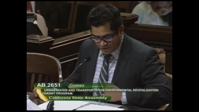 4MIN
Assembly Standing Committee on Water, Parks, and Wildlife
Bill Author

Bill Co-Author(s):