SB 379: Land use: general plan: safety element.
- Session Year: 2015-2016
- House: Senate
- Latest Version Date: 2015-10-08
The Planning and Zoning Law requires the legislative body of a city or county to adopt a comprehensive, long-term general plan that includes various elements, including, among others, a safety element for the protection of the community from unreasonable risks associated with the effects of various geologic hazards, flooding, and wildland and urban fires.
This bill would, upon the next revision of a local hazard mitigation plan on or after January 1, 2017, or, if the local jurisdiction has not adopted a local hazard mitigation plan, beginning on or before January 1, 2022, require the safety element to be reviewed and updated as necessary to address climate adaptation and resiliency strategies applicable to that city or county. The bill would require the update to include a set of goals, policies, and objectives based on a vulnerability assessment, identifying the risks that climate change poses to the local jurisdiction and the geographic areas at risk from climate change impacts, and specified information from federal, state, regional, and local agencies. By imposing new duties on cities and counties, the bill would impose a state-mandated local program.
The California Constitution requires the state to reimburse local agencies and school districts for certain costs mandated by the state. Statutory provisions establish procedures for making that reimbursement.
This bill would provide that no reimbursement is required by this act for a specified reason.
The Planning and Zoning Law requires the legislative body of a city or county to adopt a comprehensive, long-term general plan that includes various elements, including, among others, a safety element for the protection of the community from unreasonable risks associated with the effects of various geologic hazards, flooding, and wildland and urban fires.
This bill would, upon the next revision of a local hazard mitigation plan on or after January 1, 2017, or, if the local jurisdiction has not adopted a local hazard mitigation plan, beginning on or before January 1, 2022, require the safety element to be reviewed and updated as necessary to address climate adaptation and resiliency strategies applicable to that city or county. The bill would require the update to include a set of goals, policies, and objectives based on a vulnerability assessment, identifying the risks that climate change poses to the local jurisdiction and the geographic areas at risk from climate change impacts, and specified information from federal, state, regional, and local agencies. By imposing new duties on cities and counties, the bill would impose a state-mandated local program.
The California Constitution requires the state to reimburse local agencies and school districts for certain costs mandated by the state. Statutory provisions establish procedures for making that reimbursement.
This bill would provide that no reimbursement is required by this act for a specified reason.
The Planning and Zoning Law requires the legislative body of a city or county to adopt a comprehensive, long-term general plan that includes various elements, including, among others, a safety element for the protection of the community from unreasonable risks associated with the effects of various geologic hazards, flooding, and wildland and urban fires.
This bill would, upon the next revision of a local hazard mitigation plan on or after January 1, 2017, or, if the local jurisdiction has not adopted a local hazard mitigation plan, beginning on or before January 1, 2022, require the safety element to be reviewed and updated as necessary to address climate adaptation and resiliency strategies applicable to that city or county. The bill would require the update to include a set of goals, policies, and objectives based on a vulnerability assessment, identifying the risks that climate change poses to the local jurisdiction and the geographic areas at risk from climate change impacts, and specified information from federal, state, regional, and local agencies. By imposing new duties on cities and counties, the bill would impose a state-mandated local program.
The California Constitution requires the state to reimburse local agencies and school districts for certain costs mandated by the state. Statutory provisions establish procedures for making that reimbursement.
This bill would provide that no reimbursement is required by this act for a specified reason.
The Planning and Zoning Law requires the legislative body of a city or county to adopt a comprehensive, long-term general plan that includes various elements, including, among others, a safety element for the protection of the community from unreasonable risks associated with the effects of various geologic hazards, flooding, and wildland and urban fires.
This bill would, upon the next revision of a local hazard mitigation plan on or after January 1, 2017, or, if the local jurisdiction has not adopted a local hazard mitigation plan plan, beginning on or after before January 1, 2022, require the safety element to be reviewed and updated as necessary to address climate adaptation and resiliency strategies applicable to that city or county. The bill would require the update to include a set of goals, policies, and objectives based on a vulnerability assessment, identifying the risks that climate change poses to the local jurisdiction and the geographic areas at risk from climate change impacts, and specified information from federal, state, regional, and local agencies. By imposing new duties on cities and counties, the bill would impose a state-mandated local program.
The California Constitution requires the state to reimburse local agencies and school districts for certain costs mandated by the state. Statutory provisions establish procedures for making that reimbursement.
This bill would provide that no reimbursement is required by this act for a specified reason.
The Planning and Zoning Law requires the legislative body of a city or county to adopt a comprehensive, long-term general plan that includes various elements, including, among others, a safety element for the protection of the community from unreasonable risks associated with the effects of various geologic hazards, flooding, and wildland and urban fires.
This bill would, upon the next revision of the housing element a local hazard mitigation plan on or after January 1, 2017, or, if the local jurisdiction has not adopted a local hazard mitigation plan beginning on or after January 1, 2022, require the safety element to be reviewed and updated as necessary to address climate adaptation and resiliency strategies applicable to that city or county. The bill would require the update to include a set of goals, policies, and objectives based on a vulnerability assessment, identifying the risks that climate change poses to the local jurisdiction and the geographic areas at risk from climate change impacts, and specified information from federal, state, regional, and local agencies. By imposing new duties on cities and counties, the bill would impose a state-mandated local program.
The California Constitution requires the state to reimburse local agencies and school districts for certain costs mandated by the state. Statutory provisions establish procedures for making that reimbursement.
This bill would provide that no reimbursement is required by this act for a specified reason.
The Planning and Zoning Law requires the legislative body of a city or county to adopt a comprehensive, long-term general plan that includes various elements, including, among others, a safety element for the protection of the community from unreasonable risks associated with the effects of various geologic hazards, flooding, and wildland and urban fires.
This bill would, upon the next revision of the housing element on or after January 1, 2017, require the safety element to be reviewed and updated as necessary to address climate adaptation and resiliency strategies applicable to that city or county. The bill would require the update to include a set of goals, policies, and objectives based on a vulnerability assessment assessment, identifying the risks that climate change poses to the local jurisdiction and the geographic areas at risk from climate change impacts, and specified information from federal, state, regional, and local agencies. By imposing new duties on cities and counties, the bill would impose a state-mandated local program.
The California Constitution requires the state to reimburse local agencies and school districts for certain costs mandated by the state. Statutory provisions establish procedures for making that reimbursement.
This bill would provide that no reimbursement is required by this act for a specified reason.
The Planning and Zoning Law requires the legislative body of a city or county to adopt a comprehensive, long-term general plan that includes various elements, including, among others, a safety element for the protection of the community from unreasonable risks associated with the effects of various geologic hazards, flooding, and wildland and urban fires.
This bill would, upon the next revision of the housing element on or after January 1, 2017, require the safety element to be reviewed and updated as necessary to address climate adaptation and resiliency strategies applicable to that city or county. The bill would require the update to include a set of goals, policies, and objectives based on the most current information available regarding climate change adaptation and resiliency. a vulnerability assessment identifying the risks that climate change poses to the local jurisdiction and specified information from federal, state, regional, and local agencies. By imposing new duties on cities and counties, the bill would impose a state-mandated local program.
The California Constitution requires the state to reimburse local agencies and school districts for certain costs mandated by the state. Statutory provisions establish procedures for making that reimbursement.
This bill would provide that no reimbursement is required by this act for a specified reason.
The Planning and Zoning Law requires the legislative body of a city or county to adopt a comprehensive, long-term general plan that includes various elements, including, among others, a safety element for the protection of the community from unreasonable risks associated with the effects of various geologic hazards, flooding, and wildland and urban fires.
This bill would, upon the next revision of the housing element on or after January 1, 2017, require the safety element to be reviewed and updated as necessary to address climate adaptation and resiliency strategies applicable to that city or county. The bill would require the update to include a set of goals, policies, and objectives based on the most current information available regarding climate change adaptation and resiliency. By imposing new duties on cities and counties, the bill would impose a state-mandated local program.
The California Constitution requires the state to reimburse local agencies and school districts for certain costs mandated by the state. Statutory provisions establish procedures for making that reimbursement.
This bill would provide that no reimbursement is required by this act for a specified reason.
The general plan shall consist of a statement of development policies and shall include a diagram or diagrams and text setting forth objectives, principles, standards, and plan proposals. The plan shall include the following elements:
(a)A land use element that designates the proposed general distribution and general location and extent of the uses of the land for housing, business, industry, open space, including agriculture, natural resources, recreation, and enjoyment of scenic beauty, education, public buildings and grounds, solid and liquid waste disposal facilities, and other categories of public and private uses of land. The location and designation of the extent of the uses of the land for public and private uses shall consider the identification of land and natural resources pursuant to paragraph (3) of subdivision (d). The land use element shall include a statement of the standards of population density and building intensity recommended for the various districts and other territory covered by the plan. The land use element shall identify and annually review those areas covered by the plan that are subject to flooding identified by flood plain mapping prepared by the Federal Emergency Management Agency (FEMA) or the Department of Water Resources. The land use element shall also do both of the following:
(1)Designate in a land use category that provides for timber production those parcels of real property zoned for timberland production pursuant to the California Timberland Productivity Act of 1982 (Chapter 6.7 (commencing with Section 51100) of Part 1 of Division 1 of Title 5).
(2)Consider the impact of new growth on military readiness activities carried out on military bases, installations, and operating and training areas, when proposing zoning ordinances or designating land uses covered by the general plan for land, or other territory adjacent to military facilities, or underlying designated military aviation routes and airspace.
(A)In determining the impact of new growth on military readiness activities, information provided by military facilities shall be considered. Cities and counties shall address military impacts based on information from the military and other sources.
(B)The following definitions govern this paragraph:
(i)Military readiness activities mean all of the following:
(I)Training, support, and operations that prepare the men and women of the military for combat.
(II)Operation, maintenance, and security of any military installation.
(III)Testing of military equipment, vehicles, weapons, and sensors for proper operation or suitability for combat use.
(ii)Military installation means a base, camp, post, station, yard, center, homeport facility for any ship, or other activity under the jurisdiction of the United States Department of Defense as defined in paragraph (1) of subsection (g) of Section 2687 of Title 10 of the United States Code.
(b)(1)A circulation element consisting of the general location and extent of existing and proposed major thoroughfares, transportation routes, terminals, any military airports and ports, and other local public utilities and facilities, all correlated with the land use element of the plan.
(2)(A)Commencing January 1, 2011, upon any substantive revision of the circulation element, the legislative body shall modify the circulation element to plan for a balanced, multimodal transportation network that meets the needs of all users of streets, roads, and highways for safe and convenient travel in a manner that is suitable to the rural, suburban, or urban context of the general plan.
(B)For purposes of this paragraph, users of streets, roads, and highways mean bicyclists, children, persons with disabilities, motorists, movers of commercial goods, pedestrians, users of public transportation, and seniors.
(c)A housing element as provided in Article 10.6 (commencing with Section 65580).
(d)(1)A conservation element for the conservation, development, and utilization of natural resources including water and its hydraulic force, forests, soils, rivers and other waters, harbors, fisheries, wildlife, minerals, and other natural resources. The conservation element shall consider the effect of development within the jurisdiction, as described in the land use element, on natural resources located on public lands, including military installations. That portion of the conservation element including waters shall be developed in coordination with any countywide water agency and with all district and city agencies, including flood management, water conservation, or groundwater agencies that have developed, served, controlled, managed, or conserved water of any type for any purpose in the county or city for which the plan is prepared. Coordination shall include the discussion and evaluation of any water supply and demand information described in Section 65352.5, if that information has been submitted by the water agency to the city or county.
(2)The conservation element may also cover all of the following:
(A)The reclamation of land and waters.
(B)Prevention and control of the pollution of streams and other waters.
(C)Regulation of the use of land in stream channels and other areas required for the accomplishment of the conservation plan.
(D)Prevention, control, and correction of the erosion of soils, beaches, and shores.
(E)Protection of watersheds.
(F)The location, quantity and quality of the rock, sand, and gravel resources.
(3)Upon the next revision of the housing element on or after January 1, 2009, the conservation element shall identify rivers, creeks, streams, flood corridors, riparian habitats, and land that may accommodate floodwater for purposes of groundwater recharge and stormwater management.
(e)An open-space element as provided in Article 10.5 (commencing with Section 65560).
(f)(1)A noise element that shall identify and appraise noise problems in the community. The noise element shall analyze and quantify, to the extent practicable, as determined by the legislative body, current and projected noise levels for all of the following sources:
(A)Highways and freeways.
(B)Primary arterials and major local streets.
(C)Passenger and freight online railroad operations and ground rapid transit systems.
(D)Commercial, general aviation, heliport, helistop, and military airport operations, aircraft overflights, jet engine test stands, and all other ground facilities and maintenance functions related to airport operation.
(E)Local industrial plants, including, but not limited to, railroad classification yards.
(F)Other ground stationary noise sources, including, but not limited to, military installations, identified by local agencies as contributing to the community noise environment.
(2)Noise contours shall be shown for all of these sources and stated in terms of community noise equivalent level (CNEL) or day-night average sound level (Ldn). The noise contours shall be prepared on the basis of noise monitoring or following generally accepted noise modeling techniques for the various sources identified in paragraphs (1) to (6), inclusive.
(3)The noise contours shall be used as a guide for establishing a pattern of land uses in the land use element that minimizes the exposure of community residents to excessive noise.
(4)The noise element shall include implementation measures and possible solutions that address existing and foreseeable noise problems, if any. The adopted noise element shall serve as a guideline for compliance with the states noise insulation standards.
(g)(1)A safety element for the protection of the community from any unreasonable risks associated with the effects of seismically induced surface rupture, ground shaking, ground failure, tsunami, seiche, and dam failure; slope instability leading to mudslides and landslides; subsidence; liquefaction; and other seismic hazards identified pursuant to Chapter 7.8 (commencing with Section 2690) of Division 2 of the Public Resources Code, and other geologic hazards known to the legislative body; flooding; and wildland and urban fires. The safety element shall include mapping of known seismic and other geologic hazards. It shall also address evacuation routes, military installations, peakload water supply requirements, and minimum road widths and clearances around structures, as those items relate to identified fire and geologic hazards.
(2)The safety element, upon the next revision of the housing element on or after January 1, 2009, shall also do the following:
(A)Identify information regarding flood hazards, including, but not limited to, the following:
(i)Flood hazard zones. As used in this subdivision, flood hazard zone means an area subject to flooding that is delineated as either a special hazard area or an area of moderate or minimal hazard on an official flood insurance rate map issued by the Federal Emergency Management Agency (FEMA). The identification of a flood hazard zone does not imply that areas outside the flood hazard zones or uses permitted within flood hazard zones will be free from flooding or flood damage.
(ii)National Flood Insurance Program maps published by FEMA.
(iii)Information about flood hazards that is available from the United States Army Corps of Engineers.
(iv)Designated floodway maps that are available from the Central Valley Flood Protection Board.
(v)Dam failure inundation maps prepared pursuant to Section 8589.5 that are available from the Office of Emergency Services.
(vi)Awareness Floodplain Mapping Program maps and 200-year flood plain maps that are or may be available from, or accepted by, the Department of Water Resources.
(vii)Maps of levee protection zones.
(viii)Areas subject to inundation in the event of the failure of project or nonproject levees or floodwalls.
(ix)Historical data on flooding, including locally prepared maps of areas that are subject to flooding, areas that are vulnerable to flooding after wildfires, and sites that have been repeatedly damaged by flooding.
(x)Existing and planned development in flood hazard zones, including structures, roads, utilities, and essential public facilities.
(xi)Local, state, and federal agencies with responsibility for flood protection, including special districts and local offices of emergency services.
(B)Establish a set of comprehensive goals, policies, and objectives based on the information identified pursuant to subparagraph (A), for the protection of the community from the unreasonable risks of flooding, including, but not limited to:
(i)Avoiding or minimizing the risks of flooding to new development.
(ii)Evaluating whether new development should be located in flood hazard zones, and identifying construction methods or other methods to minimize damage if new development is located in flood hazard zones.
(iii)Maintaining the structural and operational integrity of essential public facilities during flooding.
(iv)Locating, when feasible, new essential public facilities outside of flood hazard zones, including hospitals and health care facilities, emergency shelters, fire stations, emergency command centers, and emergency communications facilities or identifying construction methods or other methods to minimize damage if these facilities are located in flood hazard zones.
(v)Establishing cooperative working relationships among public agencies with responsibility for flood protection.
(C)Establish a set of feasible implementation measures designed to carry out the goals, policies, and objectives established pursuant to subparagraph (B).
(3)Upon the next revision of the housing element on or after January 1, 2014, the safety element shall be reviewed and updated as necessary to address the risk of fire for land classified as state responsibility areas, as defined in Section 4102 of the Public Resources Code, and land classified as very high fire hazard severity zones, as defined in Section 51177. This review shall consider the advice included in the Office of Planning and Researchs most recent publication of Fire Hazard Planning, General Plan Technical Advice Series and shall also include all of the following:
(A)Information regarding fire hazards, including, but not limited to, all of the following:
(i)Fire hazard severity zone maps available from the Department of Forestry and Fire Protection.
(ii) Any historical data on wildfires available from local agencies or a reference to where the data can be found.
(iii)Information about wildfire hazard areas that may be available from the United States Geological Survey.
(iv)General location and distribution of existing and planned uses of land in very high fire hazard severity zones and in state responsibility areas, including structures, roads, utilities, and essential public facilities. The location and distribution of planned uses of land shall not require defensible space compliance measures required by state law or local ordinance to occur on publicly owned lands or open space designations of homeowner associations.
(v)Local, state, and federal agencies with responsibility for fire protection, including special districts and local offices of emergency services.
(B)A set of goals, policies, and objectives based on the information identified pursuant to subparagraph (A) for the protection of the community from the unreasonable risk of wildfire.
(C)A set of feasible implementation measures designed to carry out the goals, policies, and objectives based on the information identified pursuant to subparagraph (B) including, but not limited to, all of the following:
(i)Avoiding or minimizing the wildfire hazards associated with new uses of land.
(ii)Locating, when feasible, new essential public facilities outside of high fire risk areas, including, but not limited to, hospitals and health care facilities, emergency shelters, emergency command centers, and emergency communications facilities, or identifying construction methods or other methods to minimize damage if these facilities are located in a state responsibility area or very high fire hazard severity zone.
(iii)Designing adequate infrastructure if a new development is located in a state responsibility area or in a very high fire hazard severity zone, including safe access for emergency response vehicles, visible street signs, and water supplies for structural fire suppression.
(iv)Working cooperatively with public agencies with responsibility for fire protection.
(D)If a city or county has adopted a fire safety plan or document separate from the general plan, an attachment of, or reference to, a city or countys adopted fire safety plan or document that fulfills commensurate goals and objectives and contains information required pursuant to this paragraph.
(4)Upon the next revision of a local hazard mitigation plan, adopted in accordance with the federal Disaster Mitigation Act of 2000 (Public Law 106-390), on or after January 1, 2017, or, if a local jurisdiction has not adopted a local hazard mitigation plan, beginning on or before January 1, 2022, the safety element shall be reviewed and updated as necessary to address climate adaptation and resiliency strategies applicable to the city or county. This review shall consider advice provided in the Office of Planning and Researchs General Plan Guidelines and shall include all of the following:
(A)(i)A vulnerability assessment that identifies the risks that climate change poses to the local jurisdiction and the geographic areas at risk from climate change impacts, including, but not limited to, an assessment of how climate change may affect the risks addressed pursuant to paragraphs (2) and (3).
(ii)Information that may be available from federal, state, regional, and local agencies that will assist in developing the vulnerability assessment and the adaptation policies and strategies required pursuant to subparagraph (B), including, but not limited to, all of the following:
(I)Information from the Internet-based Cal-Adapt tool.
(II)Information from the most recent version of the California Adaptation Planning Guide.
(III)Information from local agencies on the types of assets, resources, and populations that will be sensitive to various climate change exposures.
(IV)Information from local agencies on their current ability to deal with the impacts of climate change.
(V)Historical data on natural events and hazards, including locally prepared maps of areas subject to previous risk, areas that are vulnerable, and sites that have been repeatedly damaged.
(VI)Existing and planned development in identified at-risk areas, including structures, roads, utilities, and essential public facilities.
(VII)Federal, state, regional, and local agencies with responsibility for the protection of public health and safety and the environment, including special districts and local offices of emergency services.
(B)A set of adaptation and resilience goals, policies, and objectives based on the information specified in subparagraph (A) for the protection of the community.
(C)A set of feasible implementation measures designed to carry out the goals, policies, and objectives identified pursuant to subparagraph (B) including, but not limited to, all of the following:
(i)Feasible methods to avoid or minimize climate change impacts associated with new uses of land.
(ii)The location, when feasible, of new essential public facilities outside of at-risk areas, including, but not limited to, hospitals and health care facilities, emergency shelters, emergency command centers, and emergency communications facilities, or identifying construction methods or other methods to minimize damage if these facilities are located in at-risk areas.
(iii)The designation of adequate and feasible infrastructure located in an at-risk area.
(iv)Guidelines for working cooperatively with relevant local, regional, state, and federal agencies.
(v)The identification of natural infrastructure that may be used in adaptation projects, where feasible. Where feasible, the plan shall use existing natural features and ecosystem processes, or the restoration of natural features and ecosystem processes, when developing alternatives for consideration. For the purposes of this clause, natural infrastructure means the preservation or restoration of ecological systems, or utilization of engineered systems that use ecological processes, to increase resiliency to climate change, manage other environmental hazards, or both. This may include, but is not limited to, floodplain and wetlands restoration or preservation, combining levees with restored natural systems to reduce flood risk, and urban tree planting to mitigate high heat days.
(D)(i)If a city or county has adopted the local hazard mitigation plan, or other climate adaptation plan or document that fulfills commensurate goals and objectives and contains the information required pursuant to this paragraph, separate from the general plan, an attachment of, or reference to, the local hazard mitigation plan or other climate adaptation plan or document.
(ii)Cities or counties that have an adopted hazard mitigation plan, or other climate adaptation plan or document that substantially complies with this section, or have substantially equivalent provisions to this subdivision in their general plans, may use that information in the safety element to comply with this subdivision, and shall summarize and incorporate by reference into the safety element the other general plan provisions, climate adaptation plan or document, specifically showing how each requirement of this subdivision has been met.
(5)After the initial revision of the safety element pursuant to paragraphs (2), (3), and (4) upon each revision of the housing element, the planning agency shall review and, if necessary, revise the safety element to identify new information that was not available during the previous revision of the safety element.
(6)Cities and counties that have flood plain management ordinances that have been approved by FEMA that substantially comply with this section, or have substantially equivalent provisions to this subdivision in their general plans, may use that information in the safety element to comply with this subdivision, and shall summarize and incorporate by reference into the safety element the other general plan provisions or the flood plain ordinance, specifically showing how each requirement of this subdivision has been met.
(7)Prior to the periodic review of its general plan and prior to preparing or revising its safety element, each city and county shall consult the California Geological Survey of the Department of Conservation, the Central Valley Flood Protection Board, if the city or county is located within the boundaries of the Sacramento and San Joaquin Drainage District, as set forth in Section 8501 of the Water Code, and the Office of Emergency Services for the purpose of including information known by and available to the department, the agency, and the board required by this subdivision.
(8)To the extent that a countys safety element is sufficiently detailed and contains appropriate policies and programs for adoption by a city, a city may adopt that portion of the countys safety element that pertains to the citys planning area in satisfaction of the requirement imposed by this subdivision.
SEC. 2.No reimbursement is required by this act pursuant to Section 6 of Article XIIIB of the California Constitution because a local agency or school district has the authority to levy service charges, fees, or assessments sufficient to pay for the program or level of service mandated by this act, within the meaning of Section 17556 of the Government Code.
The general plan shall consist of a statement of development policies and shall include a diagram or diagrams and text setting forth objectives, principles, standards, and plan proposals. The plan shall include the following elements:
(a)A land use element that designates the proposed general distribution and general location and extent of the uses of the land for housing, business, industry, open space, including agriculture, natural resources, recreation, and enjoyment of scenic beauty, education, public buildings and grounds, solid and liquid waste disposal facilities, and other categories of public and private uses of land. The location and designation of the extent of the uses of the land for public and private uses shall consider the identification of land and natural resources pursuant to paragraph (3) of subdivision (d). The land use element shall include a statement of the standards of population density and building intensity recommended for the various districts and other territory covered by the plan. The land use element shall identify and annually review those areas covered by the plan that are subject to flooding identified by flood plain mapping prepared by the Federal Emergency Management Agency (FEMA) or the Department of Water Resources. The land use element shall also do both of the following:
(1)Designate in a land use category that provides for timber production those parcels of real property zoned for timberland production pursuant to the California Timberland Productivity Act of 1982 (Chapter 6.7 (commencing with Section 51100) of Part 1 of Division 1 of Title 5).
(2)Consider the impact of new growth on military readiness activities carried out on military bases, installations, and operating and training areas, when proposing zoning ordinances or designating land uses covered by the general plan for land, or other territory adjacent to military facilities, or underlying designated military aviation routes and airspace.
(A)In determining the impact of new growth on military readiness activities, information provided by military facilities shall be considered. Cities and counties shall address military impacts based on information from the military and other sources.
(B)The following definitions govern this paragraph:
(i)Military readiness activities mean all of the following:
(I)Training, support, and operations that prepare the men and women of the military for combat.
(II)Operation, maintenance, and security of any military installation.
(III)Testing of military equipment, vehicles, weapons, and sensors for proper operation or suitability for combat use.
(ii)Military installation means a base, camp, post, station, yard, center, homeport facility for any ship, or other activity under the jurisdiction of the United States Department of Defense as defined in paragraph (1) of subsection (g) of Section 2687 of Title 10 of the United States Code.
(b)(1)A circulation element consisting of the general location and extent of existing and proposed major thoroughfares, transportation routes, terminals, any military airports and ports, and other local public utilities and facilities, all correlated with the land use element of the plan.
(2)(A)Commencing January 1, 2011, upon any substantive revision of the circulation element, the legislative body shall modify the circulation element to plan for a balanced, multimodal transportation network that meets the needs of all users of streets, roads, and highways for safe and convenient travel in a manner that is suitable to the rural, suburban, or urban context of the general plan.
(B)For purposes of this paragraph, users of streets, roads, and highways mean bicyclists, children, persons with disabilities, motorists, movers of commercial goods, pedestrians, users of public transportation, and seniors.
(c)A housing element as provided in Article 10.6 (commencing with Section 65580).
(d)(1)A conservation element for the conservation, development, and utilization of natural resources including water and its hydraulic force, forests, soils, rivers and other waters, harbors, fisheries, wildlife, minerals, and other natural resources. The conservation element shall consider the effect of development within the jurisdiction, as described in the land use element, on natural resources located on public lands, including military installations. That portion of the conservation element including waters shall be developed in coordination with any countywide water agency and with all district and city agencies, including flood management, water conservation, or groundwater agencies that have developed, served, controlled, managed, or conserved water of any type for any purpose in the county or city for which the plan is prepared. Coordination shall include the discussion and evaluation of any water supply and demand information described in Section 65352.5, if that information has been submitted by the water agency to the city or county.
(2)The conservation element may also cover all of the following:
(A)The reclamation of land and waters.
(B)Prevention and control of the pollution of streams and other waters.
(C)Regulation of the use of land in stream channels and other areas required for the accomplishment of the conservation plan.
(D)Prevention, control, and correction of the erosion of soils, beaches, and shores.
(E)Protection of watersheds.
(F)The location, quantity and quality of the rock, sand, and gravel resources.
(3)Upon the next revision of the housing element on or after January 1, 2009, the conservation element shall identify rivers, creeks, streams, flood corridors, riparian habitats, and land that may accommodate floodwater for purposes of groundwater recharge and stormwater management.
(e)An open-space element as provided in Article 10.5 (commencing with Section 65560).
(f)(1)A noise element that shall identify and appraise noise problems in the community. The noise element shall analyze and quantify, to the extent practicable, as determined by the legislative body, current and projected noise levels for all of the following sources:
(A)Highways and freeways.
(B)Primary arterials and major local streets.
(C)Passenger and freight online railroad operations and ground rapid transit systems.
(D)Commercial, general aviation, heliport, helistop, and military airport operations, aircraft overflights, jet engine test stands, and all other ground facilities and maintenance functions related to airport operation.
(E)Local industrial plants, including, but not limited to, railroad classification yards.
(F)Other ground stationary noise sources, including, but not limited to, military installations, identified by local agencies as contributing to the community noise environment.
(2)Noise contours shall be shown for all of these sources and stated in terms of community noise equivalent level (CNEL) or day-night average sound level (Ldn). The noise contours shall be prepared on the basis of noise monitoring or following generally accepted noise modeling techniques for the various sources identified in paragraphs (1) to (6), inclusive.
(3)The noise contours shall be used as a guide for establishing a pattern of land uses in the land use element that minimizes the exposure of community residents to excessive noise.
(4)The noise element shall include implementation measures and possible solutions that address existing and foreseeable noise problems, if any. The adopted noise element shall serve as a guideline for compliance with the states noise insulation standards.
(g)(1)A safety element for the protection of the community from any unreasonable risks associated with the effects of seismically induced surface rupture, ground shaking, ground failure, tsunami, seiche, and dam failure; slope instability leading to mudslides and landslides; subsidence; liquefaction; and other seismic hazards identified pursuant to Chapter 7.8 (commencing with Section 2690) of Division 2 of the Public Resources Code, and other geologic hazards known to the legislative body; flooding; and wildland and urban fires. The safety element shall include mapping of known seismic and other geologic hazards. It shall also address evacuation routes, military installations, peakload water supply requirements, and minimum road widths and clearances around structures, as those items relate to identified fire and geologic hazards.
(2)The safety element, upon the next revision of the housing element on or after January 1, 2009, shall also do the following:
(A)Identify information regarding flood hazards, including, but not limited to, the following:
(i)Flood hazard zones. As used in this subdivision, flood hazard zone means an area subject to flooding that is delineated as either a special hazard area or an area of moderate or minimal hazard on an official flood insurance rate map issued by the Federal Emergency Management Agency (FEMA). The identification of a flood hazard zone does not imply that areas outside the flood hazard zones or uses permitted within flood hazard zones will be free from flooding or flood damage.
(ii)National Flood Insurance Program maps published by FEMA.
(iii)Information about flood hazards that is available from the United States Army Corps of Engineers.
(iv)Designated floodway maps that are available from the Central Valley Flood Protection Board.
(v)Dam failure inundation maps prepared pursuant to Section 8589.5 that are available from the Office of Emergency Services.
(vi)Awareness Floodplain Mapping Program maps and 200-year flood plain maps that are or may be available from, or accepted by, the Department of Water Resources.
(vii)Maps of levee protection zones.
(viii)Areas subject to inundation in the event of the failure of project or nonproject levees or floodwalls.
(ix)Historical data on flooding, including locally prepared maps of areas that are subject to flooding, areas that are vulnerable to flooding after wildfires, and sites that have been repeatedly damaged by flooding.
(x)Existing and planned development in flood hazard zones, including structures, roads, utilities, and essential public facilities.
(xi)Local, state, and federal agencies with responsibility for flood protection, including special districts and local offices of emergency services.
(B)Establish a set of comprehensive goals, policies, and objectives based on the information identified pursuant to subparagraph (A), for the protection of the community from the unreasonable risks of flooding, including, but not limited to:
(i)Avoiding or minimizing the risks of flooding to new development.
(ii)Evaluating whether new development should be located in flood hazard zones, and identifying construction methods or other methods to minimize damage if new development is located in flood hazard zones.
(iii)Maintaining the structural and operational integrity of essential public facilities during flooding.
(iv)Locating, when feasible, new essential public facilities outside of flood hazard zones, including hospitals and health care facilities, emergency shelters, fire stations, emergency command centers, and emergency communications facilities or identifying construction methods or other methods to minimize damage if these facilities are located in flood hazard zones.
(v)Establishing cooperative working relationships among public agencies with responsibility for flood protection.
(C)Establish a set of feasible implementation measures designed to carry out the goals, policies, and objectives established pursuant to subparagraph (B).
(3)Upon the next revision of the housing element on or after January 1, 2014, the safety element shall be reviewed and updated as necessary to address the risk of fire for land classified as state responsibility areas, as defined in Section 4102 of the Public Resources Code, and land classified as very high fire hazard severity zones, as defined in Section 51177. This review shall consider the advice included in the Office of Planning and Researchs most recent publication of Fire Hazard Planning, General Plan Technical Advice Series and shall also include all of the following:
(A)Information regarding fire hazards, including, but not limited to, all of the following:
(i)Fire hazard severity zone maps available from the Department of Forestry and Fire Protection.
(ii) Any historical data on wildfires available from local agencies or a reference to where the data can be found.
(iii)Information about wildfire hazard areas that may be available from the United States Geological Survey.
(iv)General location and distribution of existing and planned uses of land in very high fire hazard severity zones and in state responsibility areas, including structures, roads, utilities, and essential public facilities. The location and distribution of planned uses of land shall not require defensible space compliance measures required by state law or local ordinance to occur on publicly owned lands or open space designations of homeowner associations.
(v)Local, state, and federal agencies with responsibility for fire protection, including special districts and local offices of emergency services.
(B)A set of goals, policies, and objectives based on the information identified pursuant to subparagraph (A) for the protection of the community from the unreasonable risk of wildfire.
(C)A set of feasible implementation measures designed to carry out the goals, policies, and objectives based on the information identified pursuant to subparagraph (B) including, but not limited to, all of the following:
(i)Avoiding or minimizing the wildfire hazards associated with new uses of land.
(ii)Locating, when feasible, new essential public facilities outside of high fire risk areas, including, but not limited to, hospitals and health care facilities, emergency shelters, emergency command centers, and emergency communications facilities, or identifying construction methods or other methods to minimize damage if these facilities are located in a state responsibility area or very high fire hazard severity zone.
(iii)Designing adequate infrastructure if a new development is located in a state responsibility area or in a very high fire hazard severity zone, including safe access for emergency response vehicles, visible street signs, and water supplies for structural fire suppression.
(iv)Working cooperatively with public agencies with responsibility for fire protection.
(D)If a city or county has adopted a fire safety plan or document separate from the general plan, an attachment of, or reference to, a city or countys adopted fire safety plan or document that fulfills commensurate goals and objectives and contains information required pursuant to this paragraph.
(4)Upon the next revision of a local hazard mitigation plan, adopted in accordance with the federal Disaster Mitigation Act of 2000 (Public Law 106-390), on or after January 1, 2017, or, if a local jurisdiction has not adopted a local hazard mitigation plan, beginning on or before January 1, 2022, the safety element shall be reviewed and updated as necessary to address climate adaptation and resiliency strategies applicable to the city or county. This review shall consider advice provided in the Office of Planning and Researchs General Plan Guidelines and shall include all of the following:
(A)(i)A vulnerability assessment that identifies the risks that climate change poses to the local jurisdiction and the geographic areas at risk from climate change impacts, including, but not limited to, an assessment of how climate change may affect the risks addressed pursuant to paragraphs (2) and (3).
(ii)Information that may be available from federal, state, regional, and local agencies that will assist in developing the vulnerability assessment and the adaptation policies and strategies required pursuant to subparagraph (B), including, but not limited to, all of the following:
(I)Information from the Internet-based Cal-Adapt tool.
(II)Information from the most recent version of the California Adaptation Planning Guide.
(III)Information from local agencies on the types of assets, resources, and populations that will be sensitive to various climate change exposures.
(IV)Information from local agencies on their current ability to deal with the impacts of climate change.
(V)Historical data on natural events and hazards, including locally prepared maps of areas subject to previous risk, areas that are vulnerable, and sites that have been repeatedly damaged.
(VI)Existing and planned development in identified at-risk areas, including structures, roads, utilities, and essential public facilities.
(VII)Federal, state, regional, and local agencies with responsibility for the protection of public health and safety and the environment, including special districts and local offices of emergency services.
(B)A set of adaptation and resilience goals, policies, and objectives based on the information specified in subparagraph (A) for the protection of the community.
(C)A set of feasible implementation measures designed to carry out the goals, policies, and objectives identified pursuant to subparagraph (B) including, but not limited to, all of the following:
(i)Feasible methods to avoid or minimize climate change impacts associated with new uses of land.
(ii)The location, when feasible, of new essential public facilities outside of at-risk areas, including, but not limited to, hospitals and health care facilities, emergency shelters, emergency command centers, and emergency communications facilities, or identifying construction methods or other methods to minimize damage if these facilities are located in at-risk areas.
(iii)The designation of adequate and feasible infrastructure located in an at-risk area.
(iv)Guidelines for working cooperatively with relevant local, regional, state, and federal agencies.
(v)The identification of natural infrastructure that may be used in adaptation projects, where feasible. Where feasible, the plan shall use existing natural features and ecosystem processes, or the restoration of natural features and ecosystem processes, when developing alternatives for consideration. For the purposes of this clause, natural infrastructure means the preservation or restoration of ecological systems, or utilization of engineered systems that use ecological processes, to increase resiliency to climate change, manage other environmental hazards, or both. This may include, but is not limited to, floodplain and wetlands restoration or preservation, combining levees with restored natural systems to reduce flood risk, and urban tree planting to mitigate high heat days.
(D)(i)If a city or county has adopted the local hazard mitigation plan, or other climate adaptation plan or document that fulfills commensurate goals and objectives and contains the information required pursuant to this paragraph, separate from the general plan, an attachment of, or reference to, the local hazard mitigation plan or other climate adaptation plan or document.
(ii)Cities or counties that have an adopted hazard mitigation plan, or other climate adaptation plan or document that substantially complies with this section, or have substantially equivalent provisions to this subdivision in their general plans, may use that information in the safety element to comply with this subdivision, and shall summarize and incorporate by reference into the safety element the other general plan provisions, climate adaptation plan or document, specifically showing how each requirement of this subdivision has been met.
(5)After the initial revision of the safety element pursuant to paragraphs (2), (3), and (4) upon each revision of the housing element, the planning agency shall review and, if necessary, revise the safety element to identify new information that was not available during the previous revision of the safety element.
(6)Cities and counties that have flood plain management ordinances that have been approved by FEMA that substantially comply with this section, or have substantially equivalent provisions to this subdivision in their general plans, may use that information in the safety element to comply with this subdivision, and shall summarize and incorporate by reference into the safety element the other general plan provisions or the flood plain ordinance, specifically showing how each requirement of this subdivision has been met.
(7)Prior to the periodic review of its general plan and prior to preparing or revising its safety element, each city and county shall consult the California Geological Survey of the Department of Conservation, the Central Valley Flood Protection Board, if the city or county is located within the boundaries of the Sacramento and San Joaquin Drainage District, as set forth in Section 8501 of the Water Code, and the Office of Emergency Services for the purpose of including information known by and available to the department, the agency, and the board required by this subdivision.
(8)To the extent that a countys safety element is sufficiently detailed and contains appropriate policies and programs for adoption by a city, a city may adopt that portion of the countys safety element that pertains to the citys planning area in satisfaction of the requirement imposed by this subdivision.
SEC. 2.No reimbursement is required by this act pursuant to Section 6 of Article XIIIB of the California Constitution because a local agency or school district has the authority to levy service charges, fees, or assessments sufficient to pay for the program or level of service mandated by this act, within the meaning of Section 17556 of the Government Code.
The general plan shall consist of a statement of development policies and shall include a diagram or diagrams and text setting forth objectives, principles, standards, and plan proposals. The plan shall include the following elements:
(a)A land use element that designates the proposed general distribution and general location and extent of the uses of the land for housing, business, industry, open space, including agriculture, natural resources, recreation, and enjoyment of scenic beauty, education, public buildings and grounds, solid and liquid waste disposal facilities, and other categories of public and private uses of land. The location and designation of the extent of the uses of the land for public and private uses shall consider the identification of land and natural resources pursuant to paragraph (3) of subdivision (d). The land use element shall include a statement of the standards of population density and building intensity recommended for the various districts and other territory covered by the plan. The land use element shall identify and annually review those areas covered by the plan that are subject to flooding identified by flood plain mapping prepared by the Federal Emergency Management Agency (FEMA) or the Department of Water Resources. The land use element shall also do both of the following:
(1)Designate in a land use category that provides for timber production those parcels of real property zoned for timberland production pursuant to the California Timberland Productivity Act of 1982 (Chapter 6.7 (commencing with Section 51100) of Part 1 of Division 1 of Title 5).
(2)Consider the impact of new growth on military readiness activities carried out on military bases, installations, and operating and training areas, when proposing zoning ordinances or designating land uses covered by the general plan for land, or other territory adjacent to military facilities, or underlying designated military aviation routes and airspace.
(A)In determining the impact of new growth on military readiness activities, information provided by military facilities shall be considered. Cities and counties shall address military impacts based on information from the military and other sources.
(B)The following definitions govern this paragraph:
(i)Military readiness activities mean all of the following:
(I)Training, support, and operations that prepare the men and women of the military for combat.
(II)Operation, maintenance, and security of any military installation.
(III)Testing of military equipment, vehicles, weapons, and sensors for proper operation or suitability for combat use.
(ii)Military installation means a base, camp, post, station, yard, center, homeport facility for any ship, or other activity under the jurisdiction of the United States Department of Defense as defined in paragraph (1) of subsection (g) of Section 2687 of Title 10 of the United States Code.
(b)(1)A circulation element consisting of the general location and extent of existing and proposed major thoroughfares, transportation routes, terminals, any military airports and ports, and other local public utilities and facilities, all correlated with the land use element of the plan.
(2)(A)Commencing January 1, 2011, upon any substantive revision of the circulation element, the legislative body shall modify the circulation element to plan for a balanced, multimodal transportation network that meets the needs of all users of streets, roads, and highways for safe and convenient travel in a manner that is suitable to the rural, suburban, or urban context of the general plan.
(B)For purposes of this paragraph, users of streets, roads, and highways mean bicyclists, children, persons with disabilities, motorists, movers of commercial goods, pedestrians, users of public transportation, and seniors.
(c)A housing element as provided in Article 10.6 (commencing with Section 65580).
(d)(1)A conservation element for the conservation, development, and utilization of natural resources including water and its hydraulic force, forests, soils, rivers and other waters, harbors, fisheries, wildlife, minerals, and other natural resources. The conservation element shall consider the effect of development within the jurisdiction, as described in the land use element, on natural resources located on public lands, including military installations. That portion of the conservation element including waters shall be developed in coordination with any countywide water agency and with all district and city agencies, including flood management, water conservation, or groundwater agencies that have developed, served, controlled, managed, or conserved water of any type for any purpose in the county or city for which the plan is prepared. Coordination shall include the discussion and evaluation of any water supply and demand information described in Section 65352.5, if that information has been submitted by the water agency to the city or county.
(2)The conservation element may also cover all of the following:
(A)The reclamation of land and waters.
(B)Prevention and control of the pollution of streams and other waters.
(C)Regulation of the use of land in stream channels and other areas required for the accomplishment of the conservation plan.
(D)Prevention, control, and correction of the erosion of soils, beaches, and shores.
(E)Protection of watersheds.
(F)The location, quantity and quality of the rock, sand, and gravel resources.
(3)Upon the next revision of the housing element on or after January 1, 2009, the conservation element shall identify rivers, creeks, streams, flood corridors, riparian habitats, and land that may accommodate floodwater for purposes of groundwater recharge and stormwater management.
(e)An open-space element as provided in Article 10.5 (commencing with Section 65560).
(f)(1)A noise element that shall identify and appraise noise problems in the community. The noise element shall analyze and quantify, to the extent practicable, as determined by the legislative body, current and projected noise levels for all of the following sources:
(A)Highways and freeways.
(B)Primary arterials and major local streets.
(C)Passenger and freight online railroad operations and ground rapid transit systems.
(D)Commercial, general aviation, heliport, helistop, and military airport operations, aircraft overflights, jet engine test stands, and all other ground facilities and maintenance functions related to airport operation.
(E)Local industrial plants, including, but not limited to, railroad classification yards.
(F)Other ground stationary noise sources, including, but not limited to, military installations, identified by local agencies as contributing to the community noise environment.
(2)Noise contours shall be shown for all of these sources and stated in terms of community noise equivalent level (CNEL) or day-night average sound level (Ldn). The noise contours shall be prepared on the basis of noise monitoring or following generally accepted noise modeling techniques for the various sources identified in paragraphs (1) to (6), inclusive.
(3)The noise contours shall be used as a guide for establishing a pattern of land uses in the land use element that minimizes the exposure of community residents to excessive noise.
(4)The noise element shall include implementation measures and possible solutions that address existing and foreseeable noise problems, if any. The adopted noise element shall serve as a guideline for compliance with the states noise insulation standards.
(g)(1)A safety element for the protection of the community from any unreasonable risks associated with the effects of seismically induced surface rupture, ground shaking, ground failure, tsunami, seiche, and dam failure; slope instability leading to mudslides and landslides; subsidence; liquefaction; and other seismic hazards identified pursuant to Chapter 7.8 (commencing with Section 2690) of Division 2 of the Public Resources Code, and other geologic hazards known to the legislative body; flooding; and wildland and urban fires. The safety element shall include mapping of known seismic and other geologic hazards. It shall also address evacuation routes, military installations, peakload water supply requirements, and minimum road widths and clearances around structures, as those items relate to identified fire and geologic hazards.
(2)The safety element, upon the next revision of the housing element on or after January 1, 2009, shall also do the following:
(A)Identify information regarding flood hazards, including, but not limited to, the following:
(i)Flood hazard zones. As used in this subdivision, flood hazard zone means an area subject to flooding that is delineated as either a special hazard area or an area of moderate or minimal hazard on an official flood insurance rate map issued by the Federal Emergency Management Agency (FEMA). The identification of a flood hazard zone does not imply that areas outside the flood hazard zones or uses permitted within flood hazard zones will be free from flooding or flood damage.
(ii)National Flood Insurance Program maps published by FEMA.
(iii)Information about flood hazards that is available from the United States Army Corps of Engineers.
(iv)Designated floodway maps that are available from the Central Valley Flood Protection Board.
(v)Dam failure inundation maps prepared pursuant to Section 8589.5 that are available from the Office of Emergency Services.
(vi)Awareness Floodplain Mapping Program maps and 200-year flood plain maps that are or may be available from, or accepted by, the Department of Water Resources.
(vii)Maps of levee protection zones.
(viii)Areas subject to inundation in the event of the failure of project or nonproject levees or floodwalls.
(ix)Historical data on flooding, including locally prepared maps of areas that are subject to flooding, areas that are vulnerable to flooding after wildfires, and sites that have been repeatedly damaged by flooding.
(x)Existing and planned development in flood hazard zones, including structures, roads, utilities, and essential public facilities.
(xi)Local, state, and federal agencies with responsibility for flood protection, including special districts and local offices of emergency services.
(B)Establish a set of comprehensive goals, policies, and objectives based on the information identified pursuant to subparagraph (A), for the protection of the community from the unreasonable risks of flooding, including, but not limited to:
(i)Avoiding or minimizing the risks of flooding to new development.
(ii)Evaluating whether new development should be located in flood hazard zones, and identifying construction methods or other methods to minimize damage if new development is located in flood hazard zones.
(iii)Maintaining the structural and operational integrity of essential public facilities during flooding.
(iv)Locating, when feasible, new essential public facilities outside of flood hazard zones, including hospitals and health care facilities, emergency shelters, fire stations, emergency command centers, and emergency communications facilities or identifying construction methods or other methods to minimize damage if these facilities are located in flood hazard zones.
(v)Establishing cooperative working relationships among public agencies with responsibility for flood protection.
(C)Establish a set of feasible implementation measures designed to carry out the goals, policies, and objectives established pursuant to subparagraph (B).
(3)Upon the next revision of the housing element on or after January 1, 2014, the safety element shall be reviewed and updated as necessary to address the risk of fire for land classified as state responsibility areas, as defined in Section 4102 of the Public Resources Code, and land classified as very high fire hazard severity zones, as defined in Section 51177. This review shall consider the advice included in the Office of Planning and Researchs most recent publication of Fire Hazard Planning, General Plan Technical Advice Series and shall also include all of the following:
(A)Information regarding fire hazards, including, but not limited to, all of the following:
(i)Fire hazard severity zone maps available from the Department of Forestry and Fire Protection.
(ii) Any historical data on wildfires available from local agencies or a reference to where the data can be found.
(iii)Information about wildfire hazard areas that may be available from the United States Geological Survey.
(iv)General location and distribution of existing and planned uses of land in very high fire hazard severity zones and in state responsibility areas, including structures, roads, utilities, and essential public facilities. The location and distribution of planned uses of land shall not require defensible space compliance measures required by state law or local ordinance to occur on publicly owned lands or open space designations of homeowner associations.
(v)Local, state, and federal agencies with responsibility for fire protection, including special districts and local offices of emergency services.
(B)A set of goals, policies, and objectives based on the information identified pursuant to subparagraph (A) for the protection of the community from the unreasonable risk of wildfire.
(C)A set of feasible implementation measures designed to carry out the goals, policies, and objectives based on the information identified pursuant to subparagraph (B) including, but not limited to, all of the following:
(i)Avoiding or minimizing the wildfire hazards associated with new uses of land.
(ii)Locating, when feasible, new essential public facilities outside of high fire risk areas, including, but not limited to, hospitals and health care facilities, emergency shelters, emergency command centers, and emergency communications facilities, or identifying construction methods or other methods to minimize damage if these facilities are located in a state responsibility area or very high fire hazard severity zone.
(iii)Designing adequate infrastructure if a new development is located in a state responsibility area or in a very high fire hazard severity zone, including safe access for emergency response vehicles, visible street signs, and water supplies for structural fire suppression.
(iv)Working cooperatively with public agencies with responsibility for fire protection.
(D)If a city or county has adopted a fire safety plan or document separate from the general plan, an attachment of, or reference to, a city or countys adopted fire safety plan or document that fulfills commensurate goals and objectives and contains information required pursuant to this paragraph.
(4)Upon the next revision of a local hazard mitigation plan, adopted in accordance with the federal Disaster Mitigation Act of 2000 (Public Law 106-390), on or after January 1, 2017, or, if a local jurisdiction has not adopted a local hazard mitigation plan, beginning on or before January 1, 2022, the safety element shall be reviewed and updated as necessary to address climate adaptation and resiliency strategies applicable to the city or county. This review shall consider advice provided in the Office of Planning and Researchs General Plan Guidelines and shall include all of the following:
(A)(i)A vulnerability assessment that identifies the risks that climate change poses to the local jurisdiction and the geographic areas at risk from climate change impacts, including, but not limited to, an assessment of how climate change may affect the risks addressed pursuant to paragraphs (2) and (3).
(ii)Information that may be available from federal, state, regional, and local agencies that will assist in developing the vulnerability assessment and the adaptation policies and strategies required pursuant to subparagraph (B), including, but not limited to, all of the following:
(I)Information from the Internet-based Cal-Adapt tool.
(II)Information from the most recent version of the California Adaptation Planning Guide.
(III)Information from local agencies on the types of assets, resources, and populations that will be sensitive to various climate change exposures.
(IV)Information from local agencies on their current ability to deal with the impacts of climate change.
(V)Historical data on natural events and hazards, including locally prepared maps of areas subject to previous risk, areas that are vulnerable, and sites that have been repeatedly damaged.
(VI)Existing and planned development in identified at-risk areas, including structures, roads, utilities, and essential public facilities.
(VII)Federal, state, regional, and local agencies with responsibility for the protection of public health and safety and the environment, including special districts and local offices of emergency services.
(B)A set of adaptation and resilience goals, policies, and objectives based on the information specified in subparagraph (A) for the protection of the community.
(C)A set of feasible implementation measures designed to carry out the goals, policies, and objectives identified pursuant to subparagraph (B) including, but not limited to, all of the following:
(i)Feasible methods to avoid or minimize climate change impacts associated with new uses of land.
(ii)The location, when feasible, of new essential public facilities outside of at-risk areas, including, but not limited to, hospitals and health care facilities, emergency shelters, emergency command centers, and emergency communications facilities, or identifying construction methods or other methods to minimize damage if these facilities are located in at-risk areas.
(iii)The designation of adequate and feasible infrastructure located in an at-risk area.
(iv)Guidelines for working cooperatively with relevant local, regional, state, and federal agencies.
(v)The identification of natural infrastructure that may be used in adaptation projects, where feasible. Where feasible, the plan shall use existing natural features and ecosystem processes, or the restoration of natural features and ecosystem processes, when developing alternatives for consideration. For the purposes of this clause, natural infrastructure means the preservation or restoration of ecological systems, or utilization of engineered systems that use ecological processes, to increase resiliency to climate change, manage other environmental hazards, or both. This may include, but is not limited to, floodplain and wetlands restoration or preservation, combining levees with restored natural systems to reduce flood risk, and urban tree planting to mitigate high heat days.
(D)(i)If a city or county has adopted the local hazard mitigation plan, or other climate adaptation plan or document that fulfills commensurate goals and objectives and contains the information required pursuant to this paragraph, separate from the general plan, an attachment of, or reference to, the local hazard mitigation plan or other climate adaptation plan or document.
(ii)Cities or counties that have an adopted hazard mitigation plan, or other climate adaptation plan or document that substantially complies with this section, or have substantially equivalent provisions to this subdivision in their general plans, may use that information in the safety element to comply with this subdivision, and shall summarize and incorporate by reference into the safety element the other general plan provisions, climate adaptation plan or document, specifically showing how each requirement of this subdivision has been met.
(5)After the initial revision of the safety element pursuant to paragraphs (2), (3), and (4) upon each revision of the housing element, the planning agency shall review and, if necessary, revise the safety element to identify new information that was not available during the previous revision of the safety element.
(6)Cities and counties that have flood plain management ordinances that have been approved by FEMA that substantially comply with this section, or have substantially equivalent provisions to this subdivision in their general plans, may use that information in the safety element to comply with this subdivision, and shall summarize and incorporate by reference into the safety element the other general plan provisions or the flood plain ordinance, specifically showing how each requirement of this subdivision has been met.
(7)Prior to the periodic review of its general plan and prior to preparing or revising its safety element, each city and county shall consult the California Geological Survey of the Department of Conservation, the Central Valley Flood Protection Board, if the city or county is located within the boundaries of the Sacramento and San Joaquin Drainage District, as set forth in Section 8501 of the Water Code, and the Office of Emergency Services for the purpose of including information known by and available to the department, the agency, and the board required by this subdivision.
(8)To the extent that a countys safety element is sufficiently detailed and contains appropriate policies and programs for adoption by a city, a city may adopt that portion of the countys safety element that pertains to the citys planning area in satisfaction of the requirement imposed by this subdivision.
SEC. 2.No reimbursement is required by this act pursuant to Section 6 of Article XIIIB of the California Constitution because a local agency or school district has the authority to levy service charges, fees, or assessments sufficient to pay for the program or level of service mandated by this act, within the meaning of Section 17556 of the Government Code.
The general plan shall consist of a statement of development policies and shall include a diagram or diagrams and text setting forth objectives, principles, standards, and plan proposals. The plan shall include the following elements:
(a)A land use element that designates the proposed general distribution and general location and extent of the uses of the land for housing, business, industry, open space, including agriculture, natural resources, recreation, and enjoyment of scenic beauty, education, public buildings and grounds, solid and liquid waste disposal facilities, and other categories of public and private uses of land. The location and designation of the extent of the uses of the land for public and private uses shall consider the identification of land and natural resources pursuant to paragraph (3) of subdivision (d). The land use element shall include a statement of the standards of population density and building intensity recommended for the various districts and other territory covered by the plan. The land use element shall identify and annually review those areas covered by the plan that are subject to flooding identified by flood plain mapping prepared by the Federal Emergency Management Agency (FEMA) or the Department of Water Resources. The land use element shall also do both of the following:
(1)Designate in a land use category that provides for timber production those parcels of real property zoned for timberland production pursuant to the California Timberland Productivity Act of 1982 (Chapter 6.7 (commencing with Section 51100) of Part 1 of Division 1 of Title 5).
(2)Consider the impact of new growth on military readiness activities carried out on military bases, installations, and operating and training areas, when proposing zoning ordinances or designating land uses covered by the general plan for land, or other territory adjacent to military facilities, or underlying designated military aviation routes and airspace.
(A)In determining the impact of new growth on military readiness activities, information provided by military facilities shall be considered. Cities and counties shall address military impacts based on information from the military and other sources.
(B)The following definitions govern this paragraph:
(i)Military readiness activities mean all of the following:
(I)Training, support, and operations that prepare the men and women of the military for combat.
(II)Operation, maintenance, and security of any military installation.
(III)Testing of military equipment, vehicles, weapons, and sensors for proper operation or suitability for combat use.
(ii)Military installation means a base, camp, post, station, yard, center, homeport facility for any ship, or other activity under the jurisdiction of the United States Department of Defense as defined in paragraph (1) of subsection (g) of Section 2687 of Title 10 of the United States Code.
(b)(1)A circulation element consisting of the general location and extent of existing and proposed major thoroughfares, transportation routes, terminals, any military airports and ports, and other local public utilities and facilities, all correlated with the land use element of the plan.
(2)(A)Commencing January 1, 2011, upon any substantive revision of the circulation element, the legislative body shall modify the circulation element to plan for a balanced, multimodal transportation network that meets the needs of all users of streets, roads, and highways for safe and convenient travel in a manner that is suitable to the rural, suburban, or urban context of the general plan.
(B)For purposes of this paragraph, users of streets, roads, and highways mean bicyclists, children, persons with disabilities, motorists, movers of commercial goods, pedestrians, users of public transportation, and seniors.
(c)A housing element as provided in Article 10.6 (commencing with Section 65580).
(d)(1)A conservation element for the conservation, development, and utilization of natural resources including water and its hydraulic force, forests, soils, rivers and other waters, harbors, fisheries, wildlife, minerals, and other natural resources. The conservation element shall consider the effect of development within the jurisdiction, as described in the land use element, on natural resources located on public lands, including military installations. That portion of the conservation element including waters shall be developed in coordination with any countywide water agency and with all district and city agencies, including flood management, water conservation, or groundwater agencies that have developed, served, controlled, managed, or conserved water of any type for any purpose in the county or city for which the plan is prepared. Coordination shall include the discussion and evaluation of any water supply and demand information described in Section 65352.5, if that information has been submitted by the water agency to the city or county.
(2)The conservation element may also cover all of the following:
(A)The reclamation of land and waters.
(B)Prevention and control of the pollution of streams and other waters.
(C)Regulation of the use of land in stream channels and other areas required for the accomplishment of the conservation plan.
(D)Prevention, control, and correction of the erosion of soils, beaches, and shores.
(E)Protection of watersheds.
(F)The location, quantity and quality of the rock, sand, and gravel resources.
(3)Upon the next revision of the housing element on or after January 1, 2009, the conservation element shall identify rivers, creeks, streams, flood corridors, riparian habitats, and land that may accommodate floodwater for purposes of groundwater recharge and stormwater management.
(e)An open-space element as provided in Article 10.5 (commencing with Section 65560).
(f)(1)A noise element that shall identify and appraise noise problems in the community. The noise element shall analyze and quantify, to the extent practicable, as determined by the legislative body, current and projected noise levels for all of the following sources:
(A)Highways and freeways.
(B)Primary arterials and major local streets.
(C)Passenger and freight online railroad operations and ground rapid transit systems.
(D)Commercial, general aviation, heliport, helistop, and military airport operations, aircraft overflights, jet engine test stands, and all other ground facilities and maintenance functions related to airport operation.
(E)Local industrial plants, including, but not limited to, railroad classification yards.
(F)Other ground stationary noise sources, including, but not limited to, military installations, identified by local agencies as contributing to the community noise environment.
(2)Noise contours shall be shown for all of these sources and stated in terms of community noise equivalent level (CNEL) or day-night average sound level (Ldn). The noise contours shall be prepared on the basis of noise monitoring or following generally accepted noise modeling techniques for the various sources identified in paragraphs (1) to (6), inclusive.
(3)The noise contours shall be used as a guide for establishing a pattern of land uses in the land use element that minimizes the exposure of community residents to excessive noise.
(4)The noise element shall include implementation measures and possible solutions that address existing and foreseeable noise problems, if any. The adopted noise element shall serve as a guideline for compliance with the states noise insulation standards.
(g)(1)A safety element for the protection of the community from any unreasonable risks associated with the effects of seismically induced surface rupture, ground shaking, ground failure, tsunami, seiche, and dam failure; slope instability leading to mudslides and landslides; subsidence; liquefaction; and other seismic hazards identified pursuant to Chapter 7.8 (commencing with Section 2690) of Division 2 of the Public Resources Code, and other geologic hazards known to the legislative body; flooding; and wildland and urban fires. The safety element shall include mapping of known seismic and other geologic hazards. It shall also address evacuation routes, military installations, peakload water supply requirements, and minimum road widths and clearances around structures, as those items relate to identified fire and geologic hazards.
(2)The safety element, upon the next revision of the housing element on or after January 1, 2009, shall also do the following:
(A)Identify information regarding flood hazards, including, but not limited to, the following:
(i)Flood hazard zones. As used in this subdivision, flood hazard zone means an area subject to flooding that is delineated as either a special hazard area or an area of moderate or minimal hazard on an official flood insurance rate map issued by the Federal Emergency Management Agency (FEMA). The identification of a flood hazard zone does not imply that areas outside the flood hazard zones or uses permitted within flood hazard zones will be free from flooding or flood damage.
(ii)National Flood Insurance Program maps published by FEMA.
(iii)Information about flood hazards that is available from the United States Army Corps of Engineers.
(iv)Designated floodway maps that are available from the Central Valley Flood Protection Board.
(v)Dam failure inundation maps prepared pursuant to Section 8589.5 that are available from the Office of Emergency Services.
(vi)Awareness Floodplain Mapping Program maps and 200-year flood plain maps that are or may be available from, or accepted by, the Department of Water Resources.
(vii)Maps of levee protection zones.
(viii)Areas subject to inundation in the event of the failure of project or nonproject levees or floodwalls.
(ix)Historical data on flooding, including locally prepared maps of areas that are subject to flooding, areas that are vulnerable to flooding after wildfires, and sites that have been repeatedly damaged by flooding.
(x)Existing and planned development in flood hazard zones, including structures, roads, utilities, and essential public facilities.
(xi)Local, state, and federal agencies with responsibility for flood protection, including special districts and local offices of emergency services.
(B)Establish a set of comprehensive goals, policies, and objectives based on the information identified pursuant to subparagraph (A), for the protection of the community from the unreasonable risks of flooding, including, but not limited to:
(i)Avoiding or minimizing the risks of flooding to new development.
(ii)Evaluating whether new development should be located in flood hazard zones, and identifying construction methods or other methods to minimize damage if new development is located in flood hazard zones.
(iii)Maintaining the structural and operational integrity of essential public facilities during flooding.
(iv)Locating, when feasible, new essential public facilities outside of flood hazard zones, including hospitals and health care facilities, emergency shelters, fire stations, emergency command centers, and emergency communications facilities or identifying construction methods or other methods to minimize damage if these facilities are located in flood hazard zones.
(v)Establishing cooperative working relationships among public agencies with responsibility for flood protection.
(C)Establish a set of feasible implementation measures designed to carry out the goals, policies, and objectives established pursuant to subparagraph (B).
(3)Upon the next revision of the housing element on or after January 1, 2014, the safety element shall be reviewed and updated as necessary to address the risk of fire for land classified as state responsibility areas, as defined in Section 4102 of the Public Resources Code, and land classified as very high fire hazard severity zones, as defined in Section 51177. This review shall consider the advice included in the Office of Planning and Researchs most recent publication of Fire Hazard Planning, General Plan Technical Advice Series and shall also include all of the following:
(A)Information regarding fire hazards, including, but not limited to, all of the following:
(i)Fire hazard severity zone maps available from the Department of Forestry and Fire Protection.
(ii) Any historical data on wildfires available from local agencies or a reference to where the data can be found.
(iii)Information about wildfire hazard areas that may be available from the United States Geological Survey.
(iv)General location and distribution of existing and planned uses of land in very high fire hazard severity zones and in state responsibility areas, including structures, roads, utilities, and essential public facilities. The location and distribution of planned uses of land shall not require defensible space compliance measures required by state law or local ordinance to occur on publicly owned lands or open space designations of homeowner associations.
(v)Local, state, and federal agencies with responsibility for fire protection, including special districts and local offices of emergency services.
(B)A set of goals, policies, and objectives based on the information identified pursuant to subparagraph (A) for the protection of the community from the unreasonable risk of wildfire.
(C)A set of feasible implementation measures designed to carry out the goals, policies, and objectives based on the information identified pursuant to subparagraph (B) including, but not limited to, all of the following:
(i)Avoiding or minimizing the wildfire hazards associated with new uses of land.
(ii)Locating, when feasible, new essential public facilities outside of high fire risk areas, including, but not limited to, hospitals and health care facilities, emergency shelters, emergency command centers, and emergency communications facilities, or identifying construction methods or other methods to minimize damage if these facilities are located in a state responsibility area or very high fire hazard severity zone.
(iii)Designing adequate infrastructure if a new development is located in a state responsibility area or in a very high fire hazard severity zone, including safe access for emergency response vehicles, visible street signs, and water supplies for structural fire suppression.
(iv)Working cooperatively with public agencies with responsibility for fire protection.
(D)If a city or county has adopted a fire safety plan or document separate from the general plan, an attachment of, or reference to, a city or countys adopted fire safety plan or document that fulfills commensurate goals and objectives and contains information required pursuant to this paragraph.
(4)Upon the next revision of a local hazard mitigation plan, adopted in accordance with the federal Disaster Mitigation Act of 2000 (Public Law 106-390), on or after January 1, 2017, or, if a local jurisdiction has not adopted a local hazard mitigation plan, beginning on or after before January 1, 2022, the safety element shall be reviewed and updated as necessary to address climate adaptation and resiliency strategies applicable to the city or county. This review shall consider advice provided in the Office of Planning and Researchs General Plan Guidelines and shall include all of the following:
(A)(i)A vulnerability assessment that identifies the risks that climate change poses to the local jurisdiction and the geographic areas at risk from climate change impacts, including, but not limited to, an assessment of how climate change may affect the risks addressed pursuant to paragraphs (2) and (3).
(ii)Information that may be available from federal, state, regional, and local agencies that will assist in developing the vulnerability assessment and the adaptation policies and strategies required pursuant to subparagraph (B), including, but not limited to, all of the following:
(I)Information from the Internet-based Cal-Adapt tool.
(II)Information from the most recent version of the California Adaptation Planning Guide.
(III)Information from local agencies on the types of assets, resources, and populations that will be sensitive to various climate change exposures.
(IV)Information from local agencies on their current ability to deal with the impacts of climate change.
(V)Historical data on natural events and hazards, including locally prepared maps of areas subject to previous risk, areas that are vulnerable, and sites that have been repeatedly damaged.
(VI)Existing and planned development in identified at-risk areas, including structures, roads, utilities, and essential public facilities.
(VII)Federal, state, regional, and local agencies with responsibility for the protection of public health and safety and the environment, including special districts and local offices of emergency services.
(B)A set of adaptation and resilience goals, policies, and objectives based on the information specified in subparagraph (A) for the protection of the community.
(C)A set of feasible implementation measures designed to carry out the goals, policies, and objectives identified pursuant to subparagraph (B) including, but not limited to, all of the following:
(i)Feasible methods to avoid or minimize climate change impacts associated with new uses of land.
(ii)The location, when feasible, of new essential public facilities outside of at-risk areas, including, but not limited to, hospitals and health care facilities, emergency shelters, emergency command centers, and emergency communications facilities, or identifying construction methods or other methods to minimize damage if these facilities are located in at-risk areas.
(iii)The designation of adequate and feasible infrastructure located in an at-risk area.
(iv)Guidelines for working cooperatively with relevant local, regional, state, and federal agencies.
(v)The identification of natural infrastructure that may be used in adaptation projects, where feasible. Where feasible, the plan shall use existing natural features and ecosystem processes, or the restoration of natural features and ecosystem processes, when developing alternatives for consideration. For the purposes of this clause, natural infrastructure means the preservation or restoration of ecological systems, or utilization of engineered systems that use ecological processes, to increase resiliency to climate change, manage other environmental hazards, or both. This may include, but is not limited to, floodplain and wetlands restoration or preservation, combining levees with restored natural systems to reduce flood risk, and urban tree planting to mitigate high heat days.
(D)If a city or county has adopted the local hazard mitigation plan, or other climate adaptation plan or document that fulfills commensurate goals and objectives and contains the information required pursuant to this paragraph, separate from the general plan, an attachment of, or reference to, the local hazard mitigation plan or other climate adaptation plan or document.
(5)After the initial revision of the safety element pursuant to paragraphs (2), (3), and (4) upon each revision of the housing element, the planning agency shall review and, if necessary, revise the safety element to identify new information that was not available during the previous revision of the safety element.
(6)Cities and counties that have flood plain management ordinances that have been approved by FEMA that substantially comply with this section, or have substantially equivalent provisions to this subdivision in their general plans, may use that information in the safety element to comply with this subdivision, and shall summarize and incorporate by reference into the safety element the other general plan provisions or the flood plain ordinance, specifically showing how each requirement of this subdivision has been met.
(7)Prior to the periodic review of its general plan and prior to preparing or revising its safety element, each city and county shall consult the California Geological Survey of the Department of Conservation, the Central Valley Flood Protection Board, if the city or county is located within the boundaries of the Sacramento and San Joaquin Drainage District, as set forth in Section 8501 of the Water Code, and the Office of Emergency Services for the purpose of including information known by and available to the department, the agency, and the board required by this subdivision.
(8)To the extent that a countys safety element is sufficiently detailed and contains appropriate policies and programs for adoption by a city, a city may adopt that portion of the countys safety element that pertains to the citys planning area in satisfaction of the requirement imposed by this subdivision.
SEC. 2.No reimbursement is required by this act pursuant to Section 6 of Article XIIIB of the California Constitution because a local agency or school district has the authority to levy service charges, fees, or assessments sufficient to pay for the program or level of service mandated by this act, within the meaning of Section 17556 of the Government Code.
The general plan shall consist of a statement of development policies and shall include a diagram or diagrams and text setting forth objectives, principles, standards, and plan proposals. The plan shall include the following elements:
(a)A land use element that designates the proposed general distribution and general location and extent of the uses of the land for housing, business, industry, open space, including agriculture, natural resources, recreation, and enjoyment of scenic beauty, education, public buildings and grounds, solid and liquid waste disposal facilities, and other categories of public and private uses of land. The location and designation of the extent of the uses of the land for public and private uses shall consider the identification of land and natural resources pursuant to paragraph (3) of subdivision (d). The land use element shall include a statement of the standards of population density and building intensity recommended for the various districts and other territory covered by the plan. The land use element shall identify and annually review those areas covered by the plan that are subject to flooding identified by flood plain mapping prepared by the Federal Emergency Management Agency (FEMA) or the Department of Water Resources. The land use element shall also do both of the following:
(1)Designate in a land use category that provides for timber production those parcels of real property zoned for timberland production pursuant to the California Timberland Productivity Act of 1982 (Chapter 6.7 (commencing with Section 51100) of Part 1 of Division 1 of Title 5).
(2)Consider the impact of new growth on military readiness activities carried out on military bases, installations, and operating and training areas, when proposing zoning ordinances or designating land uses covered by the general plan for land, or other territory adjacent to military facilities, or underlying designated military aviation routes and airspace.
(A)In determining the impact of new growth on military readiness activities, information provided by military facilities shall be considered. Cities and counties shall address military impacts based on information from the military and other sources.
(B)The following definitions govern this paragraph:
(i)Military readiness activities mean all of the following:
(I)Training, support, and operations that prepare the men and women of the military for combat.
(II)Operation, maintenance, and security of any military installation.
(III)Testing of military equipment, vehicles, weapons, and sensors for proper operation or suitability for combat use.
(ii)Military installation means a base, camp, post, station, yard, center, homeport facility for any ship, or other activity under the jurisdiction of the United States Department of Defense as defined in paragraph (1) of subsection (g) of Section 2687 of Title 10 of the United States Code.
(b)(1)A circulation element consisting of the general location and extent of existing and proposed major thoroughfares, transportation routes, terminals, any military airports and ports, and other local public utilities and facilities, all correlated with the land use element of the plan.
(2)(A)Commencing January 1, 2011, upon any substantive revision of the circulation element, the legislative body shall modify the circulation element to plan for a balanced, multimodal transportation network that meets the needs of all users of streets, roads, and highways for safe and convenient travel in a manner that is suitable to the rural, suburban, or urban context of the general plan.
(B)For purposes of this paragraph, users of streets, roads, and highways mean bicyclists, children, persons with disabilities, motorists, movers of commercial goods, pedestrians, users of public transportation, and seniors.
(c)A housing element as provided in Article 10.6 (commencing with Section 65580).
(d)(1)A conservation element for the conservation, development, and utilization of natural resources including water and its hydraulic force, forests, soils, rivers and other waters, harbors, fisheries, wildlife, minerals, and other natural resources. The conservation element shall consider the effect of development within the jurisdiction, as described in the land use element, on natural resources located on public lands, including military installations. That portion of the conservation element including waters shall be developed in coordination with any countywide water agency and with all district and city agencies, including flood management, water conservation, or groundwater agencies that have developed, served, controlled, managed, or conserved water of any type for any purpose in the county or city for which the plan is prepared. Coordination shall include the discussion and evaluation of any water supply and demand information described in Section 65352.5, if that information has been submitted by the water agency to the city or county.
(2)The conservation element may also cover all of the following:
(A)The reclamation of land and waters.
(B)Prevention and control of the pollution of streams and other waters.
(C)Regulation of the use of land in stream channels and other areas required for the accomplishment of the conservation plan.
(D)Prevention, control, and correction of the erosion of soils, beaches, and shores.
(E)Protection of watersheds.
(F)The location, quantity and quality of the rock, sand, and gravel resources.
(3)Upon the next revision of the housing element on or after January 1, 2009, the conservation element shall identify rivers, creeks, streams, flood corridors, riparian habitats, and land that may accommodate floodwater for purposes of groundwater recharge and stormwater management.
(e)An open-space element as provided in Article 10.5 (commencing with Section 65560).
(f)(1)A noise element that shall identify and appraise noise problems in the community. The noise element shall analyze and quantify, to the extent practicable, as determined by the legislative body, current and projected noise levels for all of the following sources:
(A)Highways and freeways.
(B)Primary arterials and major local streets.
(C)Passenger and freight online railroad operations and ground rapid transit systems.
(D)Commercial, general aviation, heliport, helistop, and military airport operations, aircraft overflights, jet engine test stands, and all other ground facilities and maintenance functions related to airport operation.
(E)Local industrial plants, including, but not limited to, railroad classification yards.
(F)Other ground stationary noise sources, including, but not limited to, military installations, identified by local agencies as contributing to the community noise environment.
(2)Noise contours shall be shown for all of these sources and stated in terms of community noise equivalent level (CNEL) or day-night average sound level (Ldn). The noise contours shall be prepared on the basis of noise monitoring or following generally accepted noise modeling techniques for the various sources identified in paragraphs (1) to (6), inclusive.
(3)The noise contours shall be used as a guide for establishing a pattern of land uses in the land use element that minimizes the exposure of community residents to excessive noise.
(4)The noise element shall include implementation measures and possible solutions that address existing and foreseeable noise problems, if any. The adopted noise element shall serve as a guideline for compliance with the states noise insulation standards.
(g)(1)A safety element for the protection of the community from any unreasonable risks associated with the effects of seismically induced surface rupture, ground shaking, ground failure, tsunami, seiche, and dam failure; slope instability leading to mudslides and landslides; subsidence; liquefaction; and other seismic hazards identified pursuant to Chapter 7.8 (commencing with Section 2690) of Division 2 of the Public Resources Code, and other geologic hazards known to the legislative body; flooding; and wildland and urban fires. The safety element shall include mapping of known seismic and other geologic hazards. It shall also address evacuation routes, military installations, peakload water supply requirements, and minimum road widths and clearances around structures, as those items relate to identified fire and geologic hazards.
(2)The safety element, upon the next revision of the housing element on or after January 1, 2009, shall also do the following:
(A)Identify information regarding flood hazards, including, but not limited to, the following:
(i)Flood hazard zones. As used in this subdivision, flood hazard zone means an area subject to flooding that is delineated as either a special hazard area or an area of moderate or minimal hazard on an official flood insurance rate map issued by the Federal Emergency Management Agency (FEMA). The identification of a flood hazard zone does not imply that areas outside the flood hazard zones or uses permitted within flood hazard zones will be free from flooding or flood damage.
(ii)National Flood Insurance Program maps published by FEMA.
(iii)Information about flood hazards that is available from the United States Army Corps of Engineers.
(iv)Designated floodway maps that are available from the Central Valley Flood Protection Board.
(v)Dam failure inundation maps prepared pursuant to Section 8589.5 that are available from the Office of Emergency Services.
(vi)Awareness Floodplain Mapping Program maps and 200-year flood plain maps that are or may be available from, or accepted by, the Department of Water Resources.
(vii)Maps of levee protection zones.
(viii)Areas subject to inundation in the event of the failure of project or nonproject levees or floodwalls.
(ix)Historical data on flooding, including locally prepared maps of areas that are subject to flooding, areas that are vulnerable to flooding after wildfires, and sites that have been repeatedly damaged by flooding.
(x)Existing and planned development in flood hazard zones, including structures, roads, utilities, and essential public facilities.
(xi)Local, state, and federal agencies with responsibility for flood protection, including special districts and local offices of emergency services.
(B)Establish a set of comprehensive goals, policies, and objectives based on the information identified pursuant to subparagraph (A), for the protection of the community from the unreasonable risks of flooding, including, but not limited to:
(i)Avoiding or minimizing the risks of flooding to new development.
(ii)Evaluating whether new development should be located in flood hazard zones, and identifying construction methods or other methods to minimize damage if new development is located in flood hazard zones.
(iii)Maintaining the structural and operational integrity of essential public facilities during flooding.
(iv)Locating, when feasible, new essential public facilities outside of flood hazard zones, including hospitals and health care facilities, emergency shelters, fire stations, emergency command centers, and emergency communications facilities or identifying construction methods or other methods to minimize damage if these facilities are located in flood hazard zones.
(v)Establishing cooperative working relationships among public agencies with responsibility for flood protection.
(C)Establish a set of feasible implementation measures designed to carry out the goals, policies, and objectives established pursuant to subparagraph (B).
(3)Upon the next revision of the housing element on or after January 1, 2014, the safety element shall be reviewed and updated as necessary to address the risk of fire for land classified as state responsibility areas, as defined in Section 4102 of the Public Resources Code, and land classified as very high fire hazard severity zones, as defined in Section 51177. This review shall consider the advice included in the Office of Planning and Researchs most recent publication of Fire Hazard Planning, General Plan Technical Advice Series and shall also include all of the following:
(A)Information regarding fire hazards, including, but not limited to, all of the following:
(i)Fire hazard severity zone maps available from the Department of Forestry and Fire Protection.
(ii) Any historical data on wildfires available from local agencies or a reference to where the data can be found.
(iii)Information about wildfire hazard areas that may be available from the United States Geological Survey.
(iv)General location and distribution of existing and planned uses of land in very high fire hazard severity zones and in state responsibility areas, including structures, roads, utilities, and essential public facilities. The location and distribution of planned uses of land shall not require defensible space compliance measures required by state law or local ordinance to occur on publicly owned lands or open space designations of homeowner associations.
(v)Local, state, and federal agencies with responsibility for fire protection, including special districts and local offices of emergency services.
(B)A set of goals, policies, and objectives based on the information identified pursuant to subparagraph (A) for the protection of the community from the unreasonable risk of wildfire.
(C)A set of feasible implementation measures designed to carry out the goals, policies, and objectives based on the information identified pursuant to subparagraph (B) including, but not limited to, all of the following:
(i)Avoiding or minimizing the wildfire hazards associated with new uses of land.
(ii)Locating, when feasible, new essential public facilities outside of high fire risk areas, including, but not limited to, hospitals and health care facilities, emergency shelters, emergency command centers, and emergency communications facilities, or identifying construction methods or other methods to minimize damage if these facilities are located in a state responsibility area or very high fire hazard severity zone.
(iii)Designing adequate infrastructure if a new development is located in a state responsibility area or in a very high fire hazard severity zone, including safe access for emergency response vehicles, visible street signs, and water supplies for structural fire suppression.
(iv)Working cooperatively with public agencies with responsibility for fire protection.
(D)If a city or county has adopted a fire safety plan or document separate from the general plan, an attachment of, or reference to, a city or countys adopted fire safety plan or document that fulfills commensurate goals and objectives and contains information required pursuant to this paragraph.
(4)Upon the next revision of the housing element a local hazard mitigation plan, adopted in accordance with the federal Disaster Mitigation Act of 2000 (Public Law 106-390), on or after January 1, 2017, or, if a local jurisdiction has not adopted a local hazard mitigation plan, beginning on or after January 1, 2022, the safety element shall be reviewed and updated as necessary to address climate adaptation and resiliency strategies applicable to the city or county. This review shall consider advice provided in the Office of Planning and Researchs General Plan Guidelines and shall include all of the following:
(A)(i)A vulnerability assessment that identifies the risks that climate change poses to the local jurisdiction and the geographic areas at risk from climate change impacts. impacts, including, but not limited to, an assessment of how climate change may affect the risks addressed pursuant to paragraphs (2) and (3).
(ii)Information that may be available from federal, state, regional, and local agencies that will assist in developing the vulnerability assessment and the adaptation policies and strategies required pursuant to subparagraph (B), including, but not limited to, all of the following:
(I)Information from the Internet-based Cal-Adapt tool.
(II)Information from the most recent version of the California Adaptation Planning Guide.
(III)Information from local agencies on the types of assets, resources, and populations that will be sensitive to various climate change exposures.
(IV)Information from local agencies on their current ability to deal with the impacts of climate change.
(V)Historical data on natural events and hazards, including locally prepared maps of areas subject to previous risk, areas that are vulnerable, and sites that have been repeatedly damaged.
(VI)Existing and planned development in identified at-risk areas, including structures, roads, utilities, and essential public facilities.
(VII)Federal, state, regional, and local agencies with responsibility for the protection of public health and safety and the environment, including special districts and local offices of emergency services.
(B)A set of adaptation and resilience goals, policies, and objectives based on the information specified in subparagraph (A) for the protection of the community.
(C)A set of feasible implementation measures designed to carry out the goals, policies, and objectives identified pursuant to subparagraph (B) including, but not limited to, all of the following:
(i)Methods Feasible methods to avoid or minimize climate change impacts associated with new uses of land.
(ii)The location, when feasible, of new essential public facilities outside of at-risk areas, including, but not limited to, hospitals and health care facilities, emergency shelters, emergency command centers, and emergency communications facilities, or identifying construction methods or other methods to minimize damage if these facilities are located in at-risk areas.
(iii)The designation of adequate and feasible infrastructure if a new development is located in an at-risk area, including, but not limited to, safe access for emergency response vehicles. area.
(iv)Guidelines for working cooperatively with relevant local, regional, state, and federal agencies.
(D)If a city or county has adopted a plan or document the local hazard mitigation plan, or other climate adaptation plan or document that fulfills commensurate goals and objectives and contains the information required pursuant to this paragraph, separate from the general plan, an attachment of, or reference to, the plan or document that fulfills commensurate goals and objectives and contains information required pursuant to this paragraph. local hazard mitigation plan or other climate adaptation plan or document.
(5)After the initial revision of the safety element pursuant to paragraphs (2), (3), and (4) upon each revision of the housing element, the planning agency shall review and, if necessary, revise the safety element to identify new information that was not available during the previous revision of the safety element.
(6)Cities and counties that have flood plain management ordinances that have been approved by FEMA that substantially comply with this section, or have substantially equivalent provisions to this subdivision in their general plans, may use that information in the safety element to comply with this subdivision, and shall summarize and incorporate by reference into the safety element the other general plan provisions or the flood plain ordinance, specifically showing how each requirement of this subdivision has been met.
(7)Prior to the periodic review of its general plan and prior to preparing or revising its safety element, each city and county shall consult the California Geological Survey of the Department of Conservation, the Central Valley Flood Protection Board, if the city or county is located within the boundaries of the Sacramento and San Joaquin Drainage District, as set forth in Section 8501 of the Water Code, and the Office of Emergency Services for the purpose of including information known by and available to the department, the agency, and the board required by this subdivision.
(8)To the extent that a countys safety element is sufficiently detailed and contains appropriate policies and programs for adoption by a city, a city may adopt that portion of the countys safety element that pertains to the citys planning area in satisfaction of the requirement imposed by this subdivision.
SEC. 2.No reimbursement is required by this act pursuant to Section 6 of Article XIIIB of the California Constitution because a local agency or school district has the authority to levy service charges, fees, or assessments sufficient to pay for the program or level of service mandated by this act, within the meaning of Section 17556 of the Government Code.
The general plan shall consist of a statement of development policies and shall include a diagram or diagrams and text setting forth objectives, principles, standards, and plan proposals. The plan shall include the following elements:
(a)A land use element that designates the proposed general distribution and general location and extent of the uses of the land for housing, business, industry, open space, including agriculture, natural resources, recreation, and enjoyment of scenic beauty, education, public buildings and grounds, solid and liquid waste disposal facilities, and other categories of public and private uses of land. The location and designation of the extent of the uses of the land for public and private uses shall consider the identification of land and natural resources pursuant to paragraph (3) of subdivision (d). The land use element shall include a statement of the standards of population density and building intensity recommended for the various districts and other territory covered by the plan. The land use element shall identify and annually review those areas covered by the plan that are subject to flooding identified by flood plain mapping prepared by the Federal Emergency Management Agency (FEMA) or the Department of Water Resources. The land use element shall also do both of the following:
(1)Designate in a land use category that provides for timber production those parcels of real property zoned for timberland production pursuant to the California Timberland Productivity Act of 1982 (Chapter 6.7 (commencing with Section 51100) of Part 1 of Division 1 of Title 5).
(2)Consider the impact of new growth on military readiness activities carried out on military bases, installations, and operating and training areas, when proposing zoning ordinances or designating land uses covered by the general plan for land, or other territory adjacent to military facilities, or underlying designated military aviation routes and airspace.
(A)In determining the impact of new growth on military readiness activities, information provided by military facilities shall be considered. Cities and counties shall address military impacts based on information from the military and other sources.
(B)The following definitions govern this paragraph:
(i)Military readiness activities mean all of the following:
(I)Training, support, and operations that prepare the men and women of the military for combat.
(II)Operation, maintenance, and security of any military installation.
(III)Testing of military equipment, vehicles, weapons, and sensors for proper operation or suitability for combat use.
(ii)Military installation means a base, camp, post, station, yard, center, homeport facility for any ship, or other activity under the jurisdiction of the United States Department of Defense as defined in paragraph (1) of subsection (g) of Section 2687 of Title 10 of the United States Code.
(b)(1)A circulation element consisting of the general location and extent of existing and proposed major thoroughfares, transportation routes, terminals, any military airports and ports, and other local public utilities and facilities, all correlated with the land use element of the plan.
(2)(A)Commencing January 1, 2011, upon any substantive revision of the circulation element, the legislative body shall modify the circulation element to plan for a balanced, multimodal transportation network that meets the needs of all users of streets, roads, and highways for safe and convenient travel in a manner that is suitable to the rural, suburban, or urban context of the general plan.
(B)For purposes of this paragraph, users of streets, roads, and highways mean bicyclists, children, persons with disabilities, motorists, movers of commercial goods, pedestrians, users of public transportation, and seniors.
(c)A housing element as provided in Article 10.6 (commencing with Section 65580).
(d)(1)A conservation element for the conservation, development, and utilization of natural resources including water and its hydraulic force, forests, soils, rivers and other waters, harbors, fisheries, wildlife, minerals, and other natural resources. The conservation element shall consider the effect of development within the jurisdiction, as described in the land use element, on natural resources located on public lands, including military installations. That portion of the conservation element including waters shall be developed in coordination with any countywide water agency and with all district and city agencies, including flood management, water conservation, or groundwater agencies that have developed, served, controlled, managed, or conserved water of any type for any purpose in the county or city for which the plan is prepared. Coordination shall include the discussion and evaluation of any water supply and demand information described in Section 65352.5, if that information has been submitted by the water agency to the city or county.
(2)The conservation element may also cover all of the following:
(A)The reclamation of land and waters.
(B)Prevention and control of the pollution of streams and other waters.
(C)Regulation of the use of land in stream channels and other areas required for the accomplishment of the conservation plan.
(D)Prevention, control, and correction of the erosion of soils, beaches, and shores.
(E)Protection of watersheds.
(F)The location, quantity and quality of the rock, sand, and gravel resources.
(3)Upon the next revision of the housing element on or after January 1, 2009, the conservation element shall identify rivers, creeks, streams, flood corridors, riparian habitats, and land that may accommodate floodwater for purposes of groundwater recharge and stormwater management.
(e)An open-space element as provided in Article 10.5 (commencing with Section 65560).
(f)(1)A noise element that shall identify and appraise noise problems in the community. The noise element shall analyze and quantify, to the extent practicable, as determined by the legislative body, current and projected noise levels for all of the following sources:
(A)Highways and freeways.
(B)Primary arterials and major local streets.
(C)Passenger and freight online railroad operations and ground rapid transit systems.
(D)Commercial, general aviation, heliport, helistop, and military airport operations, aircraft overflights, jet engine test stands, and all other ground facilities and maintenance functions related to airport operation.
(E)Local industrial plants, including, but not limited to, railroad classification yards.
(F)Other ground stationary noise sources, including, but not limited to, military installations, identified by local agencies as contributing to the community noise environment.
(2)Noise contours shall be shown for all of these sources and stated in terms of community noise equivalent level (CNEL) or day-night average sound level (Ldn). The noise contours shall be prepared on the basis of noise monitoring or following generally accepted noise modeling techniques for the various sources identified in paragraphs (1) to (6), inclusive.
(3)The noise contours shall be used as a guide for establishing a pattern of land uses in the land use element that minimizes the exposure of community residents to excessive noise.
(4)The noise element shall include implementation measures and possible solutions that address existing and foreseeable noise problems, if any. The adopted noise element shall serve as a guideline for compliance with the states noise insulation standards.
(g)(1)A safety element for the protection of the community from any unreasonable risks associated with the effects of seismically induced surface rupture, ground shaking, ground failure, tsunami, seiche, and dam failure; slope instability leading to mudslides and landslides; subsidence; liquefaction; and other seismic hazards identified pursuant to Chapter 7.8 (commencing with Section 2690) of Division 2 of the Public Resources Code, and other geologic hazards known to the legislative body; flooding; and wildland and urban fires. The safety element shall include mapping of known seismic and other geologic hazards. It shall also address evacuation routes, military installations, peakload water supply requirements, and minimum road widths and clearances around structures, as those items relate to identified fire and geologic hazards.
(2)The safety element, upon the next revision of the housing element on or after January 1, 2009, shall also do the following:
(A)Identify information regarding flood hazards, including, but not limited to, the following:
(i)Flood hazard zones. As used in this subdivision, flood hazard zone means an area subject to flooding that is delineated as either a special hazard area or an area of moderate or minimal hazard on an official flood insurance rate map issued by the Federal Emergency Management Agency (FEMA). The identification of a flood hazard zone does not imply that areas outside the flood hazard zones or uses permitted within flood hazard zones will be free from flooding or flood damage.
(ii)National Flood Insurance Program maps published by FEMA.
(iii)Information about flood hazards that is available from the United States Army Corps of Engineers.
(iv)Designated floodway maps that are available from the Central Valley Flood Protection Board.
(v)Dam failure inundation maps prepared pursuant to Section 8589.5 that are available from the Office of Emergency Services.
(vi)Awareness Floodplain Mapping Program maps and 200-year flood plain maps that are or may be available from, or accepted by, the Department of Water Resources.
(vii)Maps of levee protection zones.
(viii)Areas subject to inundation in the event of the failure of project or nonproject levees or floodwalls.
(ix)Historical data on flooding, including locally prepared maps of areas that are subject to flooding, areas that are vulnerable to flooding after wildfires, and sites that have been repeatedly damaged by flooding.
(x)Existing and planned development in flood hazard zones, including structures, roads, utilities, and essential public facilities.
(xi)Local, state, and federal agencies with responsibility for flood protection, including special districts and local offices of emergency services.
(B)Establish a set of comprehensive goals, policies, and objectives based on the information identified pursuant to subparagraph (A), for the protection of the community from the unreasonable risks of flooding, including, but not limited to:
(i)Avoiding or minimizing the risks of flooding to new development.
(ii)Evaluating whether new development should be located in flood hazard zones, and identifying construction methods or other methods to minimize damage if new development is located in flood hazard zones.
(iii)Maintaining the structural and operational integrity of essential public facilities during flooding.
(iv)Locating, when feasible, new essential public facilities outside of flood hazard zones, including hospitals and health care facilities, emergency shelters, fire stations, emergency command centers, and emergency communications facilities or identifying construction methods or other methods to minimize damage if these facilities are located in flood hazard zones.
(v)Establishing cooperative working relationships among public agencies with responsibility for flood protection.
(C)Establish a set of feasible implementation measures designed to carry out the goals, policies, and objectives established pursuant to subparagraph (B).
(3)Upon the next revision of the housing element on or after January 1, 2014, the safety element shall be reviewed and updated as necessary to address the risk of fire for land classified as state responsibility areas, as defined in Section 4102 of the Public Resources Code, and land classified as very high fire hazard severity zones, as defined in Section 51177. This review shall consider the advice included in the Office of Planning and Researchs most recent publication of Fire Hazard Planning, General Plan Technical Advice Series and shall also include all of the following:
(A)Information regarding fire hazards, including, but not limited to, all of the following:
(i)Fire hazard severity zone maps available from the Department of Forestry and Fire Protection.
(ii) Any historical data on wildfires available from local agencies or a reference to where the data can be found.
(iii)Information about wildfire hazard areas that may be available from the United States Geological Survey.
(iv)General location and distribution of existing and planned uses of land in very high fire hazard severity zones and in state responsibility areas, including structures, roads, utilities, and essential public facilities. The location and distribution of planned uses of land shall not require defensible space compliance measures required by state law or local ordinance to occur on publicly owned lands or open space designations of homeowner associations.
(v)Local, state, and federal agencies with responsibility for fire protection, including special districts and local offices of emergency services.
(B)A set of goals, policies, and objectives based on the information identified pursuant to subparagraph (A) for the protection of the community from the unreasonable risk of wildfire.
(C)A set of feasible implementation measures designed to carry out the goals, policies, and objectives based on the information identified pursuant to subparagraph (B) including, but not limited to, all of the following:
(i)Avoiding or minimizing the wildfire hazards associated with new uses of land.
(ii)Locating, when feasible, new essential public facilities outside of high fire risk areas, including, but not limited to, hospitals and health care facilities, emergency shelters, emergency command centers, and emergency communications facilities, or identifying construction methods or other methods to minimize damage if these facilities are located in a state responsibility area or very high fire hazard severity zone.
(iii)Designing adequate infrastructure if a new development is located in a state responsibility area or in a very high fire hazard severity zone, including safe access for emergency response vehicles, visible street signs, and water supplies for structural fire suppression.
(iv)Working cooperatively with public agencies with responsibility for fire protection.
(D)If a city or county has adopted a fire safety plan or document separate from the general plan, an attachment of, or reference to, a city or countys adopted fire safety plan or document that fulfills commensurate goals and objectives and contains information required pursuant to this paragraph.
(4)Upon the next revision of the housing element on or after January 1, 2017, the safety element shall be reviewed and updated as necessary to address climate adaptation and resiliency strategies applicable to the city or county. This review shall consider advice provided in the Office of Planning and Researchs General Plan Guidelines and shall include all of the following:
(A)(i)A vulnerability assessment that identifies the risks that climate change poses to the local jurisdiction. jurisdiction and the geographic areas at risk from climate change impacts.
(ii)Information that may be available from federal, state, regional, and local agencies that will assist in developing the vulnerability assessment and the adaptation policies and strategies required pursuant to subparagraph (B), including, but not limited to, all of the following:
(I)Information from the Internet-based Cal-Adapt tool.
(II)Information from the most recent version of the California Adaptation Planning Guide.
(III)Information from local agencies on the types of assets, resources, and populations that will be sensitive to various climate change exposures.
(IV)Information from local agencies on their current ability to deal with the impacts of climate change.
(V)Historical data on natural events and hazards, including locally prepared maps of areas subject to previous risk, areas that are vulnerable, and sites that have been repeatedly damaged.
(VI)Existing and planned development in identified at-risk areas, including structures, roads, utilities, and essential public facilities.
(VII)Federal, state, regional, and local agencies with responsibility for the protection of public health and safety and the environment, including special districts and local offices of emergency services.
(B)A set of adaptation and resilience goals, policies, and objectives based on the information specified in subparagraph (A) for the protection of the community.
(C)A set of feasible implementation measures designed to carry out the goals, policies, and objectives identified pursuant to subparagraph (B) including, but not limited to, all of the following:
(i)Methods to avoid or minimize climate change impacts associated with new uses of land.
(ii)The relocation, location, when feasible, of new essential public facilities outside of at-risk areas, including, but not limited to, hospitals and health care facilities, emergency shelters, emergency command centers, and emergency communications facilities, or identifying construction methods or other methods to minimize damage if these facilities are located in at-risk areas.
(iii)The designation of adequate infrastructure if a new development is located in an at-risk area, including, but not limited to, safe access for emergency response vehicles.
(iv)Guidelines for working cooperatively with relevant local, regional, state, and federal agencies.
(D)If a city or county has adopted a plan or document separate from the general plan, an attachment of, or reference to, the plan or document that fulfills commensurate goals and objectives and contains information required pursuant to this paragraph.
(5)After the initial revision of the safety element pursuant to paragraphs (2), (3), and (4) upon each revision of the housing element, the planning agency shall review and, if necessary, revise the safety element to identify new information that was not available during the previous revision of the safety element.
(6)Cities and counties that have flood plain management ordinances that have been approved by FEMA that substantially comply with this section, or have substantially equivalent provisions to this subdivision in their general plans, may use that information in the safety element to comply with this subdivision, and shall summarize and incorporate by reference into the safety element the other general plan provisions or the flood plain ordinance, specifically showing how each requirement of this subdivision has been met.
(7)Prior to the periodic review of its general plan and prior to preparing or revising its safety element, each city and county shall consult the California Geological Survey of the Department of Conservation, the Central Valley Flood Protection Board, if the city or county is located within the boundaries of the Sacramento and San Joaquin Drainage District, as set forth in Section 8501 of the Water Code, and the Office of Emergency Services for the purpose of including information known by and available to the department, the agency, and the board required by this subdivision.
(8)To the extent that a countys safety element is sufficiently detailed and contains appropriate policies and programs for adoption by a city, a city may adopt that portion of the countys safety element that pertains to the citys planning area in satisfaction of the requirement imposed by this subdivision.
SEC. 2.No reimbursement is required by this act pursuant to Section 6 of Article XIIIB of the California Constitution because a local agency or school district has the authority to levy service charges, fees, or assessments sufficient to pay for the program or level of service mandated by this act, within the meaning of Section 17556 of the Government Code.
The general plan shall consist of a statement of development policies and shall include a diagram or diagrams and text setting forth objectives, principles, standards, and plan proposals. The plan shall include the following elements:
(a)A land use element that designates the proposed general distribution and general location and extent of the uses of the land for housing, business, industry, open space, including agriculture, natural resources, recreation, and enjoyment of scenic beauty, education, public buildings and grounds, solid and liquid waste disposal facilities, and other categories of public and private uses of land. The location and designation of the extent of the uses of the land for public and private uses shall consider the identification of land and natural resources pursuant to paragraph (3) of subdivision (d). The land use element shall include a statement of the standards of population density and building intensity recommended for the various districts and other territory covered by the plan. The land use element shall identify and annually review those areas covered by the plan that are subject to flooding identified by flood plain mapping prepared by the Federal Emergency Management Agency (FEMA) or the Department of Water Resources. The land use element shall also do both of the following:
(1)Designate in a land use category that provides for timber production those parcels of real property zoned for timberland production pursuant to the California Timberland Productivity Act of 1982 (Chapter 6.7 (commencing with Section 51100) of Part 1 of Division 1 of Title 5).
(2)Consider the impact of new growth on military readiness activities carried out on military bases, installations, and operating and training areas, when proposing zoning ordinances or designating land uses covered by the general plan for land, or other territory adjacent to military facilities, or underlying designated military aviation routes and airspace.
(A)In determining the impact of new growth on military readiness activities, information provided by military facilities shall be considered. Cities and counties shall address military impacts based on information from the military and other sources.
(B)The following definitions govern this paragraph:
(i)Military readiness activities mean all of the following:
(I)Training, support, and operations that prepare the men and women of the military for combat.
(II)Operation, maintenance, and security of any military installation.
(III)Testing of military equipment, vehicles, weapons, and sensors for proper operation or suitability for combat use.
(ii)Military installation means a base, camp, post, station, yard, center, homeport facility for any ship, or other activity under the jurisdiction of the United States Department of Defense as defined in paragraph (1) of subsection (e) (g) of Section 2687 of Title 10 of the United States Code.
(b)(1)A circulation element consisting of the general location and extent of existing and proposed major thoroughfares, transportation routes, terminals, any military airports and ports, and other local public utilities and facilities, all correlated with the land use element of the plan.
(2)(A)Commencing January 1, 2011, upon any substantive revision of the circulation element, the legislative body shall modify the circulation element to plan for a balanced, multimodal transportation network that meets the needs of all users of streets, roads, and highways for safe and convenient travel in a manner that is suitable to the rural, suburban, or urban context of the general plan.
(B)For purposes of this paragraph, users of streets, roads, and highways mean bicyclists, children, persons with disabilities, motorists, movers of commercial goods, pedestrians, users of public transportation, and seniors.
(c)A housing element as provided in Article 10.6 (commencing with Section 65580).
(d)(1)A conservation element for the conservation, development, and utilization of natural resources including water and its hydraulic force, forests, soils, rivers and other waters, harbors, fisheries, wildlife, minerals, and other natural resources. The conservation element shall consider the effect of development within the jurisdiction, as described in the land use element, on natural resources located on public lands, including military installations. That portion of the conservation element including waters shall be developed in coordination with any countywide water agency and with all district and city agencies, including flood management, water conservation, or groundwater agencies that have developed, served, controlled, managed, or conserved water of any type for any purpose in the county or city for which the plan is prepared. Coordination shall include the discussion and evaluation of any water supply and demand information described in Section 65352.5, if that information has been submitted by the water agency to the city or county.
(2)The conservation element may also cover all of the following:
(A)The reclamation of land and waters.
(B)Prevention and control of the pollution of streams and other waters.
(C)Regulation of the use of land in stream channels and other areas required for the accomplishment of the conservation plan.
(D)Prevention, control, and correction of the erosion of soils, beaches, and shores.
(E)Protection of watersheds.
(F)The location, quantity and quality of the rock, sand, and gravel resources.
(3)Upon the next revision of the housing element on or after January 1, 2009, the conservation element shall identify rivers, creeks, streams, flood corridors, riparian habitats, and land that may accommodate floodwater for purposes of groundwater recharge and stormwater management.
(e)An open-space element as provided in Article 10.5 (commencing with Section 65560).
(f)(1)A noise element that shall identify and appraise noise problems in the community. The noise element shall analyze and quantify, to the extent practicable, as determined by the legislative body, current and projected noise levels for all of the following sources:
(A)Highways and freeways.
(B)Primary arterials and major local streets.
(C)Passenger and freight online railroad operations and ground rapid transit systems.
(D)Commercial, general aviation, heliport, helistop, and military airport operations, aircraft overflights, jet engine test stands, and all other ground facilities and maintenance functions related to airport operation.
(E)Local industrial plants, including, but not limited to, railroad classification yards.
(F)Other ground stationary noise sources, including, but not limited to, military installations, identified by local agencies as contributing to the community noise environment.
(2)Noise contours shall be shown for all of these sources and stated in terms of community noise equivalent level (CNEL) or day-night average sound level (Ldn). The noise contours shall be prepared on the basis of noise monitoring or following generally accepted noise modeling techniques for the various sources identified in paragraphs (1) to (6), inclusive.
(3)The noise contours shall be used as a guide for establishing a pattern of land uses in the land use element that minimizes the exposure of community residents to excessive noise.
(4)The noise element shall include implementation measures and possible solutions that address existing and foreseeable noise problems, if any. The adopted noise element shall serve as a guideline for compliance with the states noise insulation standards.
(g)(1)A safety element for the protection of the community from any unreasonable risks associated with the effects of seismically induced surface rupture, ground shaking, ground failure, tsunami, seiche, and dam failure; slope instability leading to mudslides and landslides; subsidence; liquefaction; and other seismic hazards identified pursuant to Chapter 7.8 (commencing with Section 2690) of Division 2 of the Public Resources Code, and other geologic hazards known to the legislative body; flooding; and wildland and urban fires. The safety element shall include mapping of known seismic and other geologic hazards. It shall also address evacuation routes, military installations, peakload water supply requirements, and minimum road widths and clearances around structures, as those items relate to identified fire and geologic hazards.
(2)The safety element, upon the next revision of the housing element on or after January 1, 2009, shall also do the following:
(A)Identify information regarding flood hazards, including, but not limited to, the following:
(i)Flood hazard zones. As used in this subdivision, flood hazard zone means an area subject to flooding that is delineated as either a special hazard area or an area of moderate or minimal hazard on an official flood insurance rate map issued by the Federal Emergency Management Agency (FEMA). The identification of a flood hazard zone does not imply that areas outside the flood hazard zones or uses permitted within flood hazard zones will be free from flooding or flood damage.
(ii)National Flood Insurance Program maps published by FEMA.
(iii)Information about flood hazards that is available from the United States Army Corps of Engineers.
(iv)Designated floodway maps that are available from the Central Valley Flood Protection Board.
(v)Dam failure inundation maps prepared pursuant to Section 8589.5 that are available from the Office of Emergency Services.
(vi)Awareness Floodplain Mapping Program maps and 200-year flood plain maps that are or may be available from, or accepted by, the Department of Water Resources.
(vii)Maps of levee protection zones.
(viii)Areas subject to inundation in the event of the failure of project or nonproject levees or floodwalls.
(ix)Historical data on flooding, including locally prepared maps of areas that are subject to flooding, areas that are vulnerable to flooding after wildfires, and sites that have been repeatedly damaged by flooding.
(x)Existing and planned development in flood hazard zones, including structures, roads, utilities, and essential public facilities.
(xi)Local, state, and federal agencies with responsibility for flood protection, including special districts and local offices of emergency services.
(B)Establish a set of comprehensive goals, policies, and objectives based on the information identified pursuant to subparagraph (A), for the protection of the community from the unreasonable risks of flooding, including, but not limited to:
(i)Avoiding or minimizing the risks of flooding to new development.
(ii)Evaluating whether new development should be located in flood hazard zones, and identifying construction methods or other methods to minimize damage if new development is located in flood hazard zones.
(iii)Maintaining the structural and operational integrity of essential public facilities during flooding.
(iv)Locating, when feasible, new essential public facilities outside of flood hazard zones, including hospitals and health care facilities, emergency shelters, fire stations, emergency command centers, and emergency communications facilities or identifying construction methods or other methods to minimize damage if these facilities are located in flood hazard zones.
(v)Establishing cooperative working relationships among public agencies with responsibility for flood protection.
(C)Establish a set of feasible implementation measures designed to carry out the goals, policies, and objectives established pursuant to subparagraph (B).
(3)Upon the next revision of the housing element on or after January 1, 2014, the safety element shall be reviewed and updated as necessary to address the risk of fire for land classified as state responsibility areas, as defined in Section 4102 of the Public Resources Code, and land classified as very high fire hazard severity zones, as defined in Section 51177. This review shall consider the advice included in the Office of Planning and Researchs most recent publication of Fire Hazard Planning, General Plan Technical Advice Series and shall also include all of the following:
(A)Information regarding fire hazards, including, but not limited to, all of the following:
(i)Fire hazard severity zone maps available from the Department of Forestry and Fire Protection.
(ii) Any historical data on wildfires available from local agencies or a reference to where the data can be found.
(iii)Information about wildfire hazard areas that may be available from the United States Geological Survey.
(iv)General location and distribution of existing and planned uses of land in very high fire hazard severity zones and in state responsibility areas, including structures, roads, utilities, and essential public facilities. The location and distribution of planned uses of land shall not require defensible space compliance measures required by state law or local ordinance to occur on publicly owned lands or open space designations of homeowner associations.
(v)Local, state, and federal agencies with responsibility for fire protection, including special districts and local offices of emergency services.
(B)A set of goals, policies, and objectives based on the information identified pursuant to subparagraph (A) for the protection of the community from the unreasonable risk of wildfire.
(C)A set of feasible implementation measures designed to carry out the goals, policies, and objectives based on the information identified pursuant to subparagraph (B) including, but not limited to, all of the following:
(i)Avoiding or minimizing the wildfire hazards associated with new uses of land.
(ii)Locating, when feasible, new essential public facilities outside of high fire risk areas, including, but not limited to, hospitals and health care facilities, emergency shelters, emergency command centers, and emergency communications facilities, or identifying construction methods or other methods to minimize damage if these facilities are located in a state responsibility area or very high fire hazard severity zone.
(iii)Designing adequate infrastructure if a new development is located in a state responsibility area or in a very high fire hazard severity zone, including safe access for emergency response vehicles, visible street signs, and water supplies for structural fire suppression.
(iv)Working cooperatively with public agencies with responsibility for fire protection.
(D)If a city or county has adopted a fire safety plan or document separate from the general plan, an attachment of, or reference to, a city or countys adopted fire safety plan or document that fulfills commensurate goals and objectives and contains information required pursuant to this paragraph.
(4)Upon the next revision of the housing element on or after January 1, 2017, the safety element shall be reviewed and updated as necessary to address climate adaptation and resiliency strategies applicable to the city or county. This review shall consider advice provided in the Office of Planning and Researchs most recent General Plan Guidelines and shall include all of the following:
(A)The most current information available regarding climate change adaptation and resiliency, as appropriate. (i)A vulnerability assessment that identifies the risks that climate change poses to the local jurisdiction.
(ii)Information that may be available from federal, state, regional, and local agencies that will assist in developing the vulnerability assessment and the adaptation policies and strategies required pursuant to subparagraph (B), including, but not limited to, all of the following:
(I)Information from the Internet-based Cal-Adapt tool.
(II)Information from the most recent version of the California Adaptation Planning Guide.
(III)Information from local agencies on the types of assets, resources, and populations that will be sensitive to various climate change exposures.
(IV)Information from local agencies on their current ability to deal with the impacts of climate change.
(V)Historical data on natural events and hazards, including locally prepared maps of areas subject to previous risk, areas that are vulnerable, and sites that have been repeatedly damaged.
(VI)Existing and planned development in identified at-risk areas, including structures, roads, utilities, and essential public facilities.
(VII)Federal, state, regional, and local agencies with responsibility for the protection of public health and safety and the environment, including special districts and local offices of emergency services.
(B)A set of adaptation and resilience goals, policies, and objectives based on the information identified pursuant to specified in subparagraph (A) for the protection of the community.
(C)A set of feasible implementation measures designed to carry out the goals, policies, and objectives identified pursuant to subparagraph (B) including, but not limited to, all of the following:
(i)Methods to avoid or minimize climate change impacts associated with new uses of land.
(ii)An identification of high-risk areas within the city or county.
(iii)
(ii)The relocation, when feasible, of new essential public facilities outside of high-risk at-risk areas, including, but not limited to, hospitals and health care facilities, emergency shelters, emergency command centers, and emergency communications facilities, or identifying construction methods or other methods to minimize damage if these facilities are located in high-risk at-risk areas.
(iv)
(iii)The designation of adequate infrastructure if a new development is located in a high-risk an at-risk area, including, but not limited to, safe access for emergency response vehicles.
(v)
(iv)Guidelines for working cooperatively with relevant local, regional, state, and federal agencies.
(D)If a city or county has adopted a plan or document separate from the general plan, an attachment of, or reference to, the plan or document that fulfills commensurate goals and objectives and contains information required pursuant to this paragraph.
(5)After the initial revision of the safety element pursuant to paragraphs (2), (3), and (4) upon each revision of the housing element, the planning agency shall review and, if necessary, revise the safety element to identify new information that was not available during the previous revision of the safety element.
(6)Cities and counties that have flood plain management ordinances that have been approved by FEMA that substantially comply with this section, or have substantially equivalent provisions to this subdivision in their general plans, may use that information in the safety element to comply with this subdivision, and shall summarize and incorporate by reference into the safety element the other general plan provisions or the flood plain ordinance, specifically showing how each requirement of this subdivision has been met.
(7)Prior to the periodic review of its general plan and prior to preparing or revising its safety element, each city and county shall consult the California Geological Survey of the Department of Conservation, the Central Valley Flood Protection Board, if the city or county is located within the boundaries of the Sacramento and San Joaquin Drainage District, as set forth in Section 8501 of the Water Code, and the Office of Emergency Services for the purpose of including information known by and available to the department, the agency, and the board required by this subdivision.
(8)To the extent that a countys safety element is sufficiently detailed and contains appropriate policies and programs for adoption by a city, a city may adopt that portion of the countys safety element that pertains to the citys planning area in satisfaction of the requirement imposed by this subdivision.
SEC. 2.No reimbursement is required by this act pursuant to Section 6 of Article XIIIB of the California Constitution because a local agency or school district has the authority to levy service charges, fees, or assessments sufficient to pay for the program or level of service mandated by this act, within the meaning of Section 17556 of the Government Code.
The general plan shall consist of a statement of development policies and shall include a diagram or diagrams and text setting forth objectives, principles, standards, and plan proposals. The plan shall include the following elements:
(a)A land use element that designates the proposed general distribution and general location and extent of the uses of the land for housing, business, industry, open space, including agriculture, natural resources, recreation, and enjoyment of scenic beauty, education, public buildings and grounds, solid and liquid waste disposal facilities, and other categories of public and private uses of land. The location and designation of the extent of the uses of the land for public and private uses shall consider the identification of land and natural resources pursuant to paragraph (3) of subdivision (d). The land use element shall include a statement of the standards of population density and building intensity recommended for the various districts and other territory covered by the plan. The land use element shall identify and annually review those areas covered by the plan that are subject to flooding identified by flood plain mapping prepared by the Federal Emergency Management Agency (FEMA) or the Department of Water Resources. The land use element shall also do both of the following:
(1)Designate in a land use category that provides for timber production those parcels of real property zoned for timberland production pursuant to the California Timberland Productivity Act of 1982 (Chapter 6.7 (commencing with Section 51100) of Part 1 of Division 1 of Title 5).
(2)Consider the impact of new growth on military readiness activities carried out on military bases, installations, and operating and training areas, when proposing zoning ordinances or designating land uses covered by the general plan for land, or other territory adjacent to military facilities, or underlying designated military aviation routes and airspace.
(A)In determining the impact of new growth on military readiness activities, information provided by military facilities shall be considered. Cities and counties shall address military impacts based on information from the military and other sources.
(B)The following definitions govern this paragraph:
(i)Military readiness activities mean all of the following:
(I)Training, support, and operations that prepare the men and women of the military for combat.
(II)Operation, maintenance, and security of any military installation.
(III)Testing of military equipment, vehicles, weapons, and sensors for proper operation or suitability for combat use.
(ii)Military installation means a base, camp, post, station, yard, center, homeport facility for any ship, or other activity under the jurisdiction of the United States Department of Defense as defined in paragraph (1) of subsection (e) of Section 2687 of Title 10 of the United States Code.
(b)(1)A circulation element consisting of the general location and extent of existing and proposed major thoroughfares, transportation routes, terminals, any military airports and ports, and other local public utilities and facilities, all correlated with the land use element of the plan.
(2)(A)Commencing January 1, 2011, upon any substantive revision of the circulation element, the legislative body shall modify the circulation element to plan for a balanced, multimodal transportation network that meets the needs of all users of streets, roads, and highways for safe and convenient travel in a manner that is suitable to the rural, suburban, or urban context of the general plan.
(B)For purposes of this paragraph, users of streets, roads, and highways mean bicyclists, children, persons with disabilities, motorists, movers of commercial goods, pedestrians, users of public transportation, and seniors.
(c)A housing element as provided in Article 10.6 (commencing with Section 65580).
(d)(1)A conservation element for the conservation, development, and utilization of natural resources including water and its hydraulic force, forests, soils, rivers and other waters, harbors, fisheries, wildlife, minerals, and other natural resources. The conservation element shall consider the effect of development within the jurisdiction, as described in the land use element, on natural resources located on public lands, including military installations. That portion of the conservation element including waters shall be developed in coordination with any countywide water agency and with all district and city agencies, including flood management, water conservation, or groundwater agencies that have developed, served, controlled, managed, or conserved water of any type for any purpose in the county or city for which the plan is prepared. Coordination shall include the discussion and evaluation of any water supply and demand information described in Section 65352.5, if that information has been submitted by the water agency to the city or county.
(2)The conservation element may also cover all of the following:
(A)The reclamation of land and waters.
(B)Prevention and control of the pollution of streams and other waters.
(C)Regulation of the use of land in stream channels and other areas required for the accomplishment of the conservation plan.
(D)Prevention, control, and correction of the erosion of soils, beaches, and shores.
(E)Protection of watersheds.
(F)The location, quantity and quality of the rock, sand, and gravel resources.
(3)Upon the next revision of the housing element on or after January 1, 2009, the conservation element shall identify rivers, creeks, streams, flood corridors, riparian habitats, and land that may accommodate floodwater for purposes of groundwater recharge and stormwater management.
(e)An open-space element as provided in Article 10.5 (commencing with Section 65560).
(f)(1)A noise element that shall identify and appraise noise problems in the community. The noise element shall analyze and quantify, to the extent practicable, as determined by the legislative body, current and projected noise levels for all of the following sources:
(A)Highways and freeways.
(B)Primary arterials and major local streets.
(C)Passenger and freight online railroad operations and ground rapid transit systems.
(D)Commercial, general aviation, heliport, helistop, and military airport operations, aircraft overflights, jet engine test stands, and all other ground facilities and maintenance functions related to airport operation.
(E)Local industrial plants, including, but not limited to, railroad classification yards.
(F)Other ground stationary noise sources, including, but not limited to, military installations, identified by local agencies as contributing to the community noise environment.
(2)Noise contours shall be shown for all of these sources and stated in terms of community noise equivalent level (CNEL) or day-night average level (Ldn). The noise contours shall be prepared on the basis of noise monitoring or following generally accepted noise modeling techniques for the various sources identified in paragraphs (1) to (6), inclusive.
(3)The noise contours shall be used as a guide for establishing a pattern of land uses in the land use element that minimizes the exposure of community residents to excessive noise.
(4)The noise element shall include implementation measures and possible solutions that address existing and foreseeable noise problems, if any. The adopted noise element shall serve as a guideline for compliance with the states noise insulation standards.
(g)(1)A safety element for the protection of the community from any unreasonable risks associated with the effects of seismically induced surface rupture, ground shaking, ground failure, tsunami, seiche, and dam failure; slope instability leading to mudslides and landslides; subsidence; liquefaction; and other seismic hazards identified pursuant to Chapter 7.8 (commencing with Section 2690) of Division 2 of the Public Resources Code, and other geologic hazards known to the legislative body; flooding; and wildland and urban fires. The safety element shall include mapping of known seismic and other geologic hazards. It shall also address evacuation routes, military installations, peakload water supply requirements, and minimum road widths and clearances around structures, as those items relate to identified fire and geologic hazards.
(2)The safety element, upon the next revision of the housing element on or after January 1, 2009, shall also do the following:
(A)Identify information regarding flood hazards, including, but not limited to, the following:
(i)Flood hazard zones. As used in this subdivision, flood hazard zone means an area subject to flooding that is delineated as either a special hazard area or an area of moderate or minimal hazard on an official flood insurance rate map issued by the Federal Emergency Management Agency (FEMA). The identification of a flood hazard zone does not imply that areas outside the flood hazard zones or uses permitted within flood hazard zones will be free from flooding or flood damage.
(ii)National Flood Insurance Program maps published by FEMA.
(iii)Information about flood hazards that is available from the United States Army Corps of Engineers.
(iv)Designated floodway maps that are available from the Central Valley Flood Protection Board.
(v)Dam failure inundation maps prepared pursuant to Section 8589.5 that are available from the Office of Emergency Services.
(vi)Awareness Floodplain Mapping Program maps and 200-year flood plain maps that are or may be available from, or accepted by, the Department of Water Resources.
(vii)Maps of levee protection zones.
(viii)Areas subject to inundation in the event of the failure of project or nonproject levees or floodwalls.
(ix)Historical data on flooding, including locally prepared maps of areas that are subject to flooding, areas that are vulnerable to flooding after wildfires, and sites that have been repeatedly damaged by flooding.
(x)Existing and planned development in flood hazard zones, including structures, roads, utilities, and essential public facilities.
(xi)Local, state, and federal agencies with responsibility for flood protection, including special districts and local offices of emergency services.
(B)Establish a set of comprehensive goals, policies, and objectives based on the information identified pursuant to subparagraph (A), for the protection of the community from the unreasonable risks of flooding, including, but not limited to:
(i)Avoiding or minimizing the risks of flooding to new development.
(ii)Evaluating whether new development should be located in flood hazard zones, and identifying construction methods or other methods to minimize damage if new development is located in flood hazard zones.
(iii)Maintaining the structural and operational integrity of essential public facilities during flooding.
(iv)Locating, when feasible, new essential public facilities outside of flood hazard zones, including hospitals and health care facilities, emergency shelters, fire stations, emergency command centers, and emergency communications facilities or identifying construction methods or other methods to minimize damage if these facilities are located in flood hazard zones.
(v)Establishing cooperative working relationships among public agencies with responsibility for flood protection.
(C)Establish a set of feasible implementation measures designed to carry out the goals, policies, and objectives established pursuant to subparagraph (B).
(3)Upon the next revision of the housing element on or after January 1, 2014, the safety element shall be reviewed and updated as necessary to address the risk of fire for land classified as state responsibility areas, as defined in Section 4102 of the Public Resources Code, and land classified as very high fire hazard severity zones, as defined in Section 51177. This review shall consider the advice included in the Office of Planning and Researchs most recent publication of Fire Hazard Planning, General Technical Advice Series and shall also include all of the following:
(A)Information regarding fire hazards, including, but not limited to, all of the following:
(i)Fire hazard severity zone maps available from the Department of Forestry and Fire Protection.
(ii) Any historical data on wildfires available from local agencies or a reference to where the data can be found.
(iii)Information about wildfire hazard areas that may be available from the United States Geological Survey.
(iv)General location and distribution of existing and planned uses of land in very high fire hazard severity zones and in state responsibility areas, including structures, roads, utilities, and essential public facilities. The location and distribution of planned uses of land shall not require defensible space compliance measures required by state law or local ordinance to occur on publicly owned lands or open space designations of homeowner associations.
(v)Local, state, and federal agencies with responsibility for fire protection, including special districts and local offices of emergency services.
(B)A set of goals, policies, and objectives based on the information identified pursuant to subparagraph (A) for the protection of the community from the unreasonable risk of wildfire.
(C)A set of feasible implementation measures designed to carry out the goals, policies, and objectives based on the information identified pursuant to subparagraph (B) including, but not limited to, all of the following:
(i)Avoiding or minimizing the wildfire hazards associated with new uses of land.
(ii)Locating, when feasible, new essential public facilities outside of high fire risk areas, including, but not limited to, hospitals and health care facilities, emergency shelters, emergency command centers, and emergency communications facilities, or identifying construction methods or other methods to minimize damage if these facilities are located in a state responsibility area or very high fire hazard severity zone.
(iii)Designing adequate infrastructure if a new development is located in a state responsibility area or in a very high fire hazard severity zone, including safe access for emergency response vehicles, visible street signs, and water supplies for structural fire suppression.
(iv)Working cooperatively with public agencies with responsibility for fire protection.
(D)If a city or county has adopted a fire safety plan or document separate from the general plan, an attachment of, or reference to, a city or countys adopted fire safety plan or document that fulfills commensurate goals and objectives and contains information required pursuant to this paragraph.
(4)Upon the next revision of the housing element on or after January 1, 2017, the safety element shall be reviewed and updated as necessary to address climate adaptation and resiliency strategies applicable to the city or county. This review shall consider advice provided in the Office of Planning and Researchs most recent General Plan Guidelines and shall include all of the following:
(A)The most current information available regarding climate change adaptation and resiliency, as appropriate.
(B)A set of goals, policies, and objectives based on the information identified pursuant to subparagraph (A) for the protection of the community.
(C)A set of feasible implementation measures designed to carry out the goals, policies, and objectives identified pursuant to subparagraph (B) including, but not limited to, all of the following:
(i)Methods to avoid or minimize climate change impacts associated with new uses of land.
(ii)An identification of high-risk areas within the city or county.
(iii)The relocation, when feasible, of new essential public facilities outside of high-risk areas, including, but not limited to, hospitals and health care facilities, emergency shelters, emergency command centers, and emergency communications facilities, or identifying construction methods or other methods to minimize damage if these facilities are located in high-risk areas.
(iv)The designation of adequate infrastructure if a new development is located in a high-risk area, including, but not limited to, safe access for emergency response vehicles.
(v)Guidelines for working cooperatively with relevant local, state, and federal agencies.
(D)If a city or county has adopted a plan or document separate from the general plan, an attachment of, or reference to, the plan or document that fulfills commensurate goals and objectives and contains information required pursuant to this paragraph.
(4)
(5)After the initial revision of the safety element pursuant to paragraphs (2) and (2), (3), and (4) upon each revision of the housing element, the planning agency shall review and, if necessary, revise the safety element to identify new information that was not available during the previous revision of the safety element.
(5)
(6)Cities and counties that have flood plain management ordinances that have been approved by FEMA that substantially comply with this section, or have substantially equivalent provisions to this subdivision in their general plans, may use that information in the safety element to comply with this subdivision, and shall summarize and incorporate by reference into the safety element the other general plan provisions or the flood plain ordinance, specifically showing how each requirement of this subdivision has been met.
(6)
(7)Prior to the periodic review of its general plan and prior to preparing or revising its safety element, each city and county shall consult the California Geological Survey of the Department of Conservation, the Central Valley Flood Protection Board, if the city or county is located within the boundaries of the Sacramento and San Joaquin Drainage District, as set forth in Section 8501 of the Water Code, and the Office of Emergency Services for the purpose of including information known by and available to the department, the agency, and the board required by this subdivision.
(7)
(8)To the extent that a countys safety element is sufficiently detailed and contains appropriate policies and programs for adoption by a city, a city may adopt that portion of the countys safety element that pertains to the citys planning area in satisfaction of the requirement imposed by this subdivision.
SEC. 2.No reimbursement is required by this act pursuant to Section 6 of Article XIIIB of the California Constitution because a local agency or school district has the authority to levy service charges, fees, or assessments sufficient to pay for the program or level of service mandated by this act, within the meaning of Section 17556 of the Government Code.
|
Date
|
Status
|
|---|---|
| Aug 31, 2015 | In Senate. Concurrence in Assembly amendments pending. |
| Jun 3, 2015 | Read third time. Passed. (Ayes 23. Noes 16.) Ordered to the Assembly. |
| Jun 4, 2015 | In Assembly. Read first time. Held at Desk. |
| Jun 18, 2015 | Referred to Com. on L. GOV. |
| Jun 22, 2015 | From committee with author's amendments. Read second time and amended. Re-referred to Com. on L. GOV. |
| Jul 2, 2015 | From committee: Do pass as amended and re-refer to Com. on APPR. (Ayes 8. Noes 0.) (July 1). |
| Jul 6, 2015 | Read second time and amended. Re-referred to Com. on APPR. |
| Aug 19, 2015 | From committee: Do pass. (Ayes 12. Noes 5.) (August 19). |
| Aug 20, 2015 | Read second time. Ordered to third reading. |
| Jun 3, 2015 | Read third time. Passed. (Ayes 23. Noes 16. Page 1287.) Ordered to the Assembly. |
| Aug 31, 2015 | Read third time. Passed. Ordered to the Senate. |
| Aug 31, 2015 | Read third time. Passed. (Ayes 55. Noes 25. Page 2683.) Ordered to the Senate. |
| Sep 1, 2015 | Assembly amendments concurred in. (Ayes 25. Noes 15. Page 2369.) Ordered to engrossing and enrolling. |
| Sep 1, 2015 | Assembly amendments concurred in. (Ayes 25. Noes 15.) Ordered to engrossing and enrolling. |
| Sep 3, 2015 | Enrolled and presented to the Governor at 5:45 p.m. |
| Oct 8, 2015 | Approved by the Governor. |
| Oct 8, 2015 | Chaptered by Secretary of State. Chapter 608, Statutes of 2015. |
| Feb 24, 2015 | Introduced. Read first time. To Com. on RLS. for assignment. To print. |
| Jun 2, 2015 | Read second time. Ordered to third reading. |
| Jun 1, 2015 | Read third time and amended. |
| Jun 1, 2015 | Ordered to second reading. |
| May 19, 2015 | Read second time. Ordered to third reading. |
| May 18, 2015 | From committee: Be ordered to second reading pursuant to Senate Rule 28.8. |
| May 8, 2015 | Set for hearing May 18. |
| May 5, 2015 | Read second time and amended. Re-referred to Com. on APPR. |
| May 4, 2015 | From committee: Do pass as amended and re-refer to Com. on APPR. (Ayes 5. Noes 0.) (April 29). |
| May 4, 2015 | From committee: Do pass as amended and re-refer to Com. on APPR. (Ayes 5. Noes 0. Page 858.) (April 29). |
| Apr 17, 2015 | Set for hearing April 29. |
| Apr 15, 2015 | From committee: Do pass and re-refer to Com. on E.Q. (Ayes 5. Noes 2. Page 618.) (April 15). Re-referred to Com. on E.Q. |
| Apr 7, 2015 | From committee with author's amendments. Read second time and amended. Re-referred to Com. on GOV. & F. |
| Mar 27, 2015 | Set for hearing April 15. |
| Mar 5, 2015 | Referred to Coms. on GOV. & F. and E.Q. |
| Feb 25, 2015 | From printer. May be acted upon on or after March 27. |
|
Date
|
Description
|
Location
|
Votes
|
|
|---|---|---|---|---|
| Sep 1, 2015 | Unfinished Business SB379 Jackson Concurrence | Senate Floor |
Passed |
|
| Aug 31, 2015 | SB 379 Jackson Senate Third Reading By GORDON | Assembly Floor |
Passed |
|
| Aug 19, 2015 | Do pass. | Assembly Standing Committee on Appropriations |
Passed |
|
| Jul 1, 2015 | Do pass as amended and be re-referred to the Committee on [Appropriations] | Assembly Standing Committee on Local Government |
Passed |
|
| Jun 3, 2015 | Senate 3rd Reading SB379 Jackson | Senate Floor |
Passed |
|
| Apr 29, 2015 | Do pass as amended, but first amend, and re-refer to the Committee on [Appropriations] | Senate Standing Committee on Environmental Quality |
Passed |
|
| Apr 15, 2015 | Do pass, but first be re-referred to the Committee on [Environmental Quality] | Senate Standing Committee on Governance and Finance |
Passed |
This list shows positions taken on this bill by organizations on the date displayed, which is linked to the original source.
Positions by individuals are not included.
|
Organization
|
Position
|
Date
|
|---|---|---|
| American Planning Association, California Chapter | ** Support | Aug 31, 2015 |
| Audubon California | ** Support | Aug 31, 2015 |
| Autobahn California | * Support | Aug 19, 2015 |
| Building Industry Association | ** Against | Jun 3, 2015 |
| California Chamber Of Commerce | ** Against | Jun 3, 2015 |
| California Coastal Environmental Rights Foundation | ** Support | Aug 31, 2015 |
| California Employment Lawyers Association | * Support | Aug 19, 2015 |
| California Fire Chiefs Association | ** Support | Aug 31, 2015 |
| California Labor Federation, Afl-Cio | * Support | Aug 19, 2015 |
| California League Of Conservation Voters | ** Support | Aug 31, 2015 |
| California Professional Firefighters | ** Support | Aug 31, 2015 |
| California Releaf | ** Support | Aug 31, 2015 |
| California Teachers Association | * Support | Aug 19, 2015 |
| California Urban Forests | ** Support | Aug 31, 2015 |
| Center for Climate Change & Health | ** Support | Jul 1, 2015 |
| Child Care Law Center | * Support | Aug 19, 2015 |
| City and County of San Francisco | ** Support | Aug 31, 2015 |
| City Of Oakland | ** Support | Aug 31, 2015 |
| Climate Resolve | ** Support | Aug 31, 2015 |
| Coastal Environmental Rights Foundation | ** Support | Jul 1, 2015 |
| County of San Francisco | * For If Amend | Apr 29, 2015 |
| County of Santa Barbara | ** Support | Aug 31, 2015 |
| Environment California | ** Support | Aug 31, 2015 |
| Environmental Defense Fund | * For If Amend | Apr 29, 2015 |
| League Of California Cities | ** Against | Aug 31, 2015 |
| Legal Aid Society Employment Law Center | * Support | Aug 19, 2015 |
| Little Hoover Commission | ** Support | Aug 31, 2015 |
| Local Government Commission | ** Support | Aug 31, 2015 |
| Mayor Ed Lee | * Support | Aug 19, 2015 |
| National Association Of Social Workers, California Chapter | * Support | Aug 19, 2015 |
| San Francisco Bay Conservation and Development Commission | ** Support | Aug 31, 2015 |
| Sierra Club | ** Support | Aug 31, 2015 |
| The Nature Conservancy | ** Support | Aug 31, 2015 |
| Tree People | ** Support | Aug 31, 2015 |
| u ARGUMENTS IN | ** Against | Apr 29, 2015 |
| West Marin Environmental Action Committee | ** Support | Aug 31, 2015 |
SB 379
Page 6
|
Office of Senate Floor Analyses (916) 651-1520 Fax: (916) 327-4478 |
UNFINISHED BUSINESS
Bill No: SB 379
Amended: 7/6/15
SENATE GOVERNANCE & FIN. COMMITTEE: 5-2, 4/15/15
AYES: Hertzberg, Beall, Hernandez, Lara, Pavley
NOES: Nguyen, Bates
SENATE ENVIRONMENTAL QUALITY COMMITTEE: 5-0, 4/29/15
AYES: Wieckowski, Hill, Jackson, Leno, Pavley
NO VOTE RECORDED: Gaines, Bates
SENATE APPROPRIATIONS COMMITTEE: Senate Rule 28.8
SENATE FLOOR: 23-16, 6/3/15
AYES: Allen, Beall, Block, De León, Hall, Hancock, Hernandez, Hertzberg, Hill, Hueso, Jackson, Lara, Leno, Leyva, Liu, McGuire, Mendoza, Mitchell, Monning, Pan, Pavley, Wieckowski, Wolk
NOES: Anderson, Bates, Berryhill, Cannella, Fuller, Gaines, Galgiani, Huff, Moorlach, Morrell, Nguyen, Nielsen, Roth, Runner, Stone, Vidak
NO VOTE RECORDED: Glazer
ASSEMBLY FLOOR: 55-25, 8/31/15 - See last page for vote
SUBJECT: Land use: general plan: safety element
DIGEST: This bill requires cities and counties to review and update their general plans’ safety elements to address risks posed by climate change.
Assembly Amendments:
Clarify the timeline by which a local jurisdiction must comply with this bill’s provisions.
Require that specified general plan revisions mandated by this bill must include identification of natural infrastructure that may be used in adaptation projects, where feasible and, where feasible, must use existing natural features and ecosystem processes, or the restoration of natural features and ecosystem processes, when developing alternatives for consideration.
Allows cities or counties that have an adopted hazard mitigation plan, or other climate adaptation plan or document that substantially complies with this bill’s requirements, or have substantially equivalent provisions in their general plans, to use that information in the safety element to comply with this bill’s provisions.
ANALYSIS: Existing law requires every county and city to adopt a general plan with seven mandatory elements: land use, circulation, housing, conservation, open space, noise, and safety.
This bill requires cities and counties to review and update their general plans’ safety elements to address climate adaptation and resiliency strategies applicable to the city or county. Local officials must act either the next time they revise their local hazard mitigation plans on or after January 1, 2017, or, if a local agency has not adopted a hazard mitigation plan, on or before January 1, 2022. Specifically, this bill:
Requires cities and counties to consider the Governor’s Office of Planning and Research (OPR) General Plan Guidelines and expands the required contents of safety elements to include:
A vulnerability assessment that identifies what risks climate change poses to the local jurisdiction and the geographic areas at risk from climate change impacts, including an assessment of how climate change may affect fire and flood risks addressed elsewhere in the safety element.
Specified information about climate change risks, including:
Information from the Web-based Cal-Adapt tool;
Information from the most recent version of the California Adaptation Planning Guide;
Information from local agencies on the types of assets, resources, and populations that will be sensitive to various climate change exposures;
Information from local agencies on their current ability to deal with the impacts of climate change;
Historical data on natural events/hazards, including locally prepared maps of areas subject to previous risk, areas that are vulnerable, and sites that have been repeatedly damaged;
Existing and planned development in identified at-risk areas, including structures, roads, utilities, and essential public facilities; and
Public agencies with responsibility for the protection of public health, safety, and the environment.
Based on that information, a set of adaptation and resilience goals, policies, and objectives for the protection of the community from climate change risks identified in the vulnerability assessment.
To carry out those goals, policies, and objectives, a set of feasible implementation measures, including:
Feasible methods to avoid or minimize climate change impacts associated with new uses of land.
The location, when feasible, of new essential public facilities outside of at-risk areas, including hospitals and health care facilities, emergency shelters, emergency command centers, and emergency communications facilities, or identifying construction methods or other methods to minimize damage if these facilities are located in at-risk areas.
The designation of adequate and feasible infrastructure located in an at-risk area.
Guidelines for working cooperatively with relevant public agencies.
The identification of natural infrastructure that may be used in adaptation projects, where feasible. Where feasible, the plan must use existing natural features and ecosystem processes, or the restoration of natural features and ecosystem processes, when developing alternatives for consideration. “Natural infrastructure” means the preservation or restoration of ecological systems, or utilization of engineered systems that use ecological processes, to increase resiliency to climate change, manage other environmental hazards, or both. This may include floodplain and wetlands restoration or preservation, combining levees with restored natural systems to reduce flood risk, and urban tree planting to mitigate high heat days.
Allows a city or county to update its safety element by attaching or making reference to a local hazard mitigation plan or other climate adaptation plan or document that fulfills commensurate goals and objectives and contains information required by this bill.
Allows cities or counties that have an adopted hazard mitigation plan, or other climate adaptation plan or document that substantially complies with this bill’s provisions, or have substantially equivalent provisions in their general plans, to use that information in the safety element to comply with this bill. Requires a city or county to summarize and incorporate by reference into the safety element the other general plan provisions, climate adaptation plan or document, specifically showing how each requirement of this bill’s provisions has been met.
FISCAL EFFECT: Appropriation: No Fiscal Com.: Yes Local: Yes
According to the Assembly Appropriations Committee, negligible state cost. Local agencies have the authority to charge fees to pay for the required updates, therefore, local mandate costs are not reimbursable.
American Planning Association, California Chapter
Audubon California
California Coastal Environmental Rights Foundation
California Fire Chiefs Association
California League of Conservation Voters
California Professional Firefighters
California ReLeaf
California Urban Forests
City of Oakland
City and County of San Francisco
Climate Resolve
County of Santa Barbara
Environment California
Little Hoover Commission
Local Government Commission
Nature Conservancy
Public Health Institute Center for Climate Change and Health
San Francisco Bay Conservation and Development Commission
Sierra Club
Tree People
West Marin Environmental Action Committee
OPPOSITION: (Verified 8/31/15)
League of California Cities
ARGUMENTS IN SUPPORT: Comprehensive land use planning serves two purposes. First, it helps public officials avoid problems when they make decisions about the future. Second, it helps public officials solve past problems. The Legislature promoted both of those purposes in 2007 and 2012 when it increased the local planning requirements for flood and fire hazards. Legislators required local general plans’ safety elements to present information, set goals and policies based on that information, and come up with feasible measures to carry out those goals and policies. That three-part approach helps city councils and county supervisors make better land use decisions that avoid or minimize the risks of flooding and fires. This bill applies the same three-part approach to the risks associated with climate change. California’s 2009 Climate Adaptation Strategy recommends that “communities with General Plans and Local Coastal Plans should begin, when possible, to amend their plans to assess climate change impacts, identify areas most vulnerable to these impacts, and develop reasonable and rational risk reduction strategies.” Using the accepted three-part approach to land use planning, this bill will help local officials make better land use decisions in anticipation of climate change’s impacts.
ARGUMENTS IN OPPOSITION: The Legislature first required cities and counties to adopt general plans in 1937 (AB 722, Weber, Chapter 665, Statutes of 1937). Over the last 70 years, legislators have insisted on increasingly detailed local plans. The recent trend has been to require general plans to pay more attention to specialized topics: San Joaquin Valley’s air quality (AB 170, Reyes, Chapter 472, Statutes of 2003), wildland fires (AB 3065, Kehoe, Chapter 951, Statutes of 2004, and AB 1241, Kehoe, Chapter 311, Statutes of 2012), tribal cultural places (SB 18, Burton, Chapter 905, Statutes of 2004), military operating areas (SB 926, Knight, Chapter 907, Statutes of 2004), and flood hazards (AB 162, Wolk, Chapter 369, Statutes of 2007). When land use problems hit the headlines, the Legislature imposes new planning chores on cities and counties. But, California doesn’t invest State General Fund money in long-range, comprehensive, local planning. The burden of funding these new state mandated local programs falls on local general funds and on the property owners who apply for development permits. This bill is another well-intentioned, but unfunded, state mandated local program.
ASSEMBLY FLOOR: 55-25, 8/31/15
AYES: Alejo, Bloom, Bonilla, Bonta, Brown, Burke, Calderon, Campos, Chau, Chiu, Chu, Cooley, Cooper, Dababneh, Daly, Dodd, Eggman, Frazier, Cristina Garcia, Eduardo Garcia, Gatto, Gipson, Gomez, Gonzalez, Gordon, Gray, Hadley, Roger Hernández, Holden, Irwin, Jones-Sawyer, Levine, Linder, Lopez, Low, Maienschein, McCarty, Medina, Mullin, Nazarian, O'Donnell, Perea, Quirk, Rendon, Ridley-Thomas, Rodriguez, Salas, Santiago, Mark Stone, Thurmond, Ting, Weber, Williams, Wood, Atkins
NOES: Achadjian, Travis Allen, Baker, Bigelow, Brough, Chang, Chávez, Dahle, Beth Gaines, Gallagher, Grove, Harper, Jones, Kim, Lackey, Mathis, Mayes, Melendez, Obernolte, Olsen, Patterson, Steinorth, Wagner, Waldron, Wilk
Prepared by: Brian Weinberger / GOV. & F. / (916) 651-4119
8/31/15 19:58:23
**** END ****
SB 379
Page 6
SENATE THIRD READING
SB 379
(Jackson)
As Amended July 6, 2015
Majority vote
SENATE VOTE: 23-16
Committee |
Votes |
Ayes |
Noes |
Local Government |
8-0 |
Maienschein, Gonzalez, Alejo, Chiu, Cooley, Gordon, Holden, Linder |
|
Appropriations |
12-5 |
Gomez, Bloom, Bonta, Calderon, Daly, Eggman, Eduardo Garcia, Holden, Quirk, Rendon, Weber, Wood |
Bigelow, Chang, Gallagher, Jones, Wagner |
SUMMARY: Requires cities and counties to update their safety elements to address climate adaptation and resiliency strategies. Specifically, this bill:
Requires a city or county to review and update the safety element as necessary to address climate adaptation and resiliency strategies applicable to that city or county, either upon the next revision of a local hazard mitigation plan, on or after January 1, 2017, adopted in accordance with the federal Disaster Mitigation Act of 2000, or if a local jurisdiction has not adopted a local hazard mitigation plan, beginning on or before January 1, 2022.
Requires the review to consider advice provided in the Office of Planning and Research's (OPR) General Plan Guidelines, and to include all of the following:
A vulnerability assessment that identifies the risks that climate change poses to the local jurisdiction and the geographic areas at risk from climate change impacts, including, but not limited to, an assessment of how climate change may affect the risks addressed, pursuant to provisions in the safety element that require a city or county to identify flood hazards and fire hazards;
Information that may be available from federal, state, regional, and local agencies that will assist in developing the vulnerability assessment and the adaptation policies and strategies required pursuant to b) below, including, but not limited to, all of the following:
Information from the Internet-based Cal-Adapt tool;
Information from the most recent version of the California Adaptation Planning Guide;
Information from local agencies on the types of assets, resources, and populations that will be sensitive to various climate change exposures;
Information from local agencies on their current ability to deal with the impacts of climate change;
Historical data on natural events and hazards, including locally prepared maps of areas subject to previous risk, areas that are vulnerable, and sites that have been repeatedly damaged;
Existing and planned development in identified at-risk areas, including structures, roads, utilities, and essential public facilities; and,
Federal, state, regional, and local agencies with responsibility for the protection of public health and safety and the environment, including special districts and local offices of emergency services.
A set of adaptation and resilience goals, policies, and objectives based on the information specified in a) above, for the protection of the community.
A set of feasible implementation measures designed to carry out the goals, policies, and objectives identified pursuant to b) above, including, but not limited to, all of the following:
Feasible methods to avoid or minimize climate change impacts associated with new uses of land;
The location, when feasible, of new essential public facilities outside of at-risk areas, including, but not limited to, hospitals and health care facilities, emergency shelters, emergency command centers, and emergency communications facilities, or identifying construction methods or other methods to minimize damage if these facilities are located in at-risk areas;
The designation of adequate and feasible infrastructure in an at-risk area;
Guidelines for working cooperatively with relevant local, regional, state, and federal agencies; and,
The identification of natural infrastructure that may be used in adaptation projects, where feasible. Where feasible, the plan shall use existing natural features and ecosystem processes, or the restoration of natural features and ecosystem processes, when developing alternatives for consideration. Defines "natural infrastructure" to mean the preservation or restoration of ecological processes, to increase resiliency to climate change, manage other environmental hazards, or both. States that this may include, but is not limited to, floodplain and wetlands restoration or preservation, combining levees with restored natural systems to reduce flood risk, and urban tree planting to mitigate high heat days.
If a city or county has adopted a local hazard mitigation plan, or other climate adaptation plan or document that fulfills commensurate goals and objectives and contains the information required pursuant to this bill's provisions, separate from the general plan, an attachment of, or reference to, the local hazard mitigation plan or other climate adaption plan or document.
Allows cities or counties that have an adopted hazard mitigation plan, or other climate adaptation plan or document that substantially complies with this bill's provisions, or have substantially equivalent provisions in their general plans, to use that information in the safety element to comply with this bill's provisions, and requires cities and counties to summarize and incorporate by reference into the safety element the other general plan provisions, climate adaptation plan or document specifically showing how each requirement of this bill's provisions has been met.
Requires, after the initial revision of the safety element pursuant to this bill's provisions, the planning agency to review, and if necessary, revise the safety element to identify new information that was not available during the previous revision of the safety element, upon each subsequent revision of the housing element.
EXISTING LAW:
Requires every city and county to adopt a general plan with seven mandatory elements: land use, circulation, housing, conservation, open space, noise and safety.
Requires the general plan to include a safety element for the protection of the community from any unreasonable risks associated with the effects of seismically induced surface rupture, ground shaking, ground failure, tsunami, seiche, and dam failure, slope instability leading to mudslides and landslides, subsidence, liquefaction, and other seismic hazards as specified, and other geologic hazards known to the legislative body, flooding, and wildland and urban fires. Requires the safety element to include mapping of known seismic and other geologic hazards and to address evacuation routes, military installations, peakload water supply requirements, and minimum road widths and clearances around structures, as those items related to identified fire and geologic hazards.
Requires the safety element, upon the next revision of the housing element on or after January 1, 2009, to do the following:
Identify information regarding flood hazards, as specified;
Establish a set of comprehensive goals, policies, and objectives based on information identified pursuant to a) above; and,
Establish a set of feasible implementation measures designed to carry out the goals, policies and objectives established pursuant to 3b), above.
Requires, upon the next revision of the housing element on or after January 1, 2014, the safety element to be reviewed and updated as necessary to address the risk of fire for land classified as state responsibility areas, and land classified as very high fire hazard severity zones.
Requires, after the initial revision of the safety element pursuant to 3) and 4) above, the planning agency to review, and if necessary, revise the safety element to identify new information that was not available during the previous revision of the safety element, upon each revision of the housing element.
FISCAL EFFECT: According to the Assembly Appropriations Committee, negligible state cost. Local agencies have the authority to charge fees to pay for the required updates, therefore, local mandate costs are not reimbursable.
COMMENTS:
Bill Summary. This bill requires cities and counties to include a vulnerability assessment and climate adaptation and resilience strategies in the safety elements of their general plans beginning on January 1, 2017, upon the next revision of their local hazard mitigation plan adopted per the federal Disaster Mitigation Act of 2000. If a city or county does not have an adopted local hazard mitigation plan, the city or county would be required to update the safety element before January 1, 2022. The bill requires the climate adaptation strategy to include a set of goals, policies and objectives for the community, and a set of feasible implementation measures designed to carry out the identified goals, policies, and objectives.
This bill is an author-sponsored measure.
Author's Statement. According to the author, "Except for the housing element, the Planning and Zoning Law does not require counties and cities to regularly revise their general plans. Cities' and counties' major land use decisions – subdivisions, zoning, public works projects, use permits – must be consistent with their general plans.
"Climate change may well be the foremost challenge of our time – and it is already having a significant and measurable impact on California's environment. An August 2013 report by California's Office of Environmental Health Hazard Assessment entitled 'Indicators of Climate Change in California,' tracks 36 indicators of climate change and its effects and shows that climate change is occurring throughout California, including impacts to the coast, the Central Valley and the Sierra Nevada Mountains. These impacts include decreasing spring snowmelt runoff, rising sea levels, shrinking glaciers, increasing wildfires, warming lakes and oceans, and the gradual migration of many plants and animals to higher elevations.
"There are many efforts under way in California by the administration and state agencies to address climate change. For example, in July 2014, the California Natural Resources Agency, in coordination with other state agencies, updated its 2009 California Climate Adaptation Strategy, now called the "Safeguarding California Plan." This Plan is designed to provide policy guidance for state decision makers in nine specific areas. In July 2012, the Governor's Office of Emergency Services, the California Natural Resources Agency, and the Federal Emergency Management Agency released the "California Adaptation Planning Guide" for use by local communities to address climate change impacts. Further examples include the California Coastal Commission's recent release of its draft Sea Level Rise Policy Guidance and there is the expectation that the Governor's Office of Planning and Research will soon release revised General Plan Guidelines that will include climate adaptation.
"California has become the national leader on efforts to mitigate the effects of climate change by reducing greenhouse gas emissions, but much work still needs to be done at the state, regional, and local levels to adapt to the effects of climate change impacting California. While some cities and counties have been proactive in addressing climate change adaptation in their local planning efforts, many have not. There is no requirement in current law that they consider climate adaptation as part of their general plan process as they plan for the future."
Background on Climate Adaptation. The 2012 California Climate Adaptation Planning Guide, prepared and promoted by the Natural Resources Agency, the Office of Emergency Services, and OPR, provides guidance and support to regional and local bodies in developing vulnerability assessments and adaptation strategies. The guide consists of an overview document and three companion documents for use as needed in defining local and regional impacts, understanding regional characteristics, and identifying adaptation strategies. The guide is meant to allow for flexibility across communities in terms of the time, money, and effort available for adaptation.
The Little Hoover Commission, an independent state oversight agency with bipartisan membership, released a 2014 report titled "Governing California Through Climate Change." This study reviewed the state's preparedness for the impacts of climate change, often referred to as "slow-moving emergency," through conducting multiple hearings, meetings, and interviews with experts and stakeholders. One of their five main recommendations included: "Governments at all levels should build climate risk assessment and adaptation into general plans, hazard mitigation plans and all local planning processes."
Local Government Plans. Every county and city must adopt a general plan with seven mandatory elements: land use, circulation, housing, conservation, open space, noise, and safety. Except for housing elements, state law does not require counties and cities to regularly revise their general plans. OPR's General Plan Guidelines recommend the information that local planners should collect, suggest goals, policies, and objectives that local general plans could adopt, and list a wide range of feasible implementation measures to carry out those local goals. OPR is expected to release updated General Plan Guidelines later in 2015.
The federal Disaster Mitigation Act of 2000 requires local governments to adopt comprehensive Hazard Mitigation Plans (HMPs) in order to receive additional federal funding after a disaster. HMPs must describe the type, location, and extent of all natural hazards that can affect the jurisdiction; describe the jurisdiction's vulnerability to these hazards; include a mitigation strategy that provides the jurisdiction's blueprint for reducing the potential losses; and, contain a plan maintenance process. The plan maintenance process must include a schedule of monitoring, evaluating, and updating the mitigation plan on a five-year process for local governments to incorporate the mitigation plan into other planning mechanisms, and discuss how the community will continue public participation in the plan maintenance process.
Climate action plans are another local government planning tool, although voluntary in nature. Climate action plans provide one way for an agency to outline the specific activities that the agency is planning to undertake to reduce greenhouse gas (GHGs) emissions. In general, information is gathered by the city or county to produce a GHG inventory, and then the climate action plan builds upon that information to focus on those activities that can achieve the greatest emission reductions in the most cost effective manner.
OPR recommends that climate action plans, or other similar local government policies or programs to address GHG emissions, should be developed in conjunction with a general plan update whenever possible (usually affecting the land use and circulation elements in a general plan). Other types of planning instruments related to GHG emissions reductions include the adoption of policies in the General Plan, adoption of an optional climate change or global warming element in the General Plan, Greenhouse Gas Reduction Plans, Sustainability Plans, and ordinances, which can all serve a purpose similar to that of a climate action plan.
Based on OPR's Annual Planning Survey Results from 2012 (based on 2011 responses), of the 482 cities, 83 cities had already adopted some sort of climate action plan or policy, 170 cities were "in process" of doing so, and 85 cities had a climate action plan or program or policy "planned" for the future. Of the 58 counties, 12 counties had already adopted some sort of climate action plan or policy, 25 counties were "in the process" of doing so, and eight counties had a climate action plan or program "planned" for the future.
Arguments in Support. Supporters argue that there is no requirement in law that cities and counties consider climate adaptation as part of their general plan process in planning for the future, and that this bill fills that gap by requiring them to prepare, as part of their safety elements, a vulnerability assessment that identifies what risks climate change poses to the local jurisdiction, adaptation and resiliency policies and objectives, and feasible implementation measures to achieve them.
Arguments in Opposition. The League of California Cities believes that this bill should be amended to provide a definition of "climate adaptation and resiliency," provide funding for the new duties under the bill, and not limit climate-change planning to the safety element.
Analysis Prepared by: Debbie Michel / L. GOV. / (916) 319-3958 FN: 0001389
Date of Hearing: August 19, 2015
ASSEMBLY COMMITTEE ON APPROPRIATIONS
Jimmy Gomez, Chair
SB 379
(Jackson) – As Amended July 6, 2015
Policy Committee: |
Local Government |
Vote: |
8 - 0 |
|
|
|
|
|
|
|
|
Urgency: No State Mandated Local Program: Yes Reimbursable: No
SUMMARY:
This bill requires cities and counties to review and update their general plans’ safety elements to address risks posed by climate change. Specifically, this bill:
Requires a city or county to review and update the safety element as necessary to address climate adaptation and resiliency strategies applicable to that city or county, either upon the next revision of a local hazard mitigation plan, on or after January 1, 2017, adopted in accordance with the federal Disaster Mitigation Act of 2000, or if a local jurisdiction has not adopted a local hazard mitigation plan, beginning on or before January 1, 2022.
Requires the review to consider advice provided in the Governor's Office of Planning and Research's (OPR) General Plan Guidelines, and to include all of the following:
A vulnerability assessment that identifies the risks that climate change poses to the local jurisdiction and the geographic areas at risk from climate change impacts
A set of adaptation and resilience goals, policies, and objectives based on the information specified in (a), above, for the protection of the community.
A set of feasible implementation measures designed to carry out the goals, policies, and objectives identified pursuant to (b), above.
An attachment of, or reference to, the local hazard mitigation plan or other climate adaption plan or document, if the city or county has adopted one separate from the general plan. Allows a city or county to incorporate by reference into the safety element, any such plan that substantially complies with the requirements of this bill.
Requires, after the initial revision of the safety element pursuant to the bill's provisions, the planning agency to review, and if necessary, revise the safety element to identify new information that was not available during the previous revision of the safety element, upon each subsequent revision of the housing element.
FISCAL EFFECT:
Negligible state cost. Local agencies have the authority to charge fees to pay for the required updates, therefore, local mandate costs are not reimbursable.
COMMENTS:
Purpose. This bill will require that cities and counties consider climate adaptation in their general plans. According to the author, "California has become the national leader on efforts to mitigate the effects of climate change by reducing greenhouse gas emissions, but much work still needs to be done at the state, regional, and local levels to adapt to the effects of climate change impacting California. While some cities and counties have been proactive in addressing climate change adaptation in their local planning efforts, many have not. There is no requirement in current law that they consider climate adaptation as part of their general plan process."
Background. The author states, "Climate change may well be the foremost challenge of our time – and it is already having a significant and measurable impact on California’s environment. An August 2013 report by California’s Office of Environmental Health Hazard Assessment entitled “Indicators of Climate Change in California,” tracks 36 indicators of climate change and its effects and shows that climate change is occurring throughout California, including impacts to the coast, the Central Valley and the Sierra Nevada Mountains."
Every county and city must adopt a general plan with seven mandatory elements: land use, circulation, housing, conservation, open space, noise, and safety. Except for housing elements, state law does not require counties and cities to regularly revise their general plans. OPR’s General Plan Guidelines recommend the information that local planners should collect, suggest goals, policies, and objectives that local general plans could adopt, and list a wide range of feasible implementation measures to carry out those local goals. OPR is expected to release updated General Plan Guidelines later in 2015 that will include climate adaptation.
In addition, there are other planning documents that a city or county can use to address climate change impacts, including the California Adaptation Planning Guide, optional climate change or global warming elements, hazard mitigation plans, Greenhouse Gas Reduction Plans, and Sustainability Plans.
Based on OPR's Annual Planning Survey Results from 2012, of the 482 cities, 83 cities had adopted some type of climate action plan or policy, 170 cities were "in process" of doing so, and 85 cities had something "planned" for the future. Of the 58 counties, 12 counties had adopted some type of climate action plan or policy, 25 counties were "in process" of doing so, and eight counties had a climate action plan or program "planned" for the future.
Prior Legislation
SB 1241 (Kehoe), Chapter 311, Statutes of 2012, further expanded the safety element to include information on fire hazards on land classified as state responsibility areas and very high fire hazard severity zones.
AB 162 (Wolk), Chapter 369, Statutes of 2007, expanded the safety element’s requirements for flood management by requiring cities and counties to add more information and policies relating to flood hazards.
Analysis Prepared by: Jennifer Swenson / APPR. / (916) 319-2081
SB 379
Page 7
Date of Hearing: July 1, 2015
ASSEMBLY COMMITTEE ON LOCAL GOVERNMENT
Brian Maienschein, Chair
SB 379
(Jackson) – As Amended June 22, 2015
SENATE VOTE: 23-16
SUBJECT: Land use: general plan: safety element.
SUMMARY: Requires cities and counties to update their safety elements to address climate adaptation and resiliency strategies. Specifically, this bill:
Requires a city or county to review and update the safety element as necessary to address climate adaptation and resiliency strategies applicable to that city or county, either upon the next revision of a local hazard mitigation plan, on or after January 1, 2017, adopted in accordance with the federal Disaster Mitigation Act of 2000, or if a local jurisdiction has not adopted a local hazard mitigation plan, beginning on or before January 1, 2022.
Requires the review to consider advice provided in the Office of Planning and Research's (OPR) General Plan Guidelines, and to include all of the following:
A vulnerability assessment that identifies the risks that climate change poses to the local jurisdiction and the geographic areas at risk from climate change impacts, including, but not limited to, an assessment of how climate change may affect the risks addressed, pursuant to provisions in the safety element that require a city or county to identify flood hazards and fire hazards;
Information that may be available from federal, state, regional, and local agencies that will assist in developing the vulnerability assessment and the adaptation policies and strategies required pursuant to b), below, including, but not limited to, all of the following:
Information from the Internet-based Cal-Adapt tool;
Information from the most recent version of the California Adaptation Planning Guide;
Information from local agencies on the types of assets, resources, and populations that will be sensitive to various climate change exposures;
Information from local agencies on their current ability to deal with the impacts of climate change;
Historical data on natural events and hazards, including locally prepared maps of areas subject to previous risk, areas that are vulnerable, and sites that have been repeatedly damaged;
Existing and planned development in identified at-risk areas, including structures, roads, utilities, and essential public facilities; and,
Federal, state, regional, and local agencies with responsibility for the protection of public health and safety and the environment, including special districts and local offices of emergency services;
A set of adaptation and resilience goals, policies, and objectives based on the information specified in a), above, for the protection of the community.
A set of feasible implementation measures designed to carry out the goals, policies, and objectives identified pursuant to b), above, including, but not limited to, all of the following:
Feasible methods to avoid or minimize climate change impacts associated with new uses of land;
The location, when feasible, of new essential public facilities outside of at-risk areas, including, but not limited to, hospitals and health care facilities, emergency shelters, emergency command centers, and emergency communications facilities, or identifying construction methods or other methods to minimize damage if these facilities are located in at-risk areas;
The designation of adequate and feasible infrastructure in an at-risk area;
Guidelines for working cooperatively with relevant local, regional, state, and federal agencies; and,
The identification of natural infrastructure that may be used in adaptation projects, where feasible. Where feasible, the plan shall use existing natural features and ecosystem processes, or the restoration of natural features and ecosystem processes, when developing alternatives for consideration. Defines "natural infrastructure" to mean the preservation or restoration of ecological processes, to increase resiliency to climate change, manage other environmental hazards, or both. States that this may include, but is not limited to, floodplain and wetlands restoration or preservation, combining levees with restored natural systems to reduce flood risk, and urban tree planting to mitigate high heat days.
If a city or county has adopted a local hazard mitigation plan, or other climate adaptation plan or document that fulfills commensurate goals and objectives and contains the information required pursuant to the bill's provisions, separate from the general plan, an attachment of, or reference to, the local hazard mitigation plan or other climate adaption plan or document.
Requires, after the initial revision of the safety element pursuant to the bill's provisions, the planning agency to review, and if necessary, revise the safety element to identify new information that was not available during the previous revision of the safety element, upon each subsequent revision of the housing element.
EXISTING LAW:
Requires every city and county to adopt a general plan with seven mandatory elements: land use, circulation, housing, conservation, open space, noise and safety.
Requires the general plan to include a safety element for the protection of the community from any unreasonable risks associated with the effects of seismically induced surface rupture, ground shaking, ground failure, tsunami, seiche, and dam failure, slope instability leading to mudslides and landslides, subsidence, liquefaction, and other seismic hazards as specified, and other geologic hazards known to the legislative body, flooding, and wildland and urban fires. Requires the safety element to include mapping of known seismic and other geologic hazards and to address evacuation routes, military installations, peakload water supply requirements, and minimum road widths and clearances around structures, as those items related to identified fire and geologic hazards.
Requires the safety element, upon the next revision of the housing element on or after January 1, 2009, to do the following:
Identify information regarding flood hazards, as specified;
Establish a set of comprehensive goals, policies, and objectives based on information identified pursuant to 3a), above; and,
Establish a set of feasible implementation measures designed to carry out the goals, policies and objectives established pursuant to 3c), above.
Requires, upon the next revision of the housing element on or after January 1, 2014, the safety element to be reviewed and updated as necessary to address the risk of fire for land classified as state responsibility areas, and land classified as very high fire hazard severity zones.
Requires, after the initial revision of the safety element pursuant to 3) and 4), above, the planning agency to review, and if necessary, revise the safety element to identify new information that was not available during the previous revision of the safety element, upon each revision of the housing element.
FISCAL EFFECT: According to the Senate Appropriations Committee, pursuant to Senate Rule 28.8, negligible state costs.
COMMENTS:
Bill Summary. This bill requires cities and counties to include a vulnerability assessment and climate adaptation and resilience strategies in the safety elements of their general plans beginning on January 1, 2017, upon the next revision of their local hazard mitigation plan adopted per the federal Disaster Mitigation Act of 2000. If a city or county does not have an adopted local hazard mitigation plan, the city or county would be required to update the safety element before January 1, 2022. The bill requires the climate adaptation strategy to include a set of goals, policies and objectives for the community, and a set of feasible implementation measures designed to carry out the identified goals, policies, and objectives.
This bill is an author-sponsored measure.
Author's Statement. According to the author, "Except for the housing element, the Planning and Zoning Law does not require counties and cities to regularly revise their general plans. Cities’ and counties’ major land use decisions – subdivisions, zoning, public works projects, use permits – must be consistent with their general plans.
"Climate change may well be the foremost challenge of our time – and it is already having a significant and measurable impact on California’s environment. An August 2013 report by California’s Office of Environmental Health Hazard Assessment entitled “Indicators of Climate Change in California,” tracks 36 indicators of climate change and its effects and shows that climate change is occurring throughout California, including impacts to the coast, the Central Valley and the Sierra Nevada Mountains. These impacts include decreasing spring snowmelt runoff, rising sea levels, shrinking glaciers, increasing wildfires, warming lakes and oceans, and the gradual migration of many plants and animals to higher elevations.
"There are many efforts under way in California by the administration and state agencies to address climate change. For example, in July 2014, the California Natural Resources Agency, in coordination with other state agencies, updated its 2009 California Climate Adaptation Strategy, now called the “Safeguarding California Plan.” This Plan is designed to provide policy guidance for state decision makers in nine specific areas. In July 2012, the Governor’s Office of Emergency Services, the California Natural Resources Agency, and the Federal Emergency Management Agency released the “California Adaptation Planning Guide” for use by local communities to address climate change impacts. Further examples include the California Coastal Commission’s recent release of its draft Sea Level Rise Policy Guidance and there is the expectation that the Governor’s Office of Planning and Research will soon release revised General Plan Guidelines that will include climate adaptation.
"California has become the national leader on efforts to mitigate the effects of climate change by reducing greenhouse gas emissions, but much work still needs to be done at the state, regional, and local levels to adapt to the effects of climate change impacting California. While some cities and counties have been proactive in addressing climate change adaptation in their local planning efforts, many have not. There is no requirement in current law that they consider climate adaptation as part of their general plan process as they plan for the future."
Background on Climate Adaptation. The 2012 California Climate Adaptation Planning Guide, prepared and promoted by the Natural Resources Agency, the Office of Emergency Services, and OPR, provides guidance and support to regional and local bodies in developing vulnerability assessments and adaptation strategies. The guide consists of an overview document and three companion documents for use as needed in defining local and regional impacts, understanding regional characteristics, and identifying adaptation strategies. The guide is meant to allow for flexibility across communities in terms of the time, money, and effort available for adaptation.
The Little Hoover Commission, an independent state oversight agency with bipartisan membership, released a 2014 report titled “Governing California Through Climate Change.” This study reviewed the state’s preparedness for the impacts of climate change, often referred to as “slow-moving emergency,” through conducting multiple hearings, meetings, and interviews with experts and stakeholders. One of their five main recommendations included: “Governments at all levels should build climate risk assessment and adaptation into general plans, hazard mitigation plans and all local planning processes.”Local Government Plans. Every county and city must adopt a general plan with seven mandatory elements: land use, circulation, housing, conservation, open space, noise, and safety. Except for housing elements, state law does not require counties and cities to regularly revise their general plans. OPR’s General Plan Guidelines recommend the information that local planners should collect, suggest goals, policies, and objectives that local general plans could adopt, and list a wide range of feasible implementation measures to carry out those local goals. OPR is expected to release updated General Plan Guidelines later in 2015.
The federal Disaster Mitigation Act of 2000 requires local governments to adopt comprehensive Hazard Mitigation Plans (HMPs) in order to receive additional federal funding after a disaster. HMPs must describe the type, location, and extent of all natural hazards that can affect the jurisdiction; describe the jurisdiction's vulnerability to these hazards; include a mitigation strategy that provides the jurisdiction's blueprint for reducing the potential losses; and, contain a plan maintenance process. The plan maintenance process must include a schedule of monitoring, evaluating, and updating the mitigation plan on a five-year process for local governments to incorporate the mitigation plan into other planning mechanisms, and discuss how the community will continue public participation in the plan maintenance process.
Climate action plans are another local government planning tool, although voluntary in nature. Climate action plans provide one way for an agency to outline the specific activities that the agency is planning to undertake to reduce greenhouse gas emissions (GHGs). In general, information is gathered by the city or county to produce a GHG inventory, and then the climate action plan builds upon that information to focus on those activities that can achieve the greatest emission reductions in the most cost effective manner.
OPR recommends that climate action plans, or other similar local government policies or programs to address GHG emissions, should be developed in conjunction with a general plan update whenever possible (usually affecting the land use and circulation elements in a general plan). Other types of planning instruments related to GHG emissions reductions include the adoption of policies in the General Plan, adoption of an optional climate change or global warming element in the General Plan, Greenhouse Gas Reduction Plans, Sustainability Plans, and ordinances, which can all serve a purpose similar to that of a climate action plan.
Based on OPR's Annual Planning Survey Results from 2012 (based on 2011 responses), of the 482 cities, 83 cities had already adopted some sort of climate action plan or policy, 170 cities were "in process" of doing so, and 85 cities had a climate action plan or program or policy "planned" for the future. Of the 58 counties, 12 counties had already adopted some sort of climate action plan or policy, 25 counties were "in the process" of doing so, and eight counties had a climate action plan or program "planned" for the future.
Policy Considerations. The Committee may wish to consider the following:
Right Element? This bill requires updating of the safety element to address climate adaptation, however, there are other elements of the General Plan that might also be appropriate for such information. The Committee may wish to consider whether addressing the issues of climate change resilience and adaptation should be incorporated into other general plan elements, and whether local agencies should retain the discretion of where to place such information, as long as it is included in the general plan.
Coordinated Approach. HMPs are required to be updated and adopted every five years under federal law, in order to qualify for federal disaster funding. In general, HMPs are reviewed and updated by emergency services staff, rather than planning staff. City and county planners generally review and update elements of the General Plan. The Committee may wish to consider how to better coordinate the updating of HMPs and the safety element, since there are different city or county staff (and sometimes outside consultants) involved in each, in order to adequately address climate adaptation and resiliency strategies.
Local Plans. There are multiple planning documents that a city or county could use to address climate change, including optional climate change or global warming elements, hazard mitigation plans, Greenhouse Gas Reduction Plans, Sustainability Plans, or other ordinances, or even in other areas of the General Plan. Should a city or county already have an adopted plan in place that meets some or all of the requirements of the bill, the Committee may wish to consider whether the city or county could fulfill some or all of the requirements of the bill by updating the safety element to include a reference to that plan or document.
The Committee may wish to consider adding in the following underlined language to the bill on page 10:
(D) If a city or county has adopted the local hazard mitigation plan, or other climate adaptation plan or document that fulfills commensurate goals and objectives and contains the information required pursuant to this paragraph, separate from the general plan, an attachment of, or reference to, the local hazard mitigation plan or other climate adaptation plan or document. Cities or counties that have an adopted hazard mitigation plan, or other climate adaptation plan or document that substantially complies with this section, or have substantially equivalent provisions to this subdivision in their general plans, may use that information in the safety element to comply with this subdivision, and shall summarize and incorporate by reference into the safety element the other general plan provisions, climate adaptation plan or document, specifically showing how each requirement of this subdivision has been met.
Funding. This bill specifies that no reimbursement is necessary because local agencies have the authority to levy service charges, fees, or assessments sufficient to pay for the program or level of service mandated by the bill's provision. The Committee may wish to consider, when a city or county is revising its safety element, who that city or county can charge fees to. The League of California Cities, in their "opposition" letter, writes that this bill should be amended to "provide funding to implement the bill's stipulation, the fulfilling of which would require most communities to seek outside expertise at great expense."
Arguments in Support. Supporters argue that there is no requirement in law that cities and counties consider climate adaptation as part of their general plan process in planning for the future, and that this bill fills that gap by requiring them to prepare, as part of their safety elements, a vulnerability assessment that identifies what risks climate change poses to the local jurisdiction, adaptation and resiliency policies and objectives, and feasible implementation measures to achieve them.
Arguments in Opposition. The League of California Cities believes that the bill should be amended to provide a definition of "climate adaptation and resiliency," provide funding for the new duties under the bill, not limit climate-change planning to the safety element, and clarify that cities may fulfill the measure's requirements either by incorporating climate change adaptation into their General Plans, or by adopting a separate planning document, among other suggested amendments.
REGISTERED SUPPORT / OPPOSITION:
Support
American Planning Association, California Chapter (if amended)
Audubon California
California Fire Chiefs Association
California League of Conservation Voters
California ReLeaf
California Urban Forests
Center for Climate Change & Health
City and County of San Francisco
Climate Resolve
Coastal Environmental Rights Foundation
Environment California
Environmental Action Committee of West Marin
Little Hoover Commission
Local Government Commission
San Francisco Bay Conservation and Development Commission
Sierra Club California
The Nature Conservancy
TreePeople
West Marin Environmental Action Committee
Opposition
League of California Cities
Analysis Prepared by: Debbie Michel / L. GOV. / (916) 319-3958
SB 379
Page 5
|
Office of Senate Floor Analyses (916) 651-1520 Fax: (916) 327-4478 |
THIRD READING
Bill No: SB 379
Amended: 6/1/15
SENATE GOVERNANCE & FIN. COMMITTEE: 5-2, 4/15/15
AYES: Hertzberg, Beall, Hernandez, Lara, Pavley
NOES: Nguyen, Bates
SENATE ENVIRONMENTAL QUALITY COMMITTEE: 5-0, 4/29/15
AYES: Wieckowski, Hill, Jackson, Leno, Pavley
NO VOTE RECORDED: Gaines, Bates
SENATE APPROPRIATIONS COMMITTEE: Senate Rule 28.8
SUBJECT: Land use: general plan: safety element
DIGEST: This bill requires cities and counties to review and update their general plans’ safety elements to address risks posed by climate change.
Senate Floor Amendments of 6/1/15 change the timeline by which local governments must update their general plans’ safety elements, modify the types of information that must be included in a vulnerability assessment, and allow a general plan safety element to comply with the bill’s provisions by attaching or referencing a local hazard mitigation plan or other climate adaptation plan.
ANALYSIS: Existing law requires every county and city to adopt a general plan with seven mandatory elements: land use, circulation, housing, conservation, open space, noise, and safety.
This bill requires cities and counties to review and update their general plans’ safety elements to address climate adaptation and resiliency strategies applicable to the city or county. Local officials must act either the next time they revise their local hazard mitigation plans on or after January 1, 2017, or, if a local agency has not adopted a hazard mitigation plan, on or after January 1, 2022. Specifically, this bill:
Requires cities and counties to consider the Governor’s Office of Planning and Research (OPR) General Plan Guidelines and expands the required contents of safety elements to include:
A vulnerability assessment that identifies what risks climate change poses to the local jurisdiction and the geographic areas at risk from climate change impacts, including an assessment of how climate change may affect fire and flood risks addressed elsewhere in the safety element.
Specified information about climate change risks, including:
Information from the Web-based Cal-Adapt tool;
Information from the most recent version of the California Adaptation Planning Guide;
Information from local agencies on the types of assets, resources, and populations that will be sensitive to various climate change exposures;
Information from local agencies on their current ability to deal with the impacts of climate change;
Historical data on natural events/hazards, including locally prepared maps of areas subject to previous risk, areas that are vulnerable, and sites that have been repeatedly damaged;
Existing and planned development in identified at-risk areas, including structures, roads, utilities, and essential public facilities; and
Public agencies with responsibility for the protection of public health, safety, and the environment.
Based on that information, a set of adaptation and resilience goals, policies, and objectives for the protection of the community from climate change risks identified in the vulnerability assessment.
To carry out those goals, policies, and objectives, a set of feasible implementation measures, including:
Feasible methods to avoid or minimize climate change impacts associated with new uses of land.
The location, when feasible, of new essential public facilities outside of at-risk areas, including hospitals and health care facilities, emergency shelters, emergency command centers, and emergency communications facilities, or identifying construction methods or other methods to minimize damage if these facilities are located in at-risk areas.
The designation of adequate and feasible infrastructure located in an at-risk area.
Guidelines for working cooperatively with relevant public agencies.
Allows a city or county to update its safety element by attaching or making reference to a local hazard mitigation plan or other climate adaptation plan or document that fulfills commensurate goals and objectives and contains information required by this bill.
Background
Except for the housing elements, state law does not require counties and cities to regularly revise their general plans. Cities and counties’ major land use decisions – subdivisions, zoning, public works projects, use permits – must be consistent with their general plans. Development decisions must carry out and not obstruct a general plan’s policies.
To help local officials interpret these statutory requirements, the OPR publishes General Plan Guidelines. OPR’s Guidelines recommend the information that local planners should collect, suggest goals, policies, and objectives that local general plans could adopt, and list a wide range of feasible implementation measures to carry out those local goals. OPR is expected to release updated General Plan Guidelines later in 2015.
The Planning and Zoning Law says that the safety element’s purpose is to protect the community from unreasonable risks from geologic hazards, flooding, and wildland and urban fires. In 2007, the Legislature expanded the safety elements’ contents for flood hazards (AB 162, Wolk, Chapter 369, Statutes of 2007). Similarly, in 2012, the Legislature expanded the safety elements’ contents for fire risks on land classified as state responsibility areas and very high fire hazard severity zones (SB 1241, Kehoe, Chapter 311, Statutes of 2012). The Wolk and Kehoe bills require safety elements to contain:
Specified information about flood hazards and fire hazards.
Based on that information, a set of comprehensive goals, policies, and objectives to protect against unreasonable flood risks and fire risks.
To carry out those goals, a set of feasible implementation measures.
In recent years, local officials have started to focus more attention on the risks posed to communities throughout California by the potential effects of global climate change, including increased temperatures, sea level rise, a reduced winter snowpack, altered precipitation patterns, and more frequent storm events. Some recent state climate change planning documents have suggested that local general plans should be amended to incorporate climate change adaptation and resilience policies.
FISCAL EFFECT: Appropriation: No Fiscal Com.: Yes Local: Yes
American Planning Association, California Chapter
Audubon California
California Coastal Environmental Rights Foundation
California Fire Chiefs Association
California League of Conservation Voters
Climate Resolve
County of Santa Barbara
Environment California
Little Hoover Commission
Local Government Commission
Nature Conservancy
Public Health Institute Center for Climate Change and Health
San Francisco Bay Conservation and Development Commission
Sierra Club
Tree People
West Marin Environmental Action Committee
Building Industry Association
California Chamber of Commerce
League of California Cities
Prepared by: Brian Weinberger / GOV. & F. / (916) 651-4119
6/2/15 22:11:55
**** END ****
SB 379
Page 4
|
Office of Senate Floor Analyses (916) 651-1520 Fax: (916) 327-4478 |
THIRD READING
Bill No: SB 379
Amended: 5/5/15
SENATE GOVERNANCE & FIN. COMMITTEE: 5-2, 4/15/15
AYES: Hertzberg, Beall, Hernandez, Lara, Pavley
NOES: Nguyen, Bates
SENATE ENVIRONMENTAL QUALITY COMMITTEE: 5-0, 4/29/15
AYES: Wieckowski, Hill, Jackson, Leno, Pavley
NO VOTE RECORDED: Gaines, Bates
SENATE APPROPRIATIONS COMMITTEE: Senate Rule 28.8
SUBJECT: Land use: general plan: safety element
DIGEST: This bill requires cities and counties to review and update their general plans’ safety elements to address risks posed by climate change.
ANALYSIS: Existing law requires every county and city to adopt a general plan with seven mandatory elements: land use, circulation, housing, conservation, open space, noise, and safety.
This bill requires cities and counties to review and update their general plans’ safety elements to address climate adaptation and resiliency strategies applicable to the city or county. Local officials must act the next time they revise their housing elements on or after January 1, 2017. Specifically, this bill:
Requires cities and counties to consider the Governor’s Office of Planning and Research (OPR) General Plan Guidelines and expands the required contents of safety elements to include:
A vulnerability assessment that identifies what risks climate change poses to the local jurisdiction and the geographic areas at risk from climate change impacts.
Specified information about climate change risks, including:
Information from the Web-based Cal-Adapt tool;
Information from the most recent version of the California Adaptation Planning Guide;
Information from local agencies on the types of assets, resources, and populations that will be sensitive to various climate change exposures;
Information from local agencies on their current ability to deal with the impacts of climate change;
Historical data on natural events/hazards, including locally prepared maps of areas subject to previous risk, areas that are vulnerable, and sites that have been repeatedly damaged;
Existing and planned development in identified at-risk areas, including structures, roads, utilities, and essential public facilities; and
Public agencies with responsibility for the protection of public health, safety, and the environment.
Based on that information, a set of adaptation and resilience goals, policies, and objectives for the protection of the community from climate change risks identified in the vulnerability assessment.
To carry out those goals, policies, and objectives, a set of feasible implementation measures, including:
Methods to avoid or minimize climate change impacts associated with new uses of land.
The location, when feasible, of new essential public facilities outside of at-risk areas, including hospitals and health care facilities, emergency shelters, emergency command centers, and emergency communications facilities, or identifying construction methods or other methods to minimize damage if these facilities are located in at-risk areas.
The designation of adequate infrastructure if a new development is located in an at-risk area, including safe access for emergency vehicles.
Guidelines for working cooperatively with relevant public agencies.
Allows a city or county to update its safety element by attaching or making reference to a plan or document separate from the general plan that fulfills commensurate goals and objectives and contains information required by this bill.
Background
Except for the housing elements, state law does not require counties and cities to regularly revise their general plans. Cities and counties’ major land use decisions – subdivisions, zoning, public works projects, use permits – must be consistent with their general plans. Development decisions must carry out and not obstruct a general plan’s policies.
To help local officials interpret these statutory requirements, the OPR publishes General Plan Guidelines. OPR’s Guidelines recommend the information that local planners should collect, suggest goals, policies, and objectives that local general plans could adopt, and list a wide range of feasible implementation measures to carry out those local goals. OPR is expected to release updated General Plan Guidelines later in 2015.
The Planning and Zoning Law says that the safety element’s purpose is to protect the community from unreasonable risks from geologic hazards, flooding, and wildland and urban fires. In 2007, the Legislature expanded the safety elements’ contents for flood hazards (AB 162, Wolk, Chapter 369, Statutes of 2007). Similarly, in 2012, the Legislature expanded the safety elements’ contents for fire risks on land classified as state responsibility areas and very high fire hazard severity zones (SB 1241, Kehoe, Chapter 311, Statutes of 2012). The Wolk and Kehoe bills require safety elements to contain:
Specified information about flood hazards and fire hazards.
Based on that information, a set of comprehensive goals, policies, and objectives to protect against unreasonable flood risks and fire risks.
To carry out those goals, a set of feasible implementation measures.
In recent years, local officials have started to focus more attention on the risks posed to communities throughout California by the potential effects of global climate change, including increased temperatures, sea level rise, a reduced winter snowpack, altered precipitation patterns, and more frequent storm events. Some recent state climate change planning documents have suggested that local general plans should be amended to incorporate climate change adaptation and resilience policies.
FISCAL EFFECT: Appropriation: No Fiscal Com.: Yes Local: Yes
American Planning Association, California Chapter
Audubon California
California Coastal Environmental Rights Foundation
California Fire Chiefs Association
California League of Conservation Voters
Climate Resolve
Environment California
Little Hoover Commission
Local Government Commission
Nature Conservancy
Public Health Institute Center for Climate Change and Health
San Francisco Bay Conservation and Development Commission
Sierra Club
Tree People
West Marin Environmental Action Committee
OPPOSITION: (Verified 5/19/15)
Building Industry Association
California Chamber of Commerce
League of California Cities
Prepared by: Brian Weinberger / GOV. & F. / (916) 651-4119
5/20/15 15:49:20
**** END ****
SB 379 (Jackson) Page 8 of 8
SENATE COMMITTEE ON ENVIRONMENTAL QUALITY
Senator Wieckowski, Chair
2015 - 2016 Regular
Bill No: SB 379
Author: |
Jackson |
||
Version: |
4/7/2015 |
Hearing Date: |
4/29/2015 |
Urgency: |
No |
Fiscal: |
Yes |
Consultant: |
Laurie Harris |
||
SUBJECT: Land use: general plan: safety element
ANALYSIS:
Existing law:
Requires local planning agencies to prepare a comprehensive, long-term general plan for the physical development of the county or city and for any land outside of its boundaries that bears relation to its planning. (Government Code §65300)
Requires the general plan to consist of a statement of development policies and include the following elements: land use, circulation, housing, conservation, open space, noise, and safety. (GOV §65302)
Requires that local governments regularly revise the housing element of their general plan every five years or as specified for particular regional jurisdictions. (GOV §65588)
Requires that local general plans contain a safety element for the protection of the community from unreasonable risks associated with earthquakes, flooding, wild land and urban fires. The law also requires that, upon the next revision of the housing element, the safety element shall identify hazards, establish goals, policies, and objectives, and establish feasible implementation measures for protection regarding flooding and fire. (GOV §65302)
Requires that the Governor’s Office of Planning and Research (OPR) adopt and periodically revise guidelines for the preparation and content of city and county general plans. (GOV §65040.2)
This bill:
Upon the next revision of the housing element for a local general planning document, on or after January 1, 2017, requires that the safety element also be reviewed and updated to address applicable climate change adaptation and resiliency strategies applicable to the city or county.
Requires that this safety element review considers advice from the Office of Planning and Research’s General Plan Guidelines and all of the following:
A vulnerability assessment identifying the risks to the local jurisdiction from climate change based on available information from federal, state, regional and local agencies, including, but not limited to, all of the following:
Information from the Cal-Adapt online tool;
Information from the most recent version of the California Adaptation Planning Guide;
Information from local agencies on the types of assets, resources, and populations that will be sensitive to various climate change exposures;
Information from local agencies on their current ability to deal with the impacts of climate change;
Historical data on natural events and hazards, including locally prepared maps of areas subject to previous risk, areas that are vulnerable, and sites that have been repeatedly damaged;
Existing and planned development in identified at-risk areas, including structures, roads, utilities, and essential public facilities;
Federal, state, regional, and local agencies with responsibility for the protection of public health and safety and the environment, including special districts and local offices of emergency services.
A set of adaptation and resilience goals, policies, and objectives based on the information specified in the vulnerability assessment.
A set of feasible implementation measures designed to carry out the adaptation and resilience goals, policies, and objectives, including at minimum:
Methods to avoid or minimize climate change impacts associated with new uses of land;
When feasible, the relocation of new essential public facilities outside of at-risk areas, or the identification of construction or other methods to minimize damage if facilities are located in at-risk areas;
The designation of adequate infrastructure if a new development is located in an at-risk area, such as safe access for emergency response vehicles; and
Guidelines for working cooperatively with relevant local, regional, state, and federal agencies.
Authorizes a city or county that has previously adopted a plan or document which fulfills commensurate goals and objectives, and includes the information required by this bill, to comply by referencing or attaching the previously adopted plan or document.
Background
Adaptation & Planning Guidance Documents.
The state has prepared several comprehensive reports on climate change and adaptation in California.
The 2014 Safeguarding California Plan is an update to California’s 2009 Climate Adaptation Strategy. These documents provide policy guidance for state decision makers as part of the efforts to prepare for the effects of climate change, with impacts, progress, and recommendations highlighted in nine sectors, including: agriculture, biodiversity and habitat, emergency management, energy, forestry, ocean and coastal ecosystems and resources, public health, transportation, and water.
One of the initial recommendations in the strategy document was that communities should amend their general plans to assess climate change impacts, identify vulnerable areas, and develop reasonable risk reduction strategies as soon as possible, given that climate change will affect nearly every aspect of the general plan and long-term developments. The strategy further notes that communities will need to implement adaptation measures because many plans can only be implemented at the local level.
The 2012 California Climate Adaptation Planning Guide, prepared and promoted by the Natural Resources Agency, the Office of Emergency Services, and the Office of Planning and Research, provides guidance and support to regional and local bodies in developing vulnerability assessments and adaptation strategies. The guide consists of an overview document and three companion documents for use as needed in defining local and regional impacts, understanding regional characteristics, and identifying adaptation strategies. The guide is meant to allow for flexibility across communities in terms of the time, money, and effort available for adaptation.
The Office of Planning and Research’s General Plan Guidelines provide advisory guidelines for cities and counties preparing local general plans and encourages “collaborative and comprehensive land use planning at the local, regional, and statewide levels to achieve sustainable development goals of protecting the environment, maintaining a healthy economy, and ensuring equitable treatment of all people.” OPR is currently working on an update to the guidelines, which is expected to be released later this year. The update is anticipated to include advice on how general plans can incorporate contemporary planning issues such as climate adaptation.
Independent Report Recommendation.
The Little Hoover Commission, an independent state oversight agency with bipartisan membership, released a 2014 report titled “Governing California Through Climate Change.” This study reviewed the state’s preparedness for the impacts of climate change, often referred to as “slow-moving emergency,” through conducting multiple hearings, meetings, and interviews with experts and stakeholders. One of their five main recommendations included: “Governments at all levels should build climate risk assessment and adaptation into general plans, hazard mitigation plans and all local planning processes.” This bill begins to address that recommendation.
Recent State and Federal Laws Regarding Local Planning.
AB 162 (Wolk), Chapter 369, Statutes of 2007, and SB 1241 (Kehoe), Chapter 311, Statutes of 2012, updated local plan guideline requirements regarding flood and fire hazards. Together, they required the safety element to have information, goals, policies, objectives, and feasible implementation measures related to identifying and protecting against unreasonable flood and fire risks. The structure of this approach to plan for flood and fire risks is similar to that of SB 379 for adaptation to climate risks. The flood and fire requirements were also tied to a revision of the housing element. Aside from the housing element, other elements of local general plans are not required to be regularly revised in state law.
The Federal Emergency Management Agency (FEMA) requires that local jurisdictions prepare a Hazard Mitigation Plan in order to receive certain types of non-emergency disaster assistance, including funding for mitigation projects. The Robert T. Stafford Disaster Relief and Emergency Assistance Act (Public Law 93-288) provides for state, local, and tribal governments to undertake a risk-based approach to reducing risks from natural hazards through mitigation planning.
Comments
Purpose of Bill.
According to the author, “Climate change may well be the foremost challenge of our time—and it is already having a significant and measurable impact on California’s environment.
“California has become the national leader on efforts to mitigate the effects of climate change by reducing greenhouse gas emissions, but much work still needs to be done at the state, regional, and local levels to adapt to the effects of climate change impacting California.
“While some cities and counties have been proactive in addressing climate change adaptation in their local planning efforts, many have not. There is no requirement in current law that they consider climate adaptation as part of their general plan process as they plan for the future.
“SB 379 is a natural follow-up to, and builds on the requirements of, AB 162 (Wolk, Ch. 369, Stats. of 2007) which added flood protection information and SB 1241 (Kehoe, Ch. 311, Stats. of 2012) which added fire protection information to the safety elements of general plans. It will help ensure that cities and counties are providing for the safety and protection of their communities in the future by including climate adaptation and resiliency strategies as part of the safety elements of their general plans.”
Consistency with Upcoming General Plan Guidelines Updates?
The forthcoming updates to the General Plan Guidelines (GPG) from OPR, anticipated to be released later this year, are expected to include considerations of climate change adaptation. To ensure consistency with the GPG and the requirements of this bill in order to provide clear guidance to cities and counties when updating their general plans, future amendments may be needed. The author has noted this and plans to continue to work towards consistency between the bill language and guidelines as needed.
Costs of Inaction.
Though the required vulnerability assessment and considerations of this bill will add costs to general plan updates, given the long-term use of these documents, this is an important investment. As highlighted in the Safeguarding California Plan, “The state is pursuing a broad, integrated strategy to reduce greenhouse gas emissions and build the foundation for a new clean energy economy. While these efforts will reduce the magnitude and impact of climate change, they will not prevent it from occurring. Given the potential impacts and the long-term nature of effective planning, it is only prudent to begin preparing for these impacts. Actions needed to meet these challenges will not be cheap, but will cost far less than taking no action.” The author has indicated that they are considering funding sources that may be available to assist local governments in meeting the requirements of the bill.
Technical Clarifications.
On page 9, line 38, the word “relocation” is used to refer to the placement and construction of “new essential public facilities.” As the author is referring to the creation of new facilities, an amendment is needed to change the word “relocation” to “location.”
The term “at-risk areas” is mentioned throughout the bill, but a definition is not provided. The classification of an at-risk area needs to be broad and flexible enough to be applicable across diverse cities and counties throughout the state. In lieu of a specific definition, the addition of language to note that “at-risk areas” would be identified as applicable to each local area through their particular vulnerability assessment should be added. Therefore, an amendment is needed to add language specifying that the vulnerability assessment will include identification of those areas which are at risk from climate change impacts by adding to page 9, line 4, as noted here in italics, “(i) A vulnerability assessment that identifies the risks that climate change poses to the local jurisdiction and identifies the geographic areas at risk from climate change impacts.”
Related/Prior Legislation
SB 1241 (Kehoe), Chapter 311, Statutes of 2012, further expanded the safety element to include information on fire hazards on land classified as state responsibility areas and very high fire hazard severity zones.
AB 162 (Wolk), Chapter 369, Statutes of 2007, expanded the safety element’s requirements for flood management by requiring cities and counties to add more information and policies relating to flood hazards.
SOURCE:
Author
SUPPORT:
Audubon California
California Fire Chiefs Association
California League of Conservation Voters
Climate Resolve
Coastal Environmental Rights Foundation
Environmental Action Committee of West Marin
Environment California
Local Government Commission
Little Hoover Commission
Public Health Institute’s Center for Climate Change & Health
Sierra Club California
TreePeople
OPPOSITION:
California Building Industry Association
California Chamber of Commerce
ARGUMENTS IN SUPPORT:
According to the Little Hoover Commission, based on their 2014 report, Governing California Through Climate Change, “Cities and counties are first responders, bearing the heaviest burdens of emergency response and recovery during disasters and disruption. They have broad authority over land use, determining what gets permitted and built – and where. They also have the prime responsibility to plan, finance and build local infrastructure such as streets, sewers and wastewater treatment plants. Many of California’s governments have just begun to grapple with capacity issues, conflicts and complexities that climate change will present. All need new appropriate strategies for adaptation and resiliency.
“The Commission recommended that governments at all levels build climate risk assessment and adaptation into their long-range planning and embed adaptation into local general plans and infrastructure reviews. The inclusion of climate adaptation and resiliency strategies into the safety element of the general plan will stimulate better land use decisions, and enable local officials to develop targets and response that resolve climate adaptation issues and avoid potentially costly and unnecessary actions. Senate Bill 379 will provide the necessary stimulus for cities and counties to prepare and adapt to climate change.”
A coalition of environmental interests states, “SB 379 represents a significant step forward in ensuring that cities and counties are providing for the safety and protection of their communities…”.
ARGUMENTS IN OPPOSITION:
The California Building Industry Association states, “While the magnitude of flood and fire risk and the areas where adaptation and resiliency measures may be necessary may be altered by climate change, the elements of a safety response—policies for the protection of the community from the risk of floods, sea level rise & fire—should not be any different. However, if there is a desire to clarify that the impacts of climate change should be factored into these safety plans the most effective way to do that is to include language in the existing flood and fire sections to expressly require they reflect the latest science and policy reflecting the impacts of climate change.”
They further state that they are opposed to the bill unless it is amended to “clarify that the ‘feasibility’ of various measures must also be considered, as is the case throughout existing law” and provide a definition in the bill of what constitutes an at-risk area.
DOUBLE REFERRAL:
This measure was heard in the Senate Governance and Finance Committee on April 15, 2015, and passed out of committee with a vote of 5-2.
-- END --
SB 379 (Jackson) 4/7/15 Page 4 of 4
SENATE COMMITTEE ON GOVERNANCE AND FINANCE
Senator Robert M. Hertzberg, Chair
2015 - 2016 Regular
Bill No: |
SB 379 |
Hearing Date: |
4/15/15 |
Author: |
Jackson |
Tax Levy: |
No |
Version: |
4/7/15 |
Fiscal: |
Yes |
Consultant: |
Weinberger |
||
CLIMATE CHANGE HAZARDS AND LAND USE PLANNING
Requires cities and counties to review and update their general plans’ safety elements to address risks posed by climate change.
Background and Existing Law
Every county and city must adopt a general plan with seven mandatory elements: land use, circulation, housing, conservation, open space, noise, and safety. Except for the housing elements, state law does not require counties and cities to regularly revise their general plans. Cities and counties’ major land use decisions --- subdivisions, zoning, public works projects, use permits --- must be consistent with their general plans. Development decisions must carry out and not obstruct a general plan’s policies.
To help local officials interpret these statutory requirements, the Governor’s Office of Planning and Research (OPR) publishes General Plan Guidelines. OPR’s Guidelines recommend the information that local planners should collect, suggest goals, policies, and objectives that local general plans could adopt, and list a wide range of feasible implementation measures to carry out those local goals. OPR is expected to release updated General Plan Guidelines later in 2015.
The Planning and Zoning Law says that the safety element’s purpose is to protect the community from unreasonable risks from geologic hazards, flooding, and wildland and urban fires. In 2007, the Legislature expanded the safety elements’ contents for flood hazards (AB 162, Wolk, 2007). Similarly, in 2012, the Legislature expanded the safety elements’ contents for fire risks on land classified as SRA and very high fire hazard severity zones (SB 1241, Kehoe, 2012). The Wolk and Kehoe bills require safety elements to contain:
Specified information about flood hazards and fire hazards.
Based on that information, a set of comprehensive goals, policies, and objectives to protect against unreasonable flood risks and fire risks.
To carry out those goals, a set of feasible implementation measures.
In recent years, local officials have started to focus more attention on the risks posed to communities throughout California by the potential effects of global climate change, including increased temperatures, sea level rise, a reduced winter snowpack, altered precipitation patterns, and more frequent storm events. Some recent state climate change planning documents have suggested that local general plans should be amended to incorporate climate change adaptation and resilience policies.
Proposed Law
Senate Bill 379 requires cities and counties to review and update their safety elements to address climate adaptation and resiliency strategies applicable to the city or county. Local officials must act the next time they revise their housing elements on or after January 1, 2017.
SB 379 requires cities and counties to consider the Governor’s Office of Planning and Research General Plan Guidelines and expands the required contents of safety elements to include:
A vulnerability assessment that identifies what risks climate change poses to the local jurisdiction and specified information about climate change risks, including:
Information from the web-based Cal-Adapt tool;
Information from the most recent version of the California Adaptation Planning Guide;
Information from local agencies on the types of assets, resources, and populations that will be sensitive to various climate change exposures;
Information from local agencies on their current ability to deal with the impacts of climate change;
Historical data on natural events/hazards, including locally prepared maps of areas subject to previous risk, areas that are vulnerable, and sites that have been repeatedly damaged;
Existing and planned development in identified at-risk areas, including structures, roads, utilities, and essential public facilities; and
Public agencies with responsibility for the protection of public health, safety, and the environment.
Based on that information, a set of adaptation and resilience goals, policies, and objectives for the protection of the community from climate change risks identified in the vulnerability assessment.
To carry out those goals, policies, and objectives, a set of feasible implementation measures, including:
Methods to avoid or minimize climate change impacts associated with new uses of land.
The relocation, when feasible, of new essential public facilities outside of at-risk areas, including hospitals and health care facilities, emergency shelters, emergency command centers, and emergency communications facilities, or identifying construction methods or other methods to minimize damage if these facilities are located in at-risk areas.
The designation of adequate infrastructure if a new development is located in an at-risk area, including safe access for emergency vehicles.
Guidelines for working cooperatively with relevant public agencies.
To comply with SB 379’s requirements, a city or county can update its safety element by attaching or making reference to a plan or document separate from the general plan that that fulfills commensurate goals and objectives and contains information required by the bill.
State Revenue Impact
No estimate.
Comments
1. Purpose of the bill. Comprehensive land use planning serves two purposes. First, it helps public officials avoid problems when they make decisions about the future. Second, it helps public officials solve past problems. The Legislature promoted both of those purposes in 2007 and 2012 when it increased the local planning requirements for flood and fire hazards. Legislators required local general plans’ safety elements to present information, set goals and policies based on that information, and come up with feasible measures to carry out those goals and policies. That three-part approach helps city councils and county supervisors make better land use decisions that avoid or minimize the risks of flooding and fires. SB 379 applies the same three-part approach to the risks associated with climate change. California’s 2009 Climate Adaptation Strategy recommends that “communities with General Plans and Local Coastal Plans should begin, when possible, to amend their plans to assess climate change impacts, identify areas most vulnerable to these impacts, and develop reasonable and rational risk reduction strategies.” Using the accepted three-part approach to land use planning, SB 379 will help local officials make better land use decisions in anticipation of climate change’s impacts.
2. Who pays? The Legislature first required cities and counties to adopt general plans in 1937 (AB 722, Weber, 1937). Over the last 70 years, legislators have insisted on increasingly detailed local plans. The recent trend has been to require general plans to pay more attention to specialized topics: San Joaquin Valley’s air quality (AB 170, Reyes, 2003), wildland fires (AB 3065, Kehoe, 2004, and AB 1241, Kehoe, 2012), tribal cultural places (SB 18, Burton, 2004), military operating areas (SB 926, Knight, 2004), and flood hazards (AB 162, Wolk, 2007). When land use problems hit the headlines, the Legislature imposes new planning chores on cities and counties. But, California doesn’t invest State General Fund money in long-range, comprehensive, local planning. The burden of funding these new state mandated local programs falls on local general funds and on the property owners who apply for development permits. SB 379 is another well-intentioned, but unfunded, state mandated local program.
3. Other planning documents. General plans’ safety elements are not the only planning documents that can play a role in promoting climate change resilience and adaptability in local communities. Many communities prepare hazard mitigation plans pursuant to requirements specified in federal law. Other communities have added a separate climate change element into their general plan documents. SB 379 allows a safety element to incorporate, by reference, other planning documents that fulfill the same purposes specified by the bill. Legislators may also wish to consider whether climate change resilience and adaptation should be incorporated into other general plan elements, like the conservation element or land use element.
4. The great unknown. Land use planning stakeholders throughout California are anxiously awaiting the Governor’s Office of Planning and Research’s updated general plan guidelines. The update that is expected to be released later this year will likely contain extensive new advice for incorporating climate change considerations into local governments’ land use planning efforts. SB 379 specifically requires local governments to consider OPR’s guidelines when amending their safety elements. But, legislators may wish to consider whether SB 379’s provisions will need to be amended after the updated guidelines are released to ensure that the bill’s provisions are consistent with OPR’s document.
5. Double-referred. The Senate Rules Committee has ordered a double-referral of SB 379 --- first to the Senate Governance & Finance Committee which has policy jurisdiction over the land use statutes, and then to the Senate Environmental Quality Committee.
Support and Opposition
(4/9/15)
Support: Audubon California; California League of Conservation Voters; Coastal Environmental Rights Foundation; Nature Conservancy.
Opposition: Unknown.
-- END --
Discussed in Hearing
 3MIN
Senate Floor
 2MIN
Assembly Floor
 5MIN
Assembly Standing Committee on Appropriations
 9MIN
Assembly Standing Committee on Local Government
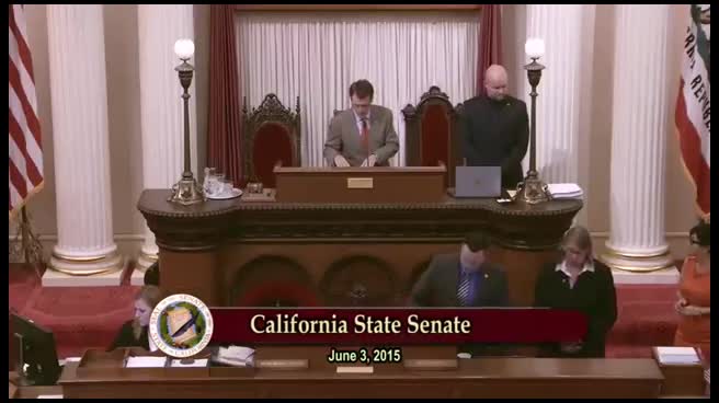 5MIN
Senate Floor
 15MIN
Senate Standing Committee on Environmental Quality
Bill Author

Bill Co-Author(s):