AB 2163: Department of Technology: GIS data: regional notification centers: subsurface installations.
- Session Year: 2017-2018
- House: Assembly
- Latest Version Date: 2018-08-23
Existing law establishes within the Government Operations Agency the Department of Technology, which is supervised by the Director of Technology. Existing law authorizes the director and the department to exercise various powers in creating and managing the information technology policy of the state. Existing law includes among the directors duties the duty to perform enterprise information technology functions and services, including, but not limited to, implementing Geographic Information Systems (GIS), shared services, applications, and program and project management activities in partnership with the owning agency or department.
Existing law requires every operator of a subsurface installation, including specified private entities and any state or local public agency except the Department of Transportation, to become a member of, participate in, and share in the costs of, a regional notification center, defined to mean a nonprofit association or other organization of operators of subsurface installations that provides advance warning of excavations or other work close to existing subsurface installations, for the purpose of protecting those installations from damage, removal, relocation, or repair. Regional notification centers include, but are not limited to, the Underground Service AlertNorthern California and the Underground Service AlertSouthern California.
This bill would require the department to provide GIS data to a regional notification center for those purposes.
Existing law establishes within the Government Operations Agency the Department of Technology, which is supervised by the Director of Technology. Existing law authorizes the director and the department to exercise various powers in creating and managing the information technology policy of the state. Existing law includes among the directors duties the duty to perform enterprise information technology functions and services, including, but not limited to, implementing Geographic Information Systems (GIS), shared services, applications, and program and project management activities in partnership with the owning agency or department.
Existing law requires every operator of a subsurface installation, including specified private entities and any state or local public agency except the Department of Transportation, to become a member of, participate in, and share in the costs of, a regional notification center, defined to mean a nonprofit association or other organization of operators of subsurface installations that provides advance warning of excavations or other work close to existing subsurface installations, for the purpose of protecting those installations from damage, removal, relocation, or repair. Regional notification centers include, but are not limited to, the Underground Service AlertNorthern California and the Underground Service AlertSouthern California.
This bill would require the department to provide GIS service data to a regional notification center for those purposes.
Existing law establishes within the Government Operations Agency the Department of Technology, which is supervised by the Director of Technology. Existing law authorizes the director and the department to exercise various powers in creating and managing the information technology policy of the state. Existing law includes among the directors duties the duty to perform enterprise information technology functions and services, including, but not limited to, implementing Geographic Information Systems (GIS), shared services, applications, and program and project management activities in partnership with the owning agency or department.
Existing law requires every operator of a subsurface installation, including specified private entities and any state or local public agency except the Department of Transportation, to become a member of, participate in, and share in the costs of, a regional notification center, defined to mean a nonprofit association or other organization of operators of subsurface installations that provides advance warning of excavations or other work close to existing subsurface installations, for the purpose of protecting those installations from damage, removal, relocation, or repair. Regional notification centers include, but are not limited to, the Underground Service AlertNorthern California and the Underground Service AlertSouthern California.
This bill would require the department to provide GIS service to a regional notification center for those purposes.
The department shall provide GIS data to a regional notification center, as defined in Section 4216, for the purposes of Article 2 (commencing with Section 4216) of Chapter 3.1 of Division 5 of Title 1, as provided to a state agency in accordance with this chapter.
The department shall provide GIS service data to a regional notification center, as defined in Section 4216, for the purposes of Chapter 3.1(commencing with Section 4215) Article 2 (commencing with Section 4216) of Chapter 3.1 of Division 5 of Title 1, as provided to a state agency in accordance with this chapter.
The department shall provide GIS service to a regional notification center, as defined in Section 4216, for the purposes of Chapter 3.1(commencing with Section 4215) of Division 5 of Title 1, as provided to a state agency in accordance with this chapter.
|
Date
|
Status
|
|---|---|
| Sep 28, 2018 | Vetoed by Governor. |
| Aug 27, 2018 | Enrolled and presented to the Governor at 3 p.m. |
| Aug 22, 2018 | In Assembly. Ordered to Engrossing and Enrolling. |
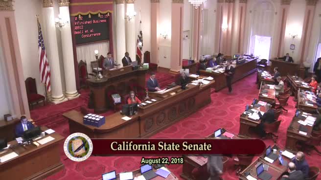
| Aug 22, 2018 | Read third time. Passed. Ordered to the Assembly. |
| Aug 6, 2018 | Ordered to third reading. |
| Aug 1, 2018 | Ordered to special consent calendar. |
| Jul 3, 2018 | Read second time. Ordered to third reading. |
| Jul 2, 2018 | From committee: Do pass. (Ayes 7. Noes 0.) (July 2). |
| Jun 21, 2018 | In committee: Hearing postponed by committee. |
| Jun 12, 2018 | From committee: Do pass and re-refer to Com. on APPR. with recommendation: To Consent Calendar. (Ayes 10. Noes 0.) (June 12). Re-referred to Com. on APPR. |
| Apr 25, 2018 | Referred to Coms. on G.O. and APPR. |
| Apr 12, 2018 | In Senate. Read first time. To Com. on RLS. for assignment. |
| Apr 12, 2018 | Read third time. Passed. Ordered to the Senate. |
| Apr 9, 2018 | Read second time. Ordered to Consent Calendar. |
| Apr 5, 2018 | Read second time and amended. Ordered returned to second reading. |
| Apr 4, 2018 | From committee: Amend, and do pass as amended. To Consent Calendar. (Ayes 10. Noes 0.) (April 3). |
| Mar 1, 2018 | Referred to Com. on P. & C.P. |
| Feb 13, 2018 | From printer. May be heard in committee March 15. |
| Feb 12, 2018 | Read first time. To print. |
|
Date
|
Description
|
Location
|
Votes
|
|
|---|---|---|---|---|
| Aug 22, 2018 | Assembly 3rd Reading AB2163 Grayson By Hill | Senate Floor |
Passed |
|
| Jul 2, 2018 | Do pass | Senate Standing Committee on Appropriations |
Passed |
|
| Jun 12, 2018 | Do pass, but first be re-referred to the Committee on [Appropriations] with the recommendation: To Consent Calendar | Senate Standing Committee on Governmental Organization |
Passed |
|
| Apr 12, 2018 | AB 2163 GRAYSON Consent Calendar Second Day Regular Session | Assembly Floor |
Passed |
|
| Apr 3, 2018 | Do pass as amended. To Consent Calendar. | Assembly Standing Committee on Privacy and Consumer Protection |
Passed |
This list shows positions taken on this bill by organizations on the date displayed, which is linked to the original source.
Positions by individuals are not included.
|
Organization
|
Position
|
Date
|
|---|---|---|
| Underground Service Alert Of Northern California And Nevada | ** Support | Apr 2, 2018 |
| Underground Service Alert Of Southern California | ** Support | Jul 3, 2018 |
GOVERNOR'S VETO
GV Bill Id:AB 2163
Author:(Grayson)
As Enrolled Ver:August 27, 2018
2/3 vote
Committee | Votes | Ayes | Noes |
Privacy | 10-0 | Chau, Kiley, Baker, Berman, Calderon, IrChau, Kiley, Baker, Berman, Calderon, Irwin, Mullin, Obernolte, Reyes, Tingwin, Mullin, Obernolte, Reyes, Ting |
ASSEMBLY: | 68-0 | (April 12, 2018) | SENATE: | 39-0 | (August 22, 2018) |
Original Committee Reference: P. & C.P.
SUMMARY: Requires the California Department of Technology (CDT) to provide Geographic Information Systems (GIS) data to a regional notification center, for purposes of California's "Call Before You Dig" law, in accordance with how CDT provides such data to state agencies under existing law.
EXISTING LAW:
- Establishes the CDT within the Government Operations Agency in state government. (Government Code Section 11545(a)(1).)
- Enumerates the duties of the CDT Director, which includes, among other things, performing enterprise information technology functions and services, including, but not limited to, implementing GIS, shared services, applications, and program and project management activities in partnership with the owning agency or department. (Government Code Section 11545(b)(8).)
- Requires, under the state's "Call Before you Dig Law," that every operator of a subsurface installation, except the Department of Transportation, become a member of, participate in, and share in the costs of, a regional notification center (RNC). (Government Code Section 4216.1.)
- Requires, except in an emergency, any person planning to conduct an excavation to contact the appropriate RNC at least two working days, but not more than 14 calendar days, prior to commencing the excavation, as specified. (Government Code Section 4216.2(b).)
- Defines various terms for these purposes, including:
- "Regional notification center" to mean a nonprofit association or other organization of operators of subsurface installations that provides advance warning of excavations or other work close to existing subsurface installations, for the purpose of protecting those installations from damage, removal, relocation, or repair. (Government Code Section 4216(q).)
- "Subsurface installation" to mean any underground pipeline, conduit, duct, wire, or other structure, except nonpressurized sewerlines, nonpressurized storm drains, or other nonpressurized drain lines. (Government Code Section 4216(s).)
FISCAL EFFECT: None. This bill has been keyed nonfiscal by the Legislative Counsel.
COMMENTS:
- Purpose of this bill: This bill is intended to require CDT to provide GIS data to RNCs in furtherance of the state's "Call Before You Dig" laws in order to prevent damage to subsurface installations, which can lead to service interruption, property damage, and personal injury to workers and bystanders, if not death. This bill is sponsored by Underground Service Alert of Northern California and Nevada (USA North 811).
- Author's statement: According to the author: "The bill requires [CDT] to share its digital map data ('GIS' – geographic information systems) with the regional notification centers so they can more precisely and efficiently notify owners of underground utility facilities about upcoming excavation that puts their underground lines at risk of damage from the excavation activity. The regional notification centers are Underground Service Alert of Northern California and Nevada, commonly known as 'USA North 811,' and Underground Service Alert of Southern California, commonly known as 'DigAlert.' The two centers are collectively referred to as '811 centers" […].
Some [811 centers] are private-sector companies like AT&T, Sempra Energy and PG&E; others are public-sector entities like cities, counties, state agencies, water districts and special service districts. Other facility owners do not provide utility service in the traditional sense, but do have underground assets, such as storm drain, traffic signals, oil and gas pipelines, and fiber optic communication cables. All of these entities cooperate to create a single point of contact for the excavator. If the 811 centers did not exist, an excavator would need to contact each utility owner individually. This would be inconvenient for the excavator and require him to know which of the 2,200 utility owners will be affected by his excavation. The utility owners also save money by cooperating to run the 811 call centers rather than each company receiving requests directly from the excavator. […]
New roads and addresses often are missing from GIS data that can be purchased from commercial data providers like Google, Garmin and Here.com, but the data exists in the GIS systems used by the city and county GIS departments. Cities and [c]ounties are the authorities that assign addresses and give names to new roads, change names of existing roads, etc. The State aggregates the data created at the local level and uses it to support various state and local agencies in their respective duties. They also create their own GIS datasets, such as highway milepost markers and exit numbers.
The 811 centers are unique in that they need access to the newest GIS data at a statewide level; 911 centers are decentralized and only cover small areas, so they can get their GIS data from the jurisdiction for which they provide service (city, county, district, etc.). Many 811 centers across the country are now using data provided by government GIS departments and some centers have formed partnerships with state agencies to use their GIS data. Examples include Utah, Ohio and Virginia."
Requiring the [CDT] to provide GIS data to the 811 centers will benefit everyone, including utility owners in both the private and public sectors, excavators, property owners and the public. Damage to underground facilities can result in utility service interruption, property damage, down time, environmental contamination, personal injury and even death. To be clear, the 811 centers are not asking the State to procure new GIS data; the bill is intended to have the State share data that it already has."
- "Call Before You Dig" law general background: In 1986, a Southern California excavating crew incorrectly assumed that no subsurface infrastructure existed at their construction site and as a result, a gas main was struck and exploded, killing a 23-year old crew member. That incident, together with others like it across the country, led to the adoption of California's "Call Before You Dig" law in 1989. (Government Code Section 4216 et seq.) This law generally requires individuals to contact an RNC prior to planned excavations, and requires any utility or other operator with subsurface installations in the vicinity of a planned excavation to go to the site and clearly identify and mark all underground infrastructure, except as otherwise specified. An RNC provides advance warning of excavations or other work close to existing subsurface installations to protect those installations from damage and, ultimately, to prevent injury as a result of those excavations. In other words, RNCs facilitate safe excavations around subsurface installations.
- CDT GIS services: According to CDT's website, GIS services provide organizations and individuals the ability to analyze, visualize, manage, disseminate and interpret geographic data, and the complex geographic relationship between them. Specifically, according to its public website, CDT's offered GIS services currently include map services, geocoding services, GIS application hosting services, and GIS consulting services. (See CDT Geographic Information Services available at <https://cdt.ca.gov/services/gis/> [as of March 18, 2018] for more detail regarding these services.)
Under this bill, CDT would be required to provide the same GIS data it currently provides to state agencies to RNCs. As stated by the author, above, this bill does not require CDT to procure any new GIS data; it merely intends that CDT share the data it already has with RNCs and, by doing so, helps prevent property damage and potentially even avoidable injuries or deaths.
This bill requires the Department of Technology to provide Geographic Information Systems data to Regional Notification Centers for the purposes of California's "Call Before You Dig" program.
The Department does not own this data and must pay a subscription for its access. Unfortunately this bill does not allow for the Department to recoup its costs from the Centers. I recommend the author work with the Department and make the necessary changes in future legislation.
Analysis Prepared by: Ronak Daylami / P. & C.P. / (916) 319-2200 FN: 0005301
Office of Senate Floor Analyses (916) 651-1520 Fax: (916) 327-4478 | AB |
THIRD READING
Bill No: AB 2163
:
SENATE GOVERNMENTAL ORG. COMMITTEE: 10-0, 6/12/18
AYES: Dodd, Wilk, Cannella, Gaines, Galgiani, Glazer, Hill, Hueso, Portantino, Vidak
NO VOTE RECORDED: Bradford, Lara
SENATE APPROPRIATIONS COMMITTEE: 7-0, 7/2/18
AYES: Portantino, Bates, Beall, Bradford, Hill, Nielsen, Wiener
ASSEMBLY FLOOR: 68-0, 4/12/18 (Consent) - See last page for vote
DIGEST:
This bill requires the Department of Technology (CDT) to provide Geographic Information Systems (GIS) data to a regional notification center for the purposes of California’s “Call Before You Dig” program.
Existing law:
- Establishes CDT within the Government Operations Agency, which is supervised by the Director of Technology (Director).
- Includes among the Director’s duties, the duty to perform enterprise information technology functions and services, including but not limited to; implementing GIS, shared services, applications, and program and project management activities in partnership with the owning agency or department.
- Establishes the “Call Before You Dig” program, and requires every operator of a subsurface installation, including specified private entities and any state or local public agency except for CDT, to become a member of, participate in, and share in the costs of, a regional notification center.
- Requires, except in an emergency, any person planning to conduct an excavation to contact the appropriate regional notification center at least two working days, but not more than 14 calendar days, prior to commencing the excavation.
- Defines “regional notification center” to mean a nonprofit association or other organization of operators of subsurface installations that provides advance warning of excavations or other work close to existing subsurface installations, for the purpose of protecting those installations from damage, removal, relocation, or repair.
This bill requires CDT to provide GIS data to a regional notification center for the purposes of the “Call Before You Dig” program.
Background
Purpose of the bill. According to the author, “AB 2163 will require CDT to share its digital map data with 811 regional notification centers. This transparency will enable the 811 centers to more accurately notify the owners of underground facilities about upcoming excavation near their subsurface installations.”
Further, the author states that “the greatest threat to underground utility lines is damage from excavation activity, and damage can result in interrupted utility service, property damage, personal injury or even death. This bill will protect California’s residents and infrastructure from potential damage to underground lines with the most current, accurate mapping data available.”
Call Before You Dig. In 1986, a Southern California excavating crew incorrectly assumed that no subsurface infrastructure existed at their construction site and as a result, a gas main was struck and exploded, killing a 23-year old crew member. That incident, together with others like it across the country, led to the adoption of California’s “Call Before You Dig” law in 1989.
The law generally requires individuals to contact a regional notification center prior to planned excavations, and requires any utility or other operator with subsurface installations in the vicinity of a planned excavation to go to the site and clearly identify and mark all underground infrastructure.
In California, the two regional notification centers are Underground Service Alert of Northern California and Nevada, commonly known as USA North 811, and Underground Service Alert of Southern California, commonly known as DigAlert. Collectively, the two centers are commonly referred to as 811 centers.
To fulfill their statutorily-mandated responsibility to notify the appropriate utility owners about excavation activity near their underground facilities, the 811 centers must be able to accurately and precisely identify the dig site location as described by the excavator. This often includes areas of recent construction in which roads and addresses are brand new.
Geographic information systems. According the CDT’s Internet Web site, GIS services provide organizations and individuals the ability to analyze, visualize, manage, disseminate, and interpret geographical data, and the complex geographic relationship between them. Specifically, the site identifies map services, geocoding services, GIS application hosting services, and GIS consulting services as GIS services currently offered by CDT.
CDT currently restricts full access to its data to government agencies. Because the 811 centers are non-governmental agencies, they are unable access complete GIS data. Under this bill, CDT would be required to provide the same GIS data it currently provides to state agencies to the 811 centers.
Related/Prior Legislation
SCR 120 (Hill, Resolution Chapter 44, Statutes of 2018) proclaimed April as California Safe Digging Month, and made various legislative findings relating to California’s “Call Before You Dig” program.
SB 661 (Hill, Chapter 809, Statutes of 2016) enacted the Dig Safe Act of 2016, and modified laws governing excavations near subsurface installations.
AB 73 (Elder, Chapter 928, Statutes of 1989) established California’s “Call Before You Dig” program, and generally required individuals to contact a regional notification center prior to planned excavations.
FISCAL EFFECT: Appropriation: Fiscal Com.: Local:
According to the Senate Appropriations Committee, up to $70,000 per year to the CDT to acquire the GIS data to be shared with the regional centers. Regional Centers will have to enter into contracts with CDT in which the initial charge will be reimbursed by the regional notification center(s). (Technology Services Revolving Fund)
Underground Service Alert of Southern California
None received
ARGUMENTS IN SUPPORT: The Underground Service Alert of Southern California (USA South) argues that “AB 2163 further assists the USA South’s mission by providing it access to GIS data maintained by the state of California. This data can be used to further increase the accuracy of maps and other data used by USA South to determine the location of underground utility infrastructure.”
ASSEMBLY FLOOR: 68-0, 4/12/18
AYES: Acosta, Aguiar-Curry, Travis Allen, Arambula, Baker, Berman, Bigelow, Bonta, Brough, Burke, Caballero, Calderon, Carrillo, Cervantes, Chau, Chávez, Chen, Chiu, Choi, Chu, Cooley, Cooper, Cunningham, Dahle, Daly, Eggman, Flora, Fong, Frazier, Friedman, Gallagher, Eduardo Garcia, Gipson, Gloria, Gonzalez Fletcher, Grayson, Harper, Holden, Irwin, Kalra, Kiley, Lackey, Levine, Maienschein, Mathis, Mayes, McCarty, Medina, Melendez, Muratsuchi, Nazarian, Obernolte, O'Donnell, Patterson, Quirk, Quirk-Silva, Reyes, Rodriguez, Rubio, Salas, Mark Stone, Thurmond, Ting, Voepel, Waldron, Weber, Wood, Rendon
NO VOTE RECORDED: Bloom, Cristina Garcia, Gray, Jones-Sawyer, Limón, Low, Mullin, Santiago, Steinorth
7/3/18 16:09:25
**** END ****
SENATE COMMITTEE ON APPROPRIATIONS
Senator Anthony Portantino, Chair
2017 - 2018 Regular Session
AB 2163 (Grayson) - Department of Technology: GIS data: regional notification centers: subsurface installations
Version: April 5, 2018 | Policy Vote: G.O. 10 - 0 |
Urgency: No | Mandate: No |
Hearing Date: July 2, 2018 | Consultant: Debra Cooper |
This bill does not meet the criteria for referral to the Suspense File.
Bill Summary:
AB 2163 would require the Department of Technology (CDT) to provide Geographical Information Systems (GIS) data to a regional notification center for the purposes of California’s “Call Before You Dig” program.
Fiscal Impact:
Up to $70,000 per year to the CDT to acquire the GIS data to be shared with the regional centers. Regional Centers will have to enter into contracts with CDT in which the initial charge will be reimbursed by the regional notification center(s). (Technology Services Revolving Fund)
Background:
Existing law, known as “Call Before You Dig”, generally requires individuals to contact a regional notification center prior to planned excavations and requires any utility or other operator with subsurface installations in the vicinity of a planned excavation to go to the site and clearly identify and mark all underground infrastructure.
Regional notification centers are an association of owners and operators of subsurface installations. The purpose of the center is to provide a single telephone number that excavators can use to give the center's members advance notification of their intent to excavate. There are two regional notification centers in California – Underground Service Alert of Northern California and Nevada (USA North 811), and Underground Service Alert of Southern California (DigAlert). Collectively, these two centers are commonly referred to as 811 centers. 811 centers must be able to accurately and precisely identify the dig site location which often includes areas of recent construction. New roads and addresses are often missing from GIS data that is available for purchase from commercial data providers such as Google, but those up-to-date data exist in systems used by city and county GIS departments.
CDT currently contracts with Digital Map Products (DMP) for GIS data. This contract offers parcel data for the entire State to different state departments. CDT currently restricts access of its data to government agencies and is not currently authorized to provide data to non-governmental entities (regional centers are non-governmental entities).
Proposed Law:
This bill would require CDT to provide GIS data to a regional notification center for the purposes of the “Call Before Your Dig” program.
Related Legislation:
SB 661 (Hill, Chapter 809, Statutes of 2016) enacted the Dig Safe Act of 2016 and modified law governing excavations near subsurface installations.
AB 73 (Elder, Chapter 928, Statutes of 1989) established California’s “Call Before You Dig” program and generally required individuals to contact a regional notification center prior to planned excavations.
Staff Comments:
CDT currently charges $35,000 per year to each state agency that requests GIS data. Once a state entity submits a request to CDT, CDT submits a work order to DMP. CDT charges the state entity for the work order and recoups the cost for data. CDT currently provides GIS data to 15 state agencies and departments.
-- END --
SENATE COMMITTEE ON GOVERNMENTAL ORGANIZATION
Senator Bill Dodd
Chair
2017 - 2018 Regular
Bill No: AB Hearing Date: 6/12/2018
Author: | Grayson | ||
Version: | Amended | ||
Urgency: | Fiscal: | ||
Consultant: | |||
SUBJECT:
DIGEST: This bill requires the Department of Technology (CDT) to provide Geographic Information Systems (GIS) data to a regional notification center for the purposes of California’s “Call Before You Dig” program.
ANALYSIS:
Existing law:
- Establishes CDT within the Government Operations Agency, which is supervised by the Director of Technology (Director).
- Authorizes the Director and CDT to exercise various powers in creating and managing the information technology policy of the state.
- Includes among the Director’s duties, the duty to perform enterprise information technology functions and services, including but not limited to; implementing GIS, shared services, applications, and program and project management activities in partnership with the owning agency or department.
- Establishes the “Call Before You Dig” program, and requires every operator of a subsurface installation, including specified private entities and any state or local public agency except for CDT, to become a member of, participate in, and share in the costs of, a regional notification center.
- Requires, except in an emergency, any person planning to conduct an excavation to contact the appropriate regional notification center at least two working days, but not more than 14 calendar days, prior to commencing the excavation.
- Defines “subsurface installation” to mean any underground pipeline, conduit, duct, wire, or other structure, except nonpressurized sewerlines, nonpressurized storm drains, or other nonpressurized drain lines.
- Defines “regional notification center” to mean a nonprofit association or other organization of operators of subsurface installations that provides advance warning of excavations or other work close to existing subsurface installations, for the purpose of protecting those installations from damage, removal, relocation, or repair.
This bill requires CDT to provide GIS data to a regional notification center for the purposes of the “Call Before You Dig” program.
Background
Purpose of the bill. According to the author, “AB 2163 will require CDT to share its digital map data with 811 regional notification centers. This transparency will enable the 811 centers to more accurately notify the owners of underground facilities about upcoming excavation near their subsurface installations.”
Further, the author states that “the greatest threat to underground utility lines is damage from excavation activity, and damage can result in interrupted utility service, property damage, personal injury or even death. This bill will protect California’s residents and infrastructure from potential damage to underground lines with the most current, accurate mapping data available.”
Call Before You Dig. In 1986, a Southern California excavating crew incorrectly assumed that no subsurface infrastructure existed at their construction site and as a result, a gas main was struck and exploded, killing a 23-year old crew member. That incident, together with others like it across the country, led to the adoption of California’s “Call Before You Dig” law in 1989.
The law generally requires individuals to contact a regional notification center prior to planned excavations, and requires any utility or other operator with subsurface installations in the vicinity of a planned excavation to go to the site and clearly identify and mark all underground infrastructure.
In California, the two regional notification centers are Underground Service Alert of Northern California and Nevada, commonly known as USA North 811, and Underground Service Alert of Southern California, commonly known as DigAlert. Collectively, the two centers are commonly referred to as 811 centers.
To fulfill their statutorily-mandated responsibility to notify the appropriate utility owners about excavation activity near their underground facilities, the 811 centers must be able to accurately and precisely identify the dig site location as described by the excavator. This often includes areas of recent construction in which roads and addresses are brand new.
New roads are often missing from GIS data that is available for purchase from commercial data providers such as Google, but the data exists in systems used by city and county GIS departments. Cities and counties are the authorities that assign addresses and street names, and the State aggregates this data to support various state duties, and creates its own GIS datasets such as highway markers and exit numbers.
The author argues that 811 centers are unique in that they need access to the newest GIS data on a statewide level, and that by requiring CDT to provide GIS data to the 811 centers will provide a benefit to everyone, including utility owners, excavators, property owners, and the public. Additionally, the author points out that this bill does not require the State to procure new GIS data, and is simply intended to require the State share data it already has with 811 centers.
Geographic information systems. According the CDT’s Internet Web site, GIS services provide organizations and individuals the ability to analyze, visualize, manage, disseminate, and interpret geographical data, and the complex geographic relationship between them. Specifically, the site identifies map services, geocoding services, GIS application hosting services, and GIS consulting services as GIS services currently offered by CDT.
CDT currently restricts full access to its data to government agencies. Because the 811 centers are non-governmental agencies, they are unable access complete GIS data. Under this bill, CDT would be required to provide the same GIS data it currently provides to state agencies to the 811 centers.
Prior/Related Legislation
SCR 120 (Hill, Res. Chapter 44, Statutes of 2018) proclaimed April as California Safe Digging Month, and made various legislative findings relating to California’s “Call Before You Dig” program.
SB 661 (Hill, Chapter 809, Statutes of 2016) enacted the Dig Safe Act of 2016, and modified laws governing excavations near subsurface installations.
AB 73 (Elder, Chapter 928, Statutes of 1989) established California’s “Call Before You Dig” program, and generally required individuals to contact a regional notification center prior to planned excavations.
FISCAL EFFECT: Appropriation: No Fiscal Com.: No Local: No
SUPPORT:
Underground Service Alert of Southern California
OPPOSITION:
None received
ARGUMENTS IN SUPPORT: The Underground Service Alert of Southern California (USA South) argues that “AB 2163 further assists the USA South’s mission by providing it access to GIS data maintained by the state of California. This data can be used to further increase the accuracy of maps and other data used by USA South to determine the location of underground utility infrastructure.”
DUAL REFERRAL: Appropriations Committee
Date of Hearing: April 3, 2018
ASSEMBLY COMMITTEE ON PRIVACY AND CONSUMER PROTECTION
Ed Chau, Chair
ABPCA Bill Id:AB 2163 (
Author:Grayson) – As Introduced Ver:February 12, 2018
SUBJECT: Department of Technology: GIS services: regional notification centers: subsurface installations
SUMMARY: This bill would require the California Department of Technology (CDT) to provide Geographic Information Systems (GIS) service to a regional notification center, for purposes of California’s “Call Before You Dig” law, in accordance with how CDT provides such services to state agencies under existing law.
EXISTING LAW:
- Establishes the CDT within the Government Operations Agency in state government. (Gov. Code Sec. 11545(a)(1).)
- Enumerates the duties of the Director of Technology, which includes, among other things, performing enterprise information technology functions and services, including, but not limited to, implementing GIS, shared services, applications, and program and project management activities in partnership with the owning agency or department. (Gov. Code Sec. 11545(b)(8).)
- Requires, under the state’s “Call Before you Dig Law,” that every operator of a subsurface installation, except the Department of Transportation, become a member of, participate in, and share in the costs of, a regional notification center (RNC). (Gov. Code Sec. 4216.1.)
- Requires, except in an emergency, any person planning to conduct an excavation to contact the appropriate RNC at least two working days, but not more than 14 calendar days, prior to commencing the excavation, as specified. (Gov. Code Sec. 4216.2(b).)
- Defines various terms for these purposes, including:
- “Regional notification center” to mean a nonprofit association or other organization of operators of subsurface installations that provides advance warning of excavations or other work close to existing subsurface installations, for the purpose of protecting those installations from damage, removal, relocation, or repair. (Gov. Code Sec. 4216(q).)
- “Subsurface installation” to mean any underground pipeline, conduit, duct, wire, or other structure, except nonpressurized sewerlines, nonpressurized storm drains, or other nonpressurized drain lines. (Gov. Code Sec. 4216(s).)
FISCAL EFFECT: None. This bill has been keyed nonfiscal by the Legislative Counsel.
COMMENTS:
- Purpose of this bill: This bill is intended to require CDT to provide GIS services to RNCs in furtherance of the state’s “Call Before You Dig” laws in order to prevent damage to subsurface installations, which can lead to service interruption, property damage, and personal injury to workers and bystanders, if not death. This bill is sponsored by Underground Service Alert of Northern California and Nevada (USA North 811).
- Author’s statement: According to the author: “The bill requires [CDT] to share its digital map data (‘GIS’ – geographic information systems) with the regional notification centers so they can more precisely and efficiently notify owners of underground utility facilities about upcoming excavation that puts their underground lines at risk of damage from the excavation activity. The regional notification centers are Underground Service Alert of Northern California and Nevada, commonly known as ‘USA North 811,’ and Underground Service Alert of Southern California, commonly known as ‘DigAlert.’ The two centers are collectively referred to as ‘811 centers” […].
Some [811 centers] are private-sector companies like AT&T, Sempra Energy and PG&E; others are public-sector entities like cities, counties, state agencies, water districts and special service districts. Other facility owners do not provide utility service in the traditional sense, but do have underground assets, such as storm drain, traffic signals, oil and gas pipelines, and fiber optic communication cables. All of these entities cooperate to create a single point of contact for the excavator. If the 811 centers did not exist, an excavator would need to contact each utility owner individually. This would be inconvenient for the excavator and require him to know which of the 2,200 utility owners will be affected by his excavation. The utility owners also save money by cooperating to run the 811 call centers rather than each company receiving requests directly from the excavator. […]
New roads and addresses often are missing from GIS data that can be purchased from commercial data providers like Google, Garmin and Here.com, but the data exists in the GIS systems used by the city and county GIS departments. Cities and [c]ounties are the authorities that assign addresses and give names to new roads, change names of existing roads, etc. The State aggregates the data created at the local level and uses it to support various state and local agencies in their respective duties. They also create their own GIS datasets, such as highway milepost markers and exit numbers.
The 811 centers are unique in that they need access to the newest GIS data at a statewide level; 911 centers are decentralized and only cover small areas, so they can get their GIS data from the jurisdiction for which they provide service (city, county, district, etc.). Many 811 centers across the country are now using data provided by government GIS departments and some centers have formed partnerships with state agencies to use their GIS data. Examples include Utah, Ohio and Virginia.”
Requiring the [CDT] to provide GIS data to the 811 centers will benefit everyone, including utility owners in both the private and public sectors, excavators, property owners and the public. Damage to underground facilities can result in utility service interruption, property damage, down time, environmental contamination, personal injury and even death. To be clear, the 811 centers are not asking the State to procure new GIS data; the bill is intended to have the State share data that it already has.”
- “Call Before You Dig” law background: In 1986, a Southern California excavating crew incorrectly assumed that no subsurface infrastructure existed at their construction site and as a result, a gas main was struck and exploded, killing a 23-year old crew member. That incident, together with others like it across the country, led to the adoption of California’s “Call Before You Dig” law in 1989. (Gov. Code Sec. 4216 et seq.) This law generally requires individuals to contact an RNC prior to planned excavations, and requires any utility or other operator with subsurface installations in the vicinity of a planned excavation to go to the site and clearly identify and mark all underground infrastructure, except as otherwise specified. An RNC provides advance warning of excavations or other work close to existing subsurface installations to protect those installations from damage and, ultimately, to prevent injury as a result of those excavations. In other words, RNCs facilitate safe excavations around subsurface installations.
- Dig Safe Act of 2016: SB 661 (Hill, Ch. 809, Stats. 2016) enacted the Dig Safe Act of 2016, amending the state’s Call Before You Dig law in response to a series of fatal incidents, including a dig-in incident (an industry term for when construction workers accidentally hit gas lines) in Fresno where an excavator punctured a 10-inch natural gas pipeline while operating heavy equipment at a road construction site, killing one person and injuring 12 others and temporarily closing down Highway 99. SB 661, among other things, required a person planning to conduct an excavation to contact the appropriate RNC prior to commencing that excavation regardless of whether the excavation would be conducted in an area that is known, or reasonably should be known, to contain subsurface installations. It further prohibited an excavator, except in an emergency, from beginning excavation until receiving a response from all operators of known subsurface installations within the delineated boundaries of the proposed area of excavation, and also created the California Underground Facilities Safe Excavation Board under the Office of the State Fire Marshall, which would investigate alleged violations of specified laws relating to the protection of underground infrastructure and develop standards relevant to safety practices in excavating around subsurface installations.
- CDT GIS services: According to CDT’s website, GIS services provide organizations and individuals the ability to analyze, visualize, manage, disseminate and interpret geographic data, and the complex geographic relationship between them. Specifically, according to its public website, CDT’s offered GIS services currently include map services, geocoding services, GIS application hosting services, and GIS consulting services:
- Map services provides the ability to take geographic information currently managed in databases and spreadsheets, and displays the data in a visual context on the Internet or on an organization’s intranet. The infrastructure for this service is completely maintained, secured, patched, and managed by CDT.
- Geocoding is the process of finding associated geographic coordinates (e.g., latitude and longitude) from data, such as street addresses, ZIP codes, or place names. The geocoding service provides unlimited transactions from the commercial grade geocoder to provide notifications, or manage large location-based datasets.
- GIS application hosting services means hosting of GIS web-based application(s) on CDT’s infrastructure.
- GIS consulting services allows organizations that lack the internal expertise to develop and maintain GIS applications to work directly with CDT staff to extend existing GIS capabilities, or develop new capabilities to realize cost savings, increase operational efficiency, and deliver more relevant services to both internal and external customers. (See CDT Geographic Information Services available at <https://cdt.ca.gov/services/gis/> [as of March 18, 2018].)
Under this bill, CDT would be required to provide the same GIS data it currently provides to state agencies to RNCs. As stated by the author in Comment 2 above, this bill does not require CDT to procure any new GIS data; it merely intends that CDT share the data it already has with RNCs and, by doing so, helps prevent property damage and potentially even avoidable injuries or deaths.
- Arguments in support: The sponsor of this bill, USA North 811 writes:
This bill is needed so that [RNCs] can more precisely and efficiently notify owners of underground utility facilities about upcoming excavation that puts their underground lines at risk of damage from the excavation activity. [ . . . ]
To fulfill their statutorily mandated responsibility to notify the appropriate utility owners about excavation activity near their underground facilities, the 811 centers must be able to accurately and precisely identify the dig site location as described by the excavator. This often includes areas of recent construction in which roads and addresses are brand new. In fact, the 811 centers will be contacted multiple times as excavation takes place to build the new roads, homes, etc.
The 811 centers are not government agencies; CDT currently restricts full access to its data to government agencies. Requiring the State to share its data via codification ensures a long-term partnership will be created, as opposed to a relationship based on internal CDT policy that may change in the future.
- Author’s amendments: The author has agreed to the following technical and clarifying amendments to: (1) change reference to “GIS service” to “GIS data” since the data is what CDT will be providing to the RNCs, not service; and (2) correct a cross reference to the appropriate article pertaining to RNCs within the Government Code:
Author’s amendments:
- On page 2, line 3, strike “service” and insert “data”
- On page 2, line 5, after “purposes of” insert “article 2 of”
On page 2, line 5, strike “commencing with Section 4215” and insert “commencing with Section 4216”
- Prior legislation: SB 661 (Hill, Ch. 809, Stats. 2016) See Comment 4.
REGISTERED SUPPORT / OPPOSITION:
Support
Underground Service Alert of Northern California and Nevada (USA North 811) (sponsor)
Underground Service Alert of Southern California (USA South)
Opposition
None on file
Analysis Prepared by: Ronak Daylami / P. & C.P. / (916) 319-2200
Bill Author
Bill Co-Author(s):