SB 1162: Capitol area planning: height limits.
- Session Year: 2017-2018
- House: Senate
- Latest Version Date: 2018-09-14
Existing law provides that the Capitol Area Plan is the official state master plan for development in the central city of the City of Sacramento. The Capitol View Protection Act requires specified height and setback requirements in specified areas surrounding Capitol Park. The act, among other things, requires a height limit of 120 feet for the blocks between L Street on the north, 17th Street on the east, N Street on the south, and 16th Street on the west.
This bill, instead, would designate Matsui Alley as the southern boundary of that area with the height limit of 120 feet.
Existing law provides that the Capitol Area Plan is the official state master plan for development in the central city of the City of Sacramento. The Capitol View Protection Act requires specified height and setback requirements in specified areas surrounding Capitol Park. The act, among other things, requires a height limit of 120 feet for the blocks between L Street on the north, 17th Street on the east, N Street on the south, and 16th Street on the west.
This bill, instead, would designate Matsui Alley as the southern boundary of that area with the height limit of 120 feet.
Existing law provides that the Capitol Area Plan is the official state master plan for development in the central city of the City of Sacramento. The Capitol View Protection Act requires specified height and setback requirements in specified areas surrounding Capitol Park. The act, among other things, requires a height limit of 120 feet for the blocks between L Street on the north, 17th Street on the east, N Street on the south, and 16th Street on the west.
This bill, instead, would designate Matsui Alley as the southern boundary of that area with the height limit of 120 feet.
Existing law requires the State Air Resources Board, by October 1, 2018, to prepare a monitoring plan regarding technologies for monitoring criteria air pollutants and toxic air contaminants and the need for and benefits of additional community air monitoring systems, as defined. Existing law requires the state board, based on the monitoring plan, to select the highest priority locations in the state for the deployment of community air monitoring systems, and requires an air pollution control or air quality management district containing a selected location to deploy a system in the selected location by July 1, 2019.This bill would make a technical, nonsubstantive change to those provisions.Existing law requires the State Air Resources Board, by October 1, 2018, to prepare a monitoring plan regarding technologies for monitoring criteria air pollutants and toxic air contaminants and the need for and benefits of additional community air monitoring systems, as defined. Existing law requires the state board, based on the monitoring plan, to select the highest priority locations in the state for the deployment of community air monitoring systems, and requires an air pollution control or air quality management district containing a selected location to deploy a system in the selected location by July 1, 2019.
This bill would make a technical, nonsubstantive change to those provisions.
Notwithstanding any other provision of law, except as provided in Section 8162.9, the following height limits shall apply as follows:
(a)The applicable height limit shall be 80 feet for the following areas:
(1)The block surrounded by L Street on the north, 16th Street on the east, Capitol Avenue on the south, and 15th Street on the west.
(2)The half block surrounded by Capitol Avenue on the north, 16th Street on the east, 15th Street on the west, and a line parallel to and 210 feet to the south of Capitol Avenue on the south.
(3)The half block to the east of 15th Street between a line running parallel to and 210 feet to the north of N Street on the north, and a line running parallel to and 210 feet to the south of N Street on the south.
(4)The half block to the south of N Street between 15th Street on the east, and a line parallel to and 200 feet to the west of 9th Street on the west.
(b)The applicable height limit shall be 120 feet for the following area:
The blocks between L Street on the north, 17th Street on the east, Matsui Alley on the south, and 16th Street on the west.
(c)The applicable height limit shall be 150 feet for the following areas:
(1)The half block to the west of 16th Street between a line parallel to and 210 feet to the north of N Street on the north, and a line parallel to and 210 feet to the south of N Street on the south.
(2)The half block to the north of O Street between 16th Street on the east and 8th Street on the west.
(3)The half block to the south of N Street between 8th Street on the west and a line parallel to and 200 feet to the east of 8th Street on the east.
(4)The block to the south of O Street between a line parallel to and 200 feet to the east of 11th Street on the east and a line parallel to and 200 feet to the west of 11th Street on the west.
(5)The half block to the north of L Street between 16th Street on the east and a line parallel to and 200 feet to the west of 9th Street on the west.
(6)The half block to the west of 9th Street between L Street on the north and N Street on the south.
(d)The applicable height limit shall be 250 feet for the following areas:
(1)The half block to the south of O Street between 13th Street and a line parallel to and 200 feet to the west of 12th Street.
(2)The half block to the south of O Street between a line parallel to and 200 feet to the east of 10th Street on the east, and a line parallel to and 200 feet to the west of 8th Street on the west.
(3)The half block to the west of 8th Street between N Street on the north and O Street on the south.
(4)The half block to the south of K Street between 12th Street on the east and 10th Street on the west.
(5)The block to the north of K Street between a line parallel to and 200 feet to the west of 11th Street on the west, and a line parallel to and 200 feet to the east of 11th Street on the east.
(e)The applicable height limit shall be 300 feet for the following areas:
(1)The half block to the south of K Street, between 16th Street on the east and 12th Street on the west.
(2)The half block to the South of K Street, between 10th Street on the east and 8th Street on the west.
(3)The half block east of 8th Street, between a line parallel to and 210 feet to the north of L Street on the north and N Street on the south.
(f)The applicable height limit shall be 350 feet for the following areas:
(1)The block to the north of J Street between a line parallel to and 200 feet to the east of 11th Street on the east and a line parallel to and 200 feet west of 11th Street on the west.
(2)The half block to the north of I Street, between 11th Street on the east and a line parallel to and 200 feet to the west of 11th Street on the west.
(g)The applicable height limit shall be 400 feet for the following areas:
(1)The half block to the north of K Street between 16th Street on the east and a line parallel to and 200 feet to the west of 12th Street on the west.
(2)The half block to the north of K Street between a line parallel to and 200 feet east of 10th Street on the east and a line parallel to and 200 feet west of 8th Street on the west.
(3)The block to the west of 8th Street between K Street on the north and N Street on the south.
(h)The applicable height limit shall be 450 feet for the following areas:
(1)The half block to the south of J Street between 16th Street on the east and a line parallel to and 200 feet west of 12th Street on the west.
(2)The half block to the south of J Street between a line parallel to and 200 feet to the east of 10th Street on the east and 7th Street on the west.
(3)The half block to the north of K Street between a line parallel to and 200 feet to the east of 7th Street on the east and 7th Street on the west.
Notwithstanding any other provision of law, except as provided in Section 8162.9, the following height limits shall apply as follows:
(a)The applicable height limit shall be 80 feet for the following areas:
(1)The block surrounded by L Street on the north, 16th Street on the east, Capitol Avenue on the south, and 15th Street on the west.
(2)The half block surrounded by Capitol Avenue on the north, 16th Street on the east, 15th Street on the west, and a line parallel to and 210 feet to the south of Capitol Avenue on the south.
(3)The half block to the east of 15th Street between a line running parallel to and 210 feet to the north of N Street on the north, and a line running parallel to and 210 feet to the south of N Street on the south.
(4)The half block to the south of N Street between 15th Street on the east, and a line parallel to and 200 feet to the west of 9th Street on the west.
(b)The applicable height limit shall be 120 feet for the following area:
The blocks between L Street on the north, 17th Street on the east, Matsui Alley on the south, and 16th Street on the west.
(c)The applicable height limit shall be 150 feet for the following areas:
(1)The half block to the west of 16th Street between a line parallel to and 210 feet to the north of N Street on the north, and a line parallel to and 210 feet to the south of N Street on the south.
(2)The half block to the north of O Street between 16th Street on the east and 8th Street on the west.
(3)The half block to the south of N Street between 8th Street on the west and a line parallel to and 200 feet to the east of 8th Street on the east.
(4)The block to the south of O Street between a line parallel to and 200 feet to the east of 11th Street on the east and a line parallel to and 200 feet to the west of 11th Street on the west.
(5)The half block to the north of L Street between 16th Street on the east and a line parallel to and 200 feet to the west of 9th Street on the west.
(6)The half block to the west of 9th Street between L Street on the north and N Street on the south.
(d)The applicable height limit shall be 250 feet for the following areas:
(1)The half block to the south of O Street between 13th Street and a line parallel to and 200 feet to the west of 12th Street.
(2)The half block to the south of O Street between a line parallel to and 200 feet to the east of 10th Street on the east, and a line parallel to and 200 feet to the west of 8th Street on the west.
(3)The half block to the west of 8th Street between N Street on the north and O Street on the south.
(4)The half block to the south of K Street between 12th Street on the east and 10th Street on the west.
(5)The block to the north of K Street between a line parallel to and 200 feet to the west of 11th Street on the west, and a line parallel to and 200 feet to the east of 11th Street on the east.
(e)The applicable height limit shall be 300 feet for the following areas:
(1)The half block to the south of K Street, between 16th Street on the east and 12th Street on the west.
(2)The half block to the South of K Street, between 10th Street on the east and 8th Street on the west.
(3)The half block east of 8th Street, between a line parallel to and 210 feet to the north of L Street on the north and N Street on the south.
(f)The applicable height limit shall be 350 feet for the following areas:
(1)The block to the north of J Street between a line parallel to and 200 feet to the east of 11th Street on the east and a line parallel to and 200 feet west of 11th Street on the west.
(2)The half block to the north of I Street, between 11th Street on the east and a line parallel to and 200 feet to the west of 11th Street on the west.
(g)The applicable height limit shall be 400 feet for the following areas:
(1)The half block to the north of K Street between 16th Street on the east and a line parallel to and 200 feet to the west of 12th Street on the west.
(2)The half block to the north of K Street between a line parallel to and 200 feet east of 10th Street on the east and a line parallel to and 200 feet west of 8th Street on the west.
(3)The block to the west of 8th Street between K Street on the north and N Street on the south.
(h)The applicable height limit shall be 450 feet for the following areas:
(1)The half block to the south of J Street between 16th Street on the east and a line parallel to and 200 feet west of 12th Street on the west.
(2)The half block to the south of J Street between a line parallel to and 200 feet to the east of 10th Street on the east and 7th Street on the west.
(3)The half block to the north of K Street between a line parallel to and 200 feet to the east of 7th Street on the east and 7th Street on the west.
Notwithstanding any other provision of law, except as provided in Section 8162.9, the following height limits shall apply as follows:
(a)The applicable height limit shall be 80 feet for the following areas:
(1)The block surrounded by L Street on the north, 16th Street on the east, Capitol Avenue on the south, and 15th Street on the west.
(2)The half block surrounded by Capitol Avenue on the north, 16th Street on the east, 15th Street on the west, and a line parallel to and 210 feet to the south of Capitol Avenue on the south.
(3)The half block to the east of 15th Street between a line running parallel to and 210 feet to the north of N Street on the north, and a line running parallel to and 210 feet to the south of N Street on the south.
(4)The half block to the south of N Street between 15th Street on the east, and a line parallel to and 200 feet to the west of 9th Street on the west.
(b)The applicable height limit shall be 120 feet for the following area:
The blocks between L Street on the north, 17th Street on the east, N Street Matsui Alley on the south south, and 16th Street on the west.
(c)The applicable height limit shall be 150 feet for the following areas:
(1)The half block to the west of 16th Street between a line parallel to and 210 feet to the north of N Street on the north, and a line parallel to and 210 feet to the south of N Street on the south.
(2)The half block to the north of O Street between 16th Street on the east and 8th Street on the west.
(3)The half block to the south of N Street between 8th Street on the west and a line parallel to and 200 feet to the east of 8th Street on the east.
(4)The block to the south of O Street between a line parallel to and 200 feet to the east of 11th Street on the east and a line parallel to and 200 feet to the west of 11th Street on the west.
(5)The half block to the north of L Street between 16th Street on the east and a line parallel to and 200 feet to the west of 9th Street on the west.
(6)The half block to the west of 9th Street between L Street on the north and N Street on the south.
(d)The applicable height limit shall be 250 feet for the following areas:
(1)The half block to the south of O Street between 13th Street and a line parallel to and 200 feet to the west of 12th Street.
(2)The half block to the south of O Street between a line parallel to and 200 feet to the east of 10th Street on the east, and a line parallel to and 200 feet to the west of 8th Street on the west.
(3)The half block to the west of 8th Street between N Street on the north and O Street on the south.
(4)The half block to the south of K Street between 12th Street on the east and 10th Street on the west.
(5)The block to the north of K Street between a line parallel to and 200 feet to the west of 11th Street on the west, and a line parallel to and 200 feet to the east of 11th Street on the east.
(e)The applicable height limit shall be 300 feet for the following areas:
(1)The half block to the south of K Street, between 16th Street on the east and 12th Street on the west.
(2)The half block to the South of K Street, between 10th Street on the east and 8th Street on the west.
(3)The half block east of 8th Street, between a line parallel to and 210 feet to the north of L Street on the north and N Street on the south.
(f)The applicable height limit shall be 350 feet for the following areas:
(1)The block to the north of J Street between a line parallel to and 200 feet to the east of 11th Street on the east and a line parallel to and 200 feet west of 11th Street on the west.
(2)The half block to the north of I Street, between 11th Street on the east and a line parallel to and 200 feet to the west of 11th Street on the west.
(g)The applicable height limit shall be 400 feet for the following areas:
(1)The half block to the north of K Street between 16th Street on the east and a line parallel to and 200 feet to the west of 12th Street on the west.
(2)The half block to the north of K Street between a line parallel to and 200 feet east of 10th Street on the east and a line parallel to and 200 feet west of 8th Street on the west.
(3)The block to the west of 8th Street between K Street on the north and N Street on the south.
(h)The applicable height limit shall be 450 feet for the following areas:
(1)The half block to the south of J Street between 16th Street on the east and a line parallel to and 200 feet west of 12th Street on the west.
(2)The half block to the south of J Street between a line parallel to and 200 feet to the east of 10th Street on the east and 7th Street on the west.
(3)The half block to the north of K Street between a line parallel to and 200 feet to the east of 7th Street on the east and 7th Street on the west.
SECTION 1.Section 42705.5 of the Health and Safety Code is amended to read:42705.5.(a)For purposes of this section, the following definitions shall apply:(1)Community air monitoring system means advanced sensing monitoring equipment that measures and records air pollutant concentrations in the ambient air at or near sensitive receptor locations and in disadvantaged communities and that may be useful for estimating associated pollutant exposures and health risks, determining trends in air pollutant levels over time, and in supporting enforcement efforts.(2)Disadvantaged community means a community identified as disadvantaged pursuant to Section 39711.(3)Fence-line monitoring system means monitoring equipment that measures and records air pollutant concentrations at or adjacent to a stationary source that may be useful for detecting or estimating emissions of pollutants from the source, including the quantity of fugitive emissions, and in supporting enforcement efforts.(4)Nonattainment pollutant has the same meaning as in Section 39607.1.(5)Sensitive receptors includes hospitals, schools and day care centers, and such other locations as the district or state board may determine.(6)Stationary source has the same meaning as in Section 39607.1.(b)On or before October 1, 2018, the state board shall prepare, in consultation with the Scientific Review Panel on Toxic Air Contaminants, the districts, the Office of Environmental Health Hazard Assessment, environmental justice organizations, affected industries, and other interested stakeholders, a monitoring plan regarding the availability and effectiveness of toxic air contaminant and criteria air pollutant advanced sensing monitoring technologies and existing community air monitoring systems, as well as the need for and benefits of establishing additional community air monitoring systems. In preparing the monitoring plan, the state board shall conduct at least one public workshop in each of the northern, central, and southern parts of the state.(c)Based on findings and recommendations in the monitoring plan prepared pursuant to subdivision (b), the state board shall select, concurrent with the monitoring plan, in consultation with the districts and based on an assessment of the locations of sensitive receptors and disadvantaged communities, the highest priority locations around the state to deploy community air monitoring systems, which shall be communities with high exposure burdens for toxic air contaminants and criteria air pollutants. By July 1, 2019, any district containing a location selected pursuant to this subdivision shall deploy a community air monitoring system in the selected location or locations. In implementing this subdivision, the district may require any stationary source that emits pollutants in, or that materially affect, the highest priority locations identified pursuant to this subdivision to deploy a fence-line monitoring system or other appropriate real-time, on-site monitoring, taking into account technical capabilities, cost, and the degree to which additional data would materially contribute to an understanding of community risk.(d)By January 1, 2020, and January 1 of every year thereafter, the state board shall select additional locations pursuant to subdivision (c), as the state board deems appropriate based on the monitoring plan described in subdivision (b). Any district containing a location selected pursuant to this subdivision shall deploy a community air monitoring system in the selected location within one year of the state board selecting the location. The state board shall hold an annual public hearing on the status of implementing the network of community air monitoring systems and make recommendations for improvements.(e)The districts shall provide to the state board the air quality data produced by the community air monitoring systems deployed pursuant to this section. The state board shall publish the air quality data on its Internet Web site.(a)For purposes of this section, the following definitions and related provisions shall apply:
(1)Community air monitoring system means advanced sensing monitoring equipment that measures and records air pollutant concentrations in the ambient air at or near sensitive receptor locations and in disadvantaged communities and that may be useful for estimating associated pollutant exposures and health risks, determining trends in air pollutant levels over time, and in supporting enforcement efforts.
(2)Disadvantaged community means a community identified as disadvantaged pursuant to Section 39711.
(3)Fence-line monitoring system means monitoring equipment that measures and records air pollutant concentrations at or adjacent to a stationary source that may be useful for detecting or estimating emissions of pollutants from the source, including the quantity of fugitive emissions, and in supporting enforcement efforts.
(4)Nonattainment pollutant has the same meaning as in Section 39607.1.
(5)Sensitive receptors includes hospitals, schools and day care centers, and such other locations as the district or state board may determine.
(6)Stationary source has the same meaning as in Section 39607.1.
(b)On or before October 1, 2018, the state board shall prepare, in consultation with the Scientific Review Panel on Toxic Air Contaminants, the districts, the Office of Environmental Health Hazard Assessment, environmental justice organizations, affected industries, and other interested stakeholders, a monitoring plan regarding the availability and effectiveness of toxic air contaminant and criteria air pollutant advanced sensing monitoring technologies and existing community air monitoring systems, as well as the need for and benefits of establishing additional community air monitoring systems. In preparing the monitoring plan, the state board shall conduct at least one public workshop in each of the northern, central, and southern parts of the state.
(c)Based on findings and recommendations in the monitoring plan prepared pursuant to subdivision (b), the state board shall select, concurrent with the monitoring plan, in consultation with the districts and based on an assessment of the locations of sensitive receptors and disadvantaged communities, the highest priority locations around the state to deploy community air monitoring systems, which shall be communities with high exposure burdens for toxic air contaminants and criteria air pollutants. By July 1, 2019, any district containing a location selected pursuant to this subdivision shall deploy a community air monitoring system in the selected location or locations. In implementing this subdivision, the district may require any stationary source that emits pollutants in, or that materially affect, the highest priority locations identified pursuant to this subdivision to deploy a fence-line monitoring system or other appropriate real-time, on-site monitoring, taking into account technical capabilities, cost, and the degree to which additional data would materially contribute to an understanding of community risk.
(d)By January 1, 2020, and January 1 of every year thereafter, the state board shall select additional locations pursuant to subdivision (c), as the state board deems appropriate based on the monitoring plan described in subdivision (b). Any district containing a location selected pursuant to this subdivision shall deploy a community air monitoring system in the selected location within one year of the state board selecting the location. The state board shall hold an annual public hearing on the status of implementing the network of community air monitoring systems and make recommendations for improvements.
(e)The districts shall provide to the state board the air quality data produced by the community air monitoring systems deployed pursuant to this section. The state board shall publish the air quality data on its Internet Web site.
|
Date
|
Status
|
|---|---|
| Sep 14, 2018 | Chaptered by Secretary of State. Chapter 415, Statutes of 2018. |
| Sep 14, 2018 | Approved by the Governor. |
| Aug 31, 2018 | Enrolled and presented to the Governor at 6 p.m. |
| Aug 23, 2018 | In Senate. Ordered to engrossing and enrolling. |
| Aug 23, 2018 | Read third time. Passed. Ordered to the Senate. |
| Aug 9, 2018 | Read second time. Ordered to third reading. |
| Aug 8, 2018 | From committee: Do pass. (Ayes 16. Noes 0.) (August 8). |
| Jun 27, 2018 | From committee: Do pass and re-refer to Com. on APPR. with recommendation: To consent calendar. (Ayes 7. Noes 0.) (June 27). Re-referred to Com. on APPR. |
| Jun 14, 2018 | Referred to Com. on A. & A.R. |
| May 17, 2018 | In Assembly. Read first time. Held at Desk. |
| May 17, 2018 | Read third time. Passed. (Ayes 37. Noes 0.) Ordered to the Assembly. |
| May 15, 2018 | Read second time. Ordered to consent calendar. |
| May 14, 2018 | From committee: Be ordered to second reading pursuant to Senate Rule 28.8 and ordered to consent calendar. |
| May 4, 2018 | Set for hearing May 14. |
| Apr 24, 2018 | From committee: Do pass and re-refer to Com. on APPR. with recommendation: To consent calendar. (Ayes 12. Noes 0. Page 4785.) (April 24). Re-referred to Com. on APPR. |
| Apr 23, 2018 | From committee: Do pass and re-refer to Com. on APPR. with recommendation: To consent calendar. (Ayes 12. Noes 0.) (April 24). Re-referred to Com. on APPR. |
| Apr 17, 2018 | Set for hearing April 24. |
| Apr 4, 2018 | Re-referred to Com. on G.O. |
| Mar 19, 2018 | From committee with author's amendments. Read second time and amended. Re-referred to Com. on RLS. |
| Feb 22, 2018 | Referred to Com. on RLS. |
| Feb 15, 2018 | From printer. May be acted upon on or after March 17. |
| Feb 14, 2018 | Introduced. Read first time. To Com. on RLS. for assignment. To print. |
|
Date
|
Description
|
Location
|
Votes
|
|
|---|---|---|---|---|
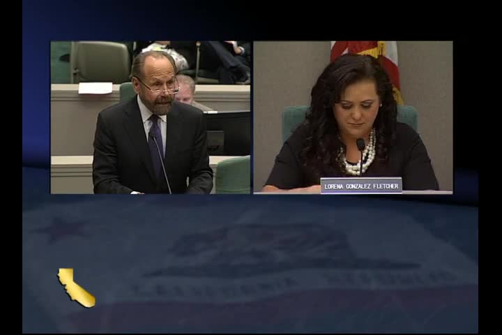
| Aug 23, 2018 | SB 1162 Pan Senate Third Reading By MCCARTY | Assembly Floor |
Passed |
|
| Aug 8, 2018 | Do pass. | Assembly Standing Committee on Appropriations |
Passed |
|
| Jun 27, 2018 | Do pass and be re-referred to the Committee on [Appropriations] with recommendation: To Consent Calendar | Assembly Standing Committee on Accountability and Administrative Review |
Passed |
|
| May 17, 2018 | Consent Calendar SB1162 | Senate Floor |
Passed |
|
| Apr 24, 2018 | Do pass, but first be re-referred to the Committee on [Appropriations] with the recommendation: To Consent Calendar | Senate Standing Committee on Governmental Organization |
Passed |
This list shows positions taken on this bill by organizations on the date displayed, which is linked to the original source.
Positions by individuals are not included.
|
Organization
|
Position
|
Date
|
|---|---|---|
| City Of Long Beach | * Support | Aug 8, 2018 |
| City Of Sacramento | ** Support | Jun 25, 2018 |
| Cresleigh Homes | ** Support | Jun 25, 2018 |
| Sacramento Area Council Of Governments | ** Support | Jun 25, 2018 |
| Sacramento Metropolitan Air Quality Management District | ** Support | Jun 25, 2018 |
| Sacramento Regional Transit District | ** Support | Jun 25, 2018 |
SENATE THIRD READING
STR Bill Id:SB 1162
Author:(Pan)
As Amended Ver:March 19, 2018
Majority vote
SENATE VOTE: 38-0
Committee | Votes | Ayes | Noes |
Accountability | 7-0 | Eggman, Patterson, Burke, Frazier, Lackey, Medina, Quirk-Silva | |
Appropriations | 16-0 | Gonzalez Fletcher, Bigelow, Bloom, Bonta, Brough, Calderon, Carrillo, Chau, Eggman, Fong, Friedman, Gallagher, Eduardo Garcia, Nazarian, Quirk, Reyes |
|
SUMMARY: Removes a parcel located at 1619 N Street in the City of Sacramento (City) from the area subject to height restrictions established in the Capitol View Protection Act (Act) of 1992 and, instead, designates Matsui Alley as the southern boundary of the area.
EXISTING LAW:
- Establishes the Act, via AB 3217 (Connelly), Chapter 841, Statutes of 1992, to guide development in the area surrounding the State Capitol Building and Capitol Park.
- Expresses legislative intent in the Act to respond to community concern about preservation of the visual prominence of the State Capitol.
- Specifies a height limit in the Act of 120 feet for the City blocks between L Street on the north, 17th Street on the east, N Street on the south, and 16th Street on the west.
FISCAL EFFECT: According to the Assembly Appropriations Committee, negligible state cost.
COMMENTS: This bill removes the 1619 N Street property from the height restrictions and setback requirements in the Act that govern development in the Capitol Park area. Specifically, this bill designates nearby Matsui Alley rather than the 1619 N Street property as the southern boundary of the area.
According to the author, subjecting the N Street parcel to a height limit of 120 feet as required in the Act conflicts with the height limit of 240 feet that is allowed for the property by the City of Sacramento's planning and development code. This discrepancy was not realized until a high density residential development was recently proposed for the site.
According to the legislative history of AB 3217, the Act was originally intended to "adopt height limits on state owned property bordering the capitol grounds." The N Street site was not a state owned property when the statute was enacted in 1992 nor is it state owned today.
Absent this bill, the proposed residential development of the N Street property would be limited to a height of 120 feet based on the boundaries specified in the Act. Cresleigh Homes, the proposed developer, states in support that the current height limit for the site is inconsistent with the limit established by the City and further restricts opportunity for residential infill development to address the City's unmet housing needs.
Analysis Prepared by: Cassie Royce / A. & A.R. / (916) 319-3600 FN: 0003819
Date of Hearing: August 8, 2018
ASSEMBLY COMMITTEE ON APPROPRIATIONS
Lorena Gonzalez Fletcher, Chair
SBPCA Bill Id:SB 1162
Author:(Pan) – As Amended Ver:March 19, 2018
Policy Committee: | Accountability and Administrative Review | Vote: | 7 - 0 |
|
| ||
|
|
Urgency: No State Mandated Local Program: No Reimbursable: No
SUMMARY:
This bill removes a parcel located at 1619 N Street in the City of Sacramento (City) from the area subject to height restrictions established in the Capitol View Protection Act of 1992 (Act) and instead designates Matsui Alley as the southern boundary of the area.
FISCAL EFFECT:
Negligible state cost.
COMMENTS:
- Purpose. This bill removes a state-mandated height restriction for a half-block area in downtown Sacramento east of Capitol Park. According to the author, subjecting the N Street parcel to a height limit of 120 feet as required in the Act conflicts with the height limit of 240 feet that is allowed for the property by the City of Sacramento's planning and development code. This discrepancy was not realized until a high-density residential development was recently proposed for the site.
- Background. AB 3217 (Connelly), Chapter 841, Statutes of 1992, established the Act to guide development surrounding the State Capitol Building and Capitol Park with the intent to preserve the visual prominence of the State Capitol. The Act applies to “state owned property bordering the capitol grounds.” The N Street site was not a state-owned property when the statute was enacted in 1992, nor is it state owned today.
The author contends that this property was erroneously included in the Act and points out that the height limit on the parcel to the west of the property, which is closer to the State Capitol, is 150 feet, or 30 feet higher than the current limit that applies to this property.
Absent this bill, the proposed residential development of the N Street property would be limited to a height of 120 feet based on the boundaries specified in the Act. Cresleigh Homes, the proposed developer, states in support that the current height limit for the site is inconsistent with the limit established by the City and further restricts opportunity for residential infill development to address the City's unmet housing needs.
Analysis Prepared by: Jennifer Swenson / APPR. / (916) 319-2081
Date of Hearing: June 27, 2018
ASSEMBLY COMMITTEE ON ACCOUNTABILITY AND ADMINISTRATIVE REVIEW
Susan Talamantes Eggman, Chair
SBPCA Bill Id:SB 1162
Author:(Pan) – As Amended Ver:March 19, 2018
SENATE VOTE: 38-0
SUBJECT: Capitol area planning: height limits
SUMMARY: Removes a parcel located at 1619 N Street in the City of Sacramento (City) from the area subject to height restrictions established in the Capitol View Protection Act of 1992 (Act). Specifically, this bill:
- Removes the 1619 N Street property as the southern boundary of the area currently subject to the Act’s 120 foot height limit.
- Designates Matsui Alley, instead, as the southern boundary of the area.
EXISTING LAW:
- Establishes the Act, via AB 3217 (Connelly), Chapter 841, Statutes of 1992, to guide development in the area surrounding the State Capitol Building and Capitol Park.
- Expresses legislative intent in the Act to respond to community concern about preservation of the visual prominence of the State Capitol.
- Specifies a height limit in the Act of 120 feet for the City blocks between L Street on the north, 17th Street on the east, N Street on the south, and 16th Street on the west.
FISCAL EFFECT: According to the Senate Appropriations Committee, pursuant to Senate Rule 28.8, negligible state costs.
COMMENTS: This bill removes the 1619 N Street property from the height restrictions and setback requirements in the Act that govern development in the Capitol Park area. Specifically, this bill designates nearby Matsui Alley rather than the 1619 N Street property as the southern boundary of the area.
According to the author, subjecting the N Street parcel to a height limit of 120 feet as required in the Act conflicts with the height limit of 240 feet that is allowed for the property by the City of Sacramento's planning and development code. This discrepancy was not realized until a high density residential development was recently proposed for the site.
The author contends that this property was erroneously included in the Act and points out that the height limit on the parcel to the west of the property, which is closer to the State Capitol, is 150 feet or 30 feet higher than the current limit that applies to this property.
According to the legislative history of AB 3217, the Act was originally intended to “adopt height limits on state owned property bordering the capitol grounds.” The N Street site was not a state owned property when the statute was enacted in 1992 nor is it state owned today.
Absent this bill, the proposed residential development of the N Street property would be limited to a height of 120 feet based on the boundaries specified in the Act. Cresleigh Homes, the proposed developer, states in support that the current height limit for the site is inconsistent with the limit established by the City and further restricts opportunity for residential infill development to address the City's unmet housing needs.
REGISTERED SUPPORT / OPPOSITION:
Support
City of Sacramento
Cresleigh Homes
Sacramento Area Council of Governments
Sacramento Metropolitan Air Quality Management District
Sacramento Regional Transit District
Opposition
None on file.
Analysis Prepared by: Cassie Royce / A. & A.R. / (916) 319-3600
Office of Senate Floor Analyses (916) 651-1520 Fax: (916) 327-4478 | SB |
CONSENT
Bill No: SB 1162
:
SENATE GOVERNMENTAL ORG. COMMITTEE: 12-0, 4/24/18
AYES: Dodd, Wilk, Bradford, Cannella, Gaines, Galgiani, Glazer, Hill, Hueso, Lara, Portantino, Vidak
SENATE APPROPRIATIONS COMMITTEE: Senate Rule 28.8
DIGEST: This bill designates Matsui Alley as the southern boundary of a specified area with the height limit of 120 feet for purposes of the Capitol View Protection Act (Act).
ANALYSIS:
Existing law:
- Provides that the Capitol Area Plan (Plan) is the official state master plan for development in the central city of the City of Sacramento (City).
- Defines “central city, to mean any area of the City of Sacramento bounded on the north by the American River, on the west by the Sacramento River, and on the south and east by Interstate Highway 80.
- Requires, under the Act, specified height and setback requirements in specified areas surrounding Capitol Park.
- Requires, under the Act, a height limit of 120 feet for the blocks between L Street on the north, 17th Street on the east, N Street on the south, and 16th Street on the West.
This bill designates Matsui Alley as the southern boundary of a specified area with the height limit of 120 feet for purposes of the Act.
Background
Purpose of the bill. According to the Author’s office, “removing the 1619 N Street property from the Act’s height limits would, subject to approval by the City of Sacramento and after compliance with all applicable laws, permit the property to be developed with up to 25 stories or 240 feet as currently allowed by the City’s building code and relevant ordinances. In order for this project to move forward, SB 1162 removes that particular parcel from the Act.”
Proposed development. In 2015 the City’s downtown Housing Initiative was launched with the goal of bringing 10,000 new housing units in the next 10 years to the Sacramento’s Central City. As part of that goal, Cresleigh Homes proposes to develop a high-density residential project at 1619 N Street, located in close proximity to SacRT’s bus and light rail services.
The location of the parcel is currently subject to the 120 foot height restrictions pursuant to the ACT. However, the same parcel, under the City’s Code has a height limit of 240 feet. This discrepancy was not realized until the development was proposed on the site. It is unclear why the parcel was included in the provisions of the Act.
The author’s office argues that this inclusion was an error. As an example, the height limit on the parcel to the west of the property, which is closer to the State Capitol, is 150 feet or 30 feet higher that the limit applicable to the property. In addition, Legislative analyses of the bill that enacted the Act, discuss the intent of the bill to “adopt height limits on state owned property bordering the capitol grounds.” This property was not a state owned property when that statute was enacted nor is it state owned today.
Based on the boundaries set forth in the Act, without this bill, the proposed development would be limited to a height of 120 feet. The author’s office argues that this limitation is not only contrary to the limitations set forth by the City but also limits the amount of housing that the City desperately needs.
Capitol Area Plan. The Capitol Area Plan was signed into law in 1997. The Plan is the official state master plan for development in the central city in the City of Sacramento. It is intended to act as a guide for future state policy in the expansion of the state’s physical footprint and in the location of state buildings and other facilities in the area.
In 1992, AB 3217 (Connelly, Chapter 841, Statutes of 1992), enacted the Act and established specified height restrictions and setback requirements for state buildings within certain areas located near the State Capitol Building and Capitol Park. Specifically, the bill established a height limit of 120 feet for the blocks between L Street on the north, 17th Street on the east, N Street on the south, and 16th Street on the West.
The Act reflected collaboration between state officials and the City of Sacramento and intended to guide the development in the area surrounding Capitol Park.
Related/Prior Legislation
AB 3217 (Connelly, Chapter 841, Statutes of 1992) enacted the Act, which established height restrictions and setback requirements, as specified, for state buildings with certain areas located near the State Capitol Building and Capitol Park.
FISCAL EFFECT: Appropriation: Fiscal Com.: Local:
Sacramento Metropolitan Air Quality Management District
Sacramento Regional Transit District
OPPOSITION: (Verified 5/15/18)
None received
ARGUMENTS IN SUPPORT: According to the Sacramento Metropolitan Air Quality Management District, “1619 N Street is located in an established urban center with high quality transit and low average per-capita vehicle miles traveled. High-density residential development on the site will encourage the use of active
transportation and may reduce the need for greenfield development on the urban fringe.”
5/16/18 9:54:25
**** END ****
SENATE COMMITTEE ON GOVERNMENTAL ORGANIZATION
Senator Bill Dodd
Chair
2017 - 2018 Regular
Bill No: SB Hearing Date: 4/24/2018
Author: | Pan | ||
Version: | Amended | ||
Urgency: | Fiscal: | ||
Consultant: | |||
SUBJECT:
DIGEST: This bill designates Matsui Alley as the southern boundary of a specified area with the height limit of 120 feet for purposes of the Capitol View Protection Act (Act).
ANALYSIS:
Existing law:
- Provides that the Capitol Area Plan (Plan) is the official state master plan for development in the central city of the City of Sacramento (City).
- Defines “central city, to mean any area of the City of Sacramento bounded on the north by the American River, on the west by the Sacramento River, and on the south and east by Interstate Highway 80.
- Requires, under the Act, specified height and setback requirements in specified areas surrounding Capitol Park.
- Requires, under the Act, a height limit of 120 feet for the blocks between L Street on the north, 17th Street on the east, N Street on the south, and 16th Street on the West.
This bill designates Matsui Alley as the southern boundary of a specified area with the height limit of 120 feet for purposes of the Act.
Background
Purpose of the bill. According to the Author’s office, “removing the 1619 N Street property from the Act’s height limits would, subject to approval by the City of Sacramento and after compliance with all applicable laws, permit the property to be developed with up to 25 stories or 240 feet as currently allowed by the City’s building code and relevant ordinances. In order for this project to move forward, SB 1162 removes that particular parcel from the Act.”
Proposed development. In 2015 the City’s downtown Housing Initiative was launched with the goal of bringing 10,000 new housing units in the next 10 years to the Sacramento’s Central City. As part of that goal, Cresleigh Homes proposes to develop a high-density residential project at 1619 N Street, located in close proximity to SacRT’s bus and light rail services.
The location of the parcel is currently subject to the 120 foot height restrictions pursuant to the ACT. However, the same parcel, under the City’s Code has a height limit of 240 feet. This discrepancy was not realized until the development was proposed on the site. It is unclear why the parcel was included in the provisions of the Act.
The author’s office argues that this inclusion was an error. As an example, the height limit on the parcel to the west of the property, which is closer to the State Capitol, is 150 feet or 30 feet higher that the limit applicable to the property. In addition, Legislative analyses of the bill that enacted the Act, discuss the intent of the bill to “adopt height limits on state owned property bordering the capitol grounds.” This property was not a state owned property when that statute was enacted nor is it state owned today.
Based on the boundaries set forth in the Act, without this bill, the proposed development would be limited to a height of 120 feet. The author’s office argues that this limitation is not only contrary to the limitations set forth by the City but also limits the amount of housing that the City desperately needs.
Capitol Area Plan. The Capitol Area Plan was signed into law in 1997. The Plan is the official state master plan for development in the central city in the City of Sacramento. It is intended to act as a guide for future state policy in the expansion of the state’s physical footprint and in the location of state buildings and other facilities in the area.
In 1992, AB 3217 (Connelly, Chapter 841, Statutes of 1992), enacted the Act and established specified height restrictions and setback requirements for state buildings within certain areas located near the State Capitol Building and Capitol Park. Specifically, the bill established a height limit of 120 feet for the blocks between L Street on the north, 17th Street on the east, N Street on the south, and 16th Street on the West.
The Act reflected collaboration between state officials and the City of Sacramento and intended to guide the development in the area surrounding Capitol Park.
Prior/Related Legislation
SB 1452 (Wilk, 2018) would establish the War on Terror Memorial Committee and requires the Committee to review the feasibility and best practices for the construction of a War on Terror Memorial in or around the State Capitol Park. (Pending in the Senate Governmental Organization Committee)
AB 2704 (Gipson, Chapter 698, Statutes of 2016) authorized the Mervyn Dymally Capitol Foundation, upon establishment, to consult with DGS to plan a bust of Mervyn Dymally to be placed in the State Capitol Building Annex; and, prohibited construction of the bust until the Joint Committee on Rules approved and adopted the plan for the bust, and the Joint Committee on Rules and the Department of Finance determined that sufficient private funding was available to construct and maintain the bust.
SB 1324 (Anderson, 2014) would have established a California Native American Monument in the State Capitol Park to honor the contributions, history, and culture of Native Americans in California. (Held in the Senate Rules Committee)
AB 146 (Olsen, 2013) would have deleted the requirement that construction of the California American Portuguese Veterans Memorial cannot begin until the master plan of the State Capitol Park is approved and adopted by the Joint Committee on Rules. (Gutted and amended into an unrelated issue)
AB 3217 (Connelly, Chapter 841, Statutes of 1992) enacted the Act, which established height restrictions and setback requirements, as specified, for state buildings with certain areas located near the State Capitol Building and Capitol Park.
FISCAL EFFECT: Appropriation: No Fiscal Com.: Yes Local: No
SUPPORT:
Sacramento Metropolitan Air Quality Management District
Sacramento Regional Transit District
OPPOSITION:
None received
ARGUMENTS IN SUPPORT: According to the Sacramento Metropolitan Air Quality Management District, “1619 N Street is located in an established urban center with high quality transit and low average per-capita vehicle miles traveled. High-density residential development on the site will encourage the use of active transportation and may reduce the need for greenfield development on the urban fringe.”
SENATE COMMITTEE ON GOVERNMENTAL ORGANIZATION
Senator Bill Dodd
Chair
2017 - 2018 Regular
Bill No: 1162 Hearing Date: 4/24/2018
Author: | |||
Version: | 3/19/2018 Amended | ||
Urgency: | No | Fiscal: | Yes |
Consultant: | Felipe Lopez | ||
SUBJECT: Capitol area planning: height limits
DIGEST: This bill designates Matsui Alley as the southern boundary of a specified area with the height limit of 120 feet for purposes of the Capitol View Protection Act (Act).
ANALYSIS:
Existing law:
- Provides that the Capitol Area Plan (Plan) is the official state master plan for development in the central city of the City of Sacramento (City).
- Defines “central city, to mean any area of the City of Sacramento bounded on the north by the American River, on the west by the Sacramento River, and on the south and east by Interstate Highway 80.
- Requires, under the Act, specified height and setback requirements in specified areas surrounding Capitol Park.
- Requires, under the Act, a height limit of 120 feet for the blocks between L Street on the north, 17th Street on the east, N Street on the south, and 16th Street on the West.
This bill designates Matsui Alley as the southern boundary of a specified area with the height limit of 120 feet for purposes of the Act.
Background
Purpose of the bill. According to the Author’s office, “removing the 1619 N Street property from the Act’s height limits would, subject to approval by the City of Sacramento and after compliance with all applicable laws, permit the property to be developed with up to 25 stories or 240 feet as currently allowed by the City’s building code and relevant ordinances. In order for this project to move forward, SB 1162 removes that particular parcel from the Act.”
Proposed development. In 2015 the City’s downtown Housing Initiative was launched with the goal of bringing 10,000 new housing units in the next 10 years to the Sacramento’s Central City. As part of that goal, Cresleigh Homes proposes to develop a high-density residential project at 1619 N Street, located in close proximity to SacRT’s bus and light rail services.
The location of the parcel is currently subject to the 120 foot height restrictions pursuant to the ACT. However, the same parcel, under the City’s Code has a height limit of 240 feet. This discrepancy was not realized until the development was proposed on the site. It is unclear why the parcel was included in the provisions of the Act.
The author’s office argues that this inclusion was an error. As an example, the height limit on the parcel to the west of the property, which is closer to the State Capitol, is 150 feet or 30 feet higher that the limit applicable to the property. In addition, Legislative analyses of the bill that enacted the Act, discuss the intent of the bill to “adopt height limits on state owned property bordering the capitol grounds.” This property was not a state owned property when that statute was enacted nor is it state owned today.
Based on the boundaries set forth in the Act, without this bill, the proposed development would be limited to a height of 120 feet. The author’s office argues that this limitation is not only contrary to the limitations set forth by the City but also limits the amount of housing that the City desperately needs.
Capitol Area Plan. The Capitol Area Plan was signed into law in 1997. The Plan is the official state master plan for development in the central city in the City of Sacramento. It is intended to act as a guide for future state policy in the expansion of the state’s physical footprint and in the location of state buildings and other facilities in the area.
In 1992, AB 3217 (Connelly, Chapter 841, Statutes of 1992), enacted the Act and established specified height restrictions and setback requirements for state buildings within certain areas located near the State Capitol Building and Capitol Park. Specifically, the bill established a height limit of 120 feet for the blocks between L Street on the north, 17th Street on the east, N Street on the south, and 16th Street on the West.
The Act reflected collaboration between state officials and the City of Sacramento and intended to guide the development in the area surrounding Capitol Park.
Prior/Related Legislation
SB 1452 (Wilk, 2018) would establish the War on Terror Memorial Committee and requires the Committee to review the feasibility and best practices for the construction of a War on Terror Memorial in or around the State Capitol Park. (Pending in the Senate Governmental Organization Committee)
AB 2704 (Gipson, Chapter 698, Statutes of 2016) authorized the Mervyn Dymally Capitol Foundation, upon establishment, to consult with DGS to plan a bust of Mervyn Dymally to be placed in the State Capitol Building Annex; and, prohibited construction of the bust until the Joint Committee on Rules approved and adopted the plan for the bust, and the Joint Committee on Rules and the Department of Finance determined that sufficient private funding was available to construct and maintain the bust.
SB 1324 (Anderson, 2014) would have established a California Native American Monument in the State Capitol Park to honor the contributions, history, and culture of Native Americans in California. (Held in the Senate Rules Committee)
AB 146 (Olsen, 2013) would have deleted the requirement that construction of the California American Portuguese Veterans Memorial cannot begin until the master plan of the State Capitol Park is approved and adopted by the Joint Committee on Rules. (Gutted and amended into an unrelated issue)
AB 3217 (Connelly, Chapter 841, Statutes of 1992) enacted the Act, which established height restrictions and setback requirements, as specified, for state buildings with certain areas located near the State Capitol Building and Capitol Park.
FISCAL EFFECT: Appropriation: Fiscal Com.: Local:
SUPPORT:
Sacramento Metropolitan Air Quality Management District
Sacramento Regional Transit District
OPPOSITION:
None received
ARGUMENTS IN SUPPORT: According to the Sacramento Metropolitan Air Quality Management District, “1619 N Street is located in an established urban center with high quality transit and low average per-capita vehicle miles traveled. High-density residential development on the site will encourage the use of active transportation and may reduce the need for greenfield development on the urban fringe.”
Discussed in Hearing
View Older Hearings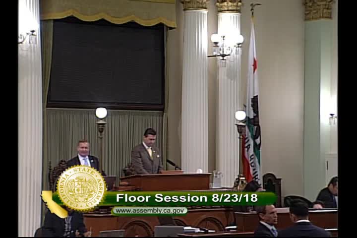
Bill Author
Bill Co-Author(s):