AB 2583: School zones: speed limits.
- Session Year: 2023-2024
- House: Assembly
- Latest Version Date: 2024-06-27
Current Status:
Failed
(2024-08-15: In committee: Held under submission.)
Introduced
In Committee
First Chamber
In Committee
Second Chamber
Enacted
What does this bill do?
The bill requires cities and counties that update their circulation plans to identify “school walk zones” — all roads and sidewalks within 1,000 feet of a school’s boundary. It changes speeds near schools by letting local officials set 20 mph school‑zone limits now, allowing 15 mph limits on some residential streets near schools, and establishing 20 mph as the standard school‑zone speed statewide later. For traffic law, it defines “school zone” as the area within 500 feet of school grounds unless otherwise posted and updates speed‑trap enforcement rules to use that definition.
The summary is provided by generative AI which can make mistakes. For original language, please view the details in the table below.
Existing law establishes a prima facie speed limit of 25 miles per hour when approaching or passing a school building or grounds contiguous to a highway or when the school grounds are not separated from the highway, as specified. Existing law authorizes a local authority, by ordinance or resolution, to reduce the prima facie speed limit based on an engineering and traffic survey, as specified.
This bill would, until January 1, 2028, instead establish a prima facie speed limit of 25 miles per hour in a school zone, as defined, subject to specified conditions, including, among others, when a school speed limit sign states when children are present and children are present, as defined, and when a school speed limit sign states specific hours, as specified. The bill would, notwithstanding the above provision and until January 1, 2028, authorize a local authority, by ordinance or resolution, to determine and declare a prima facie speed limit of 20 miles per hour in a school zone. The bill would, beginning on January 1, 2028, establish a prima facie speed limit of 20 miles per hour in a school zone, subject to conditions similar to those described above. By establishing new prima facie speed limits in school zones that would require changes to local speed limit signs, this bill would impose a state-mandated local program.
Existing law authorizes a local authority, by ordinance or resolution, to modify the prima facie speed limit based on distance from a school if the highways have a maximum of 2 traffic lanes and a maximum posted prima facie speed limit of 30 miles per hour immediately before and after the school zone, as specified.
The bill would instead authorize a local authority, by ordinance or resolution, to determine and declare a prima facie speed limit of 15 miles per hour in a residence district on a highway with a posted speed limit of 30 miles per hour or slower in a school zone, or 25 miles per hour when approaching from a school zone at a distance of 500 to 1,000 feet, without the above-mentioned conditions, as specified.
The bill would, for purposes of the above provisions, define school zone as an area of a highway within 500 feet of school grounds in any direction, unless otherwise posted, marked with appropriate signs giving notice of the area.
Existing law defines a speed trap, under certain circumstances, to mean, among other things, a particular section of a highway or state highway with a prima facie speed limit that is provided by law, as specified, if that prima facie speed limit is not justified by an engineering and traffic survey conducted within a certain specified time period, and enforcement of the speed limit involves the use of radar or another specified electronic device. Existing law exempts application of that definition to a local street, road, or school zone, senior zone, business activity district, or speed limit adopted by a local authority under certain conditions.
This bill would change the definition of school zone for purposes of these provisions to conform with the definition of school zone described above.
The California Constitution requires the state to reimburse local agencies and school districts for certain costs mandated by the state. Statutory provisions establish procedures for making that reimbursement.
This bill would provide that, if the Commission on State Mandates determines that the bill contains costs mandated by the state, reimbursement for those costs shall be made pursuant to the statutory provisions noted above.
Existing law, the Planning and Zoning Law, requires the legislative body of a city or county to adopt a comprehensive general plan that includes various elements, including a circulation element to plan for transportation routes.
This bill would require, upon any substantive revision of the circulation element on or after January 1, 2025, the legislative body of a city or county, to identify and establish school walk zones for all schools located within the scope of the general plan. The bill would define a school walk zone to mean all roadways and sidewalks within 1,000 feet in all directions of the boundary line of a school grounds. By placing new duties on county and city officials with respect to their land use planning, the bill would impose a state-mandated local program.
Existing law establishes a prima facie speed limit of 25 miles per hour when approaching or passing a school building or grounds contiguous to a highway or when the school grounds are not separated from the highway, as specified. Existing law authorizes a local authority, by ordinance or resolution, to reduce the prima facie speed limit based on an engineering and traffic survey, as specified. Existing law authorizes a local authority, by ordinance or resolution, to modify the prima facie speed limit based on distance from the school, if the highways have a maximum of two traffic lanes and a maximum posted prima facie speed limit of 30 miles per hour immediately before and after the school zone, as specified.
This bill would, beginning on January 1, 2028, establish a prima facie speed limit of 20 miles per hour in a school zone, as defined, during certain hours and days a school is in operation. The bill would, until January 1, 2028, authorize a local authority, by ordinance or resolution, to determine and declare a prima facie speed limit of 20 miles per hour in a school zone, as specified. The bill would authorize a local authority, by ordinance or resolution, to determine and declare a prima facie speed limit of 25 miles per hour when approaching a school at a distance of 500 to 1,000 feet, without the above-mentioned conditions, as specified. The bill would also make conforming changes to implement these new speed limits and authorizations.This bill would, until January 1, 2028, instead establish a prima facie speed limit of 25 miles per hour in a school zone, as defined, subject to specified conditions, including, among others, when a school speed limit sign states when children are present and children are present, as defined, and when a school speed limit sign states specific hours, as specified. The bill would, notwithstanding the above provision and until January 1, 2028, authorize a local authority, by ordinance or resolution, to determine and declare a prima facie speed limit of 20 miles per hour in a school zone. The bill would, beginning on January 1, 2028, establish a prima facie speed limit of 20 miles per hour in a school zone, subject to conditions similar to those described above.
Existing law authorizes a local authority, by ordinance or resolution, to modify the prima facie speed limit based on distance from a school if the highways have a maximum of 2 traffic lanes and a maximum posted prima facie speed limit of 30 miles per hour immediately before and after the school zone, as specified.
The bill would instead authorize a local authority, by ordinance or resolution, to determine and declare a prima facie speed limit of 15 miles per hour in a residence district on a highway with a posted speed limit of 30 miles per hour or slower in a school zone, or 25 miles per hour when approaching from a school zone at a distance of 500 to 1,000 feet, without the above-mentioned conditions, as specified.
The bill would, for purposes of the above provisions, define school zone as an area of a highway within 500 feet of school grounds in any direction, unless otherwise posted, marked with appropriate signs giving notice of the area.
Existing law defines a speed trap, under certain circumstances, to mean, among other things, a particular section of a highway or state highway with a prima facie speed limit that is provided by law, as specified, if that prima facie speed limit is not justified by an engineering and traffic survey conducted within a certain specified time period, and enforcement of the speed limit involves the use of radar or another specified electronic device. Existing law exempts application of that definition to a local street, road, or school zone, senior zone, business activity district, or speed limit adopted by a local authority under certain conditions.
This bill would expand the above-described exemption from what constitutes a speed trap to include school zones as described above. change the definition of school zone for purposes of these provisions to conform with the definition of school zone described above.
The California Constitution requires the state to reimburse local agencies and school districts for certain costs mandated by the state. Statutory provisions establish procedures for making that reimbursement.
This bill would provide that, if the Commission on State Mandates determines that the bill contains costs mandated by the state, reimbursement for those costs shall be made pursuant to the statutory provisions noted above.
Existing law, the Planning and Zoning Law, requires the legislative body of a city or county to adopt a comprehensive general plan that includes various elements, including a circulation element to plan for transportation routes.
This bill would require, upon any substantive revision of the circulation element on or after January 1, 2025, the legislative body of a city or county, to identify and establish school walk zones for all schools located within the scope of the general plan. The bill would define a school walk zone to mean all roadways and sidewalks within1/2 mile 1,000 feet in all directions of the boundary line of a school grounds. By placing new duties on county and city officials with respect to their land use planning, the bill would impose a state-mandated local program.
Existing law establishes a prima facie speed limit of 25 miles per hour when approaching or passing a school building or grounds contiguous to a highway or when the school grounds are not separated from the highway, as specified. Existing law authorizes a local authority, by ordinance or resolution, to reduce the prima facie speed limit based on an engineering and traffic survey, as specified. Existing law authorizes a local authority, by ordinance or resolution, to modify the prima facie speed limit based on distance from the school, if the highways have a maximum of two traffic lanes and a maximum posted prima facie speed limit of 30 miles per hour immediately before and after the school zone, as specified.
This bill would, beginning on January 1, 2027, 2028, establish a prima facie speed limit of 20 miles per hour in a school zone, as defined, during certain hours and days a school is in operation. The bill would, until January 1, 2027, 2028, authorize a local authority, by ordinance or resolution, to determine and declare a prima facie speed limit of 20 miles per hour in a school zone, as specified. The bill would authorize a local authority, by ordinance or resolution, to determine and declare a prima facie speed limit of 25 miles per hour when approaching a school at a distance of 500 to 1,000 feet, without the above-mentioned conditions, as specified. The bill would also make conforming changes to implement these new speed limits and authorizations.
Existing law defines a speed trap, under certain circumstances, to mean, among other things, a particular section of a highway or state highway with a prima facie speed limit that is provided by law, as specified, if that prima facie speed limit is not justified by an engineering and traffic survey conducted within a certain specified time period, and enforcement of the speed limit involves the use of radar or another specified electronic device. Existing law exempts application of that definition to a local street, road, or school zone, senior zone, business activity district, or speed limit adopted by a local authority under certain conditions.
This bill would expand the above-described exemption from what constitutes a speed trap to include school zones as described above.
The California Constitution requires the state to reimburse local agencies and school districts for certain costs mandated by the state. Statutory provisions establish procedures for making that reimbursement.
This bill would provide that, if the Commission on State Mandates determines that the bill contains costs mandated by the state, reimbursement for those costs shall be made pursuant to the statutory provisions noted above.
Existing law, the Planning and Zoning Law, requires the legislative body of a city or county to adopt a comprehensive general plan that includes various elements, including a circulation element to plan for transportation routes.
This bill would require, upon any substantive revision of the circulation element on or after January 1, 2025, the legislative body of a city or county, to identify and establish school walk zones for all schools located within the scope of the general plan. The bill would define a school walk zone to mean all roadways and sidewalks within1/2 mile in all directions of the boundary line of a school grounds. By placing new duties on county and city officials with respect to their land use planning, the bill would impose a state-mandated local program.
Existing law establishes a prima facie speed limit of 25 miles per hour when approaching or passing a school building or grounds contiguous to a highway or when the school grounds are not separated from the highway, as specified. Existing law authorizes a local authority, by ordinance or resolution, to modify that prima facie speed limit of 25 miles per hour based on an engineering and traffic survey or the distance from the school, under specified conditions.This bill would instead establish a prima facie speed limit of 15 miles per hour in a school zone, as defined, during certain hours and days a school is in operation. The bill would authorize a local authority, by ordinance or resolution, to determine and declare a prima facie speed limit of 25 miles per hour when approaching, at a distance of 500 to 1,000 feet from, a school building or the grounds thereof, contiguous to a highway and posted with a school warning sign indicating the speed limit for specified times and dates. The bill would also make conforming changes to implement these new speed limits and authorizations.Existing law establishes a prima facie speed limit of 25 miles per hour when approaching or passing a school building or grounds contiguous to a highway or when the school grounds are not separated from the highway, as specified. Existing law authorizes a local authority, by ordinance or resolution, to reduce the prima facie speed limit based on an engineering and traffic survey, as specified. Existing law authorizes a local authority, by ordinance or resolution, to modify the prima facie speed limit based on distance from the school, if the highways have a maximum of two traffic lanes and a maximum posted prima facie speed limit of 30 miles per hour immediately before and after the school zone, as specified.
This bill would, beginning on January 1, 2027, establish a prima facie speed limit of 20 miles per hour in a school zone, as defined, during certain hours and days a school is in operation. The bill would, until January 1, 2027, authorize a local authority, by ordinance or resolution, to determine and declare a prima facie speed limit of 20 miles per hour in a school zone, as specified. The bill would authorize a local authority, by ordinance or resolution, to determine and declare a prima facie speed limit of 25 miles per hour when approaching a school at a distance of 500 to 1,000 feet, without the above-mentioned conditions, as specified. The bill would also make conforming changes to implement these new speed limits and authorizations.
Existing law defines a speed trap, under certain circumstances, to mean, among other things, a particular section of a highway or state highway with a prima facie speed limit that is provided by law, as specified, if that prima facie speed limit is not justified by an engineering and traffic survey conducted within a certain specified time period, and enforcement of the speed limit involves the use of radar or another specified electronic device. Existing law exempts application of that definition to a local street, road, or school zone, senior zone, business activity district, or speed limit adopted by a local authority under certain conditions.
This bill would expand the above-described exemption from what constitutes a speed trap to include school zones as described above.
The California Constitution requires the state to reimburse local agencies and school districts for certain costs mandated by the state. Statutory provisions establish procedures for making that reimbursement.
This bill would provide that, if the Commission on State Mandates determines that the bill contains costs mandated by the state, reimbursement for those costs shall be made pursuant to the statutory provisions noted above.
Existing law, the Planning and Zoning Law, requires the legislative body of a city or county to adopt a comprehensive general plan that includes various elements, including a circulation element to plan for transportation routes.
This bill would require, upon any substantive revision of the circulation element on or after January 1, 2025, the legislative body of a city or county, to identify and establish school routes walk zones for all schools located within the scope of the general plan and establish a posted speed limit of no more than 25 miles per hour within a school route, as specified. plan. The bill would define a school route walk zone to mean all roadways and sidewalks within 1,000 feet1/2 mile in all directions of the boundary line of a school grounds. By placing new duties on county and city officials with respect to their land use planning, the bill would impose a state-mandated local program.
Existing law establishes a prima facie speed limit of 25 miles per hour when approaching or passing a school building or grounds contiguous to a highway or when the school grounds are not separated from the highway, as specified. Existing law authorizes a local authority, by ordinance or resolution, to modify that prima facie speed limit of 25 miles per hour based on an engineering and traffic survey or the distance from the school, under specified conditions.
This bill would instead establish a prima facie speed limit of 15 miles per hour in a school zone, as defined, during certain hours and days a school is in operation. The bill would authorize a local authority, by ordinance or resolution, to determine and declare a prima facie speed limit of 25 miles per hour on a highway with a posted speed limit of 35 miles per hour or slower, when approaching, at a distance of 500 to 1,000 feet from, a school building or the grounds thereof, contiguous to a highway, under specified conditions. highway and posted with a school warning sign indicating the speed limit for specified times and dates. The bill would also make conforming changes to implement these new speed limits and authorizations.
Existing law defines a speed trap, under certain circumstances, to mean, among other things, a particular section of a highway or state highway with a prima facie speed limit that is provided by law, as specified, if that prima facie speed limit is not justified by an engineering and traffic survey conducted within a certain specified time period, and enforcement of the speed limit involves the use of radar or another specified electronic device. Existing law exempts application of that definition to a local street, road, or school zone, senior zone, business activity district, or speed limit adopted by a local authority under certain conditions.
This bill would expand the above-described exemption from what constitutes a speed trap to include school zones as described above.
The California Constitution requires the state to reimburse local agencies and school districts for certain costs mandated by the state. Statutory provisions establish procedures for making that reimbursement.
This bill would provide that, if the Commission on State Mandates determines that the bill contains costs mandated by the state, reimbursement for those costs shall be made pursuant to the statutory provisions noted above.
Existing law, the Planning and Zoning Law, requires the legislative body of a city or county to adopt a comprehensive general plan that includes various elements, including a circulation element to plan for transportation routes.
This bill would require, upon any substantive revision of the circulation element on or after January 1, 2025, the legislative body of a city or county, to identify and establish school routes for all schools located within the scope of the general plan and establish a posted speed limit of no more than 25 miles per hour within a school route, as specified. The bill would define a school route to mean all roadways and sidewalks within 1,000 feet in all directions of the boundary line of a school grounds. By placing new duties on county and city officials with respect to their land use planning, the bill would impose a state-mandated local program.
Existing law establishes a prima facie speed limit of 25 miles per hour when approaching or passing a school building or grounds contiguous to a highway or when the school grounds are not separated from the highway, as specified. Existing law authorizes a local authority, by ordinance or resolution, to modify that prima facie speed limit of 25 miles per hour based on an engineering and traffic survey or the distance from the school, under specified conditions.
This bill would instead establish a prima facie speed limit of 15 miles per hour in a school zone, as defined, during certain hours and days a school is in operation. The bill would authorize a local authority, by ordinance or resolution, to determine and declare a prima facie speed limit of 25 miles per hour on a highway with a posted speed limit of 35 miles per hour or slower, when approaching, at a distance of 500 to 1,000 feet from, a school building or the grounds thereof, contiguous to a highway, under specified conditions. The bill would also make conforming changes to implement these new speed limits and authorizations.
The California Constitution requires the state to reimburse local agencies and school districts for certain costs mandated by the state. Statutory provisions establish procedures for making that reimbursement.
This bill would provide that, if the Commission on State Mandates determines that the bill contains costs mandated by the state, reimbursement for those costs shall be made pursuant to the statutory provisions noted above.
The prima facie limits are as follows and shall be applicable unless changed as authorized in this code and, if so changed, only when signs have been erected giving notice thereof:
(a)Fifteen miles per hour:
(1)When traversing a railway grade crossing, if during the last 100 feet of the approach to the crossing the driver does not have a clear and unobstructed view of the crossing and of any traffic on the railway for a distance of 400 feet in both directions along the railway. This subdivision does not apply in the case of any railway grade crossing where a human flagperson is on duty or a clearly visible electrical or mechanical railway crossing signal device is installed but does not then indicate the immediate approach of a railway train or car.
(2)When traversing any intersection of highways if during the last 100 feet of the drivers approach to the intersection the driver does not have a clear and unobstructed view of the intersection and of any traffic upon all of the highways entering the intersection for a distance of 100 feet along all those highways, except at an intersection protected by stop signs or yield right-of-way signs or controlled by official traffic control signals.
(3)On any alley.
(b)Twenty-five miles per hour:
(1)On any highway, in any business or residence district unless a different speed is determined by local authority or the Department of Transportation under procedures set forth in this code.
(2)When passing a senior center or other facility primarily used by senior citizens, contiguous to a street other than a state highway and posted with a standard SENIOR warning sign. A local authority may erect a sign pursuant to this paragraph when the local agency makes a determination that the proposed signing should be implemented. A local authority may request grant funding from the Active Transportation Program pursuant to Chapter 8 (commencing with Section 2380) of Division 3 of the Streets and Highways Code, or any other grant funding available to it, and use that grant funding to pay for the erection of those signs, or may utilize any other funds available to it to pay for the erection of those signs, including, but not limited to, donations from private sources.
(3)In a school zone when any of the following apply:
(A)A school speed limit sign with attached beacons states speed limit 25 when flashing and the beacons are flashing.
(B)A school speed limit sign states when children are present and children are present.
(C)A school speed limit sign with specific hours, which shall be determined by the local jurisdiction.
(c)For purposes of this section, the following definitions shall apply:
(1)School zone means an area of a highway within 500 feet of school grounds in any direction, unless otherwise posted, marked with appropriate signs giving notice of the area.
(2)(A)Children are present means whenever one or more children are on a roadway, sidewalk, pathway, or road shoulder within the marked school zone, regardless of school days or hours. This definition also includes children present in front of school buildings, on adjacent school grounds, on the same side of the street as the school building, and across the street from the school building, in any direction within the marked school zone.
(B)Children are present does not include children who are separated from the highway by a fence, gate, or other physical barrier.
(d)This section shall remain in effect until January 1, 2028, and as of that date is repealed.
SEC. 3.SEC. 2.Section 22352 is added to the Vehicle Code, to read:22352.The prima facie limits are as follows and shall be applicable unless changed as authorized in this code and, if so changed, only when signs have been erected giving notice thereof:
(a)Fifteen miles per hour:
(1)When traversing a railway grade crossing, if during the last 100 feet of the approach to the crossing the driver does not have a clear and unobstructed view of the crossing and of any traffic on the railway for a distance of 400 feet in both directions along the railway. This subdivision does not apply in the case of any railway grade crossing where a human flagperson is on duty or a clearly visible electrical or mechanical railway crossing signal device is installed but does not then indicate the immediate approach of a railway train or car.
(2)When traversing any intersection of highways if during the last 100 feet of the drivers approach to the intersection the driver does not have a clear and unobstructed view of the intersection and of any traffic upon all of the highways entering the intersection for a distance of 100 feet along all those highways, except at an intersection protected by stop signs or yield right-of-way signs or controlled by official traffic control signals.
(3)On any alley.
(b)Twenty miles per hour in a school zone when any of the following apply:
(1)A school speed limit sign with attached beacons states speed limit 20 when flashing and the beacons are flashing.
(2)A school speed limit sign states when children are present and children are present.
(3)A school speed limit sign with specific hours, which shall be determined by the local jurisdiction.
(c)Twenty-five miles per hour:
(1)On any highway, in any business or residence district unless a different speed is determined by local authority or the Department of Transportation under procedures set forth in this code.
(2)When passing a senior center or other facility primarily used by senior citizens, contiguous to a street other than a state highway and posted with a standard SENIOR warning sign. A local authority may erect a sign pursuant to this paragraph when the local agency makes a determination that the proposed signing should be implemented. A local authority may request grant funding from the Active Transportation Program pursuant to Chapter 8 (commencing with Section 2380) of Division 3 of the Streets and Highways Code, or any other grant funding available to it, and use that grant funding to pay for the erection of those signs, or may utilize any other funds available to it to pay for the erection of those signs, including, but not limited to, donations from private sources.
(d)For purposes of this section, the following definitions shall apply:
(1)School zone means an area of a highway within 500 feet of school grounds in any direction, unless otherwise posted, marked with appropriate signs giving notice of the area.
(2)(A)Children are present means whenever one or more children are on a roadway, sidewalk, pathway, or road shoulder within the marked school zone, regardless of school days or hours. This definition also includes children present in front of school buildings, on adjacent school grounds, on the same side of the street as the school building, and across the street from the school building, in any direction within the marked school zone.
(B)Children are present does not include children who are separated from the highway by a fence, gate, or other physical barrier.
(e)This section shall become operative on January 1, 2028.
SEC. 4.SEC. 3.Section 22352.5 is added to the Vehicle Code, to read:22352.5.(a)Notwithstanding Section 22352, a local authority may, by ordinance or resolution, determine and declare a prima facie speed limit of 20 miles per hour in a school zone.
(b)For purposes of this section, school zone has the same meaning as defined in Section 22352.
(c)This section shall remain in effect until January 1, 2028, and as of that date is repealed.
SEC. 5.SEC. 4.Section 22358.4 of the Vehicle Code is amended to read:22358.4.(a)(1)Whenever a local authority determines upon the basis of an engineering and traffic survey that the prima facie speed limit established by subdivision (b) of Section 22352 is more than is reasonable or safe, the local authority may, by ordinance or resolution, determine and declare a prima facie speed limit of 15 miles per hour if justified as the appropriate speed limit by that survey.
(2)An ordinance or resolution adopted under paragraph (1) shall not be effective until appropriate signs giving notice of the speed limit are erected upon the highway and, in the case of a state highway, until the ordinance is approved by the Department of Transportation and the appropriate signs are erected upon the highway.
(b)(1)Notwithstanding subdivision (a) or any other provision of law, a local authority may, by ordinance or resolution, determine and declare prima facie speed limits as follows:
(A)A 15 miles per hour prima facie limit in a residence district, on a highway with a posted speed limit of 30 miles per hour or slower in a school zone.
(B)A 25 miles per hour prima facie limit on a highway when approaching, at a distance of 500 to 1,000 feet from a school zone.
(2)The prima facie limit established under subparagraph (A) of paragraph (1) applies only to highways that meet all of the following conditions:
(A)A maximum of two traffic lanes.
(B)A maximum posted 30 miles per hour prima facie speed limit immediately prior to and after the school zone.
(3)The prima facie limits established under paragraph (1) apply to all lanes of an affected highway, in both directions of travel.
(4)When determining the need to lower the prima facie speed limit, the local authority shall take the provisions of Section 627 into consideration.
(5)(A)An ordinance or resolution adopted under paragraph (1) shall not be effective until appropriate signs giving notice of the speed limit are erected upon the highway and, in the case of a state highway, until the ordinance is approved by the Department of Transportation and the appropriate signs are erected upon the highway.
(B)For purposes of subparagraph (A) of paragraph (1), school warning signs indicating a speed limit of 15 miles per hour may be placed at a distance up to 500 feet away from school grounds.
(C)For purposes of subparagraph (B) of paragraph (1), school warning signs indicating a speed limit of 25 miles per hour may be placed at any distance between 500 and 1,000 feet away from the school grounds.
(D)A local authority shall reimburse the Department of Transportation for all costs incurred by the department under this subdivision.
(c)For purposes of this section, school zone has the same meaning as defined in Section 22352.
SEC. 6.SEC. 5.Section 40802 of the Vehicle Code is amended to read:40802.(a)A speed trap is either of the following:
(1)A particular section of a highway measured as to distance and with boundaries marked, designated, or otherwise determined in order that the speed of a vehicle may be calculated by securing the time it takes the vehicle to travel the known distance.
(2)A particular section of a highway with a prima facie speed limit that is provided by this code or by local ordinance pursuant to Section 22352, 22354, 22357, 22358, or 22358.3, if that prima facie speed limit is not justified by an engineering and traffic survey conducted within five years prior to the date of the alleged violation, and enforcement of the speed limit involves the use of radar or any other electronic device that measures the speed of moving objects. This paragraph does not apply to a local street, road, school zone, senior zone, business activity district, or speed limit adopted under Section 22358.7 or 22358.8.
(b)(1)For purposes of this section, a local street or road is one that is functionally classified as local on the California Road System Maps, that are approved by the Federal Highway Administration and maintained by the Department of Transportation. It may also be defined as a local street or road if it primarily provides access to abutting residential property and meets the following three conditions:
(A)Roadway width of not more than 40 feet.
(B)Not more than one-half of a mile of uninterrupted length. Interruptions shall include official traffic control signals as defined in Section 445.
(C)Not more than one traffic lane in each direction.
(2)For purposes of this section, school zone has the same meaning as defined in Section 22352.
(3)For purposes of this section, senior zone means that area approaching or passing a senior center building or other facility primarily used by senior citizens, or the grounds thereof that is contiguous to a highway and on which is posted a standard SENIOR warning sign, pursuant to Section 22352.
(4)For purposes of this section, business activity district means a section of highway described in subdivision (b) of Section 22358.9 in which a standard 25 miles per hour or 20 miles per hour speed limit sign has been posted pursuant to paragraph (1) of subdivision (a) of that section.
(c)(1)When all of the following criteria are met, paragraph (2) of this subdivision shall be applicable and subdivision (a) shall not be applicable:
(A)When radar is used, the arresting officer has successfully completed a radar operator course of not less than 24 hours on the use of police traffic radar, and the course was approved and certified by the Commission on Peace Officer Standards and Training.
(B)When a laser or any other electronic device is used to measure the speed of moving objects, the arresting officer has successfully completed the training required in subparagraph (A) and an additional training course of not less than two hours approved and certified by the Commission on Peace Officer Standards and Training.
(C)(i)The prosecution proved that the arresting officer complied with subparagraphs (A) and (B) and that an engineering and traffic survey has been conducted in accordance with subparagraph (B) of paragraph (2). The prosecution proved that, prior to the officer issuing the notice to appear, the arresting officer established that the radar, laser, or other electronic device conformed to the requirements of subparagraph (D).
(ii)The prosecution proved the speed of the accused was unsafe for the conditions present at the time of alleged violation unless the citation was for a violation of Section 22349, 22356, or 22406.
(D)The radar, laser, or other electronic device used to measure the speed of the accused meets or exceeds the minimal operational standards of the National Highway Traffic Safety Administration, and has been calibrated within the three years prior to the date of the alleged violation by an independent certified laser or radar repair and testing or calibration facility.
(2)A speed trap is either of the following:
(A)A particular section of a highway measured as to distance and with boundaries marked, designated, or otherwise determined in order that the speed of a vehicle may be calculated by securing the time it takes the vehicle to travel the known distance.
(B)(i)A particular section of a highway or state highway with a prima facie speed limit that is provided by this code or by local ordinance under paragraph (1) of subdivision (b) of Section 22352, or established under Section 22354, 22357, 22358, or 22358.3, if that prima facie speed limit is not justified by an engineering and traffic survey conducted within one of the following time periods, prior to the date of the alleged violation, and enforcement of the speed limit involves the use of radar or any other electronic device that measures the speed of moving objects:
(I)Except as specified in subclause (II), seven years.
(II)If an engineering and traffic survey was conducted more than 7 years prior to the date of the alleged violation, and a registered engineer evaluates the section of the highway and determines that no significant changes in roadway or traffic conditions have occurred, including, but not limited to, changes in adjoining property or land use, roadway width, or traffic volume, 14 years.
(ii)This subparagraph does not apply to a local street, road, or school zone, senior zone, business activity district, or speed limit adopted under Section 22358.4, 22358.7, or 22358.8.
SEC. 7.SEC. 6.If the Commission on State Mandates determines that this act contains costs mandated by the state, reimbursement to local agencies and school districts for those costs shall be made pursuant to Part 7 (commencing with Section 17500) of Division 4 of Title 2 of the Government Code.
The general plan shall consist of a statement of development policies and shall include a diagram or diagrams and text setting forth objectives, principles, standards, and plan proposals. The plan shall include the following elements:
(a)A land use element that designates the proposed general distribution and general location and extent of the uses of the land for housing, business, industry, open space, including agriculture, natural resources, recreation, and enjoyment of scenic beauty, education, public buildings and grounds, solid and liquid waste disposal facilities, greenways, as defined in Section 816.52 of the Civil Code, and other categories of public and private uses of land. The location and designation of the extent of the uses of the land for public and private uses shall consider the identification of land and natural resources pursuant to paragraph (3) of subdivision (d). The land use element shall include a statement of the standards of population density and building intensity recommended for the various districts and other territory covered by the plan. The land use element shall identify and annually review those areas covered by the plan that are subject to flooding identified by flood plain mapping prepared by the Federal Emergency Management Agency (FEMA) or the Department of Water Resources. The land use element shall also do both of the following:
(1)Designate in a land use category that provides for timber production those parcels of real property zoned for timberland production pursuant to the California Timberland Productivity Act of 1982 (Chapter 6.7 (commencing with Section 51100) of Part 1 of Division 1 of Title 5).
(2)Consider the impact of new growth on military readiness activities carried out on military bases, installations, and operating and training areas, when proposing zoning ordinances or designating land uses covered by the general plan for land, or other territory adjacent to military facilities, or underlying designated military aviation routes and airspace.
(A)In determining the impact of new growth on military readiness activities, information provided by military facilities shall be considered. Cities and counties shall address military impacts based on information from the military and other sources.
(B)The following definitions govern this paragraph:
(i)Military readiness activities mean all of the following:
(I)Training, support, and operations that prepare the members of the military for combat.
(II)Operation, maintenance, and security of any military installation.
(III)Testing of military equipment, vehicles, weapons, and sensors for proper operation or suitability for combat use.
(ii)Military installation means a base, camp, post, station, yard, center, homeport facility for any ship, or other activity under the jurisdiction of the United States Department of Defense as defined in paragraph (1) of subsection (e) of Section 2687 of Title 10 of the United States Code.
(b)(1)A circulation element consisting of the general location and extent of existing and proposed major thoroughfares, transportation routes, terminals, any military airports and ports, and other local public utilities and facilities, all correlated with the land use element of the plan.
(2)(A)Commencing January 1, 2011, upon any substantive revision of the circulation element, the legislative body shall modify the circulation element to plan for a balanced, multimodal transportation network that meets the needs of all users of streets, roads, and highways for safe and convenient travel in a manner that is suitable to the rural, suburban, or urban context of the general plan.
(B)Upon any substantive revision of the circulation element on or after January 1, 2025, the legislative body shall do all of the following:
(i)Incorporate the principles of the Federal Highway Administrations Safe System Approach, in the circulation element by including policies that aim to eliminate fatal and serious injuries for all road users through a holistic view of the roadway system, including provisions that account for human error, recognize vulnerable road users, and promote redundant and proactive safety measures.
(ii)Develop bicycle plans, pedestrian plans, and traffic calming plans based on the policies and goals in the circulation element that shall address all of the following for any urbanized area within the scope of the general plan:
(I)Identify safety corridors and any land or facility that generates high concentrations of bicyclists or pedestrians.
(II)Identify and establish school walk zones for all schools located within the scope of the general plan.
(III)Use evidence-based strategies, including strategies identified in the United States Department of Transportations Strategic Highway Safety Plan to develop safety measures specific to those areas that are intended to eliminate traffic fatalities, with an emphasis on fatalities of bicyclists, pedestrians, and users of any other form of micromobility device in the areas identified in subclauses (I) and (II).
(IV)Set goals for initiation and completion of all actions identified in the plans within 25 years of the date of adoption of the modified circulation element based upon projected development activities within urbanized areas within the scope of the general plan and projected availability of revenues.
(C)A county or city shall begin implementation of the modified circulation element plan specified in subparagraph (B) within two years of the date of adoption of the plan.
(i)A county or city shall regularly review the progress towards and identify impediments to completing implementation of the plan for a multimodal transportation network, including all bicycle plans, pedestrian plans, and traffic calming plans iterated in the modified circulation element, and the construction of any related infrastructure.
(ii)A county or city shall consider revising the circulation element if, following the review under clause (ii), (i), the county or city determines it will not reach the goals of the bicycle, pedestrian, or traffic calming plans within 25 years of the date of adoption of the modified circulation element.
(D)For the purposes of this paragraph, the following definitions shall apply:
(i)Business activity district has the same meaning as defined in Section 22358.9 of the Vehicle Code.
(ii)Land facilities that generate high concentrations of bicyclists or pedestrians has the same meaning as described in Section 22358.7 of the Vehicle Code.
(iii)Micromobility device means a bicycle, electric bicycle, or motorized scooter as those terms are defined and described in Division 1 (commencing with Section 100) of the Vehicle Code.
(iv)Safety corridor has the same meaning as defined in Section 22358.7 of the Vehicle Code.
(v)Urbanized area has the same meaning as defined in Section 21071 of the Public Resources Code.
(E)For purposes of this paragraph, users of streets, roads, and highways mean bicyclists, children, persons with disabilities, motorists, movers of commercial goods, pedestrians, users of public transportation, and seniors.
(3)For purposes of this subdivision, school walk zone means all roadways and sidewalks within 1,000 feet in all directions of the boundary line of school grounds.
(c)A housing element as provided in Article 10.6 (commencing with Section 65580).
(d)(1)A conservation element for the conservation, development, and utilization of natural resources, including water and its hydraulic force, forests, soils, rivers and other waters, harbors, fisheries, wildlife, minerals, and other natural resources. The conservation element shall consider the effect of development within the jurisdiction, as described in the land use element, on natural resources located on public lands, including military installations. That portion of the conservation element including waters shall be developed in coordination with any countywide water agency and with all district and city agencies, including flood management, water conservation, or groundwater agencies that have developed, served, controlled, managed, or conserved water of any type for any purpose in the county or city for which the plan is prepared. Coordination shall include the discussion and evaluation of any water supply and demand information described in Section 65352.5, if that information has been submitted by the water agency to the city or county.
(2)The conservation element may also cover all of the following:
(A)The reclamation of land and waters.
(B)Prevention and control of the pollution of streams and other waters.
(C)Regulation of the use of land in stream channels and other areas required for the accomplishment of the conservation plan.
(D)Prevention, control, and correction of the erosion of soils, beaches, and shores.
(E)Protection of watersheds.
(F)The location, quantity, and quality of the rock, sand, and gravel resources.
(3)Upon the next revision of the housing element on or after January 1, 2009, the conservation element shall identify rivers, creeks, streams, flood corridors, riparian habitats, and land that may accommodate floodwater for purposes of groundwater recharge and stormwater management.
(e)An open-space element as provided in Article 10.5 (commencing with Section 65560).
(f)(1)A noise element that shall identify and appraise noise problems in the community. The noise element shall analyze and quantify, to the extent practicable, as determined by the legislative body, current and projected noise levels for all of the following sources:
(A)Highways and freeways.
(B)Primary arterials and major local streets.
(C)Passenger and freight online railroad operations and ground rapid transit systems.
(D)Commercial, general aviation, heliport, helistop, and military airport operations, aircraft overflights, jet engine test stands, and all other ground facilities and maintenance functions related to airport operation.
(E)Local industrial plants, including, but not limited to, railroad classification yards.
(F)Other ground stationary noise sources, including, but not limited to, military installations, identified by local agencies as contributing to the community noise environment.
(2)Noise contours shall be shown for all of these sources and stated in terms of community noise equivalent level (CNEL) or day-night average sound level (Ldn). The noise contours shall be prepared on the basis of noise monitoring or following generally accepted noise modeling techniques for the various sources identified in subparagraphs (A) to (F) of paragraph (1), inclusive. (F), inclusive, of paragraph (1).
(3)The noise contours shall be used as a guide for establishing a pattern of land uses in the land use element that minimizes the exposure of community residents to excessive noise.
(4)The noise element shall include implementation measures and possible solutions that address existing and foreseeable noise problems, if any. The adopted noise element shall serve as a guideline for compliance with the states noise insulation standards.
(g)(1)A safety element for the protection of the community from any unreasonable risks associated with the effects of seismically induced surface rupture, ground shaking, ground failure, tsunami, seiche, and dam failure; slope instability leading to mudslides and landslides; subsidence; liquefaction; and other seismic hazards identified pursuant to Chapter 7.8 (commencing with Section 2690) of Division 2 of the Public Resources Code, and other geologic hazards known to the legislative body; flooding; and wildland and urban fires. The safety element shall include mapping of known seismic and other geologic hazards. It shall also address evacuation routes, military installations, peakload water supply requirements, and minimum road widths and clearances around structures, as those items relate to identified fire and geologic hazards.
(2)The safety element, upon the next revision of the housing element on or after January 1, 2009, shall also do the following:
(A)Identify information regarding flood hazards, including, but not limited to, the following:
(i)Flood hazard zones. As used in this subdivision, flood hazard zone means an area subject to flooding that is delineated as either a special hazard area or an area of moderate or minimal hazard on an official flood insurance rate map issued by FEMA. The identification of a flood hazard zone does not imply that areas outside the flood hazard zones or uses permitted within flood hazard zones will be free from flooding or flood damage.
(ii)National Flood Insurance Program maps published by FEMA.
(iii)Information about flood hazards that is available from the United States Army Corps of Engineers.
(iv)Designated floodway maps that are available from the Central Valley Flood Protection Board.
(v)Dam failure inundation maps prepared pursuant to Section 6161 of the Water Code that are available from the Department of Water Resources.
(vi)Awareness Floodplain Mapping Program maps and 200-year flood plain maps that are or may be available from, or accepted by, the Department of Water Resources.
(vii)Maps of levee protection zones.
(viii)Areas subject to inundation in the event of the failure of project or nonproject levees or floodwalls.
(ix)Historical data on flooding, including locally prepared maps of areas that are subject to flooding, areas that are vulnerable to flooding after wildfires, and sites that have been repeatedly damaged by flooding.
(x)Existing and planned development in flood hazard zones, including structures, roads, utilities, and essential public facilities.
(xi)Local, state, and federal agencies with responsibility for flood protection, including special districts and local offices of emergency services.
(B)Establish a set of comprehensive goals, policies, and objectives based on the information identified pursuant to subparagraph (A), for the protection of the community from the unreasonable risks of flooding, including, but not limited to:
(i)Avoiding or minimizing the risks of flooding to new development.
(ii)Evaluating whether new development should be located in flood hazard zones, and identifying construction methods or other methods to minimize damage if new development is located in flood hazard zones.
(iii)Maintaining the structural and operational integrity of essential public facilities during flooding.
(iv)Locating, when feasible, new essential public facilities outside of flood hazard zones, including hospitals and health care facilities, emergency shelters, fire stations, emergency command centers, and emergency communications facilities or identifying construction methods or other methods to minimize damage if these facilities are located in flood hazard zones.
(v)Establishing cooperative working relationships among public agencies with responsibility for flood protection.
(C)Establish a set of feasible implementation measures designed to carry out the goals, policies, and objectives established pursuant to subparagraph (B).
(3)Upon the next revision of the housing element on or after January 1, 2014, the safety element shall be reviewed and updated as necessary to address the risk of fire for land classified as state responsibility areas, as defined in Section 4102 of the Public Resources Code, and land classified as very high fire hazard severity zones, as defined in Section 51177. This review shall consider the advice included in the Office of Planning and Researchs most recent publication of Fire Hazard Planning, General Plan Technical Advice Series and shall also include all of the following:
(A)Information regarding fire hazards, including, but not limited to, all of the following:
(i)Fire hazard severity zone maps available from the Office of the State Fire Marshal.
(ii)Any historical data on wildfires available from local agencies or a reference to where the data can be found.
(iii)Information about wildfire hazard areas that may be available from the United States Geological Survey.
(iv)General location and distribution of existing and planned uses of land in very high fire hazard severity zones and in state responsibility areas, including structures, roads, utilities, and essential public facilities. The location and distribution of planned uses of land shall not require defensible space compliance measures required by state law or local ordinance to occur on publicly owned lands or open-space designations of homeowner associations.
(v)Local, state, and federal agencies with responsibility for fire protection, including special districts and local offices of emergency services.
(B)A set of goals, policies, and objectives based on the information identified pursuant to subparagraph (A) for the protection of the community from the unreasonable risk of wildfire.
(C)A set of feasible implementation measures designed to carry out the goals, policies, and objectives based on the information identified pursuant to subparagraph (B), including, but not limited to, all of the following:
(i)Avoiding or minimizing the wildfire hazards associated with new uses of land.
(ii)Locating, when feasible, new essential public facilities outside of high fire risk areas, including, but not limited to, hospitals and health care facilities, emergency shelters, emergency command centers, and emergency communications facilities, or identifying construction methods or other methods to minimize damage if these facilities are located in a state responsibility area or very high fire hazard severity zone.
(iii)Designing adequate infrastructure if a new development is located in a state responsibility area or in a very high fire hazard severity zone, including safe access for emergency response vehicles, visible street signs, and water supplies for structural fire suppression.
(iv)Working cooperatively with public agencies with responsibility for fire protection.
(D)If a city or county has adopted a fire safety plan or document separate from the general plan, an attachment of, or reference to, a city or countys adopted fire safety plan or document that fulfills commensurate goals and objectives and contains information required pursuant to this paragraph.
(4)Upon the next revision of a local hazard mitigation plan, adopted in accordance with the federal Disaster Mitigation Act of 2000 (Public Law 106-390), on or after January 1, 2017, or, if a local jurisdiction has not adopted a local hazard mitigation plan, beginning on or before January 1, 2022, the safety element shall be reviewed and updated as necessary to address climate adaptation and resiliency strategies applicable to the city or county. This review shall consider advice provided in the Office of Planning and Researchs General Plan Guidelines and shall include all of the following:
(A)(i)A vulnerability assessment that identifies the risks that climate change poses to the local jurisdiction and the geographic areas at risk from climate change impacts, including, but not limited to, an assessment of how climate change may affect the risks addressed pursuant to paragraphs (2) and (3).
(ii)Information that may be available from federal, state, regional, and local agencies that will assist in developing the vulnerability assessment and the adaptation policies and strategies required pursuant to subparagraph (B), including, but not limited to, all of the following:
(I)Information from the internet-based Cal-Adapt tool.
(II)Information from the most recent version of the California Adaptation Planning Guide.
(III)Information from local agencies on the types of assets, resources, and populations that will be sensitive to various climate change exposures.
(IV)Information from local agencies on their current ability to deal with the impacts of climate change.
(V)Historical data on natural events and hazards, including locally prepared maps of areas subject to previous risk, areas that are vulnerable, and sites that have been repeatedly damaged.
(VI)Existing and planned development in identified at-risk areas, including structures, roads, utilities, and essential public facilities.
(VII)Federal, state, regional, and local agencies with responsibility for the protection of public health and safety and the environment, including special districts and local offices of emergency services.
(B)A set of adaptation and resilience goals, policies, and objectives based on the information specified in subparagraph (A) for the protection of the community.
(C)A set of feasible implementation measures designed to carry out the goals, policies, and objectives identified pursuant to subparagraph (B), including, but not limited to, all of the following:
(i)Feasible methods to avoid or minimize climate change impacts associated with new uses of land.
(ii)The location, when feasible, of new essential public facilities outside of at-risk areas, including, but not limited to, hospitals and health care facilities, emergency shelters, emergency command centers, and emergency communications facilities, or identifying construction methods or other methods to minimize damage if these facilities are located in at-risk areas.
(iii)The designation of adequate and feasible infrastructure located in an at-risk area.
(iv)Guidelines for working cooperatively with relevant local, regional, state, and federal agencies.
(v)The identification of natural infrastructure that may be used in adaptation projects, where feasible. Where feasible, the plan shall use existing natural features and ecosystem processes, or the restoration of natural features and ecosystem processes, when developing alternatives for consideration. For purposes of this clause, natural infrastructure means using natural ecological systems or processes to reduce vulnerability to climate change related hazards, or other related climate change effects, while increasing the long-term adaptive capacity of coastal and inland areas by perpetuating or restoring ecosystem services. This includes, but is not limited to, the conservation, preservation, or sustainable management of any form of aquatic or terrestrial vegetated open space, such as beaches, dunes, tidal marshes, reefs, seagrass, parks, rain gardens, and urban tree canopies. It also includes systems and practices that use or mimic natural processes, such as permeable pavements, bioswales, and other engineered systems, such as levees that are combined with restored natural systems, to provide clean water, conserve ecosystem values and functions, and provide a wide array of benefits to people and wildlife.
(D)(i)If a city or county has adopted the local hazard mitigation plan, or other climate adaptation plan or document that fulfills commensurate goals and objectives and contains the information required pursuant to this paragraph, separate from the general plan, an attachment of, or reference to, the local hazard mitigation plan or other climate adaptation plan or document.
(ii)Cities or counties that have an adopted hazard mitigation plan, or other climate adaptation plan or document that substantially complies with this section, or have substantially equivalent provisions to this subdivision in their general plans, may use that information in the safety element to comply with this subdivision, and shall summarize and incorporate by reference into the safety element the other general plan provisions, climate adaptation plan or document, specifically showing how each requirement of this subdivision has been met.
(5)Upon the next revision of the housing element on or after January 1, 2020, the safety element shall be reviewed and updated as necessary to identify residential developments in any hazard area identified in the safety element that do not have at least two emergency evacuation routes.
(6)After the initial revision of the safety element pursuant to paragraphs (2), (3), (4), and (5), the planning agency shall review and, if necessary, revise the safety element upon each revision of the housing element or local hazard mitigation plan, but not less than once every eight years, to identify new information relating to flood and fire hazards and climate adaptation and resiliency strategies applicable to the city or county that was not available during the previous revision of the safety element.
(7)Cities and counties that have flood plain management ordinances that have been approved by FEMA that substantially comply with this section, or have substantially equivalent provisions to this subdivision in their general plans, may use that information in the safety element to comply with this subdivision, and shall summarize and incorporate by reference into the safety element the other general plan provisions or the flood plain ordinance, specifically showing how each requirement of this subdivision has been met.
(8)Before the periodic review of its general plan and before preparing or revising its safety element, each city and county shall consult the California Geological Survey of the Department of Conservation, the Central Valley Flood Protection Board, if the city or county is located within the boundaries of the Sacramento and San Joaquin Drainage District, as set forth in Section 8501 of the Water Code, and the Office of Emergency Services for the purpose of including information known by and available to the department, the agency, and the board required by this subdivision.
(9)To the extent that a countys safety element is sufficiently detailed and contains appropriate policies and programs for adoption by a city, a city may adopt that portion of the countys safety element that pertains to the citys planning area in satisfaction of the requirement imposed by this subdivision.
(h)(1)An environmental justice element, or related goals, policies, and objectives integrated in other elements, that identifies disadvantaged communities within the area covered by the general plan of the city, county, or city and county, if the city, county, or city and county has a disadvantaged community. The environmental justice element, or related environmental justice goals, policies, and objectives integrated in other elements, shall do all of the following:
(A)Identify objectives and policies to reduce the unique or compounded health risks in disadvantaged communities by means that include, but are not limited to, the reduction of pollution exposure, including the improvement of air quality, and the promotion of public facilities, food access, safe and sanitary homes, and physical activity.
(B)Identify objectives and policies to promote civic engagement in the public decisionmaking process.
(C)Identify objectives and policies that prioritize improvements and programs that address the needs of disadvantaged communities.
(2)A city, county, or city and county subject to this subdivision shall adopt or review the environmental justice element, or the environmental justice goals, policies, and objectives in other elements, upon the adoption or next revision of two or more elements concurrently on or after January 1, 2018.
(3)By adding this subdivision, the Legislature does not intend to require a city, county, or city and county to take any action prohibited by the United States Constitution or the California Constitution.
(4)For purposes of this subdivision, the following terms shall apply:
(A)Disadvantaged communities means an area identified by the California Environmental Protection Agency pursuant to Section 39711 of the Health and Safety Code or an area that is a low-income area that is disproportionately affected by environmental pollution and other hazards that can lead to negative health effects, exposure, or environmental degradation.
(B)Public facilities includes public improvements, public services, and community amenities, as defined in subdivision (d) of Section 66000.
(C)Low-income area means an area with household incomes at or below 80 percent of the statewide median income or with household incomes at or below the threshold designated as low income by the Department of Housing and Community Developments list of state income limits adopted pursuant to Section 50093 of the Health and Safety Code.
SEC. 2.Section 22352 of the Vehicle Code is amended to read:22352.The prima facie limits are as follows and shall be applicable unless changed as authorized in this code and, if so changed, only when signs have been erected giving notice thereof:
(a)Fifteen miles per hour:
(1)When traversing a railway grade crossing, if during the last 100 feet of the approach to the crossing the driver does not have a clear and unobstructed view of the crossing and of any traffic on the railway for a distance of 400 feet in both directions along the railway. This subdivision does not apply in the case of any railway grade crossing where a human flagperson is on duty or a clearly visible electrical or mechanical railway crossing signal device is installed but does not then indicate the immediate approach of a railway train or car.
(2)When traversing any intersection of highways if during the last 100 feet of the drivers approach to the intersection the driver does not have a clear and unobstructed view of the intersection and of any traffic upon all of the highways entering the intersection for a distance of 100 feet along all those highways, except at an intersection protected by stop signs or yield right-of-way signs or controlled by official traffic control signals.
(3)On any alley.
(b)Twenty-five miles per hour:
(1)On any highway, in any business or residence district unless a different speed is determined by local authority or the Department of Transportation under procedures set forth in this code.
(2)When passing a senior center or other facility primarily used by senior citizens, contiguous to a street other than a state highway and posted with a standard SENIOR warning sign. A local authority may erect a sign pursuant to this paragraph when the local agency makes a determination that the proposed signing should be implemented. A local authority may request grant funding from the Active Transportation Program pursuant to Chapter 8 (commencing with Section 2380) of Division 3 of the Streets and Highways Code, or any other grant funding available to it, and use that grant funding to pay for the erection of those signs, or may utilize any other funds available to it to pay for the erection of those signs, including, but not limited to, donations from private sources.
(3)In a school zone when any of the following apply:
(A)A school speed limit sign with attached beacons states speed limit 25 when flashing and the beacons are flashing.
(B)A school speed limit sign states when children are present and children are present.
(C)A school speed limit sign with specific hours, which shall be determined by the local jurisdiction.
(c)For purposes of this section, the following definitions shall apply:
(1)School zone means an area of a highway within 500 feet of school grounds in any direction, unless otherwise posted, marked with appropriate signs giving notice of the area.
(2)(A)Children are present means whenever one or more children are on a roadway, sidewalk, pathway, or road shoulder within the marked school zone, regardless of school days or hours. This definition also includes children present in front of school buildings, on adjacent school grounds, on the same side of the street as the school building, and across the street from the school building, in any direction within the marked school zone.
(B)Children are present does not include children who are separated from the highway by a fence, gate, or other physical barrier.
(d)This section shall remain in effect until January 1, 2028, and as of that date is repealed.
SEC. 3.Section 22352 is added to the Vehicle Code, to read:22352.The prima facie limits are as follows and shall be applicable unless changed as authorized in this code and, if so changed, only when signs have been erected giving notice thereof:
(a)Fifteen miles per hour:
(1)When traversing a railway grade crossing, if during the last 100 feet of the approach to the crossing the driver does not have a clear and unobstructed view of the crossing and of any traffic on the railway for a distance of 400 feet in both directions along the railway. This subdivision does not apply in the case of any railway grade crossing where a human flagperson is on duty or a clearly visible electrical or mechanical railway crossing signal device is installed but does not then indicate the immediate approach of a railway train or car.
(2)When traversing any intersection of highways if during the last 100 feet of the drivers approach to the intersection the driver does not have a clear and unobstructed view of the intersection and of any traffic upon all of the highways entering the intersection for a distance of 100 feet along all those highways, except at an intersection protected by stop signs or yield right-of-way signs or controlled by official traffic control signals.
(3)On any alley.
(b)Twenty miles per hour in a school zone when any of the following apply:
(1)A school speed limit sign with attached beacons states speed limit 20 when flashing and the beacons are flashing.
(2)A school speed limit sign states when children are present and children are present.
(3)A school speed limit sign with specific hours, which shall be determined by the local jurisdiction.
(c)Twenty-five miles per hour:
(1)On any highway, in any business or residence district unless a different speed is determined by local authority or the Department of Transportation under procedures set forth in this code.
(2)When passing a senior center or other facility primarily used by senior citizens, contiguous to a street other than a state highway and posted with a standard SENIOR warning sign. A local authority may erect a sign pursuant to this paragraph when the local agency makes a determination that the proposed signing should be implemented. A local authority may request grant funding from the Active Transportation Program pursuant to Chapter 8 (commencing with Section 2380) of Division 3 of the Streets and Highways Code, or any other grant funding available to it, and use that grant funding to pay for the erection of those signs, or may utilize any other funds available to it to pay for the erection of those signs, including, but not limited to, donations from private sources.
(d)For purposes of this section, the following definitions shall apply:
(1)School zone means an area of a highway within 500 feet of school grounds in any direction, unless otherwise posted, marked with appropriate signs giving notice of the area.
(2)(A)Children are present means whenever one or more children are on a roadway, sidewalk, pathway, or road shoulder within the marked school zone, regardless of school days or hours. This definition also includes children present in front of school buildings, on adjacent school grounds, on the same side of the street as the school building, and across the street from the school building, in any direction within the marked school zone.
(B)Children are present does not include children who are separated from the highway by a fence, gate, or other physical barrier.
(e)This section shall become operative on January 1, 2028.
SEC. 4.Section 22352.5 is added to the Vehicle Code, to read:22352.5.(a)Notwithstanding Section 22352, a local authority may, by ordinance or resolution, determine and declare a prima facie speed limit of 20 miles per hour in a school zone.
(b)For purposes of this section, school zone has the same meaning as defined in Section 22352.
(c)This section shall remain in effect until January 1, 2028, and as of that date is repealed.
SEC. 5.Section 22358.4 of the Vehicle Code is amended to read:22358.4.(a)(1)Whenever a local authority determines upon the basis of an engineering and traffic survey that the prima facie speed limit established by subdivision (b) of Section 22352 is more than is reasonable or safe, the local authority may, by ordinance or resolution, determine and declare a prima facie speed limit of 15 miles per hour if justified as the appropriate speed limit by that survey.
(2)An ordinance or resolution adopted under paragraph (1) shall not be effective until appropriate signs giving notice of the speed limit are erected upon the highway and, in the case of a state highway, until the ordinance is approved by the Department of Transportation and the appropriate signs are erected upon the highway.
(b)(1)Notwithstanding subdivision (a) or any other provision of law, a local authority may, by ordinance or resolution, determine and declare prima facie speed limits as follows:
(A)A 15 miles per hour prima facie limit in a residence district, on a highway with a posted speed limit of 30 miles per hour or slower in a school zone.
(B)A 25 miles per hour prima facie limit on a highway when approaching, at a distance of 500 to 1,000 feet from a school zone.
(2)The prima facie limit established under subparagraph (A) of paragraph (1) applies only to highways that meet all of the following conditions:
(A)A maximum of two traffic lanes.
(B)A maximum posted 30 miles per hour prima facie speed limit immediately prior to and after the school zone.
(3)The prima facie limits established under paragraph (1) apply to all lanes of an affected highway, in both directions of travel.
(4)When determining the need to lower the prima facie speed limit, the local authority shall take the provisions of Section 627 into consideration.
(5)(A)An ordinance or resolution adopted under paragraph (1) shall not be effective until appropriate signs giving notice of the speed limit are erected upon the highway and, in the case of a state highway, until the ordinance is approved by the Department of Transportation and the appropriate signs are erected upon the highway.
(B)For purposes of subparagraph (A) of paragraph (1), school warning signs indicating a speed limit of 15 miles per hour may be placed at a distance up to 500 feet away from school grounds.
(C)For purposes of subparagraph (B) of paragraph (1), school warning signs indicating a speed limit of 25 miles per hour may be placed at any distance between 500 and 1,000 feet away from the school grounds.
(D)A local authority shall reimburse the Department of Transportation for all costs incurred by the department under this subdivision.
(c)For purposes of this section, school zone has the same meaning as defined in Section 22352.
SEC. 6.Section 40802 of the Vehicle Code is amended to read:40802.(a)A speed trap is either of the following:
(1)A particular section of a highway measured as to distance and with boundaries marked, designated, or otherwise determined in order that the speed of a vehicle may be calculated by securing the time it takes the vehicle to travel the known distance.
(2)A particular section of a highway with a prima facie speed limit that is provided by this code or by local ordinance pursuant to Section 22352, 22354, 22357, 22358, or 22358.3, if that prima facie speed limit is not justified by an engineering and traffic survey conducted within five years prior to the date of the alleged violation, and enforcement of the speed limit involves the use of radar or any other electronic device that measures the speed of moving objects. This paragraph does not apply to a local street, road, school zone, senior zone, business activity district, or speed limit adopted under Section 22358.7 or 22358.8.
(b)(1)For purposes of this section, a local street or road is one that is functionally classified as local on the California Road System Maps, that are approved by the Federal Highway Administration and maintained by the Department of Transportation. It may also be defined as a local street or road if it primarily provides access to abutting residential property and meets the following three conditions:
(A)Roadway width of not more than 40 feet.
(B)Not more than one-half of a mile of uninterrupted length. Interruptions shall include official traffic control signals as defined in Section 445.
(C)Not more than one traffic lane in each direction.
(2)For purposes of this section, school zone has the same meaning as defined in Section 22352.
(3)For purposes of this section, senior zone means that area approaching or passing a senior center building or other facility primarily used by senior citizens, or the grounds thereof that is contiguous to a highway and on which is posted a standard SENIOR warning sign, pursuant to Section 22352.
(4)For purposes of this section, business activity district means a section of highway described in subdivision (b) of Section 22358.9 in which a standard 25 miles per hour or 20 miles per hour speed limit sign has been posted pursuant to paragraph (1) of subdivision (a) of that section.
(c)(1)When all of the following criteria are met, paragraph (2) of this subdivision shall be applicable and subdivision (a) shall not be applicable:
(A)When radar is used, the arresting officer has successfully completed a radar operator course of not less than 24 hours on the use of police traffic radar, and the course was approved and certified by the Commission on Peace Officer Standards and Training.
(B)When a laser or any other electronic device is used to measure the speed of moving objects, the arresting officer has successfully completed the training required in subparagraph (A) and an additional training course of not less than two hours approved and certified by the Commission on Peace Officer Standards and Training.
(C)(i)The prosecution proved that the arresting officer complied with subparagraphs (A) and (B) and that an engineering and traffic survey has been conducted in accordance with subparagraph (B) of paragraph (2). The prosecution proved that, prior to the officer issuing the notice to appear, the arresting officer established that the radar, laser, or other electronic device conformed to the requirements of subparagraph (D).
(ii)The prosecution proved the speed of the accused was unsafe for the conditions present at the time of alleged violation unless the citation was for a violation of Section 22349, 22356, or 22406.
(D)The radar, laser, or other electronic device used to measure the speed of the accused meets or exceeds the minimal operational standards of the National Highway Traffic Safety Administration, and has been calibrated within the three years prior to the date of the alleged violation by an independent certified laser or radar repair and testing or calibration facility.
(2)A speed trap is either of the following:
(A)A particular section of a highway measured as to distance and with boundaries marked, designated, or otherwise determined in order that the speed of a vehicle may be calculated by securing the time it takes the vehicle to travel the known distance.
(B)(i)A particular section of a highway or state highway with a prima facie speed limit that is provided by this code or by local ordinance under paragraph (1) of subdivision (b) of Section 22352, or established under Section 22354, 22357, 22358, or 22358.3, if that prima facie speed limit is not justified by an engineering and traffic survey conducted within one of the following time periods, prior to the date of the alleged violation, and enforcement of the speed limit involves the use of radar or any other electronic device that measures the speed of moving objects:
(I)Except as specified in subclause (II), seven years.
(II)If an engineering and traffic survey was conducted more than 7 years prior to the date of the alleged violation, and a registered engineer evaluates the section of the highway and determines that no significant changes in roadway or traffic conditions have occurred, including, but not limited to, changes in adjoining property or land use, roadway width, or traffic volume, 14 years.
(ii)This subparagraph does not apply to a local street, road, or school zone, senior zone, business activity district, or speed limit adopted under Section 22358.4, 22358.7, or 22358.8.
SEC. 7.If the Commission on State Mandates determines that this act contains costs mandated by the state, reimbursement to local agencies and school districts for those costs shall be made pursuant to Part 7 (commencing with Section 17500) of Division 4 of Title 2 of the Government Code.
The general plan shall consist of a statement of development policies and shall include a diagram or diagrams and text setting forth objectives, principles, standards, and plan proposals. The plan shall include the following elements:
(a)A land use element that designates the proposed general distribution and general location and extent of the uses of the land for housing, business, industry, open space, including agriculture, natural resources, recreation, and enjoyment of scenic beauty, education, public buildings and grounds, solid and liquid waste disposal facilities, greenways, as defined in Section 816.52 of the Civil Code, and other categories of public and private uses of land. The location and designation of the extent of the uses of the land for public and private uses shall consider the identification of land and natural resources pursuant to paragraph (3) of subdivision (d). The land use element shall include a statement of the standards of population density and building intensity recommended for the various districts and other territory covered by the plan. The land use element shall identify and annually review those areas covered by the plan that are subject to flooding identified by flood plain mapping prepared by the Federal Emergency Management Agency (FEMA) or the Department of Water Resources. The land use element shall also do both of the following:
(1)Designate in a land use category that provides for timber production those parcels of real property zoned for timberland production pursuant to the California Timberland Productivity Act of 1982 (Chapter 6.7 (commencing with Section 51100) of Part 1 of Division 1 of Title 5).
(2)Consider the impact of new growth on military readiness activities carried out on military bases, installations, and operating and training areas, when proposing zoning ordinances or designating land uses covered by the general plan for land, or other territory adjacent to military facilities, or underlying designated military aviation routes and airspace.
(A)In determining the impact of new growth on military readiness activities, information provided by military facilities shall be considered. Cities and counties shall address military impacts based on information from the military and other sources.
(B)The following definitions govern this paragraph:
(i)Military readiness activities mean all of the following:
(I)Training, support, and operations that prepare the members of the military for combat.
(II)Operation, maintenance, and security of any military installation.
(III)Testing of military equipment, vehicles, weapons, and sensors for proper operation or suitability for combat use.
(ii)Military installation means a base, camp, post, station, yard, center, homeport facility for any ship, or other activity under the jurisdiction of the United States Department of Defense as defined in paragraph (1) of subsection (e) of Section 2687 of Title 10 of the United States Code.
(b)(1)A circulation element consisting of the general location and extent of existing and proposed major thoroughfares, transportation routes, terminals, any military airports and ports, and other local public utilities and facilities, all correlated with the land use element of the plan.
(2)(A)Commencing January 1, 2011, upon any substantive revision of the circulation element, the legislative body shall modify the circulation element to plan for a balanced, multimodal transportation network that meets the needs of all users of streets, roads, and highways for safe and convenient travel in a manner that is suitable to the rural, suburban, or urban context of the general plan.
(B)Upon any substantive revision of the circulation element on or after January 1, 2025, the legislative body shall do all of the following:
(i)Incorporate the principles of the Federal Highway Administrations Safe System Approach, in the circulation element by including policies that aim to eliminate fatal and serious injuries for all road users through a holistic view of the roadway system, including provisions that account for human error, recognize vulnerable road users, and promote redundant and proactive safety measures.
(ii)Develop bicycle plans, pedestrian plans, and traffic calming plans based on the policies and goals in the circulation element that shall address all of the following for any urbanized area within the scope of the general plan:
(I)Identify safety corridors and any land or facility that generates high concentrations of bicyclists or pedestrians.
(II)Identify and establish school walk zones for all schools located within the scope of the general plan.
(III)Use evidence-based strategies, including strategies identified in the United States Department of Transportations Strategic Highway Safety Plan to develop safety measures specific to those areas that are intended to eliminate traffic fatalities, with an emphasis on fatalities of bicyclists, pedestrians, and users of any other form of micromobility device in the areas identified in subclauses (I) and (II).
(IV)Set goals for initiation and completion of all actions identified in the plans within 25 years of the date of adoption of the modified circulation element based upon projected development activities within urbanized areas within the scope of the general plan and projected availability of revenues.
(C)A county or city shall begin implementation of the modified circulation element plan specified in subparagraph (B) within two years of the date of adoption of the plan.
(i)A county or city shall regularly review the progress towards and identify impediments to completing implementation of the plan for a multimodal transportation network, including all bicycle plans, pedestrian plans, and traffic calming plans iterated in the modified circulation element, and the construction of any related infrastructure.
(ii)A county or city shall consider revising the circulation element if, following the review under clause (ii), the county or city determines it will not reach the goals of the bicycle, pedestrian, or traffic calming plans within 25 years of the date of adoption of the modified circulation element.
(D)For the purposes of this paragraph, the following definitions shall apply:
(i)Business activity district has the same meaning as defined in Section 22358.9 of the Vehicle Code.
(ii)Land facilities that generate high concentrations of bicyclists or pedestrians has the same meaning as described in Section 22358.7 of the Vehicle Code.
(iii)Micromobility device means a bicycle, electric bicycle, or motorized scooter as those terms are defined and described in Division 1 (commencing with Section 100) of the Vehicle Code.
(iv)Safety corridor has the same meaning as defined in Section 22358.7 of the Vehicle Code.
(v)Urbanized area has the same meaning as defined in Section 21071 of the Public Resources Code.
(E)For purposes of this paragraph, users of streets, roads, and highways mean bicyclists, children, persons with disabilities, motorists, movers of commercial goods, pedestrians, users of public transportation, and seniors.
(3)For purposes of this subdivision, school walk zone means all roadways and sidewalks within 1,000 feet in all directions of the boundary line of a school grounds.
(c)A housing element as provided in Article 10.6 (commencing with Section 65580).
(d)(1)A conservation element for the conservation, development, and utilization of natural resources, including water and its hydraulic force, forests, soils, rivers and other waters, harbors, fisheries, wildlife, minerals, and other natural resources. The conservation element shall consider the effect of development within the jurisdiction, as described in the land use element, on natural resources located on public lands, including military installations. That portion of the conservation element including waters shall be developed in coordination with any countywide water agency and with all district and city agencies, including flood management, water conservation, or groundwater agencies that have developed, served, controlled, managed, or conserved water of any type for any purpose in the county or city for which the plan is prepared. Coordination shall include the discussion and evaluation of any water supply and demand information described in Section 65352.5, if that information has been submitted by the water agency to the city or county.
(2)The conservation element may also cover all of the following:
(A)The reclamation of land and waters.
(B)Prevention and control of the pollution of streams and other waters.
(C)Regulation of the use of land in stream channels and other areas required for the accomplishment of the conservation plan.
(D)Prevention, control, and correction of the erosion of soils, beaches, and shores.
(E)Protection of watersheds.
(F)The location, quantity, and quality of the rock, sand, and gravel resources.
(3)Upon the next revision of the housing element on or after January 1, 2009, the conservation element shall identify rivers, creeks, streams, flood corridors, riparian habitats, and land that may accommodate floodwater for purposes of groundwater recharge and stormwater management.
(e)An open-space element as provided in Article 10.5 (commencing with Section 65560).
(f)(1)A noise element that shall identify and appraise noise problems in the community. The noise element shall analyze and quantify, to the extent practicable, as determined by the legislative body, current and projected noise levels for all of the following sources:
(A)Highways and freeways.
(B)Primary arterials and major local streets.
(C)Passenger and freight online railroad operations and ground rapid transit systems.
(D)Commercial, general aviation, heliport, helistop, and military airport operations, aircraft overflights, jet engine test stands, and all other ground facilities and maintenance functions related to airport operation.
(E)Local industrial plants, including, but not limited to, railroad classification yards.
(F)Other ground stationary noise sources, including, but not limited to, military installations, identified by local agencies as contributing to the community noise environment.
(2)Noise contours shall be shown for all of these sources and stated in terms of community noise equivalent level (CNEL) or day-night average sound level (Ldn). The noise contours shall be prepared on the basis of noise monitoring or following generally accepted noise modeling techniques for the various sources identified in subparagraphs (A) to (F) of paragraph (1), inclusive.
(3)The noise contours shall be used as a guide for establishing a pattern of land uses in the land use element that minimizes the exposure of community residents to excessive noise.
(4)The noise element shall include implementation measures and possible solutions that address existing and foreseeable noise problems, if any. The adopted noise element shall serve as a guideline for compliance with the states noise insulation standards.
(g)(1)A safety element for the protection of the community from any unreasonable risks associated with the effects of seismically induced surface rupture, ground shaking, ground failure, tsunami, seiche, and dam failure; slope instability leading to mudslides and landslides; subsidence; liquefaction; and other seismic hazards identified pursuant to Chapter 7.8 (commencing with Section 2690) of Division 2 of the Public Resources Code, and other geologic hazards known to the legislative body; flooding; and wildland and urban fires. The safety element shall include mapping of known seismic and other geologic hazards. It shall also address evacuation routes, military installations, peakload water supply requirements, and minimum road widths and clearances around structures, as those items relate to identified fire and geologic hazards.
(2)The safety element, upon the next revision of the housing element on or after January 1, 2009, shall also do the following:
(A)Identify information regarding flood hazards, including, but not limited to, the following:
(i)Flood hazard zones. As used in this subdivision, flood hazard zone means an area subject to flooding that is delineated as either a special hazard area or an area of moderate or minimal hazard on an official flood insurance rate map issued by FEMA. The identification of a flood hazard zone does not imply that areas outside the flood hazard zones or uses permitted within flood hazard zones will be free from flooding or flood damage.
(ii)National Flood Insurance Program maps published by FEMA.
(iii)Information about flood hazards that is available from the United States Army Corps of Engineers.
(iv)Designated floodway maps that are available from the Central Valley Flood Protection Board.
(v)Dam failure inundation maps prepared pursuant to Section 6161 of the Water Code that are available from the Department of Water Resources.
(vi)Awareness Floodplain Mapping Program maps and 200-year flood plain maps that are or may be available from, or accepted by, the Department of Water Resources.
(vii)Maps of levee protection zones.
(viii)Areas subject to inundation in the event of the failure of project or nonproject levees or floodwalls.
(ix)Historical data on flooding, including locally prepared maps of areas that are subject to flooding, areas that are vulnerable to flooding after wildfires, and sites that have been repeatedly damaged by flooding.
(x)Existing and planned development in flood hazard zones, including structures, roads, utilities, and essential public facilities.
(xi)Local, state, and federal agencies with responsibility for flood protection, including special districts and local offices of emergency services.
(B)Establish a set of comprehensive goals, policies, and objectives based on the information identified pursuant to subparagraph (A), for the protection of the community from the unreasonable risks of flooding, including, but not limited to:
(i)Avoiding or minimizing the risks of flooding to new development.
(ii)Evaluating whether new development should be located in flood hazard zones, and identifying construction methods or other methods to minimize damage if new development is located in flood hazard zones.
(iii)Maintaining the structural and operational integrity of essential public facilities during flooding.
(iv)Locating, when feasible, new essential public facilities outside of flood hazard zones, including hospitals and health care facilities, emergency shelters, fire stations, emergency command centers, and emergency communications facilities or identifying construction methods or other methods to minimize damage if these facilities are located in flood hazard zones.
(v)Establishing cooperative working relationships among public agencies with responsibility for flood protection.
(C)Establish a set of feasible implementation measures designed to carry out the goals, policies, and objectives established pursuant to subparagraph (B).
(3)Upon the next revision of the housing element on or after January 1, 2014, the safety element shall be reviewed and updated as necessary to address the risk of fire for land classified as state responsibility areas, as defined in Section 4102 of the Public Resources Code, and land classified as very high fire hazard severity zones, as defined in Section 51177. This review shall consider the advice included in the Office of Planning and Researchs most recent publication of Fire Hazard Planning, General Plan Technical Advice Series and shall also include all of the following:
(A)Information regarding fire hazards, including, but not limited to, all of the following:
(i)Fire hazard severity zone maps available from the Office of the State Fire Marshal.
(ii)Any historical data on wildfires available from local agencies or a reference to where the data can be found.
(iii)Information about wildfire hazard areas that may be available from the United States Geological Survey.
(iv)General location and distribution of existing and planned uses of land in very high fire hazard severity zones and in state responsibility areas, including structures, roads, utilities, and essential public facilities. The location and distribution of planned uses of land shall not require defensible space compliance measures required by state law or local ordinance to occur on publicly owned lands or open-space designations of homeowner associations.
(v)Local, state, and federal agencies with responsibility for fire protection, including special districts and local offices of emergency services.
(B)A set of goals, policies, and objectives based on the information identified pursuant to subparagraph (A) for the protection of the community from the unreasonable risk of wildfire.
(C)A set of feasible implementation measures designed to carry out the goals, policies, and objectives based on the information identified pursuant to subparagraph (B), including, but not limited to, all of the following:
(i)Avoiding or minimizing the wildfire hazards associated with new uses of land.
(ii)Locating, when feasible, new essential public facilities outside of high fire risk areas, including, but not limited to, hospitals and health care facilities, emergency shelters, emergency command centers, and emergency communications facilities, or identifying construction methods or other methods to minimize damage if these facilities are located in a state responsibility area or very high fire hazard severity zone.
(iii)Designing adequate infrastructure if a new development is located in a state responsibility area or in a very high fire hazard severity zone, including safe access for emergency response vehicles, visible street signs, and water supplies for structural fire suppression.
(iv)Working cooperatively with public agencies with responsibility for fire protection.
(D)If a city or county has adopted a fire safety plan or document separate from the general plan, an attachment of, or reference to, a city or countys adopted fire safety plan or document that fulfills commensurate goals and objectives and contains information required pursuant to this paragraph.
(4)Upon the next revision of a local hazard mitigation plan, adopted in accordance with the federal Disaster Mitigation Act of 2000 (Public Law 106-390), on or after January 1, 2017, or, if a local jurisdiction has not adopted a local hazard mitigation plan, beginning on or before January 1, 2022, the safety element shall be reviewed and updated as necessary to address climate adaptation and resiliency strategies applicable to the city or county. This review shall consider advice provided in the Office of Planning and Researchs General Plan Guidelines and shall include all of the following:
(A)(i)A vulnerability assessment that identifies the risks that climate change poses to the local jurisdiction and the geographic areas at risk from climate change impacts, including, but not limited to, an assessment of how climate change may affect the risks addressed pursuant to paragraphs (2) and (3).
(ii)Information that may be available from federal, state, regional, and local agencies that will assist in developing the vulnerability assessment and the adaptation policies and strategies required pursuant to subparagraph (B), including, but not limited to, all of the following:
(I)Information from the internet-based Cal-Adapt tool.
(II)Information from the most recent version of the California Adaptation Planning Guide.
(III)Information from local agencies on the types of assets, resources, and populations that will be sensitive to various climate change exposures.
(IV)Information from local agencies on their current ability to deal with the impacts of climate change.
(V)Historical data on natural events and hazards, including locally prepared maps of areas subject to previous risk, areas that are vulnerable, and sites that have been repeatedly damaged.
(VI)Existing and planned development in identified at-risk areas, including structures, roads, utilities, and essential public facilities.
(VII)Federal, state, regional, and local agencies with responsibility for the protection of public health and safety and the environment, including special districts and local offices of emergency services.
(B)A set of adaptation and resilience goals, policies, and objectives based on the information specified in subparagraph (A) for the protection of the community.
(C)A set of feasible implementation measures designed to carry out the goals, policies, and objectives identified pursuant to subparagraph (B), including, but not limited to, all of the following:
(i)Feasible methods to avoid or minimize climate change impacts associated with new uses of land.
(ii)The location, when feasible, of new essential public facilities outside of at-risk areas, including, but not limited to, hospitals and health care facilities, emergency shelters, emergency command centers, and emergency communications facilities, or identifying construction methods or other methods to minimize damage if these facilities are located in at-risk areas.
(iii)The designation of adequate and feasible infrastructure located in an at-risk area.
(iv)Guidelines for working cooperatively with relevant local, regional, state, and federal agencies.
(v)The identification of natural infrastructure that may be used in adaptation projects, where feasible. Where feasible, the plan shall use existing natural features and ecosystem processes, or the restoration of natural features and ecosystem processes, when developing alternatives for consideration. For purposes of this clause, natural infrastructure means using natural ecological systems or processes to reduce vulnerability to climate change related hazards, or other related climate change effects, while increasing the long-term adaptive capacity of coastal and inland areas by perpetuating or restoring ecosystem services. This includes, but is not limited to, the conservation, preservation, or sustainable management of any form of aquatic or terrestrial vegetated open space, such as beaches, dunes, tidal marshes, reefs, seagrass, parks, rain gardens, and urban tree canopies. It also includes systems and practices that use or mimic natural processes, such as permeable pavements, bioswales, and other engineered systems, such as levees that are combined with restored natural systems, to provide clean water, conserve ecosystem values and functions, and provide a wide array of benefits to people and wildlife.
(D)(i)If a city or county has adopted the local hazard mitigation plan, or other climate adaptation plan or document that fulfills commensurate goals and objectives and contains the information required pursuant to this paragraph, separate from the general plan, an attachment of, or reference to, the local hazard mitigation plan or other climate adaptation plan or document.
(ii)Cities or counties that have an adopted hazard mitigation plan, or other climate adaptation plan or document that substantially complies with this section, or have substantially equivalent provisions to this subdivision in their general plans, may use that information in the safety element to comply with this subdivision, and shall summarize and incorporate by reference into the safety element the other general plan provisions, climate adaptation plan or document, specifically showing how each requirement of this subdivision has been met.
(5)Upon the next revision of the housing element on or after January 1, 2020, the safety element shall be reviewed and updated as necessary to identify residential developments in any hazard area identified in the safety element that do not have at least two emergency evacuation routes.
(6)After the initial revision of the safety element pursuant to paragraphs (2), (3), (4), and (5), the planning agency shall review and, if necessary, revise the safety element upon each revision of the housing element or local hazard mitigation plan, but not less than once every eight years, to identify new information relating to flood and fire hazards and climate adaptation and resiliency strategies applicable to the city or county that was not available during the previous revision of the safety element.
(7)Cities and counties that have flood plain management ordinances that have been approved by FEMA that substantially comply with this section, or have substantially equivalent provisions to this subdivision in their general plans, may use that information in the safety element to comply with this subdivision, and shall summarize and incorporate by reference into the safety element the other general plan provisions or the flood plain ordinance, specifically showing how each requirement of this subdivision has been met.
(8)Before the periodic review of its general plan and before preparing or revising its safety element, each city and county shall consult the California Geological Survey of the Department of Conservation, the Central Valley Flood Protection Board, if the city or county is located within the boundaries of the Sacramento and San Joaquin Drainage District, as set forth in Section 8501 of the Water Code, and the Office of Emergency Services for the purpose of including information known by and available to the department, the agency, and the board required by this subdivision.
(9)To the extent that a countys safety element is sufficiently detailed and contains appropriate policies and programs for adoption by a city, a city may adopt that portion of the countys safety element that pertains to the citys planning area in satisfaction of the requirement imposed by this subdivision.
(h)(1)An environmental justice element, or related goals, policies, and objectives integrated in other elements, that identifies disadvantaged communities within the area covered by the general plan of the city, county, or city and county, if the city, county, or city and county has a disadvantaged community. The environmental justice element, or related environmental justice goals, policies, and objectives integrated in other elements, shall do all of the following:
(A)Identify objectives and policies to reduce the unique or compounded health risks in disadvantaged communities by means that include, but are not limited to, the reduction of pollution exposure, including the improvement of air quality, and the promotion of public facilities, food access, safe and sanitary homes, and physical activity.
(B)Identify objectives and policies to promote civic engagement in the public decisionmaking process.
(C)Identify objectives and policies that prioritize improvements and programs that address the needs of disadvantaged communities.
(2)A city, county, or city and county subject to this subdivision shall adopt or review the environmental justice element, or the environmental justice goals, policies, and objectives in other elements, upon the adoption or next revision of two or more elements concurrently on or after January 1, 2018.
(3)By adding this subdivision, the Legislature does not intend to require a city, county, or city and county to take any action prohibited by the United States Constitution or the California Constitution.
(4)For purposes of this subdivision, the following terms shall apply:
(A)Disadvantaged communities means an area identified by the California Environmental Protection Agency pursuant to Section 39711 of the Health and Safety Code or an area that is a low-income area that is disproportionately affected by environmental pollution and other hazards that can lead to negative health effects, exposure, or environmental degradation.
(B)Public facilities includes public improvements, public services, and community amenities, as defined in subdivision (d) of Section 66000.
(C)Low-income area means an area with household incomes at or below 80 percent of the statewide median income or with household incomes at or below the threshold designated as low income by the Department of Housing and Community Developments list of state income limits adopted pursuant to Section 50093 of the Health and Safety Code.
SEC. 2.Section 22352 of the Vehicle Code is amended to read:22352.The prima facie limits are as follows and shall be applicable unless changed as authorized in this code and, if so changed, only when signs have been erected giving notice thereof:
(a)Fifteen miles per hour:
(1)When traversing a railway grade crossing, if during the last 100 feet of the approach to the crossing the driver does not have a clear and unobstructed view of the crossing and of any traffic on the railway for a distance of 400 feet in both directions along the railway. This subdivision does not apply in the case of any railway grade crossing where a human flagperson is on duty or a clearly visible electrical or mechanical railway crossing signal device is installed but does not then indicate the immediate approach of a railway train or car.
(2)When traversing any intersection of highways if during the last 100 feet of the drivers approach to the intersection the driver does not have a clear and unobstructed view of the intersection and of any traffic upon all of the highways entering the intersection for a distance of 100 feet along all those highways, except at an intersection protected by stop signs or yield right-of-way signs or controlled by official traffic control signals.
(3)On any alley.
(b)Twenty-five miles per hour:
(1)On any highway, in any business or residence district unless a different speed is determined by local authority or the Department of Transportation under procedures set forth in this code.
(2)When passing a senior center or other facility primarily used by senior citizens, contiguous to a street other than a state highway and posted with a standard SENIOR warning sign. A local authority may erect a sign pursuant to this paragraph when the local agency makes a determination that the proposed signing should be implemented. A local authority may request grant funding from the Active Transportation Program pursuant to Chapter 8 (commencing with Section 2380) of Division 3 of the Streets and Highways Code, or any other grant funding available to it, and use that grant funding to pay for the erection of those signs, or may utilize any other funds available to it to pay for the erection of those signs, including, but not limited to, donations from private sources.
(3)When approaching or passing a school building, or the grounds thereof, contiguous to a highway and posted with a standard SCHOOL warning sign, while children are going to or leaving the school either during school hours or during the noon recess period. The prima facie limit shall also apply when approaching or passing any school grounds that are not separated from the highway by a fence, gate, or other physical barrier while the grounds are in use by children and the highway is posted with a standard SCHOOL warning sign. For purposes of this paragraph, standard SCHOOL warning signs may be placed at any distance up to 500 feet away from school grounds.(3)In a school zone when any of the following apply:
(A)A school speed limit sign with attached beacons states speed limit 25 when flashing and the beacons are flashing.
(B)A school speed limit sign states when children are present and children are present.
(C)A school speed limit sign with specific hours, which shall be determined by the local jurisdiction.
(c)For purposes of this section, the following definitions shall apply:
(1)School zone means an area of a highway within 500 feet of school grounds in any direction, unless otherwise posted, marked with appropriate signs giving notice of the area.
(2)Children are present means whenever one or more children are on a roadway, sidewalk, pathway, or road shoulder within the marked school zone, regardless of school days or hours. This definition also includes children present in front of school buildings, on adjacent school grounds, on the same side of the street as the school building, and across the street from the school building, in any direction within the marked school zone.
(c)(d)This section shall remain in effect until January 1, 2028, and as of that date is repealed.
SEC. 3.Section 22352 is added to the Vehicle Code, to read:22352.The prima facie limits are as follows and shall be applicable unless changed as authorized in this code and, if so changed, only when signs have been erected giving notice thereof:
(a)Fifteen miles per hour:
(1)When traversing a railway grade crossing, if during the last 100 feet of the approach to the crossing the driver does not have a clear and unobstructed view of the crossing and of any traffic on the railway for a distance of 400 feet in both directions along the railway. This subdivision does not apply in the case of any railway grade crossing where a human flagperson is on duty or a clearly visible electrical or mechanical railway crossing signal device is installed but does not then indicate the immediate approach of a railway train or car.
(2)When traversing any intersection of highways if during the last 100 feet of the drivers approach to the intersection the driver does not have a clear and unobstructed view of the intersection and of any traffic upon all of the highways entering the intersection for a distance of 100 feet along all those highways, except at an intersection protected by stop signs or yield right-of-way signs or controlled by official traffic control signals.
(3)On any alley.
(b)(1)Twenty miles per hour in a school zone during all of the following time periods:(A)Seven a.m. to 9 a.m., inclusive, and 2 p.m. to 5 p.m., inclusive, Monday through Friday, on days the school is in operation. A local authority may propose alternative hours, so long as the hours are no less than one hour before or after the school is in operation and the alternative hours are posted on the SCHOOL warning sign.(B)During any period when the beacons attached to a standard SCHOOL warning sign are flashing if the sign is equipped with a notice that indicates that the school zone speed limit is in effect when the beacons are flashing. For the purpose of this subparagraph, a standard SCHOOL warning sign may be placed at any distance up to 500 feet away from school grounds.(2)For the purposes of this subdivision, school zone has the same meaning as defined in Section 40802 of the Vehicle Code.(b)Twenty miles per hour in a school zone when any of the following apply:
(1)A school speed limit sign with attached beacons states speed limit 20 when flashing and the beacons are flashing.
(2)A school speed limit sign states when children are present and children are present.
(3)A school speed limit sign with specific hours, which shall be determined by the local jurisdiction.
(c)Twenty-five miles per hour:
(1)On any highway, in any business or residence district unless a different speed is determined by local authority or the Department of Transportation under procedures set forth in this code.
(2)When passing a senior center or other facility primarily used by senior citizens, contiguous to a street other than a state highway and posted with a standard SENIOR warning sign. A local authority may erect a sign pursuant to this paragraph when the local agency makes a determination that the proposed signing should be implemented. A local authority may request grant funding from the Active Transportation Program pursuant to Chapter 8 (commencing with Section 2380) of Division 3 of the Streets and Highways Code, or any other grant funding available to it, and use that grant funding to pay for the erection of those signs, or may utilize any other funds available to it to pay for the erection of those signs, including, but not limited to, donations from private sources.
(d)For purposes of this section, the following definitions shall apply:
(1)School zone means an area of a highway within 500 feet of school grounds in any direction, unless otherwise posted, marked with appropriate signs giving notice of the area.
(2)Children are present means whenever one or more children are on a roadway, sidewalk, pathway, or road shoulder within the marked school zone, regardless of school days or hours. This definition also includes children present in front of school buildings, on adjacent school grounds, on the same side of the street as the school building, and across the street from the school building, in any direction within the marked school zone.
(d)(e)This section shall become operative on January 1, 2028.
SEC. 4.Section 22352.5 is added to the Vehicle Code, to read:22352.5.(a)Notwithstanding Section 22352, a local authority may, by ordinance or resolution, determine and declare a prima facie speed limit of 20 miles per hour in a school zone during all of the following time periods: zone.
(1)Seven a.m. to 9 a.m., inclusive, and 2 p.m. to 5 p.m., inclusive, Monday through Friday, on days the school is in operation. A local authority may propose alternative hours, so long as the hours are no less than one hour before or after the school is in operation and the alternative hours are posted on the SCHOOL warning sign.(2)During any period when the beacons attached to a standard SCHOOL warning sign are flashing if the sign is equipped with a notice that indicates that the school zone speed limit is in effect when the beacons are flashing. For the purpose of this subparagraph, a standard SCHOOL warning sign may be placed at any distance up to 500 feet away from school grounds.(b)For purposes of this section, school zone has the same meaning as defined in Section 40802 of the Vehicle Code. 22352.
(c)This section shall remain in effect until January 1, 2028, and as of that date is repealed.
SEC. 5.Section 22358.4 of the Vehicle Code is amended to read:22358.4.(a)(1)Whenever a local authority determines upon the basis of an engineering and traffic survey that the prima facie speed limit established by subdivision (b) of Section 22352 is more than is reasonable or safe, the local authority may, by ordinance or resolution, determine and declare a prima facie speed limit of 15 miles per hour if justified as the appropriate speed limit by that survey.
(2)An ordinance or resolution adopted under paragraph (1) shall not be effective until appropriate signs giving notice of the speed limit are erected upon the highway and, in the case of a state highway, until the ordinance is approved by the Department of Transportation and the appropriate signs are erected upon the highway.
(b)(1)Notwithstanding subdivision (a) or any other provision of law, a local authority may, by ordinance or resolution, determine and declare prima facie speed limits as follows:
(A)A 15 miles per hour prima facie limit in a residence district, on a highway with a posted speed limit of 30 miles per hour or slower, when approaching, at a distance of less than 500 feet from, a school building or the grounds thereof, contiguous to a highway and posted with a school warning sign that indicates a speed limit of 15 miles per hour from 7 a.m. to 9 a.m., inclusive, and 2 p.m. to 5 p.m., inclusive, Monday through Friday, on days the school is in operation and the highway is posted with a school warning sign that indicates a speed limit of 15 miles per hour, or during a period when beacons attached to a standard SCHOOL warning sign are flashing and the sign is equipped with a notice that indicates that the school zone speed limit is in effect when a beacon is flashing. A local authority may propose alternative hours, so long as the hours are no less than one hour before or after the school is in operation and the alternative hours are posted on the SCHOOL warning sign. slower in a school zone.
(B)A 25 miles per hour prima facie limit on a highway when approaching, at a distance of 500 to 1,000 feet from, a school building or the grounds thereof, contiguous to a highway and posted with a school warning sign that indicates a speed limit of 25 miles per hour from 7 a.m. to 9 a.m., inclusive, and 2 p.m. to 5 p.m., inclusive, Monday through Friday, on days the school is in operation and the highway is posted with a school warning sign that indicates a speed limit of 25 miles per hour, or during a period when beacons attached to a standard SCHOOL warning sign are flashing and the sign is equipped with a notice that indicates that the school zone speed limit is in effect when a beacon is flashing. A local authority may propose alternative hours, so long as the hours are no less than one hour before or after the school is in operation and the alternative hours are posted on the SCHOOL warning sign. from a school zone.
(2)The prima facie limit established under subparagraph (A) of paragraph (1) applies only to highways that meet all of the following conditions:
(A)A maximum of two traffic lanes.
(B)A maximum posted 30 miles per hour prima facie speed limit immediately prior to and after the school zone.
(3)The prima facie limits established under paragraph (1) apply to all lanes of an affected highway, in both directions of travel.
(4)When determining the need to lower the prima facie speed limit, the local authority shall take the provisions of Section 627 into consideration.
(5)(A)An ordinance or resolution adopted under paragraph (1) shall not be effective until appropriate signs giving notice of the speed limit are erected upon the highway and, in the case of a state highway, until the ordinance is approved by the Department of Transportation and the appropriate signs are erected upon the highway.
(B)For purposes of subparagraph (A) of paragraph (1), school warning signs indicating a speed limit of 15 miles per hour may be placed at a distance up to 500 feet away from school grounds.
(C)For purposes of subparagraph (B) of paragraph (1), school warning signs indicating a speed limit of 25 miles per hour may be placed at any distance between 500 and 1,000 feet away from the school grounds.
(D)A local authority shall reimburse the Department of Transportation for all costs incurred by the department under this subdivision.
(c)This section shall remain in effect until January 1, 2028, and as of that date is repealed.(c)For purposes of this section, school zone has the same meaning as defined in Section 22352.
SEC. 6.Section 22358.4 is added to the Vehicle Code, to read:22358.4.(a)(1)Whenever a local authority determines upon the basis of an engineering and traffic survey that the prima facie speed limits established by subdivision (b) or (c) of Section 22352 are more than is reasonable or safe, the local authority may, by ordinance or resolution, determine and declare a prima facie speed limit of 15 miles per hour if justified as the appropriate speed limit by that survey.(2)An ordinance or resolution adopted under paragraph (1) shall not be effective until appropriate signs giving notice of the speed limit are erected upon the highway and, in the case of a state highway, until the ordinance is approved by the Department of Transportation and the appropriate signs are erected upon the highway.(b)(1)Notwithstanding subdivision (a) or any other provision of law, a local authority may, by ordinance or resolution, determine and declare prima facie speed limits as follows:(A)A 15 miles per hour prima facie limit in a residence district, on a highway with a posted speed limit of 30 miles per hour or slower, when approaching, at a distance of less than 500 feet from, a school building or the grounds thereof, contiguous to a highway and posted with a school warning sign that indicates a speed limit of 15 miles per hour from 7 a.m. to 9 a.m., inclusive, and 2 p.m. to 5 p.m., inclusive, Monday through Friday, on days the school is in operation and the highway is posted with a school warning sign that indicates a speed limit of 15 miles per hour, or during a period when beacons attached to a standard SCHOOL warning sign are flashing and the sign is equipped with a notice that indicates that the school zone speed limit is in effect when a beacon is flashing. A local authority may propose alternative hours, so long as the hours are no less than one hour before or after the school is in operation and the alternative hours are posted on the SCHOOL warning sign.(B)A 25 miles per hour prima facie limit on a highway when approaching, at a distance of 500 to 1,000 feet from, a school building or the grounds thereof, contiguous to a highway and posted with a school warning sign that indicates a speed limit of 25 miles per hour from 7 a.m. to 9 a.m., inclusive, and 2 p.m. to 5 p.m., inclusive, Monday through Friday, on days the school is in operation and the highway is posted with a school warning sign that indicates a speed limit of 25 miles per hour, or during a period when beacons attached to a standard SCHOOL warning sign are flashing and the sign is equipped with a notice that indicates that the school zone speed limit is in effect when a beacon is flashing. A local authority may propose alternative hours, so long as the hours are no less than one hour before or after the school is in operation and the alternative hours are posted on the SCHOOL warning sign.(2)The prima facie limit established under subparagraph (A) of paragraph (1) applies only to highways that meet all of the following conditions:(A)A maximum of two traffic lanes.(B)A maximum posted 30 miles per hour prima facie speed limit immediately prior to and after the school zone.(3)The prima facie limits established under paragraph (1) apply to all lanes of an affected highway, in both directions of travel.(4)When determining the need to lower the prima facie speed limit, the local authority shall take the provisions of Section 627 into consideration.(5)(A)An ordinance or resolution adopted under paragraph (1) shall not be effective until appropriate signs giving notice of the speed limit are erected upon the highway and, in the case of a state highway, until the ordinance is approved by the Department of Transportation and the appropriate signs are erected upon the highway.(B)For purposes of subparagraph (A) of paragraph (1), school warning signs indicating a speed limit of 15 miles per hour may be placed at a distance up to 500 feet away from school grounds.(C)For purposes of subparagraph (B) of paragraph (1), school warning signs indicating a speed limit of 25 miles per hour may be placed at any distance between 500 and 1,000 feet away from the school grounds.(D)A local authority shall reimburse the Department of Transportation for all costs incurred by the department under this subdivision.(c)This section shall become operative on January 1, 2028.SEC. 7.SEC. 6.Section 40802 of the Vehicle Code is amended to read:40802.(a)A speed trap is either of the following:
(1)A particular section of a highway measured as to distance and with boundaries marked, designated, or otherwise determined in order that the speed of a vehicle may be calculated by securing the time it takes the vehicle to travel the known distance.
(2)A particular section of a highway with a prima facie speed limit that is provided by this code or by local ordinance under paragraph (1) of subdivision (b) of Section 22352, or established under pursuant to Section 22352, 22354, 22357, 22358, or 22358.3, if that prima facie speed limit is not justified by an engineering and traffic survey conducted within five years prior to the date of the alleged violation, and enforcement of the speed limit involves the use of radar or any other electronic device that measures the speed of moving objects. This paragraph does not apply to a local street, road, school zone, senior zone, business activity district, or speed limit adopted under Section 22358.7 or 22358.8.
(b)(1)For purposes of this section, a local street or road is one that is functionally classified as local on the California Road System Maps, that are approved by the Federal Highway Administration and maintained by the Department of Transportation. It may also be defined as a local street or road if it primarily provides access to abutting residential property and meets the following three conditions:
(A)Roadway width of not more than 40 feet.
(B)Not more than one-half of a mile of uninterrupted length. Interruptions shall include official traffic control signals as defined in Section 445.
(C)Not more than one traffic lane in each direction.
(2)For purposes of this section, school zone means that area of a highway within 500 feet of school grounds and on which is posted a standard SCHOOL warning sign, from 7 a.m. to 9 a.m., inclusive, and 2 p.m. to 5 p.m., inclusive, Monday through Friday, on days the school is in operation, during a period when beacons attached to a standard SCHOOL warning sign are flashing, or while the school grounds are in use by children if that highway is posted with a standard SCHOOL warning sign. A local authority may propose alternative hours, so long as the hours are no less than one hour before or after the school is in operation and the alternative hours are posted on the SCHOOL warning sign. has the same meaning as defined in Section 22352.
(3)For purposes of this section, senior zone means that area approaching or passing a senior center building or other facility primarily used by senior citizens, or the grounds thereof that is contiguous to a highway and on which is posted a standard SENIOR warning sign, pursuant to Section 22352.
(4)For purposes of this section, business activity district means a section of highway described in subdivision (b) of Section 22358.9 in which a standard 25 miles per hour or 20 miles per hour speed limit sign has been posted pursuant to paragraph (1) of subdivision (a) of that section.
(c)(1)When all of the following criteria are met, paragraph (2) of this subdivision shall be applicable and subdivision (a) shall not be applicable:
(A)When radar is used, the arresting officer has successfully completed a radar operator course of not less than 24 hours on the use of police traffic radar, and the course was approved and certified by the Commission on Peace Officer Standards and Training.
(B)When a laser or any other electronic device is used to measure the speed of moving objects, the arresting officer has successfully completed the training required in subparagraph (A) and an additional training course of not less than two hours approved and certified by the Commission on Peace Officer Standards and Training.
(C)(i)The prosecution proved that the arresting officer complied with subparagraphs (A) and (B) and that an engineering and traffic survey has been conducted in accordance with subparagraph (B) of paragraph (2). The prosecution proved that, prior to the officer issuing the notice to appear, the arresting officer established that the radar, laser, or other electronic device conformed to the requirements of subparagraph (D).
(ii)The prosecution proved the speed of the accused was unsafe for the conditions present at the time of alleged violation unless the citation was for a violation of Section 22349, 22356, or 22406.
(D)The radar, laser, or other electronic device used to measure the speed of the accused meets or exceeds the minimal operational standards of the National Highway Traffic Safety Administration, and has been calibrated within the three years prior to the date of the alleged violation by an independent certified laser or radar repair and testing or calibration facility.
(2)A speed trap is either of the following:
(A)A particular section of a highway measured as to distance and with boundaries marked, designated, or otherwise determined in order that the speed of a vehicle may be calculated by securing the time it takes the vehicle to travel the known distance.
(B)(i)A particular section of a highway or state highway with a prima facie speed limit that is provided by this code or by local ordinance under paragraph (1) of subdivision (b) of Section 22352, or established under Section 22354, 22357, 22358, or 22358.3, if that prima facie speed limit is not justified by an engineering and traffic survey conducted within one of the following time periods, prior to the date of the alleged violation, and enforcement of the speed limit involves the use of radar or any other electronic device that measures the speed of moving objects:
(I)Except as specified in subclause (II), seven years.
(II)If an engineering and traffic survey was conducted more than 7 years prior to the date of the alleged violation, and a registered engineer evaluates the section of the highway and determines that no significant changes in roadway or traffic conditions have occurred, including, but not limited to, changes in adjoining property or land use, roadway width, or traffic volume, 14 years.
(ii)This subparagraph does not apply to a local street, road, or school zone, senior zone, business activity district, or speed limit adopted under Section 22358.4, 22358.7, or 22358.8.
SEC. 8.SEC. 7.If the Commission on State Mandates determines that this act contains costs mandated by the state, reimbursement to local agencies and school districts for those costs shall be made pursuant to Part 7 (commencing with Section 17500) of Division 4 of Title 2 of the Government Code.
The general plan shall consist of a statement of development policies and shall include a diagram or diagrams and text setting forth objectives, principles, standards, and plan proposals. The plan shall include the following elements:
(a)A land use element that designates the proposed general distribution and general location and extent of the uses of the land for housing, business, industry, open space, including agriculture, natural resources, recreation, and enjoyment of scenic beauty, education, public buildings and grounds, solid and liquid waste disposal facilities, greenways, as defined in Section 816.52 of the Civil Code, and other categories of public and private uses of land. The location and designation of the extent of the uses of the land for public and private uses shall consider the identification of land and natural resources pursuant to paragraph (3) of subdivision (d). The land use element shall include a statement of the standards of population density and building intensity recommended for the various districts and other territory covered by the plan. The land use element shall identify and annually review those areas covered by the plan that are subject to flooding identified by flood plain mapping prepared by the Federal Emergency Management Agency (FEMA) or the Department of Water Resources. The land use element shall also do both of the following:
(1)Designate in a land use category that provides for timber production those parcels of real property zoned for timberland production pursuant to the California Timberland Productivity Act of 1982 (Chapter 6.7 (commencing with Section 51100) of Part 1 of Division 1 of Title 5).
(2)Consider the impact of new growth on military readiness activities carried out on military bases, installations, and operating and training areas, when proposing zoning ordinances or designating land uses covered by the general plan for land, or other territory adjacent to military facilities, or underlying designated military aviation routes and airspace.
(A)In determining the impact of new growth on military readiness activities, information provided by military facilities shall be considered. Cities and counties shall address military impacts based on information from the military and other sources.
(B)The following definitions govern this paragraph:
(i)Military readiness activities mean all of the following:
(I)Training, support, and operations that prepare the members of the military for combat.
(II)Operation, maintenance, and security of any military installation.
(III)Testing of military equipment, vehicles, weapons, and sensors for proper operation or suitability for combat use.
(ii)Military installation means a base, camp, post, station, yard, center, homeport facility for any ship, or other activity under the jurisdiction of the United States Department of Defense as defined in paragraph (1) of subsection (e) of Section 2687 of Title 10 of the United States Code.
(b)(1)A circulation element consisting of the general location and extent of existing and proposed major thoroughfares, transportation routes, terminals, any military airports and ports, school walk zones, and other local public utilities and facilities, all correlated with the land use element of the plan.
(2)(A)Commencing January 1, 2011, upon any substantive revision of the circulation element, the legislative body shall modify the circulation element to plan for a balanced, multimodal transportation network that meets the needs of all users of streets, roads, and highways for safe and convenient travel in a manner that is suitable to the rural, suburban, or urban context of the general plan.
(B)Upon any substantive revision of the circulation element on or after January 1, 2025, the legislative body shall do all of the following:
(i)Incorporate the principles of the Federal Highway Administrations Safe System Approach, in the circulation element by including policies that aim to eliminate fatal and serious injuries for all road users through a holistic view of the roadway system, including provisions that account for human error, recognize vulnerable road users, and promote redundant and proactive safety measures.
(ii)Develop bicycle plans, pedestrian plans, and traffic calming plans based on the policies and goals in the circulation element that shall address all of the following for any urbanized area within the scope of the general plan:
(I)Identify safety corridors and any land or facility that generates high concentrations of bicyclists or pedestrians.
(II)Identify and establish school walk zones for all schools located within the scope of the general plan.
(III)Use evidence-based strategies, including strategies identified in the United States Department of Transportations Strategic Highway Safety Plan to develop safety measures specific to those areas that are intended to eliminate traffic fatalities, with an emphasis on fatalities of bicyclists, pedestrians, and users of any other form of micromobility device in the areas identified in subclauses (I) and (II).
(IV)Set goals for initiation and completion of all actions identified in the plans within 25 years of the date of adoption of the modified circulation element based upon projected development activities within urbanized areas within the scope of the general plan and projected availability of revenues.
(C)A county or city shall begin implementation of the modified circulation element plan specified in subparagraph (B) within two years of the date of adoption of the plan.
(i)A county or city shall regularly review the progress towards and identify impediments to completing implementation of the plan for a multimodal transportation network, including all bicycle plans, pedestrian plans, and traffic calming plans iterated in the modified circulation element, and the construction of any related infrastructure.
(ii)A county or city shall consider revising the circulation element if, following the review under clause (ii), the county or city determines it will not reach the goals of the bicycle, pedestrian, or traffic calming plans within 25 years of the date of adoption of the modified circulation element.
(D)For the purposes of this paragraph, the following definitions shall apply:
(i)Business activity district has the same meaning as defined in Section 22358.9 of the Vehicle Code.
(ii)Land facilities that generate high concentrations of bicyclists or pedestrians has the same meaning as described in Section 22358.7 of the Vehicle Code.
(iii)Micromobility device means a bicycle, electric bicycle, or motorized scooter as those terms are defined and described in Division 1 (commencing with Section 100) of the Vehicle Code.
(iv)Safety corridor has the same meaning as defined in Section 22358.7 of the Vehicle Code.
(v)Urbanized area has the same meaning as defined in Section 21071 of the Public Resources Code.
(E)For purposes of this paragraph, users of streets, roads, and highways mean bicyclists, children, persons with disabilities, motorists, movers of commercial goods, pedestrians, users of public transportation, and seniors.
(3)For purposes of this subdivision, school walk zone means all roadways and sidewalks within one-half mile 1,000 feet in all directions of the boundary line of a school grounds.
(c)A housing element as provided in Article 10.6 (commencing with Section 65580).
(d)(1)A conservation element for the conservation, development, and utilization of natural resources, including water and its hydraulic force, forests, soils, rivers and other waters, harbors, fisheries, wildlife, minerals, and other natural resources. The conservation element shall consider the effect of development within the jurisdiction, as described in the land use element, on natural resources located on public lands, including military installations. That portion of the conservation element including waters shall be developed in coordination with any countywide water agency and with all district and city agencies, including flood management, water conservation, or groundwater agencies that have developed, served, controlled, managed, or conserved water of any type for any purpose in the county or city for which the plan is prepared. Coordination shall include the discussion and evaluation of any water supply and demand information described in Section 65352.5, if that information has been submitted by the water agency to the city or county.
(2)The conservation element may also cover all of the following:
(A)The reclamation of land and waters.
(B)Prevention and control of the pollution of streams and other waters.
(C)Regulation of the use of land in stream channels and other areas required for the accomplishment of the conservation plan.
(D)Prevention, control, and correction of the erosion of soils, beaches, and shores.
(E)Protection of watersheds.
(F)The location, quantity, and quality of the rock, sand, and gravel resources.
(3)Upon the next revision of the housing element on or after January 1, 2009, the conservation element shall identify rivers, creeks, streams, flood corridors, riparian habitats, and land that may accommodate floodwater for purposes of groundwater recharge and stormwater management.
(e)An open-space element as provided in Article 10.5 (commencing with Section 65560).
(f)(1)A noise element that shall identify and appraise noise problems in the community. The noise element shall analyze and quantify, to the extent practicable, as determined by the legislative body, current and projected noise levels for all of the following sources:
(A)Highways and freeways.
(B)Primary arterials and major local streets.
(C)Passenger and freight online railroad operations and ground rapid transit systems.
(D)Commercial, general aviation, heliport, helistop, and military airport operations, aircraft overflights, jet engine test stands, and all other ground facilities and maintenance functions related to airport operation.
(E)Local industrial plants, including, but not limited to, railroad classification yards.
(F)Other ground stationary noise sources, including, but not limited to, military installations, identified by local agencies as contributing to the community noise environment.
(2)Noise contours shall be shown for all of these sources and stated in terms of community noise equivalent level (CNEL) or day-night average sound level (Ldn). The noise contours shall be prepared on the basis of noise monitoring or following generally accepted noise modeling techniques for the various sources identified in subparagraphs (A) to (F) of paragraph (1), inclusive.
(3)The noise contours shall be used as a guide for establishing a pattern of land uses in the land use element that minimizes the exposure of community residents to excessive noise.
(4)The noise element shall include implementation measures and possible solutions that address existing and foreseeable noise problems, if any. The adopted noise element shall serve as a guideline for compliance with the states noise insulation standards.
(g)(1)A safety element for the protection of the community from any unreasonable risks associated with the effects of seismically induced surface rupture, ground shaking, ground failure, tsunami, seiche, and dam failure; slope instability leading to mudslides and landslides; subsidence; liquefaction; and other seismic hazards identified pursuant to Chapter 7.8 (commencing with Section 2690) of Division 2 of the Public Resources Code, and other geologic hazards known to the legislative body; flooding; and wildland and urban fires. The safety element shall include mapping of known seismic and other geologic hazards. It shall also address evacuation routes, military installations, peakload water supply requirements, and minimum road widths and clearances around structures, as those items relate to identified fire and geologic hazards.
(2)The safety element, upon the next revision of the housing element on or after January 1, 2009, shall also do the following:
(A)Identify information regarding flood hazards, including, but not limited to, the following:
(i)Flood hazard zones. As used in this subdivision, flood hazard zone means an area subject to flooding that is delineated as either a special hazard area or an area of moderate or minimal hazard on an official flood insurance rate map issued by FEMA. The identification of a flood hazard zone does not imply that areas outside the flood hazard zones or uses permitted within flood hazard zones will be free from flooding or flood damage.
(ii)National Flood Insurance Program maps published by FEMA.
(iii)Information about flood hazards that is available from the United States Army Corps of Engineers.
(iv)Designated floodway maps that are available from the Central Valley Flood Protection Board.
(v)Dam failure inundation maps prepared pursuant to Section 6161 of the Water Code that are available from the Department of Water Resources.
(vi)Awareness Floodplain Mapping Program maps and 200-year flood plain maps that are or may be available from, or accepted by, the Department of Water Resources.
(vii)Maps of levee protection zones.
(viii)Areas subject to inundation in the event of the failure of project or nonproject levees or floodwalls.
(ix)Historical data on flooding, including locally prepared maps of areas that are subject to flooding, areas that are vulnerable to flooding after wildfires, and sites that have been repeatedly damaged by flooding.
(x)Existing and planned development in flood hazard zones, including structures, roads, utilities, and essential public facilities.
(xi)Local, state, and federal agencies with responsibility for flood protection, including special districts and local offices of emergency services.
(B)Establish a set of comprehensive goals, policies, and objectives based on the information identified pursuant to subparagraph (A), for the protection of the community from the unreasonable risks of flooding, including, but not limited to:
(i)Avoiding or minimizing the risks of flooding to new development.
(ii)Evaluating whether new development should be located in flood hazard zones, and identifying construction methods or other methods to minimize damage if new development is located in flood hazard zones.
(iii)Maintaining the structural and operational integrity of essential public facilities during flooding.
(iv)Locating, when feasible, new essential public facilities outside of flood hazard zones, including hospitals and health care facilities, emergency shelters, fire stations, emergency command centers, and emergency communications facilities or identifying construction methods or other methods to minimize damage if these facilities are located in flood hazard zones.
(v)Establishing cooperative working relationships among public agencies with responsibility for flood protection.
(C)Establish a set of feasible implementation measures designed to carry out the goals, policies, and objectives established pursuant to subparagraph (B).
(3)Upon the next revision of the housing element on or after January 1, 2014, the safety element shall be reviewed and updated as necessary to address the risk of fire for land classified as state responsibility areas, as defined in Section 4102 of the Public Resources Code, and land classified as very high fire hazard severity zones, as defined in Section 51177. This review shall consider the advice included in the Office of Planning and Researchs most recent publication of Fire Hazard Planning, General Plan Technical Advice Series and shall also include all of the following:
(A)Information regarding fire hazards, including, but not limited to, all of the following:
(i)Fire hazard severity zone maps available from the Office of the State Fire Marshal.
(ii)Any historical data on wildfires available from local agencies or a reference to where the data can be found.
(iii)Information about wildfire hazard areas that may be available from the United States Geological Survey.
(iv)General location and distribution of existing and planned uses of land in very high fire hazard severity zones and in state responsibility areas, including structures, roads, utilities, and essential public facilities. The location and distribution of planned uses of land shall not require defensible space compliance measures required by state law or local ordinance to occur on publicly owned lands or open-space designations of homeowner associations.
(v)Local, state, and federal agencies with responsibility for fire protection, including special districts and local offices of emergency services.
(B)A set of goals, policies, and objectives based on the information identified pursuant to subparagraph (A) for the protection of the community from the unreasonable risk of wildfire.
(C)A set of feasible implementation measures designed to carry out the goals, policies, and objectives based on the information identified pursuant to subparagraph (B), including, but not limited to, all of the following:
(i)Avoiding or minimizing the wildfire hazards associated with new uses of land.
(ii)Locating, when feasible, new essential public facilities outside of high fire risk areas, including, but not limited to, hospitals and health care facilities, emergency shelters, emergency command centers, and emergency communications facilities, or identifying construction methods or other methods to minimize damage if these facilities are located in a state responsibility area or very high fire hazard severity zone.
(iii)Designing adequate infrastructure if a new development is located in a state responsibility area or in a very high fire hazard severity zone, including safe access for emergency response vehicles, visible street signs, and water supplies for structural fire suppression.
(iv)Working cooperatively with public agencies with responsibility for fire protection.
(D)If a city or county has adopted a fire safety plan or document separate from the general plan, an attachment of, or reference to, a city or countys adopted fire safety plan or document that fulfills commensurate goals and objectives and contains information required pursuant to this paragraph.
(4)Upon the next revision of a local hazard mitigation plan, adopted in accordance with the federal Disaster Mitigation Act of 2000 (Public Law 106-390), on or after January 1, 2017, or, if a local jurisdiction has not adopted a local hazard mitigation plan, beginning on or before January 1, 2022, the safety element shall be reviewed and updated as necessary to address climate adaptation and resiliency strategies applicable to the city or county. This review shall consider advice provided in the Office of Planning and Researchs General Plan Guidelines and shall include all of the following:
(A)(i)A vulnerability assessment that identifies the risks that climate change poses to the local jurisdiction and the geographic areas at risk from climate change impacts, including, but not limited to, an assessment of how climate change may affect the risks addressed pursuant to paragraphs (2) and (3).
(ii)Information that may be available from federal, state, regional, and local agencies that will assist in developing the vulnerability assessment and the adaptation policies and strategies required pursuant to subparagraph (B), including, but not limited to, all of the following:
(I)Information from the internet-based Cal-Adapt tool.
(II)Information from the most recent version of the California Adaptation Planning Guide.
(III)Information from local agencies on the types of assets, resources, and populations that will be sensitive to various climate change exposures.
(IV)Information from local agencies on their current ability to deal with the impacts of climate change.
(V)Historical data on natural events and hazards, including locally prepared maps of areas subject to previous risk, areas that are vulnerable, and sites that have been repeatedly damaged.
(VI)Existing and planned development in identified at-risk areas, including structures, roads, utilities, and essential public facilities.
(VII)Federal, state, regional, and local agencies with responsibility for the protection of public health and safety and the environment, including special districts and local offices of emergency services.
(B)A set of adaptation and resilience goals, policies, and objectives based on the information specified in subparagraph (A) for the protection of the community.
(C)A set of feasible implementation measures designed to carry out the goals, policies, and objectives identified pursuant to subparagraph (B), including, but not limited to, all of the following:
(i)Feasible methods to avoid or minimize climate change impacts associated with new uses of land.
(ii)The location, when feasible, of new essential public facilities outside of at-risk areas, including, but not limited to, hospitals and health care facilities, emergency shelters, emergency command centers, and emergency communications facilities, or identifying construction methods or other methods to minimize damage if these facilities are located in at-risk areas.
(iii)The designation of adequate and feasible infrastructure located in an at-risk area.
(iv)Guidelines for working cooperatively with relevant local, regional, state, and federal agencies.
(v)The identification of natural infrastructure that may be used in adaptation projects, where feasible. Where feasible, the plan shall use existing natural features and ecosystem processes, or the restoration of natural features and ecosystem processes, when developing alternatives for consideration. For purposes of this clause, natural infrastructure means using natural ecological systems or processes to reduce vulnerability to climate change related hazards, or other related climate change effects, while increasing the long-term adaptive capacity of coastal and inland areas by perpetuating or restoring ecosystem services. This includes, but is not limited to, the conservation, preservation, or sustainable management of any form of aquatic or terrestrial vegetated open space, such as beaches, dunes, tidal marshes, reefs, seagrass, parks, rain gardens, and urban tree canopies. It also includes systems and practices that use or mimic natural processes, such as permeable pavements, bioswales, and other engineered systems, such as levees that are combined with restored natural systems, to provide clean water, conserve ecosystem values and functions, and provide a wide array of benefits to people and wildlife.
(D)(i)If a city or county has adopted the local hazard mitigation plan, or other climate adaptation plan or document that fulfills commensurate goals and objectives and contains the information required pursuant to this paragraph, separate from the general plan, an attachment of, or reference to, the local hazard mitigation plan or other climate adaptation plan or document.
(ii)Cities or counties that have an adopted hazard mitigation plan, or other climate adaptation plan or document that substantially complies with this section, or have substantially equivalent provisions to this subdivision in their general plans, may use that information in the safety element to comply with this subdivision, and shall summarize and incorporate by reference into the safety element the other general plan provisions, climate adaptation plan or document, specifically showing how each requirement of this subdivision has been met.
(5)Upon the next revision of the housing element on or after January 1, 2020, the safety element shall be reviewed and updated as necessary to identify residential developments in any hazard area identified in the safety element that do not have at least two emergency evacuation routes.
(6)After the initial revision of the safety element pursuant to paragraphs (2), (3), (4), and (5), the planning agency shall review and, if necessary, revise the safety element upon each revision of the housing element or local hazard mitigation plan, but not less than once every eight years, to identify new information relating to flood and fire hazards and climate adaptation and resiliency strategies applicable to the city or county that was not available during the previous revision of the safety element.
(7)Cities and counties that have flood plain management ordinances that have been approved by FEMA that substantially comply with this section, or have substantially equivalent provisions to this subdivision in their general plans, may use that information in the safety element to comply with this subdivision, and shall summarize and incorporate by reference into the safety element the other general plan provisions or the flood plain ordinance, specifically showing how each requirement of this subdivision has been met.
(8)Before the periodic review of its general plan and before preparing or revising its safety element, each city and county shall consult the California Geological Survey of the Department of Conservation, the Central Valley Flood Protection Board, if the city or county is located within the boundaries of the Sacramento and San Joaquin Drainage District, as set forth in Section 8501 of the Water Code, and the Office of Emergency Services for the purpose of including information known by and available to the department, the agency, and the board required by this subdivision.
(9)To the extent that a countys safety element is sufficiently detailed and contains appropriate policies and programs for adoption by a city, a city may adopt that portion of the countys safety element that pertains to the citys planning area in satisfaction of the requirement imposed by this subdivision.
(h)(1)An environmental justice element, or related goals, policies, and objectives integrated in other elements, that identifies disadvantaged communities within the area covered by the general plan of the city, county, or city and county, if the city, county, or city and county has a disadvantaged community. The environmental justice element, or related environmental justice goals, policies, and objectives integrated in other elements, shall do all of the following:
(A)Identify objectives and policies to reduce the unique or compounded health risks in disadvantaged communities by means that include, but are not limited to, the reduction of pollution exposure, including the improvement of air quality, and the promotion of public facilities, food access, safe and sanitary homes, and physical activity.
(B)Identify objectives and policies to promote civic engagement in the public decisionmaking process.
(C)Identify objectives and policies that prioritize improvements and programs that address the needs of disadvantaged communities.
(2)A city, county, or city and county subject to this subdivision shall adopt or review the environmental justice element, or the environmental justice goals, policies, and objectives in other elements, upon the adoption or next revision of two or more elements concurrently on or after January 1, 2018.
(3)By adding this subdivision, the Legislature does not intend to require a city, county, or city and county to take any action prohibited by the United States Constitution or the California Constitution.
(4)For purposes of this subdivision, the following terms shall apply:
(A)Disadvantaged communities means an area identified by the California Environmental Protection Agency pursuant to Section 39711 of the Health and Safety Code or an area that is a low-income area that is disproportionately affected by environmental pollution and other hazards that can lead to negative health effects, exposure, or environmental degradation.
(B)Public facilities includes public improvements, public services, and community amenities, as defined in subdivision (d) of Section 66000.
(C)Low-income area means an area with household incomes at or below 80 percent of the statewide median income or with household incomes at or below the threshold designated as low income by the Department of Housing and Community Developments list of state income limits adopted pursuant to Section 50093 of the Health and Safety Code.
SEC. 2.Section 22352 of the Vehicle Code is amended to read:22352.The prima facie limits are as follows and shall be applicable unless changed as authorized in this code and, if so changed, only when signs have been erected giving notice thereof:
(a)Fifteen miles per hour:
(1)When traversing a railway grade crossing, if during the last 100 feet of the approach to the crossing the driver does not have a clear and unobstructed view of the crossing and of any traffic on the railway for a distance of 400 feet in both directions along the railway. This subdivision does not apply in the case of any railway grade crossing where a human flagperson is on duty or a clearly visible electrical or mechanical railway crossing signal device is installed but does not then indicate the immediate approach of a railway train or car.
(2)When traversing any intersection of highways if during the last 100 feet of the drivers approach to the intersection the driver does not have a clear and unobstructed view of the intersection and of any traffic upon all of the highways entering the intersection for a distance of 100 feet along all those highways, except at an intersection protected by stop signs or yield right-of-way signs or controlled by official traffic control signals.
(3)On any alley.
(b)Twenty-five miles per hour:
(1)On any highway, in any business or residence district unless a different speed is determined by local authority or the Department of Transportation under procedures set forth in this code.
(2)When passing a senior center or other facility primarily used by senior citizens, contiguous to a street other than a state highway and posted with a standard SENIOR warning sign. A local authority may erect a sign pursuant to this paragraph when the local agency makes a determination that the proposed signing should be implemented. A local authority may request grant funding from the Active Transportation Program pursuant to Chapter 8 (commencing with Section 2380) of Division 3 of the Streets and Highways Code, or any other grant funding available to it, and use that grant funding to pay for the erection of those signs, or may utilize any other funds available to it to pay for the erection of those signs, including, but not limited to, donations from private sources.
(3)(A)In a school zone during all of the following time periods:(i)Seven a.m. through 10 a.m., inclusive, and 2 p.m. through 5 p.m., inclusive, Monday through Friday, on days the school is in operation. A local authority may propose alternative hours, so long as the hours are no less than one hour before or after the school is in operation and the alternative hours are posted on the SCHOOL warning sign.(ii)During any period when the beacons attached to a standard SCHOOL warning sign are flashing if the sign is equipped with a notice that indicates that the school zone speed limit is in effect when the beacons are flashing. For the purpose of this subparagraph, a standard SCHOOL warning sign may be placed at any distance up to 500 feet away from school grounds.(B)For the purposes of this paragraph, school zone has the same meaning as defined in Section 40802 of the Vehicle Code.(3)When approaching or passing a school building, or the grounds thereof, contiguous to a highway and posted with a standard SCHOOL warning sign, while children are going to or leaving the school either during school hours or during the noon recess period. The prima facie limit shall also apply when approaching or passing any school grounds that are not separated from the highway by a fence, gate, or other physical barrier while the grounds are in use by children and the highway is posted with a standard SCHOOL warning sign. For purposes of this paragraph, standard SCHOOL warning signs may be placed at any distance up to 500 feet away from school grounds.
(c)This section shall become inoperative on remain in effect until January 1, 2027, 2028, and as of that date is repealed.
SEC. 3.Section 22352 is added to the Vehicle Code, to read:22352.The prima facie limits are as follows and shall be applicable unless changed as authorized in this code and, if so changed, only when signs have been erected giving notice thereof:
(a)Fifteen miles per hour:
(1)When traversing a railway grade crossing, if during the last 100 feet of the approach to the crossing the driver does not have a clear and unobstructed view of the crossing and of any traffic on the railway for a distance of 400 feet in both directions along the railway. This subdivision does not apply in the case of any railway grade crossing where a human flagperson is on duty or a clearly visible electrical or mechanical railway crossing signal device is installed but does not then indicate the immediate approach of a railway train or car.
(2)When traversing any intersection of highways if during the last 100 feet of the drivers approach to the intersection the driver does not have a clear and unobstructed view of the intersection and of any traffic upon all of the highways entering the intersection for a distance of 100 feet along all those highways, except at an intersection protected by stop signs or yield right-of-way signs or controlled by official traffic control signals.
(3)On any alley.
(b)(1)Twenty miles per hour in a school zone during all of the following time periods:
(A)Seven a.m. through 10 to 9 a.m., inclusive, and 2 p.m. through to 5 p.m., inclusive, Monday through Friday, on days the school is in operation. A local authority may propose alternative hours, so long as the hours are no less than one hour before or after the school is in operation and the alternative hours are posted on the SCHOOL warning sign.
(B)During any period when the beacons attached to a standard SCHOOL warning sign are flashing if the sign is equipped with a notice that indicates that the school zone speed limit is in effect when the beacons are flashing. For the purpose of this subparagraph, a standard SCHOOL warning sign may be placed at any distance up to 500 feet away from school grounds.
(2)For the purposes of this subdivision, school zone has the same meaning as defined in Section 40802 of the Vehicle Code.
(c)Twenty-five miles per hour:
(1)On any highway, in any business or residence district unless a different speed is determined by local authority or the Department of Transportation under procedures set forth in this code.
(2)When passing a senior center or other facility primarily used by senior citizens, contiguous to a street other than a state highway and posted with a standard SENIOR warning sign. A local authority may erect a sign pursuant to this paragraph when the local agency makes a determination that the proposed signing should be implemented. A local authority may request grant funding from the Active Transportation Program pursuant to Chapter 8 (commencing with Section 2380) of Division 3 of the Streets and Highways Code, or any other grant funding available to it, and use that grant funding to pay for the erection of those signs, or may utilize any other funds available to it to pay for the erection of those signs, including, but not limited to, donations from private sources.
(d)This section shall become operative on January 1, 2027. 2028.
SEC. 4.Section 22352.5 is added to the Vehicle Code, to read:22352.5.(a)Notwithstanding Section 22352, a local authority may, by ordinance or resolution, determine and declare a prima facie speed limit of 20 miles per hour in a school zone during all of the following time periods:
(1)Seven a.m. through 10 to 9 a.m., inclusive, and 2 p.m. through to 5 p.m., inclusive, Monday through Friday, on days the school is in operation. A local authority may propose alternative hours, so long as the hours are no less than one hour before or after the school is in operation and the alternative hours are posted on the SCHOOL warning sign.
(2)During any period when the beacons attached to a standard SCHOOL warning sign are flashing if the sign is equipped with a notice that indicates that the school zone speed limit is in effect when the beacons are flashing. For the purpose of this subparagraph, a standard SCHOOL warning sign may be placed at any distance up to 500 feet away from school grounds.
(b)For purposes of this section, school zone has the same meaning as defined in Section 40802 of the Vehicle Code.
(c)This section shall become inoperative on remain in effect until January 1, 2027, 2028, and as of that date is repealed.
SEC. 5.Section 22358.4 of the Vehicle Code is amended to read:22358.4.(a)(1)Whenever a local authority determines upon the basis of an engineering and traffic survey that the prima facie speed limit established by subdivision (b) of Section 22352 is more than is reasonable or safe, the local authority may, by ordinance or resolution, determine and declare a prima facie speed limit of 15 miles per hour if justified as the appropriate speed limit by that survey.
(2)An ordinance or resolution adopted under paragraph (1) shall not be effective until appropriate signs giving notice of the speed limit are erected upon the highway and, in the case of a state highway, until the ordinance is approved by the Department of Transportation and the appropriate signs are erected upon the highway.
(b)(1)Notwithstanding subdivision (a) or any other provision of law, a local authority may, by ordinance or resolution, determine and declare prima facie speed limits as follows:
(A)A 15 miles per hour prima facie limit in a residence district, on a highway with a posted speed limit of 30 miles per hour or slower, when approaching, at a distance of less than 500 feet from, a school building or the grounds thereof, contiguous to a highway and posted with a school warning sign that indicates a speed limit of 15 miles per hour from 7 a.m. through 10 to 9 a.m., inclusive, and 2 p.m. through to 5 p.m., inclusive, Monday through Friday, on days the school is in operation and the highway is posted with a school warning sign that indicates a speed limit of 15 miles per hour, or during a period when beacons attached to a standard SCHOOL warning sign are flashing and the sign is equipped with a notice that indicates that the school zone speed limit is in effect when a beacon is flashing. A local authority may propose alternative hours, so long as the hours are no less than one hour before or after the school is in operation and the alternative hours are posted on the SCHOOL warning sign.
(B)A 25 miles per hour prima facie limit on a highway when approaching, at a distance of 500 to 1,000 feet from, a school building or the grounds thereof, contiguous to a highway and posted with a school warning sign that indicates a speed limit of 25 miles per hour from 7 a.m. through 10 to 9 a.m., inclusive, and 2 p.m. through to 5 p.m., inclusive, Monday through Friday, on days the school is in operation and the highway is posted with a school warning sign that indicates a speed limit of 25 miles per hour, or during a period when beacons attached to a standard SCHOOL warning sign are flashing and the sign is equipped with a notice that indicates that the school zone speed limit is in effect when a beacon is flashing. A local authority may propose alternative hours, so long as the hours are no less than one hour before or after the school is in operation and the alternative hours are posted on the SCHOOL warning sign.
(2)The prima facie limit established under subparagraph (A) of paragraph (1) applies only to highways that meet all of the following conditions:
(A)A maximum of two traffic lanes.
(B)A maximum posted 30 miles per hour prima facie speed limit immediately prior to and after the school zone.
(3)The prima facie limits established under paragraph (1) apply to all lanes of an affected highway, in both directions of travel.
(4)When determining the need to lower the prima facie speed limit, the local authority shall take the provisions of Section 627 into consideration.
(5)(A)An ordinance or resolution adopted under paragraph (1) shall not be effective until appropriate signs giving notice of the speed limit are erected upon the highway and, in the case of a state highway, until the ordinance is approved by the Department of Transportation and the appropriate signs are erected upon the highway.
(B)For purposes of subparagraph (A) of paragraph (1), school warning signs indicating a speed limit of 15 miles per hour may be placed at a distance up to 500 feet away from school grounds.
(C)For purposes of subparagraph (B) of paragraph (1), school warning signs indicating a speed limit of 25 miles per hour may be placed at any distance between 500 and 1,000 feet away from the school grounds.
(D)A local authority shall reimburse the Department of Transportation for all costs incurred by the department under this subdivision.
(c)This section shall become inoperative on remain in effect until January 1, 2027, 2028, and as of that date is repealed.
SEC. 6.Section 22358.4 is added to the Vehicle Code, to read:22358.4.(a)(1)Whenever a local authority determines upon the basis of an engineering and traffic survey that the prima facie speed limits established by subdivision (b) or (c) of Section 22352 are more than is reasonable or safe, the local authority may, by ordinance or resolution, determine and declare a prima facie speed limit of 15 miles per hour if justified as the appropriate speed limit by that survey.
(2)An ordinance or resolution adopted under paragraph (1) shall not be effective until appropriate signs giving notice of the speed limit are erected upon the highway and, in the case of a state highway, until the ordinance is approved by the Department of Transportation and the appropriate signs are erected upon the highway.
(b)(1)Notwithstanding subdivision (a) or any other provision of law, a local authority may, by ordinance or resolution, determine and declare prima facie speed limits as follows:
(A)A 15 miles per hour prima facie limit in a residence district, on a highway with a posted speed limit of 30 miles per hour or slower, when approaching, at a distance of less than 500 feet from, a school building or the grounds thereof, contiguous to a highway and posted with a school warning sign that indicates a speed limit of 15 miles per hour from 7 a.m. through 10 to 9 a.m., inclusive, and 2 p.m. through to 5 p.m., inclusive, Monday through Friday, on days the school is in operation and the highway is posted with a school warning sign that indicates a speed limit of 15 miles per hour, or during a period when beacons attached to a standard SCHOOL warning sign are flashing and the sign is equipped with a notice that indicates that the school zone speed limit is in effect when a beacon is flashing. A local authority may propose alternative hours, so long as the hours are no less than one hour before or after the school is in operation and the alternative hours are posted on the SCHOOL warning sign.
(B)A 25 miles per hour prima facie limit on a highway when approaching, at a distance of 500 to 1,000 feet from, a school building or the grounds thereof, contiguous to a highway and posted with a school warning sign that indicates a speed limit of 25 miles per hour from 7 a.m. through 10 to 9 a.m., inclusive, and 2 p.m. through to 5 p.m., inclusive, Monday through Friday, on days the school is in operation and the highway is posted with a school warning sign that indicates a speed limit of 25 miles per hour, or during a period when beacons attached to a standard SCHOOL warning sign are flashing and the sign is equipped with a notice that indicates that the school zone speed limit is in effect when a beacon is flashing. A local authority may propose alternative hours, so long as the hours are no less than one hour before or after the school is in operation and the alternative hours are posted on the SCHOOL warning sign.
(2)The prima facie limit established under subparagraph (A) of paragraph (1) applies only to highways that meet all of the following conditions:
(A)A maximum of two traffic lanes.
(B)A maximum posted 30 miles per hour prima facie speed limit immediately prior to and after the school zone.
(3)The prima facie limits established under paragraph (1) apply to all lanes of an affected highway, in both directions of travel.
(4)When determining the need to lower the prima facie speed limit, the local authority shall take the provisions of Section 627 into consideration.
(5)(A)An ordinance or resolution adopted under paragraph (1) shall not be effective until appropriate signs giving notice of the speed limit are erected upon the highway and, in the case of a state highway, until the ordinance is approved by the Department of Transportation and the appropriate signs are erected upon the highway.
(B)For purposes of subparagraph (A) of paragraph (1), school warning signs indicating a speed limit of 15 miles per hour may be placed at a distance up to 500 feet away from school grounds.
(C)For purposes of subparagraph (B) of paragraph (1), school warning signs indicating a speed limit of 25 miles per hour may be placed at any distance between 500 and 1,000 feet away from the school grounds.
(D)A local authority shall reimburse the Department of Transportation for all costs incurred by the department under this subdivision.
(c)This section shall become operative on January 1, 2027. 2028.
SEC. 7.Section 40802 of the Vehicle Code is amended to read:40802.(a)A speed trap is either of the following:
(1)A particular section of a highway measured as to distance and with boundaries marked, designated, or otherwise determined in order that the speed of a vehicle may be calculated by securing the time it takes the vehicle to travel the known distance.
(2)A particular section of a highway with a prima facie speed limit that is provided by this code or by local ordinance under paragraph (1) of subdivision (b) of Section 22352, or established under Section 22354, 22357, 22358, or 22358.3, if that prima facie speed limit is not justified by an engineering and traffic survey conducted within five years prior to the date of the alleged violation, and enforcement of the speed limit involves the use of radar or any other electronic device that measures the speed of moving objects. This paragraph does not apply to a local street, road, school zone, senior zone, business activity district, or speed limit adopted under Section 22358.7 or 22358.8.
(b)(1)For purposes of this section, a local street or road is one that is functionally classified as local on the California Road System Maps, that are approved by the Federal Highway Administration and maintained by the Department of Transportation. It may also be defined as a local street or road if it primarily provides access to abutting residential property and meets the following three conditions:
(A)Roadway width of not more than 40 feet.
(B)Not more than one-half of a mile of uninterrupted length. Interruptions shall include official traffic control signals as defined in Section 445.
(C)Not more than one traffic lane in each direction.
(2)For purposes of this section, school zone means that area of a highway within 500 feet of school grounds and on which is posted a standard SCHOOL warning sign, from 7 a.m. through 10 to 9 a.m., inclusive, and 2 p.m. through to 5 p.m., inclusive, Monday through Friday, on days the school is in operation, during a period when beacons attached to a standard SCHOOL warning sign are flashing, or while the school grounds are in use by children if that highway is posted with a standard SCHOOL warning sign. A local authority may propose alternative hours, so long as the hours are no less than one hour before or after the school is in operation and the alternative hours are posted on the SCHOOL warning sign.
(3)For purposes of this section, senior zone means that area approaching or passing a senior center building or other facility primarily used by senior citizens, or the grounds thereof that is contiguous to a highway and on which is posted a standard SENIOR warning sign, pursuant to Section 22352.
(4)For purposes of this section, business activity district means a section of highway described in subdivision (b) of Section 22358.9 in which a standard 25 miles per hour or 20 miles per hour speed limit sign has been posted pursuant to paragraph (1) of subdivision (a) of that section.
(c)(1)When all of the following criteria are met, paragraph (2) of this subdivision shall be applicable and subdivision (a) shall not be applicable:
(A)When radar is used, the arresting officer has successfully completed a radar operator course of not less than 24 hours on the use of police traffic radar, and the course was approved and certified by the Commission on Peace Officer Standards and Training.
(B)When a laser or any other electronic device is used to measure the speed of moving objects, the arresting officer has successfully completed the training required in subparagraph (A) and an additional training course of not less than two hours approved and certified by the Commission on Peace Officer Standards and Training.
(C)(i)The prosecution proved that the arresting officer complied with subparagraphs (A) and (B) and that an engineering and traffic survey has been conducted in accordance with subparagraph (B) of paragraph (2). The prosecution proved that, prior to the officer issuing the notice to appear, the arresting officer established that the radar, laser, or other electronic device conformed to the requirements of subparagraph (D).
(ii)The prosecution proved the speed of the accused was unsafe for the conditions present at the time of alleged violation unless the citation was for a violation of Section 22349, 22356, or 22406.
(D)The radar, laser, or other electronic device used to measure the speed of the accused meets or exceeds the minimal operational standards of the National Highway Traffic Safety Administration, and has been calibrated within the three years prior to the date of the alleged violation by an independent certified laser or radar repair and testing or calibration facility.
(2)A speed trap is either of the following:
(A)A particular section of a highway measured as to distance and with boundaries marked, designated, or otherwise determined in order that the speed of a vehicle may be calculated by securing the time it takes the vehicle to travel the known distance.
(B)(i)A particular section of a highway or state highway with a prima facie speed limit that is provided by this code or by local ordinance under paragraph (1) of subdivision (b) of Section 22352, or established under Section 22354, 22357, 22358, or 22358.3, if that prima facie speed limit is not justified by an engineering and traffic survey conducted within one of the following time periods, prior to the date of the alleged violation, and enforcement of the speed limit involves the use of radar or any other electronic device that measures the speed of moving objects:
(I)Except as specified in subclause (II), seven years.
(II)If an engineering and traffic survey was conducted more than 7 years prior to the date of the alleged violation, and a registered engineer evaluates the section of the highway and determines that no significant changes in roadway or traffic conditions have occurred, including, but not limited to, changes in adjoining property or land use, roadway width, or traffic volume, 14 years.
(ii)This subparagraph does not apply to a local street, road, or school zone, senior zone, business activity district, or speed limit adopted under Section 22358.4, 22358.7, or 22358.8.
SEC. 8.If the Commission on State Mandates determines that this act contains costs mandated by the state, reimbursement to local agencies and school districts for those costs shall be made pursuant to Part 7 (commencing with Section 17500) of Division 4 of Title 2 of the Government Code.
The general plan shall consist of a statement of development policies and shall include a diagram or diagrams and text setting forth objectives, principles, standards, and plan proposals. The plan shall include the following elements:
(a)A land use element that designates the proposed general distribution and general location and extent of the uses of the land for housing, business, industry, open space, including agriculture, natural resources, recreation, and enjoyment of scenic beauty, education, public buildings and grounds, solid and liquid waste disposal facilities, greenways, as defined in Section 816.52 of the Civil Code, and other categories of public and private uses of land. The location and designation of the extent of the uses of the land for public and private uses shall consider the identification of land and natural resources pursuant to paragraph (3) of subdivision (d). The land use element shall include a statement of the standards of population density and building intensity recommended for the various districts and other territory covered by the plan. The land use element shall identify and annually review those areas covered by the plan that are subject to flooding identified by flood plain mapping prepared by the Federal Emergency Management Agency (FEMA) or the Department of Water Resources. The land use element shall also do both of the following:
(1)Designate in a land use category that provides for timber production those parcels of real property zoned for timberland production pursuant to the California Timberland Productivity Act of 1982 (Chapter 6.7 (commencing with Section 51100) of Part 1 of Division 1 of Title 5).
(2)Consider the impact of new growth on military readiness activities carried out on military bases, installations, and operating and training areas, when proposing zoning ordinances or designating land uses covered by the general plan for land, or other territory adjacent to military facilities, or underlying designated military aviation routes and airspace.
(A)In determining the impact of new growth on military readiness activities, information provided by military facilities shall be considered. Cities and counties shall address military impacts based on information from the military and other sources.
(B)The following definitions govern this paragraph:
(i)Military readiness activities mean all of the following:
(I)Training, support, and operations that prepare the members of the military for combat.
(II)Operation, maintenance, and security of any military installation.
(III)Testing of military equipment, vehicles, weapons, and sensors for proper operation or suitability for combat use.
(ii)Military installation means a base, camp, post, station, yard, center, homeport facility for any ship, or other activity under the jurisdiction of the United States Department of Defense as defined in paragraph (1) of subsection (e) of Section 2687 of Title 10 of the United States Code.
(b)(1)A circulation element consisting of the general location and extent of existing and proposed major thoroughfares, transportation routes, terminals, any military airports and ports, school walk zones, and other local public utilities and facilities, all correlated with the land use element of the plan.
(2)(A)Commencing January 1, 2011, upon any substantive revision of the circulation element, the legislative body shall modify the circulation element to plan for a balanced, multimodal transportation network that meets the needs of all users of streets, roads, and highways for safe and convenient travel in a manner that is suitable to the rural, suburban, or urban context of the general plan.
(B)Upon any substantive revision of the circulation element on or after January 1, 2025, the legislative body shall do all of the following:
(i)Incorporate the principles of the Federal Highway Administrations Safe System Approach, in the circulation element by including policies that aim to eliminate fatal and serious injuries for all road users through a holistic view of the roadway system, including provisions that account for human error, recognize vulnerable road users, and promote redundant and proactive safety measures.
(ii)Develop bicycle plans, pedestrian plans, and traffic calming plans based on the policies and goals in the circulation element that shall address all of the following for any urbanized area within the scope of the general plan:
(I)Identify safety corridors and any land or facility that generates high concentrations of bicyclists or pedestrians.
(II)Identify and establish school walk zones for all schools located within the scope of the general plan.
(III)Use evidence-based strategies, including strategies identified in the United States Department of Transportations Strategic Highway Safety Plan to develop safety measures specific to those areas that are intended to eliminate traffic fatalities, with an emphasis on fatalities of bicyclists, pedestrians, and users of any other form of micromobility device in the areas identified in subclauses (I) and (II).
(IV)Set goals for initiation and completion of all actions identified in the plans within 25 years of the date of adoption of the modified circulation element based upon projected development activities within urbanized areas within the scope of the general plan and projected availability of revenues.
(C)A county or city shall begin implementation of the modified circulation element plan specified in subparagraph (B) within two years of the date of adoption of the plan.
(i)A county or city shall regularly review the progress towards and identify impediments to completing implementation of the plan for a multimodal transportation network, including all bicycle plans, pedestrian plans, and traffic calming plans iterated in the modified circulation element, and the construction of any related infrastructure.
(ii)A county or city shall consider revising the circulation element if, following the review under clause (ii), the county or city determines it will not reach the goals of the bicycle, pedestrian, or traffic calming plans within 25 years of the date of adoption of the modified circulation element.
(D)For the purposes of this paragraph, the following definitions shall apply:
(i)Business activity district has the same meaning as defined in Section 22358.9 of the Vehicle Code.
(ii)Land facilities that generate high concentrations of bicyclists or pedestrians has the same meaning as described in Section 22358.7 of the Vehicle Code.
(iii)Micromobility device means a bicycle, electric bicycle, or motorized scooter as those terms are defined and described in Division 1 (commencing with Section 100) of the Vehicle Code.
(iv)Safety corridor has the same meaning as defined in Section 22358.7 of the Vehicle Code.
(v)Urbanized area has the same meaning as defined in Section 21071 of the Public Resources Code.
(E)For purposes of this paragraph, users of streets, roads, and highways mean bicyclists, children, persons with disabilities, motorists, movers of commercial goods, pedestrians, users of public transportation, and seniors.
(3)For purposes of this subdivision, school walk zone means all roadways and sidewalks within one-half mile in all directions of the boundary line of a school grounds.
(c)A housing element as provided in Article 10.6 (commencing with Section 65580).
(d)(1)A conservation element for the conservation, development, and utilization of natural resources, including water and its hydraulic force, forests, soils, rivers and other waters, harbors, fisheries, wildlife, minerals, and other natural resources. The conservation element shall consider the effect of development within the jurisdiction, as described in the land use element, on natural resources located on public lands, including military installations. That portion of the conservation element including waters shall be developed in coordination with any countywide water agency and with all district and city agencies, including flood management, water conservation, or groundwater agencies that have developed, served, controlled, managed, or conserved water of any type for any purpose in the county or city for which the plan is prepared. Coordination shall include the discussion and evaluation of any water supply and demand information described in Section 65352.5, if that information has been submitted by the water agency to the city or county.
(2)The conservation element may also cover all of the following:
(A)The reclamation of land and waters.
(B)Prevention and control of the pollution of streams and other waters.
(C)Regulation of the use of land in stream channels and other areas required for the accomplishment of the conservation plan.
(D)Prevention, control, and correction of the erosion of soils, beaches, and shores.
(E)Protection of watersheds.
(F)The location, quantity, and quality of the rock, sand, and gravel resources.
(3)Upon the next revision of the housing element on or after January 1, 2009, the conservation element shall identify rivers, creeks, streams, flood corridors, riparian habitats, and land that may accommodate floodwater for purposes of groundwater recharge and stormwater management.
(e)An open-space element as provided in Article 10.5 (commencing with Section 65560).
(f)(1)A noise element that shall identify and appraise noise problems in the community. The noise element shall analyze and quantify, to the extent practicable, as determined by the legislative body, current and projected noise levels for all of the following sources:
(A)Highways and freeways.
(B)Primary arterials and major local streets.
(C)Passenger and freight online railroad operations and ground rapid transit systems.
(D)Commercial, general aviation, heliport, helistop, and military airport operations, aircraft overflights, jet engine test stands, and all other ground facilities and maintenance functions related to airport operation.
(E)Local industrial plants, including, but not limited to, railroad classification yards.
(F)Other ground stationary noise sources, including, but not limited to, military installations, identified by local agencies as contributing to the community noise environment.
(2)Noise contours shall be shown for all of these sources and stated in terms of community noise equivalent level (CNEL) or day-night average sound level (Ldn). The noise contours shall be prepared on the basis of noise monitoring or following generally accepted noise modeling techniques for the various sources identified in subparagraphs (A) to (F) of paragraph (1), inclusive.
(3)The noise contours shall be used as a guide for establishing a pattern of land uses in the land use element that minimizes the exposure of community residents to excessive noise.
(4)The noise element shall include implementation measures and possible solutions that address existing and foreseeable noise problems, if any. The adopted noise element shall serve as a guideline for compliance with the states noise insulation standards.
(g)(1)A safety element for the protection of the community from any unreasonable risks associated with the effects of seismically induced surface rupture, ground shaking, ground failure, tsunami, seiche, and dam failure; slope instability leading to mudslides and landslides; subsidence; liquefaction; and other seismic hazards identified pursuant to Chapter 7.8 (commencing with Section 2690) of Division 2 of the Public Resources Code, and other geologic hazards known to the legislative body; flooding; and wildland and urban fires. The safety element shall include mapping of known seismic and other geologic hazards. It shall also address evacuation routes, military installations, peakload water supply requirements, and minimum road widths and clearances around structures, as those items relate to identified fire and geologic hazards.
(2)The safety element, upon the next revision of the housing element on or after January 1, 2009, shall also do the following:
(A)Identify information regarding flood hazards, including, but not limited to, the following:
(i)Flood hazard zones. As used in this subdivision, flood hazard zone means an area subject to flooding that is delineated as either a special hazard area or an area of moderate or minimal hazard on an official flood insurance rate map issued by FEMA. The identification of a flood hazard zone does not imply that areas outside the flood hazard zones or uses permitted within flood hazard zones will be free from flooding or flood damage.
(ii)National Flood Insurance Program maps published by FEMA.
(iii)Information about flood hazards that is available from the United States Army Corps of Engineers.
(iv)Designated floodway maps that are available from the Central Valley Flood Protection Board.
(v)Dam failure inundation maps prepared pursuant to Section 6161 of the Water Code that are available from the Department of Water Resources.
(vi)Awareness Floodplain Mapping Program maps and 200-year flood plain maps that are or may be available from, or accepted by, the Department of Water Resources.
(vii)Maps of levee protection zones.
(viii)Areas subject to inundation in the event of the failure of project or nonproject levees or floodwalls.
(ix)Historical data on flooding, including locally prepared maps of areas that are subject to flooding, areas that are vulnerable to flooding after wildfires, and sites that have been repeatedly damaged by flooding.
(x)Existing and planned development in flood hazard zones, including structures, roads, utilities, and essential public facilities.
(xi)Local, state, and federal agencies with responsibility for flood protection, including special districts and local offices of emergency services.
(B)Establish a set of comprehensive goals, policies, and objectives based on the information identified pursuant to subparagraph (A), for the protection of the community from the unreasonable risks of flooding, including, but not limited to:
(i)Avoiding or minimizing the risks of flooding to new development.
(ii)Evaluating whether new development should be located in flood hazard zones, and identifying construction methods or other methods to minimize damage if new development is located in flood hazard zones.
(iii)Maintaining the structural and operational integrity of essential public facilities during flooding.
(iv)Locating, when feasible, new essential public facilities outside of flood hazard zones, including hospitals and health care facilities, emergency shelters, fire stations, emergency command centers, and emergency communications facilities or identifying construction methods or other methods to minimize damage if these facilities are located in flood hazard zones.
(v)Establishing cooperative working relationships among public agencies with responsibility for flood protection.
(C)Establish a set of feasible implementation measures designed to carry out the goals, policies, and objectives established pursuant to subparagraph (B).
(3)Upon the next revision of the housing element on or after January 1, 2014, the safety element shall be reviewed and updated as necessary to address the risk of fire for land classified as state responsibility areas, as defined in Section 4102 of the Public Resources Code, and land classified as very high fire hazard severity zones, as defined in Section 51177. This review shall consider the advice included in the Office of Planning and Researchs most recent publication of Fire Hazard Planning, General Plan Technical Advice Series and shall also include all of the following:
(A)Information regarding fire hazards, including, but not limited to, all of the following:
(i)Fire hazard severity zone maps available from the Office of the State Fire Marshal.
(ii)Any historical data on wildfires available from local agencies or a reference to where the data can be found.
(iii)Information about wildfire hazard areas that may be available from the United States Geological Survey.
(iv)General location and distribution of existing and planned uses of land in very high fire hazard severity zones and in state responsibility areas, including structures, roads, utilities, and essential public facilities. The location and distribution of planned uses of land shall not require defensible space compliance measures required by state law or local ordinance to occur on publicly owned lands or open-space designations of homeowner associations.
(v)Local, state, and federal agencies with responsibility for fire protection, including special districts and local offices of emergency services.
(B)A set of goals, policies, and objectives based on the information identified pursuant to subparagraph (A) for the protection of the community from the unreasonable risk of wildfire.
(C)A set of feasible implementation measures designed to carry out the goals, policies, and objectives based on the information identified pursuant to subparagraph (B), including, but not limited to, all of the following:
(i)Avoiding or minimizing the wildfire hazards associated with new uses of land.
(ii)Locating, when feasible, new essential public facilities outside of high fire risk areas, including, but not limited to, hospitals and health care facilities, emergency shelters, emergency command centers, and emergency communications facilities, or identifying construction methods or other methods to minimize damage if these facilities are located in a state responsibility area or very high fire hazard severity zone.
(iii)Designing adequate infrastructure if a new development is located in a state responsibility area or in a very high fire hazard severity zone, including safe access for emergency response vehicles, visible street signs, and water supplies for structural fire suppression.
(iv)Working cooperatively with public agencies with responsibility for fire protection.
(D)If a city or county has adopted a fire safety plan or document separate from the general plan, an attachment of, or reference to, a city or countys adopted fire safety plan or document that fulfills commensurate goals and objectives and contains information required pursuant to this paragraph.
(4)Upon the next revision of a local hazard mitigation plan, adopted in accordance with the federal Disaster Mitigation Act of 2000 (Public Law 106-390), on or after January 1, 2017, or, if a local jurisdiction has not adopted a local hazard mitigation plan, beginning on or before January 1, 2022, the safety element shall be reviewed and updated as necessary to address climate adaptation and resiliency strategies applicable to the city or county. This review shall consider advice provided in the Office of Planning and Researchs General Plan Guidelines and shall include all of the following:
(A)(i)A vulnerability assessment that identifies the risks that climate change poses to the local jurisdiction and the geographic areas at risk from climate change impacts, including, but not limited to, an assessment of how climate change may affect the risks addressed pursuant to paragraphs (2) and (3).
(ii)Information that may be available from federal, state, regional, and local agencies that will assist in developing the vulnerability assessment and the adaptation policies and strategies required pursuant to subparagraph (B), including, but not limited to, all of the following:
(I)Information from the internet-based Cal-Adapt tool.
(II)Information from the most recent version of the California Adaptation Planning Guide.
(III)Information from local agencies on the types of assets, resources, and populations that will be sensitive to various climate change exposures.
(IV)Information from local agencies on their current ability to deal with the impacts of climate change.
(V)Historical data on natural events and hazards, including locally prepared maps of areas subject to previous risk, areas that are vulnerable, and sites that have been repeatedly damaged.
(VI)Existing and planned development in identified at-risk areas, including structures, roads, utilities, and essential public facilities.
(VII)Federal, state, regional, and local agencies with responsibility for the protection of public health and safety and the environment, including special districts and local offices of emergency services.
(B)A set of adaptation and resilience goals, policies, and objectives based on the information specified in subparagraph (A) for the protection of the community.
(C)A set of feasible implementation measures designed to carry out the goals, policies, and objectives identified pursuant to subparagraph (B), including, but not limited to, all of the following:
(i)Feasible methods to avoid or minimize climate change impacts associated with new uses of land.
(ii)The location, when feasible, of new essential public facilities outside of at-risk areas, including, but not limited to, hospitals and health care facilities, emergency shelters, emergency command centers, and emergency communications facilities, or identifying construction methods or other methods to minimize damage if these facilities are located in at-risk areas.
(iii)The designation of adequate and feasible infrastructure located in an at-risk area.
(iv)Guidelines for working cooperatively with relevant local, regional, state, and federal agencies.
(v)The identification of natural infrastructure that may be used in adaptation projects, where feasible. Where feasible, the plan shall use existing natural features and ecosystem processes, or the restoration of natural features and ecosystem processes, when developing alternatives for consideration. For purposes of this clause, natural infrastructure means using natural ecological systems or processes to reduce vulnerability to climate change related hazards, or other related climate change effects, while increasing the long-term adaptive capacity of coastal and inland areas by perpetuating or restoring ecosystem services. This includes, but is not limited to, the conservation, preservation, or sustainable management of any form of aquatic or terrestrial vegetated open space, such as beaches, dunes, tidal marshes, reefs, seagrass, parks, rain gardens, and urban tree canopies. It also includes systems and practices that use or mimic natural processes, such as permeable pavements, bioswales, and other engineered systems, such as levees that are combined with restored natural systems, to provide clean water, conserve ecosystem values and functions, and provide a wide array of benefits to people and wildlife.
(D)(i)If a city or county has adopted the local hazard mitigation plan, or other climate adaptation plan or document that fulfills commensurate goals and objectives and contains the information required pursuant to this paragraph, separate from the general plan, an attachment of, or reference to, the local hazard mitigation plan or other climate adaptation plan or document.
(ii)Cities or counties that have an adopted hazard mitigation plan, or other climate adaptation plan or document that substantially complies with this section, or have substantially equivalent provisions to this subdivision in their general plans, may use that information in the safety element to comply with this subdivision, and shall summarize and incorporate by reference into the safety element the other general plan provisions, climate adaptation plan or document, specifically showing how each requirement of this subdivision has been met.
(5)Upon the next revision of the housing element on or after January 1, 2020, the safety element shall be reviewed and updated as necessary to identify residential developments in any hazard area identified in the safety element that do not have at least two emergency evacuation routes.
(6)After the initial revision of the safety element pursuant to paragraphs (2), (3), (4), and (5), the planning agency shall review and, if necessary, revise the safety element upon each revision of the housing element or local hazard mitigation plan, but not less than once every eight years, to identify new information relating to flood and fire hazards and climate adaptation and resiliency strategies applicable to the city or county that was not available during the previous revision of the safety element.
(7)Cities and counties that have flood plain management ordinances that have been approved by FEMA that substantially comply with this section, or have substantially equivalent provisions to this subdivision in their general plans, may use that information in the safety element to comply with this subdivision, and shall summarize and incorporate by reference into the safety element the other general plan provisions or the flood plain ordinance, specifically showing how each requirement of this subdivision has been met.
(8)Before the periodic review of its general plan and before preparing or revising its safety element, each city and county shall consult the California Geological Survey of the Department of Conservation, the Central Valley Flood Protection Board, if the city or county is located within the boundaries of the Sacramento and San Joaquin Drainage District, as set forth in Section 8501 of the Water Code, and the Office of Emergency Services for the purpose of including information known by and available to the department, the agency, and the board required by this subdivision.
(9)To the extent that a countys safety element is sufficiently detailed and contains appropriate policies and programs for adoption by a city, a city may adopt that portion of the countys safety element that pertains to the citys planning area in satisfaction of the requirement imposed by this subdivision.
(h)(1)An environmental justice element, or related goals, policies, and objectives integrated in other elements, that identifies disadvantaged communities within the area covered by the general plan of the city, county, or city and county, if the city, county, or city and county has a disadvantaged community. The environmental justice element, or related environmental justice goals, policies, and objectives integrated in other elements, shall do all of the following:
(A)Identify objectives and policies to reduce the unique or compounded health risks in disadvantaged communities by means that include, but are not limited to, the reduction of pollution exposure, including the improvement of air quality, and the promotion of public facilities, food access, safe and sanitary homes, and physical activity.
(B)Identify objectives and policies to promote civic engagement in the public decisionmaking process.
(C)Identify objectives and policies that prioritize improvements and programs that address the needs of disadvantaged communities.
(2)A city, county, or city and county subject to this subdivision shall adopt or review the environmental justice element, or the environmental justice goals, policies, and objectives in other elements, upon the adoption or next revision of two or more elements concurrently on or after January 1, 2018.
(3)By adding this subdivision, the Legislature does not intend to require a city, county, or city and county to take any action prohibited by the United States Constitution or the California Constitution.
(4)For purposes of this subdivision, the following terms shall apply:
(A)Disadvantaged communities means an area identified by the California Environmental Protection Agency pursuant to Section 39711 of the Health and Safety Code or an area that is a low-income area that is disproportionately affected by environmental pollution and other hazards that can lead to negative health effects, exposure, or environmental degradation.
(B)Public facilities includes public improvements, public services, and community amenities, as defined in subdivision (d) of Section 66000.
(C)Low-income area means an area with household incomes at or below 80 percent of the statewide median income or with household incomes at or below the threshold designated as low income by the Department of Housing and Community Developments list of state income limits adopted pursuant to Section 50093 of the Health and Safety Code.
SEC. 2.Section 22352 of the Vehicle Code is amended to read:22352.The prima facie limits are as follows and shall be applicable unless changed as authorized in this code and, if so changed, only when signs have been erected giving notice thereof:
(a)Fifteen miles per hour:
(1)When traversing a railway grade crossing, if during the last 100 feet of the approach to the crossing the driver does not have a clear and unobstructed view of the crossing and of any traffic on the railway for a distance of 400 feet in both directions along the railway. This subdivision does not apply in the case of any railway grade crossing where a human flagperson is on duty or a clearly visible electrical or mechanical railway crossing signal device is installed but does not then indicate the immediate approach of a railway train or car.
(2)When traversing any intersection of highways if during the last 100 feet of the drivers approach to the intersection the driver does not have a clear and unobstructed view of the intersection and of any traffic upon all of the highways entering the intersection for a distance of 100 feet along all those highways, except at an intersection protected by stop signs or yield right-of-way signs or controlled by official traffic control signals.
(3)On any alley.
(4)(A)In a school zone during all of the following time periods:(i)Seven a.m. through 10 a.m., inclusive, and 2 p.m. through 5 p.m., inclusive, Monday through Friday, on days the school is in operation. A local authority may propose alternative hours, so long as the hours are no less than one hour before or after the school is in operation and the alternative hours are posted on the SCHOOL warning sign.(ii)During any period when the beacons attached to a standard SCHOOL warning sign are flashing if the sign is equipped with a notice that indicates that the school zone speed limit is in effect when the beacons are flashing. For the purpose of this subparagraph, a standard SCHOOL warning sign may be placed at any distance up to 500 feet away from school grounds.(B)For the purposes of this paragraph, school zone has the same meaning as defined in Section 40802 of the Vehicle Code.(b)Twenty-five miles per hour:
(1)On any highway, in any business or residence district unless a different speed is determined by local authority or the Department of Transportation under procedures set forth in this code.
(2)When passing a senior center or other facility primarily used by senior citizens, contiguous to a street other than a state highway and posted with a standard SENIOR warning sign. A local authority may erect a sign pursuant to this paragraph when the local agency makes a determination that the proposed signing should be implemented. A local authority may request grant funding from the Active Transportation Program pursuant to Chapter 8 (commencing with Section 2380) of Division 3 of the Streets and Highways Code, or any other grant funding available to it, and use that grant funding to pay for the erection of those signs, or may utilize any other funds available to it to pay for the erection of those signs, including, but not limited to, donations from private sources.
(3)(A)In a school zone during all of the following time periods:
(i)Seven a.m. through 10 a.m., inclusive, and 2 p.m. through 5 p.m., inclusive, Monday through Friday, on days the school is in operation. A local authority may propose alternative hours, so long as the hours are no less than one hour before or after the school is in operation and the alternative hours are posted on the SCHOOL warning sign.
(ii)During any period when the beacons attached to a standard SCHOOL warning sign are flashing if the sign is equipped with a notice that indicates that the school zone speed limit is in effect when the beacons are flashing. For the purpose of this subparagraph, a standard SCHOOL warning sign may be placed at any distance up to 500 feet away from school grounds.
(B)For the purposes of this paragraph, school zone has the same meaning as defined in Section 40802 of the Vehicle Code.
(c)This section shall become inoperative on January 1, 2027, and as of that date is repealed.
SEC. 3.Section 22352 is added to the Vehicle Code, to read:22352.The prima facie limits are as follows and shall be applicable unless changed as authorized in this code and, if so changed, only when signs have been erected giving notice thereof:
(a)Fifteen miles per hour:
(1)When traversing a railway grade crossing, if during the last 100 feet of the approach to the crossing the driver does not have a clear and unobstructed view of the crossing and of any traffic on the railway for a distance of 400 feet in both directions along the railway. This subdivision does not apply in the case of any railway grade crossing where a human flagperson is on duty or a clearly visible electrical or mechanical railway crossing signal device is installed but does not then indicate the immediate approach of a railway train or car.
(2)When traversing any intersection of highways if during the last 100 feet of the drivers approach to the intersection the driver does not have a clear and unobstructed view of the intersection and of any traffic upon all of the highways entering the intersection for a distance of 100 feet along all those highways, except at an intersection protected by stop signs or yield right-of-way signs or controlled by official traffic control signals.
(3)On any alley.
(b)(1)Twenty miles per hour in a school zone during all of the following time periods:
(A)Seven a.m. through 10 a.m., inclusive, and 2 p.m. through 5 p.m., inclusive, Monday through Friday, on days the school is in operation. A local authority may propose alternative hours, so long as the hours are no less than one hour before or after the school is in operation and the alternative hours are posted on the SCHOOL warning sign.
(B)During any period when the beacons attached to a standard SCHOOL warning sign are flashing if the sign is equipped with a notice that indicates that the school zone speed limit is in effect when the beacons are flashing. For the purpose of this subparagraph, a standard SCHOOL warning sign may be placed at any distance up to 500 feet away from school grounds.
(2)For the purposes of this subdivision, school zone has the same meaning as defined in Section 40802 of the Vehicle Code.
(c)Twenty-five miles per hour:
(1)On any highway, in any business or residence district unless a different speed is determined by local authority or the Department of Transportation under procedures set forth in this code.
(2)When passing a senior center or other facility primarily used by senior citizens, contiguous to a street other than a state highway and posted with a standard SENIOR warning sign. A local authority may erect a sign pursuant to this paragraph when the local agency makes a determination that the proposed signing should be implemented. A local authority may request grant funding from the Active Transportation Program pursuant to Chapter 8 (commencing with Section 2380) of Division 3 of the Streets and Highways Code, or any other grant funding available to it, and use that grant funding to pay for the erection of those signs, or may utilize any other funds available to it to pay for the erection of those signs, including, but not limited to, donations from private sources.
(d)This section shall become operative on January 1, 2027.
SEC. 4.Section 22352.5 is added to the Vehicle Code, to read:22352.5.(a)Notwithstanding Section 22352, a local authority may, by ordinance or resolution, determine and declare a prima facie speed limit of 20 miles per hour in a school zone during all of the following time periods:
(1)Seven a.m. through 10 a.m., inclusive, and 2 p.m. through 5 p.m., inclusive, Monday through Friday, on days the school is in operation. A local authority may propose alternative hours, so long as the hours are no less than one hour before or after the school is in operation and the alternative hours are posted on the SCHOOL warning sign.
(2)During any period when the beacons attached to a standard SCHOOL warning sign are flashing if the sign is equipped with a notice that indicates that the school zone speed limit is in effect when the beacons are flashing. For the purpose of this subparagraph, a standard SCHOOL warning sign may be placed at any distance up to 500 feet away from school grounds.
(b)For purposes of this section, school zone has the same meaning as defined in Section 40802 of the Vehicle Code.
(c)This section shall become inoperative on January 1, 2027, and as of that date is repealed.
SEC. 3.Section 22358.4 of the Vehicle Code is repealed.SEC. 4.Section 22358.4 is added to the Vehicle Code, to read:22358.4.(a)Notwithstanding any other provision of law, a local authority may, by ordinance or resolution, determine and declare a prima facie speed limit of 25 miles per hour on a highway when approaching, at a distance of 500 to 1,000 feet from, a school building or the grounds thereof, contiguous to a highway and posted with a school warning sign that indicates a speed limit of 25 miles per hour from 7 a.m. through 10 a.m., inclusive, and 2 p.m. through 5 p.m., inclusive, Monday through Friday, on days the school is in operation and the highway is posted with a school warning sign that indicates a speed limit of 25 miles per hour, or during a period when beacons attached to a standard SCHOOL warning sign are flashing and the sign is equipped with a notice that indicates that the school zone speed limit is in effect when a beacon is flashing. A local authority may propose alternative hours, so long as the hours are no less than one hour before or after the school is in operation and the alternative hours are posted on the SCHOOL warning sign.(b)The prima facie limits established under subdivision (a) shall apply to all lanes of an affected highway, in both directions of travel.(c)(1)An ordinance or resolution adopted under subdivision (a) shall not be effective until appropriate signs giving notice of the speed limit are erected upon the highway and, in the case of a state highway, until the ordinance is approved by the Department of Transportation and the appropriate signs are erected upon the highway.(2)A local authority shall reimburse the Department of Transportation for all costs incurred by the department under this subdivision.(3)For purposes of subdivision (a), the school warning signs indicating a speed limit of 25 miles per hour may be placed at any distance between 500 and 1,000 feet away from the school grounds.SEC. 5.Section 22358.4 of the Vehicle Code is amended to read:22358.4.(a)(1)Whenever a local authority determines upon the basis of an engineering and traffic survey that the prima facie speed limit of 25 miles per hour established by subdivision (b) of Section 22352 is more than is reasonable or safe, the local authority may, by ordinance or resolution, determine and declare a prima facie speed limit of 20 or 15 miles per hour, whichever is hour if justified as the appropriate speed limit by that survey.
(2)An ordinance or resolution adopted under paragraph (1) shall not be effective until appropriate signs giving notice of the speed limit are erected upon the highway and, in the case of a state highway, until the ordinance is approved by the Department of Transportation and the appropriate signs are erected upon the highway.
(b)(1)Notwithstanding subdivision (a) or any other provision of law, a local authority may, by ordinance or resolution, determine and declare prima facie speed limits as follows:
(A)A 15 miles per hour prima facie limit in a residence district, on a highway with a posted speed limit of 30 miles per hour or slower, when approaching, at a distance of less than 500 feet from, or passing, a school building or the grounds of a school building, contiguous to a highway and posted with a school warning sign that indicates a speed limit of 15 miles per hour, while children are going to or leaving the school, either during school hours or during the noon recess period. The prima facie limit shall also apply when approaching, at a distance of less than 500 feet from, or passing, school grounds that are not separated from the highway by a fence, gate, or other physical barrier while the grounds are in use by children and the highway is posted with a school warning sign that indicates a speed limit of 15 miles per hour.(B)A 25 miles per hour prima facie limit in a residence district, on a highway with a posted speed limit of 30 miles per hour or slower, when approaching, at a distance of 500 to 1,000 feet from, a school building or the grounds thereof, contiguous to a highway and posted with a school warning sign that indicates a speed limit of 25 miles per hour, while children are going to or leaving the school, either during school hours or during the noon recess period. The prima facie limit shall also apply when approaching, at a distance of 500 to 1,000 feet from, school grounds that are not separated from the highway by a fence, gate, or other physical barrier while the grounds are in use by children and the highway is posted with a school warning sign that indicates a speed limit of 25 miles per hour.(A)A 15 miles per hour prima facie limit in a residence district, on a highway with a posted speed limit of 30 miles per hour or slower, when approaching, at a distance of less than 500 feet from, a school building or the grounds thereof, contiguous to a highway and posted with a school warning sign that indicates a speed limit of 15 miles per hour from 7 a.m. through 10 a.m., inclusive, and 2 p.m. through 5 p.m., inclusive, Monday through Friday, on days the school is in operation and the highway is posted with a school warning sign that indicates a speed limit of 15 miles per hour, or during a period when beacons attached to a standard SCHOOL warning sign are flashing and the sign is equipped with a notice that indicates that the school zone speed limit is in effect when a beacon is flashing. A local authority may propose alternative hours, so long as the hours are no less than one hour before or after the school is in operation and the alternative hours are posted on the SCHOOL warning sign.
(B)A 25 miles per hour prima facie limit on a highway when approaching, at a distance of 500 to 1,000 feet from, a school building or the grounds thereof, contiguous to a highway and posted with a school warning sign that indicates a speed limit of 25 miles per hour from 7 a.m. through 10 a.m., inclusive, and 2 p.m. through 5 p.m., inclusive, Monday through Friday, on days the school is in operation and the highway is posted with a school warning sign that indicates a speed limit of 25 miles per hour, or during a period when beacons attached to a standard SCHOOL warning sign are flashing and the sign is equipped with a notice that indicates that the school zone speed limit is in effect when a beacon is flashing. A local authority may propose alternative hours, so long as the hours are no less than one hour before or after the school is in operation and the alternative hours are posted on the SCHOOL warning sign.
(2)The prima facie limits limit established under subparagraph (A) of paragraph (1) apply applies only to highways that meet all of the following conditions:
(A)A maximum of two traffic lanes.
(B)A maximum posted 30 miles per hour prima facie speed limit immediately prior to and after the school zone.
(3)The prima facie limits established under paragraph (1) apply to all lanes of an affected highway, in both directions of travel.
(4)When determining the need to lower the prima facie speed limit, the local authority shall take the provisions of Section 627 into consideration.
(5)(A)An ordinance or resolution adopted under paragraph (1) shall not be effective until appropriate signs giving notice of the speed limit are erected upon the highway and, in the case of a state highway, until the ordinance is approved by the Department of Transportation and the appropriate signs are erected upon the highway.
(B)For purposes of subparagraph (A) of paragraph (1), school warning signs indicating a speed limit of 15 miles per hour may be placed at a distance up to 500 feet away from school grounds.
(C)For purposes of subparagraph (B) of paragraph (1), school warning signs indicating a speed limit of 25 miles per hour may be placed at any distance between 500 and 1,000 feet away from the school grounds.
(D)A local authority shall reimburse the Department of Transportation for all costs incurred by the department under this subdivision.
(c)This section shall become inoperative on January 1, 2027, and as of that date is repealed.
SEC. 6.Section 22358.4 is added to the Vehicle Code, to read:22358.4.(a)(1)Whenever a local authority determines upon the basis of an engineering and traffic survey that the prima facie speed limits established by subdivision (b) or (c) of Section 22352 are more than is reasonable or safe, the local authority may, by ordinance or resolution, determine and declare a prima facie speed limit of 15 miles per hour if justified as the appropriate speed limit by that survey.
(2)An ordinance or resolution adopted under paragraph (1) shall not be effective until appropriate signs giving notice of the speed limit are erected upon the highway and, in the case of a state highway, until the ordinance is approved by the Department of Transportation and the appropriate signs are erected upon the highway.
(b)(1)Notwithstanding subdivision (a) or any other provision of law, a local authority may, by ordinance or resolution, determine and declare prima facie speed limits as follows:
(A)A 15 miles per hour prima facie limit in a residence district, on a highway with a posted speed limit of 30 miles per hour or slower, when approaching, at a distance of less than 500 feet from, a school building or the grounds thereof, contiguous to a highway and posted with a school warning sign that indicates a speed limit of 15 miles per hour from 7 a.m. through 10 a.m., inclusive, and 2 p.m. through 5 p.m., inclusive, Monday through Friday, on days the school is in operation and the highway is posted with a school warning sign that indicates a speed limit of 15 miles per hour, or during a period when beacons attached to a standard SCHOOL warning sign are flashing and the sign is equipped with a notice that indicates that the school zone speed limit is in effect when a beacon is flashing. A local authority may propose alternative hours, so long as the hours are no less than one hour before or after the school is in operation and the alternative hours are posted on the SCHOOL warning sign.
(B)A 25 miles per hour prima facie limit on a highway when approaching, at a distance of 500 to 1,000 feet from, a school building or the grounds thereof, contiguous to a highway and posted with a school warning sign that indicates a speed limit of 25 miles per hour from 7 a.m. through 10 a.m., inclusive, and 2 p.m. through 5 p.m., inclusive, Monday through Friday, on days the school is in operation and the highway is posted with a school warning sign that indicates a speed limit of 25 miles per hour, or during a period when beacons attached to a standard SCHOOL warning sign are flashing and the sign is equipped with a notice that indicates that the school zone speed limit is in effect when a beacon is flashing. A local authority may propose alternative hours, so long as the hours are no less than one hour before or after the school is in operation and the alternative hours are posted on the SCHOOL warning sign.
(2)The prima facie limit established under subparagraph (A) of paragraph (1) applies only to highways that meet all of the following conditions:
(A)A maximum of two traffic lanes.
(B)A maximum posted 30 miles per hour prima facie speed limit immediately prior to and after the school zone.
(3)The prima facie limits established under paragraph (1) apply to all lanes of an affected highway, in both directions of travel.
(4)When determining the need to lower the prima facie speed limit, the local authority shall take the provisions of Section 627 into consideration.
(5)(A)An ordinance or resolution adopted under paragraph (1) shall not be effective until appropriate signs giving notice of the speed limit are erected upon the highway and, in the case of a state highway, until the ordinance is approved by the Department of Transportation and the appropriate signs are erected upon the highway.
(B)For purposes of subparagraph (A) of paragraph (1), school warning signs indicating a speed limit of 15 miles per hour may be placed at a distance up to 500 feet away from school grounds.
(C)For purposes of subparagraph (B) of paragraph (1), school warning signs indicating a speed limit of 25 miles per hour may be placed at any distance between 500 and 1,000 feet away from the school grounds.
(D)A local authority shall reimburse the Department of Transportation for all costs incurred by the department under this subdivision.
(c)This section shall become operative on January 1, 2027.
SEC. 5.SEC. 7.Section 40802 of the Vehicle Code is amended to read:40802.(a)A speed trap is either of the following:
(1)A particular section of a highway measured as to distance and with boundaries marked, designated, or otherwise determined in order that the speed of a vehicle may be calculated by securing the time it takes the vehicle to travel the known distance.
(2)A particular section of a highway with a prima facie speed limit that is provided by this code or by local ordinance under paragraph (1) of subdivision (b) of Section 22352, or established under Section 22354, 22357, 22358, or 22358.3, if that prima facie speed limit is not justified by an engineering and traffic survey conducted within five years prior to the date of the alleged violation, and enforcement of the speed limit involves the use of radar or any other electronic device that measures the speed of moving objects. This paragraph does not apply to a local street, road, school zone, senior zone, business activity district, or speed limit adopted under Section 22358.7 or 22358.8.
(b)(1)For purposes of this section, a local street or road is one that is functionally classified as local on the California Road System Maps, that are approved by the Federal Highway Administration and maintained by the Department of Transportation. It may also be defined as a local street or road if it primarily provides access to abutting residential property and meets the following three conditions:
(A)Roadway width of not more than 40 feet.
(B)Not more than one-half of a mile of uninterrupted length. Interruptions shall include official traffic control signals as defined in Section 445.
(C)Not more than one traffic lane in each direction.
(2)For purposes of this section, school zone means that area of a highway within 500 feet of school grounds and on which is posted a standard SCHOOL warning sign, from 7 a.m. through 10 a.m., inclusive, and 2 p.m. through 5 p.m., inclusive, Monday through Friday, on days the school is in operation, during a period when beacons attached to a standard SCHOOL warning sign are flashing, or while the school grounds are in use by children if that highway is posted with a standard SCHOOL warning sign. A local authority may propose alternative hours, so long as the hours are no less than one hour before or after the school is in operation and the alternative hours are posted on the SCHOOL warning sign.
(3)For purposes of this section, senior zone means that area approaching or passing a senior center building or other facility primarily used by senior citizens, or the grounds thereof that is contiguous to a highway and on which is posted a standard SENIOR warning sign, pursuant to Section 22352.
(4)For purposes of this section, business activity district means a section of highway described in subdivision (b) of Section 22358.9 in which a standard 25 miles per hour or 20 miles per hour speed limit sign has been posted pursuant to paragraph (1) of subdivision (a) of that section.
(c)(1)When all of the following criteria are met, paragraph (2) of this subdivision shall be applicable and subdivision (a) shall not be applicable:
(A)When radar is used, the arresting officer has successfully completed a radar operator course of not less than 24 hours on the use of police traffic radar, and the course was approved and certified by the Commission on Peace Officer Standards and Training.
(B)When a laser or any other electronic device is used to measure the speed of moving objects, the arresting officer has successfully completed the training required in subparagraph (A) and an additional training course of not less than two hours approved and certified by the Commission on Peace Officer Standards and Training.
(C)(i)The prosecution proved that the arresting officer complied with subparagraphs (A) and (B) and that an engineering and traffic survey has been conducted in accordance with subparagraph (B) of paragraph (2). The prosecution proved that, prior to the officer issuing the notice to appear, the arresting officer established that the radar, laser, or other electronic device conformed to the requirements of subparagraph (D).
(ii)The prosecution proved the speed of the accused was unsafe for the conditions present at the time of alleged violation unless the citation was for a violation of Section 22349, 22356, or 22406.
(D)The radar, laser, or other electronic device used to measure the speed of the accused meets or exceeds the minimal operational standards of the National Highway Traffic Safety Administration, and has been calibrated within the three years prior to the date of the alleged violation by an independent certified laser or radar repair and testing or calibration facility.
(2)A speed trap is either of the following:
(A)A particular section of a highway measured as to distance and with boundaries marked, designated, or otherwise determined in order that the speed of a vehicle may be calculated by securing the time it takes the vehicle to travel the known distance.
(B)(i)A particular section of a highway or state highway with a prima facie speed limit that is provided by this code or by local ordinance under paragraph (1) of subdivision (b) of Section 22352, or established under Section 22354, 22357, 22358, or 22358.3, if that prima facie speed limit is not justified by an engineering and traffic survey conducted within one of the following time periods, prior to the date of the alleged violation, and enforcement of the speed limit involves the use of radar or any other electronic device that measures the speed of moving objects:
(I)Except as specified in subclause (II), seven years.
(II)If an engineering and traffic survey was conducted more than 7 years prior to the date of the alleged violation, and a registered engineer evaluates the section of the highway and determines that no significant changes in roadway or traffic conditions have occurred, including, but not limited to, changes in adjoining property or land use, roadway width, or traffic volume, 14 years.
(ii)This subparagraph does not apply to a local street, road, or school zone, senior zone, business activity district, or speed limit adopted under Section 22358.4, 22358.7, or 22358.8.
SEC. 6.SEC. 8.If the Commission on State Mandates determines that this act contains costs mandated by the state, reimbursement to local agencies and school districts for those costs shall be made pursuant to Part 7 (commencing with Section 17500) of Division 4 of Title 2 of the Government Code.
REVISIONS: HeadingLine 2.The general plan shall consist of a statement of development policies and shall include a diagram or diagrams and text setting forth objectives, principles, standards, and plan proposals. The plan shall include the following elements:
(a)A land use element that designates the proposed general distribution and general location and extent of the uses of the land for housing, business, industry, open space, including agriculture, natural resources, recreation, and enjoyment of scenic beauty, education, public buildings and grounds, solid and liquid waste disposal facilities, greenways, as defined in Section 816.52 of the Civil Code, and other categories of public and private uses of land. The location and designation of the extent of the uses of the land for public and private uses shall consider the identification of land and natural resources pursuant to paragraph (3) of subdivision (d). The land use element shall include a statement of the standards of population density and building intensity recommended for the various districts and other territory covered by the plan. The land use element shall identify and annually review those areas covered by the plan that are subject to flooding identified by flood plain mapping prepared by the Federal Emergency Management Agency (FEMA) or the Department of Water Resources. The land use element shall also do both of the following:
(1)Designate in a land use category that provides for timber production those parcels of real property zoned for timberland production pursuant to the California Timberland Productivity Act of 1982 (Chapter 6.7 (commencing with Section 51100) of Part 1 of Division 1 of Title 5).
(2)Consider the impact of new growth on military readiness activities carried out on military bases, installations, and operating and training areas, when proposing zoning ordinances or designating land uses covered by the general plan for land, or other territory adjacent to military facilities, or underlying designated military aviation routes and airspace.
(A)In determining the impact of new growth on military readiness activities, information provided by military facilities shall be considered. Cities and counties shall address military impacts based on information from the military and other sources.
(B)The following definitions govern this paragraph:
(i)Military readiness activities mean all of the following:
(I)Training, support, and operations that prepare the members of the military for combat.
(II)Operation, maintenance, and security of any military installation.
(III)Testing of military equipment, vehicles, weapons, and sensors for proper operation or suitability for combat use.
(ii)Military installation means a base, camp, post, station, yard, center, homeport facility for any ship, or other activity under the jurisdiction of the United States Department of Defense as defined in paragraph (1) of subsection (e) of Section 2687 of Title 10 of the United States Code.
(b)(1)A circulation element consisting of the general location and extent of existing and proposed major thoroughfares, transportation routes, terminals, any military airports and ports, school routes, walk zones, and other local public utilities and facilities, all correlated with the land use element of the plan.
(2)(A)Commencing January 1, 2011, upon any substantive revision of the circulation element, the legislative body shall modify the circulation element to plan for a balanced, multimodal transportation network that meets the needs of all users of streets, roads, and highways for safe and convenient travel in a manner that is suitable to the rural, suburban, or urban context of the general plan.
(B)Upon any substantive revision of the circulation element on or after January 1, 2025, the legislative body shall do all of the following:
(i)Incorporate the principles of the Federal Highway Administrations Safe System Approach, in the circulation element by including policies that aim to eliminate fatal and serious injuries for all road users through a holistic view of the roadway system, including provisions that account for human error, recognize vulnerable road users, and promote redundant and proactive safety measures.
(ii)Develop bicycle plans, pedestrian plans, and traffic calming plans based on the policies and goals in the circulation element that shall address all of the following for any urbanized area within the scope of the general plan:
(I)Identify safety corridors and any land or facility that generates high concentrations of bicyclists or pedestrians.
(II)Identify and establish school routes walk zones for all schools located within the scope of the general plan.
(III)Use evidence-based strategies, including strategies identified in the United States Department of Transportations Strategic Highway Safety Plan to develop safety measures specific to those areas that are intended to eliminate traffic fatalities, with an emphasis on fatalities of bicyclists, pedestrians, and users of any other form of micromobility device in the areas identified in subclauses (I) and (II).
(IV)Set goals for initiation and completion of all actions identified in the plans within 25 years of the date of adoption of the modified circulation element based upon projected development activities within urbanized areas within the scope of the general plan and projected availability of revenues.
(C)(i)A county or city shall begin implementation of the modified circulation element plan specified in subparagraph (B) within two years of the date of adoption of the plan.
(ii)A county or city shall establish a posted speed limit of no more than 25 miles per hour for all portions of the roadways within the school routes identified in the modified circulation element plan within two years of the date of adoption of the plan.(iii)(i)A county or city shall regularly review the progress towards and identify impediments to completing implementation of the plan for a multimodal transportation network, including all bicycle plans, pedestrian plans, and traffic calming plans iterated in the modified circulation element, and the construction of any related infrastructure.
(iv)(ii)A county or city shall consider revising the circulation element if, following the review under clause (ii), the county or city determines it will not reach the goals of the bicycle, pedestrian, or traffic calming plans within 25 years of the date of adoption of the modified circulation element.
(D)For the purposes of this paragraph, the following definitions shall apply:
(i)Business activity district has the same meaning as defined in Section 22358.9 of the Vehicle Code.
(ii)Land facilities that generate high concentrations of bicyclists or pedestrians has the same meaning as described in Section 22358.7 of the Vehicle Code.
(iii)Micromobility device means a bicycle, electric bicycle, or motorized scooter as those terms are defined and described in Division 1 (commencing with Section 100) of the Vehicle Code.
(iv)Safety corridor has the same meaning as defined in Section 22358.7 of the Vehicle Code.
(v)Urbanized area has the same meaning as defined in Section 21071 of the Public Resources Code.
(E)For purposes of this paragraph, users of streets, roads, and highways mean bicyclists, children, persons with disabilities, motorists, movers of commercial goods, pedestrians, users of public transportation, and seniors.
(3)For purposes of this subdivision, school route walk zone means all roadways and sidewalks within 1,000 feet one-half mile in all directions of the boundary line of a school grounds.
(c)A housing element as provided in Article 10.6 (commencing with Section 65580).
(d)(1)A conservation element for the conservation, development, and utilization of natural resources, including water and its hydraulic force, forests, soils, rivers and other waters, harbors, fisheries, wildlife, minerals, and other natural resources. The conservation element shall consider the effect of development within the jurisdiction, as described in the land use element, on natural resources located on public lands, including military installations. That portion of the conservation element including waters shall be developed in coordination with any countywide water agency and with all district and city agencies, including flood management, water conservation, or groundwater agencies that have developed, served, controlled, managed, or conserved water of any type for any purpose in the county or city for which the plan is prepared. Coordination shall include the discussion and evaluation of any water supply and demand information described in Section 65352.5, if that information has been submitted by the water agency to the city or county.
(2)The conservation element may also cover all of the following:
(A)The reclamation of land and waters.
(B)Prevention and control of the pollution of streams and other waters.
(C)Regulation of the use of land in stream channels and other areas required for the accomplishment of the conservation plan.
(D)Prevention, control, and correction of the erosion of soils, beaches, and shores.
(E)Protection of watersheds.
(F)The location, quantity, and quality of the rock, sand, and gravel resources.
(3)Upon the next revision of the housing element on or after January 1, 2009, the conservation element shall identify rivers, creeks, streams, flood corridors, riparian habitats, and land that may accommodate floodwater for purposes of groundwater recharge and stormwater management.
(e)An open-space element as provided in Article 10.5 (commencing with Section 65560).
(f)(1)A noise element that shall identify and appraise noise problems in the community. The noise element shall analyze and quantify, to the extent practicable, as determined by the legislative body, current and projected noise levels for all of the following sources:
(A)Highways and freeways.
(B)Primary arterials and major local streets.
(C)Passenger and freight online railroad operations and ground rapid transit systems.
(D)Commercial, general aviation, heliport, helistop, and military airport operations, aircraft overflights, jet engine test stands, and all other ground facilities and maintenance functions related to airport operation.
(E)Local industrial plants, including, but not limited to, railroad classification yards.
(F)Other ground stationary noise sources, including, but not limited to, military installations, identified by local agencies as contributing to the community noise environment.
(2)Noise contours shall be shown for all of these sources and stated in terms of community noise equivalent level (CNEL) or day-night average sound level (Ldn). The noise contours shall be prepared on the basis of noise monitoring or following generally accepted noise modeling techniques for the various sources identified in subparagraphs (A) to (F) of paragraph (1), inclusive.
(3)The noise contours shall be used as a guide for establishing a pattern of land uses in the land use element that minimizes the exposure of community residents to excessive noise.
(4)The noise element shall include implementation measures and possible solutions that address existing and foreseeable noise problems, if any. The adopted noise element shall serve as a guideline for compliance with the states noise insulation standards.
(g)(1)A safety element for the protection of the community from any unreasonable risks associated with the effects of seismically induced surface rupture, ground shaking, ground failure, tsunami, seiche, and dam failure; slope instability leading to mudslides and landslides; subsidence; liquefaction; and other seismic hazards identified pursuant to Chapter 7.8 (commencing with Section 2690) of Division 2 of the Public Resources Code, and other geologic hazards known to the legislative body; flooding; and wildland and urban fires. The safety element shall include mapping of known seismic and other geologic hazards. It shall also address evacuation routes, military installations, peakload water supply requirements, and minimum road widths and clearances around structures, as those items relate to identified fire and geologic hazards.
(2)The safety element, upon the next revision of the housing element on or after January 1, 2009, shall also do the following:
(A)Identify information regarding flood hazards, including, but not limited to, the following:
(i)Flood hazard zones. As used in this subdivision, flood hazard zone means an area subject to flooding that is delineated as either a special hazard area or an area of moderate or minimal hazard on an official flood insurance rate map issued by FEMA. The identification of a flood hazard zone does not imply that areas outside the flood hazard zones or uses permitted within flood hazard zones will be free from flooding or flood damage.
(ii)National Flood Insurance Program maps published by FEMA.
(iii)Information about flood hazards that is available from the United States Army Corps of Engineers.
(iv)Designated floodway maps that are available from the Central Valley Flood Protection Board.
(v)Dam failure inundation maps prepared pursuant to Section 6161 of the Water Code that are available from the Department of Water Resources.
(vi)Awareness Floodplain Mapping Program maps and 200-year flood plain maps that are or may be available from, or accepted by, the Department of Water Resources.
(vii)Maps of levee protection zones.
(viii)Areas subject to inundation in the event of the failure of project or nonproject levees or floodwalls.
(ix)Historical data on flooding, including locally prepared maps of areas that are subject to flooding, areas that are vulnerable to flooding after wildfires, and sites that have been repeatedly damaged by flooding.
(x)Existing and planned development in flood hazard zones, including structures, roads, utilities, and essential public facilities.
(xi)Local, state, and federal agencies with responsibility for flood protection, including special districts and local offices of emergency services.
(B)Establish a set of comprehensive goals, policies, and objectives based on the information identified pursuant to subparagraph (A), for the protection of the community from the unreasonable risks of flooding, including, but not limited to:
(i)Avoiding or minimizing the risks of flooding to new development.
(ii)Evaluating whether new development should be located in flood hazard zones, and identifying construction methods or other methods to minimize damage if new development is located in flood hazard zones.
(iii)Maintaining the structural and operational integrity of essential public facilities during flooding.
(iv)Locating, when feasible, new essential public facilities outside of flood hazard zones, including hospitals and health care facilities, emergency shelters, fire stations, emergency command centers, and emergency communications facilities or identifying construction methods or other methods to minimize damage if these facilities are located in flood hazard zones.
(v)Establishing cooperative working relationships among public agencies with responsibility for flood protection.
(C)Establish a set of feasible implementation measures designed to carry out the goals, policies, and objectives established pursuant to subparagraph (B).
(3)Upon the next revision of the housing element on or after January 1, 2014, the safety element shall be reviewed and updated as necessary to address the risk of fire for land classified as state responsibility areas, as defined in Section 4102 of the Public Resources Code, and land classified as very high fire hazard severity zones, as defined in Section 51177. This review shall consider the advice included in the Office of Planning and Researchs most recent publication of Fire Hazard Planning, General Plan Technical Advice Series and shall also include all of the following:
(A)Information regarding fire hazards, including, but not limited to, all of the following:
(i)Fire hazard severity zone maps available from the Office of the State Fire Marshal.
(ii)Any historical data on wildfires available from local agencies or a reference to where the data can be found.
(iii)Information about wildfire hazard areas that may be available from the United States Geological Survey.
(iv)General location and distribution of existing and planned uses of land in very high fire hazard severity zones and in state responsibility areas, including structures, roads, utilities, and essential public facilities. The location and distribution of planned uses of land shall not require defensible space compliance measures required by state law or local ordinance to occur on publicly owned lands or open space open-space designations of homeowner associations.
(v)Local, state, and federal agencies with responsibility for fire protection, including special districts and local offices of emergency services.
(B)A set of goals, policies, and objectives based on the information identified pursuant to subparagraph (A) for the protection of the community from the unreasonable risk of wildfire.
(C)A set of feasible implementation measures designed to carry out the goals, policies, and objectives based on the information identified pursuant to subparagraph (B), including, but not limited to, all of the following:
(i)Avoiding or minimizing the wildfire hazards associated with new uses of land.
(ii)Locating, when feasible, new essential public facilities outside of high fire risk areas, including, but not limited to, hospitals and health care facilities, emergency shelters, emergency command centers, and emergency communications facilities, or identifying construction methods or other methods to minimize damage if these facilities are located in a state responsibility area or very high fire hazard severity zone.
(iii)Designing adequate infrastructure if a new development is located in a state responsibility area or in a very high fire hazard severity zone, including safe access for emergency response vehicles, visible street signs, and water supplies for structural fire suppression.
(iv)Working cooperatively with public agencies with responsibility for fire protection.
(D)If a city or county has adopted a fire safety plan or document separate from the general plan, an attachment of, or reference to, a city or countys adopted fire safety plan or document that fulfills commensurate goals and objectives and contains information required pursuant to this paragraph.
(4)Upon the next revision of a local hazard mitigation plan, adopted in accordance with the federal Disaster Mitigation Act of 2000 (Public Law 106-390), on or after January 1, 2017, or, if a local jurisdiction has not adopted a local hazard mitigation plan, beginning on or before January 1, 2022, the safety element shall be reviewed and updated as necessary to address climate adaptation and resiliency strategies applicable to the city or county. This review shall consider advice provided in the Office of Planning and Researchs General Plan Guidelines and shall include all of the following:
(A)(i)A vulnerability assessment that identifies the risks that climate change poses to the local jurisdiction and the geographic areas at risk from climate change impacts, including, but not limited to, an assessment of how climate change may affect the risks addressed pursuant to paragraphs (2) and (3).
(ii)Information that may be available from federal, state, regional, and local agencies that will assist in developing the vulnerability assessment and the adaptation policies and strategies required pursuant to subparagraph (B), including, but not limited to, all of the following:
(I)Information from the internet-based Cal-Adapt tool.
(II)Information from the most recent version of the California Adaptation Planning Guide.
(III)Information from local agencies on the types of assets, resources, and populations that will be sensitive to various climate change exposures.
(IV)Information from local agencies on their current ability to deal with the impacts of climate change.
(V)Historical data on natural events and hazards, including locally prepared maps of areas subject to previous risk, areas that are vulnerable, and sites that have been repeatedly damaged.
(VI)Existing and planned development in identified at-risk areas, including structures, roads, utilities, and essential public facilities.
(VII)Federal, state, regional, and local agencies with responsibility for the protection of public health and safety and the environment, including special districts and local offices of emergency services.
(B)A set of adaptation and resilience goals, policies, and objectives based on the information specified in subparagraph (A) for the protection of the community.
(C)A set of feasible implementation measures designed to carry out the goals, policies, and objectives identified pursuant to subparagraph (B), including, but not limited to, all of the following:
(i)Feasible methods to avoid or minimize climate change impacts associated with new uses of land.
(ii)The location, when feasible, of new essential public facilities outside of at-risk areas, including, but not limited to, hospitals and health care facilities, emergency shelters, emergency command centers, and emergency communications facilities, or identifying construction methods or other methods to minimize damage if these facilities are located in at-risk areas.
(iii)The designation of adequate and feasible infrastructure located in an at-risk area.
(iv)Guidelines for working cooperatively with relevant local, regional, state, and federal agencies.
(v)The identification of natural infrastructure that may be used in adaptation projects, where feasible. Where feasible, the plan shall use existing natural features and ecosystem processes, or the restoration of natural features and ecosystem processes, when developing alternatives for consideration. For purposes of this clause, natural infrastructure means using natural ecological systems or processes to reduce vulnerability to climate change related hazards, or other related climate change effects, while increasing the long-term adaptive capacity of coastal and inland areas by perpetuating or restoring ecosystem services. This includes, but is not limited to, the conservation, preservation, or sustainable management of any form of aquatic or terrestrial vegetated open space, such as beaches, dunes, tidal marshes, reefs, seagrass, parks, rain gardens, and urban tree canopies. It also includes systems and practices that use or mimic natural processes, such as permeable pavements, bioswales, and other engineered systems, such as levees that are combined with restored natural systems, to provide clean water, conserve ecosystem values and functions, and provide a wide array of benefits to people and wildlife.
(D)(i)If a city or county has adopted the local hazard mitigation plan, or other climate adaptation plan or document that fulfills commensurate goals and objectives and contains the information required pursuant to this paragraph, separate from the general plan, an attachment of, or reference to, the local hazard mitigation plan or other climate adaptation plan or document.
(ii)Cities or counties that have an adopted hazard mitigation plan, or other climate adaptation plan or document that substantially complies with this section, or have substantially equivalent provisions to this subdivision in their general plans, may use that information in the safety element to comply with this subdivision, and shall summarize and incorporate by reference into the safety element the other general plan provisions, climate adaptation plan or document, specifically showing how each requirement of this subdivision has been met.
(5)Upon the next revision of the housing element on or after January 1, 2020, the safety element shall be reviewed and updated as necessary to identify residential developments in any hazard area identified in the safety element that do not have at least two emergency evacuation routes.
(6)After the initial revision of the safety element pursuant to paragraphs (2), (3), (4), and (5), the planning agency shall review and, if necessary, revise the safety element upon each revision of the housing element or local hazard mitigation plan, but not less than once every eight years, to identify new information relating to flood and fire hazards and climate adaptation and resiliency strategies applicable to the city or county that was not available during the previous revision of the safety element.
(7)Cities and counties that have flood plain management ordinances that have been approved by FEMA that substantially comply with this section, or have substantially equivalent provisions to this subdivision in their general plans, may use that information in the safety element to comply with this subdivision, and shall summarize and incorporate by reference into the safety element the other general plan provisions or the flood plain ordinance, specifically showing how each requirement of this subdivision has been met.
(8)Before the periodic review of its general plan and before preparing or revising its safety element, each city and county shall consult the California Geological Survey of the Department of Conservation, the Central Valley Flood Protection Board, if the city or county is located within the boundaries of the Sacramento and San Joaquin Drainage District, as set forth in Section 8501 of the Water Code, and the Office of Emergency Services for the purpose of including information known by and available to the department, the agency, and the board required by this subdivision.
(9)To the extent that a countys safety element is sufficiently detailed and contains appropriate policies and programs for adoption by a city, a city may adopt that portion of the countys safety element that pertains to the citys planning area in satisfaction of the requirement imposed by this subdivision.
(h)(1)An environmental justice element, or related goals, policies, and objectives integrated in other elements, that identifies disadvantaged communities within the area covered by the general plan of the city, county, or city and county, if the city, county, or city and county has a disadvantaged community. The environmental justice element, or related environmental justice goals, policies, and objectives integrated in other elements, shall do all of the following:
(A)Identify objectives and policies to reduce the unique or compounded health risks in disadvantaged communities by means that include, but are not limited to, the reduction of pollution exposure, including the improvement of air quality, and the promotion of public facilities, food access, safe and sanitary homes, and physical activity.
(B)Identify objectives and policies to promote civic engagement in the public decisionmaking process.
(C)Identify objectives and policies that prioritize improvements and programs that address the needs of disadvantaged communities.
(2)A city, county, or city and county subject to this subdivision shall adopt or review the environmental justice element, or the environmental justice goals, policies, and objectives in other elements, upon the adoption or next revision of two or more elements concurrently on or after January 1, 2018.
(3)By adding this subdivision, the Legislature does not intend to require a city, county, or city and county to take any action prohibited by the United States Constitution or the California Constitution.
(4)For purposes of this subdivision, the following terms shall apply:
(A)Disadvantaged communities means an area identified by the California Environmental Protection Agency pursuant to Section 39711 of the Health and Safety Code or an area that is a low-income area that is disproportionately affected by environmental pollution and other hazards that can lead to negative health effects, exposure, or environmental degradation.
(B)Public facilities includes public improvements, public services, and community amenities, as defined in subdivision (d) of Section 66000.
(C)Low-income area means an area with household incomes at or below 80 percent of the statewide median income or with household incomes at or below the threshold designated as low income by the Department of Housing and Community Developments list of state income limits adopted pursuant to Section 50093 of the Health and Safety Code.
SEC. 2.Section 22352 of the Vehicle Code is amended to read:22352.The prima facie limits are as follows and shall be applicable unless changed as authorized in this code and, if so changed, only when signs have been erected giving notice thereof:
(a)Fifteen miles per hour:
(1)When traversing a railway grade crossing, if during the last 100 feet of the approach to the crossing the driver does not have a clear and unobstructed view of the crossing and of any traffic on the railway for a distance of 400 feet in both directions along the railway. This subdivision does not apply in the case of any railway grade crossing where a human flagperson is on duty or a clearly visible electrical or mechanical railway crossing signal device is installed but does not then indicate the immediate approach of a railway train or car.
(2)When traversing any intersection of highways if during the last 100 feet of the drivers approach to the intersection the driver does not have a clear and unobstructed view of the intersection and of any traffic upon all of the highways entering the intersection for a distance of 100 feet along all those highways, except at an intersection protected by stop signs or yield right-of-way signs or controlled by official traffic control signals.
(3)On any alley.
(4)(A)In a school zone during all of the following time periods:
(i)Seven a.m. through 10 a.m., inclusive, and 2 p.m. through 5 p.m., inclusive, Monday through Friday, on days the school is in operation. A local authority may propose alternative hours, so long as the hours are no less than one hour before or after the school is in operation and the alternative hours are posted on the SCHOOL warning sign.
(ii)During any period when the beacons attached to a standard SCHOOL warning sign are flashing if the sign is equipped with a notice that indicates that the school zone speed limit is in effect when the beacons are flashing. For the purpose of this subparagraph, a standard SCHOOL warning sign may be placed at any distance up to 500 feet away from school grounds.
(B)For the purposes of this paragraph, school zone has the same meaning as defined in Section 40802 of the Vehicle Code.
(b)Twenty-five miles per hour:
(1)On any highway, in any business or residence district unless a different speed is determined by local authority or the Department of Transportation under procedures set forth in this code.
(2)When passing a senior center or other facility primarily used by senior citizens, contiguous to a street other than a state highway and posted with a standard SENIOR warning sign. A local authority may erect a sign pursuant to this paragraph when the local agency makes a determination that the proposed signing should be implemented. A local authority may request grant funding from the Active Transportation Program pursuant to Chapter 8 (commencing with Section 2380) of Division 3 of the Streets and Highways Code, or any other grant funding available to it, and use that grant funding to pay for the erection of those signs, or may utilize any other funds available to it to pay for the erection of those signs, including, but not limited to, donations from private sources.
SEC. 3.Section 22358.4 of the Vehicle Code is repealed.SEC. 4.Section 22358.4 is added to the Vehicle Code, to read:22358.4.(a)Notwithstanding any other provision of law, a local authority may, by ordinance or resolution, determine and declare a prima facie speed limit of 25 miles per hour on a highway with a posted speed limit of 35 miles per hour or slower, when approaching, at a distance of 500 to 1,000 feet from, a school building or the grounds thereof, contiguous to a highway and posted with a school warning sign that indicates a speed limit of 25 miles per hour from 7 a.m. through 10 a.m., inclusive, and 2 p.m. through 5 p.m., inclusive, Monday through Friday, on days the school is in operation and the highway is posted with a school warning sign that indicates a speed limit of 25 miles per hour, or during a period when beacons attached to a standard SCHOOL warning sign are flashing and the sign is equipped with a notice that indicates that the school zone speed limit is in effect when a beacon is flashing. A local authority may propose alternative hours, so long as the hours are no less than one hour before or after the school is in operation and the alternative hours are posted on the SCHOOL warning sign.
(b)The prima facie limits established under subdivision (a) shall apply only to highways that meet all of the following conditions:(1)A maximum of two traffic lanes in each direction.(2)A maximum posted 35 miles per hour prima facie speed limit immediately prior to and after the school zone.(c)(b)The prima facie limits established under subdivision (a) shall apply to all lanes of an affected highway, in both directions of travel.
(d)(c)(1)An ordinance or resolution adopted under subdivision (a) shall not be effective until appropriate signs giving notice of the speed limit are erected upon the highway and, in the case of a state highway, until the ordinance is approved by the Department of Transportation and the appropriate signs are erected upon the highway.
(2)A local authority shall reimburse the Department of Transportation for all costs incurred by the department under this subdivision.
(3)For purposes of subdivision (a), the school warning signs indicating a speed limit of 25 miles per hour may be placed at any distance between 500 and 1,000 feet away from the school grounds.
SEC. 5.Section 40802 of the Vehicle Code is amended to read:40802.(a)A speed trap is either of the following:
(1)A particular section of a highway measured as to distance and with boundaries marked, designated, or otherwise determined in order that the speed of a vehicle may be calculated by securing the time it takes the vehicle to travel the known distance.
(2)A particular section of a highway with a prima facie speed limit that is provided by this code or by local ordinance under paragraph (1) of subdivision (b) of Section 22352, or established under Section 22354, 22357, 22358, or 22358.3, if that prima facie speed limit is not justified by an engineering and traffic survey conducted within five years prior to the date of the alleged violation, and enforcement of the speed limit involves the use of radar or any other electronic device that measures the speed of moving objects. This paragraph does not apply to a local street, road, school zone, senior zone, business activity district, or speed limit adopted under Section 22358.7 or 22358.8.
(b)(1)For purposes of this section, a local street or road is one that is functionally classified as local on the California Road System Maps, that are approved by the Federal Highway Administration and maintained by the Department of Transportation. It may also be defined as a local street or road if it primarily provides access to abutting residential property and meets the following three conditions:
(A)Roadway width of not more than 40 feet.
(B)Not more than one-half of a mile of uninterrupted length. Interruptions shall include official traffic control signals as defined in Section 445.
(C)Not more than one traffic lane in each direction.
(2)For purposes of this section, school zone means that area of a highway within 500 feet of school grounds and on which is posted a standard SCHOOL warning sign, from 7 a.m. through 10 a.m., inclusive, and 2 p.m. through 5 p.m., inclusive, Monday through Friday, on days the school is in operation, during a period when beacons attached to a standard SCHOOL warning sign are flashing, or while the school grounds are in use by children if that highway is posted with a standard SCHOOL warning sign. A local authority may propose alternative hours, so long as the hours are no less than one hour before or after the school is in operation and the alternative hours are posted on the SCHOOL warning sign.
(3)For purposes of this section, senior zone means that area approaching or passing a senior center building or other facility primarily used by senior citizens, or the grounds thereof that is contiguous to a highway and on which is posted a standard SENIOR warning sign, pursuant to Section 22352.
(4)For purposes of this section, business activity district means a section of highway described in subdivision (b) of Section 22358.9 in which a standard 25 miles per hour or 20 miles per hour speed limit sign has been posted pursuant to paragraph (1) of subdivision (a) of that section.
(c)(1)When all of the following criteria are met, paragraph (2) of this subdivision shall be applicable and subdivision (a) shall not be applicable:
(A)When radar is used, the arresting officer has successfully completed a radar operator course of not less than 24 hours on the use of police traffic radar, and the course was approved and certified by the Commission on Peace Officer Standards and Training.
(B)When a laser or any other electronic device is used to measure the speed of moving objects, the arresting officer has successfully completed the training required in subparagraph (A) and an additional training course of not less than two hours approved and certified by the Commission on Peace Officer Standards and Training.
(C)(i)The prosecution proved that the arresting officer complied with subparagraphs (A) and (B) and that an engineering and traffic survey has been conducted in accordance with subparagraph (B) of paragraph (2). The prosecution proved that, prior to the officer issuing the notice to appear, the arresting officer established that the radar, laser, or other electronic device conformed to the requirements of subparagraph (D).
(ii)The prosecution proved the speed of the accused was unsafe for the conditions present at the time of alleged violation unless the citation was for a violation of Section 22349, 22356, or 22406.
(D)The radar, laser, or other electronic device used to measure the speed of the accused meets or exceeds the minimal operational standards of the National Highway Traffic Safety Administration, and has been calibrated within the three years prior to the date of the alleged violation by an independent certified laser or radar repair and testing or calibration facility.
(2)A speed trap is either of the following:
(A)A particular section of a highway measured as to distance and with boundaries marked, designated, or otherwise determined in order that the speed of a vehicle may be calculated by securing the time it takes the vehicle to travel the known distance.
(B)(i)A particular section of a highway or state highway with a prima facie speed limit that is provided by this code or by local ordinance under paragraph (1) of subdivision (b) of Section 22352, or established under Section 22354, 22357, 22358, or 22358.3, if that prima facie speed limit is not justified by an engineering and traffic survey conducted within one of the following time periods, prior to the date of the alleged violation, and enforcement of the speed limit involves the use of radar or any other electronic device that measures the speed of moving objects:
(I)Except as specified in subclause (II), seven years.
(II)If an engineering and traffic survey was conducted more than seven 7 years prior to the date of the alleged violation, and a registered engineer evaluates the section of the highway and determines that no significant changes in roadway or traffic conditions have occurred, including, but not limited to, changes in adjoining property or land use, roadway width, or traffic volume, 14 years.
(ii)This subparagraph does not apply to a local street, road, or school zone, senior zone, business activity district, or speed limit adopted under Section 22358.7 22358.4, 22358.7, or 22358.8.
SEC. 6.If the Commission on State Mandates determines that this act contains costs mandated by the state, reimbursement to local agencies and school districts for those costs shall be made pursuant to Part 7 (commencing with Section 17500) of Division 4 of Title 2 of the Government Code.
The general plan shall consist of a statement of development policies and shall include a diagram or diagrams and text setting forth objectives, principles, standards, and plan proposals. The plan shall include the following elements:
(a)A land use element that designates the proposed general distribution and general location and extent of the uses of the land for housing, business, industry, open space, including agriculture, natural resources, recreation, and enjoyment of scenic beauty, education, public buildings and grounds, solid and liquid waste disposal facilities, greenways, as defined in Section 816.52 of the Civil Code, and other categories of public and private uses of land. The location and designation of the extent of the uses of the land for public and private uses shall consider the identification of land and natural resources pursuant to paragraph (3) of subdivision (d). The land use element shall include a statement of the standards of population density and building intensity recommended for the various districts and other territory covered by the plan. The land use element shall identify and annually review those areas covered by the plan that are subject to flooding identified by flood plain mapping prepared by the Federal Emergency Management Agency (FEMA) or the Department of Water Resources. The land use element shall also do both of the following:
(1)Designate in a land use category that provides for timber production those parcels of real property zoned for timberland production pursuant to the California Timberland Productivity Act of 1982 (Chapter 6.7 (commencing with Section 51100) of Part 1 of Division 1 of Title 5).
(2)Consider the impact of new growth on military readiness activities carried out on military bases, installations, and operating and training areas, when proposing zoning ordinances or designating land uses covered by the general plan for land, or other territory adjacent to military facilities, or underlying designated military aviation routes and airspace.
(A)In determining the impact of new growth on military readiness activities, information provided by military facilities shall be considered. Cities and counties shall address military impacts based on information from the military and other sources.
(B)The following definitions govern this paragraph:
(i)Military readiness activities mean all of the following:
(I)Training, support, and operations that prepare the members of the military for combat.
(II)Operation, maintenance, and security of any military installation.
(III)Testing of military equipment, vehicles, weapons, and sensors for proper operation or suitability for combat use.
(ii)Military installation means a base, camp, post, station, yard, center, homeport facility for any ship, or other activity under the jurisdiction of the United States Department of Defense as defined in paragraph (1) of subsection (e) of Section 2687 of Title 10 of the United States Code.
(b)(1)A circulation element consisting of the general location and extent of existing and proposed major thoroughfares, transportation routes, terminals, any military airports and ports, school routes, and other local public utilities and facilities, all correlated with the land use element of the plan.
(2)(A)Commencing January 1, 2011, upon any substantive revision of the circulation element, the legislative body shall modify the circulation element to plan for a balanced, multimodal transportation network that meets the needs of all users of streets, roads, and highways for safe and convenient travel in a manner that is suitable to the rural, suburban, or urban context of the general plan.
(B)Upon any substantive revision of the circulation element on or after January 1, 2025, the legislative body shall do all of the following:
(i)Incorporate the principles of the Federal Highway Administrations Safe System Approach, in the circulation element by including policies that aim to eliminate fatal and serious injuries for all road users through a holistic view of the roadway system, including provisions that account for human error, recognize vulnerable road users, and promote redundant and proactive safety measures.
(ii)Develop bicycle plans, pedestrian plans, and traffic calming plans based on the policies and goals in the circulation element that shall address all of the following for any urbanized area within the scope of the general plan:
(I)Identify safety corridors and any land or facility that generates high concentrations of bicyclists or pedestrians.
(II)Identify and establish school routes for all schools located within the scope of the general plan.
(II)(III)Use evidence-based strategies, including strategies identified in the United States Department of Transportations Strategic Highway Safety Plan to develop safety measures specific to those areas that are intended to eliminate traffic fatalities, with an emphasis on fatalities of bicyclists, pedestrians, and users of any other form of micromobility device in the areas identified in subclause (I). subclauses (I) and (II).
(III)(IV)Set goals for initiation and completion of all actions identified in the plans within 25 years of the date of adoption of the modified circulation element based upon projected development activities within urbanized areas within the scope of the general plan and projected availability of revenues.
(C)(i)A county or city shall begin implementation of the modified circulation element plan specified in subparagraph (B) within two years of the date of adoption of the plan.
(ii)A county or city shall establish a posted speed limit of no more than 25 miles per hour for all portions of the roadways within the school routes identified in the modified circulation element plan within two years of the date of adoption of the plan.
(ii)(iii)A county or city shall regularly review the progress towards and identify impediments to completing implementation of the plan for a multimodal transportation network, including all bicycle plans, pedestrian plans, and traffic calming plans iterated in the modified circulation element, and the construction of any related infrastructure.
(iii)(iv)A county or city shall consider revising the circulation element if, following the review under clause (ii), the county or city determines it will not reach the goals of the bicycle, pedestrian, or traffic calming plans within 25 years of the date of adoption of the modified circulation element.
(D)For the purposes of this paragraph, the following definitions shall apply:
(i)Business activity district has the same meaning as defined in Section 22358.9 of the Vehicle Code.
(ii)Land facilities that generate high concentrations of bicyclists or pedestrians has the same meaning as described in Section 22358.7 of the Vehicle Code.
(iii)Micromobility device means a bicycle, electric bicycle, or motorized scooter as those terms are defined and described in Division 1 (commencing with Section 100) of the Vehicle Code.
(iv)Safety corridor has the same meaning as defined in Section 22358.7 of the Vehicle Code.
(v)Urbanized area has the same meaning as defined in Section 21071 of the Public Resources Code.
(E)For purposes of this paragraph, users of streets, roads, and highways mean bicyclists, children, persons with disabilities, motorists, movers of commercial goods, pedestrians, users of public transportation, and seniors.
(3)For purposes of this subdivision, school route means all roadways and sidewalks within 1,000 feet in all directions of the boundary line of a school grounds.
(c)A housing element as provided in Article 10.6 (commencing with Section 65580).
(d)(1)A conservation element for the conservation, development, and utilization of natural resources, including water and its hydraulic force, forests, soils, rivers and other waters, harbors, fisheries, wildlife, minerals, and other natural resources. The conservation element shall consider the effect of development within the jurisdiction, as described in the land use element, on natural resources located on public lands, including military installations. That portion of the conservation element including waters shall be developed in coordination with any countywide water agency and with all district and city agencies, including flood management, water conservation, or groundwater agencies that have developed, served, controlled, managed, or conserved water of any type for any purpose in the county or city for which the plan is prepared. Coordination shall include the discussion and evaluation of any water supply and demand information described in Section 65352.5, if that information has been submitted by the water agency to the city or county.
(2)The conservation element may also cover all of the following:
(A)The reclamation of land and waters.
(B)Prevention and control of the pollution of streams and other waters.
(C)Regulation of the use of land in stream channels and other areas required for the accomplishment of the conservation plan.
(D)Prevention, control, and correction of the erosion of soils, beaches, and shores.
(E)Protection of watersheds.
(F)The location, quantity, and quality of the rock, sand, and gravel resources.
(3)Upon the next revision of the housing element on or after January 1, 2009, the conservation element shall identify rivers, creeks, streams, flood corridors, riparian habitats, and land that may accommodate floodwater for purposes of groundwater recharge and stormwater management.
(e)An open-space element as provided in Article 10.5 (commencing with Section 65560).
(f)(1)A noise element that shall identify and appraise noise problems in the community. The noise element shall analyze and quantify, to the extent practicable, as determined by the legislative body, current and projected noise levels for all of the following sources:
(A)Highways and freeways.
(B)Primary arterials and major local streets.
(C)Passenger and freight online railroad operations and ground rapid transit systems.
(D)Commercial, general aviation, heliport, helistop, and military airport operations, aircraft overflights, jet engine test stands, and all other ground facilities and maintenance functions related to airport operation.
(E)Local industrial plants, including, but not limited to, railroad classification yards.
(F)Other ground stationary noise sources, including, but not limited to, military installations, identified by local agencies as contributing to the community noise environment.
(2)Noise contours shall be shown for all of these sources and stated in terms of community noise equivalent level (CNEL) or day-night average sound level (Ldn). The noise contours shall be prepared on the basis of noise monitoring or following generally accepted noise modeling techniques for the various sources identified in subparagraphs (A) to (F) of paragraph (1), inclusive.
(3)The noise contours shall be used as a guide for establishing a pattern of land uses in the land use element that minimizes the exposure of community residents to excessive noise.
(4)The noise element shall include implementation measures and possible solutions that address existing and foreseeable noise problems, if any. The adopted noise element shall serve as a guideline for compliance with the states noise insulation standards.
(g)(1)A safety element for the protection of the community from any unreasonable risks associated with the effects of seismically induced surface rupture, ground shaking, ground failure, tsunami, seiche, and dam failure; slope instability leading to mudslides and landslides; subsidence; liquefaction; and other seismic hazards identified pursuant to Chapter 7.8 (commencing with Section 2690) of Division 2 of the Public Resources Code, and other geologic hazards known to the legislative body; flooding; and wildland and urban fires. The safety element shall include mapping of known seismic and other geologic hazards. It shall also address evacuation routes, military installations, peakload water supply requirements, and minimum road widths and clearances around structures, as those items relate to identified fire and geologic hazards.
(2)The safety element, upon the next revision of the housing element on or after January 1, 2009, shall also do the following:
(A)Identify information regarding flood hazards, including, but not limited to, the following:
(i)Flood hazard zones. As used in this subdivision, flood hazard zone means an area subject to flooding that is delineated as either a special hazard area or an area of moderate or minimal hazard on an official flood insurance rate map issued by FEMA. The identification of a flood hazard zone does not imply that areas outside the flood hazard zones or uses permitted within flood hazard zones will be free from flooding or flood damage.
(ii)National Flood Insurance Program maps published by FEMA.
(iii)Information about flood hazards that is available from the United States Army Corps of Engineers.
(iv)Designated floodway maps that are available from the Central Valley Flood Protection Board.
(v)Dam failure inundation maps prepared pursuant to Section 6161 of the Water Code that are available from the Department of Water Resources.
(vi)Awareness Floodplain Mapping Program maps and 200-year flood plain maps that are or may be available from, or accepted by, the Department of Water Resources.
(vii)Maps of levee protection zones.
(viii)Areas subject to inundation in the event of the failure of project or nonproject levees or floodwalls.
(ix)Historical data on flooding, including locally prepared maps of areas that are subject to flooding, areas that are vulnerable to flooding after wildfires, and sites that have been repeatedly damaged by flooding.
(x)Existing and planned development in flood hazard zones, including structures, roads, utilities, and essential public facilities.
(xi)Local, state, and federal agencies with responsibility for flood protection, including special districts and local offices of emergency services.
(B)Establish a set of comprehensive goals, policies, and objectives based on the information identified pursuant to subparagraph (A), for the protection of the community from the unreasonable risks of flooding, including, but not limited to:
(i)Avoiding or minimizing the risks of flooding to new development.
(ii)Evaluating whether new development should be located in flood hazard zones, and identifying construction methods or other methods to minimize damage if new development is located in flood hazard zones.
(iii)Maintaining the structural and operational integrity of essential public facilities during flooding.
(iv)Locating, when feasible, new essential public facilities outside of flood hazard zones, including hospitals and health care facilities, emergency shelters, fire stations, emergency command centers, and emergency communications facilities or identifying construction methods or other methods to minimize damage if these facilities are located in flood hazard zones.
(v)Establishing cooperative working relationships among public agencies with responsibility for flood protection.
(C)Establish a set of feasible implementation measures designed to carry out the goals, policies, and objectives established pursuant to subparagraph (B).
(3)Upon the next revision of the housing element on or after January 1, 2014, the safety element shall be reviewed and updated as necessary to address the risk of fire for land classified as state responsibility areas, as defined in Section 4102 of the Public Resources Code, and land classified as very high fire hazard severity zones, as defined in Section 51177. This review shall consider the advice included in the Office of Planning and Researchs most recent publication of Fire Hazard Planning, General Plan Technical Advice Series and shall also include all of the following:
(A)Information regarding fire hazards, including, but not limited to, all of the following:
(i)Fire hazard severity zone maps available from the Office of the State Fire Marshal.
(ii)Any historical data on wildfires available from local agencies or a reference to where the data can be found.
(iii)Information about wildfire hazard areas that may be available from the United States Geological Survey.
(iv)General location and distribution of existing and planned uses of land in very high fire hazard severity zones and in state responsibility areas, including structures, roads, utilities, and essential public facilities. The location and distribution of planned uses of land shall not require defensible space compliance measures required by state law or local ordinance to occur on publicly owned lands or open space designations of homeowner associations.
(v)Local, state, and federal agencies with responsibility for fire protection, including special districts and local offices of emergency services.
(B)A set of goals, policies, and objectives based on the information identified pursuant to subparagraph (A) for the protection of the community from the unreasonable risk of wildfire.
(C)A set of feasible implementation measures designed to carry out the goals, policies, and objectives based on the information identified pursuant to subparagraph (B), including, but not limited to, all of the following:
(i)Avoiding or minimizing the wildfire hazards associated with new uses of land.
(ii)Locating, when feasible, new essential public facilities outside of high fire risk areas, including, but not limited to, hospitals and health care facilities, emergency shelters, emergency command centers, and emergency communications facilities, or identifying construction methods or other methods to minimize damage if these facilities are located in a state responsibility area or very high fire hazard severity zone.
(iii)Designing adequate infrastructure if a new development is located in a state responsibility area or in a very high fire hazard severity zone, including safe access for emergency response vehicles, visible street signs, and water supplies for structural fire suppression.
(iv)Working cooperatively with public agencies with responsibility for fire protection.
(D)If a city or county has adopted a fire safety plan or document separate from the general plan, an attachment of, or reference to, a city or countys adopted fire safety plan or document that fulfills commensurate goals and objectives and contains information required pursuant to this paragraph.
(4)Upon the next revision of a local hazard mitigation plan, adopted in accordance with the federal Disaster Mitigation Act of 2000 (Public Law 106-390), on or after January 1, 2017, or, if a local jurisdiction has not adopted a local hazard mitigation plan, beginning on or before January 1, 2022, the safety element shall be reviewed and updated as necessary to address climate adaptation and resiliency strategies applicable to the city or county. This review shall consider advice provided in the Office of Planning and Researchs General Plan Guidelines and shall include all of the following:
(A)(i)A vulnerability assessment that identifies the risks that climate change poses to the local jurisdiction and the geographic areas at risk from climate change impacts, including, but not limited to, an assessment of how climate change may affect the risks addressed pursuant to paragraphs (2) and (3).
(ii)Information that may be available from federal, state, regional, and local agencies that will assist in developing the vulnerability assessment and the adaptation policies and strategies required pursuant to subparagraph (B), including, but not limited to, all of the following:
(I)Information from the internet-based Cal-Adapt tool.
(II)Information from the most recent version of the California Adaptation Planning Guide.
(III)Information from local agencies on the types of assets, resources, and populations that will be sensitive to various climate change exposures.
(IV)Information from local agencies on their current ability to deal with the impacts of climate change.
(V)Historical data on natural events and hazards, including locally prepared maps of areas subject to previous risk, areas that are vulnerable, and sites that have been repeatedly damaged.
(VI)Existing and planned development in identified at-risk areas, including structures, roads, utilities, and essential public facilities.
(VII)Federal, state, regional, and local agencies with responsibility for the protection of public health and safety and the environment, including special districts and local offices of emergency services.
(B)A set of adaptation and resilience goals, policies, and objectives based on the information specified in subparagraph (A) for the protection of the community.
(C)A set of feasible implementation measures designed to carry out the goals, policies, and objectives identified pursuant to subparagraph (B), including, but not limited to, all of the following:
(i)Feasible methods to avoid or minimize climate change impacts associated with new uses of land.
(ii)The location, when feasible, of new essential public facilities outside of at-risk areas, including, but not limited to, hospitals and health care facilities, emergency shelters, emergency command centers, and emergency communications facilities, or identifying construction methods or other methods to minimize damage if these facilities are located in at-risk areas.
(iii)The designation of adequate and feasible infrastructure located in an at-risk area.
(iv)Guidelines for working cooperatively with relevant local, regional, state, and federal agencies.
(v)The identification of natural infrastructure that may be used in adaptation projects, where feasible. Where feasible, the plan shall use existing natural features and ecosystem processes, or the restoration of natural features and ecosystem processes, when developing alternatives for consideration. For purposes of this clause, natural infrastructure means using natural ecological systems or processes to reduce vulnerability to climate change related hazards, or other related climate change effects, while increasing the long-term adaptive capacity of coastal and inland areas by perpetuating or restoring ecosystem services. This includes, but is not limited to, the conservation, preservation, or sustainable management of any form of aquatic or terrestrial vegetated open space, such as beaches, dunes, tidal marshes, reefs, seagrass, parks, rain gardens, and urban tree canopies. It also includes systems and practices that use or mimic natural processes, such as permeable pavements, bioswales, and other engineered systems, such as levees that are combined with restored natural systems, to provide clean water, conserve ecosystem values and functions, and provide a wide array of benefits to people and wildlife.
(D)(i)If a city or county has adopted the local hazard mitigation plan, or other climate adaptation plan or document that fulfills commensurate goals and objectives and contains the information required pursuant to this paragraph, separate from the general plan, an attachment of, or reference to, the local hazard mitigation plan or other climate adaptation plan or document.
(ii)Cities or counties that have an adopted hazard mitigation plan, or other climate adaptation plan or document that substantially complies with this section, or have substantially equivalent provisions to this subdivision in their general plans, may use that information in the safety element to comply with this subdivision, and shall summarize and incorporate by reference into the safety element the other general plan provisions, climate adaptation plan or document, specifically showing how each requirement of this subdivision has been met.
(5)Upon the next revision of the housing element on or after January 1, 2020, the safety element shall be reviewed and updated as necessary to identify residential developments in any hazard area identified in the safety element that do not have at least two emergency evacuation routes.
(6)After the initial revision of the safety element pursuant to paragraphs (2), (3), (4), and (5), the planning agency shall review and, if necessary, revise the safety element upon each revision of the housing element or local hazard mitigation plan, but not less than once every eight years, to identify new information relating to flood and fire hazards and climate adaptation and resiliency strategies applicable to the city or county that was not available during the previous revision of the safety element.
(7)Cities and counties that have flood plain management ordinances that have been approved by FEMA that substantially comply with this section, or have substantially equivalent provisions to this subdivision in their general plans, may use that information in the safety element to comply with this subdivision, and shall summarize and incorporate by reference into the safety element the other general plan provisions or the flood plain ordinance, specifically showing how each requirement of this subdivision has been met.
(8)Before the periodic review of its general plan and before preparing or revising its safety element, each city and county shall consult the California Geological Survey of the Department of Conservation, the Central Valley Flood Protection Board, if the city or county is located within the boundaries of the Sacramento and San Joaquin Drainage District, as set forth in Section 8501 of the Water Code, and the Office of Emergency Services for the purpose of including information known by and available to the department, the agency, and the board required by this subdivision.
(9)To the extent that a countys safety element is sufficiently detailed and contains appropriate policies and programs for adoption by a city, a city may adopt that portion of the countys safety element that pertains to the citys planning area in satisfaction of the requirement imposed by this subdivision.
(h)(1)An environmental justice element, or related goals, policies, and objectives integrated in other elements, that identifies disadvantaged communities within the area covered by the general plan of the city, county, or city and county, if the city, county, or city and county has a disadvantaged community. The environmental justice element, or related environmental justice goals, policies, and objectives integrated in other elements, shall do all of the following:
(A)Identify objectives and policies to reduce the unique or compounded health risks in disadvantaged communities by means that include, but are not limited to, the reduction of pollution exposure, including the improvement of air quality, and the promotion of public facilities, food access, safe and sanitary homes, and physical activity.
(B)Identify objectives and policies to promote civic engagement in the public decisionmaking process.
(C)Identify objectives and policies that prioritize improvements and programs that address the needs of disadvantaged communities.
(2)A city, county, or city and county subject to this subdivision shall adopt or review the environmental justice element, or the environmental justice goals, policies, and objectives in other elements, upon the adoption or next revision of two or more elements concurrently on or after January 1, 2018.
(3)By adding this subdivision, the Legislature does not intend to require a city, county, or city and county to take any action prohibited by the United States Constitution or the California Constitution.
(4)For purposes of this subdivision, the following terms shall apply:
(A)Disadvantaged communities means an area identified by the California Environmental Protection Agency pursuant to Section 39711 of the Health and Safety Code or an area that is a low-income area that is disproportionately affected by environmental pollution and other hazards that can lead to negative health effects, exposure, or environmental degradation.
(B)Public facilities includes public improvements, public services, and community amenities, as defined in subdivision (d) of Section 66000.
(C)Low-income area means an area with household incomes at or below 80 percent of the statewide median income or with household incomes at or below the threshold designated as low income by the Department of Housing and Community Developments list of state income limits adopted pursuant to Section 50093 of the Health and Safety Code.
SEC. 2.Section 22352 of the Vehicle Code is amended to read:22352.The prima facie limits are as follows and shall be applicable unless changed as authorized in this code and, if so changed, only when signs have been erected giving notice thereof:
(a)Fifteen miles per hour:
(1)When traversing a railway grade crossing, if during the last 100 feet of the approach to the crossing the driver does not have a clear and unobstructed view of the crossing and of any traffic on the railway for a distance of 400 feet in both directions along the railway. This subdivision does not apply in the case of any railway grade crossing where a human flagperson is on duty or a clearly visible electrical or mechanical railway crossing signal device is installed but does not then indicate the immediate approach of a railway train or car.
(2)When traversing any intersection of highways if during the last 100 feet of the drivers approach to the intersection the driver does not have a clear and unobstructed view of the intersection and of any traffic upon all of the highways entering the intersection for a distance of 100 feet along all those highways, except at an intersection protected by stop signs or yield right-of-way signs or controlled by official traffic control signals.
(3)On any alley.
(4)(A)In a school zone during all of the following time periods:
(i)Seven a.m. through 10 a.m., inclusive, and 2 p.m. through 5 p.m., inclusive, Monday through Friday, on days the school is in operation. A local authority may propose alternative hours, so long as the hours are no less than one hour before or after the school is in operation and the alternative hours are posted on the SCHOOL warning sign.
(ii)During any period when the beacons attached to a standard SCHOOL warning sign are flashing if the sign is equipped with a notice that indicates that the school zone speed limit is in effect when the beacons are flashing. For the purpose of this subparagraph, a standard SCHOOL warning sign may be placed at any distance up to 500 feet away from school grounds.
(B)For the purposes of this paragraph, school zone has the same meaning as defined in Section 40802 of the Vehicle Code.
(b)Twenty-five miles per hour:
(1)On any highway, in any business or residence district unless a different speed is determined by local authority or the Department of Transportation under procedures set forth in this code.
(2)When approaching or passing a school building or the grounds thereof, contiguous to a highway and posted with a standard SCHOOL warning sign, while children are going to or leaving the school either during school hours or during the noon recess period. The prima facie limit shall also apply when approaching or passing any school grounds which are not separated from the highway by a fence, gate, or other physical barrier while the grounds are in use by children and the highway is posted with a standard SCHOOL warning sign. For purposes of this subparagraph, standard SCHOOL warning signs may be placed at any distance up to 500 feet away from school grounds.(3)(2)When passing a senior center or other facility primarily used by senior citizens, contiguous to a street other than a state highway and posted with a standard SENIOR warning sign. A local authority may erect a sign pursuant to this paragraph when the local agency makes a determination that the proposed signing should be implemented. A local authority may request grant funding from the Active Transportation Program pursuant to Chapter 8 (commencing with Section 2380) of Division 3 of the Streets and Highways Code, or any other grant funding available to it, and use that grant funding to pay for the erection of those signs, or may utilize any other funds available to it to pay for the erection of those signs, including, but not limited to, donations from private sources.
SEC. 3.Section 22358.4 of the Vehicle Code is repealed.22358.4.(a)(1)Whenever a local authority determines upon the basis of an engineering and traffic survey that the prima facie speed limit of 25 miles per hour established by subdivision (b) of Section 22352 is more than is reasonable or safe, the local authority may, by ordinance or resolution, determine and declare a prima facie speed limit of 20 or 15 miles per hour, whichever is justified as the appropriate speed limit by that survey.(2)An ordinance or resolution adopted under paragraph (1) shall not be effective until appropriate signs giving notice of the speed limit are erected upon the highway and, in the case of a state highway, until the ordinance is approved by the Department of Transportation and the appropriate signs are erected upon the highway.(b)(1)Notwithstanding subdivision (a) or any other provision of law, a local authority may, by ordinance or resolution, determine and declare prima facie speed limits as follows:(A)A 15 miles per hour prima facie limit in a residence district, on a highway with a posted speed limit of 30 miles per hour or slower, when approaching, at a distance of less than 500 feet from, or passing, a school building or the grounds of a school building, contiguous to a highway and posted with a school warning sign that indicates a speed limit of 15 miles per hour, while children are going to or leaving the school, either during school hours or during the noon recess period. The prima facie limit shall also apply when approaching, at a distance of less than 500 feet from, or passing, school grounds that are not separated from the highway by a fence, gate, or other physical barrier while the grounds are in use by children and the highway is posted with a school warning sign that indicates a speed limit of 15 miles per hour.(B)A 25 miles per hour prima facie limit in a residence district, on a highway with a posted speed limit of 30 miles per hour or slower, when approaching, at a distance of 500 to 1,000 feet from, a school building or the grounds thereof, contiguous to a highway and posted with a school warning sign that indicates a speed limit of 25 miles per hour, while children are going to or leaving the school, either during school hours or during the noon recess period. The prima facie limit shall also apply when approaching, at a distance of 500 to 1,000 feet from, school grounds that are not separated from the highway by a fence, gate, or other physical barrier while the grounds are in use by children and the highway is posted with a school warning sign that indicates a speed limit of 25 miles per hour.(2)The prima facie limits established under paragraph (1) apply only to highways that meet all of the following conditions:(A)A maximum of two traffic lanes.(B)A maximum posted 30 miles per hour prima facie speed limit immediately prior to and after the school zone.(3)The prima facie limits established under paragraph (1) apply to all lanes of an affected highway, in both directions of travel.(4)When determining the need to lower the prima facie speed limit, the local authority shall take the provisions of Section 627 into consideration.(5)(A)An ordinance or resolution adopted under paragraph (1) shall not be effective until appropriate signs giving notice of the speed limit are erected upon the highway and, in the case of a state highway, until the ordinance is approved by the Department of Transportation and the appropriate signs are erected upon the highway.(B)For purposes of subparagraph (A) of paragraph (1), school warning signs indicating a speed limit of 15 miles per hour may be placed at a distance up to 500 feet away from school grounds.(C)For purposes of subparagraph (B) of paragraph (1), school warning signs indicating a speed limit of 25 miles per hour may be placed at any distance between 500 and 1,000 feet away from the school grounds.(D)A local authority shall reimburse the Department of Transportation for all costs incurred by the department under this subdivision.SEC. 4.Section 22358.4 is added to the Vehicle Code, to read:22358.4.(a)Notwithstanding any other provision of law, a local authority may, by ordinance or resolution, determine and declare a prima facie speed limit of 25 miles per hour on a highway with a posted speed limit of 35 miles per hour or slower, when approaching, at a distance of 500 to 1,000 feet from, a school building or the grounds thereof, contiguous to a highway and posted with a school warning sign that indicates a speed limit of 25 miles per hour from 7 a.m. through 10 a.m., inclusive, and 2 p.m. through 5 p.m., inclusive, Monday through Friday, on days the school is in operation and the highway is posted with a school warning sign that indicates a speed limit of 25 miles per hour, or during a period when beacons attached to a standard SCHOOL warning sign are flashing and the sign is equipped with a notice that indicates that the school zone speed limit is in effect when a beacon is flashing. A local authority may propose alternative hours, so long as the hours are no less than one hour before or after the school is in operation and the alternative hours are posted on the SCHOOL warning sign.
(b)The prima facie limits established under subdivision (a) shall apply only to highways that meet all of the following conditions:
(1)A maximum of two traffic lanes in each direction.
(2)A maximum posted 35 miles per hour prima facie speed limit immediately prior to and after the school zone.
(c)The prima facie limits established under subdivision (a) shall apply to all lanes of an affected highway, in both directions of travel.
(d)(1)An ordinance or resolution adopted under subdivision (a) shall not be effective until appropriate signs giving notice of the speed limit are erected upon the highway and, in the case of a state highway, until the ordinance is approved by the Department of Transportation and the appropriate signs are erected upon the highway.
(2)A local authority shall reimburse the Department of Transportation for all costs incurred by the department under this subdivision.
(3)For purposes of subdivision (a), the school warning signs indicating a speed limit of 25 miles per hour may be placed at any distance between 500 and 1,000 feet away from the school grounds.
SEC. 5.Section 40802 of the Vehicle Code is amended to read:40802.(a)A speed trap is either of the following:
(1)A particular section of a highway measured as to distance and with boundaries marked, designated, or otherwise determined in order that the speed of a vehicle may be calculated by securing the time it takes the vehicle to travel the known distance.
(2)A particular section of a highway with a prima facie speed limit that is provided by this code or by local ordinance under paragraph (1) of subdivision (b) of Section 22352, or established under Section 22354, 22357, 22358, or 22358.3, if that prima facie speed limit is not justified by an engineering and traffic survey conducted within five years prior to the date of the alleged violation, and enforcement of the speed limit involves the use of radar or any other electronic device that measures the speed of moving objects. This paragraph does not apply to a local street, road, school zone, senior zone, business activity district, or speed limit adopted under Section 22358.7 or 22358.8.
(b)(1)For purposes of this section, a local street or road is one that is functionally classified as local on the California Road System Maps, that are approved by the Federal Highway Administration and maintained by the Department of Transportation. It may also be defined as a local street or road if it primarily provides access to abutting residential property and meets the following three conditions:
(A)Roadway width of not more than 40 feet.
(B)Not more than one-half of a mile of uninterrupted length. Interruptions shall include official traffic control signals as defined in Section 445.
(C)Not more than one traffic lane in each direction.
(2)For purposes of this section, school zone means that area approaching or passing a school building or the grounds thereof that is contiguous to a highway and on which is posted a standard SCHOOL warning sign, while children are going to or leaving the school either during school hours or during the noon recess period. School zone also includes the area approaching or passing any school grounds that are not separated from the highway by a fence, gate, or other physical barrier while the grounds are in use by children if that highway is posted with a standard SCHOOL warning sign.(2)For purposes of this section, school zone means that area of a highway within 500 feet of school grounds and on which is posted a standard SCHOOL warning sign, from 7 a.m. through 10 a.m., inclusive, and 2 p.m. through 5 p.m., inclusive, Monday through Friday, on days the school is in operation, during a period when beacons attached to a standard SCHOOL warning sign are flashing, or while the school grounds are in use by children if that highway is posted with a standard SCHOOL warning sign. A local authority may propose alternative hours, so long as the hours are no less than one hour before or after the school is in operation and the alternative hours are posted on the SCHOOL warning sign.
(3)For purposes of this section, senior zone means that area approaching or passing a senior center building or other facility primarily used by senior citizens, or the grounds thereof that is contiguous to a highway and on which is posted a standard SENIOR warning sign, pursuant to Section 22352.
(4)For purposes of this section, business activity district means a section of highway described in subdivision (b) of Section 22358.9 in which a standard 25 miles per hour or 20 miles per hour speed limit sign has been posted pursuant to paragraph (1) of subdivision (a) of that section.
(c)(1)When all of the following criteria are met, paragraph (2) of this subdivision shall be applicable and subdivision (a) shall not be applicable:
(A)When radar is used, the arresting officer has successfully completed a radar operator course of not less than 24 hours on the use of police traffic radar, and the course was approved and certified by the Commission on Peace Officer Standards and Training.
(B)When laser or any other electronic device is used to measure the speed of moving objects, the arresting officer has successfully completed the training required in subparagraph (A) and an additional training course of not less than two hours approved and certified by the Commission on Peace Officer Standards and Training.
(C)(i)The prosecution proved that the arresting officer complied with subparagraphs (A) and (B) and that an engineering and traffic survey has been conducted in accordance with subparagraph (B) of paragraph (2). The prosecution proved that, prior to the officer issuing the notice to appear, the arresting officer established that the radar, laser, or other electronic device conformed to the requirements of subparagraph (D).
(ii)The prosecution proved the speed of the accused was unsafe for the conditions present at the time of alleged violation unless the citation was for a violation of Section 22349, 22356, or 22406.
(D)The radar, laser, or other electronic device used to measure the speed of the accused meets or exceeds the minimal operational standards of the National Highway Traffic Safety Administration, and has been calibrated within the three years prior to the date of the alleged violation by an independent certified laser or radar repair and testing or calibration facility.
(2)A speed trap is either of the following:
(A)A particular section of a highway measured as to distance and with boundaries marked, designated, or otherwise determined in order that the speed of a vehicle may be calculated by securing the time it takes the vehicle to travel the known distance.
(B)(i)A particular section of a highway or state highway with a prima facie speed limit that is provided by this code or by local ordinance under paragraph (1) of subdivision (b) of Section 22352, or established under Section 22354, 22357, 22358, or 22358.3, if that prima facie speed limit is not justified by an engineering and traffic survey conducted within one of the following time periods, prior to the date of the alleged violation, and enforcement of the speed limit involves the use of radar or any other electronic device that measures the speed of moving objects:
(I)Except as specified in subclause (II), seven years.
(II)If an engineering and traffic survey was conducted more than seven years prior to the date of the alleged violation, and a registered engineer evaluates the section of the highway and determines that no significant changes in roadway or traffic conditions have occurred, including, but not limited to, changes in adjoining property or land use, roadway width, or traffic volume, 14 years.
(ii)This subparagraph does not apply to a local street, road, or school zone, senior zone, business activity district, or speed limit adopted under Section 22358.7 or 22358.8.
SEC. 6.If the Commission on State Mandates determines that this act contains costs mandated by the state, reimbursement to local agencies and school districts for those costs shall be made pursuant to Part 7 (commencing with Section 17500) of Division 4 of Title 2 of the Government Code.
|
Date
|
Status
|
|---|---|
| Aug 15, 2024 | In committee: Held under submission. |
| Aug 5, 2024 | In committee: Referred to APPR suspense file. |
| Jul 1, 2024 | Withdrawn from committee. |
| Jul 1, 2024 | Re-referred to Com. on APPR. |
| Jun 27, 2024 | Read second time and amended. Re-referred to Com. on L. GOV. |
| Jun 26, 2024 | From committee: Amend, and do pass as amended and re-refer to Com. on L. GOV. (Ayes 13. Noes 1.) (June 25). |
| Jun 17, 2024 | From committee chair, with author's amendments: Amend, and re-refer to committee. Read second time, amended, and re-referred to Com. on TRANS. |
| Jun 6, 2024 | From committee chair, with author's amendments: Amend, and re-refer to committee. Read second time, amended, and re-referred to Com. on TRANS. |
| Jun 5, 2024 | In committee: Hearing postponed by committee. |
| May 29, 2024 | Referred to Coms. on TRANS. and L. GOV. |
| May 22, 2024 | In Senate. Read first time. To Com. on RLS. for assignment. |
| May 21, 2024 | Read third time. Passed. Ordered to the Senate. (Ayes 72. Noes 0. Page 5425.) |
| May 20, 2024 | Read second time. Ordered to third reading. |
| May 16, 2024 | Read second time and amended. Ordered returned to second reading. |
| May 16, 2024 | Joint Rule 62(a), file notice suspended. (Page 5215.) |
| May 16, 2024 | From committee: Amend, and do pass as amended. (Ayes 11. Noes 0.) (May 16). |
| May 16, 2024 | Assembly Rule 63 suspended. |
| May 15, 2024 | In committee: Set, first hearing. Referred to APPR. suspense file. |
| Apr 25, 2024 | From committee: Do pass and re-refer to Com. on APPR. (Ayes 8. Noes 0.) (April 24). Re-referred to Com. on APPR. |
| Apr 16, 2024 | From committee: Do pass and re-refer to Com. on L. GOV. (Ayes 15. Noes 0.) (April 15). Re-referred to Com. on L. GOV. |
| Apr 16, 2024 | Coauthors revised. |
| Apr 9, 2024 | Re-referred to Com. on TRANS. |
| Apr 8, 2024 | From committee chair, with author's amendments: Amend, and re-refer to Com. on TRANS. Read second time and amended. |
| Mar 13, 2024 | Re-referred to Com. on TRANS. |
| Mar 12, 2024 | From committee chair, with author's amendments: Amend, and re-refer to Com. on TRANS. Read second time and amended. |
| Mar 11, 2024 | Referred to Coms. on TRANS. and L. GOV. |
| Feb 15, 2024 | From printer. May be heard in committee March 16. |
| Feb 14, 2024 | Read first time. To print. |
|
Date
|
Description
|
Location
|
Votes
|
|
|---|---|---|---|---|
| Aug 5, 2024 | Placed on suspense file | Senate Standing Committee on Appropriations |
Passed |
|
| Jun 25, 2024 | Do pass as amended, but first amend, and re-refer to the Committee on [Local Government] | Senate Standing Committee on Transportation |
Passed |
|
| May 21, 2024 | AB 2583 Berman Assembly Third Reading | Assembly Floor |
Passed |
|
| May 16, 2024 | Do pass as amended. | Assembly Standing Committee on Appropriations |
Passed |
|
| Apr 24, 2024 | Do pass and be re-referred to the Committee on [Appropriations] | Assembly Standing Committee on Local Government |
Passed |
|
| Apr 15, 2024 | Do pass and be re-referred to the Committee on [Local Government] | Assembly Standing Committee on Transportation |
Passed |
This list shows positions taken on this bill by organizations on the date displayed, which is linked to the original source.
Positions by individuals are not included.
|
Organization
|
Position
|
Date
|
|---|---|---|
| Active SGV | ** Support | |
| American Academy of Pediatrics | * Indeterminate | Apr 24, 2024 |
| Barrington High School | * Support | Apr 15, 2024 |
| Bike East Bay | ** Support | |
| Bike LA | ** Support | |
| Burbank Unified School District | * Support | Apr 15, 2024 |
| CalBike | * Support | Jun 26, 2024 |
| California School Employees Association | * Support | Apr 24, 2024 |
| California Teachers Association | ** Support | |
| Car-Lite Long Beach | ** Support | |
| Ccaej | ** Support | |
| Center for Community Action and Environmental Justice | ** Support | |
| CFT | * Support | Jun 25, 2024 |
| City of Rancho Palos Verdes | * Support | Jun 25, 2024 |
| City of Redwood City | * Support | Jun 25, 2024 |
| City of San Jose | * Support | Jun 25, 2024 |
| City of Santa Rosa | * Support | Jun 25, 2024 |
| cleanearth4kids.org | ** Support | |
| Conor Lynch Foundation | ** Support | |
| Cutler-Orosi Joint Unified School District | * Support | Apr 15, 2024 |
| East Bay for Everyone | ** Support | |
| El Monte City School District | * Support | Apr 15, 2024 |
| Everybody's Long Beach | ** Support | |
| Garvey School District | * Support | Apr 15, 2024 |
| Kern High School District | * Support | Apr 15, 2024 |
| La Mesa-Spring Valley Schools | * Support | Apr 15, 2024 |
| Long Beach Bike Co-op | ** Support | |
| Los Angeles Unified School District | * Support | Jun 25, 2024 |
| Los Angeles Walks | ** Support | |
| Marin County Bicycle Coalition | ** Support | |
| Monterey County Office Of Education | * Support | Apr 15, 2024 |
| Newman-Crows Landing Unified School District | * Support | Apr 15, 2024 |
| Newport-Mesa Unified School District | * Support | Apr 15, 2024 |
| Palo Alto Unified School District | * Support | Apr 15, 2024 |
| Pedal Movement | ** Support | |
| Perris Elementary School District | * Support | Apr 15, 2024 |
| Physicians for Social Responsibility-San Francisco Bay Area Chapter | ** Support | |
| Rowland Unified School District | * Support | Apr 15, 2024 |
| Safe Routes Partnership | ** Support | |
| Safer Streets LA | ** Against | |
| Socal Families for Safe Streets | ** Support | |
| Streets for All | * Support | Jun 25, 2024 |
| Transbay Coalition | ** Support | |
| Vista Unified School District | * Support | Apr 15, 2024 |
| Windsor Unified School District | * Support | Apr 15, 2024 |
| Youth Climate Strike Los Angeles | ** Support | |
| Yuba County Office of Education | * Support | Apr 15, 2024 |
SENATE COMMITTEE ON APPROPRIATIONS
Senator Anna Caballero, Chair
2023 - 2024 Regular Session
AB 2583 (Berman) - School zones: speed limits
Version: June 27, 2024 | Policy Vote: TRANS. 13 - 1 |
Urgency: No | Mandate: Yes |
Hearing Date: August 5, 2024 | Consultant: Mark McKenzie |
Bill Summary:
AB 2583 would reduce the prima facie speed limit in a school zone to 20 miles per hour (mph), subject to specified conditions, beginning on January 1, 2028, and revise the definitions of a “school zone,” when “children are present,” and “speed trap” for purposes of the applicability of school zone speed limits, as specified.
Fiscal Impact:
- Unknown significant state-mandated local costs, likely in the millions of dollars in the aggregate, for local jurisdictions to change out signage at each school site by January 1, 2028 to reflect a 20 mph prima facie speed limit in school zones. These costs are likely to be reimbursable by the state, subject to a determination by the Commission on State Mandates. (General Fund)
Background:
Existing law establishes a prima facie speed limit of 25 mph when approaching or passing a school building or school grounds. This speed limit applies where the highway is posted with a standard “SCHOOL” sign and under the following circumstances: while children are entering or exiting during school hours or the noon recess period, or while the school grounds are in use by children and the grounds are not separated from the highway by a fence, gate, or other physical barrier. This sign may be posted at any distance up to 500 feet away from school grounds. If a local authority conducts a traffic survey and determines that the 25 mph speed limit in a particular school zone is too high to be reasonably safe, the prima facie speed limit may be reduced to either 20 or 15 mph, as deemed appropriate by the survey. Existing law also allows a local authority to establish a prima facie speed limit of 15 mph within 500 feet of a school zone, and 25 mph between 500 and 100 feet of a school zone in a residence district on a highway with a maximum of two traffic lanes and a speed limit of 30 mph or slower, as specified.
Proposed Law:
AB 2583 would lower the prima facie speed limit in school zones to 20 mph beginning on January 1, 2028, and revise the signage requirements to designate a school zone. Specifically, this bill would:
- Delete current requirements to specify where a school zone speed limit applies when approaching or passing a school building, including where a highway is posted with a standard “SCHOOL” sign up to 500 feet from school grounds, and circumstances in which children are present.
- Define “school zone” to mean an area of a highway within 500 feet of school grounds in any direction marked with appropriate signs giving notice of the area.
- Define “children are present” to mean whenever one or more children are on a roadway, sidewalk, pathway, or road shoulder within the marked school zone, regardless of school days or hours, and include children present in front of school buildings, on adjacent school grounds, on the same side of the street as, and across the street from, the school building, in any direction within the marked school zone. The definition does not include children separated from the highway by a fence, gate, or other physical barrier.
- Specify that, until January 1, 2028, the 25 mph prima facie speed limit applies in a school zone when any of the following apply:
- A school speed limit sign with attached beacons states “speed limit 25 when flashing” and the beacons are flashing.
- A school speed limit sign states “when children are present” and children are present.
- A school speed limit sign with specific hours, which shall be determined by the local jurisdiction.
- Allow a local authority, until January 1, 2028 by ordinance or resolution, to establish a prima facie speed limit of 20 mph in a school zone.
- Reduce the prima facie speed limit in a school zone from 25 mph to 20 mph, beginning on January 1, 2028, when school speed limit signs are posted with flashing beacons, stating “when children are present,” or stating specific hours, as specified.
- Allow a local authority, by ordinance or resolution, to determine and declare a prima facie speed limit as follows:
- A 15 mph speed limit in a school zone in a residence district on a highway with a maximum of two traffic lanes and a speed limit of 30 mph or slower, as specified.
- A 25 mph speed limit on a highway when approaching, at a distance of 500 to 1,000 feet from a school zone.
- Make conforming changes to the statutory definition of a “speed trap” to account for the revised definition of a school zone.
Related Legislation:
SB 632 (Cannella), which failed passage in the Senate Transportation and Housing Committee in 2015, would have established a 15 mph speed limit in school zones.
SB 1151 (Cannella), which was vetoed by Governor Brown in 2014, would have established an additional $35 fine for specified traffic violations that occur in a school zone posted with specified signage. The fine revenues would be deposited into the State Highway Account to fund school zone safety projects within the Active Transportation Plan (ATP). The veto message included the following statement:
Increasing traffic fines as the method to pay transportation fund activities is a regressive increase that affects poor people disproportionately. Making safety improvements in school zones is obviously important, but not by increasing traffic fines.
Staff Comments:
This bill makes several significant changes regarding the speed limits near school sites. Specifically, the bill clarifies the limits of a “school zone” to be any area of a highway within 500 feet in any direction from school grounds, significantly expands the applicability of the meaning of when “children are present,” and lowers the prima facie speed limit from 25 mph to 20 mph, beginning in 2028. The bill provides discretion to local authorities to determine when a school zone speed limit can be enforced by authorizing signage indicating that the speed limit applies when specified beacons are flashing, when “children are present,” or within specific hours indicated on the sign.
Current law authorizes local agencies to establish a lower speed limit in school zones in certain circumstances. Staff notes that there are approximately 8,500 to 9,000 school sites in the state. To the extent a local agency has not authorized a speed limit lower than the current 25 mph prima facie limit in a school zone, this bill would require local agencies to replace existing 25 mph speed limit signs by January 1, 2028 to reflect the lower prima facie speed limit. Total local agency costs are unknown, but likely in the high millions of dollars in the aggregate. These costs are likely to be reimbursable from the state General Fund, subject to a determination by the Commission on State Mandates, to the extent a local agency files a reimbursement claim.
-- END --
SENATE COMMITTEE ON TRANSPORTATION
Senator Dave Cortese, Chair
2023 - 2024 Regular
Bill No: Hearing Date: 6/25/2024
Author: | Berman | ||
Version: | 6/17/2024 Amended | ||
Urgency: | No | Fiscal: | Yes |
Consultant: | Bob Franzoia | ||
SUBJECT:
DIGEST: This bill would require a general plan circulation element to include school walk zones. This bill would reduce the school zone speed limit from 25 miles per hour to 20 miles per hour commencing January 2028 and make available signage and posting options at local agency discretion.
ANALYSIS:
Existing law:
- Requires a city or county to adopt a comprehensive general plan that includes various elements, including a circulation element to plan for transportation routes. (GOV 65302)
- Establishes a prima facie (“at first sight”) speed limit of 25 miles per hour when approaching or passing a school building or grounds where specified signage is present. (VEC 22352)
- Authorizes a local authority to modify the prima facie speed limit based on the distance from the school, if the highways have a maximum of two lanes and a maximum posted speed limit of 30 miles per hour immediately before and after the school zone. (VEC 22358.4)
- Defines a speed trap and exempts application of that definition to a local street, road, or school zone, business activity district, or speed limit adopted by a local authority under certain conditions. (VEC 40802)
This bill:
- Would require a city or county, upon substantive revision of the circulation element of a comprehensive general plan, to include within the plan for transportation routes school walk zones, as defined. (GOV 65302)
- Would define a school walk zone included in a circulation element to mean all roadways and sidewalks within 1,000 feet in all directions of the boundary line of a school grounds.
- Would, in a 25 miles per hour school zone, permit signs to include:
- A school speed limit sign with attached beacons stating “speed limit 25 when flashing” and the beacons are flashing.
- A school speed limit sign stating “when children are present” and children are present.
- A school speed limit sign with specific hours, which shall be determined by the local jurisdiction. (VEC 22352)
- Would define “school zone” to mean an area of a highway within 500 feet of school grounds in any direction, unless otherwise posted, marked with appropriate signs giving notice of the area.
- Would define “children are present” to mean whenever one or more children are on a roadway, sidewalk, pathway, or road shoulder within the marked school zone, regardless of school days or hours. This definition also includes children present in front of school buildings, on adjacent school grounds, on the same side of the street as the school building, and across the street from the school building, in any direction within the marked school zone.
- Would specify “children are present” does not include children who are separated from the highway by a fence, gate, or other physical barrier.
- Would, beginning January 1, 2028, reduce the speed limit in a school zone from 25 miles per hour to 20 miles per hour and adjust speed signage accordingly. (VEC 22352)
- Would, notwithstanding the provisions noted in #3 above, and until January 2028, authorize a local authority by ordinance or resolution, to determine and declare a speed limit of 20 MPH in a school zone. (VEC 22352.5)
- Would authorize a local authority to determine upon the basis of an engineering and traffic survey that the speed limit in a school zone of 25 miles per hour or 20 miles per hour after January 1, 2028 is more than is reasonable or safe declare by ordinance or resolution a speed limit of 15 miles per hour if justified as the appropriate speed limit by that survey. (VEC 22358.4)
- Would make conforming changes to the definition of speed traps to account for the revised definition of school zones.
COMMENTS:
- Author’s Statement. According to the bill’s author, “the safety of every child walking and biking to school should be a priority. Research shows that reducing speed limits in school zones brings significant safety benefits. Last year the American Academy of Pediatrics recommended reducing speed limits to 20 miles per hour or less to improve child pedestrian safety. California’s outdated school zone policies make school zones less safe. Of the 39 states that set a maximum school zone speed by statute, California is just one of nine states with a school zone speed limit greater than 20 miles per hour. Only six other states exclusively mandate the use of “When Children are Present.” Allowing cities to use time-based standard or highly effective rapid flashing beacons will make it easier for drivers to comply with the speed limit and for cities to respond to the unique local needs of our school communities.”
- Background. According to the National Highway Traffic Safety Administration (NHTSA), of the 7,388 pedestrian traffic fatalities in 2011, 176 (2%) were children. Of the 966 cyclist traffic fatalities, 38 (4%) were children in 2021. Of the 1,101 children under 14 years old that were killed in 2021, 863 were passengers in a vehicle.
The speed at which a vehicle travels increases the likelihood of death in a crash. According to NHTSA, a person struck by a vehicle going 20 mph has a 5% chance of dying. That number goes up to 40% for vehicles going 30 mph, and 80% for vehicles going 40 mph. Similarly, according to the National Transportation Safety Board (NTSB), from 2005-2014, crashes in which a law enforcement officer indicated a vehicle’s speed was a factor resulted in 112,580 fatalities, representing 31% of all traffic fatalities. NTSB notes that speeding increases the risk of a crash and the severity of injuries sustained by all road users.
There has been a concerted effort across the country to change the way speed limits are set. NTSB, the National Association for City Transportation Officials, and more recently, the California State Transportation Agency (CalSTA), have all called for moving away from the 85th percentile as the basis for setting speed limits. In January 2020, CalSTA in conjunction with a legislatively established Task Force, released the CalSTA Report of Findings: AB 2363 Zero Traffic Fatalities Task Force. The report includes findings and recommendation in four categories: establishing speed limits, engineering, enforcement, and education. AB 43 (Friedman), Chapter 690, Statutes of 2021, and AB 645 (Friedman) Chapter 808, Statutes of 2023 implemented major provisions of the report, including lowering speed limits on most streets and implementing the use of speed cameras as a pilot. This bill includes a recommendation from the task force that have not been dealt with, clarifying “when children are present” for school zone speed limits.
- Effect of speed limits on the speed of drivers. In 2020, the University of California Institute of Traffic Studies (UC ITS) compiled research on the dangers of speeding and the effect speed limits have on speeding and found that while changing speed limits has a minor overall effect on the mean speed, it has a major effect on reducing speed-related injuries and fatalities. UC ITS notes that “reducing speed limits almost universally reduces speeds both on limited and mixed access roads. However, the absolute magnitude of speed changes from speed limits alone is quite small…a five mph reduction in speed limit is likely to decrease mean speed by one to two mph. With stronger enforcement, the effect of a five mph speed limit reduction may be closer to three mph.” UC ITS reports that a five mph reduction in speed can reduce injuries by 8-15%. Other studies have reported reductions as great as 28% and 39%. The benefits may be even greater for pedestrians. UC ITS notes that research has shown that environments with five mph lower posted speed limits equate to 56-88% fewer serious pedestrian injuries and 80-96% fewer pedestrian fatalities.
- Efficacy of School Zones. A study by NRC Research Press (Canada) found a strong safety benefit to reducing school zone speed limits. Specifically, in Edmington, school zone speed limits were lowered at over 200 schools from 30 mph to 18 mph. The study found that the 85th percentile speed in these school zones dropped by 7 mph, resulting in a 43.5% reduction in fatal and injury collisions.
However, lowering the speed limit may not ultimately result in compliance with that speed limit. According to Enhancing Traffic Safety at School Zones by Operation and Engineering and Countermeasures, “Roper et al. found that approximately half of all vehicles exceeded the speed limit in school zones and Kattan et al. showed that around 10% of the vehicles exceeded the speed limit by 10 km/h (6.21 mph) or higher. A similar result was found by McCoy and Heimann that the drivers’ compliance with the posted speed limit in school zones is less than 20%. Moreover, Saibel et al. found that around 45% of drivers exceeded the speed limit by at least 5 mph, and Tay showed that 54% of vehicles exceeded the speed limit in school zones. According to Ellison et al., a posted speed limit in school zones depends on the roadway characteristics on which the school is located, and the preceding segments of the roadway before the school zones start. This study showed that if the speed of the previous segment is higher than 70 km/h (43.5 mph), it is difficult to reduce the speed within the speed limit (40 km/h or 24.85 mph).”
- Speeding Toward 85. Nationwide, speed limits are generally set at or near the 85th percentile, based on an engineering and traffic study. The rationale behind the 85th percentile methodology, which empirical studies have borne out, is that 70 percent of motorists drive within a 10 mile per hour band of speed, 15 percent drive slower and 15 percent drive much faster. Because vehicles moving at widely differing speeds on the same road cause accidents, the speed limit is set to slow down the top 15 percent. That is, the speed limit is set at the 85th percentile.
- Technical Guidance. Existing law requires Caltrans, after consultation with local agencies and public hearings, to adopt rules and regulations prescribing uniform standards and specifications for traffic control devices in the state. Caltrans established the California Traffic Control Devices Committee (CTCDC) to fulfill this mandate. The CTCDC reviews rules and regulations and makes recommendations to the Caltrans director, who ultimately adopts and publishes rules and regulations in the California Manual of Uniform Traffic Control Devices. The committee is made up of representatives from Caltrans, the California Highway Patrol, and local governments, and consults with technical advisors. (VEC 21400)
- School Zones. In 2015, the Senate Transportation and Housing Committee requested the CTCDC to review and examine school zones and conditions when school speed limits are in effect.
At that time, a school speed zone was applicable 500 feet away from school grounds. Local authorities could extend school speed zones by ordinance or resolution up to 1,000 feet from school grounds under the following conditions:
- The school speed limit is no less than 25 miles per hour,
- It is in a residence district, on a highway with a posted speed limit of 30 miles per hour or slower,
- It is on a roadway with a maximum of two traffic lanes.
The CTCDC reported that extending school zones up to an additional 300 feet beyond an uncontrolled school crosswalk, with a maximum length of 1,300 feet, might serve the purpose of slowing traffic for schoolchildren crossing at that crosswalk, but other types of solutions may be more effective.
- When school speed limit in effect. At that time, the school speed limit time was in effect while:
- Children are going to or leaving the school either during school hours or during the noon recess period and
- The grounds are in use by children where the school grounds are not separated from the highway by a fence, gate or other physical barrier.
The CTCDC reported that current law strikes an appropriate balance.
- Vague and problematic? Safer Streets LA, writing in opposition of this bill, argues “While some have criticized the "When Children are Present" standard as being too vague and confusing for drivers, this approach has proven effective in California. Yet AB-2583 proposes to expand the current definition to include times when few or no children are likely to be present and times when school is not in session. At schools with large campuses, current California law permits school zones substantially greater than 1000 feet. It is currently impossible for a driver at the beginning of the school zone to see children at the far end of the school zone. Extending the school zone times and distance exacerbates this problem. The California Traffic Control Devices Committee (CTCDC) recently reviewed the protocols for school zones. After an extensive analysis, the CTCDC determined that it was not warranted to increase the length of school zones, nor reduce school zone speed limits, nor change the times when the school zone is in effect. The CTCDC specifically recommended that the current “When Children are Present” definition be maintained.”
- Author Amendment. The author will offer an amendment striking Section One of the bill relating to Government Code 65302 which proposed requiring local governments add school walk zones to the circulation element of general plans.
- Double Referral. This bill is double referred to the Senate Local Government Committee, which has jurisdiction over local agency general plans.
Related Legislation:
AB 321 (Nava, Chapter 384, Statutes of 2008). Would permit a local government to declare a speed limit of 15 miles per hour in school zones and to expand the distance a 25 mile per hour school zone may be in force to 1,000 feet from the school.
SB 632 (Cannella, 2015). Would have established a 15 miles per hour speed limit in school zones. This bill failed in this committee.
AB 2363 (Freidman, Chapter 650, Statutes of 2018). Created the Zero Traffic Fatalities Task Force.
AB 43 (Freidman, Chapter 690, Statutes of 2021). Granted Caltrans and local authorities’ flexibility in setting speed limits based on recommendations the Zero Traffic Fatality Task Force made in January 2020.
FISCAL EFFECT: Appropriation: No Fiscal Com.: Yes Local: Yes
According to the Assembly Appropriations Committee, as a result of this bill, a local government may need to change its speed limit signs to match the speed limits imposed by this bill. Costs to local governments, collectively, to do so, are difficult to predict but could easily exceed the committee’s suspense threshold of $150,000 in any given year. If local governments file claims for these costs with the Commission on State Mandates, and the commission determines such costs to be reimbursable, the state would need to reimburse these local costs (General Fund).
POSITIONS: (Communicated to the committee before noon on Wednesday,
June 19, 2024.)
SUPPORT:
Active San Gabriel Valley
American Academy of Pediatrics, California
Bike East Bay
Bike LA
California Bicycle Coalition
California Council of The Blind
California School Employees Association
California State Pta
Car-lite Long Beach
Center for Community Action and Environmental Justice
Cft- a Union of Educators & Classified Professionals, Aft, Afl-cio
City of Rancho Palos Verdes
City of Redwood City
City of Santa Rosa
Cleanearth4kids.org
Conor Lynch Foundation
East Bay for Everyone
Everybody's Long Beach
Long Beach Bike Co-op
Los Angeles Unified School District
Los Angeles Walks
Marin County Bicycle Coalition
Pedal Movement
Safe Routes Partnership
San Francisco Bay Area Physicians for Social Responsibility
Socal Families for Safe Streets
Streets for All
Transbay Coalition
Youth Climate Strike Los Angeles
OPPOSITION:
Oakland Privacy
Safer Streets LA
-- END --
ASSEMBLY THIRD READING
ATR Bill Id:AB 2583
Author:(Berman)
As Amended Ver:May 16, 2024
Majority vote
SUMMARY
Reduces the school zone speed limit to 20 mile per hour (MPH) beginning January 1, 2028.
Major Provisions
- Establishes the school zone speed limit to be in effect from 7 a.m. through 9 a.m. and 2 p.m. to 5 p.m. Monday through Friday on days school is in operation and a speed limit sign is posted starting January 1, 2028. Authorizes a local authority to have alternative times so long as it is no less than one hour before or after the school is in operation and the hours of operation are posted on a "school warning sign. Authorizes the school zone speed limit to also be in effect during any period so long as there is flashing warning sign.
- Repeals the 25 mph school zone speed limit within 500 feet of a school and on January 1, 2028 and replaces it with a 20 mph school zone speed limit.
- Authorizes local authorities, by ordinance, to establish a 20 mph school zone speed limit until January 1, 2028.
- Requires upon any substantive revision of a local authorities circulation element in its general plan to identify and establish school walk zones within 1000 feet of a school.
COMMENTS
According to the National Highway Traffic Safety Administration (NHTSA), of the 7,388 pedestrian traffic fatalities in 2011, 176 (2%) were children. Of the 966 cyclist traffic fatalities, 38 (4%) were children in 2021. Of the 1,101 children under 14 years old that were killed in 2021, 863 were passengers in a vehicle.
The speed at which a vehicle travels increases the likelihood of death in a crash. According to NHTSA, a person struck by a vehicle going 20 mph has a 5% chance of dying. That number goes up to 40% for vehicles going 30 mph, and 80% for vehicles going 40 mph. Similarly, according to the National Transportation Safety Board (NTSB), from 2005-14, crashes in which a law enforcement officer indicated a vehicle's speed was a factor resulted in 112,580 fatalities, representing 31% of all traffic fatalities. NTSB notes that speeding increases the risk of a crash and the severity of injuries sustained by all road users.
Under the Biden Administration, the United States Department of Transportation (USDOT) introduced the National Roadway Safety Strategy (NRSS). Under the NRSS, USDOT has set a goal to strive for zero roadway fatalities. Zero is the only acceptable number of deaths on our highways, roads, and streets. The USDOT is committed to taking substantial, comprehensive actions to significantly reduce serious and fatal injuries on the Nation's roadways. Reaching zero will require USDOT to work with the entire roadway transportation community and the American people to lead a significant cultural shift that treats roadway deaths as unacceptable and preventable.
To achieve this goal, USDOT is adopting a safe systems approach, with the principles that death and serious injuries are unacceptable, humans make mistakes, humans are vulnerable, responsibility is shared, safety is proactive, and redundancy is crucial. NRSS lay out five complementary objectives corresponding with a safe systems approach: safer people, safer roads, safer vehicles, safer speeds, and post-crash care. Under the Safer Speeds objective, USDOT recommends states lower speed limits, and implement the use of automated speed enforcement. Under the Safer Roads objective, USDOT recommends states implement traffic calming measures to slow cars.
There has been a concerted effort across the country to change the way speed limits are set.
NTSB, the National Association for City Transportation Officials, and more recently, the California State Transportation Agency (CalSTA), have all called for moving away from the 85th percentile as the basis for setting speed limits.
In January 2020, CalSTA in conjunction with a legislatively established Task Force, released the CalSTA Report of Findings: AB 2363 Zero Traffic Fatalities Task Force. The report includes finding and recommendation in four categories: establishing speed limits, engineering, enforcement, and education. AB 43 (Friedman), Chapter 690, Statutes of 2021, and AB 645 (Friedman) Chapter 808, Statutes of 2023 implemented major provisions of the report, including lowering speed limits on most streets and implementing the use of speed cameras as a pilot. This bill includes a recommendation from the task force that have not been dealt with: clarifying "when children are present" for school zone speed limits.
Effect of speed limits on the speed of drivers. In 2020, the University of California Institute of Traffic Studies (UC ITS) compiled research on the dangers of speeding and the effect speed limits have on speeding and found that while changing speed limits has a minor overall effect on the mean speed, it has a major effect on reducing speed-related injuries and fatalities. UC ITS notes that "reducing speed limits almost universally reduces speeds both on limited and mixed access roads. However, the absolute magnitude of speed changes from speed limits alone is quite small…a five mph reduction in speed limit is likely to decrease mean speed by one to two mph. With stronger enforcement, the effect of a five mph speed limit reduction may be closer to three mph." UC ITS reports that a five mph reduction in speed can reduce injuries by 8-15%. Other studies have reported reductions as great as 28% and 39%. The benefits may be even greater for pedestrians. UC ITS notes that research has shown that environments with five mph lower posted speed limits equate to 56-88% fewer serious pedestrian injuries and 80-96% fewer pedestrian fatalities.
Efficacy of School Zones. A study by NRC Research Press (Canda) Are School Zones Effective in Reducing Speeds and Improving Safety? found a strong safety benefit to reducing school zone speed limits. Specifically, in Edmington, school zone speed limits were lowered at over 200 schools from 30 mph to 18 mph. The study found that the 85th percentile speed in these school zones dropped by 7 mph, resulting in a 43.5% reduction in fatal and injury collisions.
However, lowering the speed limit may not ultimately result in compliance with that speed limit. According to Enhancing Traffic Safety at School Zones by Operation and Engineering and Countermeasures, "Roper et al. found that approximately half of all vehicles exceeded the speed limit in school zones and Kattan et al. showed that around 10% of the vehicles exceeded the speed limit by 10 km/h (6.21 mph) or higher. A similar result was found by McCoy and Heimann that the drivers' compliance with the posted speed limit in school zones is less than 20%. Moreover, Saibel et al. found that around 45% of drivers exceeded the speed limit by at least 5 mph, and Tay showed that 54% of vehicles exceeded the speed limit in school zones. According to Ellison et al., a posted speed limit in school zones depends on the roadway characteristics on which the school is located, and the preceding segments of the roadway before the school zones start. This study showed that if the speed of the previous segment is higher than 70 km/h (43.5 mph), it is difficult to reduce the speed within the speed limit (40 km/h or 24.85 mph)."
This bill authorizes the school zone speed limit to be in effect at any time flashing beacons are used. Flashing beacons are significantly more likely to result in compliance with a school zone speed limit than a simple posted speed limit sign. Research has found flashing beacons can reduce vehicles exceeding 35 mph by 25-30%.
According to the Author
"The safety of every child walking and biking to school should be a priority. Research shows that reducing speed limits in school zones brings significant safety benefits. Last year the American Academy of Pediatrics recommended reducing speed limits to 20 mph or less to improve child pedestrian safety. California's outdated school zone policies make school zones less safe. Of the 39 states that set a maximum school zone speed by statute, California is one of just eight states with a school zone speed limit greater than 20mph. Only six other states mandate the use of "When Children are Present." A time-based standard is easier for drivers to comply with because it provides a statewide, consistent, and easy-to-understand parameter to follow. AB 2583 would increase safety in school zones through lower speed limits, clearer timeframes when the lower speed limits are in effect, and improved planning practices."
Arguments in Support
Streets for All, the sponsors of this bill, argue "Pedestrian deaths are rapidly increasing in California, with a 50% increase in pedestrian deaths and serious injuries since 2013. According to the Centers for Disease Control (CDC), vehicle collisions are the #1 killer of Californians at every age from five to 44, and many of those collisions happen near our schools. In 2022 alone, there were 71,406 crashes within 1/2 mile of schools in California between the hours of 7 AM to 6 PM, resulting in 377 fatalities and 48,770 injuries
AB 2583 will address this urgent issue by lowering the school zone speed limit. The current speed limit in school zones is insufficient to prevent death and injury. The risk of death is almost three times higher at the current speed limit of 25 mph than at the 20 mph speed limit proposed by AB 2583. Research by the American Academy of Pediatrics (AAP) underscores that even small reductions in vehicle speed can substantially decrease the likelihood of severe injury or death in the event of a collision, which is why the AAP advocates for area-wide speed limit reductions to 20 MPH or less to reduce child pedestrian fatalities. The National Highway Traffic Safety Administration also advocates for reducing speed limits, stating that it is an effective way to reduce average driver speed and therefore reduce the number of injury and fatality collisions."
Arguments in Opposition
Safer Streets LA, writing in opposition of this bill, argues "Most agree that the "When Children are Present" message is vague and problematic in when it applies. At schools with large campuses, current California law permits school zones substantially greater than 1000
feet. It is currently impossible for a driver at the beginning of the school zone to see children at the far end of the school zone. Extending the school zone distance exacerbates this problem.
AB 2583 contemplates a solution to this dilemma by changing "When Children are Present to set hours for the school zone speed limit from 7AM-9AM and 2PM-5PM. As discussed above, this would represent a massive and unnecessary expansion of the times school zones would be in effect. However, even if the times were scaled back to a more reasonable standard, this still does not solve the driver's dilemma. First, drivers would be required to read relatively small writing on or below a speed limit sign. The vast majority of drivers would likely miss this visual cue entirely and compliance with the school zone speed limit would decrease. In addition, school is in session every day for only part of the year and drivers would find it difficult to know exactly which days or times of the year school is in session. Also, many schools have varying hours for special sessions, half days, etc. A sign with static hours could not possibly account for the variety of days and times any particular school is in session.
One solution would be to require the use of the school zone flashing beacon array. This is currently mandated for any location where a speed camera is in use in a school zone. It would make sense to expand this requirement throughout the state in all school zones."
FISCAL COMMENTS
According to Assembly Appropriations Committee, "As a result of this bill, a local government may need to change its speed limit signs to match the speed limits imposed by this bill. Costs to local governments, collectively, to do so, are difficult to predict but could easily exceed the committee's suspense threshold of $150,000 in any given year. If local governments file claims for these costs with the Commission on State Mandates, and the commission determines such costs to be reimbursable, the state would need to reimburse these local costs (General Fund).
According to the Legislative Analyst's Office, the General Fund faces a structural deficit in the tens of billions of dollars over the next several fiscal years."
VOTES
ASM TRANSPORTATION: 15-0-0
YES: Wilson, Davies, Aguiar-Curry, Berman, Juan Carrillo, Hart, Hoover, Jackson, Lowenthal, Papan, Sanchez, Ting, Wallis, Ward, Wicks
ASM LOCAL GOVERNMENT: 8-0-1
YES: Juan Carrillo, Waldron, Valencia, Kalra, Pacheco, Ramos, Ward, Wilson
ABS, ABST OR NV: Essayli
ASM APPROPRIATIONS: 11-0-4
YES: Wicks, Arambula, Bryan, Calderon, Wendy Carrillo, Mike Fong, Grayson, Haney, Hart, Pellerin, Villapudua
ABS, ABST OR NV: Sanchez, Dixon, Jim Patterson, Ta
UPDATED
VERSION: May 16, 2024
CONSULTANT: David Sforza / TRANS. / (916) 319-2093 FN: 0003348
Date of Hearing: May 15, 2024
ASSEMBLY COMMITTEE ON APPROPRIATIONS
Buffy Wicks, Chair
ABPCA Bill Id:AB 2583
Author:(Berman) – As Amended Ver:April 8, 2024
Policy Committee: | Transportation | Vote: | 15 - 0 |
Local Government | 8 - 0 | ||
|
|
Urgency: No State Mandated Local Program: Yes Reimbursable: Yes
SUMMARY:
This bill lowers speed limits in school zones to 20 miles per hour (MPH).
Specifically, this bill:
- Until, December 31, 2026:
- Makes the prima facie speed limit in a school zone 25 MPH during all of the following periods: (a) 7:00 a.m. through 10:00 a.m., inclusive, and 2:00 p.m. through 5:00 p.m., inclusive, Monday through Friday, on days the school is in operation, though a local authority may propose alternative hours, so long as the hours are no less than one hour before or after the school is in operation and the alternative hours are posted on the “SCHOOL” warning sign, and (b) during any period when the beacons attached to a standard “SCHOOL” warning sign are flashing if the sign is equipped with a notice that indicates that the school zone speed limit is in effect when the beacons are flashing.
- Authorizes a local authority to determine and declare a prima facie speed limit of 20 MPH in a school zone, consistent with the parameters described above.
- As of January 1, 2027, makes the prima facie speed limit in a school zone 20 MPH, consistent with the parameters described above.
- Requires a city or county, upon substantive revision of the circulation element of its general plan, to identify and establish school walk zones—which the bill defines as all roadways and sidewalks within one-half mile in all directions of the boundary line of a school grounds—for all schools located within the scope of the general plan.
FISCAL EFFECT:
As a result of this bill, a local government may need to change its speed limit signs to match the speed limits imposed by this bill. Costs to local governments, collectively, to do so, are difficult to predict but could easily exceed the committee’s suspense threshold of $150,000 in any given year. If local governments file claims for these costs with the Commission on State Mandates, and the commission determines such costs to be reimbursable, the state would need to reimburse these local costs (General Fund).
According to the Legislative Analyst’s Office, the General Fund faces a structural deficit in the tens of billions of dollars over the next several fiscal years.
The state would likely not need to reimburse costs to local governments to update the circulation elements of their general plans because local governments generally have fee authority to cover these types of costs.
COMMENTS:
- Purpose. The author intends this bill to lead to slower driving speeds around schools, thereby increasing student safety. According to the author:
Research shows that reducing speed limits in school zones brings significant safety benefits. Last year the American Academy of Pediatrics recommended reducing speed limits to 20 mph or less to improve child pedestrian safety. California’s outdated school zone policies make school zones less safe. Of the 39 states that set a maximum school zone speed by statute, California is one of just eight states with a school zone speed limit greater than 20mph. Only six other states mandate the use of “When Children are Present.” A time-based standard is easier for drivers to comply with because it provides a statewide, consistent, and easy-to-understand parameter to follow. AB 2583 would increase safety in school zones through lower speed limits, clearer timeframes when the lower speed limits are in effect, and improved planning practices.
- Background. Existing law regarding default speed limits makes special provision for areas around schools. Statue establishes a “prima facie” speed limit of 25 MPH in a zone 500 feet from a school when children are present. Under the law, a local authority may establish a prima facie speed limit of 15 MPH, but only in a residential district within 500 to 1,000 feet of a school when children are present and if certain roadway conditions are met. The law generally declares a prima facie speed limit a speed trap, unless the limit is based on a traffic engineering study; however, this provision generally exempts prima facie speed limits in school zones.
In addition, state law requires each city and county to adopt and periodically update a comprehensive, long-range general plan to guide future planning decisions. A general plan must include a circulation element consisting of, among other things, the general location and extent of existing and proposed major thoroughfares, transportation routes and school walk zones, all correlated with the land use element of the plan.
This bill is supported by a coalition of traffic safety advocacy organizations, which writes:
Pedestrian deaths are rapidly increasing in California, with a 50% increase in pedestrian deaths and serious injuries since 2013. According to the CDC, vehicle collisions are the #1 killer of Californians at every age from 5 to 44, and many of those collisions happen near our schools. In 2022 alone, there were 71,406 crashes within 1/2 mile of schools in California between the hours of 7AM to 6PM, resulting in 377 fatalities and 48,770 injuries… By implementing AB 2583, we can help to ensure that all children, regardless of their zip code, disability status, or race have a safe journey.
The bill is opposed by Safe Streets LA, which describes itself as “an organization dedicated to adopting scientifically sound and sensible transportation and traffic laws.” Safe Street LA writes “there is no demonstrated safety need for this legislation.” Specifically, Safe Street LA contends, among other things:
Notwithstanding the misleading claims made in the Author’s Fact Sheet, there is no evidence of large numbers of injuries or fatalities to school age children traveling to or from school…As this issue has been thoroughly studied by professionals in the recent past, it is unnecessary to reconsider the changes proposed by AB-2583. The only issue that may be warranted is to consider allowing or requiring usage of school zone flashing beacon arrays in California school zones.
- Prior Legislation. SB 632 (Cannella), of the 2015-16 Legislative Session, would have established a 15 MPH prima facie speed limit in school zones. The bill died in the Senate Transportation Committee.
Analysis Prepared by: Jay Dickenson / APPR. / (916) 319-2081
Date of Hearing: April 24, 2024
ASSEMBLY COMMITTEE ON LOCAL GOVERNMENT
Juan Carrillo, Chair
ABPCA Bill Id:AB 2583 (
Author:Berman) – As Amended Ver:April 8, 2024
SUBJECT: School zones and walk zones
SUMMARY: Requires a planning agency to identify and establish school walk zones as part of the circulation element. The bill also established a speed limit of 20 miles per hour within school zones and allows a city to place flashing beacons at any distance within 500 feet from school grounds, beginning January 1, 2027. Specifically, this bill:
- Requires a planning agency identify and establish school walk zones for all schools located within the scope of the general plan’s circulation element.
- Defines, for the purposes of the circulation element, “school walk zone” to mean all roadways and sidewalks within one-half mile in all directions of the boundary line of a school grounds.
- Establishes, until January 1, 2027, a prima facie limit of 25 miles per hour in a school zone
- Seven a.m. through 10 a.m., inclusive, and 2 p.m. through 5 p.m., inclusive, Monday through Friday, on days the school is in operation. A local authority may propose alternative hours, so long as the hours are no less than one hour before or after the school is in operation and the alternative hours are posted on the “SCHOOL” warning sign.
- During any period when the beacons attached to a standard “SCHOOL” warning sign are flashing if the sign is equipped with a notice that indicates that the school zone speed limit is in effect when the beacons are flashing. For the purpose of this subparagraph, a standard “SCHOOL” warning sign may be placed at any distance up to 500 feet away from school grounds.
- Defines “school zone” to mean an area approaching or passing a school building or the grounds thereof that is contiguous to a highway and on which is posted a standard “SCHOOL” warning sign, while children are going to or leaving the school either during school hours or during the noon recess period. “School zone” also includes the area approaching or passing any school grounds that are not separated from the highway by a fence, gate, or other physical barrier while the grounds are in use by children if that highway is posted with a standard “SCHOOL” warning sign.
- Establishes, beginning January 1, 2027, a prima facie limit of 20 miles per hour in a school zone during the time periods identified in 3).
- Allows, beginning January 1, 2027, a local authority by ordinance or resolution to determine and declare a prima facie speed limit as follows:
- A 15 miles per hour prima facie limit in a residence district, on a highway with a posted speed limit of 30 miles per hour or slower, when approaching, at a distance of less than 500 feet from, or passing, a school building or the grounds, thereof, contiguous to a highway and posted with a school warning sign that indicates a speed limit of 15 miles per hour from 7 a.m. through 10 a.m., inclusive, and 2 p.m. through 5 p.m., inclusive, Monday through Friday, on days the school is in operation and the highway is posted with a school warning sign that indicates a speed limit of 15 miles per hour. hour, or during a period when beacons attached to a standard “SCHOOL” warning sign are flashing and the sign is equipped with a notice that indicates that the school zone speed limit is in effect when a beacon is flashing. A local authority may propose alternative hours, so long as the hours are no less than one hour before or after the school is in operation and the alternative hours are posted on the “SCHOOL” warning sign.
- A 25 miles per hour prima facie limit, on a highway when approaching, at a distance of 500 to 1,000 feet from, a school building or the grounds thereof, contiguous to a highway and posted with a school warning sign that indicates a speed limit of 25 miles per hour from 7 a.m. through 10 a.m., inclusive, and 2 p.m. through 5 p.m., inclusive, Monday through Friday, on days the school is in operation and the highway is posted with a school warning sign that indicates a speed limit of 25 miles per hour, or during a period when beacons attached to a standard “SCHOOL” warning sign are flashing and the sign is equipped with a notice that indicates that the school zone speed limit is in effect when a beacon is flashing. A local authority may propose alternative hours, so long as the hours are no less than one hour before or after the school is in operation and the alternative hours are posted on the “SCHOOL” warning sign.
- A 15 miles per hour prima facie limit only applies to highways that have a maximum of two traffic lands and have a maximum posted 30 miles per hour prima facie speed limit immediately prior to and after the school zone.
- Provides that, if the Commission on State Mandates determines that this bill contains costs mandated by the state, reimbursement to local agencies and school districts for those costs shall be made pursuant to current law governing state mandated local costs.
EXISTING LAW:
- Sets 25 mph prima facie speed limit in school zones 500 feet from a school when children are present. (Vehicle Code Section (VEH) § 22352).
- Authorizes local authorities to set a 25 or 15 mph prima facie speed limit in a residence district within 500 to 1,000 feet from a school when children are present and the following factors apply:
- There is a maximum of two traffic lanes.
- A maximum posted 30 mph prima facie speed limit immediately prior to and after the school zone. (VEH § 22358.4)
- Permits a 15 mph speed limit within 500 feet of a school if the conditions (laid out in #2 above) are met.
- Provides that a prima facie speed limit is a speed trap unless it was justified by an engineering and traffic survey, with the exception of speed limits that are school zones, a local street or road as defined, senior zones, or business activity district. (VEH § 40802).
- Defines a school zone speed limit, for the purposes of the exemption of a speed trap, to mean the area approaching or passing a school building or the grounds that is contiguous to a highway and on which is posted a standard “SCHOOL” warning sign, while children are going to or leaving the school either during school hours or during the noon recess period. “School zone” also includes the area approaching or passing any school grounds that are not separated from the highway by a fence, gate, or other physical barrier while the grounds are in use by children if that highway is posted with a standard “SCHOOL” warning sign. (VEH § 40802).
FISCAL EFFECT: This bill is keyed fiscal and contains a state-mandated local program.
COMMENTS:
- Bill Summary. Beginning January 1, 2027, AB 2583 establishes a speed limit of 20 miles per hour in school zones during specified times. The bill requires local authorities to establish speed limits of 20 miles per hour within 500 feet of school during specified times or when beacons attached to standard “SCHOOL” warning signs are flashing, beginning January 1, 2027. This bill is sponsored by Streets for All.
- Author’s Statement. According to the author, “The safety of every child walking and biking to school should be a priority. Research shows that reducing speed limits in school zones brings significant safety benefits. Last year the American Academy of Pediatrics recommended reducing speed limits to 20 mph or less to improve child pedestrian safety. California’s outdated school zone policies make school zones less safe. Of the 39 states that set a maximum school zone speed by statute, California is one of just nine states with a school zone speed limit greater than 20mph. Only six other states mandate the use of ‘When Children are Present.’ A time-based standard is easier for drivers to comply with because it provides a statewide, consistent, and easy-to-understand parameter to follow. This bill would also strengthen cities ability to create a two-step reduction in speed, if they so choose, to better protect kids walking or biking to schools.”
- General Plans. State law provides powers and duties for cities and counties regarding land use. Each city and county must prepare and periodically update a comprehensive, long-range general plan to guide future planning decisions. The general plan has seven mandatory elements: land use, circulation, housing, conservation, open-space, noise, and safety. General plans must also either include an eighth element on environmental justice, or incorporate environmental justice concerns throughout the other elements. Cities and counties may adopt optional elements that address issues of their choosing, and once adopted, those elements have the same legal force as the mandatory elements. The general plan must be “internally consistent,” which means the various elements cannot have conflicting information or assumptions.
Although state law spells out the plans’ minimum contents, it also says local officials can address these topics to the extent to which they exist in their cities and counties, and with a specificity and level of detail reflecting local circumstances. Similarly, state law doesn’t require cities and counties to regularly revise their general plans (except for the housing element, which must generally be revised every eight years). - Circulation Element. The circulation element identifies the general location and extent of existing and proposed major thoroughfares, transportation routes, terminals, and other local public utilities and facilities. It serves as an infrastructure plan and must correlate with the land use element.
Generally, this element contains detailed maps, standards for operation, policies, and financing plans. Specific circulation component addressed by this element may include public transit, bicycle facilities, parking, truck routes, sewage transport, and treatment, electric gas and transmission lines, drainage facilities and waterways. Since 2011, cities revising their circulation elements myst plan for a transportation network that meets the needs of all types of users, including bicyclists, children, persons with disabilities, pedestrians, public transit users, and seniors.
The Pedestrian and Bicycle Information Center (PBIC) with support from the National Highway Traffic Safety Administration (NHTSA), Federal Highway Administration (FHWA), Centers for Disease Control and Prevention (CDC) and Institute of Transportation Engineers (ITE) created a guide to engineer safe routes to school, entitled Safe Routes to School Guide: Engineering. The guide provides advice on community planning that pairs the needs of pedestrians and cycles with best practices for traffic control to promote the safety of children and families on their way to school. These recommendations are founded in the following guiding principles:- Create school walking and bicycling route maps using a variety of assessment tools and exercises.
- Identify and regulate the school zone.
- Provide and maintain bicycle and pedestrian facilities along the school route including sidewalks, on-street bicycle facilities, paths, bridges and tunnels.
- Provide safe street crossings for bicyclists and pedestrians.
- Slow down traffic.
- Speed Limits vs Driving Behaviors. In 2020, the University of California Institute of Traffic Studies (UC ITS) compiled research on the dangers of speeding and the effect speed limits have on speeding and found that while changing speed limits has a minor overall effect on the mean speed, it has a major effect on reducing speed-related injuries and fatalities. UC ITS notes that “reducing speed limits almost universally reduces speeds both on limited and mixed access roads. However, the absolute magnitude of speed changes from speed limits alone is quite small…a five mph reduction in speed limit is likely to decrease mean speed by one to two mph. With stronger enforcement, the effect of a five mph speed limit reduction may be closer to three mph.” UC ITS reports that a five mph reduction in speed can reduce injuries by 8-15%. Other studies have reported reductions as great as 28% and 39%. The benefits may be even greater for pedestrians. UC ITS notes that research has shown that environments with five mph lower posted speed limits equate to 56-88% fewer serious pedestrian injuries and 80-96% fewer pedestrian fatalities.
- Efficacy of School Zones. A study by NRC Research Press entitled Are School Zones Effective in Reducing Speeds and Improving Safety? found a strong safety benefit to reducing school zone speed limits. Specifically, in Edmington, school zone speed limits were lowered at over 200 schools from 30 mph to 18 mph. The study found that the 85th percentile speed in these school zones dropped by 7 mph, resulting in a 43.5% reduction in fatal and injury collisions. However, lowering the speed limit may not ultimately result in compliance with that speed limit. According to Enhancing Traffic Safety at School Zones by Operation and Engineering and Countermeasures, approximately half of all vehicles exceeded the speed limit in school zones and around 10% of the vehicles exceeded the speed limit by 10 km/h (6.21 mph) or higher.
This bill authorizes the school zone speed limit to be in effect at any time flashing beacons are used. Flashing beacons are significantly more likely to result in compliance with a school zone speed limit than a simple posted speed limit sign. Research has found flashing beacons can reduce vehicles exceeding 35 mph by 25-30%.
- Previous Legislation.
- AB 645 (Friedman) Chapter 808, Statutes of 2023, authorized a six city pilot for the use of speed cameras to enforce speed limits, including school zone speed limits when flashing beacons are utilized to indicate the school zone speed limit is in effect.
- AB 43 (Friedman), Chapter 690, Statutes of 2021, granted Caltrans and local authorities greater flexibility in setting speed limits based on recommendations the Zero Traffic Fatality Task Force (Task Force) made in January 2020.
- AB 2363 (Friedman), Chapter 650, Statutes of 2018, created the Zero Traffic Fatalities Task Force.
- SB 632 (Cannella) of 2015 would have established a 15 mph prima facie speed limit in school zones. That bill died in Senate Transportation Committee.
- AB 529 (Gatto), Chapter 528, Statutes of 2011, allowed, in instances where Caltrans or the local authority should round up to reach the nearest 5 mph, that Caltrans or the local authority may instead round down but then may not reduce the posted speed limit by a 5 mph increment for a safety-related factor.
- AB 2767 (Jackson), Chapter 45, Statutes of 2000, allowed local authorities to consider residential density and bicycle and pedestrian safety as additional factors in engineering and traffic surveys conducted for purposes of setting speed limits.
- Arguments in Support. Streets for All writes in support, “AB 2583 will increase safety in school zones by requiring jurisdictions to consider all areas within ½ mile of schools in their Circulation Elements, thus encouraging jurisdictions to implement safe infrastructure and road design in these areas. Infrastructure like curb extensions, raised crosswalks can help slow down vehicles, increase visibility of pedestrians, and reduce the likelihood and severity of collisions. By incorporating various design elements tailored to the specific needs of school zones, we can create school environments that promote safer travel for everyone.”
- Arguments in Opposition. Safer Streets LA writes in opposition, “In 2015, legislation similar to AB-2583 was proposed. In response, the Senate Committee on Transportation held the bill and instead requested the California Traffic Control Devices Committee (CTCDC) to review the protocols for school zones and report back to the Transportation Committee. After an extensive analysis, the CTCDC determined that it was not warranted to increase the length of school zones nor to change the times when the school zone is in effect… As this issue has been thoroughly studied by professionals in the recent past, it is unnecessary to reconsider the changes proposed by AB-2583. The only issue that may be warranted is to consider allowing or requiring usage of school zone flashing beacon arrays in California school zones. If that change is made, it might also make sense to set specific times when the flashing beacon would be permitted to be active. The active times recommended by the TTI study would be a rational protocol to adopt in this scenario.”
Recent amendments in the Assembly Transportation Committee have addressed the concerns outlined in the letter submitted by Safer Streets LA.
- Double-Referral. This bill was double referred to the Committee on Transportation, where it passed on a 15-0 vote on April 15, 2024.
REGISTERED SUPPORT / OPPOSITION:
Support
Streets for All [Sponsor]
Active SGV
American Academy of Pediatrics, California
Bike East Bay
Bike LA
Calbike
California Federation of Teachers AFL-CIO
California Teachers Association
Car-lite Long Beach
CCAEJ
Cleanearth4kids.org
Conor Lynch Foundation
East Bay for Everyone
Everybody's Long Beach
Long Beach Bike Co-op
Los Angeles Unified School District
Los Angeles Walks
Marin County Bicycle Coalition
Pedal Movement
Physicians for Social Responsibility - San Francisco Bay Area Chapter
Safe Routes Partnership
SoCal Families for Safe Streets
Transbay Coalition
Youth Climate Strike Los Angeles
Opposition
Safer Streets LA
Analysis Prepared by: Linda Rios / L. GOV. / (916) 319-3958
Date of Hearing: April 15, 2024
ASSEMBLY COMMITTEE ON TRANSPORTATION
Lori D. Wilson, Chair
ABPCA Bill Id:AB 2583 (
Author:Berman) – As Amended Ver:April 8, 2024
SUBJECT: School zones and walk zones
SUMMARY: Reduces the school zone speed limit to 20 mile per hour (MPH) beginning January 1, 2027. Specifically, this bill:
- Establishes the school zone speed limit to be in effect from 7 a.m. through 10 a.m. and 2 p.m. through 5 p.m. Monday through Friday on days school is in operation and a speed limit sign is posted. Authorizes a local authority to have alternative times so long as it is no less than one hour before or after the school is in operation and the hours of operation are posted on a “school warning sign. Authorizes the school zone speed limit to also be in effect during any period so long as there is flashing warning sign.
- Repeals the 25 mph school zone speed limit within 500 feet of a school and on January 1, 2027 and replaces it with a 20 mph school zone speed limit.
- Authorizes local authorities, by ordinance, to establish a 20 mph school zone speed limit until January 1, 2027.
- Requires upon any substantive revision of a local authorities circulation element in its general plan to identify and establish school walk zones within a half mile of a school.
EXISTING LAW:
- Sets 25 mph prima facie speed limit in school zones 500 feet from a school when children are present. (Vehicle Code Section (VEH) 22352).
- Authorizes local authorities to set a 25 or 15 mph prima facie speed limit in a residence district within 500 to 1,000 feet from a school when children are present and the following factors apply:
- There is a maximum of two traffic lanes.
- A maximum posted 30 mph prima facie speed limit immediately prior to and after the school zone. (VEH 22358.4)
- Permits a 15 mph speed limit within 500 feet of a school if the conditions (laid out in #2 above) are met.
- Provides that a prima facie speed limit is a speed trap unless it was justified by an engineering and traffic survey, with the exception of speed limits that are school zones, a local street or road as defined, senior zones, or business activity district. (VEH 40802).
- Defines a school zone speed limit, for the purposes of the exemption of a speed trap, to mean the area approaching or passing a school building or the grounds that is contiguous to a highway and on which is posted a standard “SCHOOL” warning sign, while children are going to or leaving the school either during school hours or during the noon recess period. “School zone” also includes the area approaching or passing any school grounds that are not separated from the highway by a fence, gate, or other physical barrier while the grounds are in use by children if that highway is posted with a standard “SCHOOL” warning sign. (VEH 40802).
FISCAL EFFECT: Unknown
COMMENTS: According to the National Highway Traffic Safety Administration (NHTSA), of the 7,388 pedestrian traffic fatalities in 2011, 176 (2%) were children. Of the 966 cyclist traffic fatalities, 38 (4%) were children in 2021. Of the 1,101 children under 14 years old that were killed in 2021, 863 were passengers in a vehicle.
According to the author, “The safety of every child walking and biking to school should be a priority. Research shows that reducing speed limits in school zones brings significant safety benefits. Last year the American Academy of Pediatrics recommended reducing speed limits to 20 mph or less to improve child pedestrian safety. California’s outdated school zone policies make school zones less safe. Of the 39 states that set a maximum school zone speed by statute, California is one of just eight states with a school zone speed limit greater than 20mph. Only six other states mandate the use of “When Children are Present.” A time-based standard is easier for drivers to comply with because it provides a statewide, consistent, and easy-to-understand parameter to follow. AB 2583 would increase safety in school zones through lower speed limits, clearer timeframes when the lower speed limits are in effect, and improved planning practices.”
The speed at which a vehicle travels increases the likelihood of death in a crash. According to NHTSA, a person struck by a vehicle going 20 mph has a 5% chance of dying. That number goes up to 40% for vehicles going 30 mph, and 80% for vehicles going 40 mph. Similarly, according to the National Transportation Safety Board (NTSB), from 2005-14, crashes in which a law enforcement officer indicated a vehicle’s speed was a factor resulted in 112,580 fatalities, representing 31% of all traffic fatalities. NTSB notes that speeding increases the risk of a crash and the severity of injuries sustained by all road users.
Under the Biden Administration, the United States Department of Transportation (USDOT) introduced the National Roadway Safety Strategy (NRSS). Under the NRSS, USDOT has set a goal to strive for zero roadway fatalities. Zero is the only acceptable number of deaths on our highways, roads, and streets. The USDOT is committed to taking substantial, comprehensive actions to significantly reduce serious and fatal injuries on the Nation’s roadways. Reaching zero will require USDOT to work with the entire roadway transportation community and the American people to lead a significant cultural shift that treats roadway deaths as unacceptable and preventable.
To achieve this goal, USDOT is adopting a safe systems approach, with the principles that death and serious injuries are unacceptable, humans make mistakes, humans are vulnerable, responsibility is shared, safety is proactive, and redundancy is crucial. NRSS lay out five complementary objectives corresponding with a safe systems approach: safer people, safer roads, safer vehicles, safer speeds, and post-crash care. Under the Safer Speeds objective, USDOT recommends states lower speed limits, and implement the use of automated speed enforcement. Under the Safer Roads objective, USDOT recommends states implement traffic calming measures to slow cars.
There has been a concerted effort across the country to change the way speed limits are set.
NTSB, the National Association for City Transportation Officials, and more recently, the California State Transportation Agency (CalSTA), have all called for moving away from the 85th percentile as the basis for setting speed limits.
In January 2020, CalSTA in conjunction with a legislatively established Task Force, released the CalSTA Report of Findings: AB 2363 Zero Traffic Fatalities Task Force. The report includes finding and recommendation in four categories: establishing speed limits, engineering, enforcement, and education. AB 43 (Friedman), Chapter 690, Statutes of 2021, and AB 645 (Friedman) Chapter 808, Statutes of 2023 implemented major provisions of the report, including lowering speed limits on most streets and implementing the use of speed cameras as a pilot. This bill includes a recommendation from the task force that have not been dealt with: clarifying “when children are present” for school zone speed limits.
Streets for All, the sponsors of this bill, argue “Pedestrian deaths are rapidly increasing in California, with a 50% increase in pedestrian deaths and serious injuries since 2013. According to the Centers for Disease Control (CDC), vehicle collisions are the #1 killer of Californians at every age from five to 44, and many of those collisions happen near our schools. In 2022 alone, there were 71,406 crashes within 1/2 mile of schools in California between the hours of 7 AM to 6 PM, resulting in 377 fatalities and 48,770 injuries.
AB 2583 will address this urgent issue by lowering the school zone speed limit. The current speed limit in school zones is insufficient to prevent death and injury. The risk of death is almost three times higher at the current speed limit of 25 mph than at the 20 mph speed limit proposed by AB 2583. Research by the American Academy of Pediatrics (AAP) underscores that even small reductions in vehicle speed can substantially decrease the likelihood of severe injury or death in the event of a collision, which is why the AAP advocates for area-wide speed limit reductions to 20 MPH or less to reduce child pedestrian fatalities. The National Highway Traffic Safety Administration also advocates for reducing speed limits, stating that it is an effective way to reduce average driver speed and therefore reduce the number of injury and fatality collisions.”
Effect of speed limits on the speed of drivers. In 2020, the University of California Institute of Traffic Studies (UC ITS) compiled research on the dangers of speeding and the effect speed limits have on speeding and found that while changing speed limits has a minor overall effect on the mean speed, it has a major effect on reducing speed-related injuries and fatalities. UC ITS notes that “reducing speed limits almost universally reduces speeds both on limited and mixed access roads. However, the absolute magnitude of speed changes from speed limits alone is quite small…a five mph reduction in speed limit is likely to decrease mean speed by one to two mph. With stronger enforcement, the effect of a five mph speed limit reduction may be closer to three mph.” UC ITS reports that a five mph reduction in speed can reduce injuries by 8-15%. Other studies have reported reductions as great as 28% and 39%. The benefits may be even greater for pedestrians. UC ITS notes that research has shown that environments with five mph lower posted speed limits equate to 56-88% fewer serious pedestrian injuries and 80-96% fewer pedestrian fatalities.
Efficacy of School Zones. A study by NRC Research Press (Canda) Are School Zones Effective in Reducing Speeds and Improving Safety? found a strong safety benefit to reducing school zone speed limits. Specifically, in Edmington, school zone speed limits were lowered at over 200 schools from 30 mph to 18 mph. The study found that the 85th percentile speed in these school zones dropped by 7 mph, resulting in a 43.5% reduction in fatal and injury collisions.
However, lowering the speed limit may not ultimately result in compliance with that speed limit. According to Enhancing Traffic Safety at School Zones by Operation and Engineering and Countermeasures, “Roper et al. found that approximately half of all vehicles exceeded the speed limit in school zones and Kattan et al. showed that around 10% of the vehicles exceeded the speed limit by 10 km/h (6.21 mph) or higher. A similar result was found by McCoy and Heimann that the drivers’ compliance with the posted speed limit in school zones is less than 20%. Moreover, Saibel et al. found that around 45% of drivers exceeded the speed limit by at least 5 mph, and Tay showed that 54% of vehicles exceeded the speed limit in school zones. According to Ellison et al., a posted speed limit in school zones depends on the roadway characteristics on which the school is located, and the preceding segments of the roadway before the school zones start. This study showed that if the speed of the previous segment is higher than 70 km/h (43.5 mph), it is difficult to reduce the speed within the speed limit (40 km/h or 24.85 mph).”
This bill authorizes the school zone speed limit to be in effect at any time flashing beacons are used. Flashing beacons are significantly more likely to result in compliance with a school zone speed limit than a simple posted speed limit sign. Research has found flashing beacons can reduce vehicles exceeding 35 mph by 25-30%.
Safer Streets LA, writing in opposition of this bill, argues “Most agree that the “When Children are Present” message is vague and problematic in when it applies. At schools with large campuses, current California law permits school zones substantially greater than 1000
feet. It is currently impossible for a driver at the beginning of the school zone to see children at the far end of the school zone. Extending the school zone distance exacerbates this problem.
AB-2583 contemplates a solution to this dilemma by changing “When Children are Present” to set hours for the school zone speed limit from 7AM-10AM and 2PM-5PM. As discussed above, this would represent a massive and unnecessary expansion of the times school zones would be in effect. However, even if the times were scaled back to a more reasonable standard, this still does not solve the driver’s dilemma. First, drivers would be required to read relatively small writing on or below a speed limit sign. The vast majority of drivers would likely miss this visual cue entirely and compliance with the school zone speed limit would decrease. In addition, school is in session every day for only part of the year and drivers would find it difficult to know exactly which days or times of the year school is in session. Also, many schools have varying hours for special sessions, half days, etc. A sign with static hours could not possibly account for the variety of days and times any particular school is in session.
One solution would be to require the use of the school zone flashing beacon array. This is currently mandated for any location where a speed camera is in use in a school zone. It would make sense to expand this requirement throughout the state in all school zones.”
Double Referral: This bill is double referred to the Assembly Committee on Local Government, which will evaluate the provisions of the bill related to the circulation element and establishing school walk zones.
Previous Legislation: AB 645 (Friedman) Chapter 808, Statutes of 2023 authorized a six city pilot for the use of speed cameras to enforce speed limits, including school zone speed limits when flashing beacons are utilized to indicate the school zone speed limit is in effect.
AB 43 (Friedman), Chapter 690, Statutes of 2021 Granted Caltrans and local authorities greater flexibility in setting speed limits based on recommendations the Zero Traffic Fatality Task Force (Task Force) made in January 2020.
AB 2363 (Friedman), Chapter 650, Statutes of 2018, created the Zero Traffic Fatalities Task Force.
SB 632 (Cannella) of 2015 would have established a 15 mph prima facie speed limit in school zones. That bill died in Senate Transportation Committee.
AB 529 (Gatto), Chapter 528, statutes of 2011, allowed, in instances where Caltrans or the local authority should round up to reach the nearest 5 mph, that Caltrans or the local authority may instead round down but then may not reduce the posted speed limit by a 5 mph increment for a safety-related factor.
AB 2767 (Jackson), Chapter 45, Statutes of 2000, allowed local authorities to consider residential density and bicycle and pedestrian safety as additional factors in engineering and traffic surveys conducted for purposes of setting speed limits.
REGISTERED SUPPORT / OPPOSITION:
Support
Streets for All (sponsor)
Active San Gabriel Valley
American Academy of Pediatrics, California
Bike East Bay
Bike LA
CalBike
California Federation of Teachers, AFL-CIO
California School Employees Association
Car-Lite Long Beach
Center for Community Action and Environmental Justice
Cleanearth4kids.org
Conor Lynch Foundation
East Bay for Everyone
Everybody's Long Beach
Long Beach Bike Co-op
Los Angeles Walks
Marin County Bicycle Coalition
Pedal Movement
Physicians for Social Responsibility - San Francisco Bay Area Chapter
Safe Routes Partnership
SoCal Families for Safe Streets
Transbay Coalition
Youth Climate Strike Los Angeles
Opposition
Safer Streets LA (unless amended)
Analysis Prepared by: David Sforza / TRANS. / (916) 319-2093
Discussed in Hearing
 56SEC
Senate Standing Committee on Appropriations
 9MIN
Senate Standing Committee on Transportation
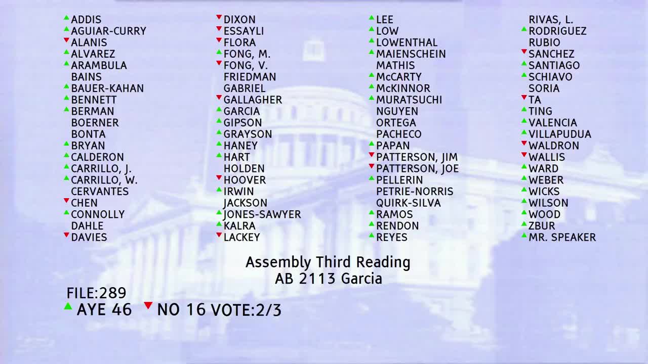 1MIN
Assembly Floor
 6MIN
Assembly Standing Committee on Local Government
 22MIN
Assembly Standing Committee on Transportation
Bill Author

Bill Co-Author(s):